
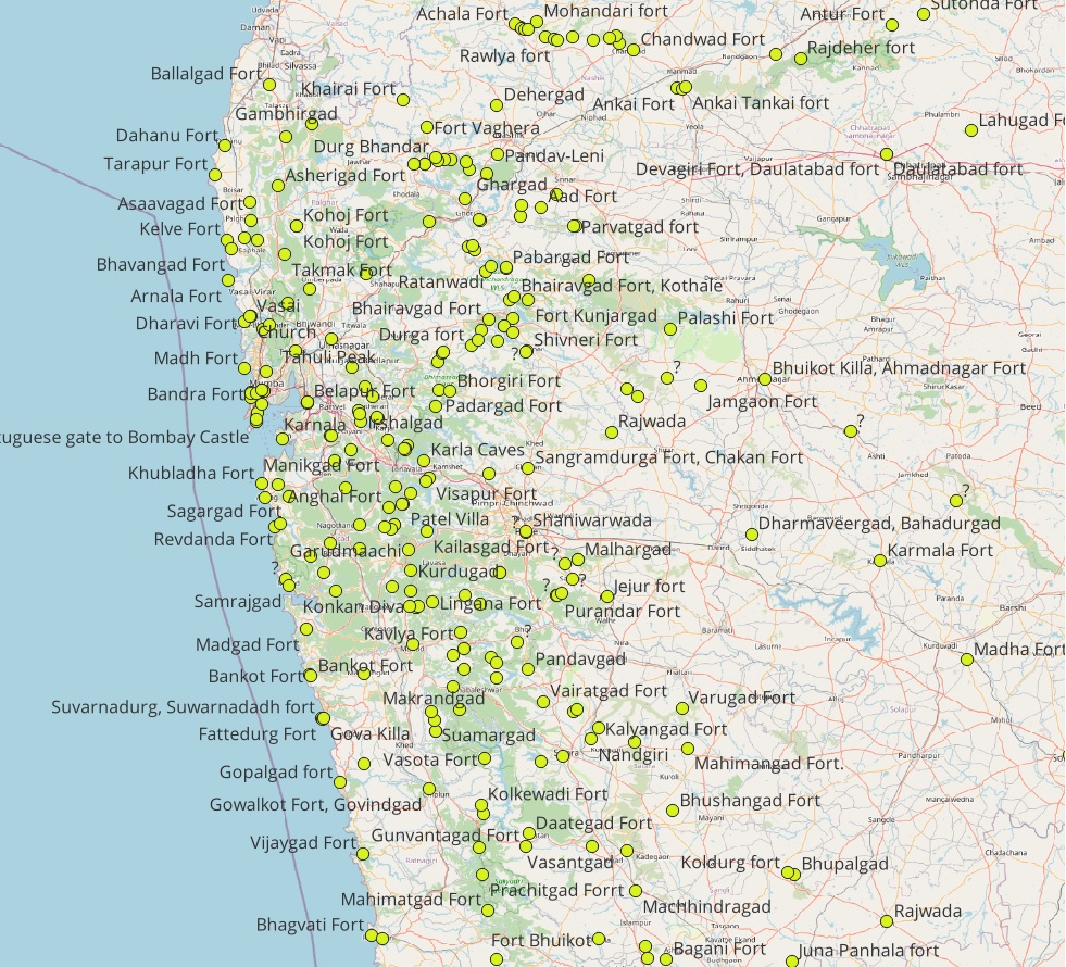
Historical Forts
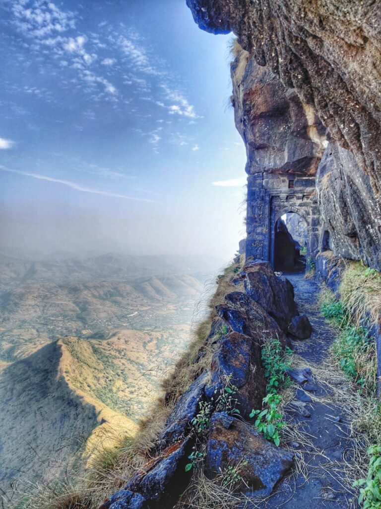
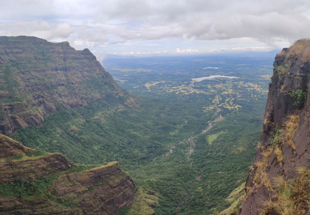
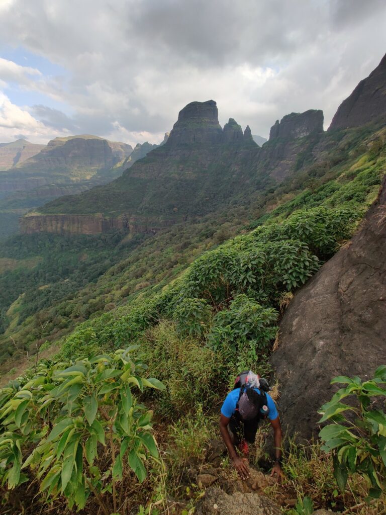
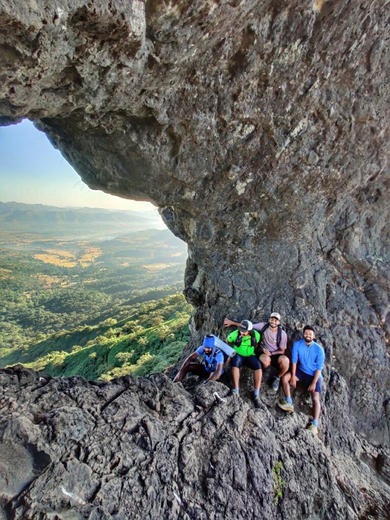
The Sahyadri range in Maharashtra has a large number of historical forts. Many of these strategic fortifications are built on top of peaks which make beautiful hiking destinations offering mesmerizing views on the surrounding landscape. More than 300 forts have been mapped in Open Street Maps across the state. Hikers from Mumbai, Pune, Nasik and other places in Maharastra travel to the base of many forts and hike up as a one day outing.
Hiking Routes
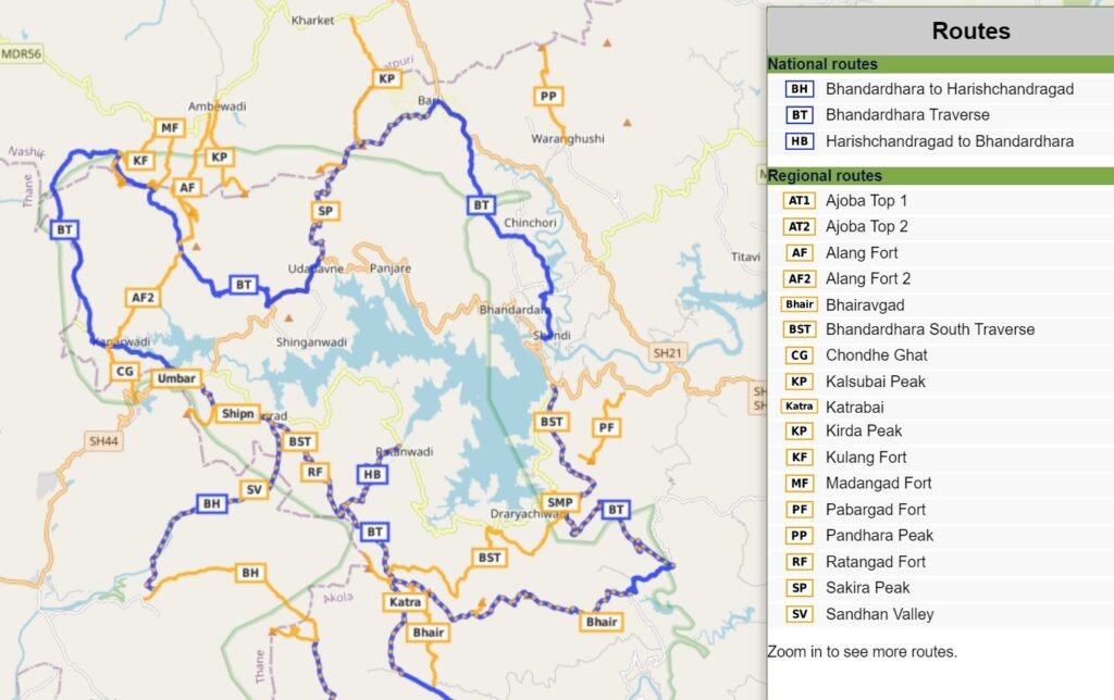
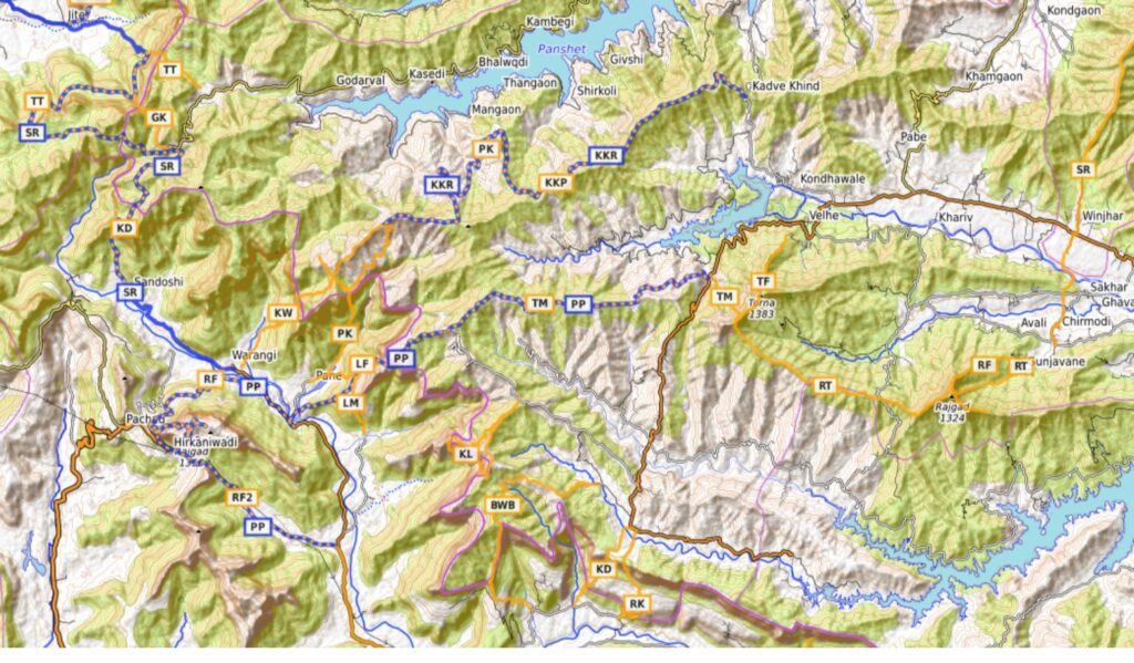
A large network of trails connecting individual forts, mountain peaks and vast reservoirs have been GPS recorded and accurately mapped in Waymarked Hiking Trails. Individual forts make beautiful day hikes while combining individual (regional, orange) sections into long continuous transverses (national, blue) makes mesmerizing multi-day expeditions across entire regions of the Sahyadri range.
Traverses
Find below 10 beautiful long traverses across 1000km of trails connecting 150+ forts, peaks, ghats and lakes spanning the entire Sahyadri range. Total distance and elevation gain (climb) for each traverse is given below. Major benefit of multi-day long traverses is that one can cover many forts and peaks in a single journey with beautiful overnight camps avoiding significant onward/return travel overhead part of multiple one-day single fort visits. Click on each traverse below for a detailed write-up. Happy exploring!

- Pune to Pratapgad – 200km / 7400m+ a linear traverse starting from Pune proceeding West to Raigad and turning South towards Pratapgad in the Mabaleshwar region.
- Bhandardhara Traverse – 79km / 4800m+ a circuit (loop) around the old Bandardhara reservoir (Artur lake) connecting 15 surrounding forts and peaks through beautiful forest and ridgeline trails.
- Lonavala to Naneghat – 112km / 3100m+ – a linear South-North traverse along the Deccan ridge from Lonavala to Bhimashankar ending at Naneghat crossing 15 forts, ghat sections offering mesmerizing views on the Konkan plains below
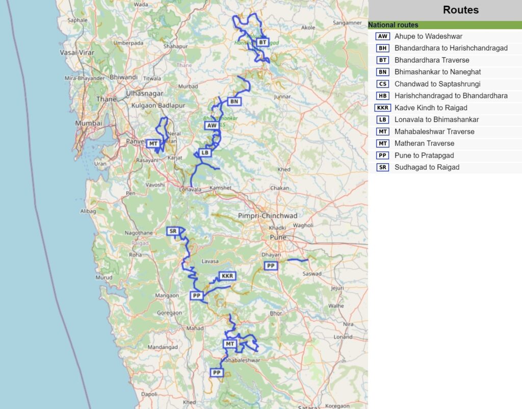
- Matheran Range – 79km / 4300m+ – a circuit East of Mumbai connecting 10 forts around the Matheran range
- Mahabaleshwar Traverse – 91km / 4900m+ – a beautiful circuit in one of my favorite regions in the Southern Sahyadri through dense forests of the Mahabaleshwar region
- Satmala Range – 110km / 7000m+ – a linear traverse through the Satmala range North of Nasik connecting 14 forts and peaks along a prolonged ridgeline from Chandwad to Saptashrungi
- Harishchandragad – Bhandardhara Circuit – 71km / 3650m+ a circuit starting from Harishchandragad proceeding across the Deccan plateau to the Bhandardhara reservoir and then returning back while hopping on/off the Deccan ridgeline and Konkan plains
- Sudhagad to Raigad – 114km / 5700m+ – a North-South traverse hopping numerous ghat sections between the Konkan plains and Deccan plateau between Sudhagad and Raigad.
- Ahupe to Wadeshwar – 112km / 6200m+ – a parallel linear traverse with the Lovala – Naneghat traverse hopping on and off the Deccan ridge going North-South from Ahupe to Wadeshwar
- Pavana – Mulshi lakes – 83km / 4700m+ hike to 17 historical forts, peaks, lakes and ghats around the Pavana and Mulshi lakes South of Lonavala. Requires in-between commute to the base of each fort.
- Manikdoh – Pimpalgaon lakes – 83km / 8000m+ hike to 21 21 beautiful forts, peaks, lakes and ghat sections around both reservoirs near Junnar.
- Selbari – Dolbari range – a natural boundary between Nashik and Dhule district, there are 14 forts and peaks located in this range (disconnected by road) with a total elevation gain of 4500 meters.
Navigation
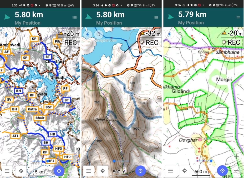
Above traverses can be easily navigated using most mobile mapping apps – most use Open Street Maps as base maps which include tens of thousands of kilometers of trails in Himalayas, Sahyadri, etc. OSM maps can be downloaded on the phone for offline exploration of the mountains without mobile network. Contours can be added to understand the topography of the terrain. My favorite app is OSMAnd.