
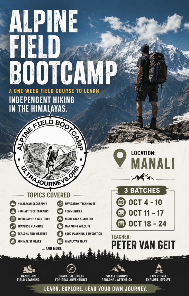
Alpine Field Bootcamp is a one week field course in the Himalayas on independent hiking, map reading & navigation, high altitude terrains, lightweight gears, traverse planning, topography, food & shelter, seasons & weather, Himalayan maps, etc. Participants will check into a beautiful basecamp in the mountains where above topics will be taught through theory and hands-on field assignments in the surrounding forests and meadows. Upon completion you become part of a community of hundreds of independent hikers which plan hikes, team up and share experiences. Register here.

Freediving. The ocean has a different world waiting beneath the surface. Learn how to breathe better, move effortlessly underwater, equalize comfortably, and experience the calmness of the underwater world — all on a single breath. Whether you are a swimmer, traveler, scuba diver, ocean lover, or complete beginner, this course is designed to help you discover what your body and mind are truly capable of underwater.. Register here.

Blog visit this section for the latest posts on ultra journeys, mapping the Himalayas, plan Himalayan traverses, understand geography and topography, trans Himalaya from Arunachal to Kyrgyzstan, guiding explorers from across the world, seasons & traverse planner for the Indian Western Himalayas as per the seasons, getting started with GIS, Himalayan maps, etc
Ultra Journeys are month long solo explorations over thousand kilometers and hundreds of mountain passes across the Indian Himalayas. As a minimalist fast-hiker I explored and mapped 350+ traverses / mountain passes across Himachal, Ladakh, Uttarakhand and Jammu & Kashmir. This section includes detailed maps, articles, blogs, news & videos for each journey.
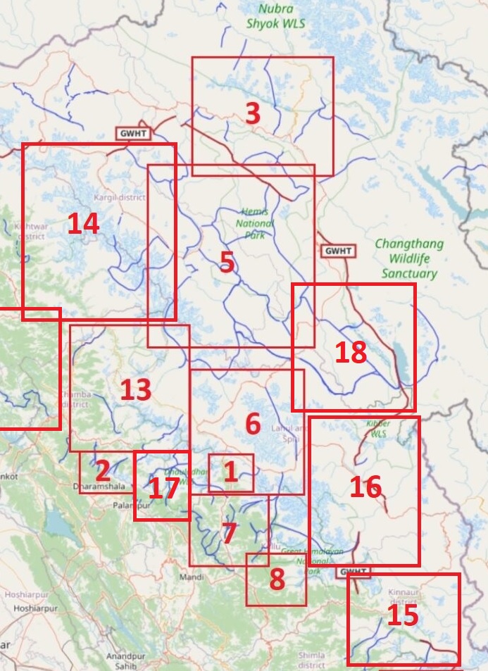
Hiking Routes. More than 800 hiking routes spanning 14 thousand kilometers across the Western Himalayas have been explored, GPS recorded and accurately mapped in Open Street Maps. Find an overview of these beautiful routes categorized in 19 Himalayan regions: geography, high ranges and main rivers and hiking route network.
Himalayan Regions. Webinars visually presenting the major regions of the Western Himalayas through my trans Himalayan journeys. Zanskar, Eastern Dhauladhar, Baspa, Manimahesh, Barot & Lug, Stok Range, Western Ladakh, Tsarap Chu, Spiti, Pir Panjal, Western Dhauladhar, GHNP, Garhwal, Kumaon, Parvathi.

Gears. Minimalist fast-hiking the Himalayas using lightweight gears, optimizing food and shelter and proper traverse planning. Going lighter is going faster for the independent solo hiker. Going faster changes everything while hiking long-distance traverses in the steep Himalayan terrain.
Courses 12 Online Courses and Webinars consolidating my extensive alpine hiking experience exploring more than 350 high passes across the Western Himalayas and a decade of wilderness exploration in the jungles of South India. Map reading and route planning, navigation techniques, planning an alpine journey, fast hiking and lightweight gears, Himalayan terrains, GIS analysis of Himalayan geography and hiking trails, Open Street Maps, etc.

Geography of the Himalayas. The best way to familiarize yourself with the Himalayas is to understand its geography – high ranges, major rivers draining these ranges, base towns in these valleys and mountain passes connecting valleys across ranges. This knowledge enables you to start planning hikes & traverses across the Himalayas

Guiding independent hikers. Based on my extensive exploration experience of 350 mountain passes in the Western Indian Himalayas and exploring jungles in South India for over a decade I guide independent hikers from around the world in planning and executing their Himalayan traverses as per the seasons, identifying a realistic schedule, advising on gears, acclimatization, night halts and food supply.

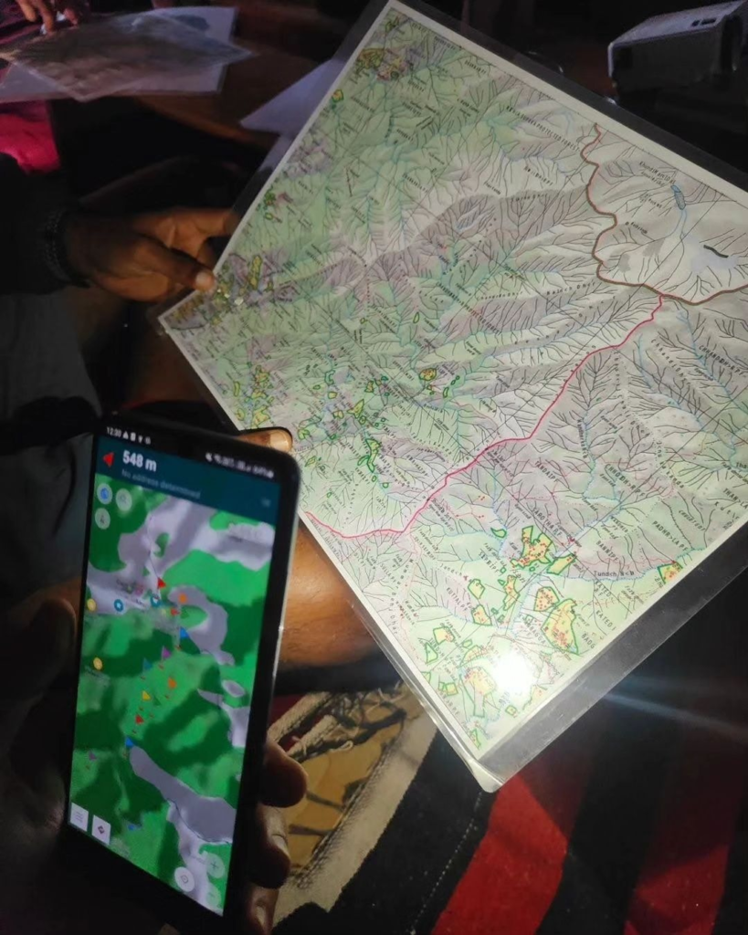
Maps to plan your Himalayan hikes. Open Street Maps, Himalayan Maps, Ultra Journey Maps, Survey of India Maps, Navigation, Topography, Olizane Maps, Soviet Military Maps, US Army Map Service. All the resources you need to research & plan your Himalayan traverses and navigate your way through the mountains.

Topography. Learn about the geography of the Himalayas. Understand topography and contours which are fundamental to plan your traverses in the Himalayas and navigate your way through the mountains. Identify terrain features like peaks, ridges, valleys and saddles while reading topographic maps.

Cycle Touring. Infinite beautiful cycling (biking, running) routes across hundreds of high passes connecting interior valleys across the Indian and Nepal Himalayas. 20 popular cycling routes mapped in OSM, various presentations on how to plan long-distance cycle tours through the mountains, 4000km cycling across Europe.
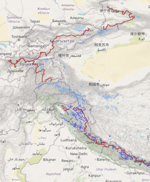
Himalayan Traverses. Long distance traverses across the Wester Himalayas, Arunachal, Nepal, Karakoram. Tajikistan, Kyrgyzstan, Tibet. Bhutan, Sikkim.
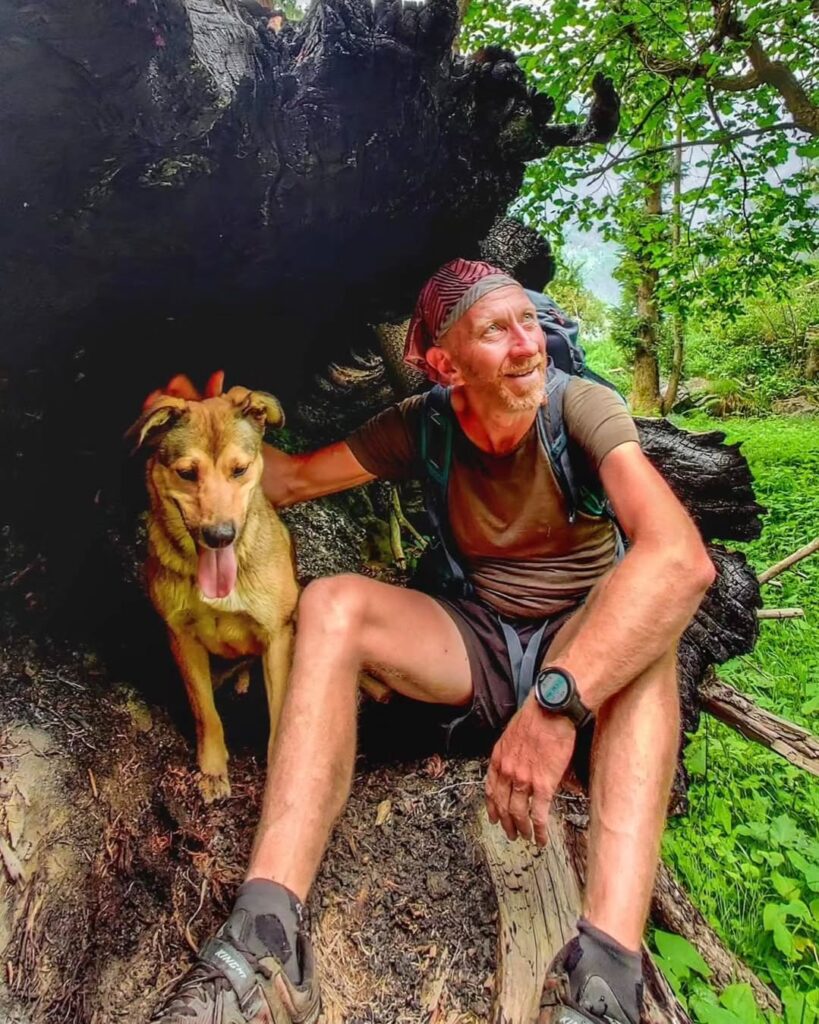
About myself. Ultra runner, alpine explorer, minimalist and diver. Born in Belgium, settled in India. Quit the corporate world in 2017 and into full time exploration & mapping of the Himalayas since then. My month long ultra journeys take me across thousands of kilometers in the remote mountains. Articles, interviews, news, awards, talks, videos and short-films, relief efforts

Traverse Planning. In this section we guide you on how to plan a long distance hiking trail through the Himalayas based on your understanding of the topography, major valleys and mountain passes. We can use simple web based tools as well as more advanced GIS systems or simply use mobile apps to plan your next traverse.

GIS. In this online series we combine the power of GIS (Geographic Information System) with OSM (Open Street Maps), DEM (Digital Elevation Model) data and external natural data sets to study and analyze the geography of the Himalayas, terrain analysis, plan Himalayan traverses, geo-reference maps, study mountain ranges & eco regions, analyze climate & weather data, visualize hydrology through basins and rivers and glaciology

Mapping the Himalayas. Understanding the importance of detailed maps to explore the Indian Himalayas, I mapped thousands of mountain passes, hiking routes, prominent peaks, alpine lakes, major rivers and tens of thousands of human settlements in Open Street Maps enabling the international outdoor community to plan and navigate journeys through the Indian Himalayas.

Patreon get first hand insight in my ongoing and future ultra journeys, interact with myself and other patrons, download hires maps of the Himalayas and thousands of hiking trails, access Himalayan webinars on my YouTube channel, join my online bootcamp to master the art of alpine style exploration, download detailed offline maps for navigation, personalize guidance on Alpine traverses. Become a Patreon.

Nepal. To plan trans Himalayan traverses hikers require a good understanding of the topography of the region: major valleys and high ranges which can be crossed through mountain passes. Hundreds of rivers, thousands of mountain passes and hundreds of hiking routes were mapped in Nepal enabling hikers to plan countless traverses across this topography
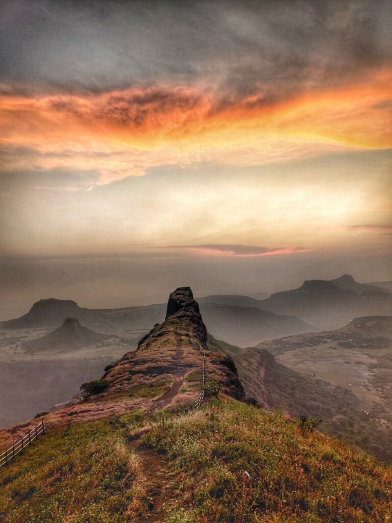
Sahyadri. 12 beautiful long traverses across 1000km of trails connecting 150+ forts, peaks, ghats and lakes spanning the Sahyadri range in the Western Ghats of India. Major benefit of multi-day long traverses is that one can cover many forts and peaks in a single journey with beautiful overnight camps avoiding significant onward/return travel overhead part of multiple one-day single fort visits.

Ultra Running. Self-supported ultra runs across thousands of kilometers through beautiful remote valleys in the Himalayas. Running routes, planning long-distance running traverses, preparing for ultra races.

Lakes of the Himalayas. Thousands of mesmerizing alpine lakes spread across the Himalayas. These high altitude water bodies are mostly frozen and covered by winter snow to open up to the human eye only during the summer season. Plan your Himalayans traverse to these water sources considered holy by the local people.