
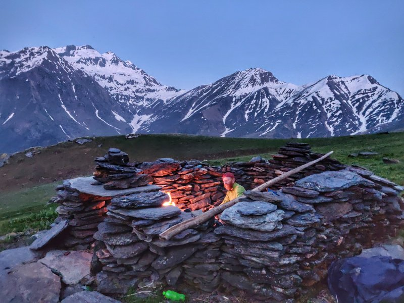
More than 600 hiking routes spanning 12 thousand kilometers across the Western Himalayas have been explored, GPS recorded and accurately mapped in Open Street Maps. Find an overview on each Himalayan Region, its geography, high ranges and main rivers and hiking route network with detailed blogs, route descriptions, elevation profile, photos and videos for many of these routes.
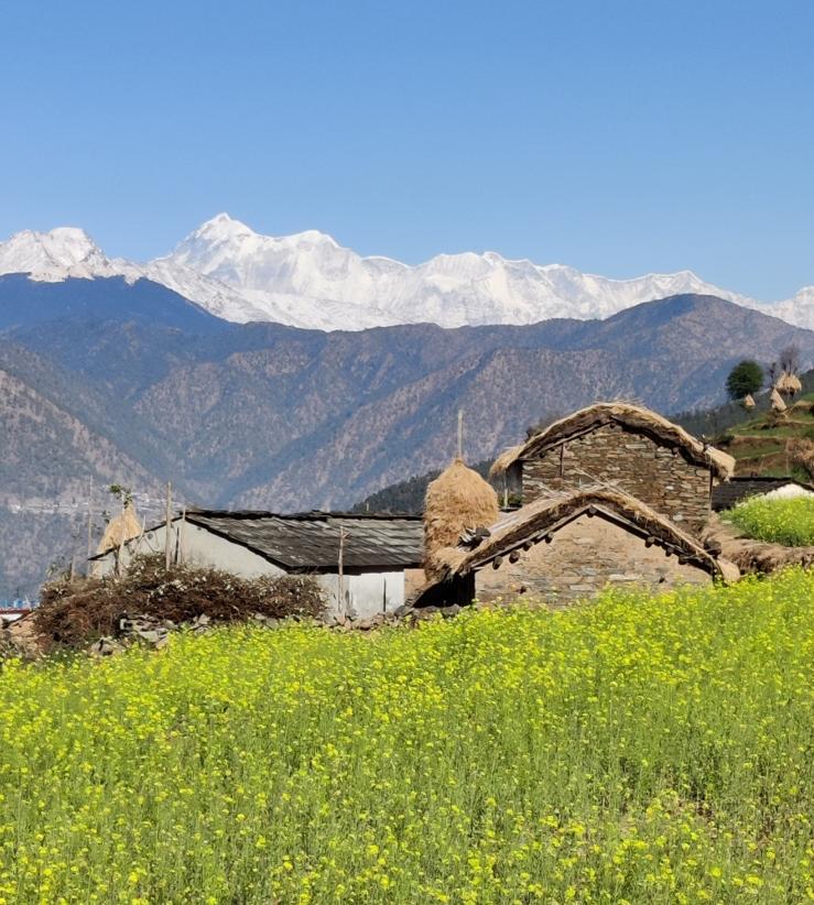
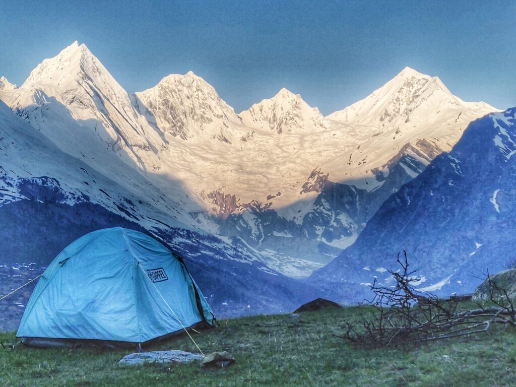
Part 1 – 50 Beautiful Hikes around Manali – Manali is a popular base for the outdoor community with lots of beautiful trails in the surrounding pine forests and meadows in the upper Beas river valley. There are umpteen day hikes for beginners, moderate trails in the valley for intermediate hikers and inter district routes across surrounding ranges for experienced hikers. One can hike throughout the year following the seasonal snowline – Winter (2500m), Spring/Autumn (3500m), Summer (4500m). Avoid the monsoon (July-Aug) when heavy rains flood most of the Himalayan foothills.
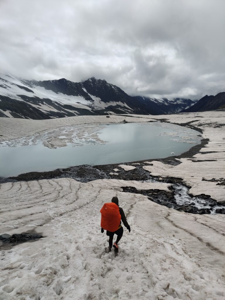
Part 2 – 50 Hikes in Dhauladhar near Dharamsala – Dharamshala located in the foothills of the Dhauladhar is a popular International tourist destination. The range rises up steeply from the Kangra plains in the South and descends gradually into the Chamba valley (Ravi river) in the North. It extends all the way from Dalhousie in the West to Manali in the East. Scenic hiking routes connect valleys with crystal clear streams flowing down from the upper ranges. One can choose from many day hikes in the foothills, regional hikes (3000m) connecting side-valleys and national routes (4000m) across the Dhauladhar.
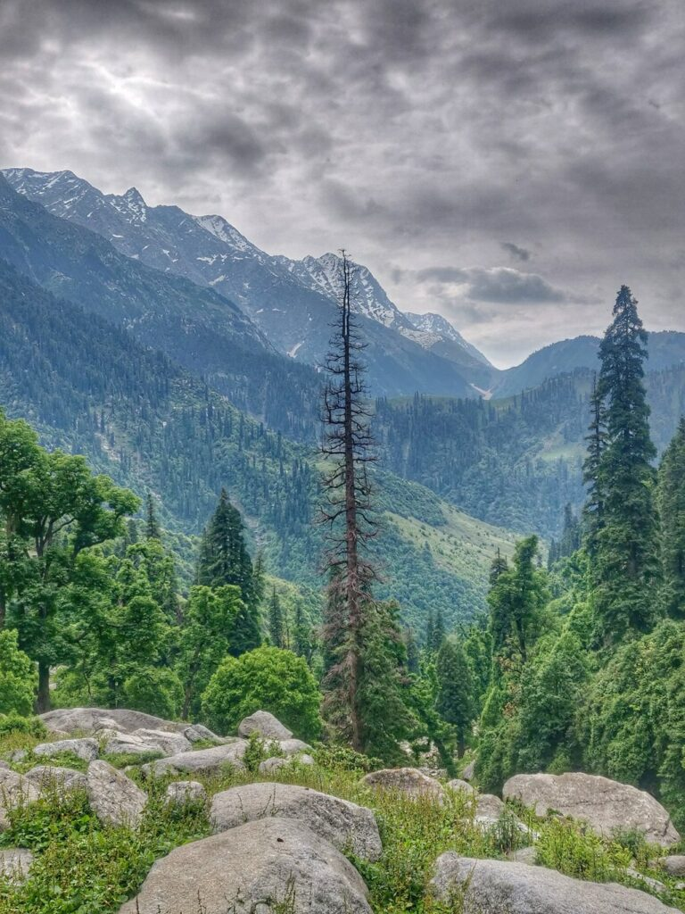
Part 3 – 40 Beautiful Hikes near Leh, Ladakh – Leh is a well known International hiking destination in the alpine desert of Ladakh. The hiking network is well documented using topographic maps since the past 2 decades giving birth to a sprawling outdoor community. Routes across numerous high passes connect several major valleys: Indus, Shyok (Nubra valley), Zanskar and Markha valleys
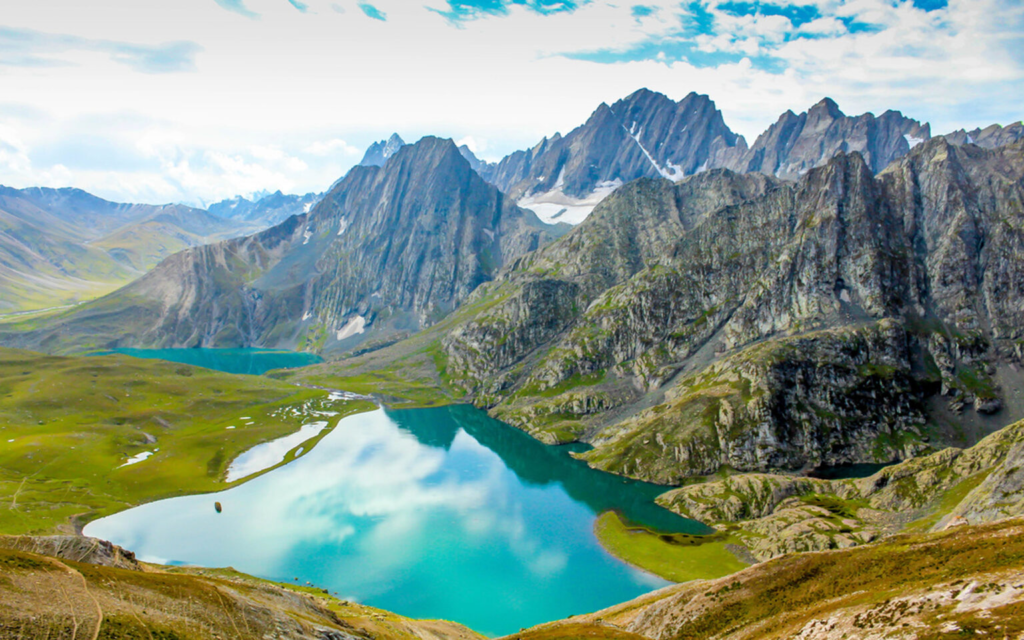
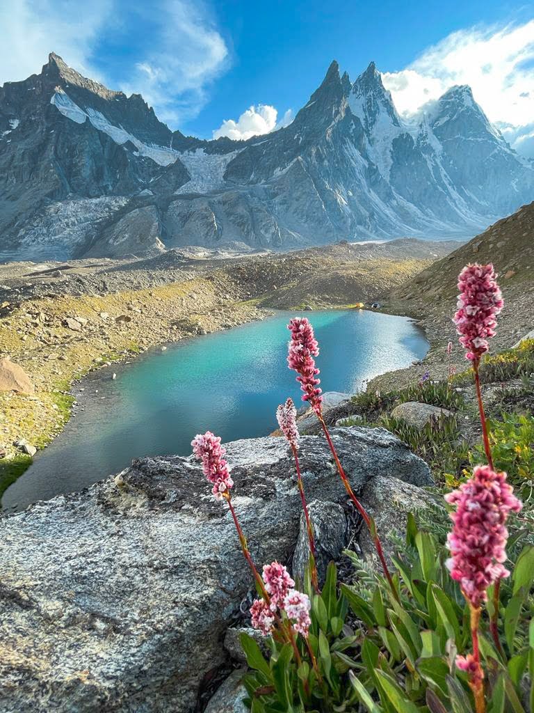
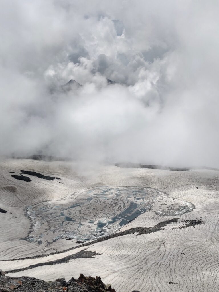
Part 4 – 40 Alpine Lakes in Kashmir – the Pir Panjal range runs through the Kashmir valley and separates it from the rest of the Indian subcontinent. This range is known for its lush green meadows, alpine lakes, dense forests, and snow-capped peaks. The range is easily accessible and offers a variety of activities such as trekking, skiing, and camping. Alpine lakes are often found in areas where glaciers formed thousands of years ago and have since melted, leaving behind small, pristine lakes that are surrounded by stunning scenery. These lakes are often referred to as “jewels of the mountains”, blue-green colors due to the presence of natural minerals and organic matter in the water.
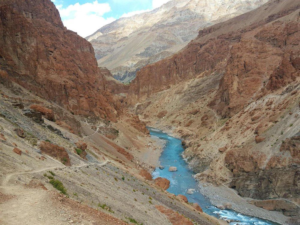
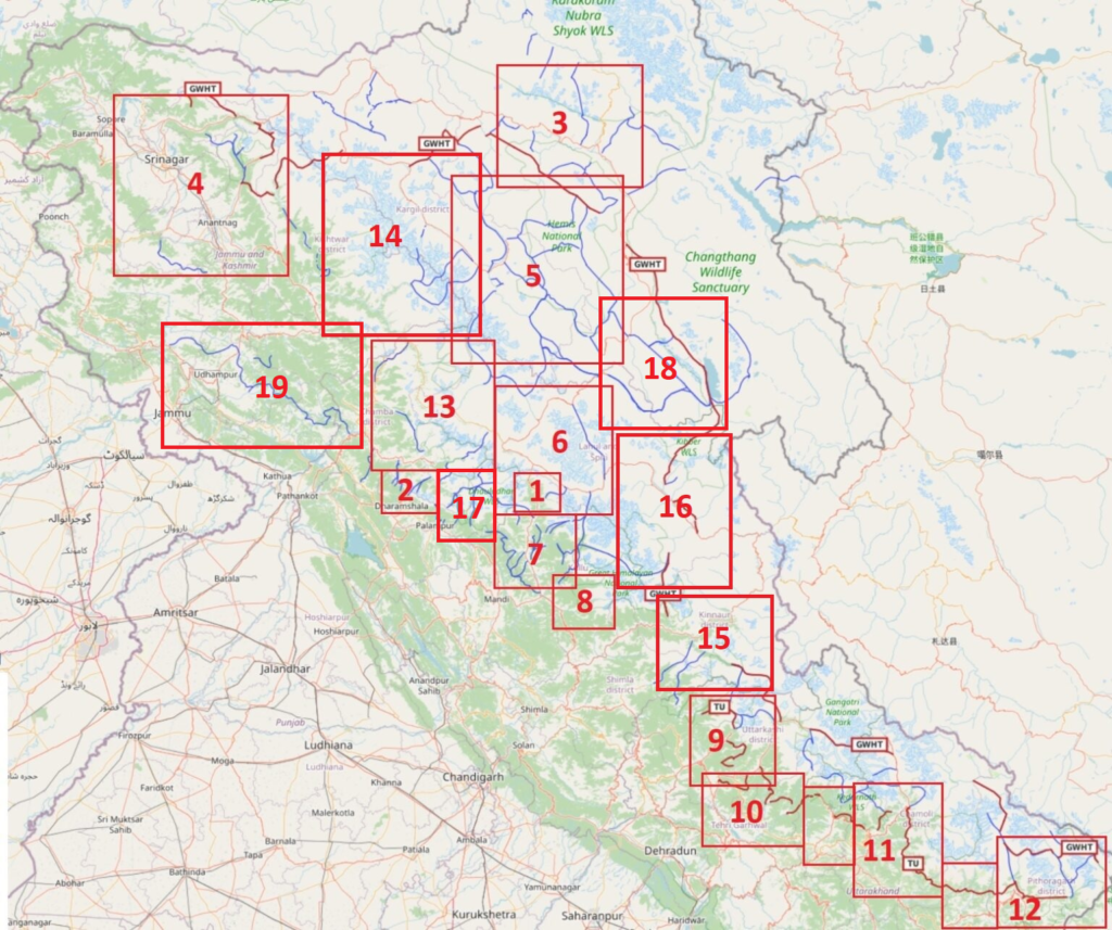
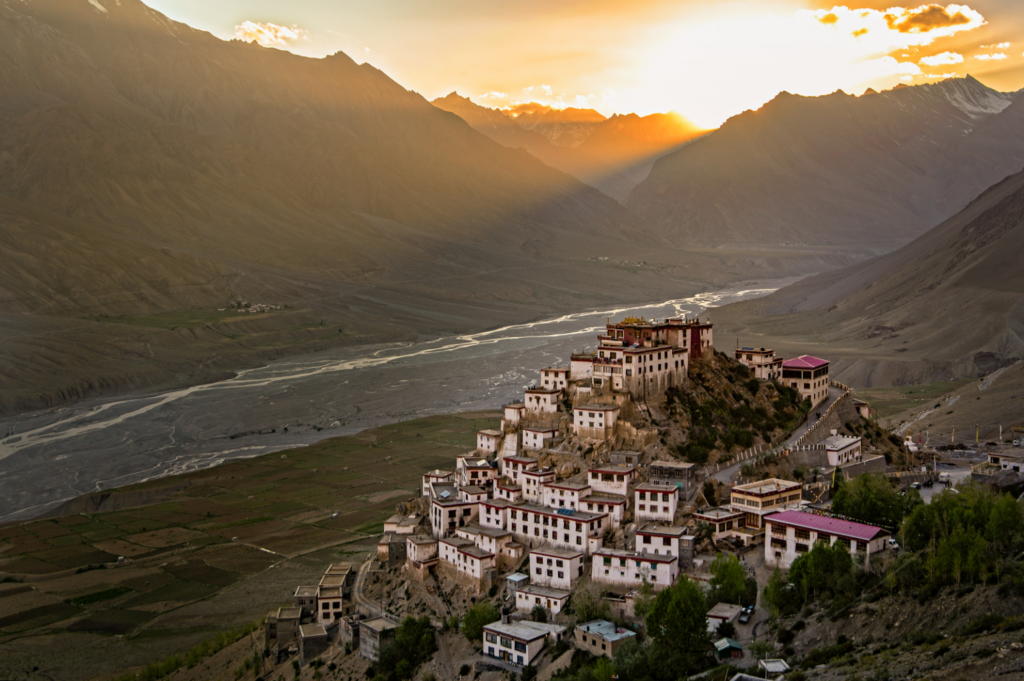
Part 5 – 25 Beautiful Hikes in Zanskar – Zanskar is a mountain range separating the Zanskar valley (South) and the Indus valley (North). We encounter an unearthly landscape here – a highly erosive alpine rock desert here with unique color gradients. Hiking routes connect major rivers across surrounding ranges – Zanskar, Tsarap, Suru, Indus and Chenab rivers.
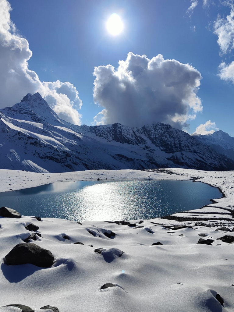
Part 6 – 30 Alpine Lakes in Kullu and Lahaul – . Kullu and Lahaul have numerous routes to beautiful alpine lakes in the Beas, Chandra, Bhaga, Yunam and Ravi river basins. These lakes are usually located below retreating glaciers naturally formed by moraines dams.
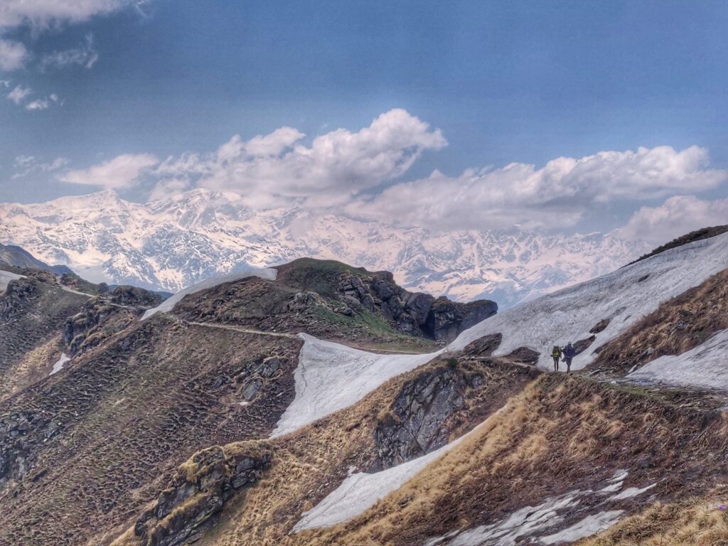
Part 7 – 40 Scenic Hikes around Kullu – Although less popular than Manali the Kullu region has many lesser known beautiful hiking routes connecting the surrounding valleys of Beas, Parvathi, Malana, Lug and Barot. Small day hikes connect picturesque hamlets and temples within one valley while intermediate hikers have ample choice in moderate routes across ranges between valleys. Kullu has many lower altitude ranges (3000m) which are open throughout most of the year (March to November
Part 8 – 20 Lesser known Routes in GHNP – just East of Kullu is the Great Himalayan National Park, a Himalayan biodiversity hotspot with a rich assemblage of forest types and fauna species. This gives the site outstanding significance for biodiversity conservation. The high ranges get drained through 3 major rivers: Jiwa Nala, Sainj and Tirthan connected through numerous hiking routes
Part 9 – 30 Beautiful Hikes in Uttarkashi – The Bandarpunch and Gangotri ranges drain into the Tons, Yamuna and Bhagirathi river valleys. Traverses
Part 10 – 40 Scenic Hikes in Tehri Garhwal – The Gangotri and Bandarpunch high ranges drain into the Bhagirathi, Bhilangana, Alaknanda rivers. Traverses
Part 11a – 40 Mesmerizing Hikes in Rudranath & Upper Chamoli – The high ranges of Gangotri, Kamet Group and Nanda Devi flow down into the Mandakini, Alaknanda, Pindar and Ramganga river valleys. Traverses. Traverses 2
Part 11b – 40 Scenic Hikes in Lower Chamoli – Mandakini, Alaknanda, Pindar, Ramganga river valleys. Traverses

Part 12 – 40 Hikes in Bageshwar and Pithoragarh – Nanda Devi, Panchachuli and East Kumaon ranges drain into the Pindar, Sarju, Ramganga, Goriganga and Dharma river valleys. Traverses
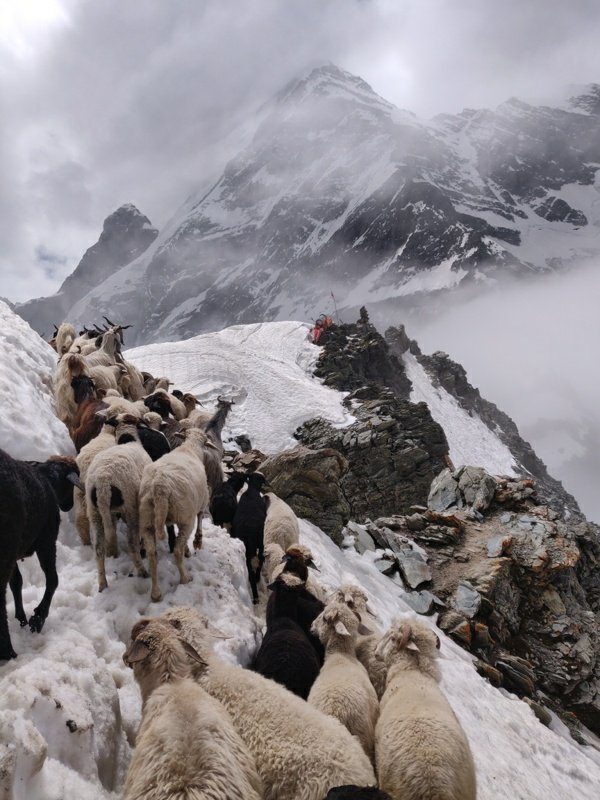
Part 13 – 20 Mesmerizing hikes in the Pir Panjal – a prolonged high range stretching out from Kisthwar in the West to Kullu in the East separating Kullu, Chamba and Doda districts in the South (Ravi river) from Lahaul & Spiti, Pangi, Kishtwar districts in the North (Chenab river). Manimahesh Dhar is a side-range from the Pir Panjal extending into central Chamba. There are many shepherd routes from Chamba across the Pir Panjal to the alpine meadows of Lahaul and Pangi valley. These include Kugti, Chobia, Kalicho, Darati, Marhu and Cheni passes. Many of these are 5000m high and open only between July to September preventing most of the monsoon reaching North.
Part 14 – 10 Traverses across the Great Himalayan Range – spans across India, China, Nepal, Pakistan, Bhutan, and Tibet. The world’s highest peaks including Mount Everest, Kangchenjunga, Lhotse, and Nanga Parbat, are part of GHR. The total West to East extension of the Great Himalayas is 2400 km and their average elevation is 6000m. Within the Western Indian Himalayas it runs along the border of Jammu & Kashmir and Ladakh, through Lahaul & Spiti, Kinnaur and upper ranges of Uttarakhand. It separates the Himalayan foothills (South) from the alpine deserts of Ladakh, Zanskar, Lahaul & Spiti and parts of Kinnaur (North).
Part 15 – 10 Beautiful Hikes in Kinnaur – Kinnaur is located in the East of Himachal Pradesh bound by Spiti (North), China (East), Shimla & Uttarkashi (South) and Kullu (West) enclosing the Baspa, Spiti and Sutlej river valleys. At the peak of Kinnaur Kailash mountain is a natural rock Shivling (Shiva Lingam). The old Hindustan-Tibet Road passes through the Kinnaur valley along the bank of river Sutlej and finally enters Tibet at Shipki La pass.
Part 16 – 10 Mesmerizing Hikes in Spiti – Spiti means “The middle land”, i.e. the land between Tibet and India. Spiti is an alpine desert bound by Ladakh (North), China (East), Kinnaur & Kullu (South) and Lahaul (West) and its high ranges are drained by the Spiti river. Numerous national hiking routes are mapped in OSM connecting Kinnaur, Spiti and the neighbouring districts
Part 17 – 10 Beautiful Hikes in the Eastern Dhauladhar. The range rises up steeply from the Kangra plains in the South and descends gradually into the Chamba valley (Ravi river) in the North. It extends all the way from Dalhousie in the West to Manali in the East. Scenic hiking routes connect valleys with crystal clear streams flowing down from the upper ranges. One can choose from many day hikes in the foothills, regional hikes (3000m) connecting side-valleys and national routes (4000m) across the Dhauladhar.
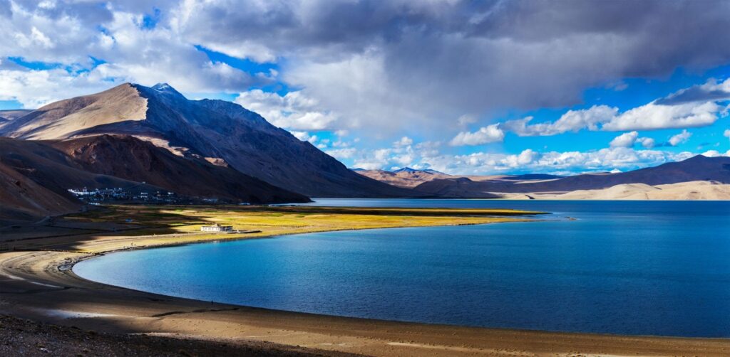
Part 18 – 10 Traverses in Eastern Ladakh. East Ladakh is the region Northeast of the Manali-Leh highway is an open, gradual high altitude range which includes the large alpine lakes of Tso Moriri and Pangong Tso
The Great Western Himalayan Traverse (GWHT) is a 950km high altitude trans Himalayan traverse through the Indian Western Himalayas across 4 states from Kashmir across Zanskar & Ladakh to Spiti & Kinnaur and across Uttarakhand to the border of Nepal across 31 high passes covering 34 thousand meters of elevation gain, 16 major rivers and 9 alpine lakes. The traverse consists of 23 individual sections which have been GPS recorded and accurately mapped in Open Street Maps for the international hiking community to explore alpine style.
Trans Uttarakhand Traverse – a 900km sub-4000m trans Uttarakhand traverse from Nepal to Himachal across 27 major river valleys and 26 mountain passes totaling 31 thousand meters of elevation gain. It’s a combination of 24 individual hiking routes through the mid-range Himalayas which makes this traverse accessible from May to October.
Hi how can I join next time
I teach people how to hike independently. I do not take on guided tours. Sign up at ultrajourneys.org/abc
Thank you very much for posting this set of material. I plan to visit the Zanskar region this summer. And find this detailed information to be very helpful for understanding current trek options. One question, using the Waymarked Trails: Hiking page, when I do a download of the GPX or KML data for a route, it does not download the altitude information, just the X/Y coordinates. I’ve tried this on two different routes and using two different tools to import the downloaded data but no success. A friend with extensive knowledge on map tools has also confirmed the same issue.
Artur, you can add elevation data through gpsvisualizer.com (generate profiles, download NASA SRTM). You can also simply view the hiking routes on mobile (e.g. OSMAnd app), route / navigate and generate an elevation profile / total ascent / descent.
Do get in touch with me through Whatsapp if you want my guidance on planning a beautiful traverse through Zanskar. I have explored the same extensively.
Peter