
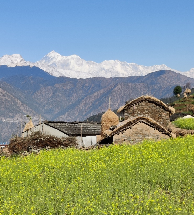
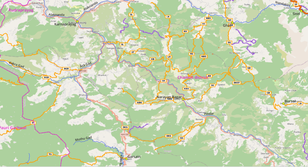
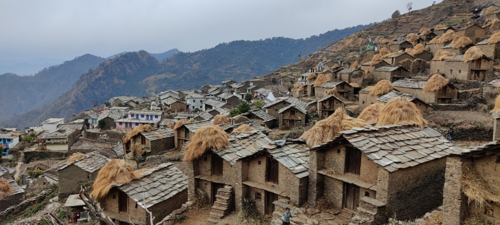
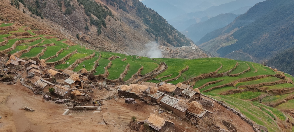
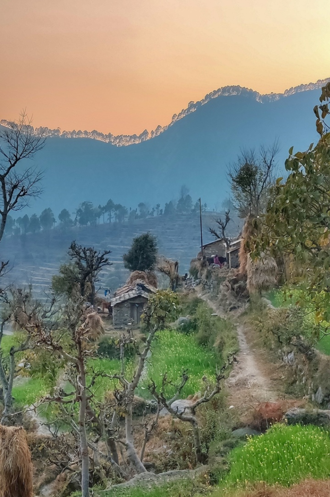
This post documents hiking routes in the lower / mid ranges of Chamoli (Southwest). Refer this post for routes in the higher ranges (Northwest).
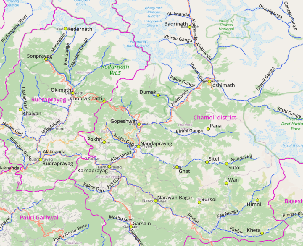
Geography
Main Rivers
- Mandakini (Kedarnath, Sonprayag, Okimath, Rudraprayag). Originates from the Gangotri range. Tributaries: Lasar Gad (Khalyan).
- Alaknanda (Badrinath, Joshimath, Gopeshwar, Nandaprayag, Karnaprayag, Rudraprayag). Tributaries: Dhauli Ganga, Birahi Ganga (Pana), Nandakini (Sutol, Sitel, Ghat), Mandakini, Bhiundar Ganga, Rishi Ganga.
- Pindar (Kathi, Kheta, Narayn Bagar, Karnaprayag). Tributaries: Kail Ganga (Himni), Bedni Ganga (Wan), Ata Gad
- Ramganga (Gairsain).
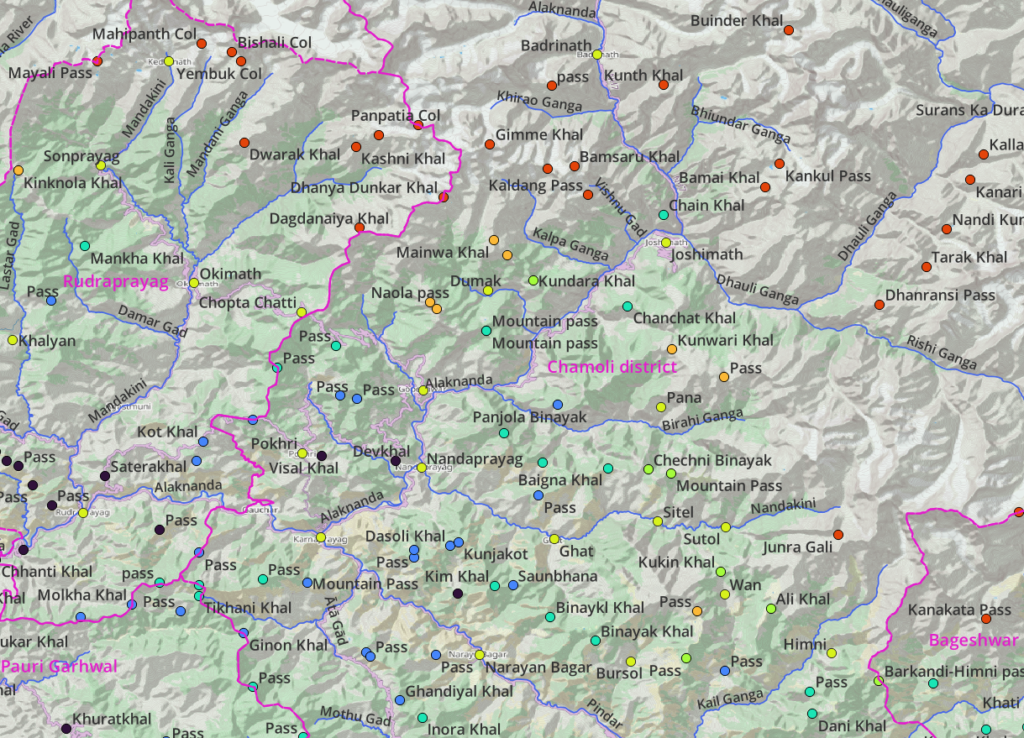
Mountain passes
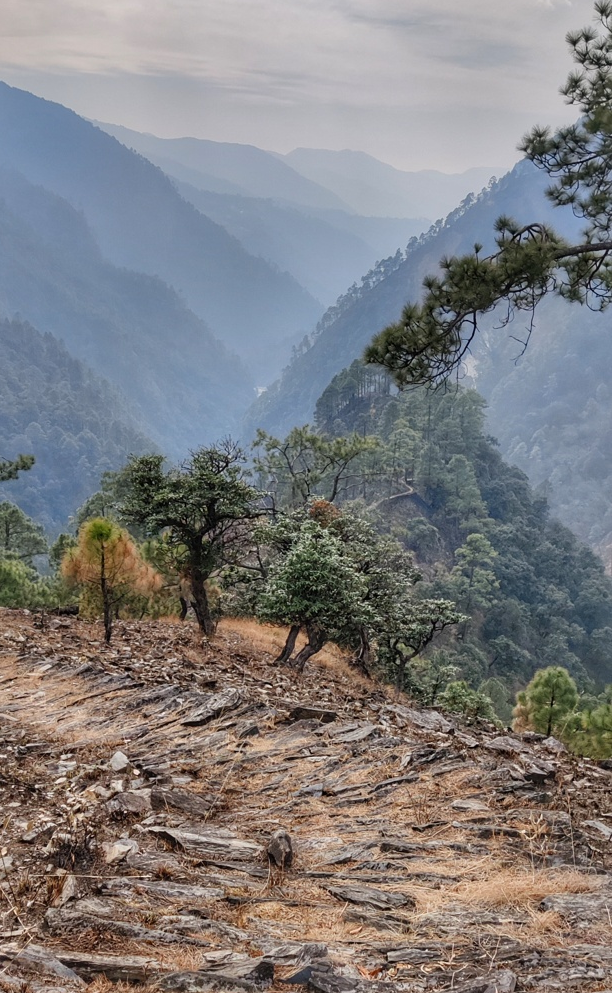
Chamoli has many high and mid ranges with numerous mountain passes connecting main river valleys and tributaries above. Refer the hiking routes below for the more popular ones.
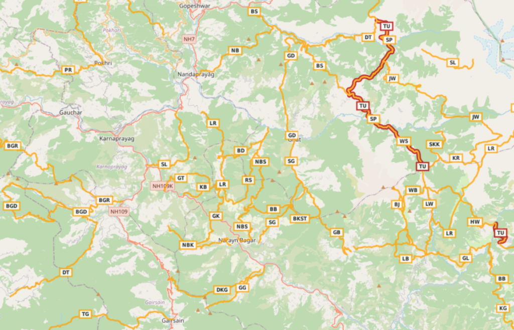
Hiking Routes
Hiking routes in Open Street Maps (OSM) are categorized in 4 different networks:
- International (red) – long distance paths that cross several countries (or states in case of India)
- National (blue) – walking routes that are nationally significant and long distance paths
- Regional (orange) – walking routes that c ross regions and are regionally significant
- Local (purple) – small local walking routes
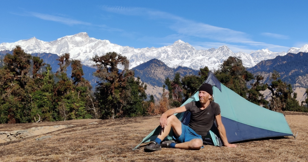
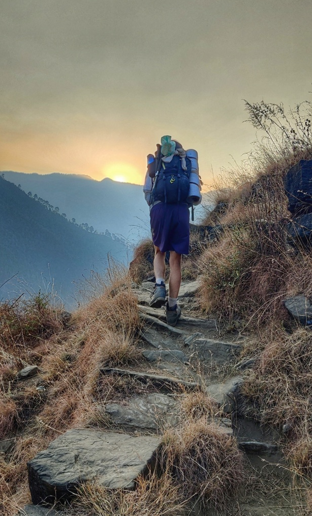
Many routes below have been explored and documented during my Trans Uttarakhand Journeys in Spring 2019 and Winter 20/21. Blogs for individual routes can be found here and here.
8 Local Routes
- Kachula to Gwar 4.5km / 550m+ starting at Gwar village in the Pindar river valley we climb Northeast across an unnamed pass (2050m) descending to Kachula in the Badi Gad valley
- Senti to Bhent 8km / 1000m+ from Senti village (near Ghat) we climb up East and contour South high above the Chuphla Gad valley to the village of Bhent (2200m)
- Ustoli to Maikot 6km / 900m+ starting at Ustoli village (near Ghat) we gradually climb Southeast up into the Chuphla Gad valley to Maikot (2550m)
- Diwali Khal to Kimoli 8.5km / 500m+ from the Diwali Khal road pass (2160m) separating the Rasoi Gad (South) and the Ata Gad (North) we climb up East across the Ghandiyal Khal (2450m) descending to Kimoli village in the Kimoli Gad valley
- Dijuli Bugyal 2.3km / 150m- (Rudraprayag) from an unnamed pass (2450m) between Lastar Gad and Chandandawar Gad valleys we proceed South along the ridgeline to Dijuli Bugyal offering mesmerizing views on the high ranges above Kedarnath. Blog post
- Jogimandi (Pauri Garhwal) 7km / 500m+ from Okhalyun in the Purvi Nayar river valley we climb up Southeast along a ridgeline to Jogimandi (2000m) turning North towards to Narsing in the Parsol Gad valley
- Sandoli Tibba 9km / 1350m+ from Debal in the Pindar river valley we climb up North along the ridgeline between Pindar (West) and Kail Ganga (East) to the Sandoli Tibba peak (2700m)
- Gain to Bhatiyana 6km / 450m+ from Bhatiyana in a side-valley of the Pindar river valley we climb up West go Gain on the ridgeline between the Ragna Gad (East) and Badi Gad (West) valleys
30 Regional Routes
- Ghat to Bursol 23km / 2000m+ from Ghat in the Nandakini river valley we head South into the Chuphla Gad valley to Bangali village where we climb up Southeast high above the Dwari Gad valley via Sup Tal (2620m) across an unnamed pass (2650m) into the Chor Gad valley climbing across the Binayak Khal (2650m) descending Southeast to Bursol in the Pranmati Gad river valley. Blog post
- Binaykl Khal to Sup Tal 5km / 750m+ from the Binaykl Khal pass (2550m) we proceed East along the ridgeline between Dwari Gad (North) and Chor Gad (South) to Sup Tal (2620m)
- Simli to Ghat 18km / 1400m+ from Simli in the Pindar river valley we climb up Northeast into the Simli Gad valley crossing over the Binaykl Khal pass (2550m) descending Northeast into Chuphla Gad valley and proceeding North to Ghat in the Nandakini valley
- Banjbagar to Bhangota 12km / 900m+ from Banjbagar in the Chuphla Gad valley we climb up Southwest to the Binaykl Khal pass (2550m) where we follow the ridgeline West to Bhangota in the Lavkush Ganga valley
- Narayn Bagar to Sera 29km / 1400m+ from Narayan Bagar in the Pindar river valley we climb up East onto the ridgeline contouring North above the Pindar valley ascending Northeast into the Lavkush Ganga valley crossing over the Saundhana pass (2430m) descending North into the Mokh Gad valley to Sera in the Nandakini river valley. Blog post Blog post 2
- Rains to Sera 15km / 1150m+ from Rains village near Chopta in the Lavkush Ganga valley we climb up Northeast along a ridgeline turning North high above the Lavkush Ganga across the Kim Khal pass (2700m) descending North into the Mokh Gad valley to Sera in the Nandakini river valley. Blog post
- Bhatiyana to Dhurma 10km / 1100m+ from Bhatiyana in a side-valley of the Pindar river valley we climb up East across an unnamed pass (2550m) descending Northeast to Dhurma in the Mokh Gad river valley
- Limrakot to Rains 18km / 1600m+ from Limrakot in the Pindari river valley we climb up East along the Viroli Gad to Hindoli where we turn Southeast along the ridgeline between Gondoya & Bhari Gad (East) and Ratna Gad (West) crossing over the Kunja Jot (2420m) descending South to Sunbhi climbing across the Khaltol Khal (1850m) and descending Southeast to Rains (near Chopta) in the Lavkush Ganga valley. Blog post
- Narayn Bagar to Kothi 13km / 1500m+ from Narayn Bagar in the Pindar river valley we climb up West above Kimoli Gad valley to the ridgeline above (2300m) from where we descend Northwest to Kothi in a tributary valley flowing into the Pindar valley (North). Blog post
- Garsera to Kaphartir 13km / 1400m+ from Garsera we climb up Northeast across an unnamed pass (2030m) descending North to Naigaon in the Pindar river valley and climbing up Northeast into the Lavkush Ganga valley turning North to Kaphartir villae near the Khaltol Khal pass (1820m)
- Kaphartir to Bagoli 8.5km / 350m+ from Kaphartir village near the Khaltol Khal pass (1820m) we descend West to Bagoli in the Pindar river valley
- Gunar to Thapli 12km / 1300m+ from Gunar hamlet in a side-valley of the Pindar river we climb up North-West (1850m) descending Southwest along a ridgeline to Thapli in the Pindar river valley
- Gairsain to Gadhera 17km / 2500m- from Gairain in the Ramganga river valley we climb up East along the ridgeline above Gwar Gadhera across an unnamed pass (2800m) descending Northeast into the Ming Gadhera valley to Gadhera in the Pindar river valley. Blog post
- Diwali Khal to Gadhera 17km / 800m+ from the Diwali Khal road pass (2160m) separating the Rasoi Gad (South) and the Ata Gad (North) we climb up East along the ridgeline above Rasoi Gad valley across the Inora Khal (2500m) descending above the Ming Gadhera valley to Gadhera in the Pindar river valley
- Thalisain to Gairsain 33km / 1500m+ from Thalisain in Pauri Garhwal we climb up Northeast in the Purvi Nayar valley across an unnamed pass (3000m) descending East to Gairsain in the Ramganga river valley in Chamoli. Blog post
- Dewalkot to Tharpalisain 22km / 1200m+ from Dewalkot in the Kalkra Gad valley of Chamoli we climb up Southwest along the ridgeline above the Wara Gad (South) crossing an unnamed pass (2870m) descending Southwest to Tharpalisain in the Dhaijyuli Gad in Pauri Garghwal. Blog post
- Benoli Gaon to Dewalkot 44km / 4360m+ from Benoli Gaon in the Ata Gad river valley we climb up West into the Kakra Gad river valley across the Tikhani Khal (2650m) turning South into the Khand Gad valley (Pauri Garhwal) climbing up East across the Ginon Khal pass (2200m) to Dewalkot in the Kakra Gad river valley in Chamoli district. Blog post
- Benoli Gaon to Rudrapayag 41km / 4500m+ from Benoli Gaon in the Ata Gad river valley in Chamoli district we climb up Northwest to the ridgeline (2600m) above the Kakra Gad (South) and Sindrawani Gad (North) descending into the Khali Gad and Bhangana Gad valleys climbing up West across an unnamed pass (2150m) descending into the Gholtir Gad valley climbing across an unnamed pass (1800m) to Rudraprayag in the Alaknanda river valley in Rudraprayag district. Blog post Blog post 2 Blog post 3
- Pokhri to Rudraprayag 33km / 3200m+ from Pokhri in Chamoli we climb up West above the Gadiyala Gad river valley crossing over the Pogta Gad valley into Rudraprayag across the Bagdwal Khal pass (2050m) contouring high above the Alaknanda river valley to Khurar near Rudraprayag on the confluence of the Mandakini and Alaknanda rivers. Blog post
- Chopta to Pokhri 25km / 1500m- from Chopta Chatti (2800m) at the base of Tungnath we descend South along the ridgeline between Nagol Gad (East, Chamoli) and Mandakini (West, Rudraprayag) river valleys. We pass the valleys of Ragsi Gad and Bhanaj Gad (West). Mid-way we find a jeep track on the West side just below the ridgeline. We descend Southeast on the ridgeline till Pokhri in the Gadiyala Gad valley. Blog post
- Chopta to Sitola from Chopta Chatti (2800m) 17km / 2500m- we descend Southeast along the road till 2720m where we enter a path along the ridgeline between Nagol Gad (West) and Balkhila Nala (East) descending to Southwest to Nauli village in the Nagol Gad valley and contouring South to Kolgam climbing across an unnamed pass (2250m) and turning Southeast towards Sitola in the Gorsal Gadhera valley, tributary of the Alaknanda near Gopeshwar. Blog post
- Kingadiya to Kher 18km / 800m+ (Rudraprayag) from Kingadiya in the Chhikona Gad valley we climb North into the Lastar Gad valley to Badani Tal (2080m) where we climb East across an unnamed pass (2450m) descending to Kher in the Chandandawar Gad valley. A yet to be mapped trail climbs up North in the Chandandawar Gad valley climbing up Northeast across the Mankha Khal pass (27770m) descending to Phata in the Mandakini valley. Blog post
- Rudraprayag to Chirbhattiya (Rudrapayag) 37km / 5000m- from Rudgraprayag in the Alaknanda river valley we climb up West across an unnamed pass (1400m) into the Bhardari Gad valley climbing up North on the ridgeline between Bhardari Gad (South) and Hilaun Gad (North). We proceed Northwest along the ridgeline across an unnamed pass (1800m), Saundakhal (1900m), Dwari Khal (1900m) and unnamed pass (2080m) to the Chirbhattiya Khal (2200m) on the border of Tehri Garhwal. Blog post Blog post 2
- Kharkiya to Kheta 30km / 3000m+ from Khati (Bageshwar) in the Pindar valley we proceed West along the left slope (downstream) of the Pindar river crossing over near Kilbara where proceed along the right slope (downstream). Near Bilap we descend along an ancient rock path (entering Chamoli district) and proceed just right above the Pindar river through uninhabited sections and remote hamlets till the road head near Kheta. Blog post
- Kheta to Ghes 19km / 1000m+ from Kheta in the Pindar river valley we climb up North into the Mauni Gad valley crossing over at 2800m to descend to Ghes in the Kail Ganga river valley. Blog post
- Bagji Bugyal 12km / 1000m+ from Ghes in the Kail Ganga river valley we climb up South to 2800m turning East to the Bagi Bugyal at 3350m overlooking the Saur Gad (East), Mauri Gad (South) and Kail Ganga (Northwest) river valleys
- Kheta to Udaipur 11km / 1700m+ from the road head near Kheta village in the Pindar river valley we climb up Northeast into the Saur Gad valley to the last hamlet of Udaipur (2100m)
- Ghes to Lohajung 17km / 760m+ from Ghes hamlet we cross over the Kail Ganga river valley and proceed Southwest across a beautiful path on the North slope of the Kail Ganga turning Northwest into the Bedni Ganga valley climbing up to Lohajung the popular base for Brahma Tal and Roop Kund hikes. Blog post
- Lohajung to Bursol 14km / 1500m+ from Lohajung in the Dhyan Gad valley we climb up West to the ridgeline between the Dhyan Gad (East) and Pranmati Gad (West) to Bigun Tal (3000m) where we descend West into the Kich Gad valley to Bursol in the Pranmati Gad river valley. Blog post
- Simli to Limrakot 17km / 1750m+ from Simli Bazar in the Pindar river valley we climb up East into a side-valley turning North onto the ridgeline between Ratna Gad (East) and Badi Gad (West) descending to Limrakot in the Alaknanda river valley. Blog post Blog post 2
References

Navigation
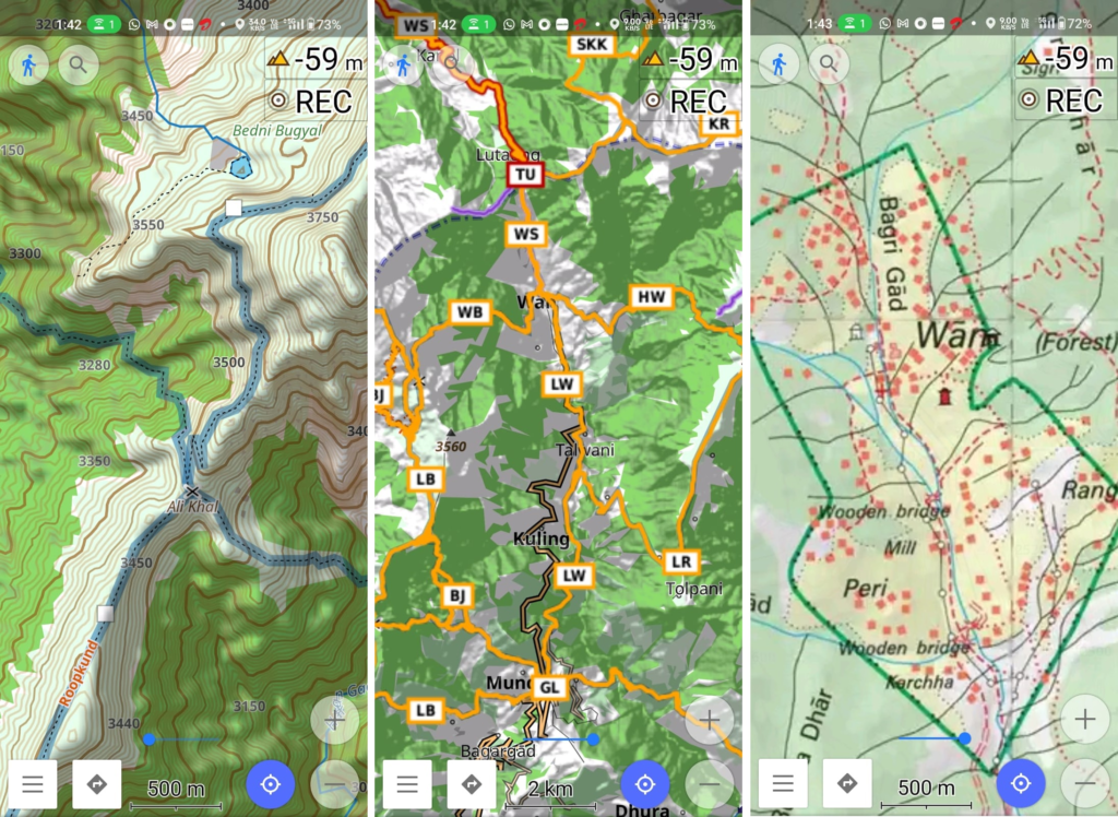
Above traverses can be easily navigated using most mobile mapping apps – many use Open Street Maps as base maps which include tens of thousands of kilometers of trails in Himalayas, Sahyadri, etc. OSM maps can be downloaded on the phone for offline exploration of the mountains without mobile network. Contours can be added to understand the topography of the terrain. Find a short tutorial over here.