
My name is Peter Van Geit, I was born and raised in Belgium and came over and settled in India in 1998. Falling in love with the natural diversity and beauty of the Indian subcontinent I started exploring the lesser known roads on my Enfield bullet riding 50 thousand km through the Western Ghats and Himalayas in the initial years. In 2008 I founded the Chennai Trekking Club chennaitrekkers.org, organizing outdoor and sports events across the 4 Southern states. Over a decade this non-profit volunteer based organization grew into a mammoth 40 thousand member community. In 2015 I got into ultra running and ran across thousands of kilometers in the Western Himalayas through beautiful valleys of Spiti and Pangi. In 2017 I quit the corporate world after 2 decades and got into “ultra journeys”, thousand kilometer long multi-month solo journeys fast hiking in remote regions of the Himalayas. In 2018-19 I crossed 150 high passes over 5000 km across 250 thousand meters of elevation gain (29x Everest height). Soul searching journeys through untouched virgin nature encountering heart warming humanity in the remotest corners of the Himalayas.
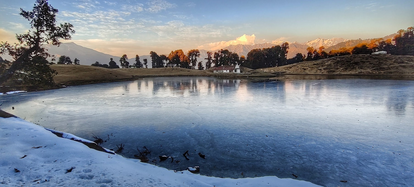
Early March 2020 I was about to embark on a 2000km long train journey heading North when India went into national lockdown spoiling my plans for a first winter exploration in the Himalayas. After my initial disappointment I soon got connected through my travel blog ultrajourneys.org with Aman doing his PhD on Himalayan glaciers. Sharing the same interest we soon started mapping out the entire Western Indian Himalayas in detail. Over 4 months we researched various legacy map sources (Survey of India, Soviet army, Olizane …) and geo-databases (NGA, THC, IMF…) to map out 2000 high passes, 700 glacial lakes, 20 thousand villages and 50 thousand kilometers of hiking routes across the states of Uttarakhand, Himachal, Ladakh, Jammu and Kashmir. Many of these dated maps were bound to be less accurate with marked trails possibly faded out over past decades overgrown by jungle, destroyed by landslides or fallen in disuse.
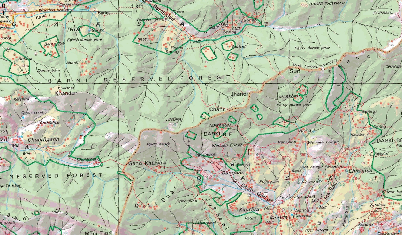
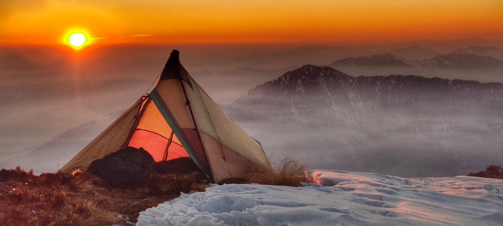
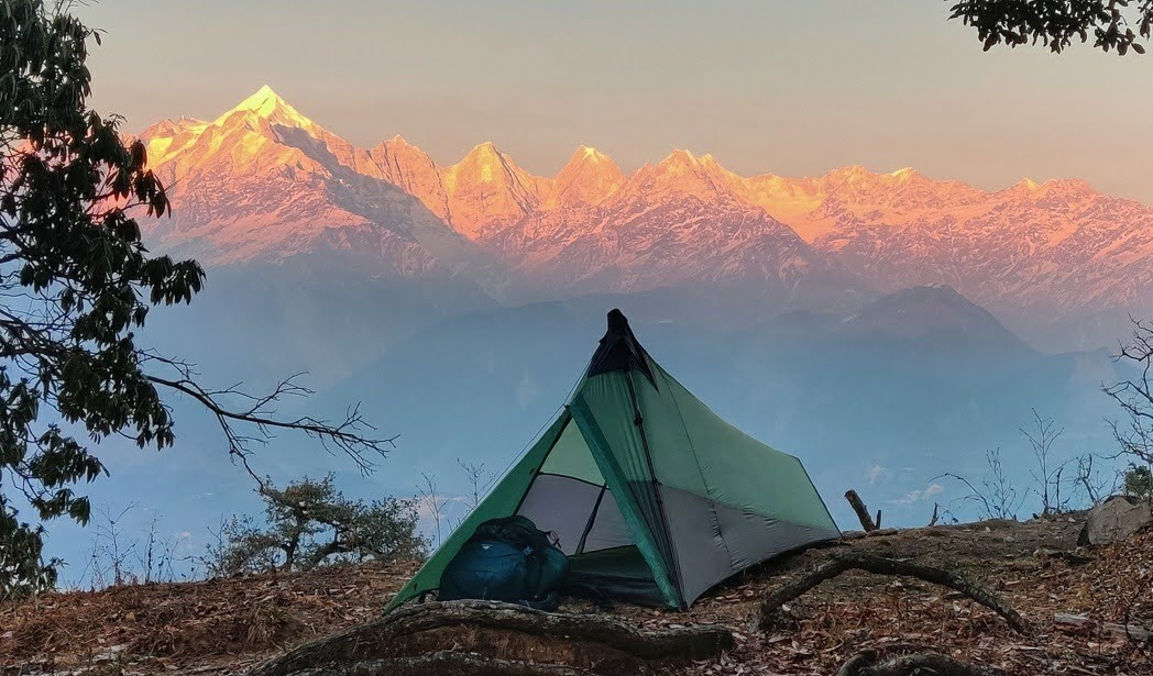
When the Northern states finally opened their borders again in November 2020 I packed up my bag and was on my way to Dehradun, the capital of Uttarakhand, for my first Himalayan winter exploration. After 2 years of fast hiking across 150 high passes during summer, I was both nervous and excited to venture out in peak winter in the high mountains for the first time. I had upgraded my backpack with the latest lightweight winter gears from Huzefa, a friend from Himachal designing his own minimalist hiking gears at blueboltgear.com. I had mapped the entire state of Uttarakhand in high detail through the 1:100K scale Survey of India maps eliminating the need to put together a months long traverse in advance. I was planning to keep my route dynamic, deciding each day on the way forward based on weather conditions, advancing snowline and my success or failure rate of exploring these lesser known, ancient trails.
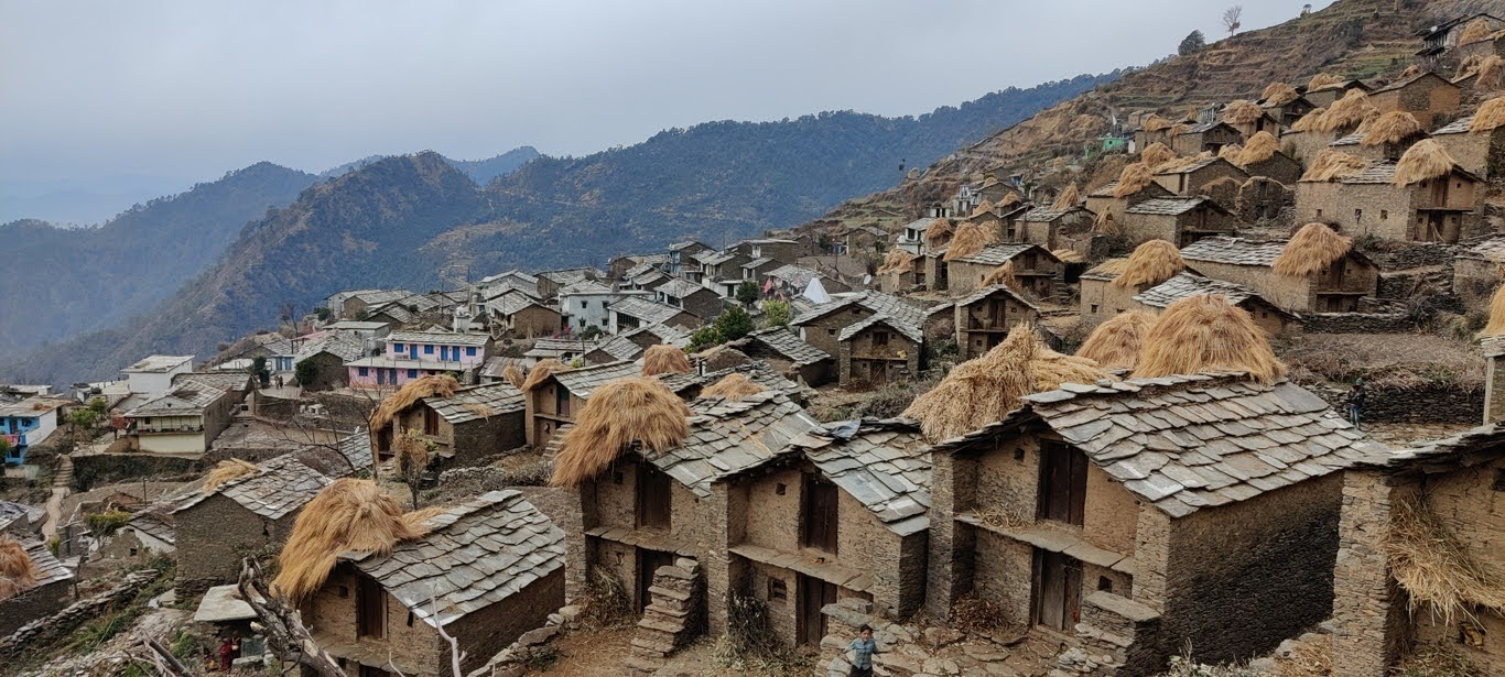
Uttarakhand is dotted with thousands of remote farming hamlets spread across countless valleys, connected by frequented trails and beautiful heritage cobbled rock paths making finding your way, food planning and night shelter easy. Having accurately mapped 20+ thousand settlements across the Himalayas one can simply hike from hamlet to hamlet referring to the names guided forward by the locals. Most passes connecting neighboring valleys can be crossed in a single day reaching a village in the next valley, providing a safe place to camp and eliminating the need to carry food. Hospitality is unmatched in these lesser known, non tourist regions, many nights a friendly villager insisted to host me in his home providing dinner and night stay. Uttarakhand also has many isolated dwellings at higher altitudes which are used to graze cattle and farming during summer months. These are deserted in winter providing a safe night halt inside a deserted rock or wooden shelter. These summer dwellings were excellent substitutes for my night stays with shepherds grazing the high meadows in summer.
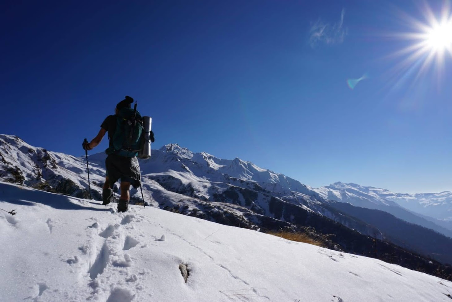
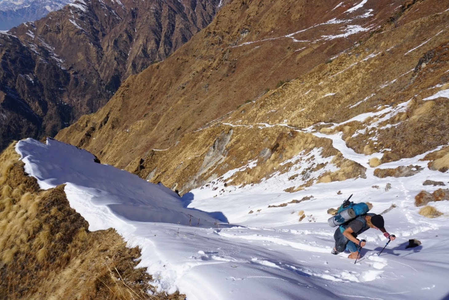
During my summer ultra journeys in previous years I covered passes in the range of 4000 to 6000 meters. Being peak winter now my focus was on a mid-level traverse of Uttarakhand targeting passes between 2500 to 4000 meters altitude moving carefully up or down as per the weather conditions. Periods of fresh snowfall would lower the snowline forcing me to focus on lower passes while subsequent weeks of snow free sunny days would retreat the snowline again allowing me move up to higher passes. Exploring these less known trails in winter would prove an exploration challenge with snow putting a uniform white blanket across the landscape making it easy to lose track. With no clear route or accurate GPS log and navigating using old, inaccurate Survey maps surveyofindia.gov.in finding my way across these remote snow covered regions would require use of all my navigation and path finding skills. Many times, offline contour maps were essential to navigate off track when losing the trail. Staying abreast of the weather forecast was key to survival not to get snowed in while exploring very remote regions.
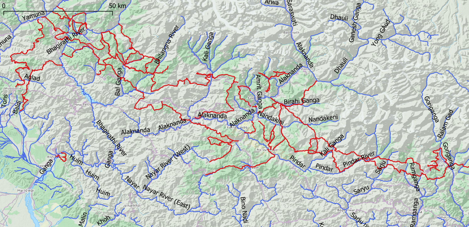
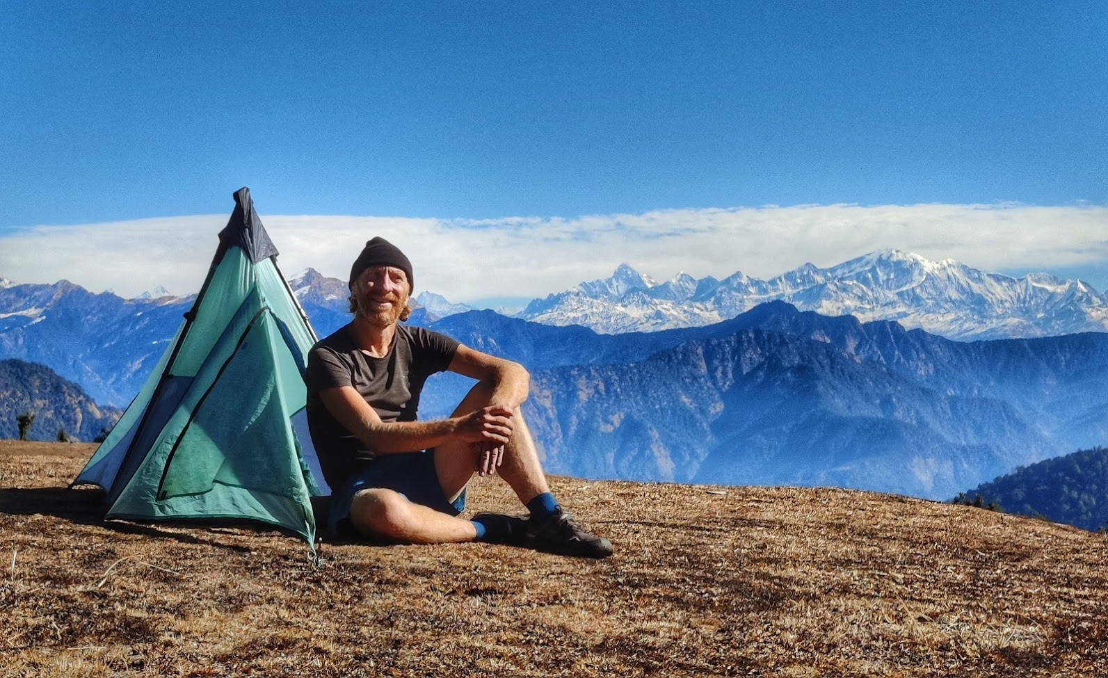
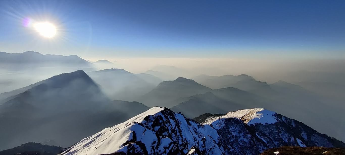
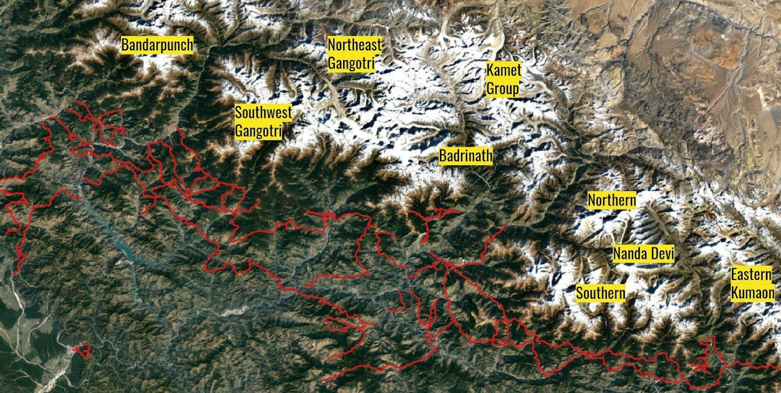
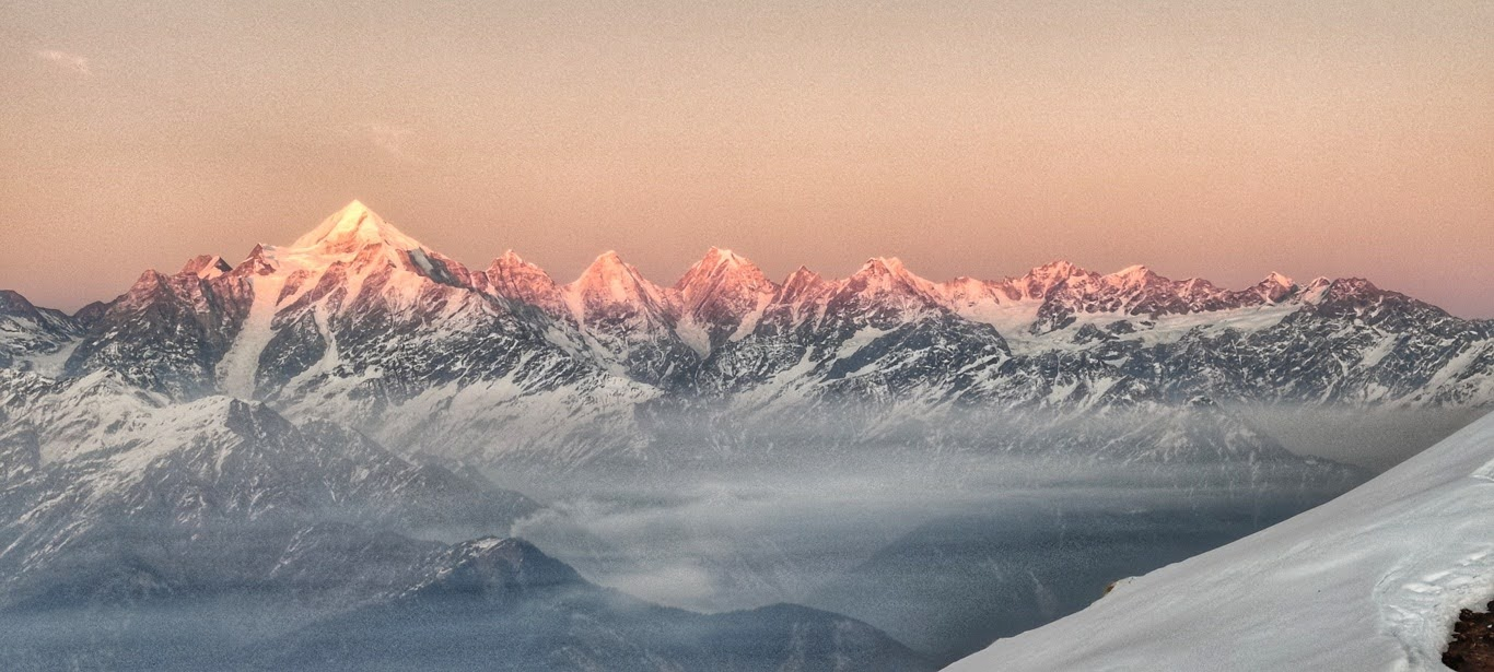
Focus was on exploring the “green zones” on the Open Street Maps osm.org demarcating virgin nature reserves with lush green forest cover and lesser human habitation. Most days I would not encounter a single soul on my way until reaching a remote hamlet by night fall. I would usually be “hopping valleys”, climbing across passes and ridgelines separating adjacent valleys. Over 3 months I climbed a total of 110 passes adding up to 1.7 lakh meters of elevation gain (19x Everest height) or nearly 1.3 passes per day. This enormous effort in a relatively short time frame is only possible by going lightweight using minimalist gears and optimizing food supply. I traversed the entire breadth of Uttarakhand across umpteen valleys: from the Yamuna river in the West to the Goriganga in the East passing through Bhagirathi, Bal Ganga, Bilangna, Kali Ganga, Amrit Ganga, Alaknanda, Birahi Ganga, Nandakeni, Pindar, Sarju and Ramganga in between. As I was climbing across the ridges in between the valleys I got mesmerizing views on snow capped high ranges in the North: from the Bandarpunch range in the West passing the Southwest and Northeast Gangotri ranges, Badrinath and Kamet groups, Southern and Northern Nanda Devi subsections to the Eastern Kumaon group near Nepal. Using the peakfinder.org app I could identify and admire many of the 6000-7000m+ well known peaks like Trishul, Chaukhamba, Nanda Devi, .. from different angles along my route.
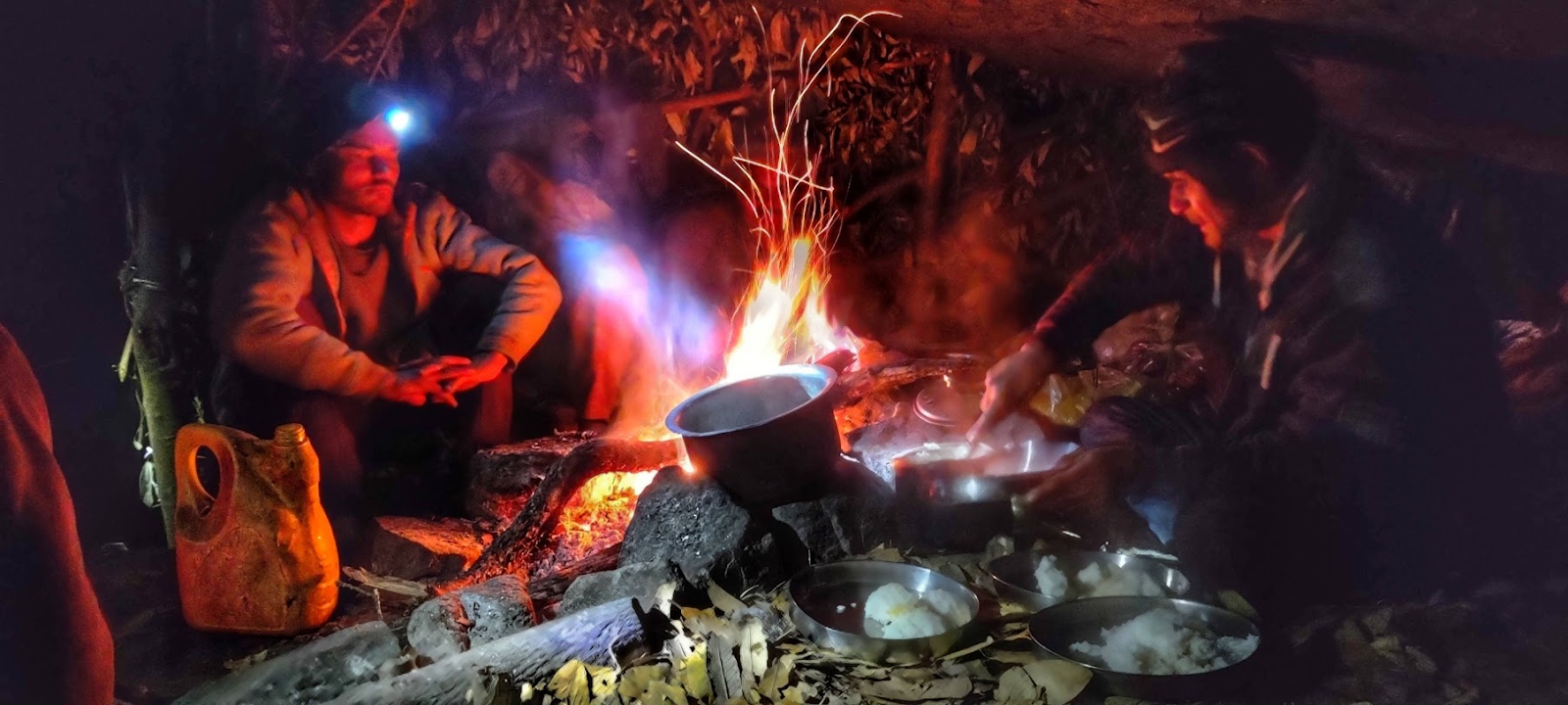
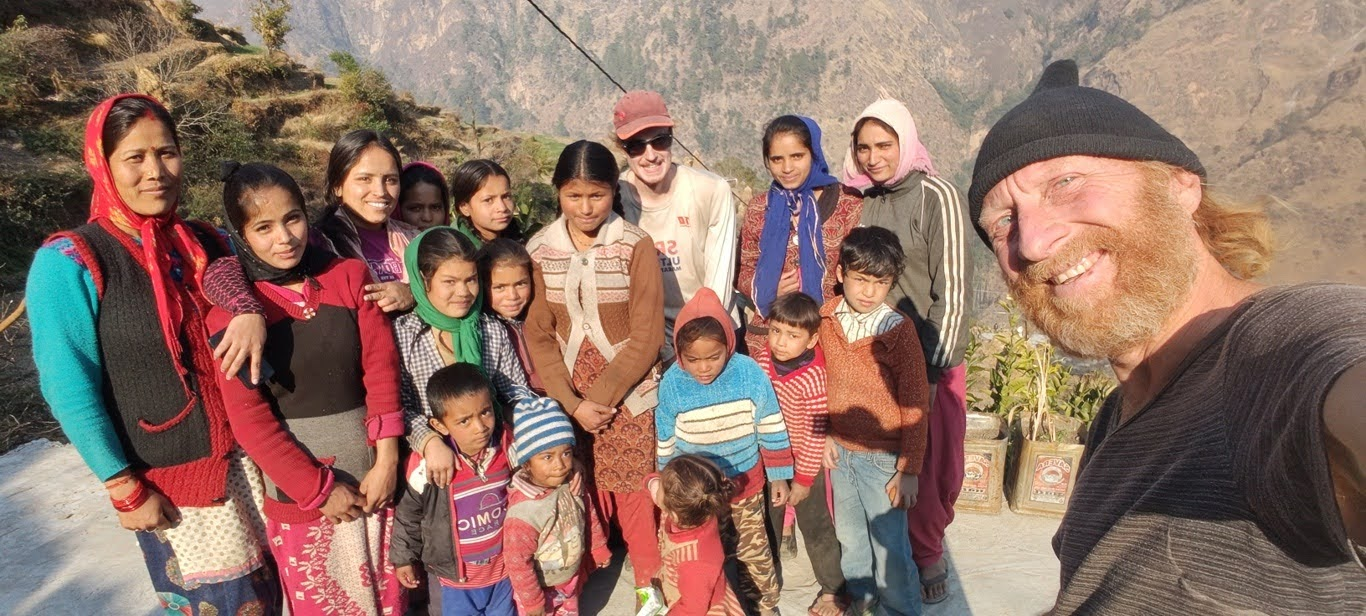
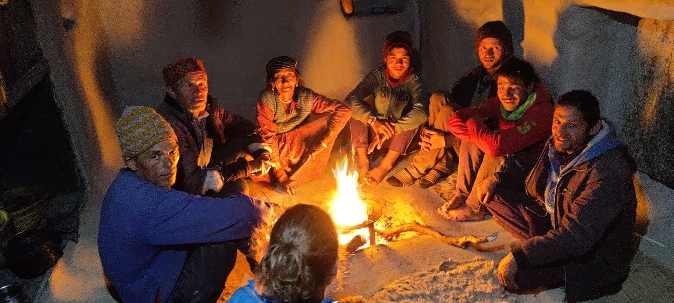
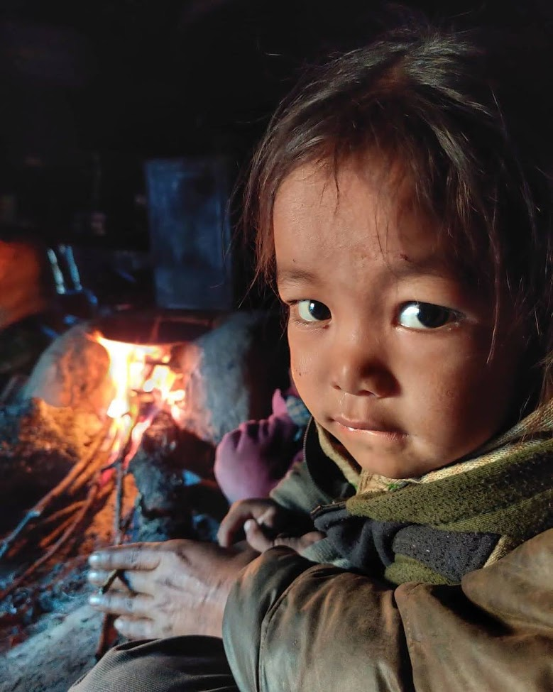
Highlight of the journey was no doubt the heart warming hospitality of the mountain people in these remote regions of Uttarakhand. Locals would be surprised to see (possibly first in a lifetime) a solo outsider passing through isolated picturesque farming settlements. Immediate intuitive response of the people would be of concern and offer guidance, a hot cup of tea, a home cooked meal and – if in the evening – night shelter. Villagers would be eager to know where I came from, where I was heading and which country I belong to, unable to grasp how I found my way through these remote, off the map locations. Some days I would get invited in homes several times a day for a cup of hot chai with the entire family or village gathering around. Certain periods I was unable to pitch up my tent for days being offered a nice room with a cozy bed and warm blankets at night after indulging in a freshly cooked home made dinner. Before heading out the next morning people would prepare breakfast or provide packed lunch and – with genuine concern – guide me in the right direction. The peacefulness and humanity experienced in these untouched natural locations are at a stark contrast with crowded commercialized tourist spots where one encounters hundreds of tents and people piled on top of each other.

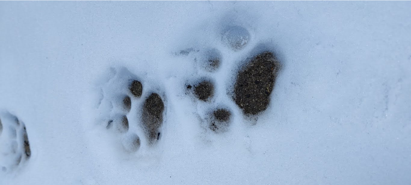
Compared to the South Indian jungles which I had been roaming for over a decade as part of the Chennai Trekking Club I usually spotted much less signs of wildlife in the high regions of the Himalayas during previous summer ultra journeys. This time in winter a white blanket revealed an active animal world with paws imprinted in the fresh snow across the trail. I encountered regular foot prints of leopards, deer, wild goats and foxes. While sleeping in deserted shelters high up in the mountains I would hear footsteps of animals roaming around at night or even jumping on the roof of my shelter. In one remote jungle near Ghuttu I discovered the corpse of a recently deceased leopard. Initially taken by surprise by this close encounter I was nervous to more closely inspect this large, beautiful predator. Informing the forest department of the exact location they recovered the carcass and identified the likely cause of death to be a territorial dispute between males. In many places I encountered jungle fowl that were breeding at high altitude snow covered regions. Equally regular were the black faced langur monkeys living together in communities. Wild goats and deer were usually too attentive to be caught by surprise, spotting them only a few times.
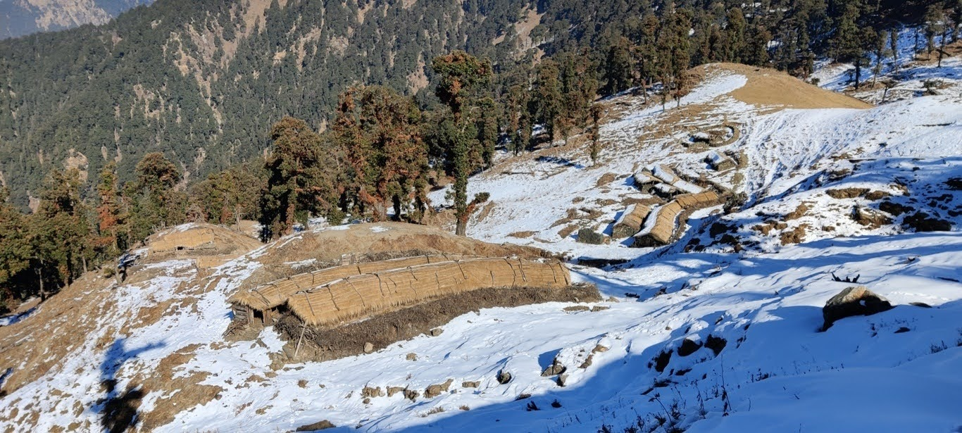
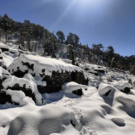
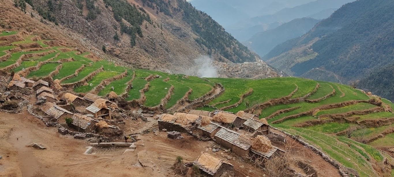
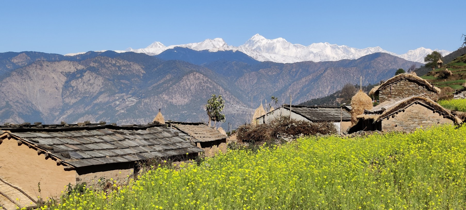
Many of the isolated dwellings higher up in the mountains and deeper inside the forests were permanently abandoned partly lying in ruins and farmlands overgrown as young generations were migrating to cities for comfort and easy money. In some cases climate change had dried up streams, vital life sources for these isolated human farming settlements. It was saddening to see these – once vibrant farming communities connected by beautiful rock pathways – abandoned as people were moving to the cities in the plains adopting a modern non sustainable lifestyle further accelerating environmental degradation and human climate migration seen first in the high mountains. While descending to lower, warmer altitudes with presence of abundant fresh stream water I would encounter vibrant villages surrounded by lush green and yellow (mustard) terrace farms dotted with pastel colored houses made of natural materials. Across Uttarakhand armies of Nepali workers were building new roads at a hectic pace connecting the most interior valleys followed by power lines and mobile towers while the human migration was happening in the reverse direction. My heart was saddened to see centuries old heritage pathways being destroyed by landslides caused by new road construction. Share taxis were soon to follow leaving these heritage paths in disuse and locals even questioning us why we were not traveling by road…
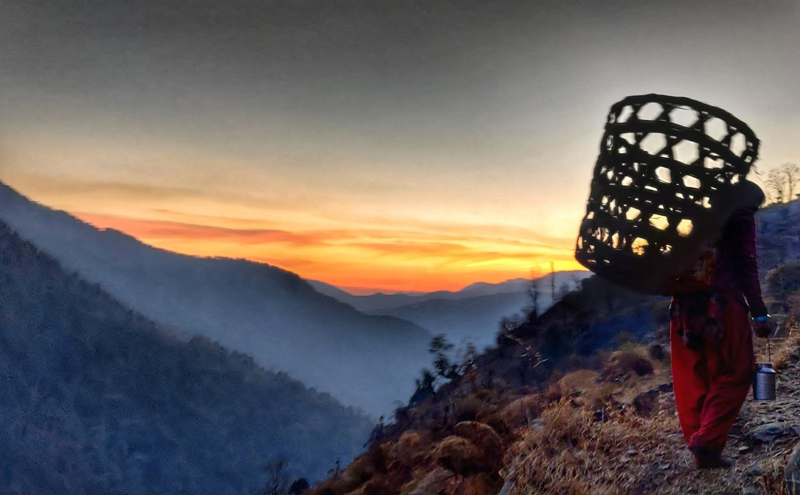
One remarkable aspect seen across Uttarakhand was women folk carrying labor on their own shoulders while men were frequently seen chilling out in groups on rooftops or near the local tea shop. Ladies, young and old, could frequently be seen carrying firewood from afar, lifting large baskets filled with leaves fetched from deep inside the forest, mixing leaves with dung collected from cattle quarters for manure to be put on the farm lands, cooking and feeding a large family (and cattle) after working the entire day outside and of course bearing and raising children. Some ladies were knitting warm clothes while carrying large sized bamboo baskets on their back. Only towards the end of winter I could see a few men getting into action ploughing the terrace farms using bulls. In some remote hamlets I was delighted to still find the art of wool spinning. In some hamlets where power had not yet reached a small building near the stream would house a common grinding stone hydro powered by the fast flowing water. November-December turned out to be an auspicious time for marriages seen and heard from afar by playing local instruments and house decorations. Frequently I was invited into these indulging in local cuisine and observing local tradition and clothing. In one place ladies were dancing and shouting out wildly calling out to the afterlife as the whole village was assembled to remember the recent death of a few of their inhabitants.
Routes explored were accurately recorded and sent back to my team at home which would upload them onto Open Street Maps visible to the worldwide hiking community. The Survey of India maps turned out to hold a hidden treasure of remote pathways and trails unknown even to some of the locals. Many of these were not entirely accurate but precise enough for me to find the actual trails on the ground and stay on track. In some cases the trails marked on the map were no longer in use and had been completely overgrown by forest or destroyed by landslides. I was navigating using OSMAnd, an offline OpenStreetMap viewer providing me a rich OSM base layer showing terrain, rivers, remote settlements overlaid with contours essential to analyze the topography or steepness of the terrain additionally overlaid with tens of thousands of kilometers of digitized hiking trails. On the ground I discovered 10x more trails than actually marked on the maps, connecting remote hamlets, grazing meadows and local pilgrim destinations. An accurate route on OSM and a detailed daily post on my blog was uploaded for each of the 110 passes / traverses allowing any independent hiker in the world to easily retrace my footsteps by just downloading the GPS log from hiking.waymarkedtrails.org and reading the detailed recount on my blog ultrajourneys.org.
More photos over here