
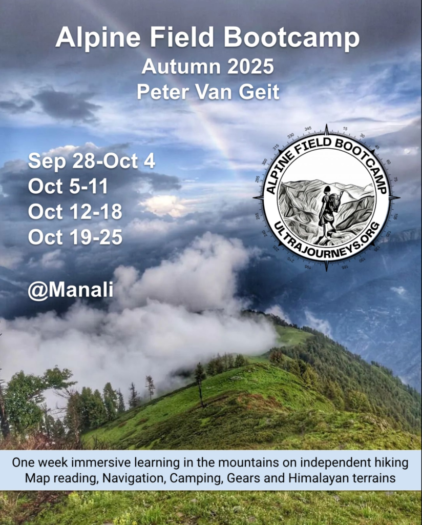
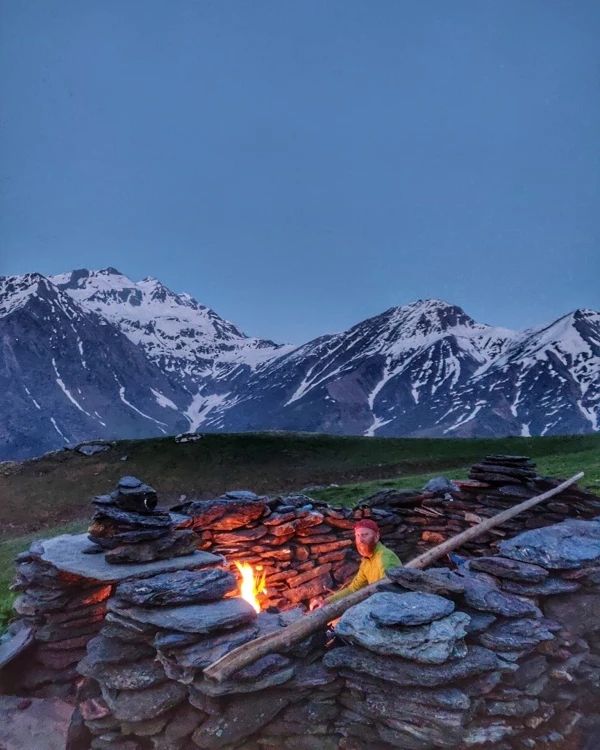
Alpine Field Bootcamp is a one week field course in the Himalayas on independent hiking, map reading & navigation, high altitude terrains, lightweight gears, traverse planning, topography, food & shelter, seasons & weather, Himalayan maps, etc. Participants will check into a beautiful basecamp in the mountains where above topics will be taught through theory and hands-on field assignments in the surrounding forests and meadows. Register here.
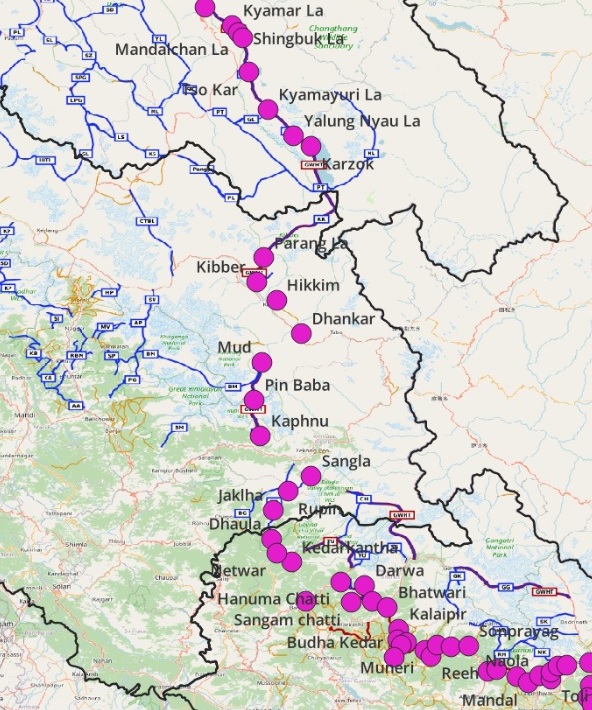
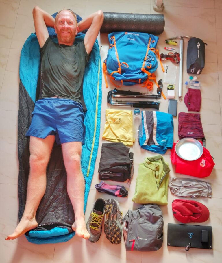
Ultra Journeys are month long solo explorations over thousand kilometers and hundreds of mountain passes across the Indian Himalayas. As a minimalist fast-hiker I explored and mapped 350+ traverses / mountain passes across Himachal, Ladakh, Uttarakhand and Jammu & Kashmir. This section includes detailed maps, articles, blogs, news & videos for each journey.
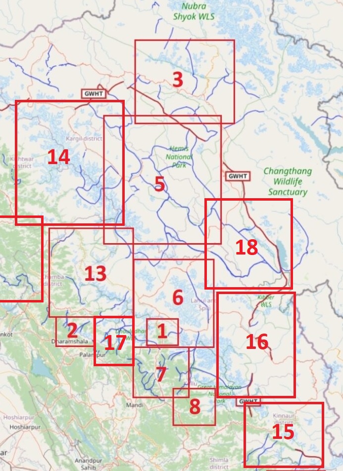
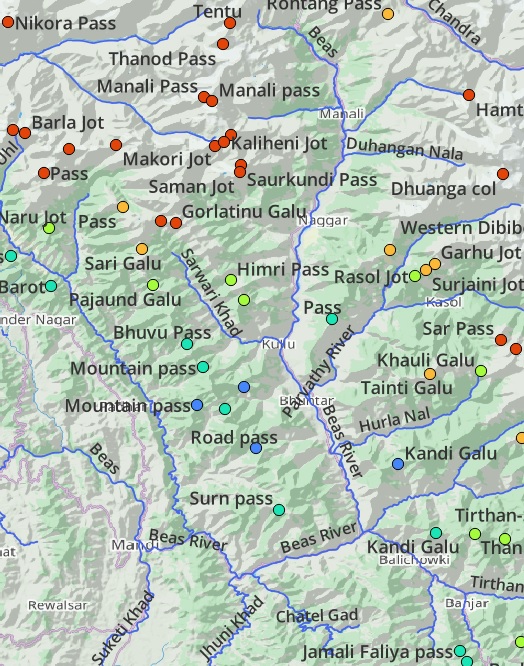
Himalayan Traverses. More than 600 hiking routes spanning 12 thousand kilometers across the Western Himalayas have been explored, GPS recorded and accurately mapped in Open Street Maps. Find an overview of these beautiful routes categorized in 19 Himalayan regions: geography, high ranges and main rivers and hiking route network.
Guiding independent hikers. Based on my extensive exploration experience of 350 mountain passes in the Western Indian Himalayas and exploring jungles in South India for over a decade I guide independent hikers from around the world in planning and executing their Himalayan traverses as per the seasons, identifying a realistic schedule, advising on gears, acclimatization, night halts and food supply.
Courses 12 Online Courses and Webinars consolidating my extensive alpine hiking experience exploring more than 350 high passes across the Western Himalayas and a decade of wilderness exploration in the jungles of South India. Map reading and route planning, navigation techniques, planning an alpine journey, fast hiking and lightweight gears, Himalayan terrains, GIS analysis of Himalayan geography and hiking trails, Open Street Maps, etc.
Himalayas. Mapping the Western Indian Himalayas and Nepal, Geography and Hiking Routes, Overview of Himalayan Regions, Planning Seasonal Traverses, Hiking Gears, Ultra Running, Cycle Touring and Glacial Lakes. All you need to know to explore the beautiful Himalayas independently.
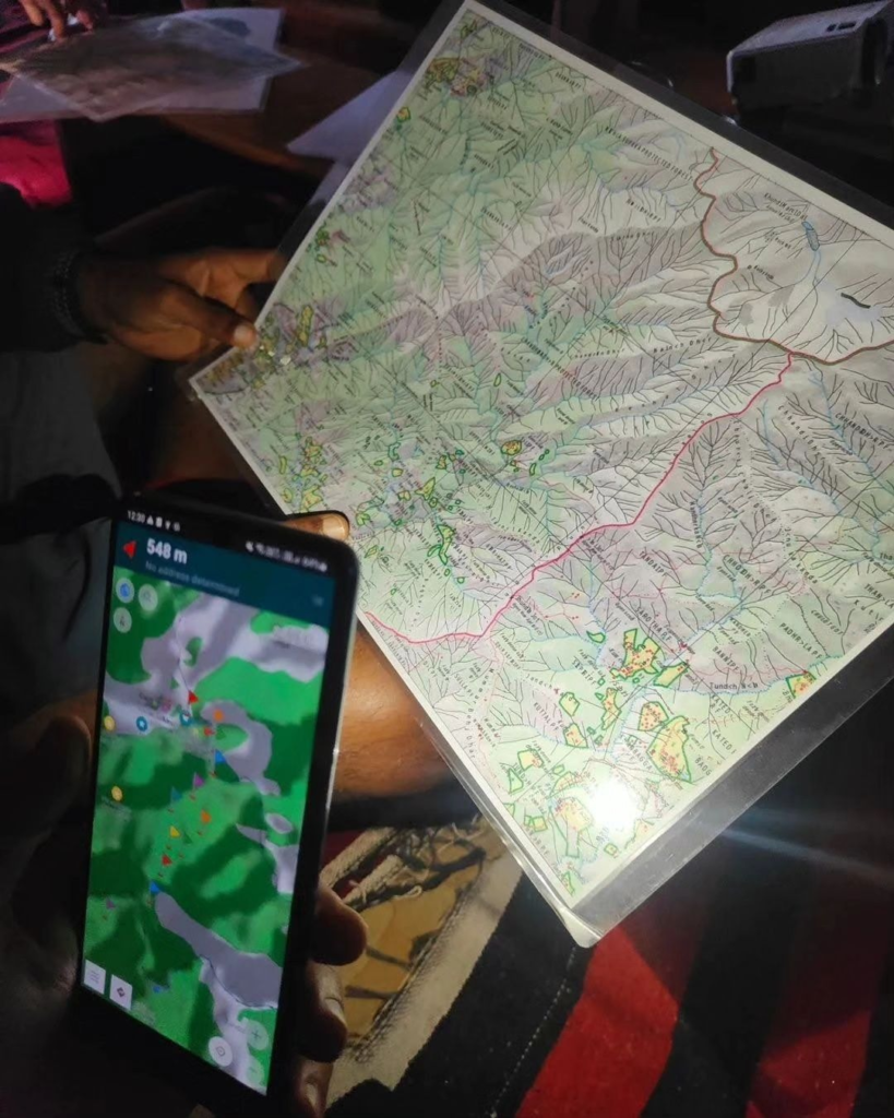
Maps to plan your Himalayan hikes. Open Street Maps, Himalayan Maps, Ultra Journey Maps, Survey of India Maps, Navigation, Topography, Olizane Maps, Soviet Military Maps, US Army Map Service. All the resources you need to research & plan your Himalayan traverses and navigate your way through the mountains.
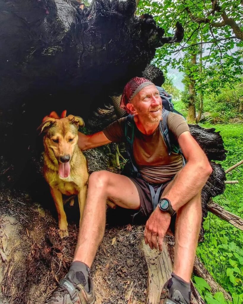
About myself. Ultra runner, alpine explorer, minimalist and diver. Born in Belgium, settled in India. Quit the corporate world in 2017 and into full time exploration & mapping of the Himalayas since then. My month long ultra journeys take me across thousands of kilometers in the remote mountains. Articles, interviews, news, awards, talks, videos and short-films, relief efforts
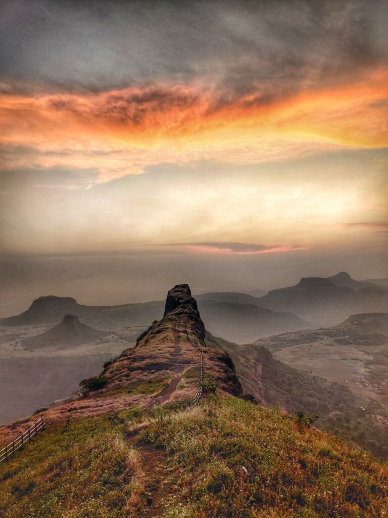
Sahyadri. 12 beautiful long traverses across 1000km of trails connecting 150+ forts, peaks, ghats and lakes spanning the Sahyadri range in the Western Ghats of India. Major benefit of multi-day long traverses is that one can cover many forts and peaks in a single journey with beautiful overnight camps avoiding significant onward/return travel overhead part of multiple one-day single fort visits.

Patreon get first hand insight in my ongoing and future ultra journeys, interact with myself and other patrons, download hires maps of the Himalayas and thousands of hiking trails, access Himalayan webinars on my YouTube channel, join my online bootcamp to master the art of alpine style exploration, download detailed offline maps for navigation, personalize guidance on Alpine traverses. Become a Patreon.