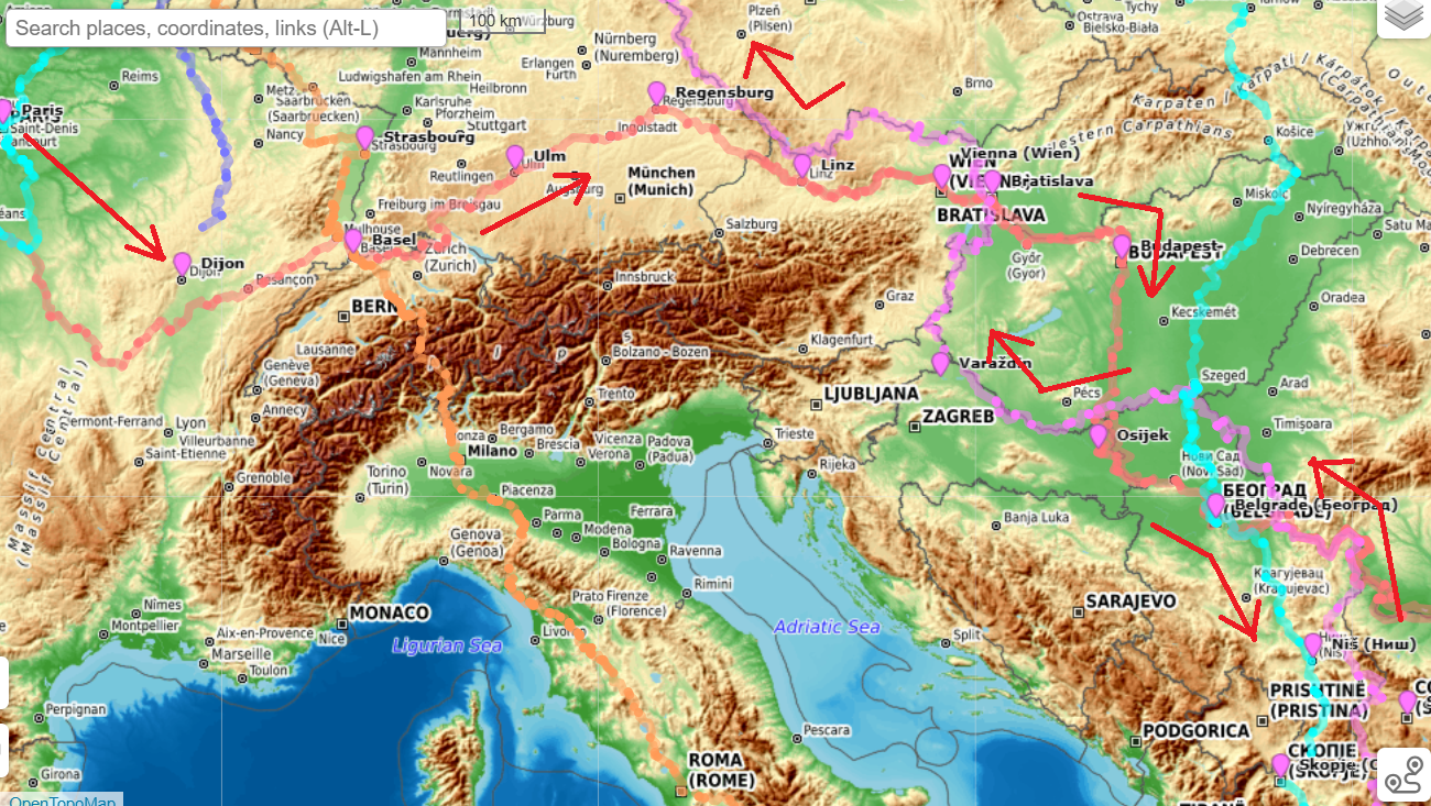
This post presents an overview on how to plan a long distance cycle tour through Europe. Last year we completed…

This post presents an overview on how to plan a long distance cycle tour through Europe. Last year we completed…
Contents Timeline Click here to download Important Notes Going East to West has two limitations: Route Monsoon May moderate rains…
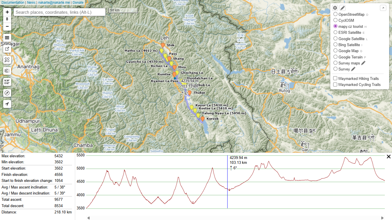
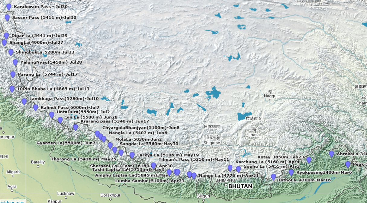
In this post we take a closer look at end-to-end planning of a route in the Himalayas. Initial planning of…

Contents Timeline Timeline / Route Food Drops (30) Download over here Important Notes Route Monsoon No impact of July monsoon…

Stories over here Memories View this post on Instagram A post shared by Peter Van Geit (@petervangeit) View this post…

Click here to register Batches Registrations open for the next edition in September. Sign up to be notified once dates…
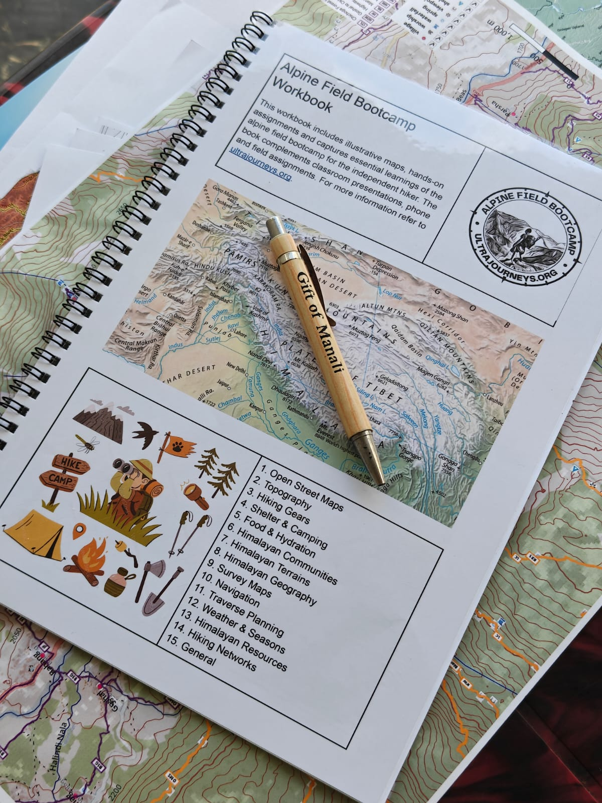
Students receive a workbook with illustrative maps, handson assignments and key learnings of the alpine field bootcamp for the independent hiker. This book complements the classroom presentations, phone and field assignments and can be use for future reference while planning independent hikes.

Find below high resolution elevation maps of the 11 major basins of the Western Indian Himalayas showing 160 base towns, 100 major rivers, 800 OSM hiking routes, 500 mountain passes and 1400 peaks. Can be printed in color on A3, A2 sizes and put on the wall to study the Himalayan geography and plan your next Himalayan traverse. Beas Alaknanda Indus Yamuna_Bhagirathi Spiti Ravi Chenab Sutlej Jhelum Shyok Sharda

Hires topographic elevation maps of 11 major basins of the Western Himalayas showing major rivers, main towns, peaks, mountain passes.…

Find below different shaded relief maps providing unique views of the Himalayas: Maps were generated via QGIS using OSM data,…