
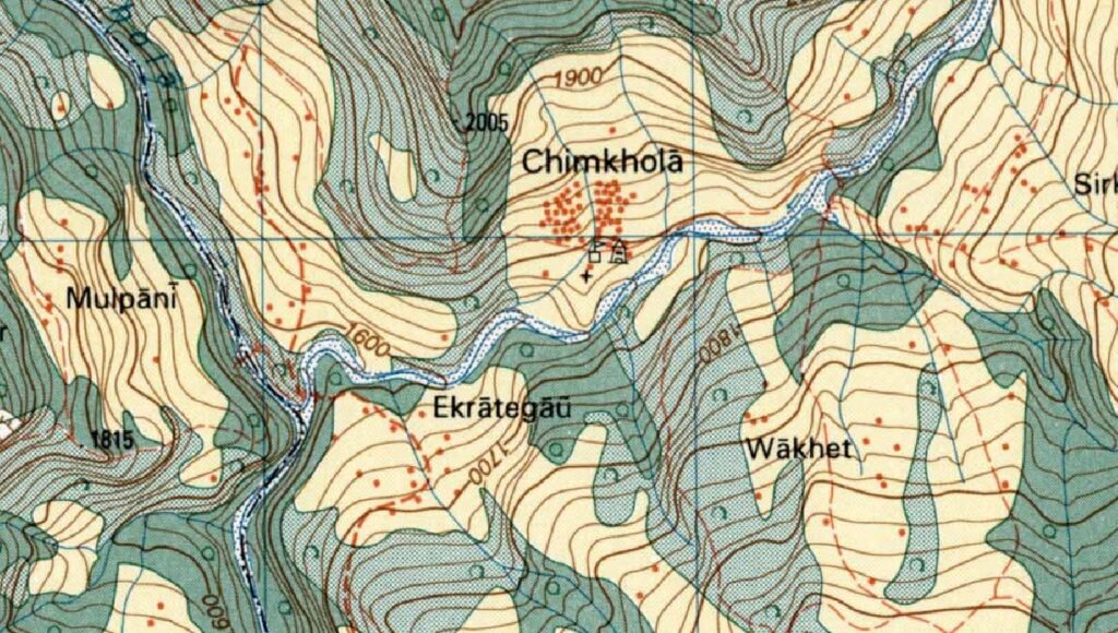
While assisting Jeremy Bige on planning a route through Nepal I stumbled upon detailed 1:50K/1:25K topo map sheets for Nepal over here. For planning and navigation purposes it is required to download, geo-reference, stich the sheets together and export the overall map in an offline tile format which can be used by GIS and navigation apps.
I downloaded around 100 topo sheets covering the upper regions of Nepal, geo-referenced them in QGIS and generated offline tiles for each province of Nepal in MBTiles (can be used in QGIS for planning) and SQLitedb format (can be used in OSMAnd for offline navigation). These maps complement the trails which have already been mapped in Open Street Maps and provide rich terrain detail (remote settlements, passes, etc).
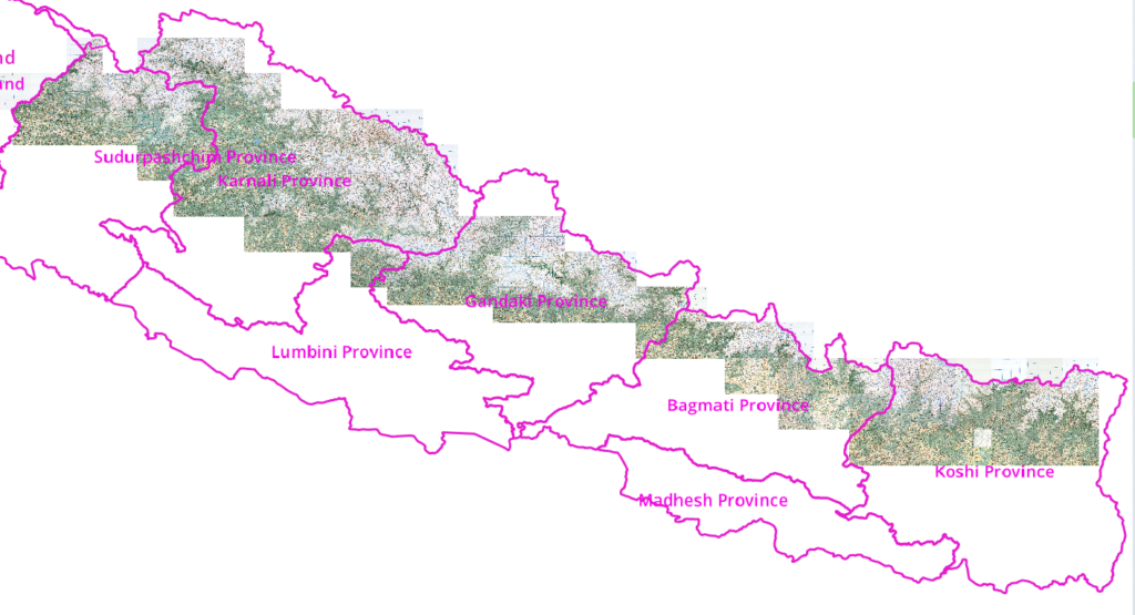
Planning a trans Himalayan traverse in Nepal using the topo sheets in QGIS:
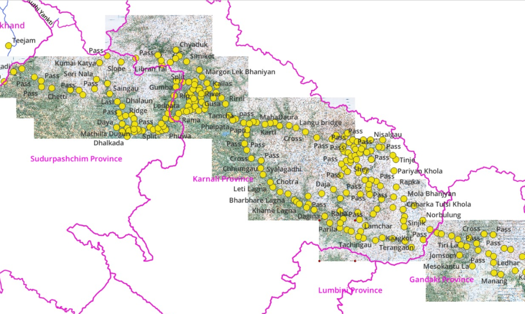
Many trails in Nepal have are already mapped in Open Street Maps:
Navigating the Himalayas using offline topo sheets in OSMAnd / mobile:
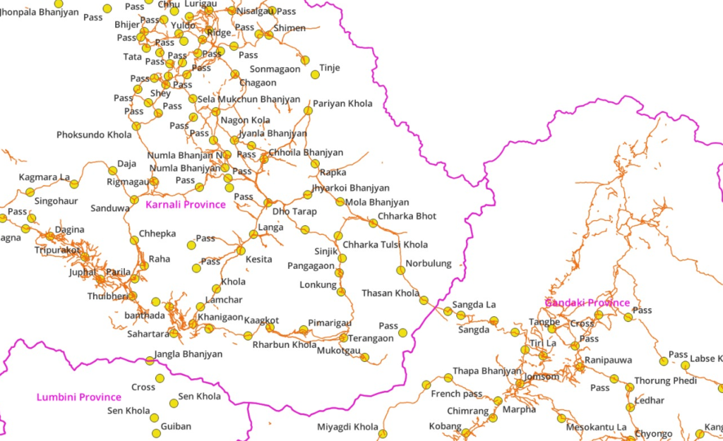
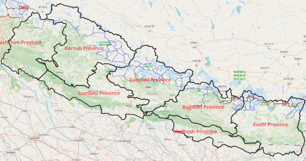
Combining trails from topo sheets and Open Street Maps we can map the Great Himalayan Trail across the entire width of Nepal:
Dear Peter,
just want to say thank you very much for posting to your website! I really enjoy receiving new posts as an email, and it’s very nice since I don’t have to get distracted to much by instagram for instance.