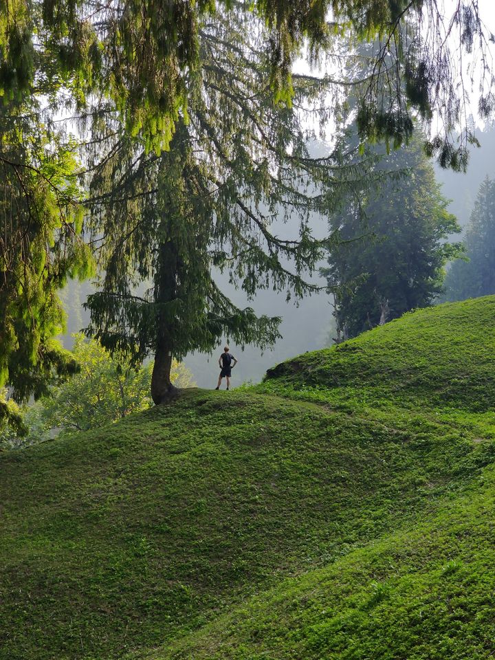
Manali is a well known destination for the outdoor community offering many beautiful hiking routes through pine forests and meadows on the surrounding slopes of the Beas river valley. There are both small local hikes connecting neighboring villages suitable for beginners as well as longer traverses to higher altitudes for intermediate hikers.
Chose the right route (altitude) during the right season. Higher altitude routes are off limits during winter due to snowfall. One can usually hike up to 2500m in winter (Jan-Feb), 3000-3500m in spring (Mar-Apr), 4000m in early summer (May-Jun) and higher up in late summer (Aug-Sep). Monsoon (July-mid Aug) is usually not recommended due to heavy rainfall / landslides / dangerous stream currents.
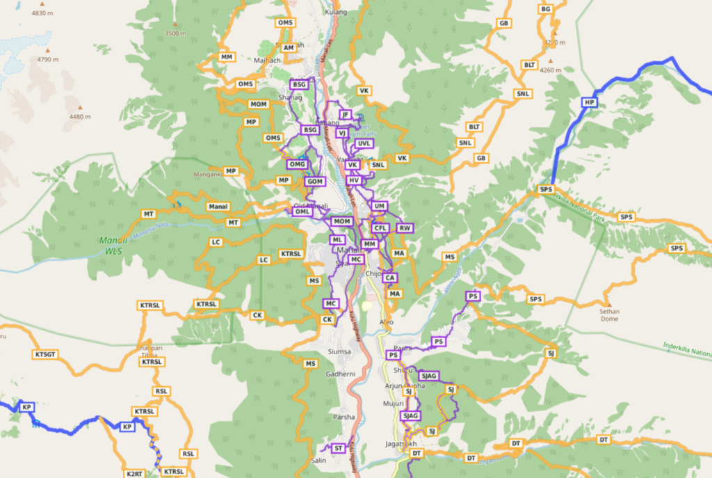
Many of the routes around Manali were initially explored and accurately mapped in Open Street Maps by @creedaz. OSM maps can be downloaded on your phone and used for easy navigation of the respective routes. OSMAnd is my favorite app.
Hiking Networks
OSM hiking routes are categorized in 4 different networks:
- International (red) – long distance paths that cross several countries
- National (blue) – walking routes that are nationally significant and long distance paths
- Regional (orange) – walking routes that cross regions and are regionally significant
- Local (purple) – small local walking routes
Multiple individual hiking routes can be connected in a longer continuous or circular traverses. Beginners usually cover around 10km per day while experienced hikers can easily complete around 20km. Villages and hamlets in between can be used for guidance, food supply, safe night stay and charging your electronics.
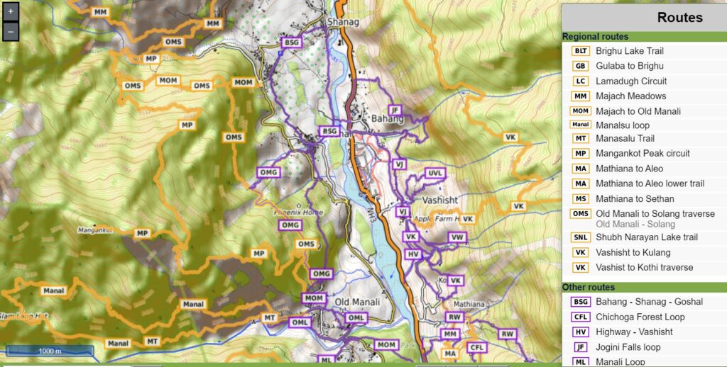
16 Local Hikes around Manali
The local hikes (purple) around Manali are a perfect start for beginners to gain experience and build confidence before taking up more challenging day/multi-day regional hikes (orange). Local routes can be completed within (less than) one day so no camping / overnight gears are required. Many of these local hikes connect the immediate surrounding villages of Manali: Old Manali, Goshal, Shanag, Bahang, Vashisht, Koshla, Mathiana, Chijoga, Aleo, Sethan, Chhyal, Nasogi. These smaller individual routes can be connected in longer, continuous traverses. Distance and elevation gain (total climb) for each hike is given below.
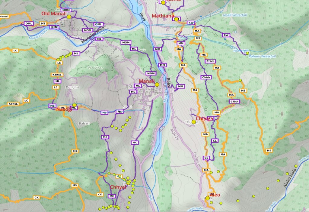
- Manali Loop (ML) – 5km / 230m+ from Mall road through Nehru Park climbing up to Dunghri, traversing in the upper pine forest and descending back via Nasogi and Siyal along a small Nala
- Manali to Old Manali (MOM) – 3km / 90m+ short hike from Mall road through Nehru Park to the top of Old Manali offering mesmerizing views on Beas river valley below
- Manali to Chhyal (MC) – 5km / 180m+ climbing up from Manali to a beautiful trail through pine forest towards Chhyal and looping back to Manali
- Manali to Mathiana (MM) – 2km / 210m+ Manali to Mathiana village through upper forest trail on Eastern slopes of Beas river valley
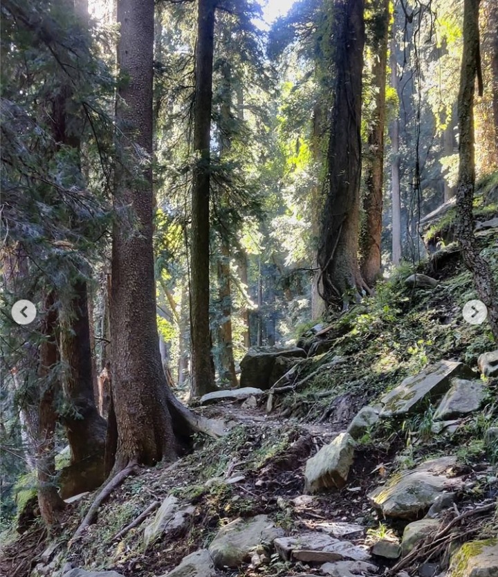
- Mathiana to Manali (MM) – 2km / 50m+ return route through lower apple orchard paths from Mathiana to Manali. Can be combined with previous one
- Upper Mathiana (UM) – 2km / 300m climb up above Mathiana village through apple farms above a small stream .
- Rahani Waterfall (RW) – 4km / 600m+ climbing up from Mathiana through remote pine forest to the hidden Rahani waterfall.
- Chichoga Forest Loop (Chich) – 3.2km / 300m+ beautiful loop through scenic pine forest on the Eastern bank of Beas river valley offering birds eye views on Manali
- Chichoga – Aleo Loop (CL) – 2.6km / 330m+ lower forest loop connecting Chichoga and Alea on the opposite bank of the Beas river
- Parini – Sethan – 4.3km / 980m+ steep hike from Beas river up to Sethan village (3000m), base of the Hampta pass trek
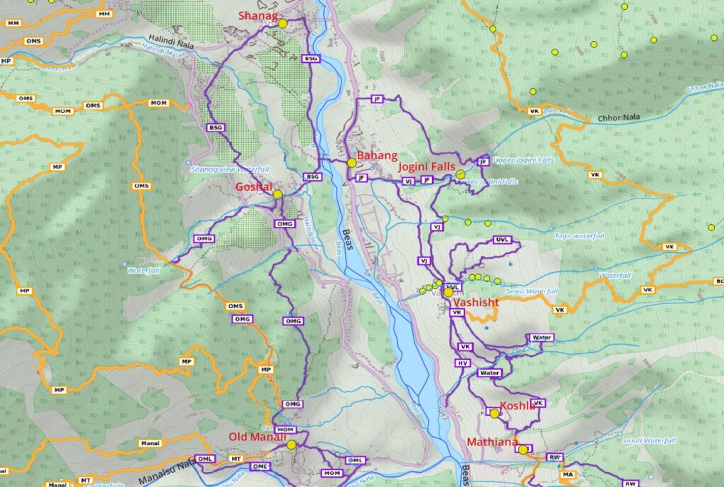
- Vashisht – Koshla (VK) – 3.2km / 450m+ beautiful trail loop through meadows and pine forest connecting neighboring villages. Can be combined with MM+MM as beautiful Manali-Vashisht loop
- Vashisht – Jogini Falls (VJ) – 2.7km / 230m+ loop through apple orchards from Vashisht to the famous Jogini Falls and back
- Vashisht Waterfalls loop (Water) – 2km / 360m+ – beautiful pine forest loop around 4 waterfalls cascading in a Nala just South of Vashisht
- Upper Vashisht loop (UVL) – 2km / 410m+ loop through apple orchards and remote settlements high above Vashisht
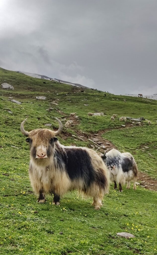
- Jogini Falls Loop (JF) – 3.6km / 620m+ beautiful trail from lower to upper Jogini falls and looping through Bahang village offering birds eye views on Beas river valley below
- Old Manali to Goshal (OMG) 5.2km / 440m+ Beautiful loop through pine forest between both villages with mesmerizing views on Beas river valley
- Bahang – Shanag – Goshal (BSG) – 3.6km / 70m+ fairly flat scenic loop through apple orchards on the West bank of Beas river
21 Regional Hikes around Manali
Once you have gained confidence in the local hiking routes you can try some of these mid-level hikes around Manali. Depending on your pace most of these routes can be completed as either day or multi-day hikes. Plan accordingly.
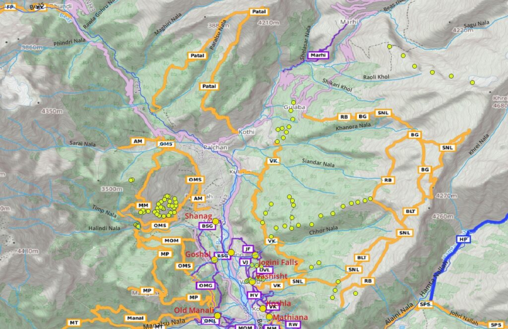
- Vashisht – Kothi (VK) – 11km / 1000m+ initial steep climb above Vashisht to a scenic horizonal traverse through pine forest to Kothi village. One of the most beautiful traverses. Blog post
- Brighu Lake (BLT) – 5.8km / 1300m+ steep climb above Vashisht (2100m) through pine forest and meadows of Pandu Ropa to the alpine Brighu lake (4200m). Mesmerizing views on the snow capped ranges on the opposite side of valley. Blog post
- Gulaba to Brighu (RB) – 12km / 1060m+ popular tourist hike. Gradual ascent from Gulaba (3000m) on the way to Rothang pass through alpine meadows high above the Beas river valley to Brighu lake (4200m). Blog post
- Patalsu Peak (Patal) – 14km / 1980m+ steep hike up from Solang valley through meadows to the Patalsu Peak (4200m) and back offers birds eye views on the Beas river valley
- Beas Kund Loop (BK) – 11km / 815m+ hike up from Dhundi through Lady’s Seat (3900m) to Beas Kund, the origin of the Beas river. Blog post Blog post 2
- Friendship Peak (FP) – 14km / 2100m+ steep ascend from Dhundi to Lady’s leg to Friendship peak (5290m). Final section is technical.
- Shitidhar Peak (Shiti) – 5km / 1550m+ steep ascend from Beas kund to Shitidhar peak (5290m). Final section is technical. Blog post
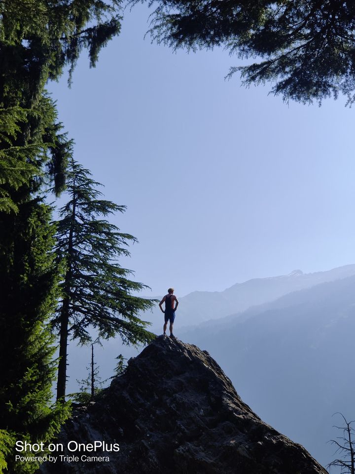
- Old Manali to Solang (OMS) – 11km / 720m scenic pine forest traverse from Old Manali to the Solang valley on the Western slopes of the Beas river valley. Crossing the Halidni Nala side-valley of Beas river near Majhach village. Blog post
- Majhach Meadows (MM) – 7km / 780m+ scenic climb through meadows high above Majhach village offering mesmerizing views (3050m) on Beas river valley below
- Magankot Peak (MP) – 13km / 1200m+ climbing up from Halindi Nala valley through meadows and forest to the Magankot peak (3350m) descending back through pine forest to Old Manali
- Manalsu Loop (ML) – 9.5km / 1260m+ a scenic loop in the Manalsu river valley from / to Old Manali along a steep slope
- Manalsu Trail (MT) – 6km / 660m+ one way hike from Old Manali into the Manalsu river valley to the Kho waterfall.
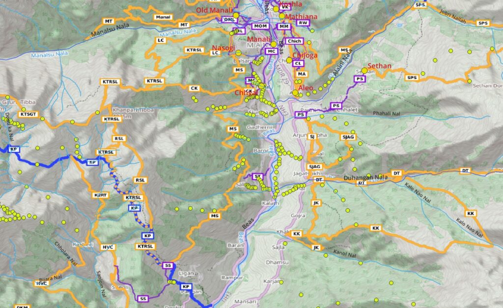
- Lamadugh Circuit (LC) – 10km / 1020m+ a scenic loop through pine forest above Manali to the popular Lamadugh meadow (3100m) and back through steep Manalsu valley. Blog post
- Kanpari Tibba & Rani Sui Lake (KTRSL) – 19km / 2500m+ hike up from Manali through pine forest to Lamadugh and continue through meadows to Kanpari Tibba (4200m) descending South to Ranu Sui lake and steep down into the Beas river valley to Sangchar village. Blog post
- Manali to Sangchar (MS) – 15km / 990m+ one of the most beautiful traverses on the Western slope of the Beas river valley between Manali and Sangchar through pine forests and alpine meadows offering beautiful views on the valley below. Blog post
- Mathiana to Aleo (MA) – 5km / 430m+ pine forest traverse above Mathiana – Chijoga – Aleo. Can be combined with other sections till Vashisht
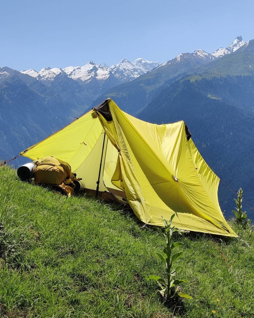
- Mathiana to Sethan (MS) – 9.3km / 900m+ hike up through beautiful pine forests above Chijoga and traverse into the Alini Nala river valley to Sethan (3000m). Blog post
- Sethan to Piangniru (SPS) – 17km / 1300m+ hike through the alpine meadows above Sethan to the Sethan Dome (4000m) looping back to Piangniru
- Shuru to Jagatsukh (SJAK) – 12km / 1400m+ hike from Shuru climbing up on the Eastern slopes of the Beas river valley to 2600m through pine forests to Jagatsukh
- Deo Tibba (DT) – 29km / 4600m+ hike up gradually through the Duhangan Nala river valley to the base of Deo Tibba (6000m). Final section is technical
- Jagatsukh to Khakal (KK) – 13km / 2100m+ climbing up from Jagtsukh on the Eastern slopes of the Beas river valley through pine forest and meadows (3700m) to Khakal
3 Long distance Hikes around Manali
Once you have gained sufficient experience on multi-day regional hiking routes and you feel confident enough you can try some of these long distance hikes around Manali across major high ranges to neighboring districts. These are multi-day hikes which require proper planning.
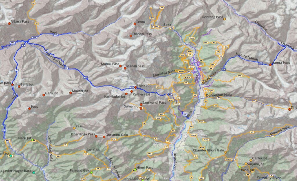
- Hampta Pass (HP) – 21km / 1400m+ starts from Sethan village (3000m) hiking up along the Hampta Nalla stream to the Hampta pass (4200m) descending steeply into the Chandra river valley of Lahaul near Chhatru. Blog post
- Kaliheni Pass (KP) – climbing up steeply from the Beas river valley near Jogin (1600m) through forest and vast meadows high above the Sanjoin Nala valley crossing over the Eastern Dhauladhar through the Sagor Jot (4800m) pass and descending into the Kaliheni Nala valley traversing vast meadows till Bara Bhanghal in Kangra. Blog post Blog post 2 Blog post 3 Blog post 4
- Thamsar Pass (TP) – a logical continuation of the Kaliheni pass route, it resume from Bara Bhangal climbing up along the Thamsar Nala back over the Dhauladhar through the Thamsar pass (4700m) into the Uhl river valley to Bada Gran
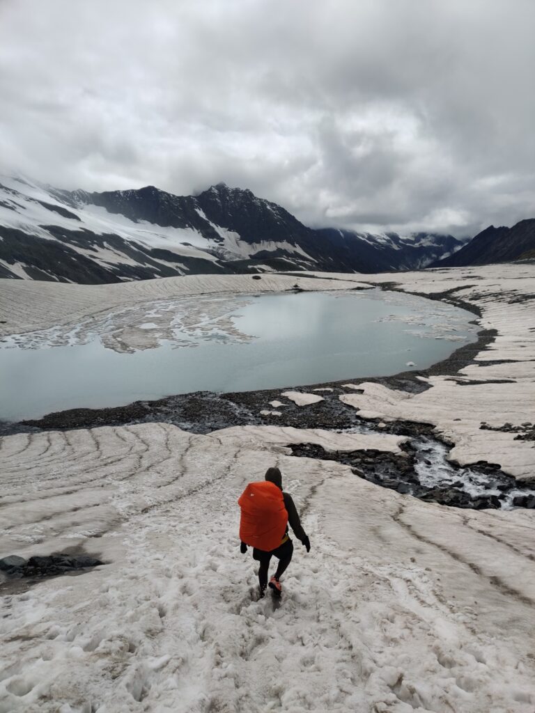
The above 50 hiking routes are located around the Manali region in the Beas river valley. Hundreds of additional hiking routes can be found further South in the Kullu region, Parvathi, Lug and Barot tributaries of the Beas and Great Himalayan National Park. More on the larger Kullu region in a subsequent post.

Very good information for novice hikers and runners. Great great photos. Thanks a lot Peter.