We woke up to a cold early morning at 3500m altitude. I braced myself mentally to get out of my cozy warm sleeping bag to get some water from the nearby stream. I started a small fire with dry wood collected the previous night as everything was wet outside. Time to cook some yummy white oats – our only hot meal for the day to climb up 2400m to the Kaliheni pass.
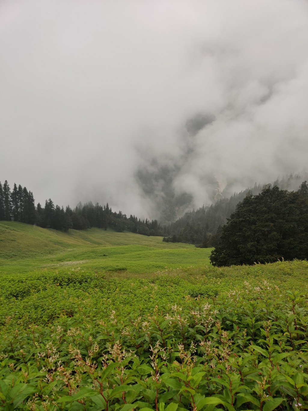
We packed up our campsite and proceeded along a clear trail through the meadows full of white flower plants. The trail was contouring nearly flat high above the valley flower. Below us we could see the slopes dotted with pine forest covered by an ever changing cloud cover.
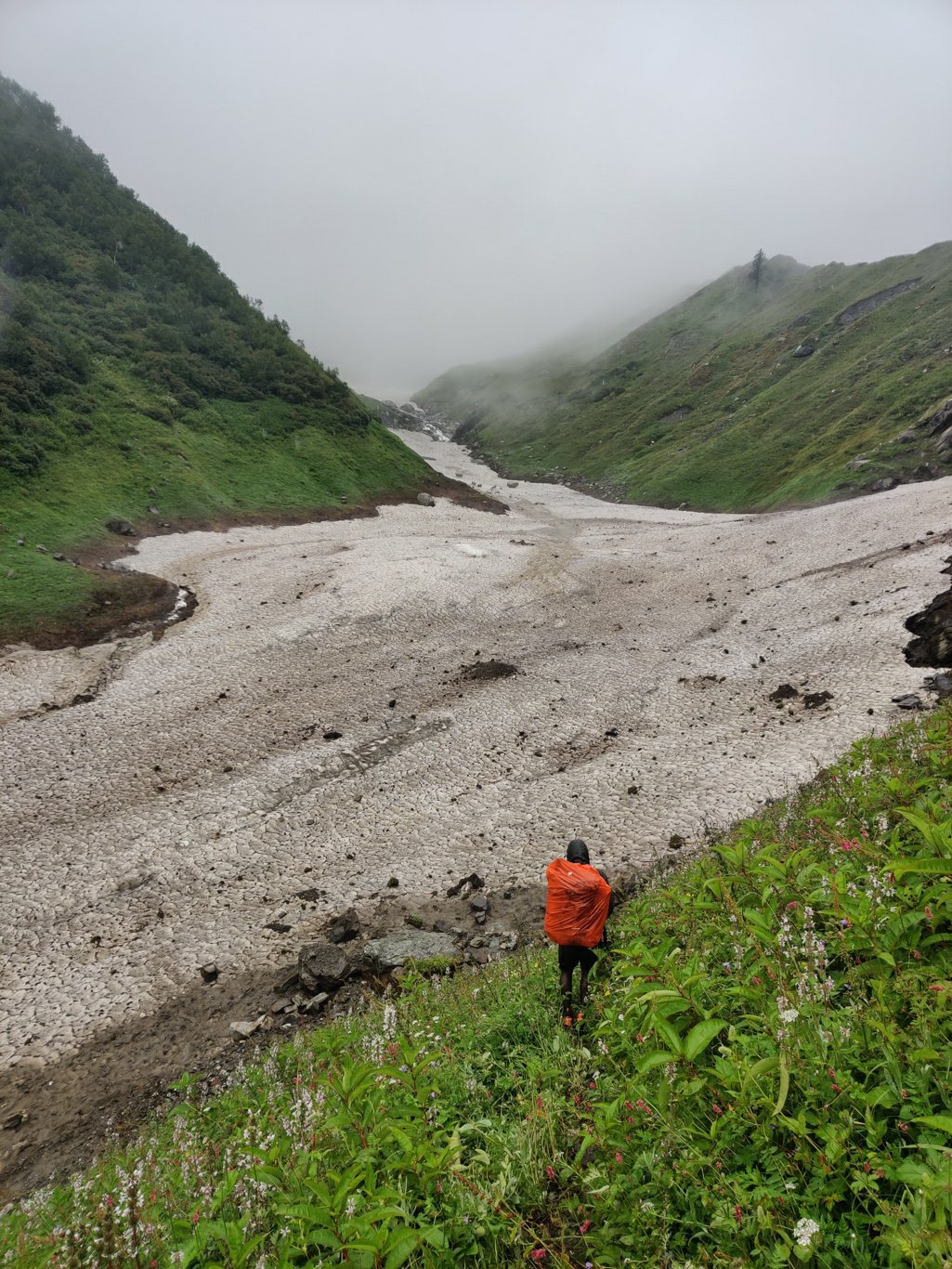
After a while we finally hit the main stream which was still covered by a snow bridge – the snow compacted during the previous winter had not yet melted even in August. Last year (2018) when I did Kaliheni in the reverse direction there had been no trace of snow all the way till the pass. Looks like snow fall during the 2018-2019 winter was unusually high. Crossing the stream was easy now – no need to wade through the cold water currents.
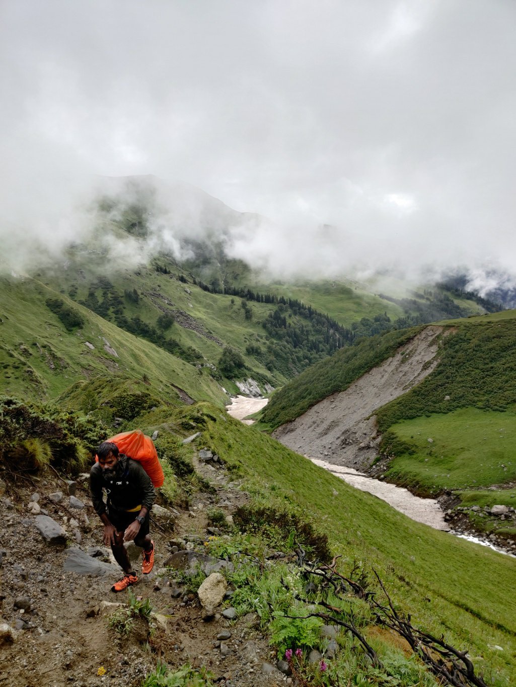
Very soon the trail crosses the stream again and climbs up steep along the right side valley slope. In several places there are mud slides due to the recent cloud burst / floods in the Himalayas (16 Aug 2019) which also made me cancel might plan to explore the inner canyons of the Hemis National Park due to dangerous stream currents in the narrow gorges of Ladakh and Zanskar. In some places an entire sections of the mountains were exposed after the upper soil had been land-slided.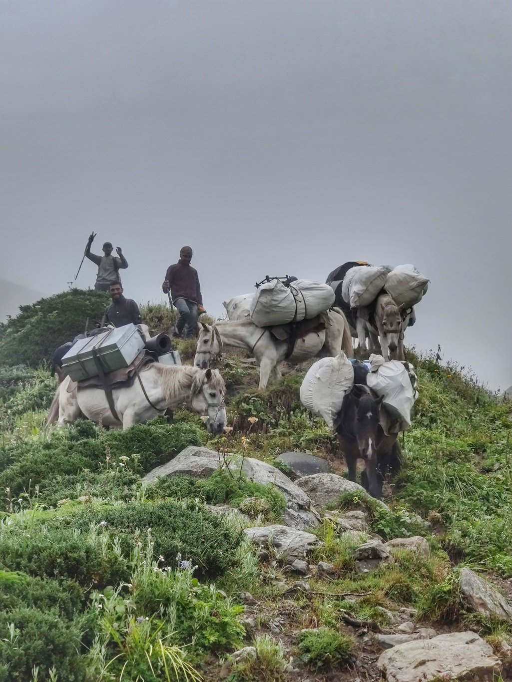
Further up the trail continued along a small ridge above the stream from were we got beautiful views on the valley below. A group of horses descended from the pass carrying heavy luggages of an Italian hiking party. Each horse carried at least 40-50kg of weight, a stark contrast with our minimalist bags which hardly weighed 4-5kg. I feel sorry sometimes for these animals carrying up so much of unnecessary things like toilet tents, dining tents, chairs, tables, lots of clothes, kitchen tents, gas cylinders and God knows what. Few people are willing to compromise on the city comforts even while venturing in the outdoors.
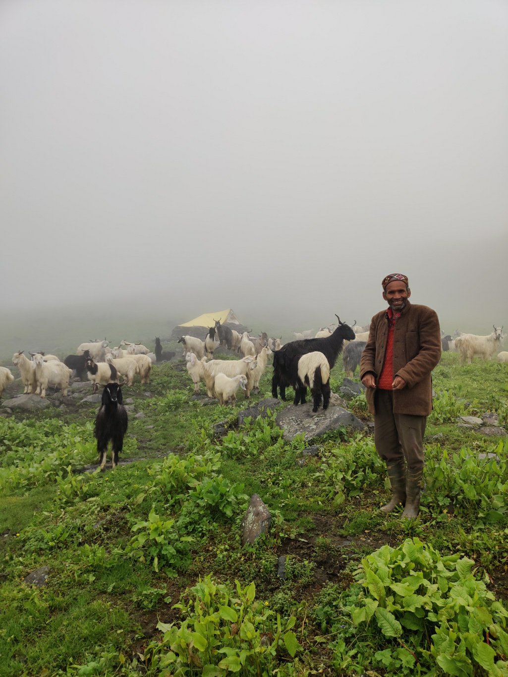
Climbing up further in the high meadows we finally meet our best friends in the mountains – the gaddi’s or shepherds. As soon as they see us – alpine style hikers – approaching they welcome us with a big smile and a hot cup of fresh goat milk chai. Warmest hospitality is experienced in the remotes corners of the Himalayas. As we hike up to higher altitudes the fog gets denser and it becomes more challenging to stay on track.
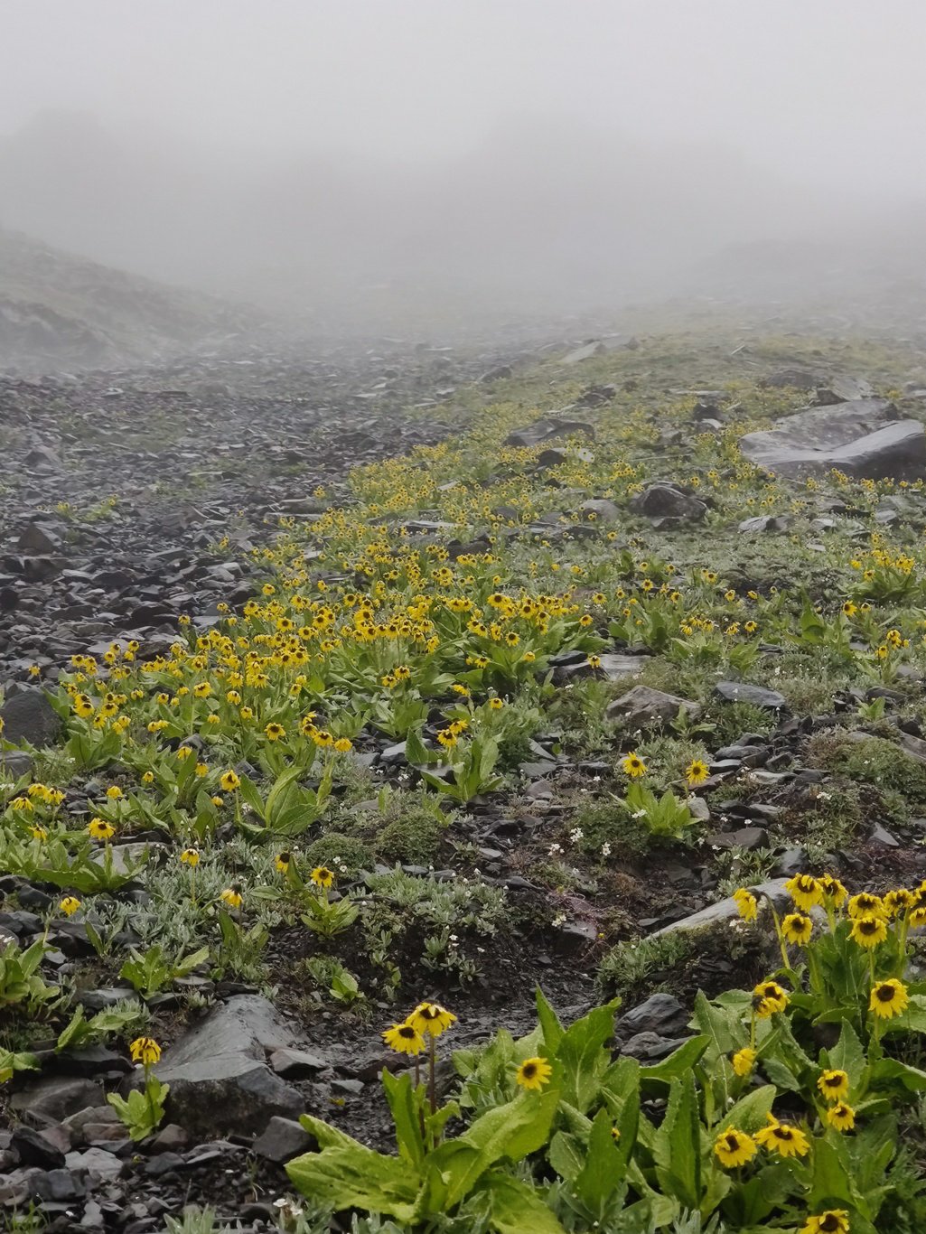
We finally leave the grassy meadows and step into a barren rock landscape covered by a yellow blanket of sun-flower type of plants. The terrain gets steeper and there are many small rock gullies. With the trail less clear here it’s easy to get in the wrong gully and get off track. So I frequently cross check the trail on Open Street Maps on my phone to stay on course. Visibility is also reducing due to the increasing density of the fog as we climb higher.
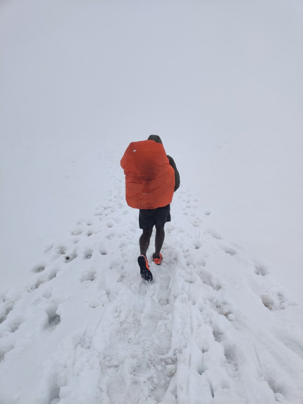
We finally step onto freshly fallen the snow a few hundred of meters below the pass. The trail is now completely hidden and with a dense fog / white out we are left disoriented. Only option is to carefully follow the OSM reference trail on the phone. Lucky there are fresh boot and hoof marks in the snow of a previous hiking party making it somewhat easy to stay on track.
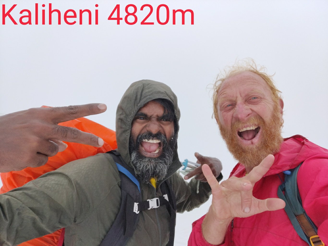
Ecstasy overwhelms when we reach the top of the Kaliheni pass at 4820m after an intense, steep 3200m climb out of the Kullu valley at 1600m. Most hiking parties would spread the climb over 3 days while we did it in a single day (2 half days after a late start from Manali) . Part of this is possible because we have already been properly acclimatized in previous traverses and of course we go much much lighter then the average hiker carrying 25kg of weight in his 60L backpack. We of course take a calculated risk while crossing the pass late afternoon exposing ourselves to non stable weather conditions.
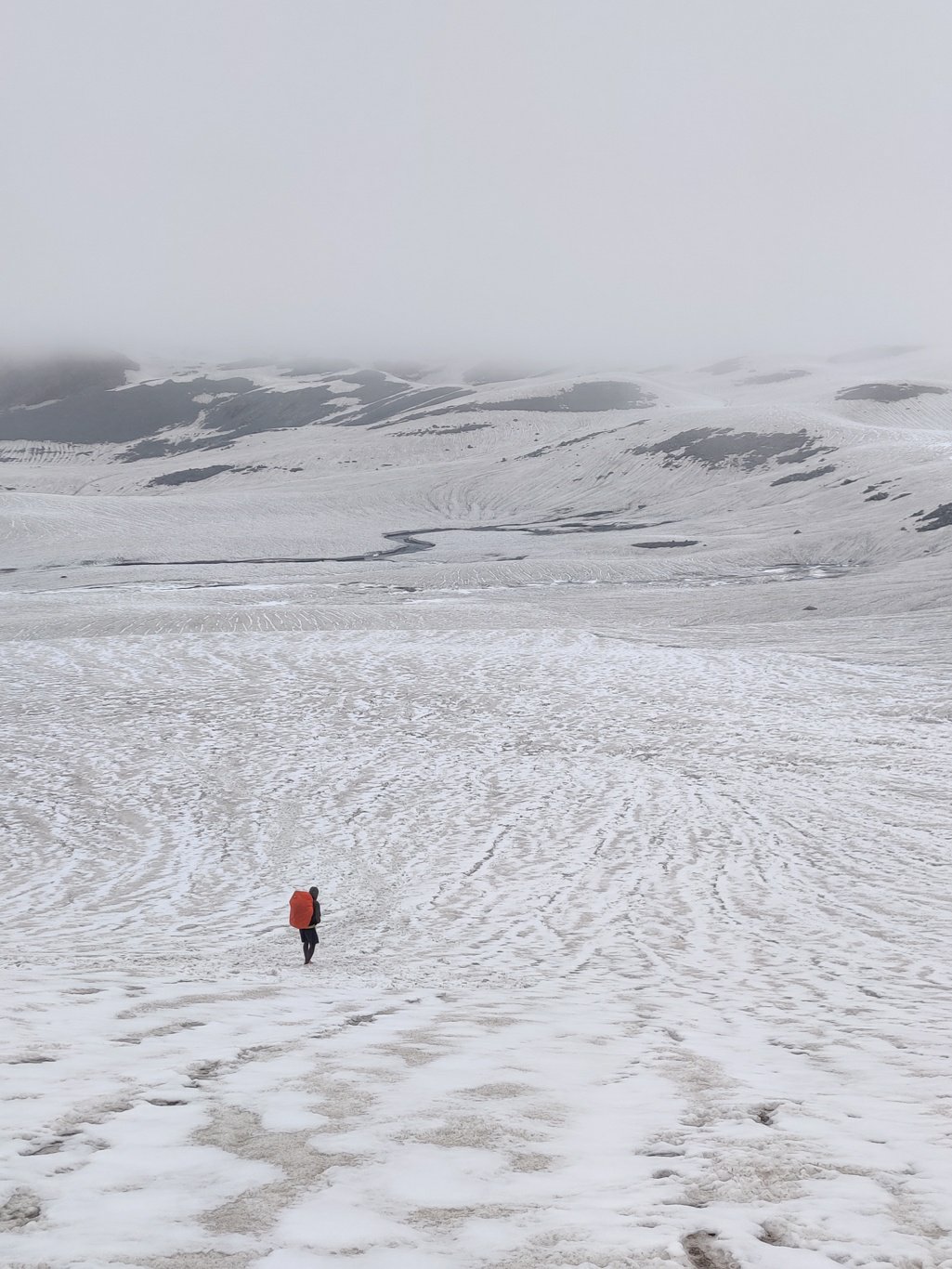
On the other side of the pass the fog clears up and the vast expanse of the snow covered glacier reveals itself. During last year’s (2018) crossing the glacier was completely exposed, a huge sheet of ice hanging from curved slope of the Dhauladhar range above. The glacier has no crevasses which would be hidden now by the fresh snow so we can walk without risk on top. Soft snow makes it much easier to traverse the otherwise slippery hard ice. Far ahead of us we see a large group of hikers from New Zealand which we pass in no time as we run with our lightweight packs down the glacier. 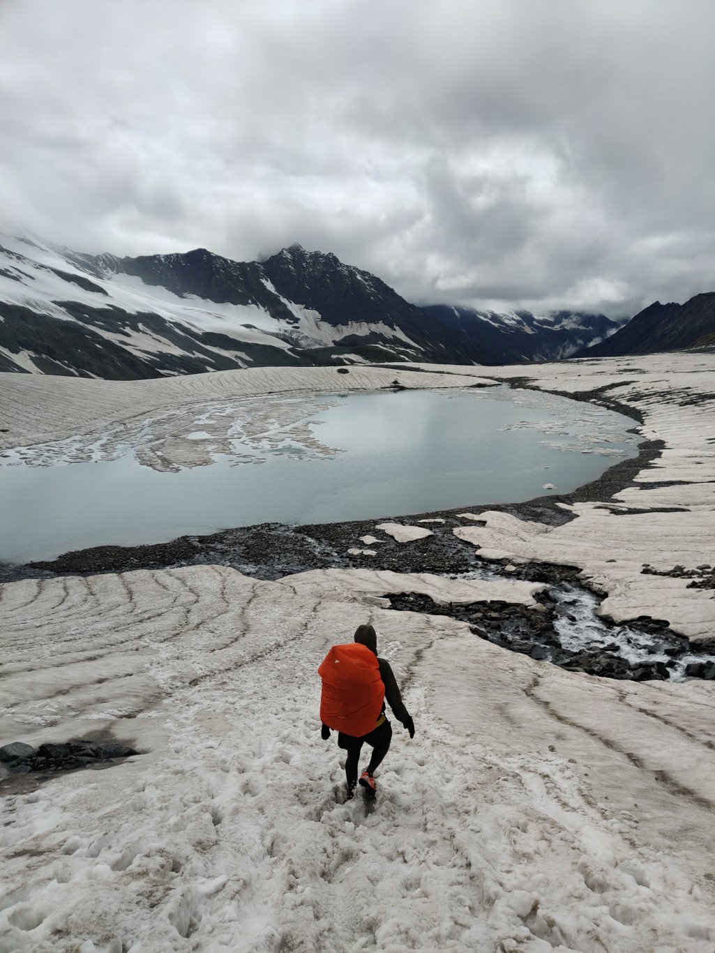
We run past the NZ hikers which appear to be in their fifties giving them a thumbs up. The group proceeds very slowly in a single line down the snow slope. They looked visibly surprised to see us running ahead and before they can utter a word we are out of sight. A beautiful glacial lake now reveals itself still partly covered by winter ice. Glacial lakes get formed when moraines block the meltwater below the glacier.
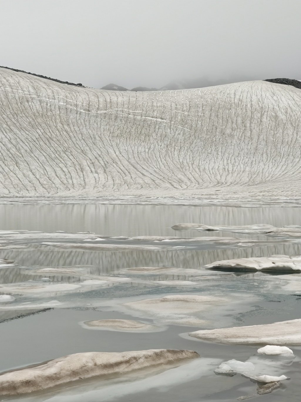
The reflection of the snow covered glacier in the partly ice covered lake is picture perfect. I feel like we are in a different world full of white, snow and ice. Above us the sun is trying hard to break through the cloud cover but remains unsuccessful. With the clock running late, we descend quickly through the moraines and exposed rocks below the glacier to get to a lower, warmer altitude to spend the night.
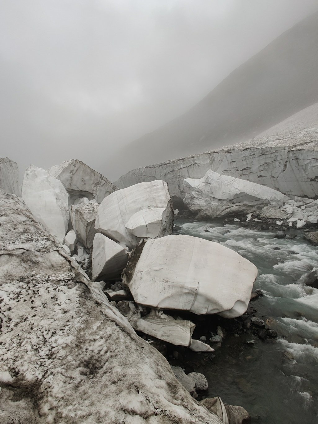
We finally hit the Kaliheni Nalla in the base of the valley where the trail continues along the stream. To my surprise the river is still covered by thick sheets of winter ice which has not yet melted at the end of summer. The snow bridges makes it easier to hike downstream – the rough ice sheet is quicker to fast-hike on then the boulders and rocks along the side of the stream. In several places the ice sheet above the river appears 10m thick and has broken under its own weight as the warm air flow has melted the ice in the center above the stream.
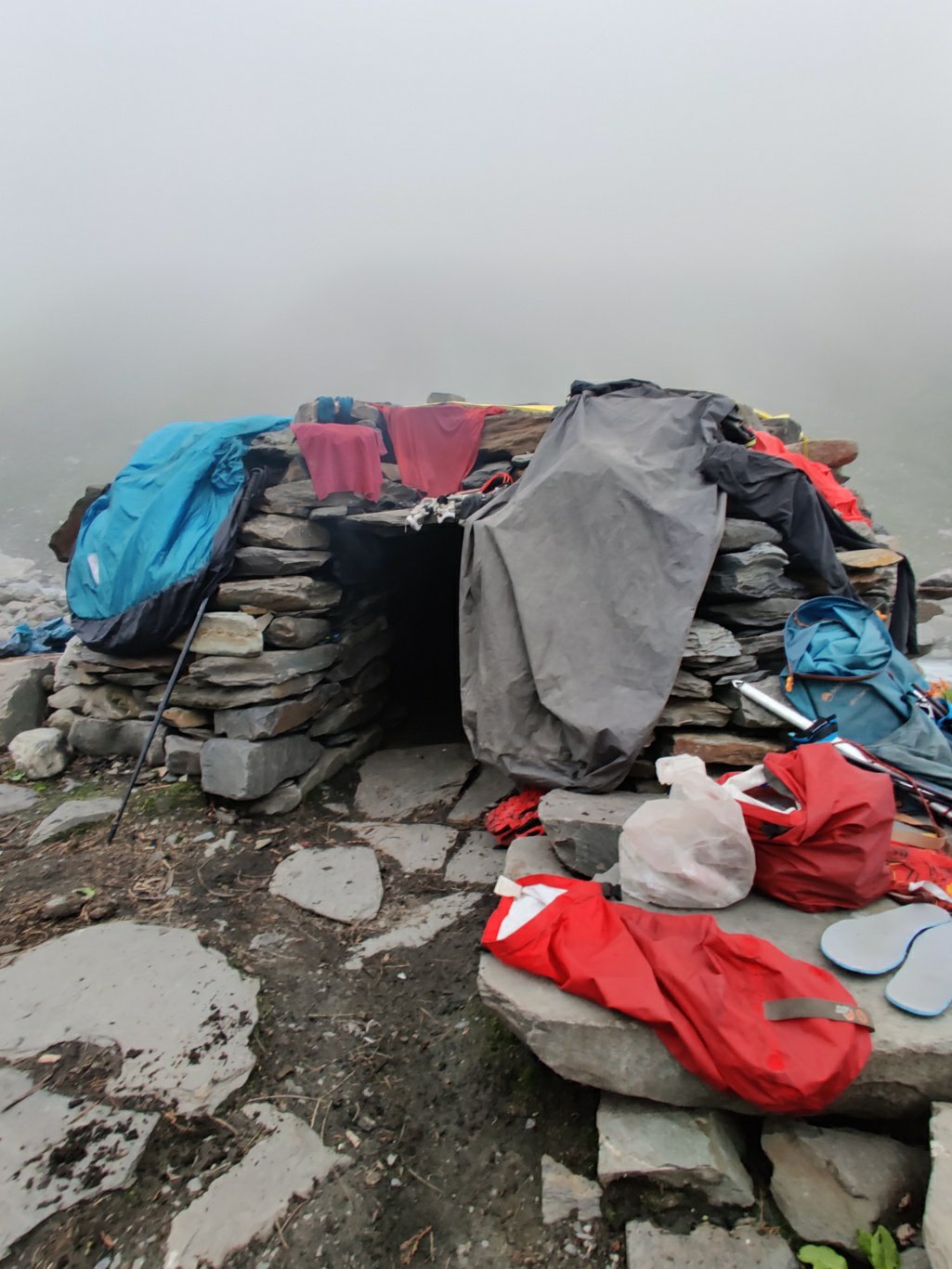
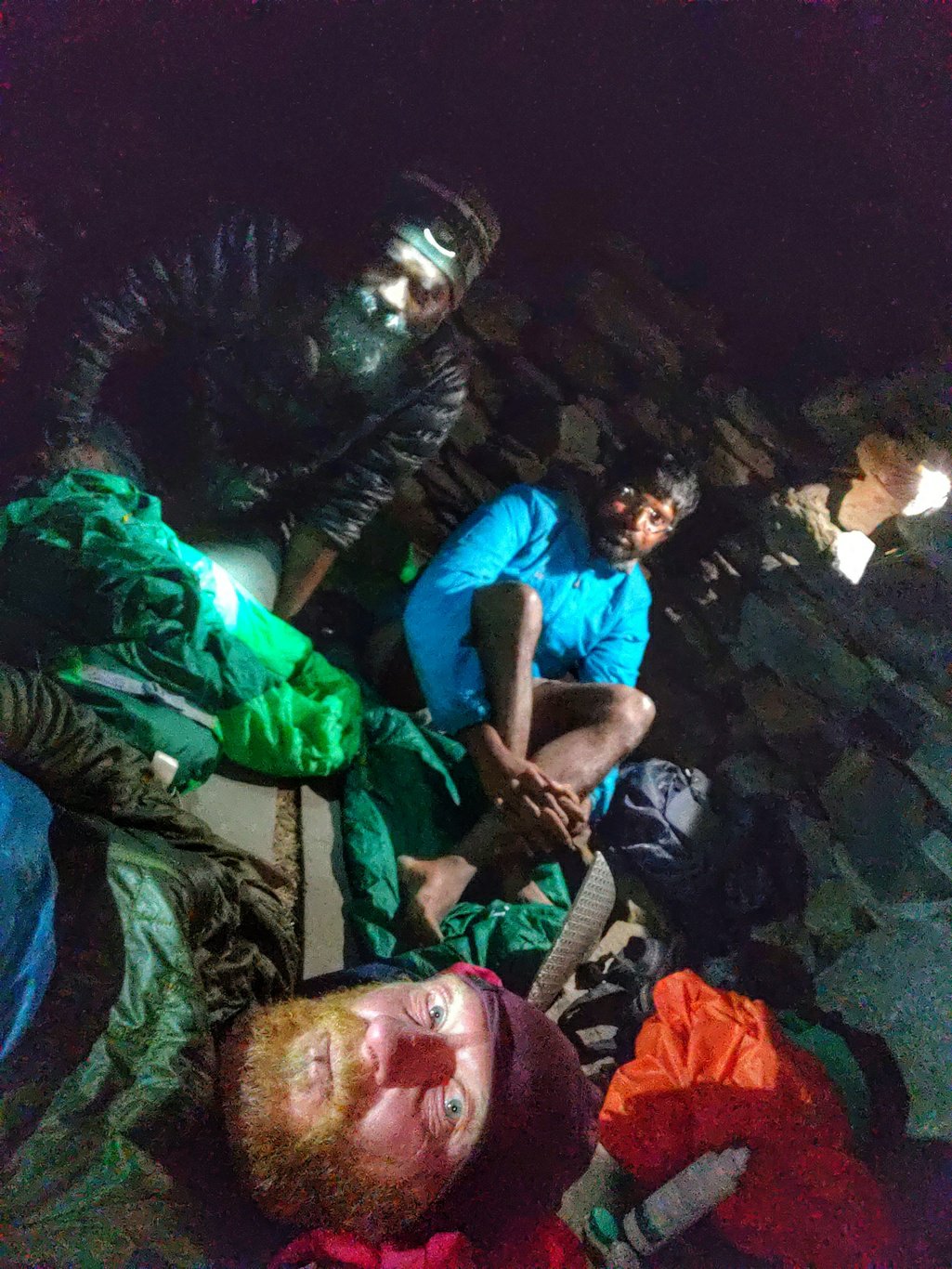
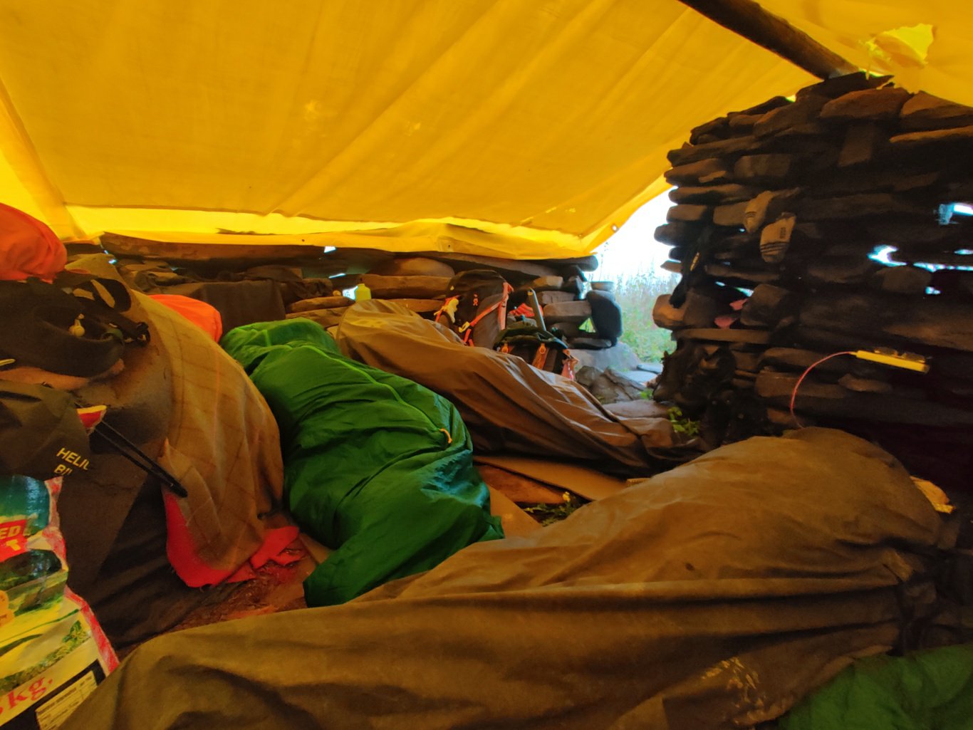
We finally reach a rock shelter marked as Devi Ki March II on Open Street Maps where we decide to settle down for the night after having burned enough calories for the day. The shelter is normally used by shepherds grazing the surrounding meadows. However they appear to have withdrawn to lower altitudes because of the recent snow fall. We spread out our wet clothes and sleeping bags on top of the shelter to dry in the breeze blowing through the valley.
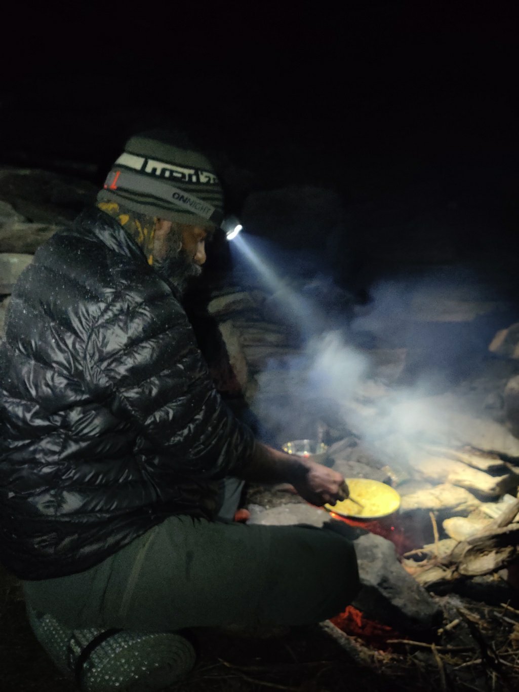
Meanwhile we collect dry firewood and water from the nearby stream to start a fire and cook some Maggie noodles, our second meal of a long, tiring day in which we burned at least some 6-8000 calories over 25km distance and 2400m climb across steep, challenging terrain. As the light fades, the temperature drop significantly and we feel comfy inside the rock shelter which blocks the cold wind in the valley next to the glacial stream. After filling our tummies, we settle down in our warm sleeping bags on a bed of straw and dream of peacefully in a remote, distant world…