
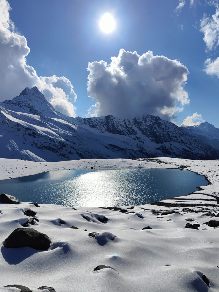
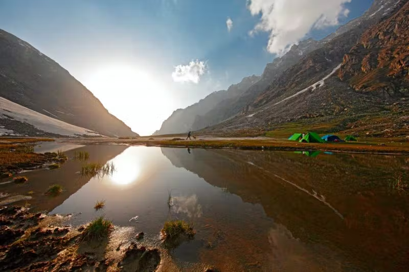
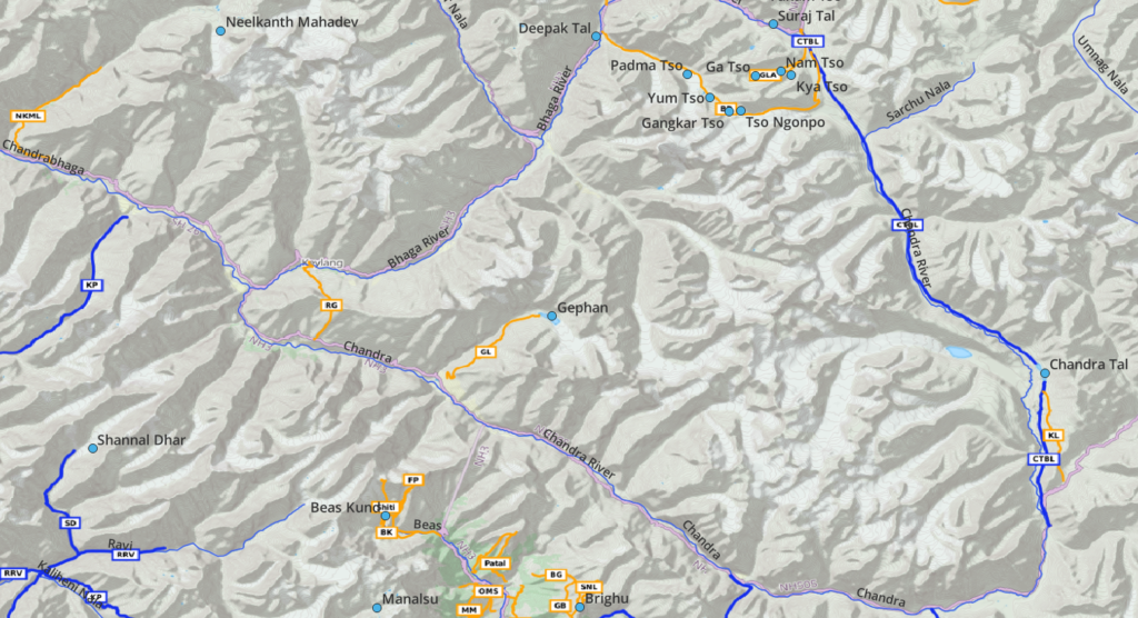
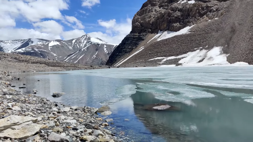
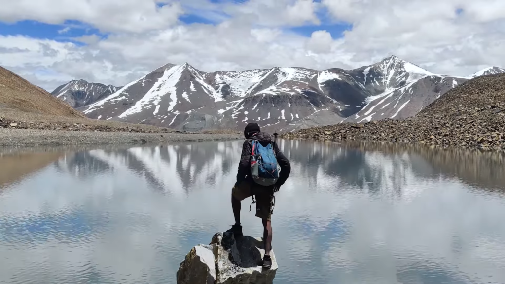
This blog documents 30+ beautiful alpine lakes in Kullu and Lahaul regions of Himachal which are accessible by hiking routes. Most of these high altitude lakes are remains of retreating glaciers formed by moraines dams. Credits to @creedaz for exploring many lakes in the Lahaul region.
Mapped Lakes
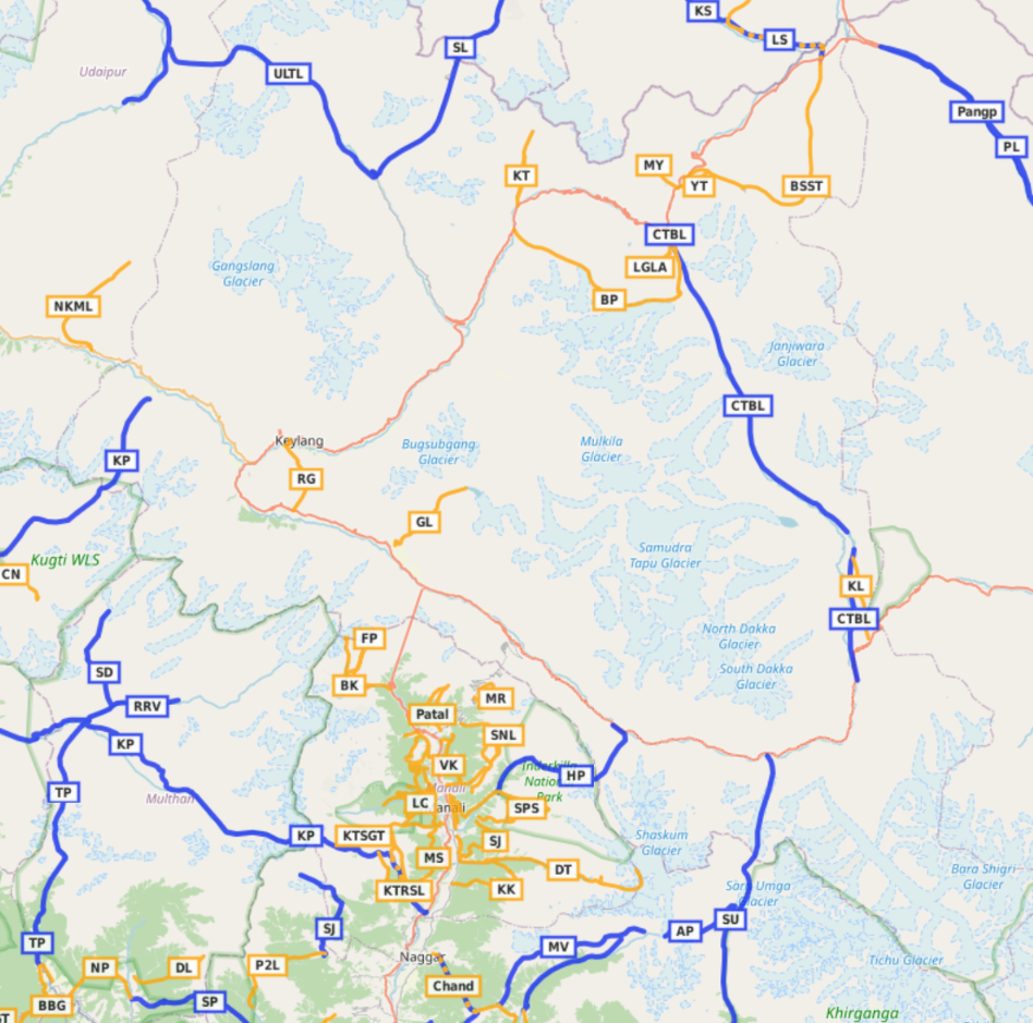
Hiking routes to these lakes have been accurately GPS recorded and mapped into Open Street Maps allowing anyone to independently explore the same. The lakes can be categorized as per 5 different river basins in which they drain.
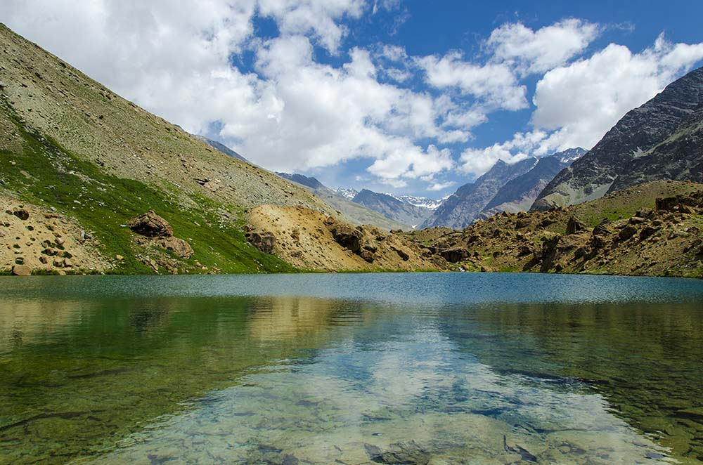
- Beas river – Beas Kund, Brighu, Rani Sui, Naag Dhumal Saur, Seri Tal, Dehna Saur, Manalsu Tal (5)
- Ravi river – Kaliheni (3), Muthu lake, Thamsar Dali (2), Shannal Dar
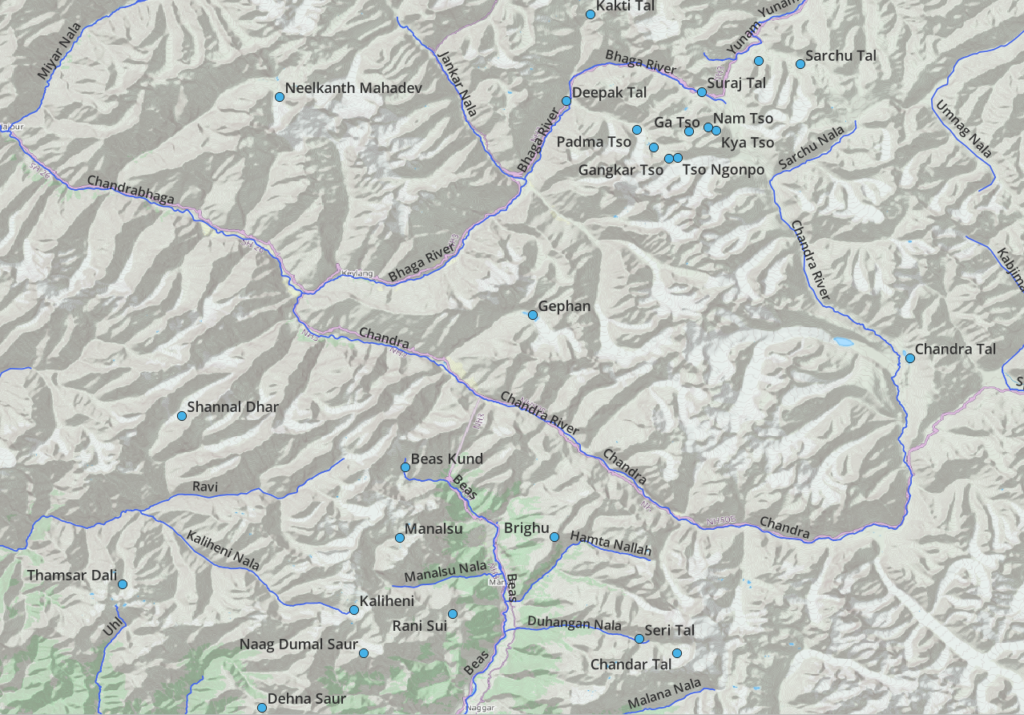
- Chenab – Neelkanth Mahadev, Gephan, Chandra Tal,
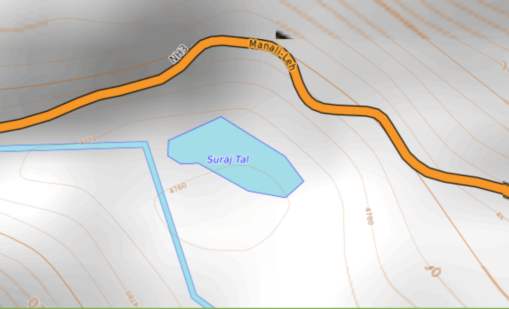
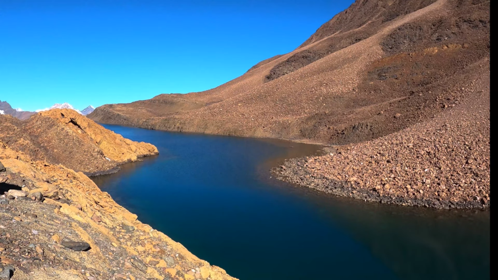
- Bhaga river – Deepak Tal, Suraj Tal, Kakti Tal, Tso Ngonpo, Yum Tso, Gankar Tso, Padma Tso, Singho Tso
- Yunam river – Ga Tso, Nam Tso, Kya Tso, Yunam Tso, Sarchu Tal, Umlung Tso
Unexplored Lakes
A number of large lakes in the region remain unexplored and yet to be mapped:
- Manalsu lake (4300m) – upper Manalsu valley (Old Manali) accessible from ridgeline via Kanpari Tibba
- Koarong lake (4400m) – Khanwar Nala draining to the Bhaga river near Darchu
- Samudri Tapu (4150m) – near Chandra Tal draining into the Chandra river
- Phuta Sar (4150m) – in the Pakhnoj valley, tributary of the Beas river
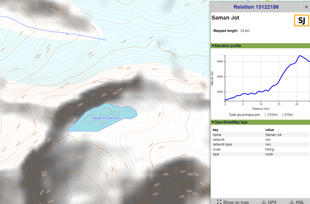
- Naag Dhumal Saur (4300m) – nearto the Saman Jot pass high above Phojal Nal valley, tributary of Beas river
- Animal Tso (4550m) – near the Animals pass between Malana and Tosh in the Tos Nal, tributary of the Paravthi valley
- Rarag Sar (4450m) – source of Gehu Nal stream joining the Parvathi river near Pulga
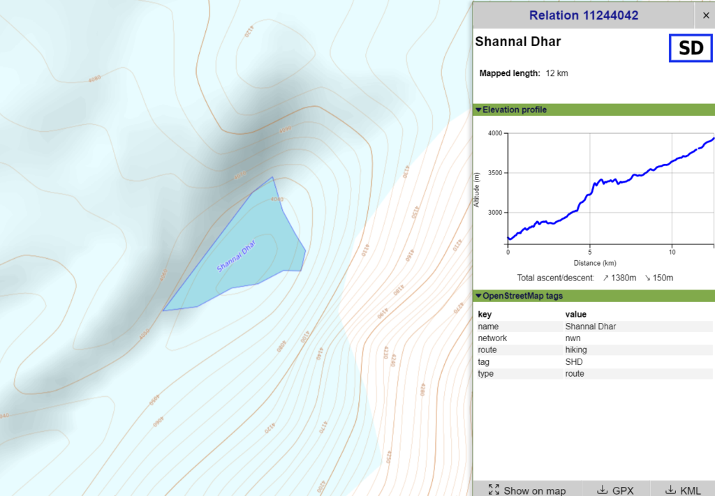
- Shannal Dar (4050m) – on the Shah glacier in Shah Nala valley joining the Ravi river valley near Bara Bhangal
- Chander Tal (4600m) – 100m above the Deo Tibba hiking route just below the glacier in the Duhangan Nal valley tributary of the Beas river
1. Beas River Basin
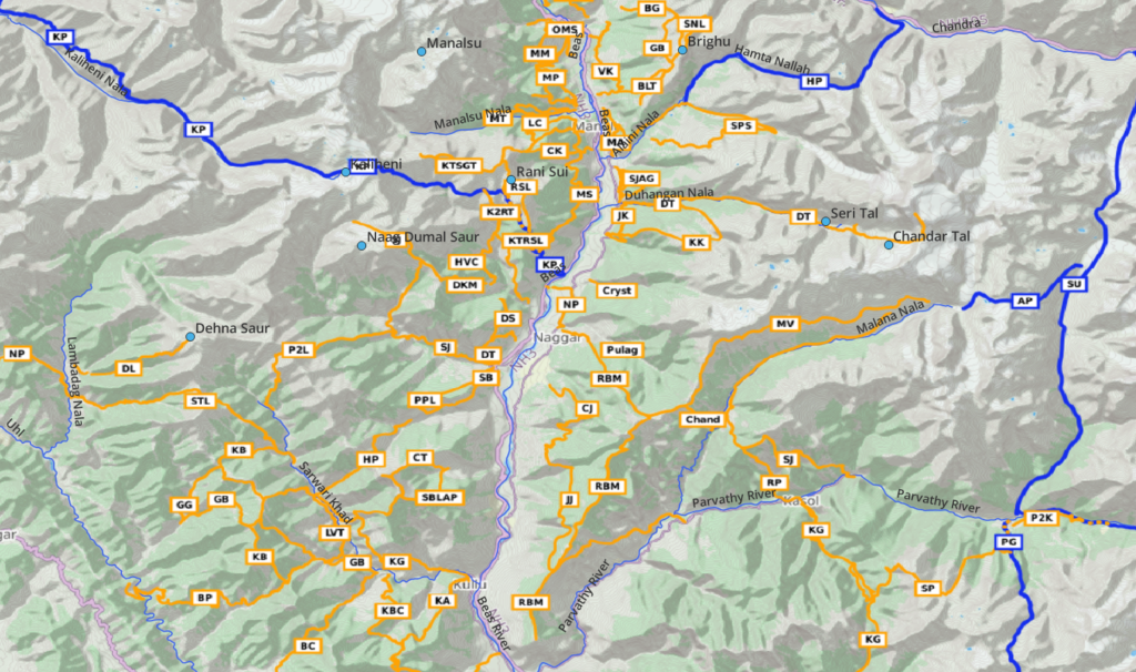
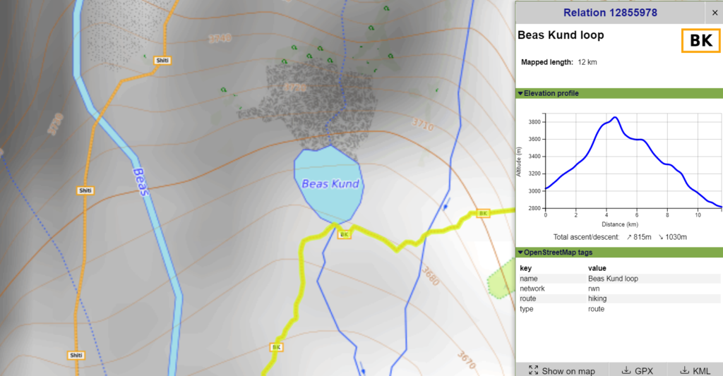
Beas Kund – 12km / 800m+
Starting from Dhundi (2850m) we follow the East bank of the Beas river hopping over the Lady Leg (3880m) saddle and descend to the Beas Kund (3700m) lake along the Kund Nala stream draining Ladakhi and Shitidar peaks above separating Lahaul and Kullu
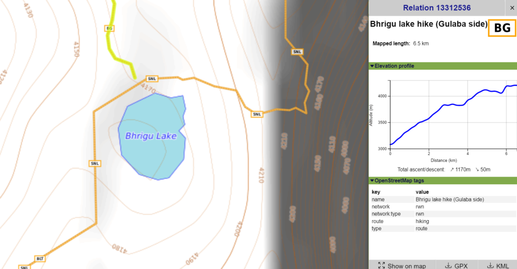
Brighu lake – 6.5km / 1200m+
Starting from Gulaba (3000m) along the Rothang pass highway we hike up a ridgeline above the Khanora Nala stream to 3800m after which we contour high above the Beas river valley towards the Brighu Lake at 4200m just below the ridgeline separating the Hampta Nala valley. Alternatively there’s a route from Vashisth (2100m) straight up to Panduropa to Brighu lake.
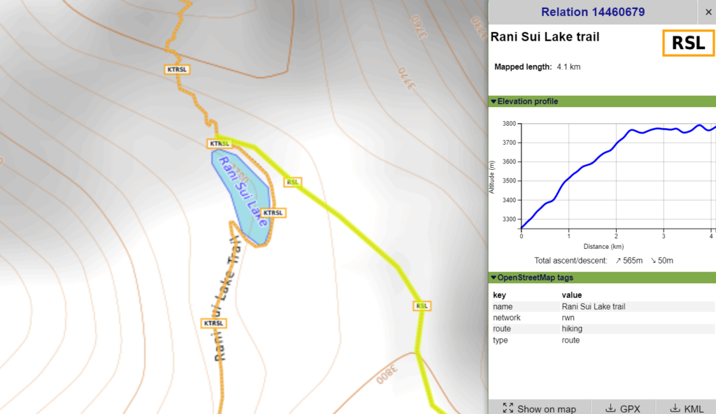
Rani Sui – 4km / 580m+
Starting from Sangchar village (2350m) we climb straight up from the Beas river valley till we hit the ridgeline above (3350m) separating the Sanjoin Nal. From here we proceed North along the ridgeline till Rani Sui Lake at 3790m. Alternatively we can start from Manali hiking up through Lamadugh to Kanpari Tibba (4200m) and descend from here to the lake.
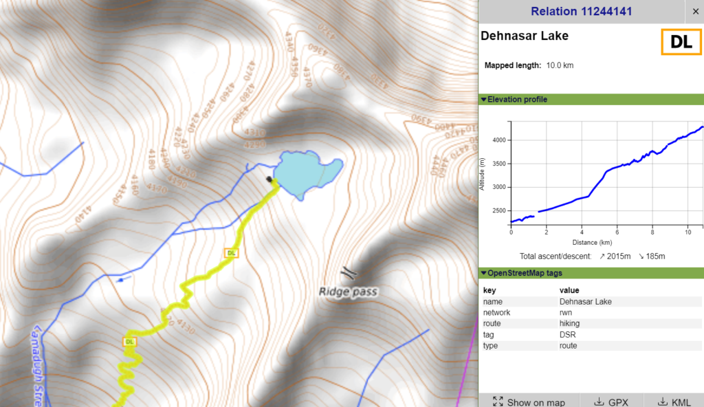
Dehna Saur – 10km / 2000m+
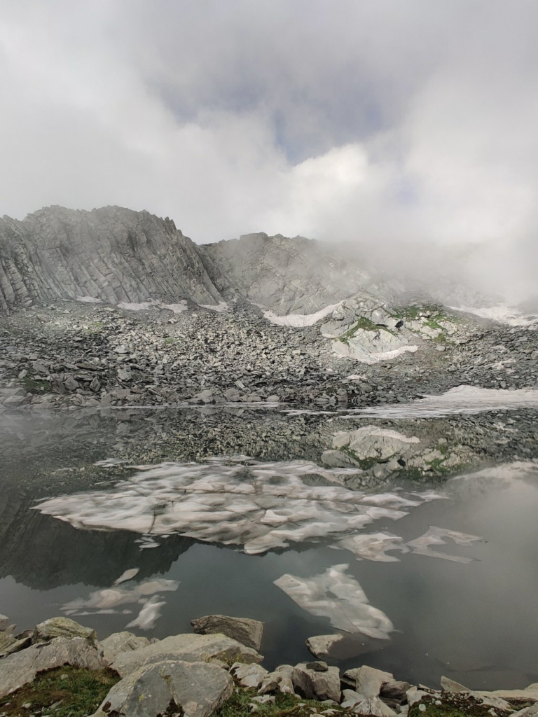
Starting from Polang village in the Lambadag Nala valley (tributary of Barot valley / Uhl river) we proceed East in a side-valley and eventually climb up to the ridgeline to the pilgrim lake of Dehna Saur at 4300m. From the lake we can connect to the nearby Sari pass. Blog post
Naag Dhumal Saar – 24km / 3100m+
We climb up either from Galang (2000m) in the Phojal Nal valley or Diringcha (2250m) in the Sanjoin Nal valley to the separating ridgeline above. From here we climb up Northwest high above the Bijara Nal valley across the Saman Jot pass (4450m) where we descend onto the glacier and hop over a smaller ridgeline to the nearby Naag Dhumal Saar lake (4300m). Blog post
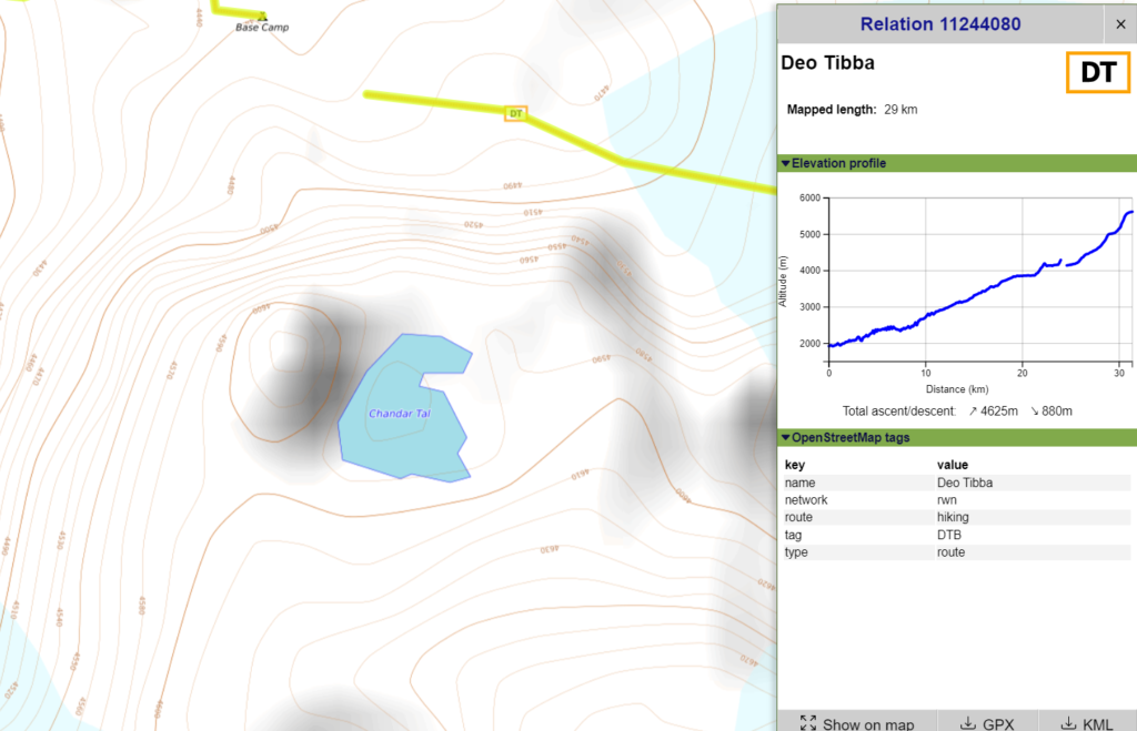
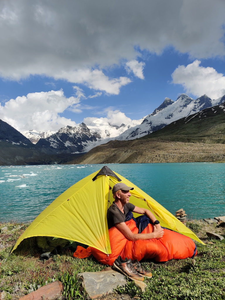
Seri lake / Chandar Tal – 29km / 4600m+
Starting from Jagatsukh (1900m) in the Beas river valley we hike up into the Duhangan Nala valley where we cross a first lake (3850m) near Seri campsite and further up to Chandar Tal at 4600m slightly above the route to the Deo Tibba peak.
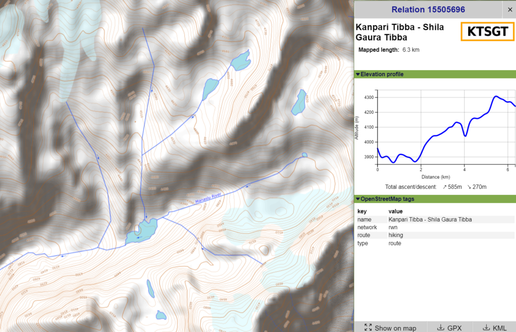
Manalsu Tal – partly explored
Starting at Manali (2000m) we hike up to Lamadugh and Kanpari Tibba (4200m) where we proceed West along the ridgeline to Shilla Gaura Tibba (4350m). Here we descend into the Manalsu valley (3500m) and climb up into the upper valley where we discover the yet to be explored Manalsu Lake at 4300m altitude along with several smaller lakes. The OSM mapped hiking route below goes till Shilla Gaura Tibba from where a shepherd trail descends into the valley still to the be GPS mapped.
2. Ravi River Basin
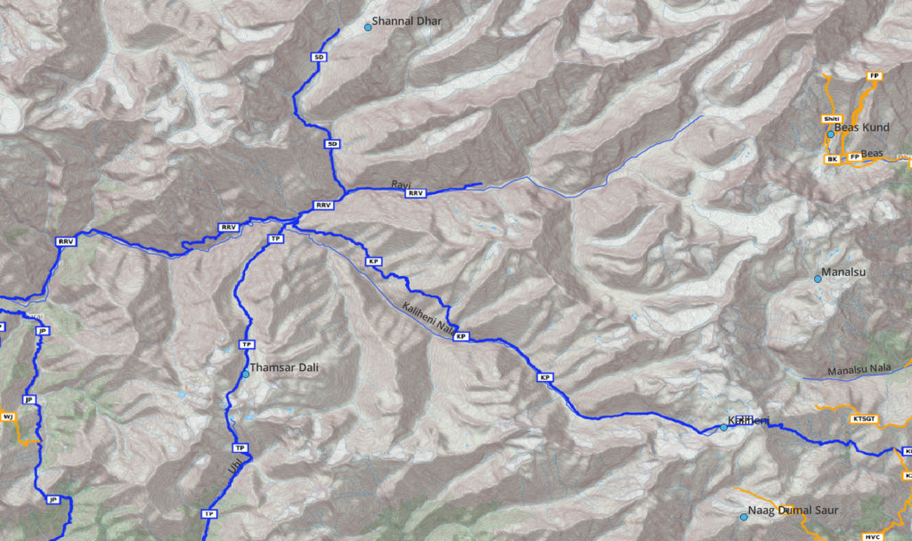
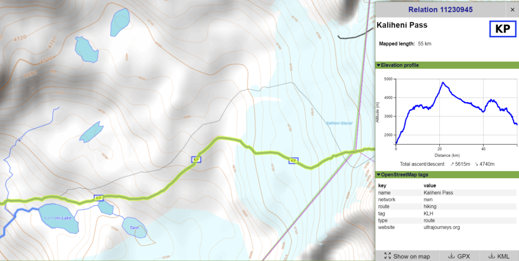
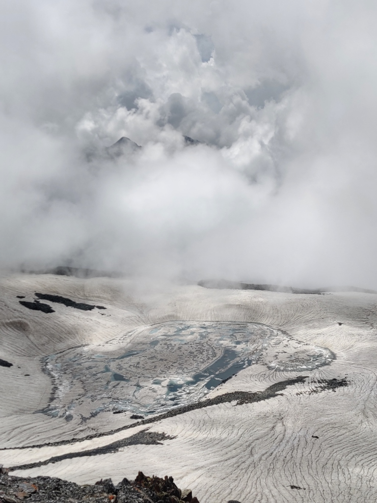
Kaliheni lakes 1 / 2 / 3 – 55km / 5600m+
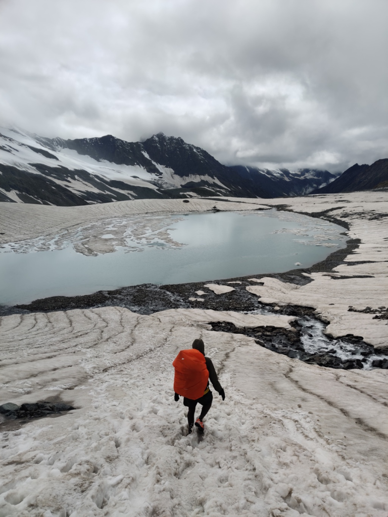
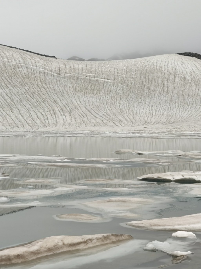
Starting from Sangchar village (2350m) in the Beas river valley we climb up straight across the ridgeline above and contour above the Sanjoin Nal valley climbing up to the Kaliheni pass (4800m) from where we descend over the Kaliheni glacier while passing by three beautiful glacial lakes at 4600m, 4590m and 4570m respectively.
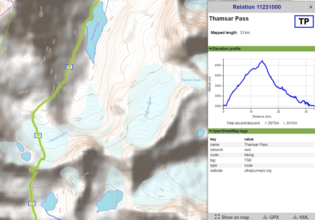
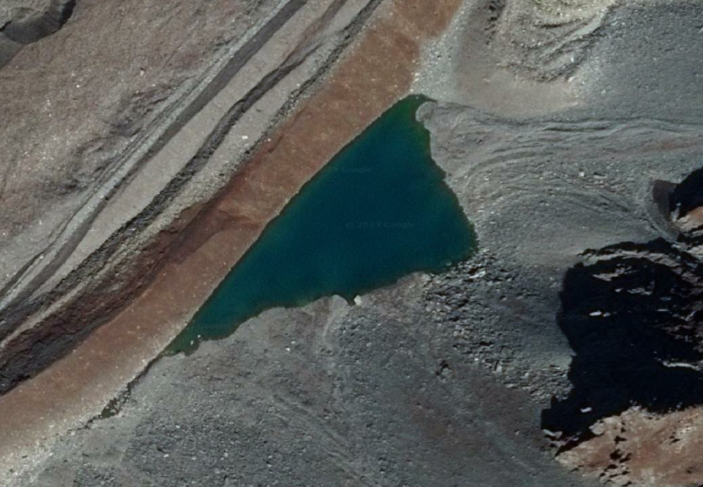
Thamsar Dali / Muttu Lake / Thamsar Dali – 33km / 3000m+
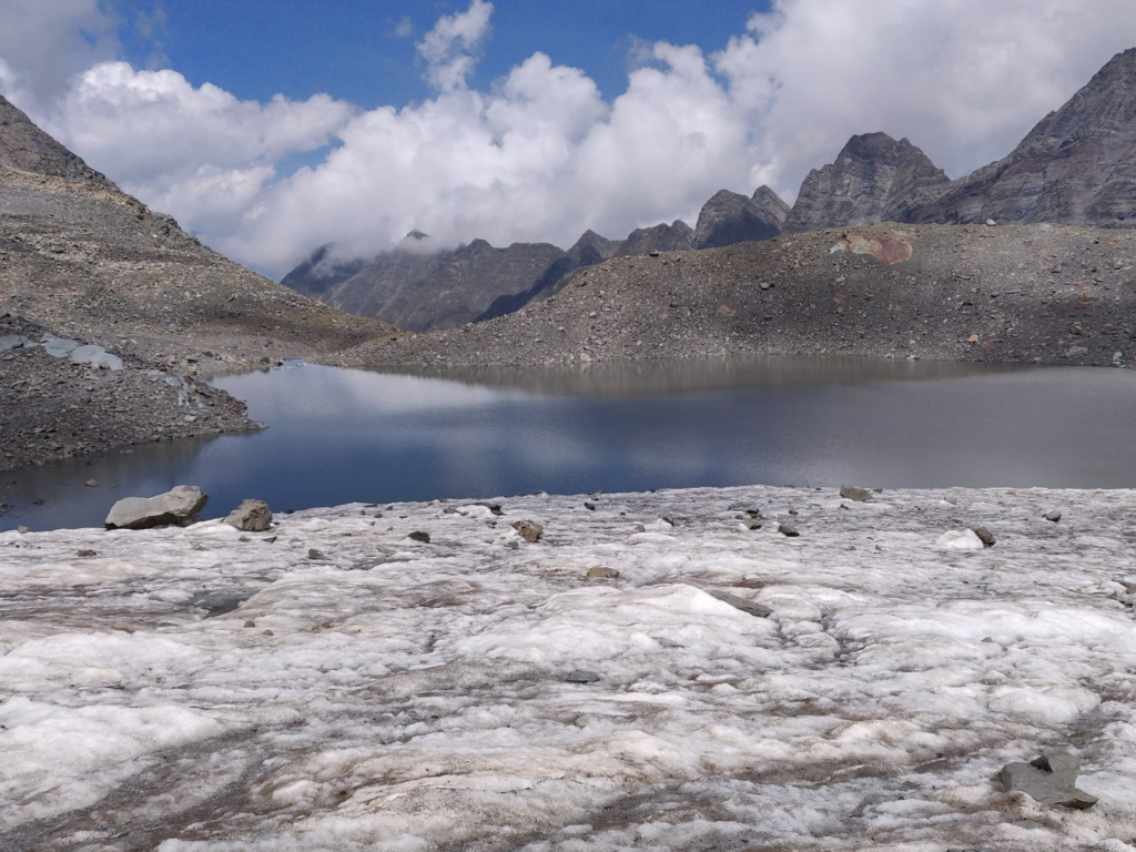
We start from Bada Gran (2400m) in the Barot valley where we hike up along the Uhl river and climb up the Thamsar pass (4720m). Before the pass we pass by Thamsar Dali (4550m). After crossing the pass we descend across the Thamsar glacier to find Mutthu Lake (4700m). Further down the Thamsar Nala stream we pass by Thamsar Dali (4350m).
Shannal Dar – 12km / 1400m+
Starting from Bara Bhanghal (2500m) we hike up in the Ravi river valley and turn North into the Shah Nala side-valley to Shannal Dar (4050m) at the base of the Shah Glacier
3. Chenab River Basin
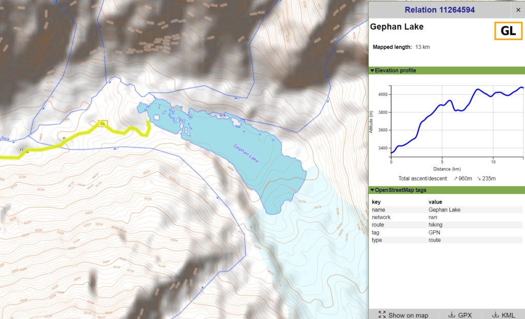
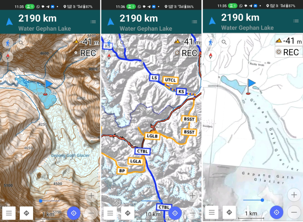
Gephan – 13km / 950m+
Starting from Sissu (3050m) we climb straight out of the Chandra river valley and hike up Northeast high above the Sissu Nala valley till we hit large Gephan lake at 4050m at the base of the large Gephan glacier hanging from the Gephan Goh peak. Blog post
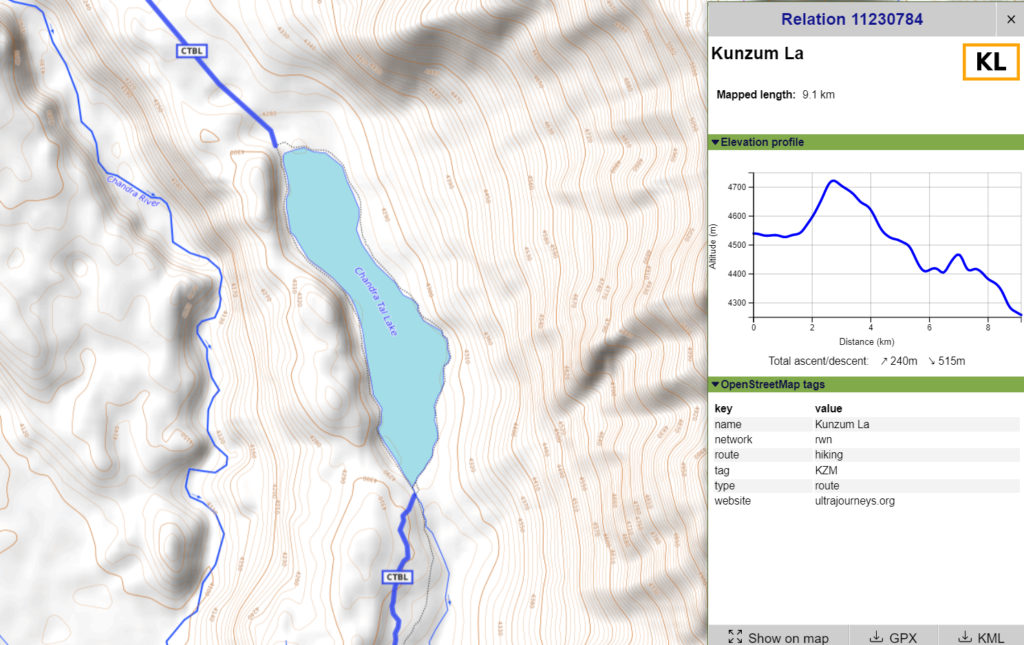
Chandra Taal – 9km / 250m+
We start from Batal (4000m) in the Chandra valley at the base of the Kunzum La pass and hike up a jeep track on the East side of the Chandra river to Chandra Tal lake at 4270m altitude. From the lake there’s a direct trail to the Kunzum La pass and another longer hiking route connecting to the Baralacha La pass.
Neel Kanth Mahadev lake – 15km / 700m+
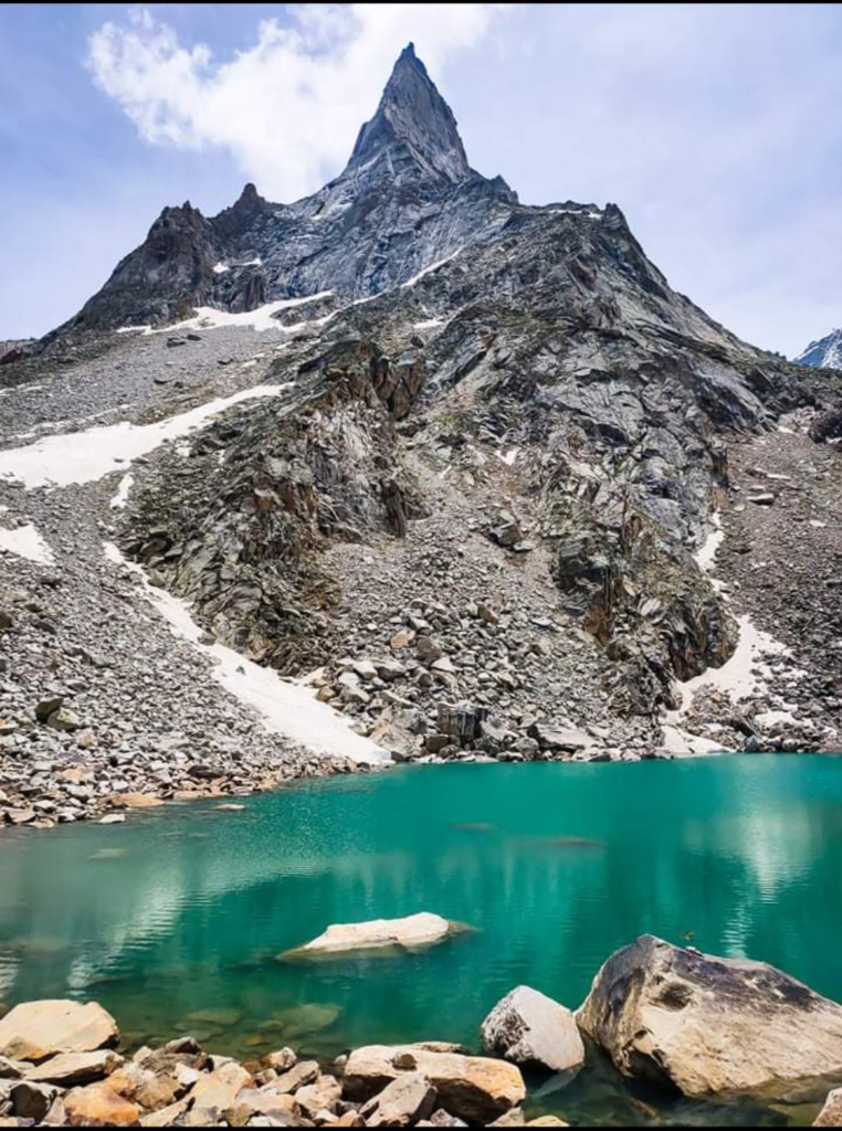
There’s a road form Murang in the Chenab river valley that takes us to Naingahar (3400m) in the Thirot Nal valley. From here we hike up the Thirot Nal and Alias Nala till the Neel Kanth Mahadev lake (4500m) at the base of the nearby glacier.
4. Bhaga River Basin
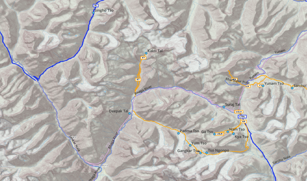
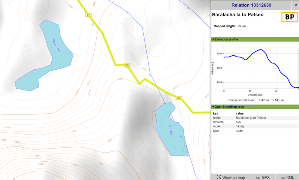
Deepak Tal / Suraj Tal
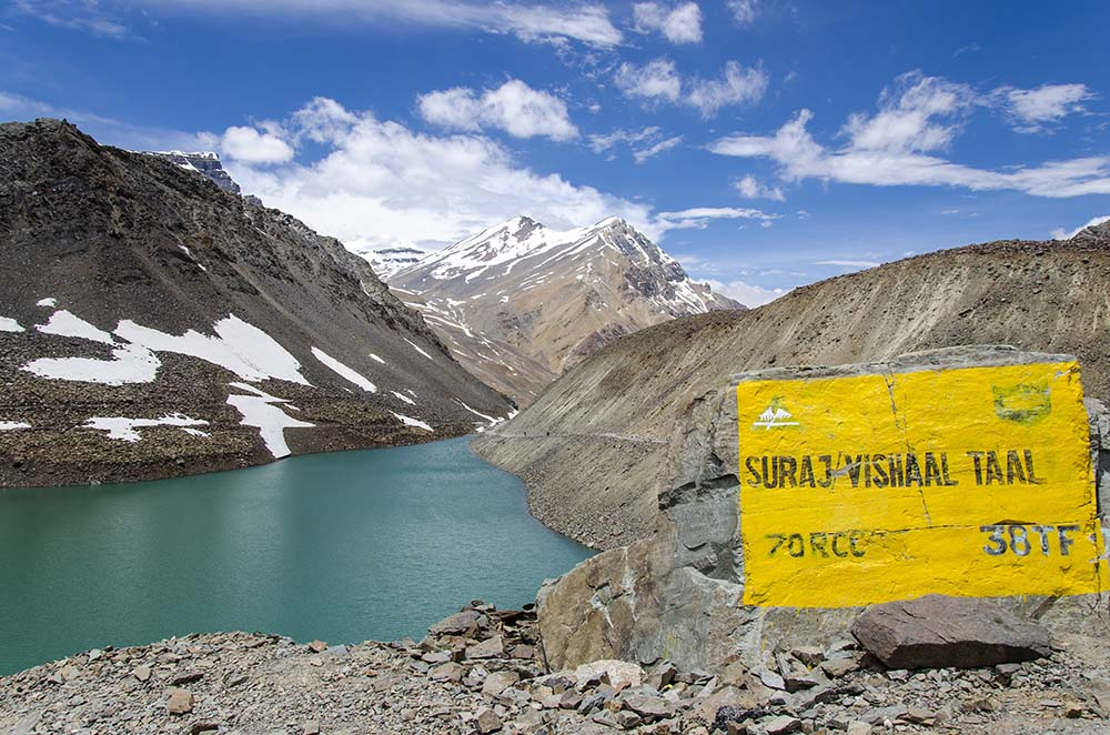
Along the Manali-Leh highway we come across Deepak Tal (4750m) nearby Patseo opposite the Panchi Nala valley. Further we pass by Suraj Tal (4750m) before we hit the Baralacha La pass (4920m).
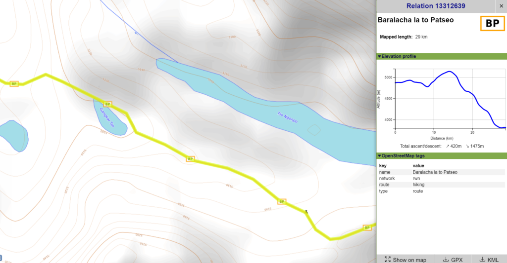
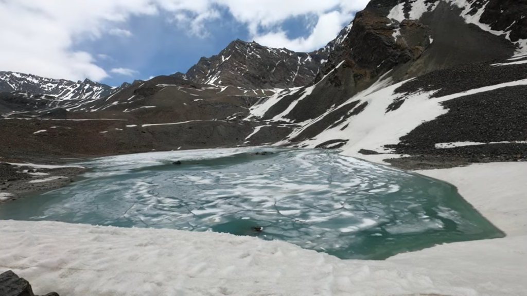
Padma Tso, Yum Tso, Gankar Tso, Tso Ngonpo – 29km / 1500m+
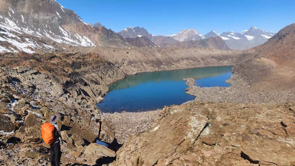
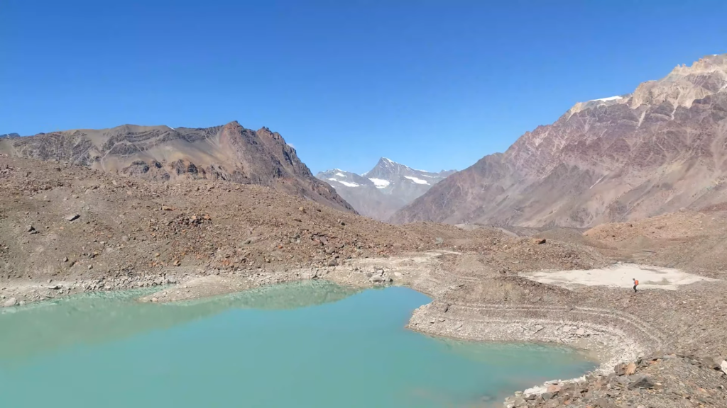
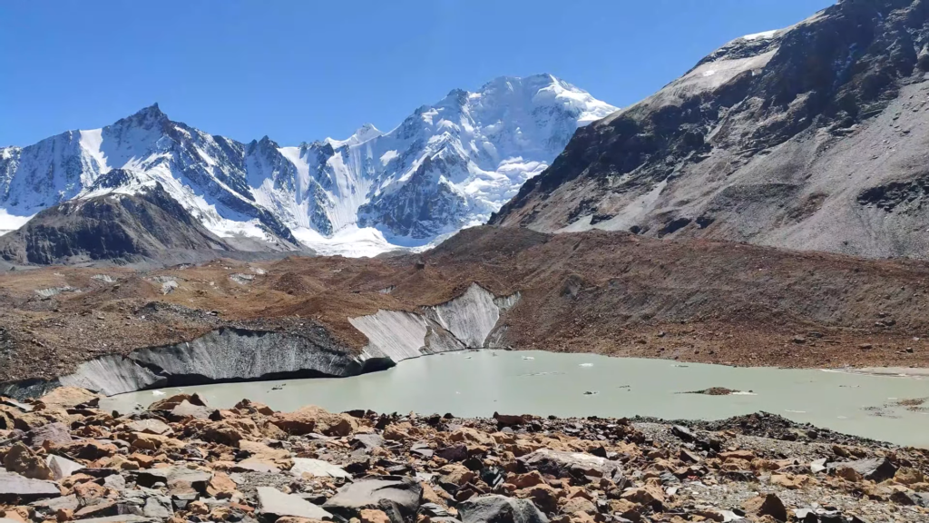
Starting from Patseo along the Manali-Leh highway we hike up through the Panchi Nala valley opposite Deepak Tal where we pass by the Padma Tso (4550m), Yum Tso (4750m), Gankar Tso (5100m) and Tso Ngonpo (5150m) before crossing an unknow pass into the Chandra river valley flowing to Chandra Tal.
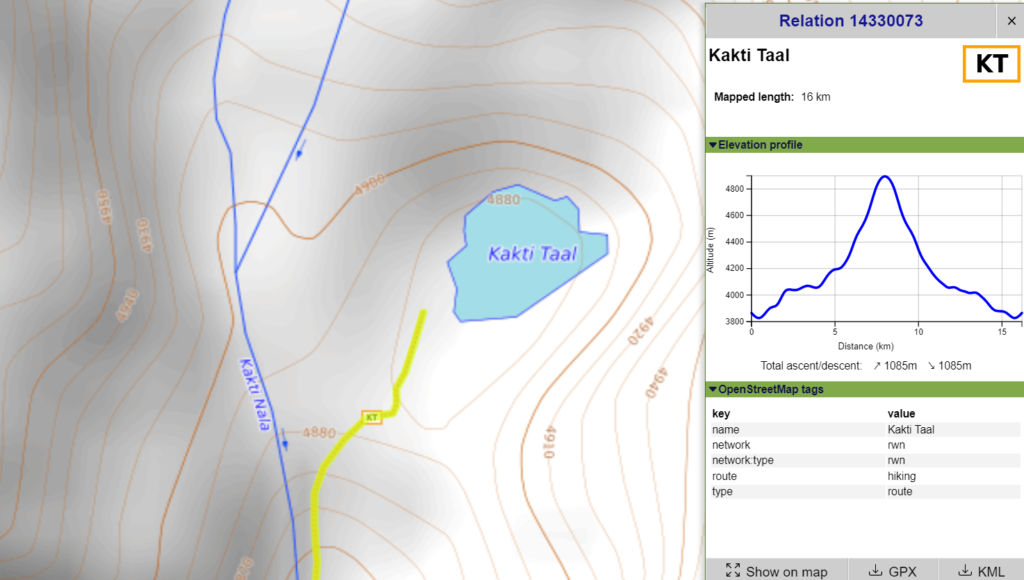
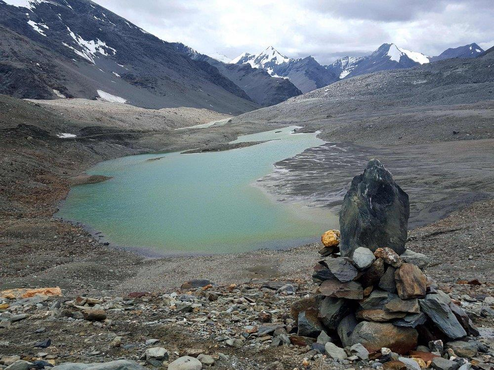
Kakti Tal – 16km / 1100m+
Starting near Tapachan (3830m) along the Manali-Leh highway in the Bhaga river valley we hike up North into the Kakti Nala valley to Kakti Tal at 4880m altitude.
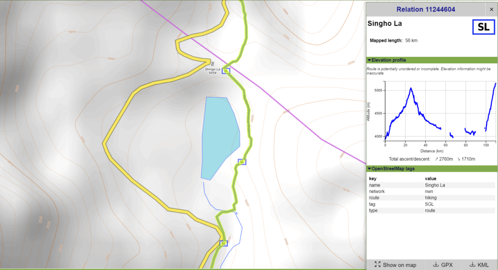
Singho Tso, 56km / 2700m+
Staring from Darcha in the Bhaga river valley we follow the road into the Jankar Nala valley until we head North into Jankar Sangpo climbing up to the Singo La pass where we discover Singo Tso lake at 5080m at the base of a retreating glacier.
5. Yunam River Basin
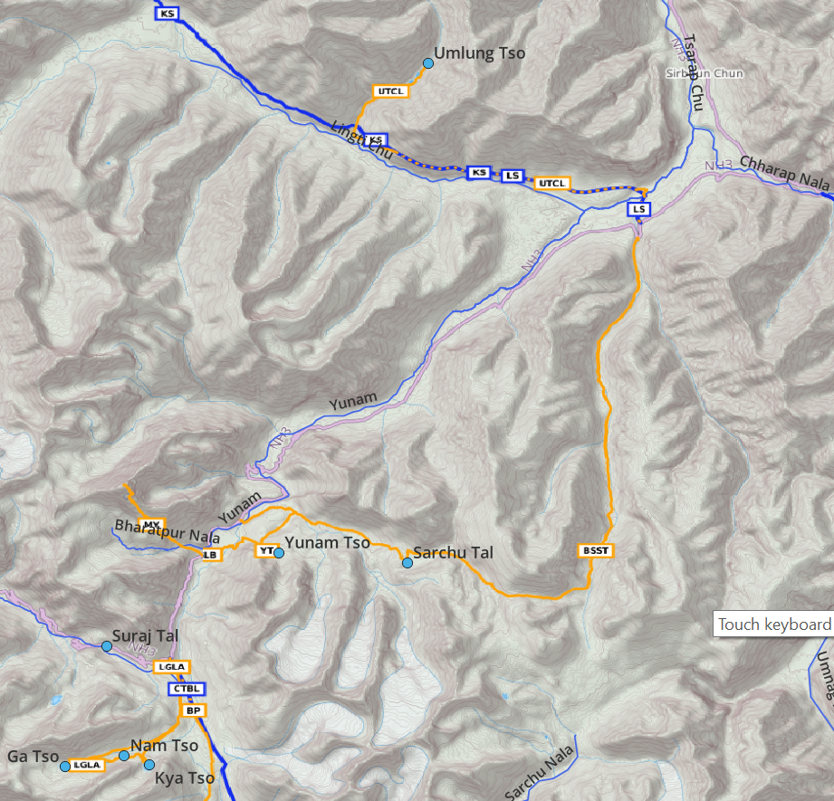
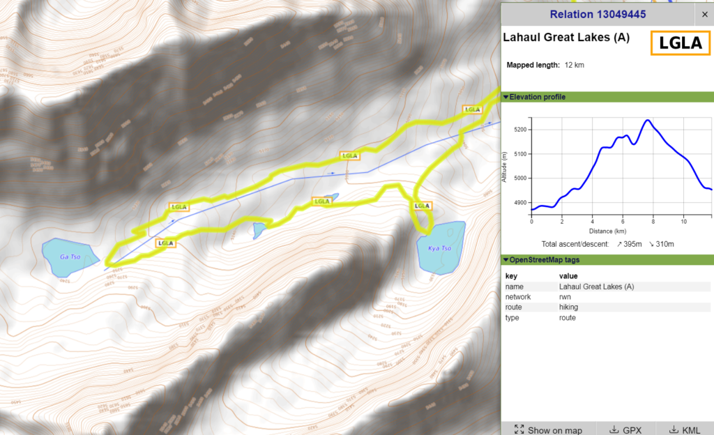
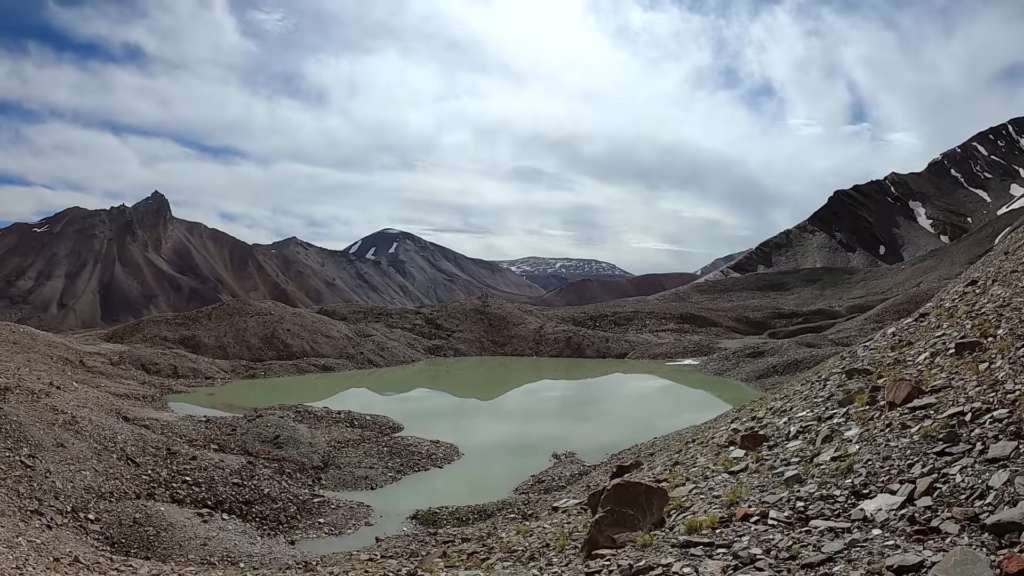
Kya Tso / Nam Tso / Unnamed / Ga Tso – 12km / 400m+
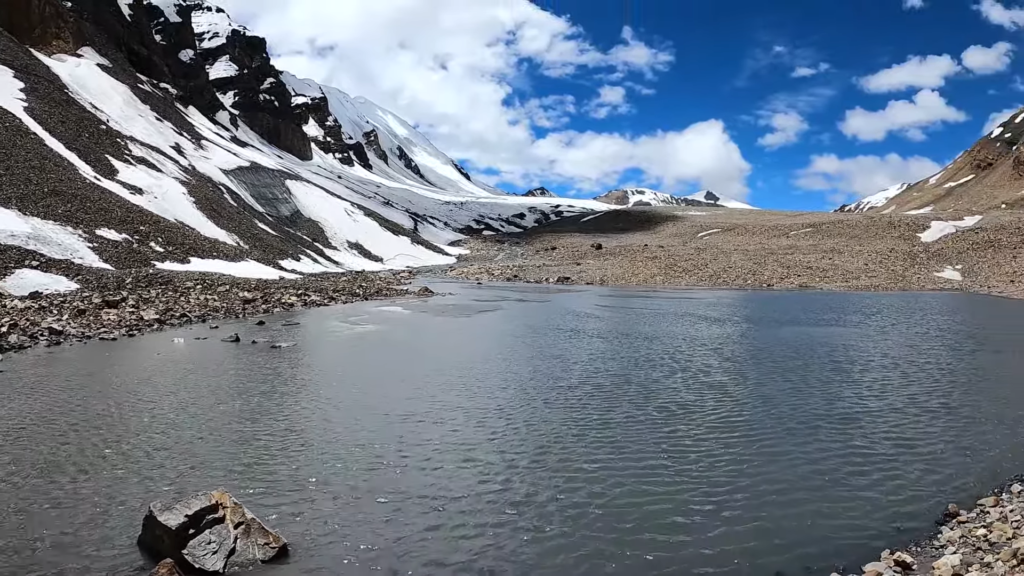
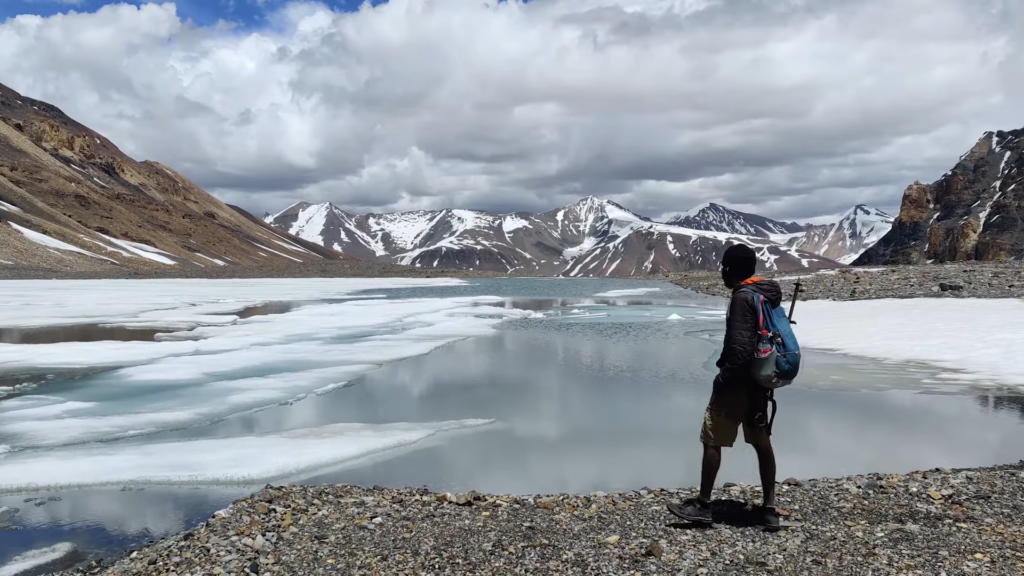
Starting from the Baralacha La (4920m) we hike up South in the Yunam river valley towards the saddle that separates the Chandra river valley. We climb up West into a 2 side-valleys where we discover three glacial melt lakes feeding the Yunam river: Kya Tso (5150m), Nam Tso (5100m) and Ga Tso (5250m)
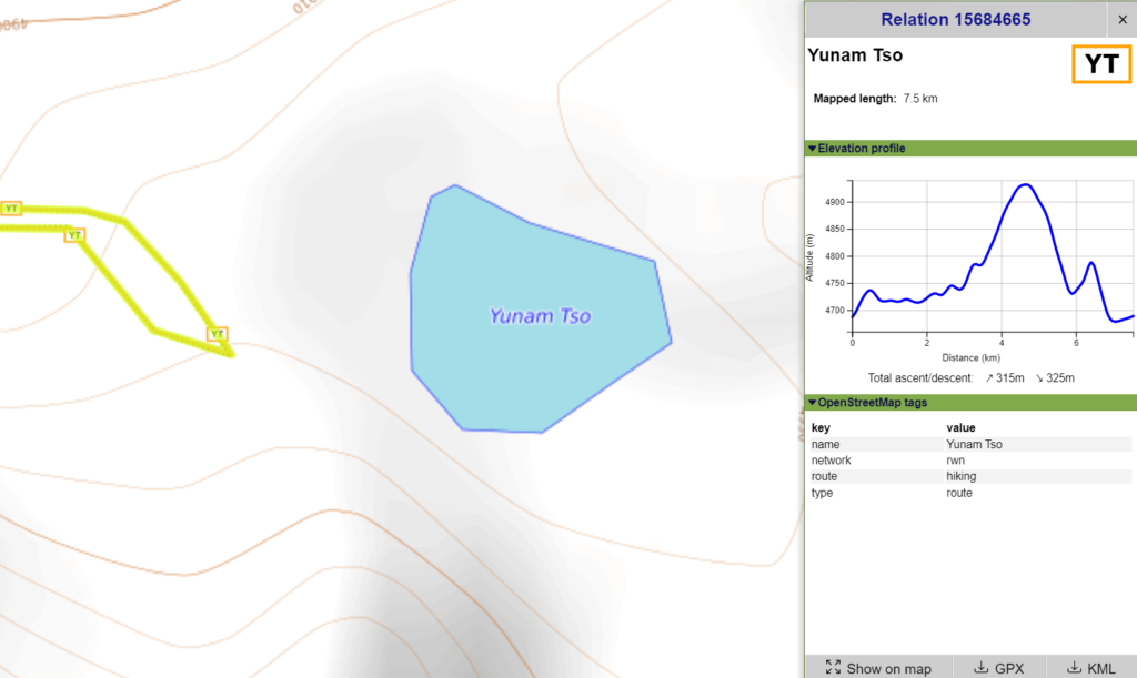
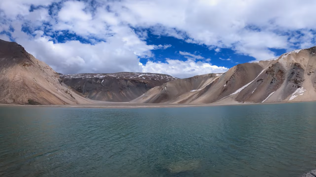
Yunam Tso – 7.5km / 320m+
From Bharatpur Tent Colony (4700m) we hike up East above the Yunam river valley to Yunam Tso (4930m).
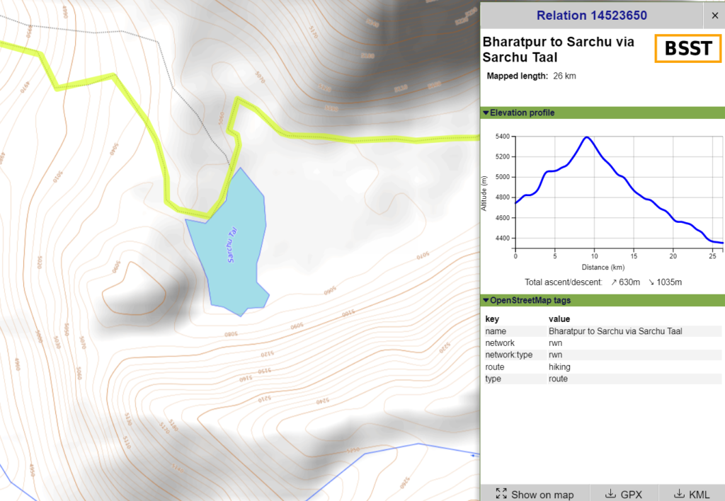
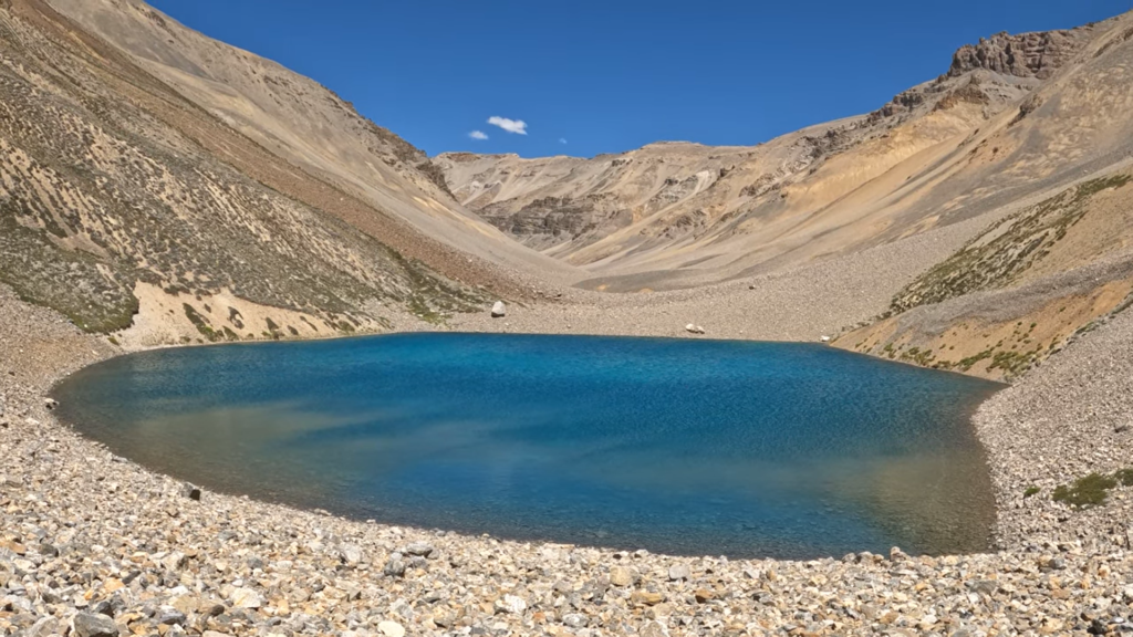
Sarchu Tal – 26km / 600m+
From nearby Bharatpur Tent Colony in the Yunam river valley (4700m) we hike up East into the side-valley to the Sarchu Tal (5070m) on the way to an unknown pass (5400m) into the Sarchu Nala valley which eventually joins the Yunam river near Sarchu.
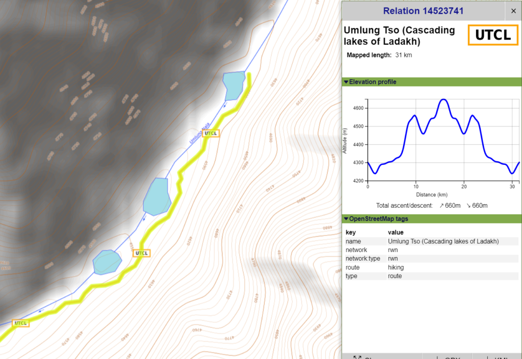
Umlung Tso 1 / 2 / 3 – 31km / 650m+
Starting from Sarchu we cross the Yunam river and hike up West into the Lingthi Chu valley and turn North into the Umlung Nala side-valley where we discover 3 lakes at 4540m, 4560m and 4580m.
6. Navigation
Above traverses can be easily navigated using most mobile mapping apps – many use Open Street Maps as base maps which include tens of thousands of kilometers of trails in Himalayas, Sahyadri, etc. OSM maps can be downloaded on the phone for offline exploration of the mountains without mobile network. Contours can be added to understand the topography of the terrain. Find a short tutorial over here.