
Geography
High Ranges
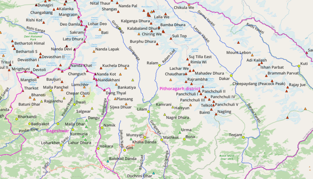
- Nanda Devi – located on the boundary of Pithoragarh, Chamoli and Bageshwar, drained by the Pindar, Sarju, Ramganga (South), Goriganga (East), Rishi Ganga (West) rivers
- Panchchuli – center North of Pithoragarh translated as “5 fingers” drained by the Ralam Gad, Goriganga (West) and Darma Yankti (East) rivers
- East Kumaon – Northeast of Pithoragarh drained by Darma Yankti (West) and Kuthi Yankti (East) near border of Nepal
Rivers
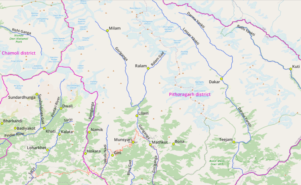
- Pindar (Dwali, Khati, Daiyakot), tributaries: Sundardunga Gad, Kail Ganga
- Sarju (Kalata, Loharket, Bageshwar), tributaries: Lahor Nadi, Gomati, Badhar Gad, Kulur Nadi
- Ramganga (Namik, Kokara), tributaries: Jakula Nadi (Gini)
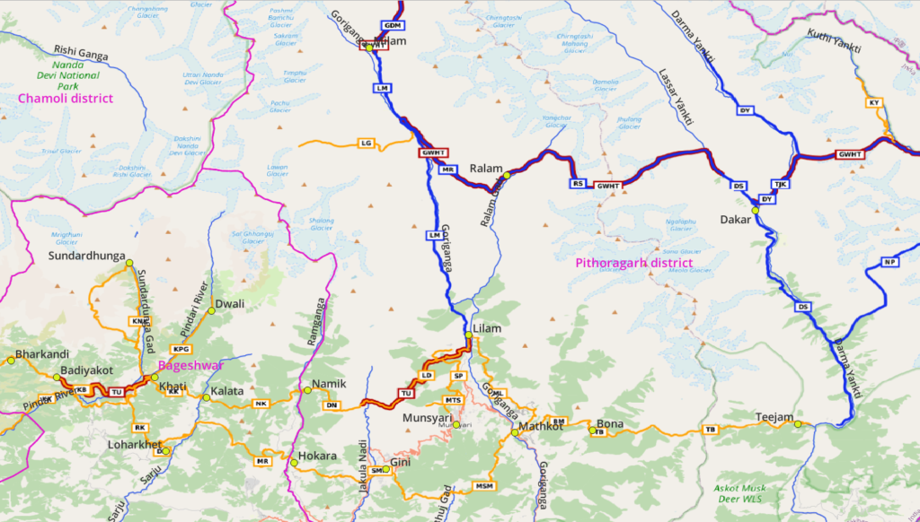
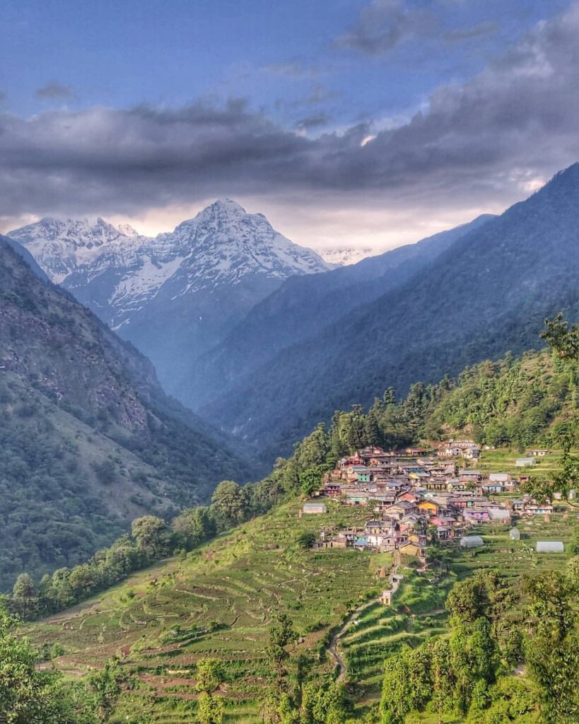
- Goriganga (Milam, Lilam, Munsyari, Mathkot), tributaries: Ralam Gad (Ralam), Paina Gad (Bona)
- Darma Yankti (Dakar, Teejam, Darchula), tributaries: Lassar Yankti,
- Kuthi Yankti (Kuti)
Lakes
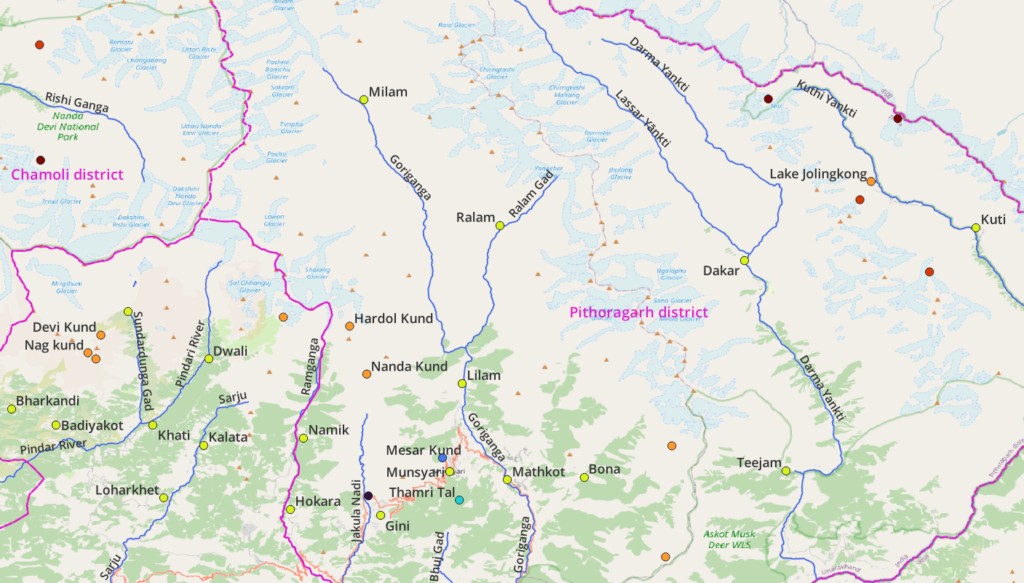
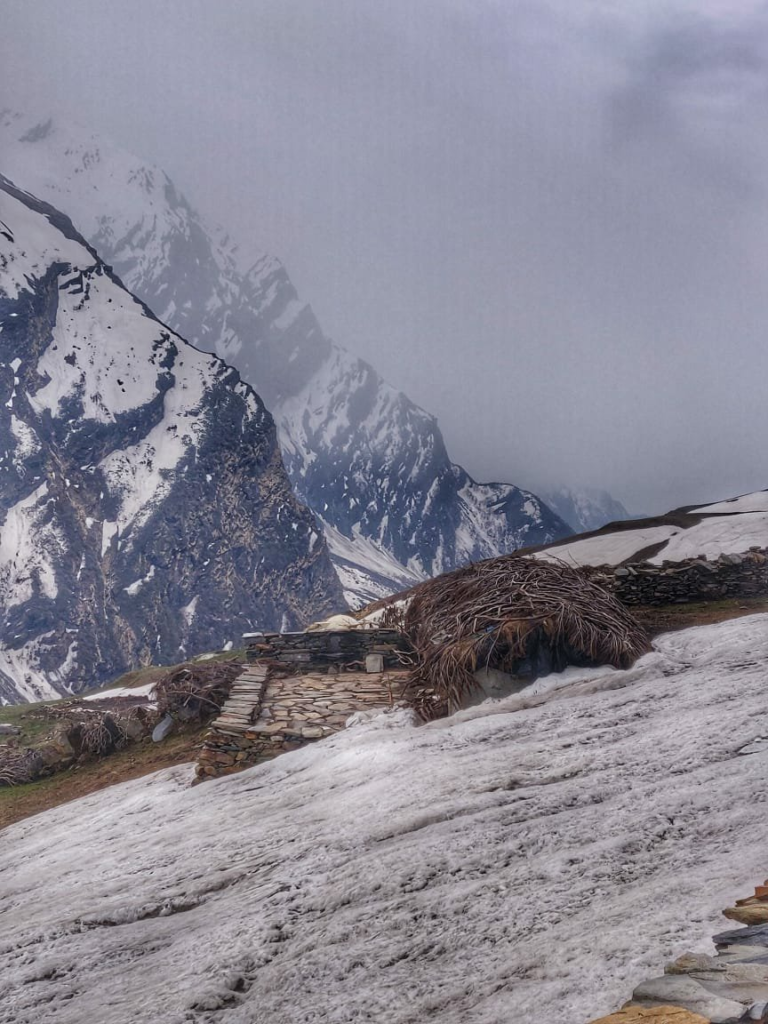
Pithoragarh and Bageshwar have a handful of known lakes: Thamri Tal (Munsyari), Devi Kund, Nag Kund (Sundardunga Gad)
Mountain Passes
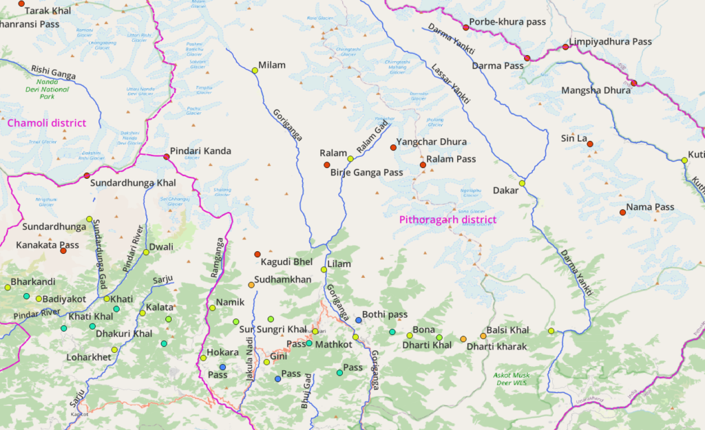
Both districts have numerous mountain passes connecting neighboring valleys – fewer in the high ranges (North), more in the mid ranges (South).
Hiking Routes
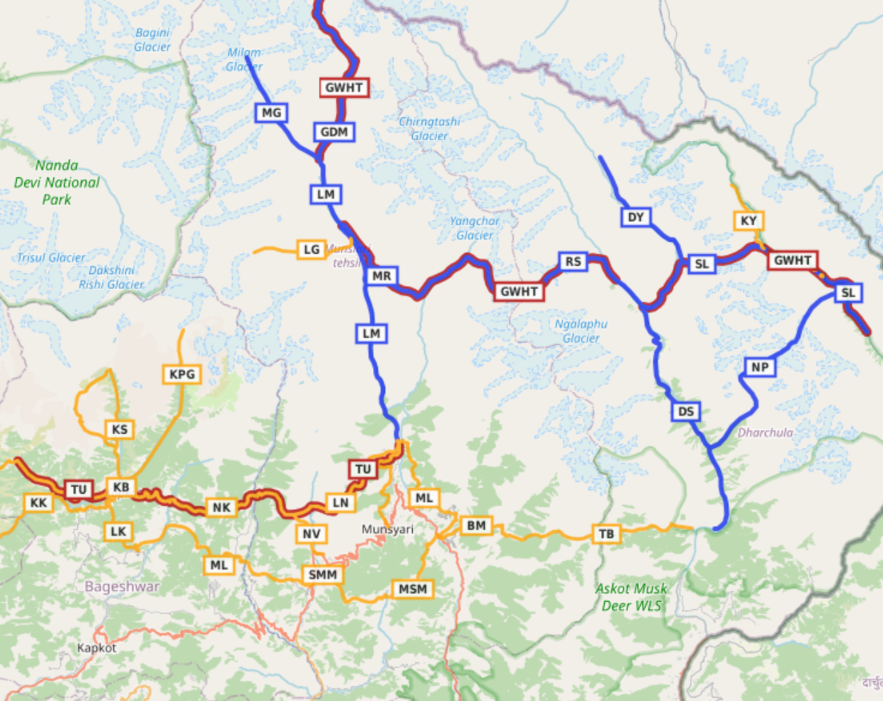
Hiking routes in Open Street Maps (OSM) are categorized in 4 different networks:
- International (red) – long distance paths that cross several countries (or states in case of India)
- National (blue) – walking routes that are nationally significant and long distance paths
- Regional (orange) – walking routes that c ross regions and are regionally significant
- Local (purple) – small local walking routes
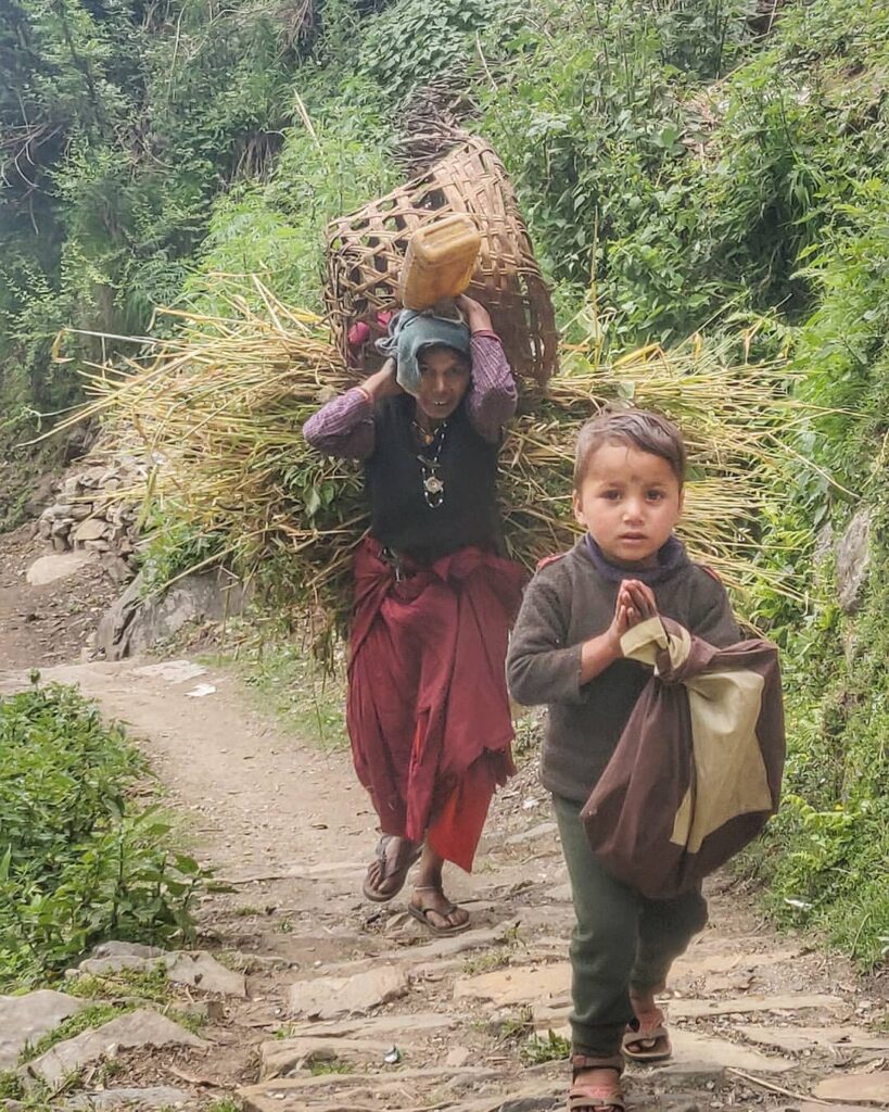
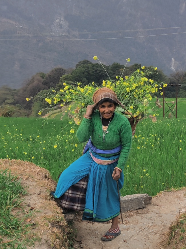
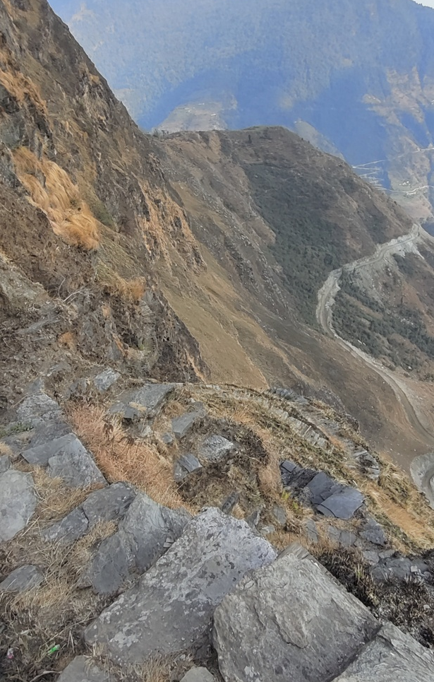
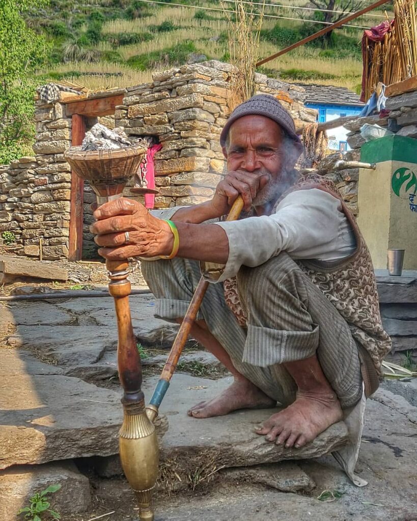
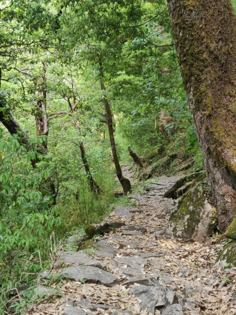
Many routes below have been explored and documented during my Trans Uttarakhand Journeys in Spring 2019 and Winter 20/21. Blogs for individual routes can be found here and here.
2 International Routes
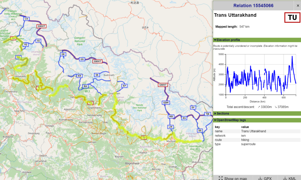
This inter-state route spans the entire state of Uttarakhand including several of the above regional routes.
- Trans Uttarakhand 550km / 33800m+ – refer detailed post over here
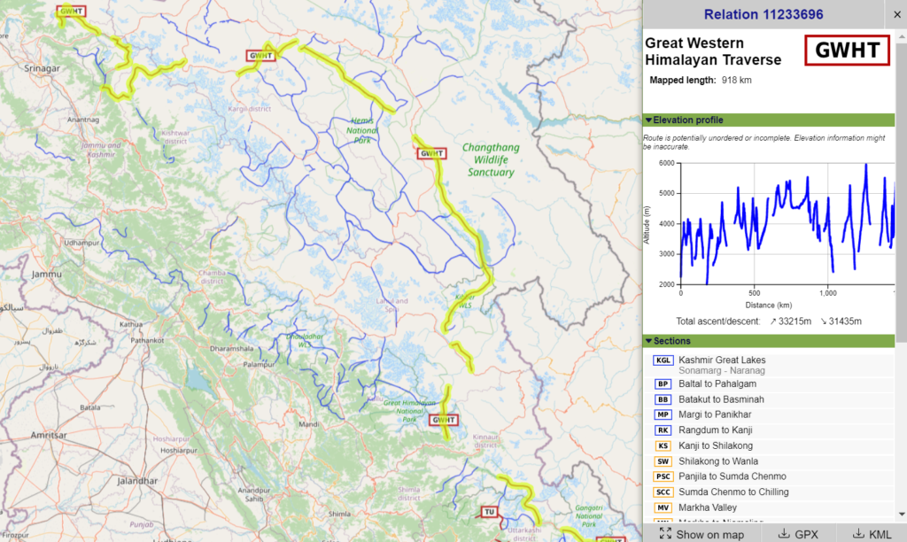
- Great Western Himalayan Traverse 920km / 33200m+ – refer detailed post over here
8 National Routes
Nama Pass 28km / 2550m+ from Sela in the Drma Yankti river valley we climb up Northeast to the Nama pass (5100m) descending onto the glacier to Kuti in the Kuti Kuthi Yankti river valley
- Sin La 37km / 1850m+ from Kuthi we climb up North in the Kuthi Yankti river valley turning West to the Sin La (5500m) descending to Khumling in the Darma Yankti river valley
- Dar to Sipu 38km / 2600m+ from Dar we hike up in the Darma Yankti valley passing through many picturesque hamlets till the last settlement of Sipu (3450m) in the Lassar Yankti valley. Blog post
- Darma Yankti 25km / 1300m+ from Tijiang on the confluence of the Lassar and Darma Yankti rivers we hike up in the Darma Yankti valley to 4450m at the base of the Darma pass (5600m)
- Ralam to Sipu 28km / 2000m+ from Ralam (3600m) we hike up Northeast in the Ralam Gad valley climbing East across the Yangchar Dhura (4780m) descending onto a glacier. We hike up South – East across the Ralam pass (5580m) descending East onto a glacier turning South to Sipu in the Yassar Yankti vally
- Milam to Ralam 16km / 1700m+ from Milam we descend South in the Goriganga river valley to Sumdu where we climb East across the Birje Ganga pass (4650m) descending to Ralam (3600m) in the Ralam Gad valley
- Lilam to Milam 40km / 2300m+ from Lilam we hike up North into the Goriganga river valley to Milam (3400m) passing many remote dwellings along the way
- Lilam to Ralam from Lilam we cross over to the East slope of the Goriganga hiking North into the Ralam Gad valley to Ralam (3600m). Blog post
- Girthi Dobala to Milam 46km / 2900m+ from Girthi Dobala (Chamoli) we hike up Southeast in the Girthi Ganga river valley climbing up South across the Unta Dhura Pass II (5550m) descending South to Milam in the Goriganga river valley
18 Regional Routes
- Teejam to Bona 28km / 2300m+ starting from Teejam in the Darma Yankti valley we head West into an unnamed side-valley to the last settlement of Sungdom where we climb up to the Balsi Khal (3900m), descending into the Jimba Gadhera (uninhabited), climbing up across the Dharti Kharak (3800m), descending into the Kulka Gadhera (uninhabited), climbing up the Dharti Khal (3450m) descending to Bona in the Paina Gad river valley. Blog post Blog post 2
- Bona to Mathkot 16km / 2000m+ from Bona in the Paina Gad valley we climb up West across an unnamed pass (2800m) descending in the Madakani Nadi valley where we turn Southwest to Mathkot at the confluence of Goriganga and Madakani Nadi rivers. Blog post Blog post 2

- Mathkot to Lilam 21km / 2750m+ from Mathkot we hike up Northeast into the Madakani Nadi valley climbing up West to the Bothi pass (2200m) from where we start contouring Northwest high above the Goriganga river valley passing through remote settlements. Near the last settlement of Buin we descend West and cross over the Goriganga to Lilam village at the entrance of the Milam valley. Blog post Blog post 2
- Munsyari to Lilam 21km / 1800m+ from Munsyari town we contour North along the upper slopes of the Goriganga river valley crossing the Senar Gad and Kwiri Gad side-valleys while passing through remote hamlets till Lilam village at the entrance of the Mailam valley. Blog post Blog post 2
- Lilam to Namik 27km / 2500m+ from Lilam village in the Goriganga river valley we climb up Southwest into the Kwiri Gad valley crossing over Senar Gad valley to the Rur Khan pass (3450m) descending West into the Jakula Nadi valley (uninhabited) where we climb up to the Sur Sungri Khal pass (3150m) descending Northwest via the Pauri Rauli valley to Namik in the Ramganga river valley. Blog post
- Namik to Khalpata 14km / 1600m+ from Namik we climb up Southwest out of the Ramganga river valley (Bageshwar district) into the Lamtara Rauli valley across the Mandhari Kharak pass (3050m) descending West to Khalpata in the Sarju river valley in Bageshwar. Blog post Blog post 2
- Khalpata to Kathi 13km / 1400m+ (Bageshwar) from Khalpata in the Sarju river valley we climb up West to Khaljuni across the Khati Khal pass (2900m) to Kathi in the Pindar river valley. From the Khati Khal pass there’s a trail North along the ridgeline to Pangu Top 5km / 550m+. Blog post Blog post 2
- Kathi to Pindari glacier 21km / 2050m+ (Bageshwar) a popular / touristic hiking route starts from Kathi and proceeds Northeast onto the West bank of the Pindar river to Dwali at the confluence of the Kaphni Gad and Pindar rivers. We proceed further North to zero point (3800m) below the Pindari glacier. Blog post
- Kathi to Sundardhunga 37km / 3150m+ a popular hike from Kathi crosses the Pindar river heading North into the Sundardhunga Gad valley to 3250m where we climb up Southwest onto the ridgeline towards Devi Kund (4300m) and Nag Kund (4470m) to the Kanataka pass (4650m) descending Southeast along the ridgeline back into the Sundardhunga Gad valley to Jatoli
- Kathi to Badiyakot 14km / 1150m+ from Kathi we proceed Southwest crossing the Pindar river below Kharkiya contouring on the North slope above the Pindar valley through scenic farming hamlets crossing the side-valley near Surag to Badiyakot in the Ghatiya Gad side-valley. Blog post
- Badiyakot to Himni 19km / 2450m+ from Badiyakot in the Ghatiya Gad, side-valley of the Pindar river, we climb up Northwest across an unnamed pass (2750m) descending to Bharkandi in the Baura Gad valley and climbing up West across an unnamed pass (3350m) descending to Himni village in the Kail Ganga river valley in Chamoli district. Blog post Blog post 2
- Kharkiya to Kheta 30km / 3000m+ from Khati (Bageshwar) in the Pindar valley we proceed West along the left slope (downstream) of the Pindar river crossing over near Kilbara where proceed along the right slope (downstream). Near Bilap we descend along an ancient rock path (entering Chamoli district) and proceed just right above the Pindar river through uninhabited sections and remote hamlets till the road head near Kheta. Blog post
- Loharkhet to Kharkiya 14km / 2250m+ (Bageshwar) a popular hike from Loharkhet in Sarju river valley climbing up Northwest along a wide rock path to the Dhakuri Khal pass (2900m) descending to Kharkiya in the Pindar river valley. Blog post
- Mahargaon to Loharkhet 22km / 1350m+ from Mahargaon in the Jakula Nadi river valley in Pithoragarh we climb up West in the Rumla Gad valley crossing an unnamed pass (2300m) contouring across the Jajar Rauli valley descending to Hokara in the Ramganga valley (Bageshwar) climbing up West across the Satgarh Rauli valley across an unnamed pass (2900m) near Lahur Gwar Kharak descending into the Barmati Gadhera valley to Loharkhet in the Sarju river valley. Blog post
- Samkot to Mahargaon 13km / 1200m+ from Samkot in the Tiktiya Gad valley, tributary of the Bhuj Gad river, we climb up North across an unnamed pass (2350m) descending Northwest above the Kidkidiya Gadhera valley to Gini in the Jakula Nadi river valley climbing up West to Mahargaon in the Rumla Gad valley . Blog post
- Mathkot to Samkot 23km / 2250m+ from Mathkot in the Goriganga river valley we climb up South in the Sungariya Gadhera valley contouring above the Tumariya valley to an unnamed pass (2750m) descending Southwest in the Chiphulwa Nadi valley crossing the Bhuj Gad and climbing up on a beautiful rock path along a steep rockface to Samkot in the Tiktiya Gad valley. Blog post
- Kuthi Yankti 11km / 400m+ from Kuthi we hike up Northwest in the Kuthi Yankti valley passing Jolingkong lake (4500m) to the trail head at 4700m altitude
- Lawan Glacier 14km / 1050m+ from Martoli in the Milam valley (Goriganga river) we climb up West into the Lavan Gad side-valley to Naspan Patti (4100m) at the base of the Lwa glacier
- Namik to Virthi 15km / 1200m+ from Namik in the Ramganga river valley we climb up Southeast to the Sur Sungri Khal pass (3150m) descending South into the Jakula Nadi valley Virthi village at the base of the ghat road towards Munsyari. Blog post
5 Local Hikes
- Munsyari to Khaliya Top 7.5km / 1500m+ a popular hiking route starting from Munsyari in the Goriganga river valley climbing up West to Khalia Danda of Khalia Top (3720m) offering 360 degree views on the snow capped high ranges (North) and the Goriganga (East), Jakula Nadi (West) and Bhuj Gad (South) valleys. Blog post
- Thamri Kund 2.2km / 250m+ a short hike from the road pass Southwest above Munsyari we proceed Southeast along the ridgeline to Thamri Kund lake (2800m) offering birds eye views on Panchchuli (East) and the Goriganga (East) and Bhuj Gad (South) valleys below. Blog post
- Kathdara 18km / 1600m+ located in the Himalayan foothills on the border of Bageshwar and Almora are the hill hamlets of Kathdara, Binsar and Dalar
- Binsar 21km / 1830m+
- Dalar 8.5km / 800m+
References

Navigation
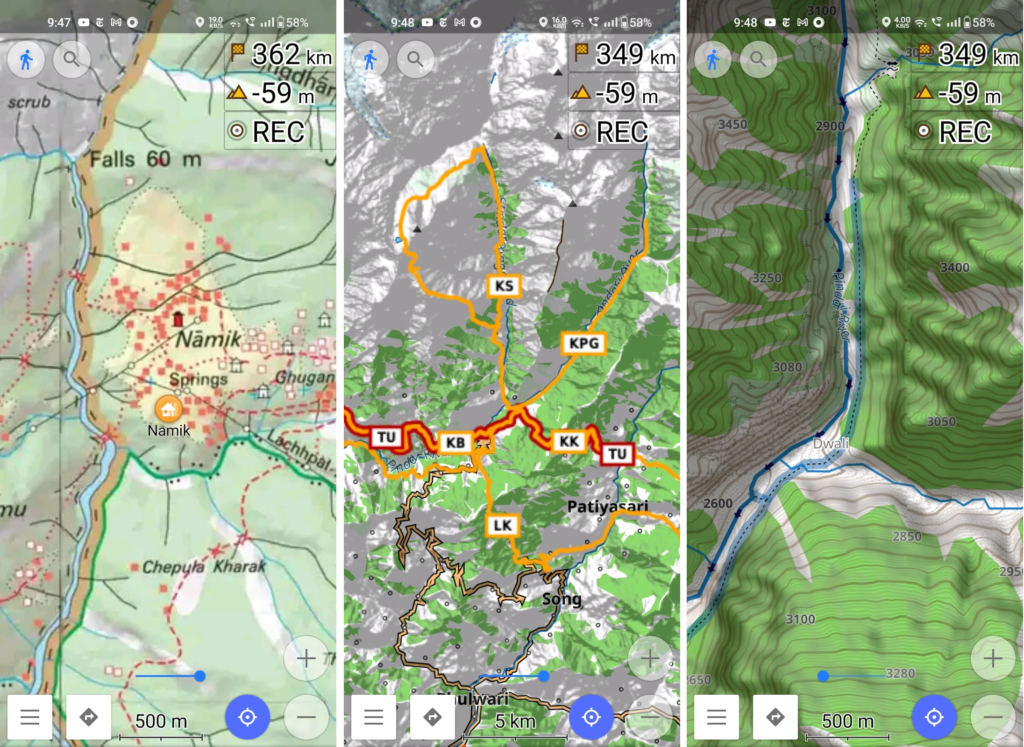
Above traverses can be easily navigated using most mobile mapping apps – many use Open Street Maps as base maps which include tens of thousands of kilometers of trails in Himalayas, Sahyadri, etc. OSM maps can be downloaded on the phone for offline exploration of the mountains without mobile network. Contours can be added to understand the topography of the terrain. Find a short tutorial over here.