
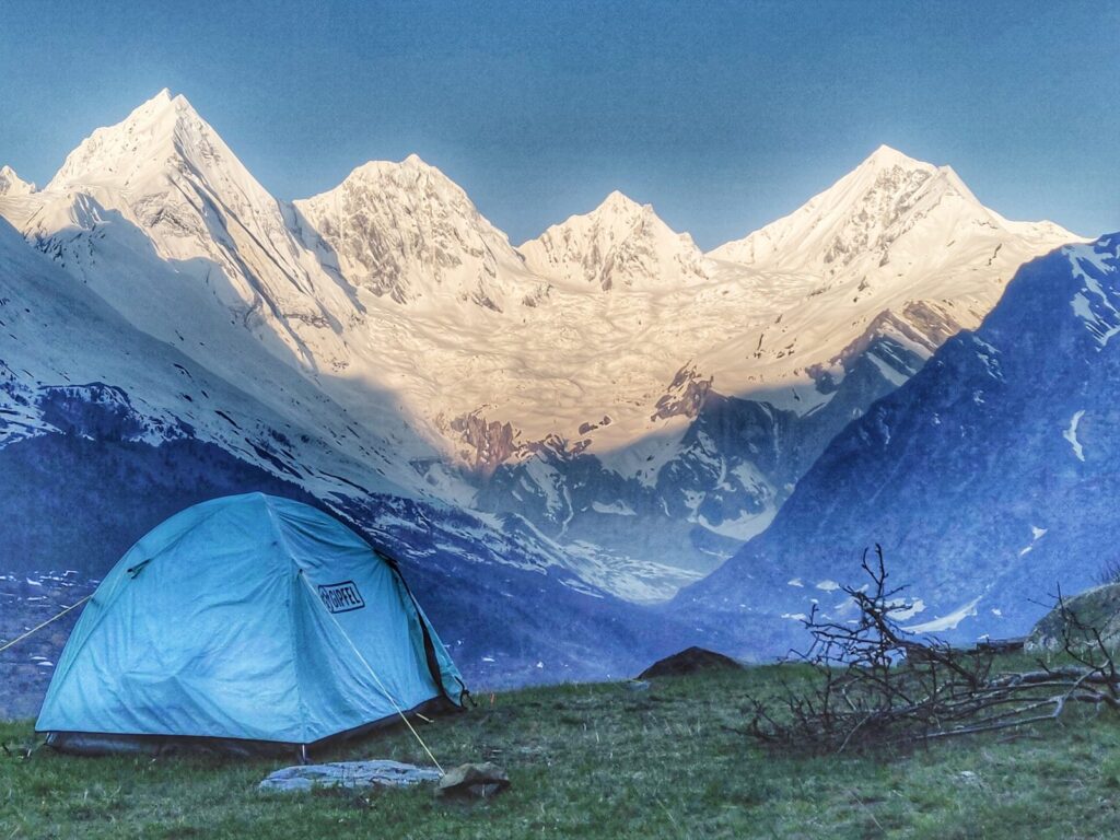
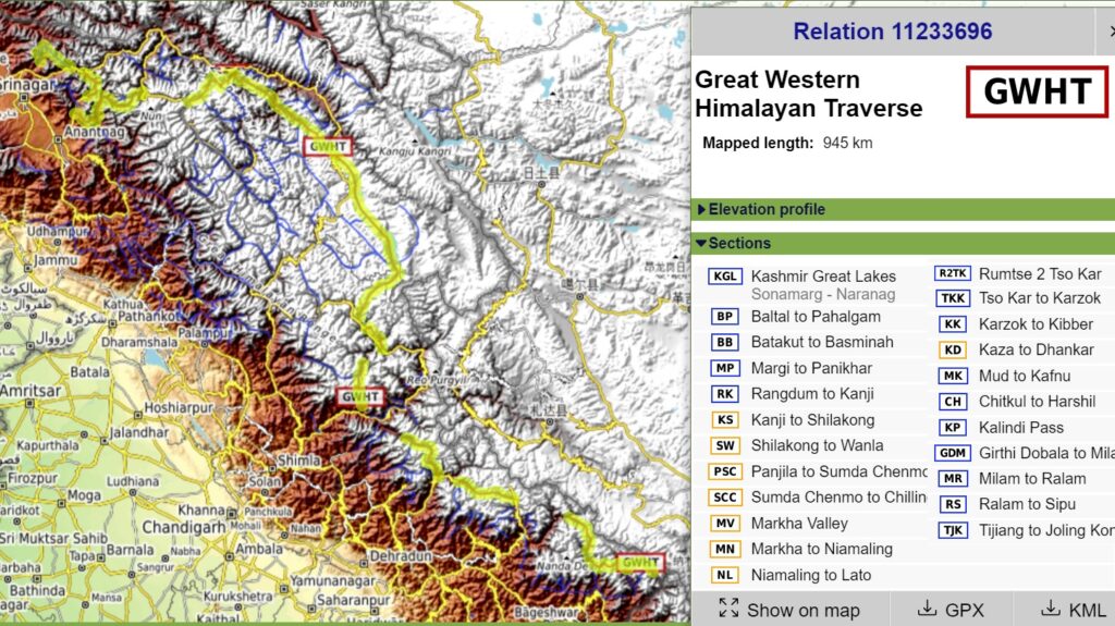
The Great Western Himalayan Traverse (GWHT) is a 950km high altitude trans Himalayan traverse through the Indian Western Himalayas across 4 states from Kashmir across Zanskar & Ladakh to Spiti & Kinnaur and across Uttarakhand to the border of Nepal across 31 high passes covering 34 thousand meters of elevation gain, 16 major rivers and 9 alpine lakes. The traverse consists of 23 individual sections which have been GPS recorded and accurately mapped in Open Street Maps for the international hiking community to explore alpine style.
23 Sections
Find below detailed info on each of the 23 individual sections with distance and elevation metrics, mountain passes, alpine lakes and valleys crossed through each of the 4 Himalayan states.
Kashmir
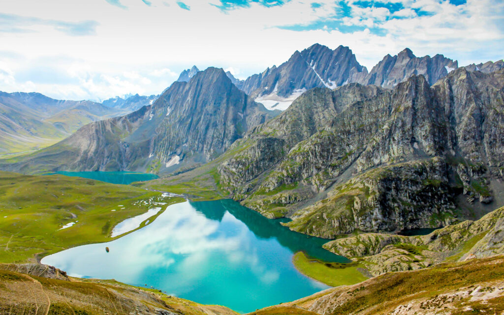
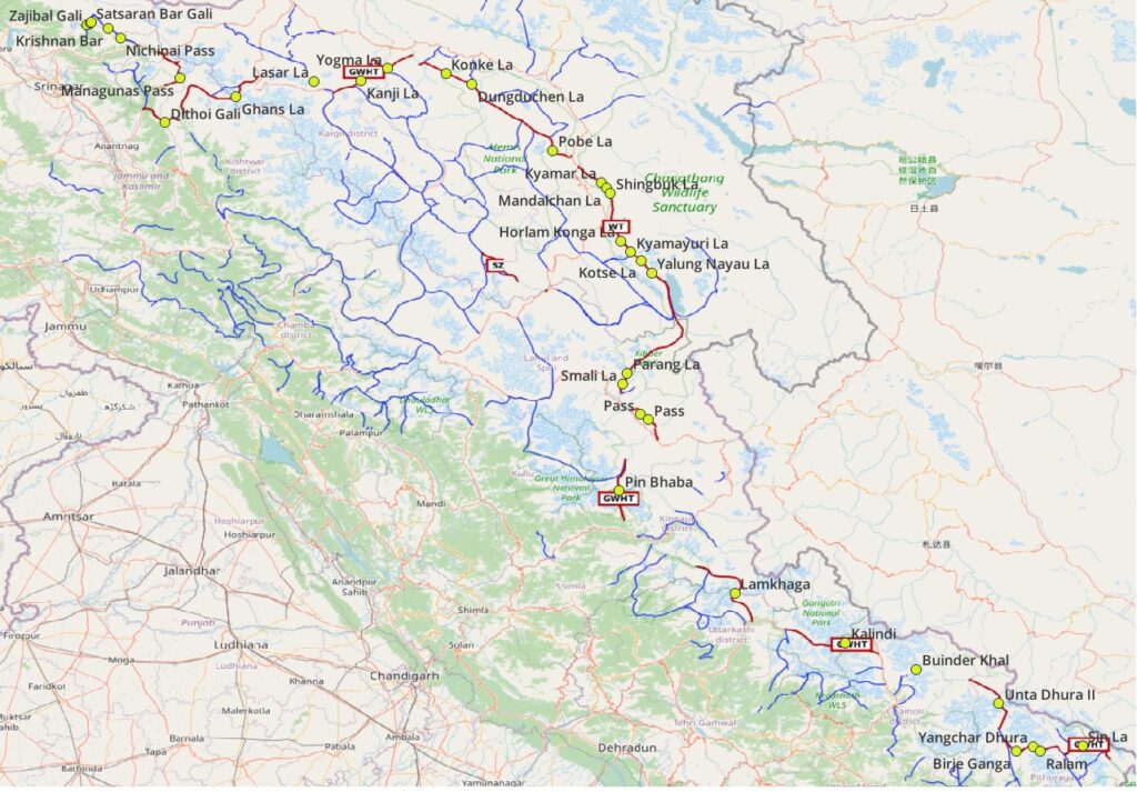
- Kashmir Great Lakes (KGL) 62km / 2720m+ starting from Naranag in the Wangat Nala valley across the Zajibal Galu (4050m) passing Nundkal lake (3500m) and Gangabal lake (3650m) across Satsaran Bar Gali (3700m) and Karobai Gali (3750m) passing Gad Sar lake (3600m) across Krishnan Bar (4200m) passing Krishnan Sar lake (3800m) and Vipan Sar lake (3650m) across Nichinai Pass -(4100m) to Sonamarg in the Sind river valley
- Baltal to Pahalham (BP) 44km / 2470m+ from Baltal in the Sind river valley to the Amarnath Cave Temple (3900m) and across Managunas Pass (4200m) to Chandwari in the East Lidder valley
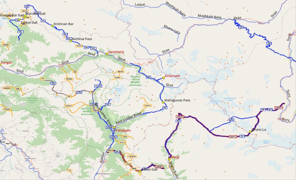
- Chandanwari via Pahalgam to Batakut – 46km road section in Lidder valley (can be avoided via Golul Gali – shepherd pass not yet mapped in OSM)
- Batakut to Basminah (BB) 28km / 2770m+ from Batakut in Lidder valley across Dithoi Gali (4000m) to Basminah in the Mariv Sudhir valley
- Margi to Panikhar (MP) – 73km / 1850m+ from Margi in Mariv Sudhir valley through the Ghans La (4400m) across the Great Himalayan Range to Panikhar in the Suru valley of Zanskar
Ladakh
- Panikhar to Rangdum 55km – road section in Suru valley (can be shortened via Lasar La, partly mapped in OSM)
- Rangdum to Kanji 37km / 1170m+ from Rangdum in the Suru valley of Zanskar upstream along the Kanji Nala river across the Kanji La (5250m) to Kanji in the Kanji Rong valley (tributary of Sangeluma) in Ladakh
- Kanji to Shilakong 14km / 1025m+ from Kanji village across Yogma La (4700m) Shilakong in Ladakh
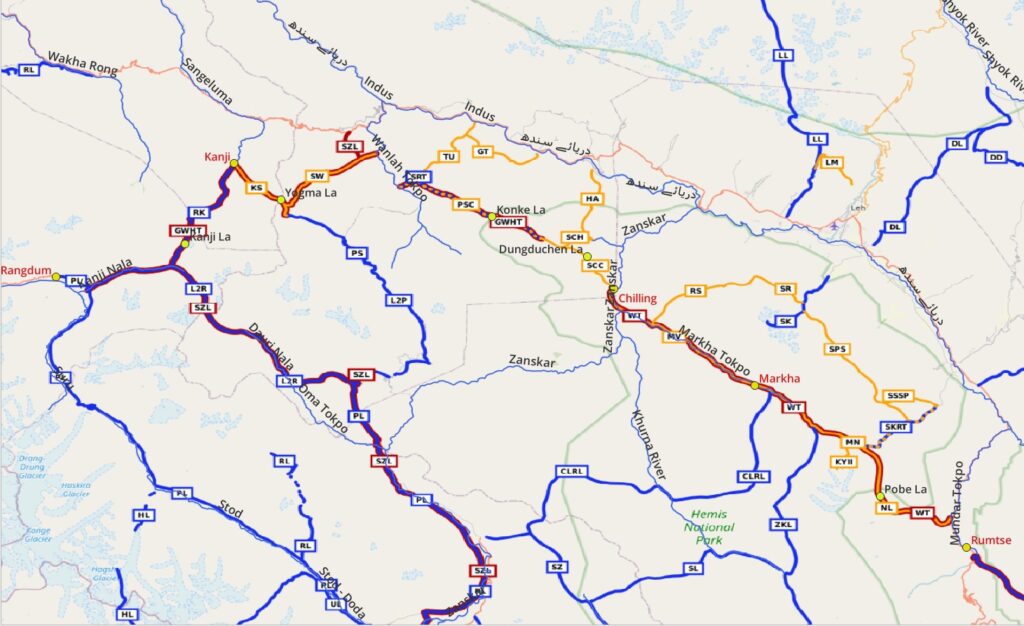
- Shilakong to Wanla 18km / 435m+ from Shilakong along the Shillakong Tokpo through a deep canyon to Wanla in the Wanla Tokpo valley
- Panjila to Sumda Chenmo 28km / 1950m+ from Panjila in the Wanla Tokpo valey upstream along the Hinju Tokpo river across the Konke La (4900m) to Sumda Chenmo in the Chenmo Tokpo valley
- Sumda Chenmo to Chilling 19km / 1300m+ from Sumda Chenmo in the Chenmo Tokpo valley across the Dungduchen La (4600m) to Chilling in the Zanskar valley (tributary of Indus)
- Markha Valley 32km / 1540m+ from Chilling in the Zanskar valley along the Markha river to Markha village in the Hemis National Park
- Markha to Niamaling 22km / 1320m+ Markha village along the Jungchhuta Tokpo to Niamaling at the base of the Kang Yatse
- Niamaling to Lato 24km / 740m+ from Niamaling across Pobe La (5600m) to Lato in the Mundar Tokpo valley (tributary of Indus) through the Hemis National Park
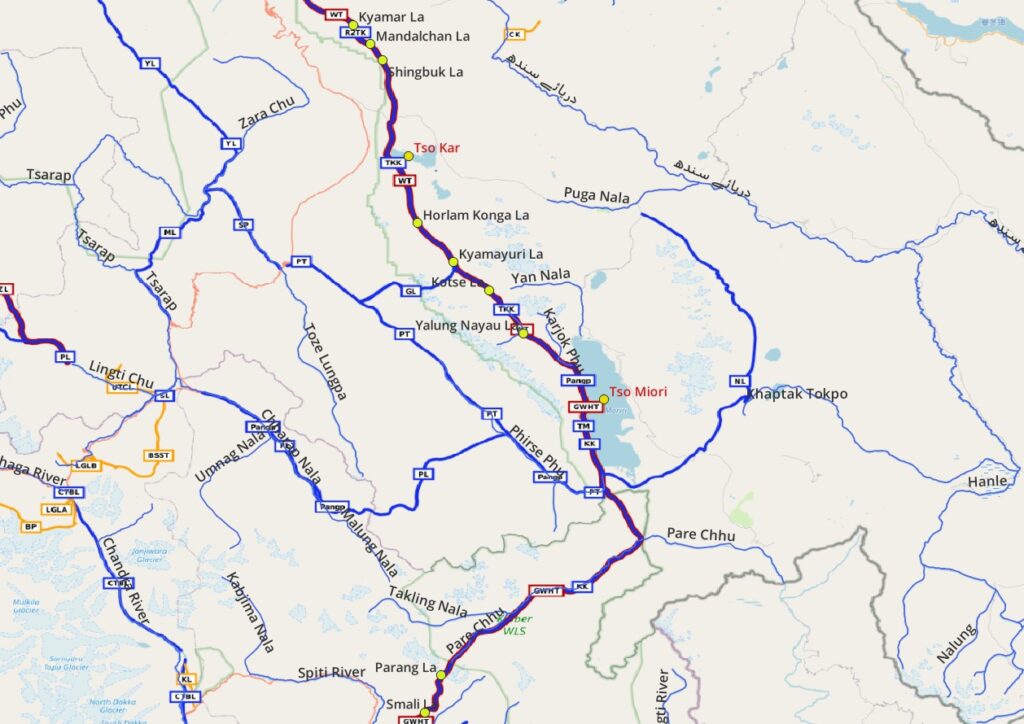
- Rumtse to Tso Kar 39km / 920m+ from Rumtse in the Mundar Tokpo valley across the Kyamar La (5100m), Mandalchan La (5200m) and Shingbuk La (5250m) to Tso Kar lake
- Tso Kar to Karzok 59km / 1280m+ from Tso Kar lake across the Horlam Kongka La (4950m), Kyamayuri La (5400m), Kotse La (5400m) and Yalung Nyau La (5450m) to Karzok village at Tso Moriri Lake
Spiti / Kinnaur
- Karzok to Kibber 102km / 2650m+ from Karzok at Tso Moriri lake through the Pare Chhu valley in the Changthang & Kibber Wildlife Sanctuaries across Parang La (5550m) and Smali La (4700m) to Kibber in the Spiti valley
- Kibber to Tashigang through Shila Lungpa valley to Langhza section can be inserted (explored but not yet mapped in OSM)
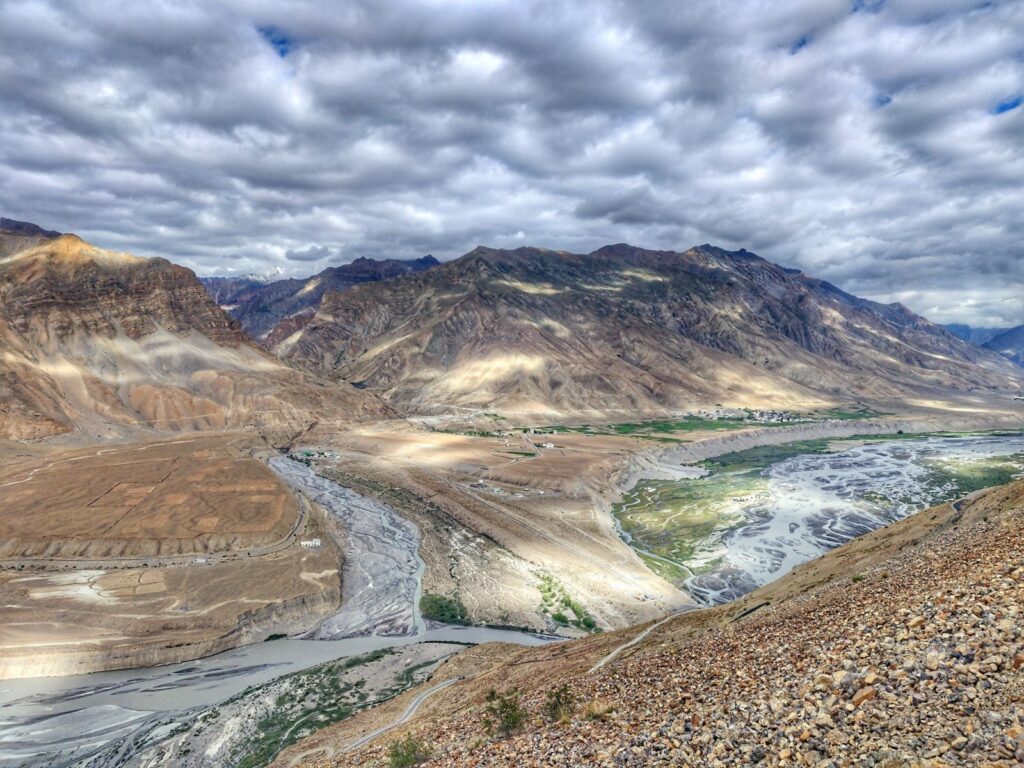
- Kaza to Dhankar 36km / 1900m+ upper Spiti traverse from Kaza valley to Langzha and Hikkim across unnamed passes (4650m, 4750n) to Demul, Dhankar and Shichling
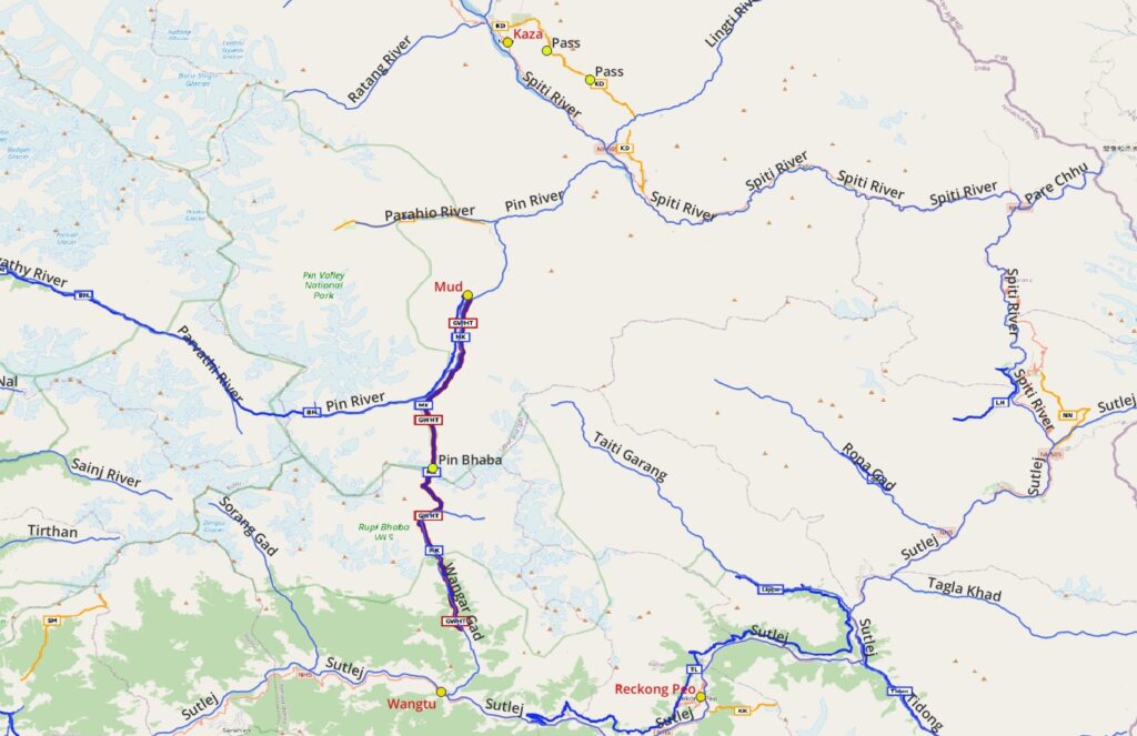
- Shichling to Mud – 40km road section in Pin river valley
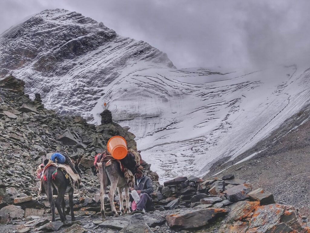
- Mud to Kafnu 49km / 2140m+ from Mud village in the Pin river valley in Spiti across the Pin Bhaba (4900m) through the Rupi Bhaba WLS to Kafnu in Wangar Gad valley in Kinnaur (tributary of Sutlej)
- Kafnu via Wangtu to Chitkul – 80km road section through Sutlej and Baspa river valleys (could be circumvented by trails on the Southern / Western slopes of valleys)
- Chitkul to Harshil 67km / 1760m+ from Chitkul in the Baspa valley in Kinnaur across the Lamkhaga (5250m ) to Harshil in the Bhagirathi river valley in Uttarakhand
Uttarakhand
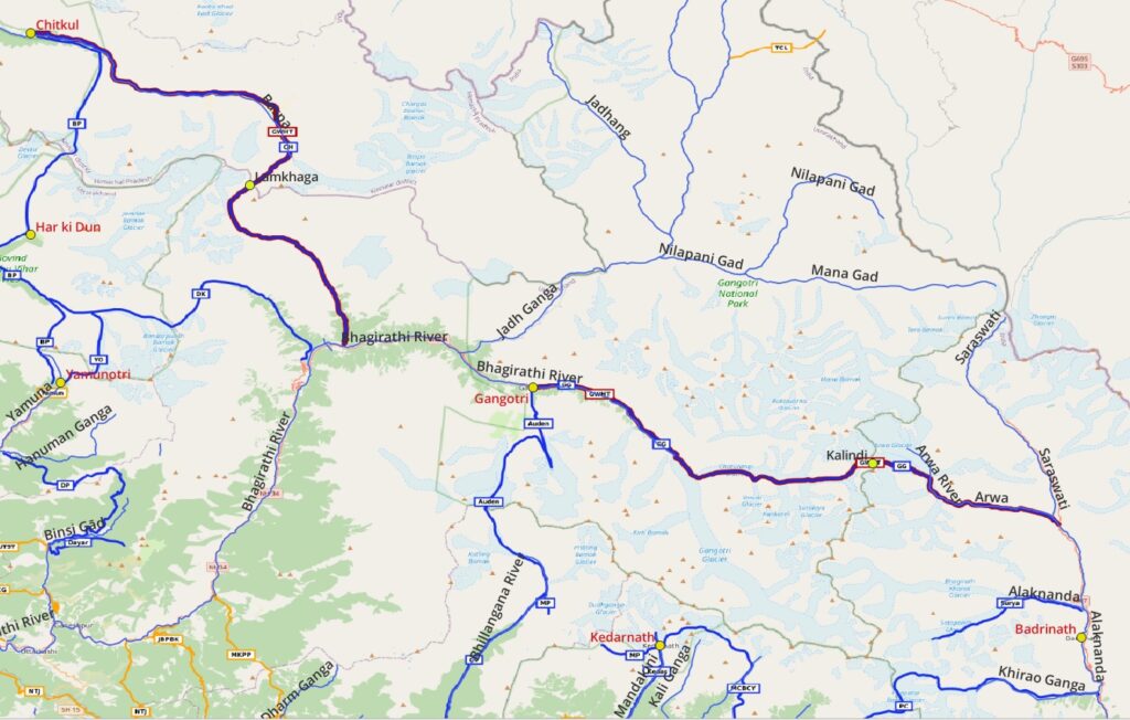
- Harshil to Gangotri – 25km road section in the Bhagirati river valley
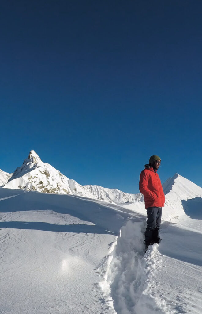
- Gangotri to Ghastoli 65km / 3560m+ Gangori in the Bhagirati river valley through the Gangotri National Park across the Kalindi Khal (6000m) to Ghastoli in the Saraswati valley (tributary of Alaknanda)
- Ghastoli to Girthi Dobala – 144km road section in Alaknanda and Dhauli Ganga valleys (can be replaced by Buinder Khal, not yet mapped in OSM)
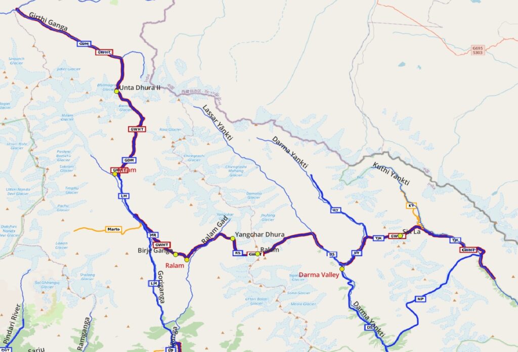
- Girthi Dobala to Milam 46km / 2850m+ from Girthi Dobala in Girthi Ganga valley across the Unta Dhura II (5550m) to Milam in the Goriganga river valley
- Milam to Ralam 16km / 1670m+ from Milam in the Gorigang river valley across Birje Ganga (4650m) to Ralam in the Ralam Gad river valley
- Ralam to Sipu 28km / 1980m+ from Ralam across the Yangchar Dhura (4800m) and Ralam pass (5550m) to Sipu in the Dharma valley
- Tijiang to Joling Kong – 37km / 1850m+ from Tijiang in the Dharma vally across the Sin La (5450m) to Joling Kong in the Kuthi Yankti valley near Nepal
31 High Passes / 9 Alpine Lakes / 16 Major Rivers
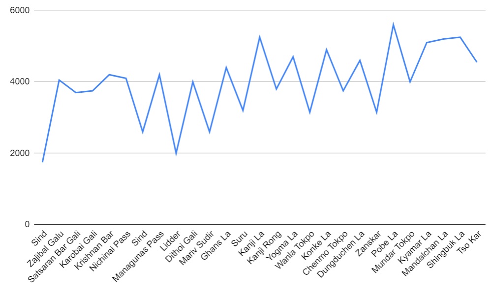
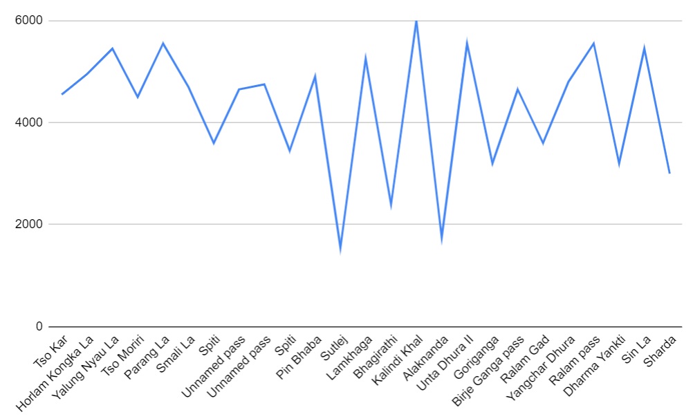
| Sind valley | Suru valley | Smali La – 4700m |
| Zajibal Galu – 4050m | Kanji La – 5250m | Spiti valley |
| Nundkal lake – 3500m | Yogma La – 4700m | Unnamed pass – 4650m |
| Gangabal lake – 3650m | Wanla Tokpo | Unnamed pass – 4750n |
| Satsaran Bar Gali – 3700m | Konke La – 4900m | Pin valley |
| Karobai Gali – 3750m | Dungduchen La – 4600m | Pin Bhaba – 4900m |
| Gad Sar lake – 3600m | Zanskar valley | Sutlej valley |
| Krishnan Bar – 4200m | Markha valley | Baspa valley |
| Krishnan Sar lake – 3800m | Pobe La – 5600m | Lamkhaga – 5250m |
| Vipan Sar lake – 3650m | Mundar Tokpo valley | Bhagirathi valley |
| Nichinai Pass – 4100m | Kyamar La – 5100m | Kalindi Khal – 6000m |
| Sind valley | Mandalchan La – 5200m | Alaknanda valley |
| Amarnath Cave Temple 3900m | Shingbuk La – 5250m | Dhauli Ganga valley |
| Managunas Pass – 4200m | Tso Kar lake – 4550m | Unta Dhura II – 5550m |
| Sheeshanag Lake – 3600m | Horlam Kongka La – 4950m | Goriganga valley |
| Lidder valley | Kyamayuri La – 5400m | Birje Ganga pass – 4650m |
| Dithoi Gali – 4000m | Kotse La – 5400m | Ralam valley |
| Ditap Nag lake – 3950m | Yalung Nyau La – 5450m | Yangchar Dhura – 4800m |
| Mariv Sudhir valley | Tso Miori lake – 4500m | Ralam pass – 5550m |
| Ghans La – 4400m | Parang La – 5550m | Sin La – 5450m |
Reference – Western Traverse by 4play