
Geography
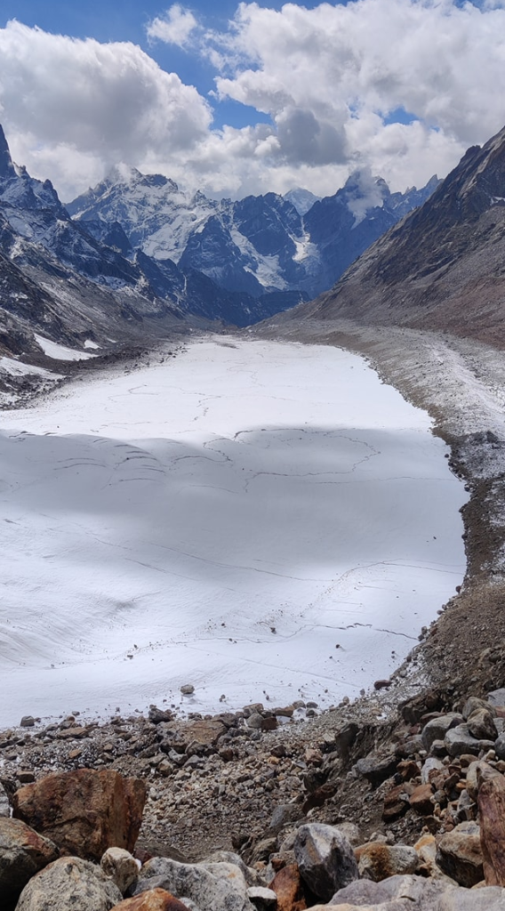
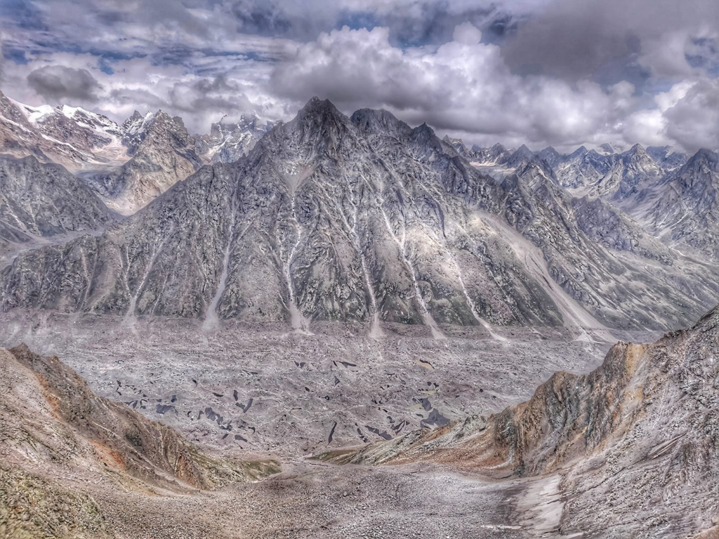
The Great Himalayan Range (GHR) spans across India, China, Nepal, Pakistan, Bhutan, and Tibet. The world’s highest peaks including Mount Everest, Kangchenjunga, Lhotse, and Nanga Parbat, are part of GHR. The total West to East extension of the Great Himalayas is 2400 km and their average elevation is 6000m. Several glaciers are contained within the range, including Gangotri Glacier, and Satopanth Glacier.
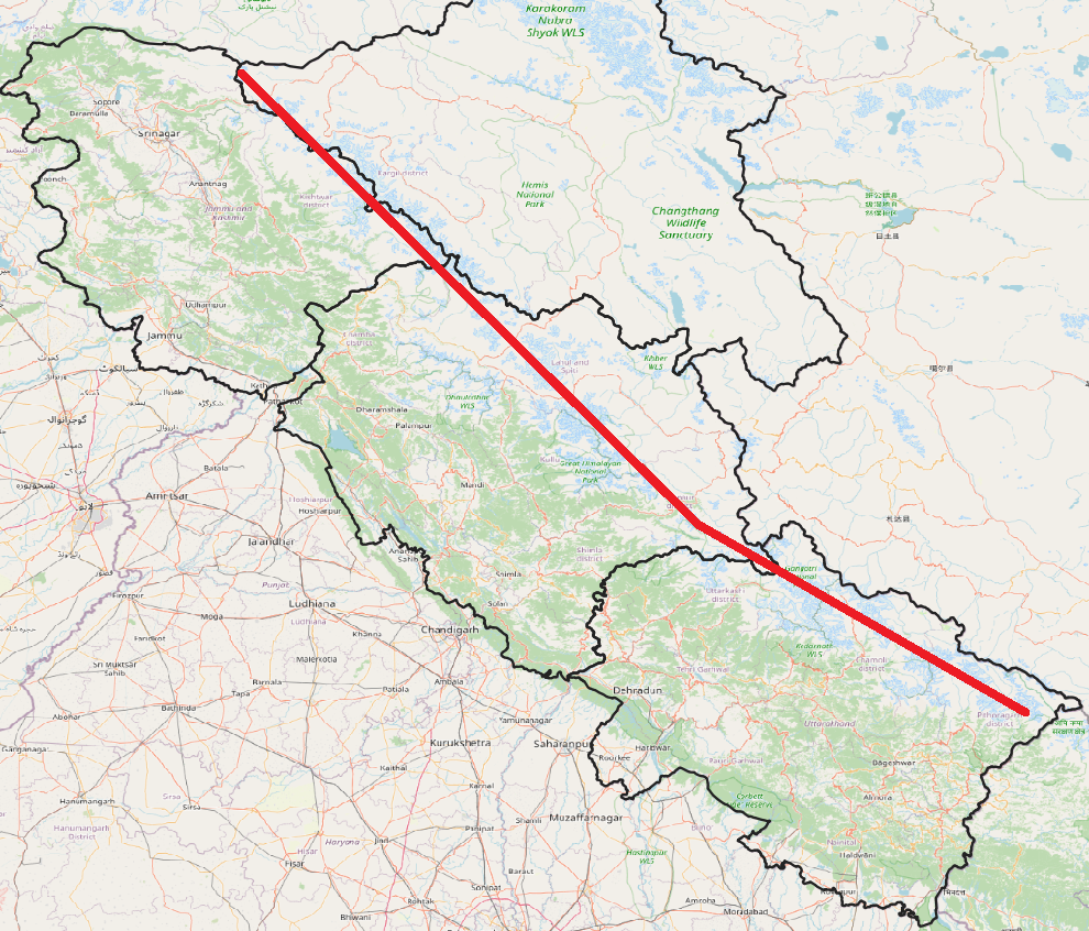
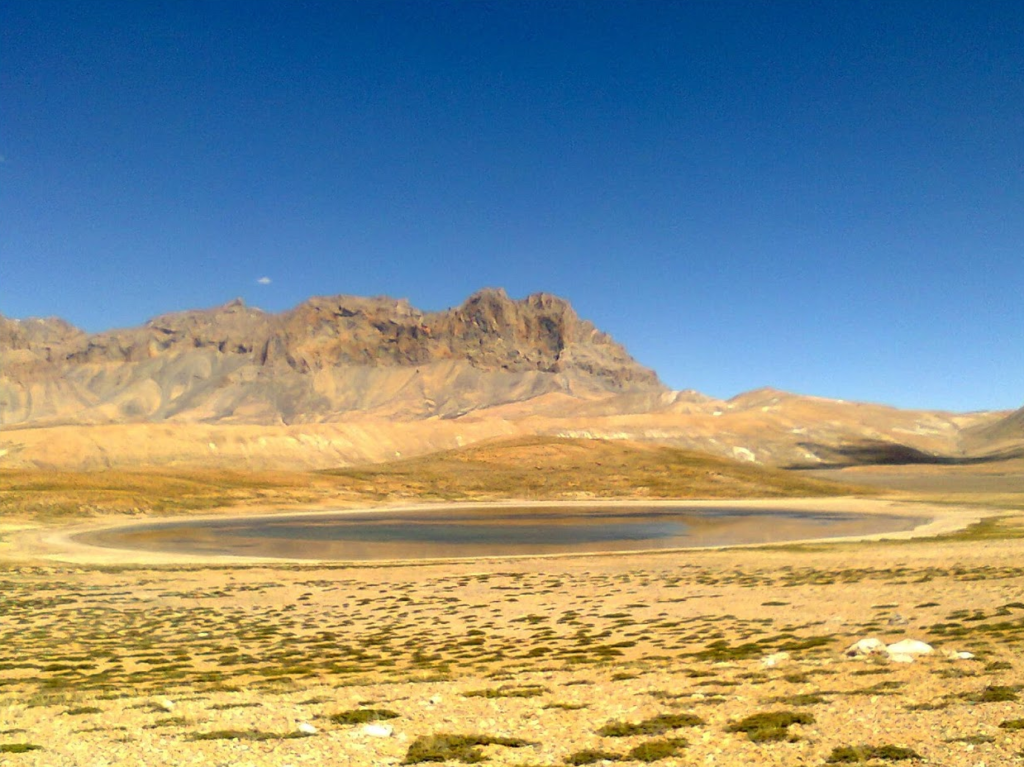
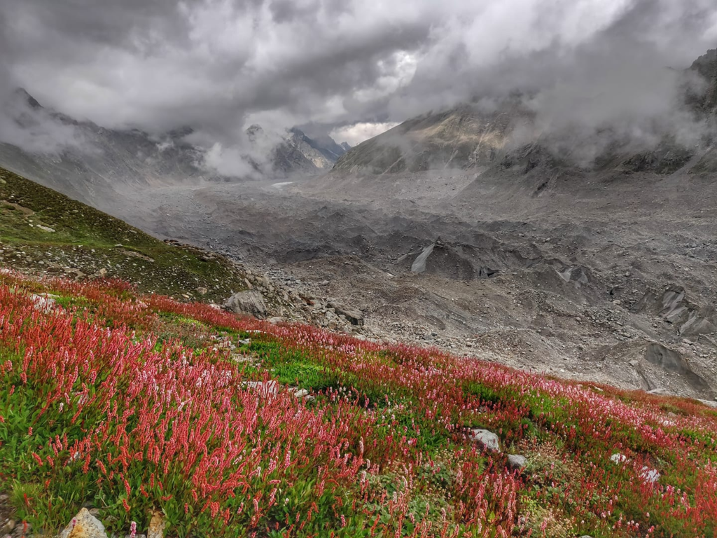
In this post we focus on the section of GHR which runs through the Western Indian Himalayas along the border of Jammu & Kaskhmir and Ladakh, through Lahaul & Spiti, Kinnaur and upper ranges of Uttarakhand. GHR separates the Himalayan foothills (South) from the alpine deserts of Ladakh, Zanskar, Lahaul & Spiti and parts of Kinnaur (North). 10 beautiful traverses across GHR have been accurately mapped into Open Street Maps: Kang La, Umasi La, Tarsalamu La, Shingo La, Parang La, Pangpo La, Baralacha La, Muni La, Hagshu La, Boban Gali
Rivers
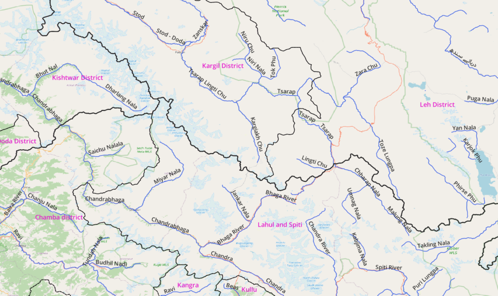
The Great Himalayan Range gets bound by several important rivers on the North and South as below.
South
- Chandrabhaga (Chenab river) bounds the Great Himalayan Range on the South. Tributaries: Chandra, Bhaga, Miyar Nala, Dharalang Nala
- Spiti river (East)
North
- Tsarap river (East). Tributaries: Tonze Lungpa, Stod
- Suru river (West). Tributaries: Dras
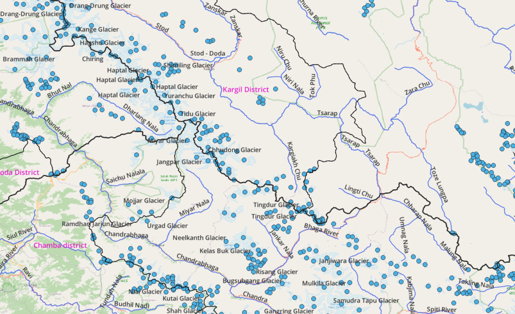
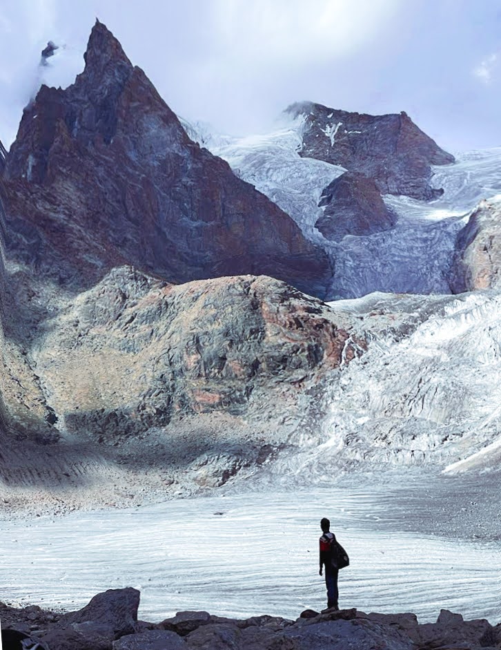
Glaciers
Being mostly above 5000m altitude the Great Himalayan Range is home to many glaciers (permanent ice) as per below map.
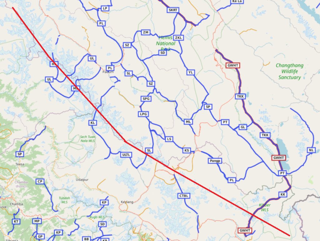
Hiking Routes
In this post we’ll be covering 10 traverses across the GHR connecting Himachal/J&K and Ladakh.
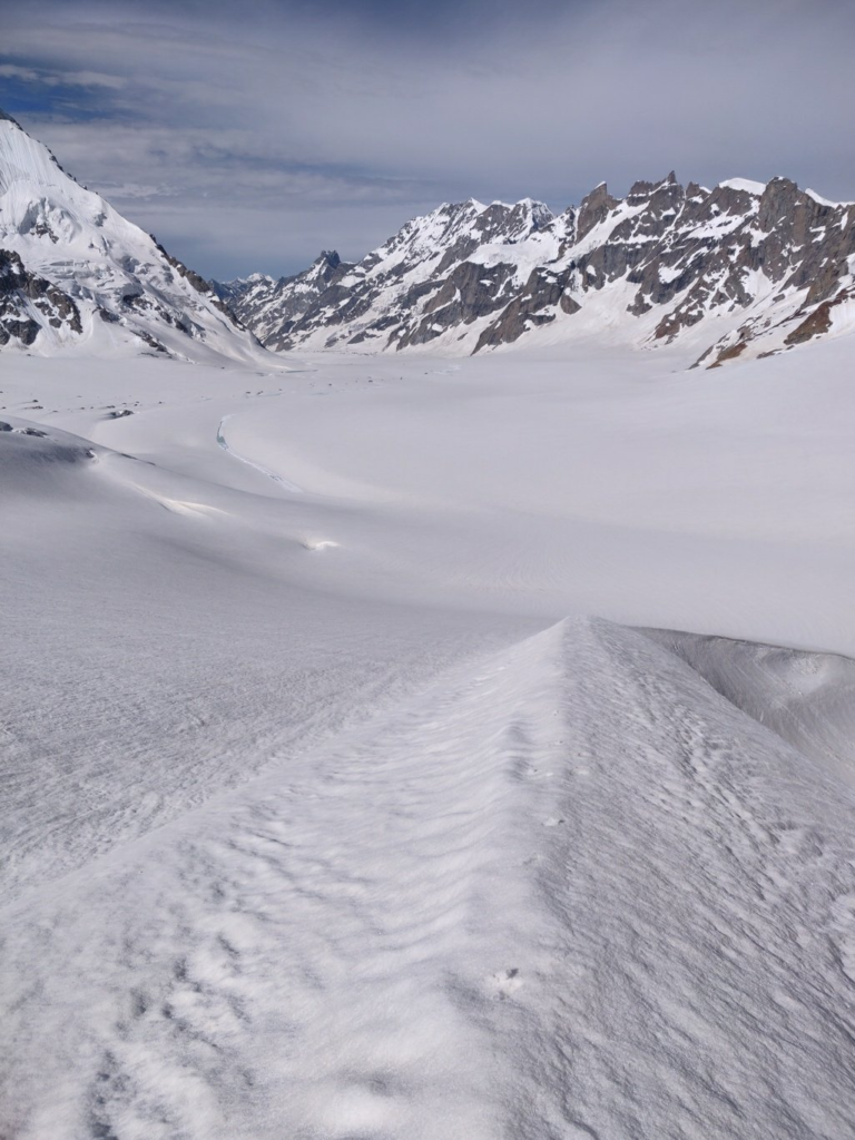
- Kang La (5450m) 78km / 1830m+ Blog post 1 Blog post 2 Blog post 3 starting from Udaipur in the Chenab river valley (Lahaul) we hike up Northeast into the Miyar Nala valley to the last hamlet of Khanjer where we cross over to the right side of the river. The Miyar valley turns North to Northwest as we hike through beautiful alpine meadows crossing the Gumba Nala, Takdung Nala, Chhudong Nala till we hit the tongue of the Miyar glacier. We now climb up on the right slope and proceed above the moraines till the Jangppar glacier (East) where we continue North on top of the moraines of the Miyar glacier. After crossing the moraines we step onto the glacier and turn Northeast to cross the Great Himalayan Range via the Kang La pass (5450m) after which we descend North into Zanskar over a shorter, crevassed glacier (danger). We turn East into the Temasa Nala valley and continue our descend till we hit the road head in the Tsarap Lingti Chu river valley which flows towards Padum, Zanskar.
- Umasi La (Pardar La, 5300m) 61km / 2150m+ Blog post Blog post 2 starting from Thana village in the Stod Doda valley in Zanskar we climb up Southwest into the Mulung Tokpo valley (North bank) passing Jhunkul Gompa crossing over to the South bank (4050m) turning South into the Nabil Tokpo valley stepping onto the Kanthang glacier and turning West across the Umasi La (5300m) descending onto the Kol Glacier in Kishtwar (J&K) turning Southwest into the Zanskari Nala valley turning West into the Bhuzas Nala valey till the first Buddhist settlement of Sumcham
- Urgin La (Tarsalamu La) (5360m) 39km / 1300m+ Blog post starting from Jankar Sumdo (base of Singho La) in Lahaul we proceed Northwest into the Jankar Nala valley (West bank) crossing the Dali Nala and turning turning West into the Mayar Nala valley climbing across an unnamed glacier through the Tarsalamu pass (5360m) descending West into the Darjeyang Nala valley turning South in the Miyar valley to the road head at Khanjar
- Shingo La (5050m) 56km / 2750m+ Blog post previously a beautiful hiking route from Lahaul into Zanskar the Shingo La is now a motorable pass. Starting from Jankar Sumdo in Lahaul we head Northeast into the Jankar Sangpo valley (West bank) crossing the Shingo La (5050m) in between the Shingo Ri (6060m) and Zangskar (5850m) peaks descending Northeast into Zanskar via the Kurgiakh Chu (East bank) crossing the Tingdur Nala, Rile Nala and Surichun Lungpa to the first hamlet of Kurgiakh
- Parang La (5550m) 102km / 2700m+ Blog post Video blog from Kibber in Spiti valley we climb up North into the Dumia Nala valley climbing Northeast into the Puri Lungpa and climbing up North onto the Parang La (5550m) descending across an unnamed glacier into the Parang or Pare Chu turning Northeast crossing the Pakshi Lamnur, Lungar Gongma Nala, Lungar Yogma Nala turning Northwest into Ladakh passing Tso Moriri lake to the first hamlet of Karzok
- Pangpo La (5700m) 119km / 1850m+ Blog post Video blog starting from Sarchu in Lahaul we head East into the Chharap Nala (Tsarap Chu) turning Southeast passing the Umnag Nala, Kurpauberu Nala turning East (4630m) into an unnamed side-valley (gorge) crossing over the Pangpo La into Ladakh passing the Skam Tso (Kum Tso) lake turning North into the Lingti Nala turning East to the Phirche Lungpa where we can either proceed Northwest towards Pang (Manali-Leh highway) or Southeast towards Tso Moriri
- Chandra Tal to Baralacha La (4900m) 53km / 1600m+ Blog post from Chandra Tal lake (4300m) in Lahaul we hike up Northwest in the Chandra river valley (East bank) fording the side-streams Tokpo Gogma, Sarchu Nala which can only be crossed early morning when the (snow melt) water flow is less. We hike up further North to the Baralacha La pass (4900m) from where the Chandra, Yunam and Bhaga rivers flow down
- Muni La (5500m) 67km / 2450m+ Blog post Video blog starting from Sani in the Stod Doda valley in Zanskar we climb up Southwest into the Haptal Tokpo valley (North bank) crossing the Satachan Tokpo and turning West onto the Haptal glacier crossing over the Great Himalayan Range via the Muni La (5500m) into Kishtwar (J&K) descending Northwest turning South across the Chomo Chhior glacier descending Southwest into the Choma Chhior Nala valley turning Northwest into the Dharlang Nala valley to the first settlement of Dangel on the confluence of Bhul and Dharlang Nala rivers
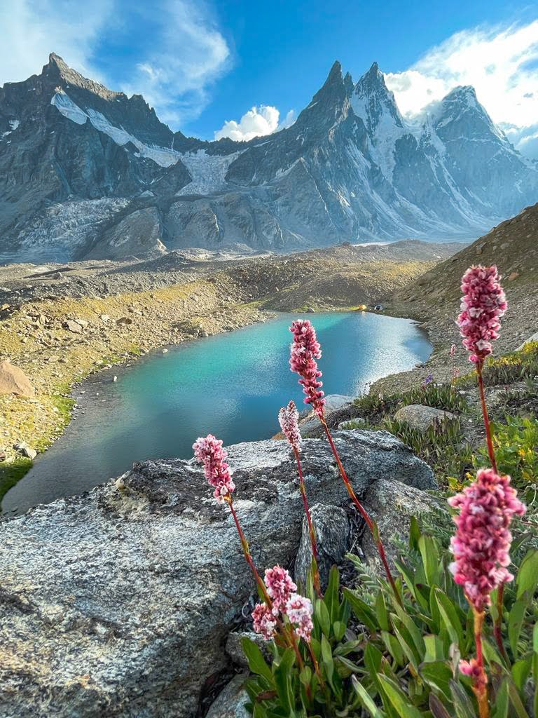
- Hagshu La (5050m) 32km /1900m+ Blog post Video blog starting from the last hamlet of Sumchan in the Bhuzas Nala valley (Kishtwar district in J&K) we turn North into Hagshu Nala passing three large alpine lakes until cross an unnamed glacier across the Hagshu La pass (5050m) descending North onto the large Hagshu glacier into the Sumche Tokpo valley turning East to the first village of Achho in the Stod Doda river valley in Zanskar
- Boban Gali (Ghans La) (4750m) 69km / 300m+ starting from Panikhar in the Suru river valley in Kargil district we climb up Southwest into the Chalong Nala valley (North bank) crossing the Shisang Lungpa and turning into the Hamgsan Lungpa turning South across the East Bobang glacier across the Boban Gali (4750m) in between Resheriah peak (5150m) and Bobang peak (5250m) descending into Kishtwar (J&K) onto the West Bobang Gali glacier turning West into the Muskil Nar valley turning Northwest into the Kaintal Nala (North bank) crossing over the Mariv Sudir river and descending South (West bank) to the first settlement of Sukhnai
Navigation
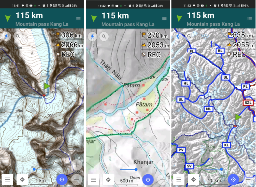
Above traverses can be easily navigated using most mobile mapping apps – many use Open Street Maps as base maps which include tens of thousands of kilometers of trails in Himalayas, Sahyadri, etc. OSM maps can be downloaded on the phone for offline exploration of the mountains without mobile network. Contours can be added to understand the topography of the terrain. Find a short tutorial over here.