
Geography

The Pir Panjal is a prolonged high range stretching out from Kisthwar (West) to Kullu (East) separating Kullu, Chamba and Doda (South, Ravi river) from Lahaul & Spiti, Pangi, Kishtwar (North, Chenab river). Manimahesh Dhar is a side-range from the Pir Panjal extending into central Chamba. Chamba gets bound on the South by the Dhauladhar range which separating it from the Kangra plains.
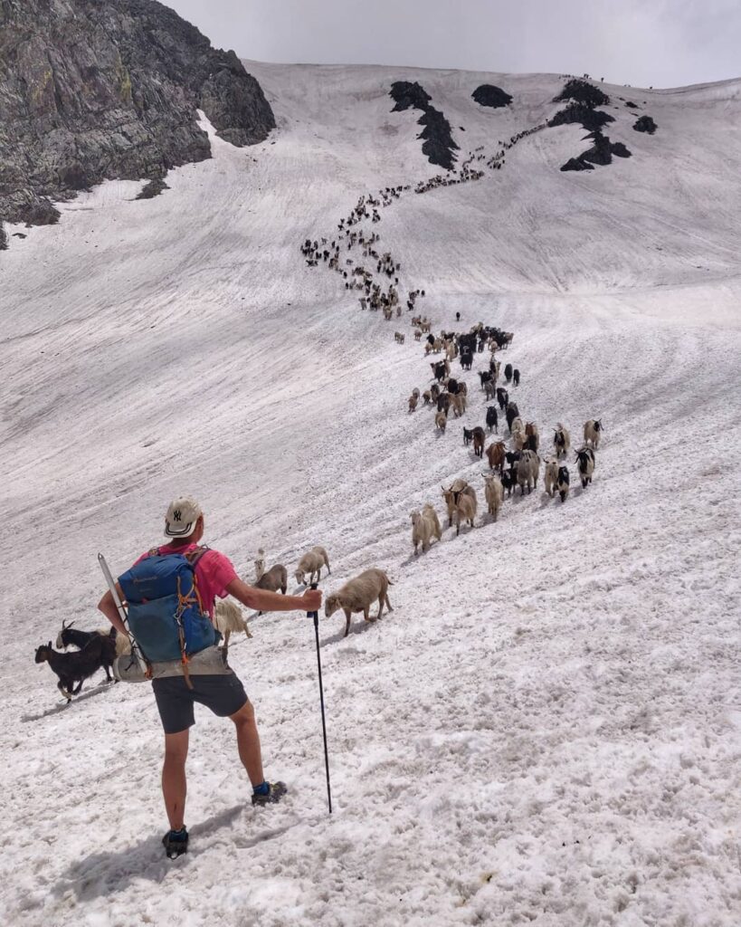
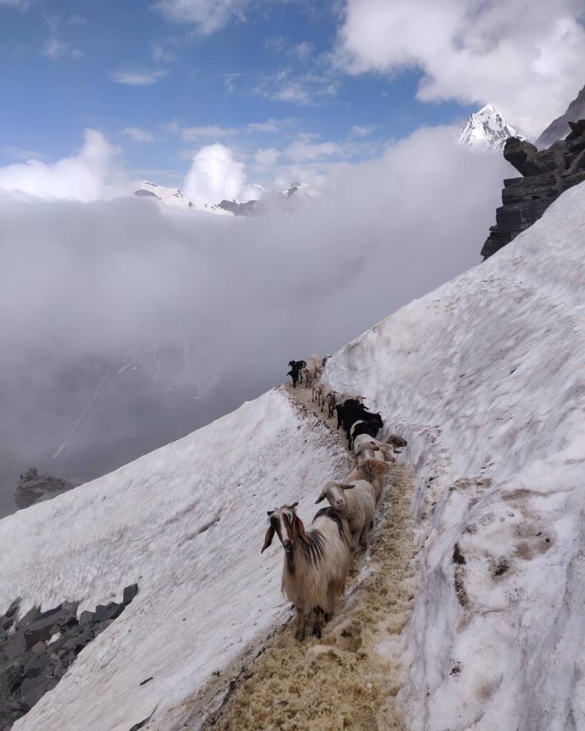
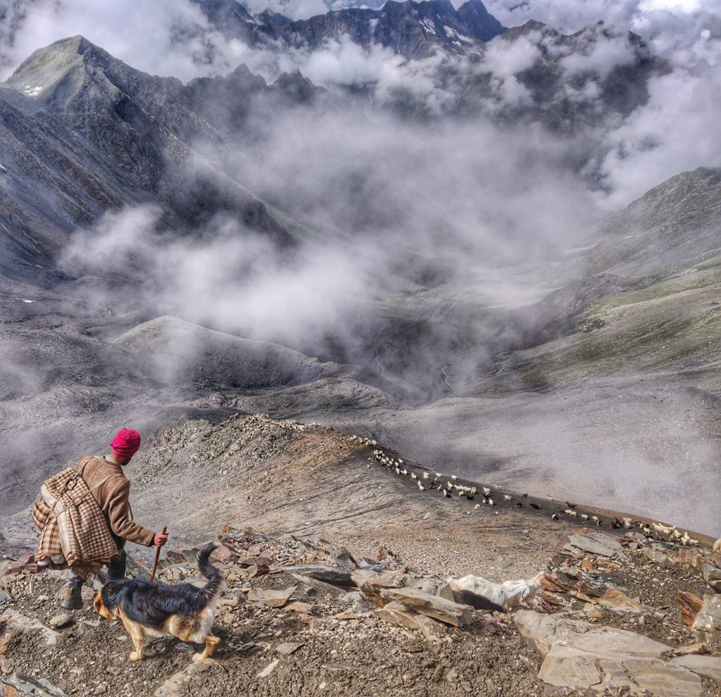
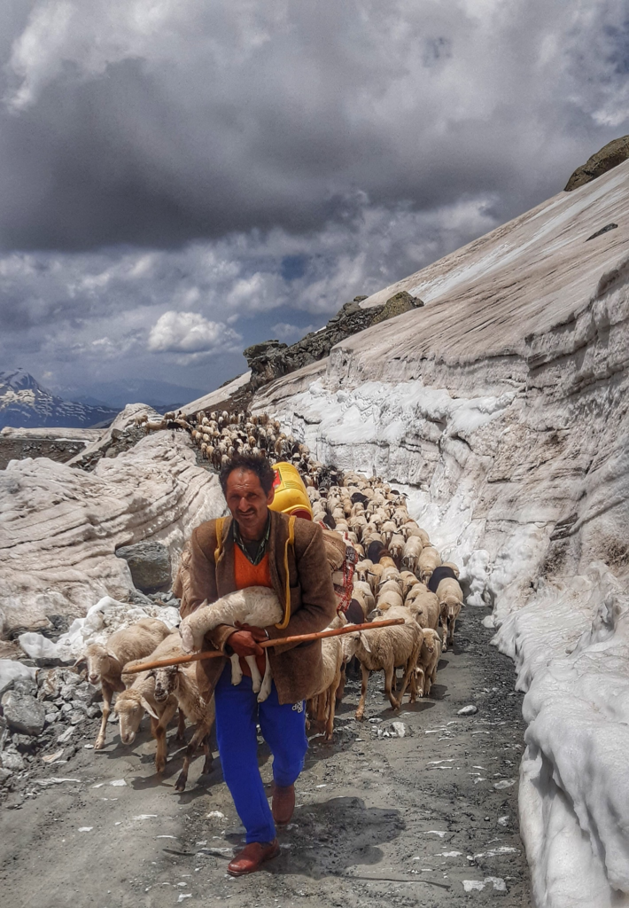
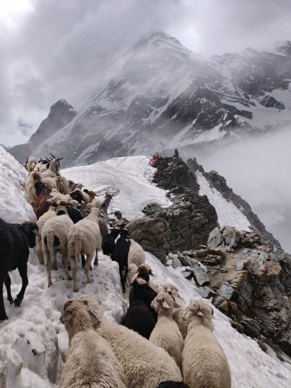
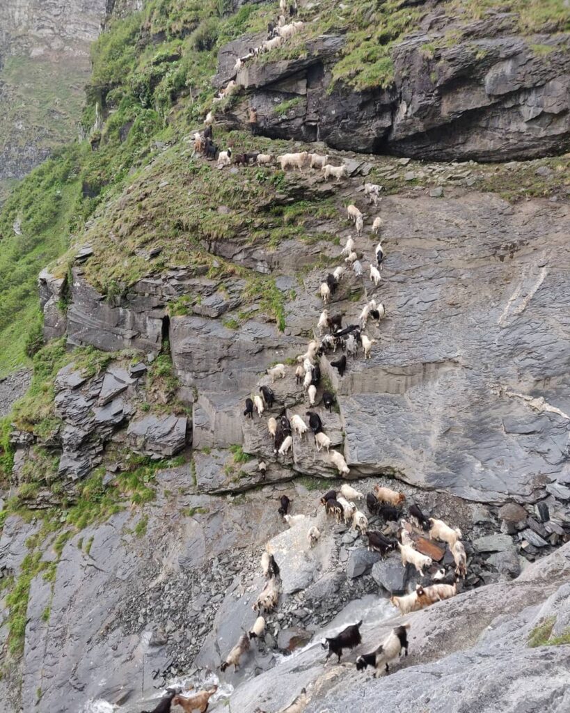
Most of the monsoon rain gets blocked by the 5000m high Pir Panjal transforming Lahaul & Spiti into an alpine desert. Shepherds migrate from Chamba across this range through various challenging passes to graze their herds in the alpine meadows of Lahaul (East) and Pangi (East, sub-district of Chamba).
Main rivers
- Ravi river (Bara Bhangal, Holi, Chamba). Originates in the East from the Rai Ghar glacier in Kangra near the intersection of the Pir Panjal and the Dhauladhar ranges and flows West through the central Chamba valley. Tributaries: Kaliheni Nala, Dhudil Nadi, Tundah Nala, Baira river
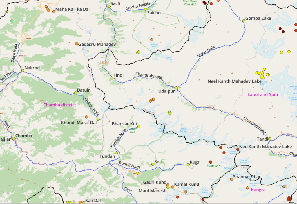
- Chenab river (Tandi, Udaipur, Tindi, Sach, Kilar, Kishtwar, Doda) – originates in Lahaul & Spiti from the Chandra and Bhaga rivers. Tributaries: Chandra, Bhaga, Miyar Nala, Saichu Nala
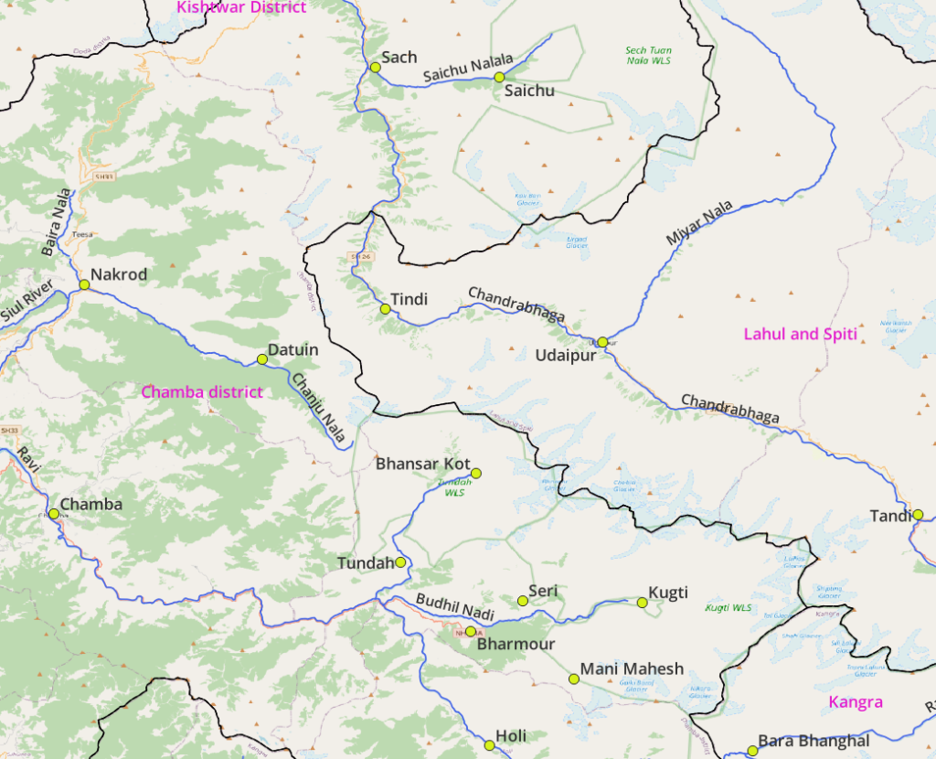
- Chanju Nala (Datuin, Nakrod). Originates in North Chamba flowing West and joins the Baira Nala (Sach pass) and Siul river to form the Baira river
- Dudhil Nadi (Kugti, Seri, Bharmour). Originates in the Kugti Wildlife Sanctuary and flows West joining the Ravi river
- Tundah Nala (Bhansar Kot, Tundah). Originates in the Tundah Wildlife Sanctuary flowing down South from the Pir Panjal and joins the Dudhil Nadi and Ravi river.
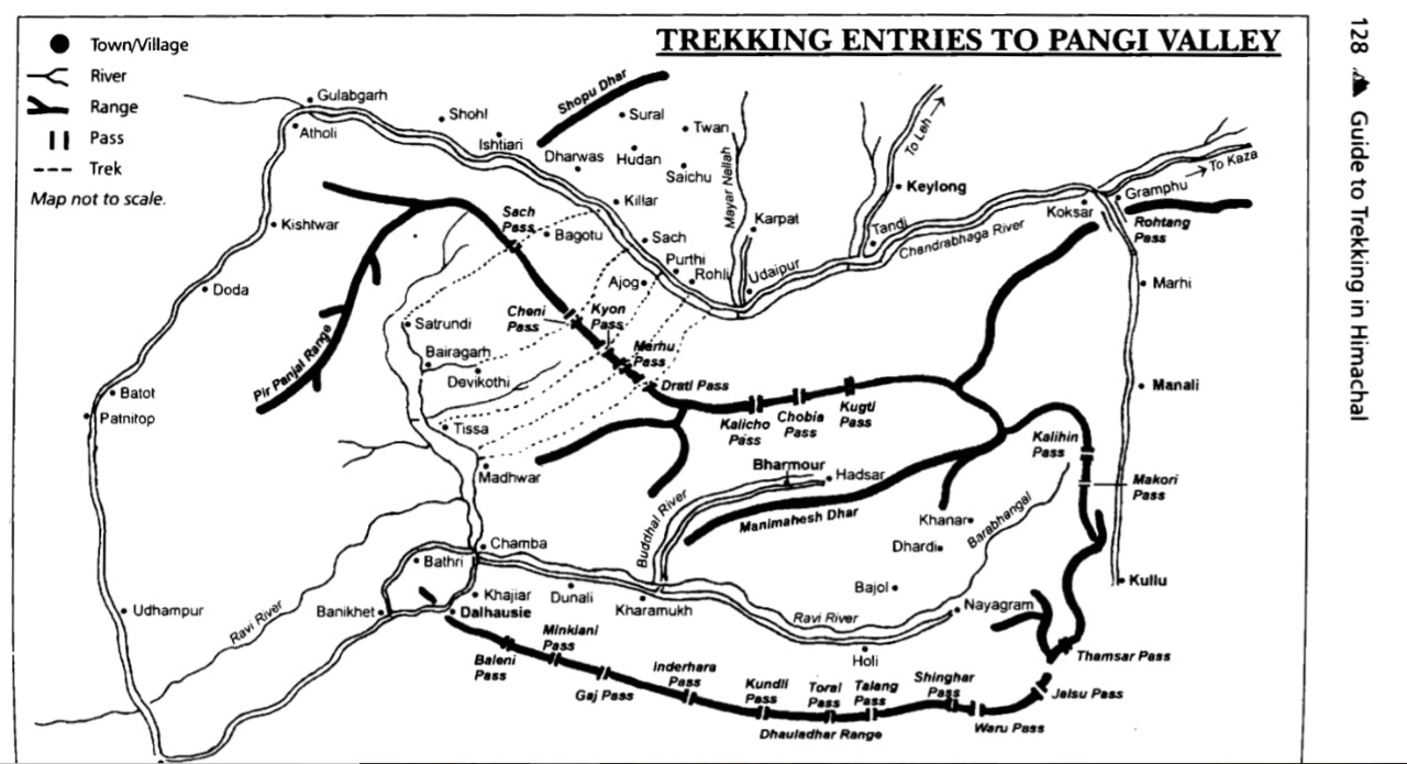
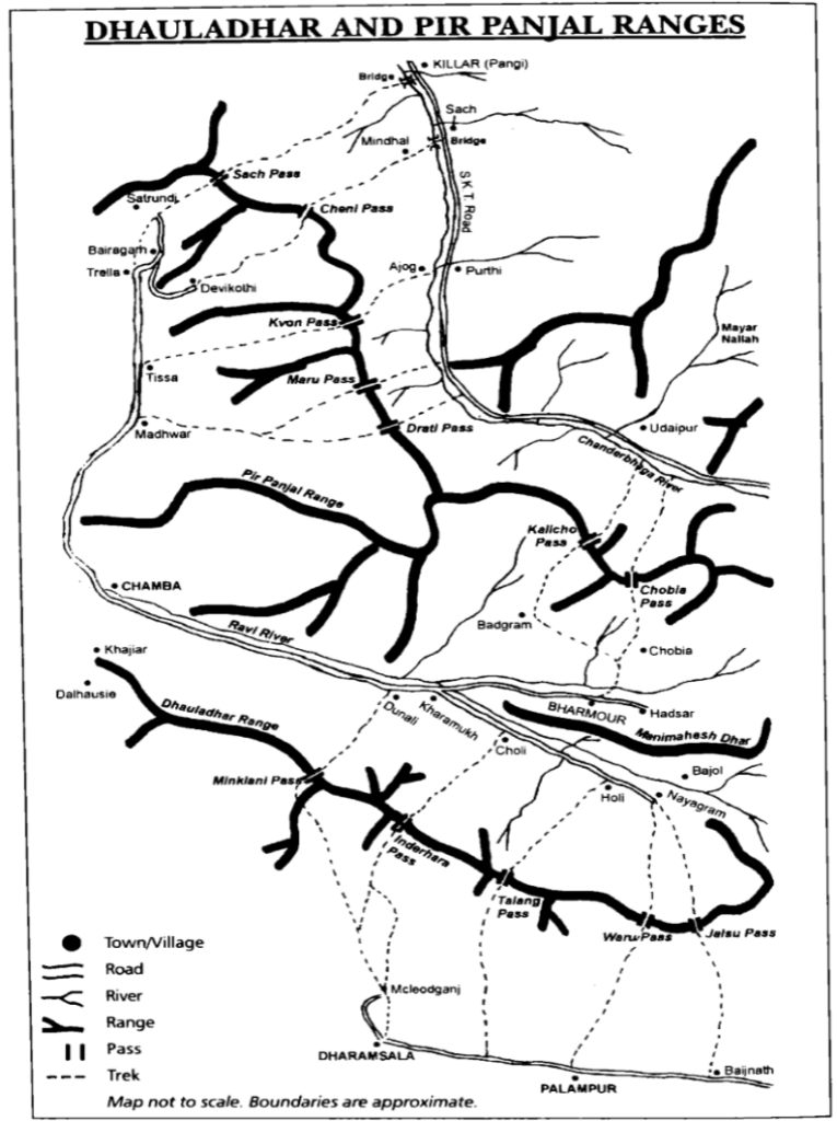
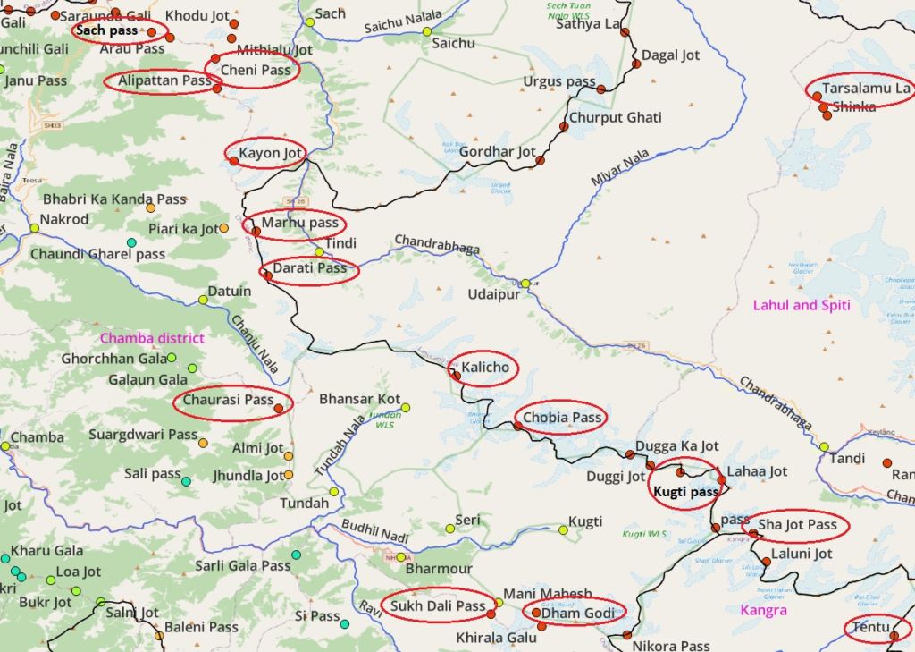
Mountain passes
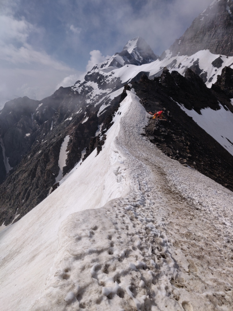
There are many (lesser known) shepherd passes crossing the Pir Panjal. The passes encircled below are documented in this post.
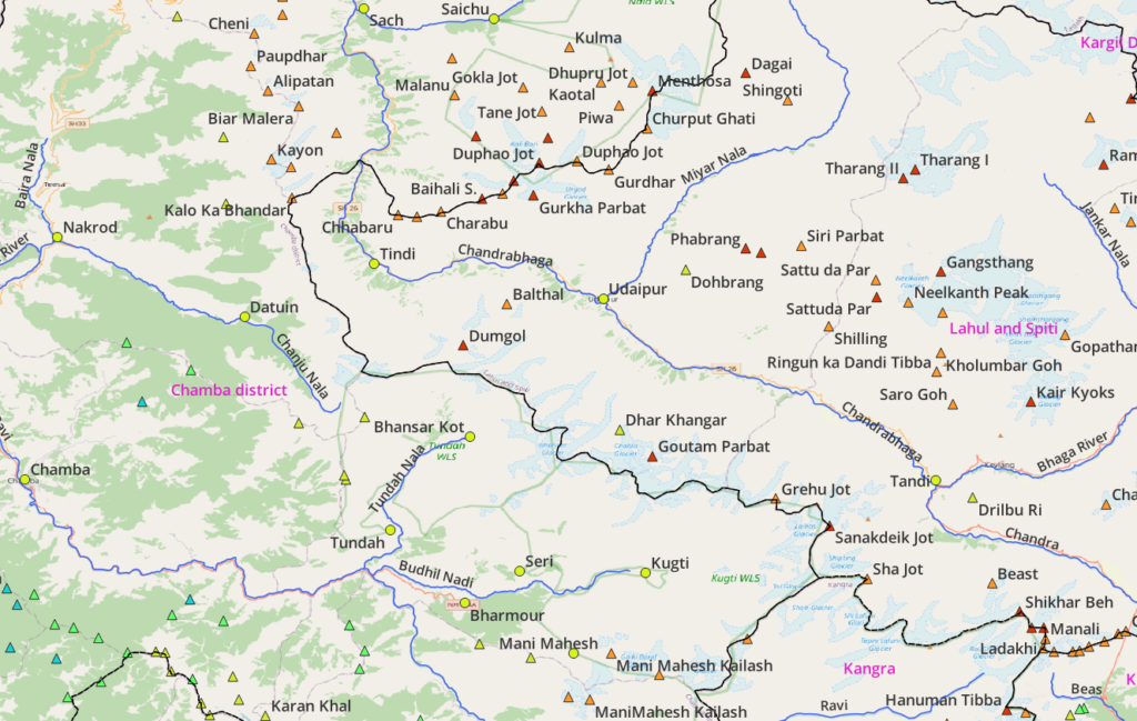
Mountain Peaks
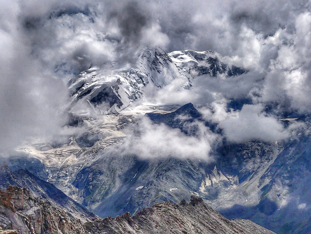
There are hundreds of peaks spread across the Pir Panjal range. Known ones include Mani Mahesh Kailash, Shikhar Beh, Ladakhi, Hanuman Tibba, Goutam Parbat, Dumgol, Menthosa
Alpine Lakes
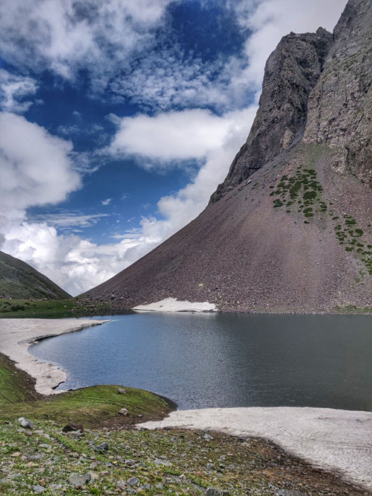
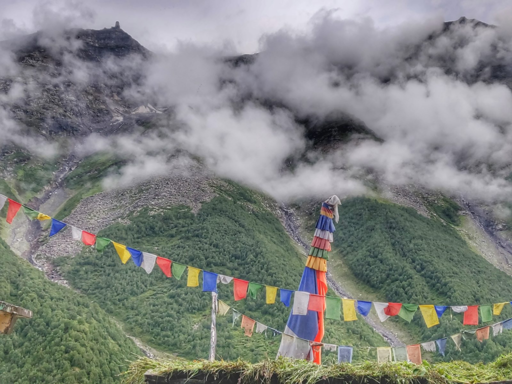
There are a number of holy lakes located in the Pir Panjal range which are the destination of annual pilgrimages. Most known is Mani Mahesh at the base of Mani Mahesh Kailash, Gadasru Mahadev, Neelkanth Mahadev, Khundi Maral Dal and Shannal Dhar.
Hiking Routes
Although many of the above mountain passes have been explored during my 2018 and 2019 ultra journeys, few have been GPS recorded and mapped in Open Street Maps. Still on each blog post below you will find a map with sufficient waypoints marked along each hiking route to retrace my footsteps.
6 National Hikes
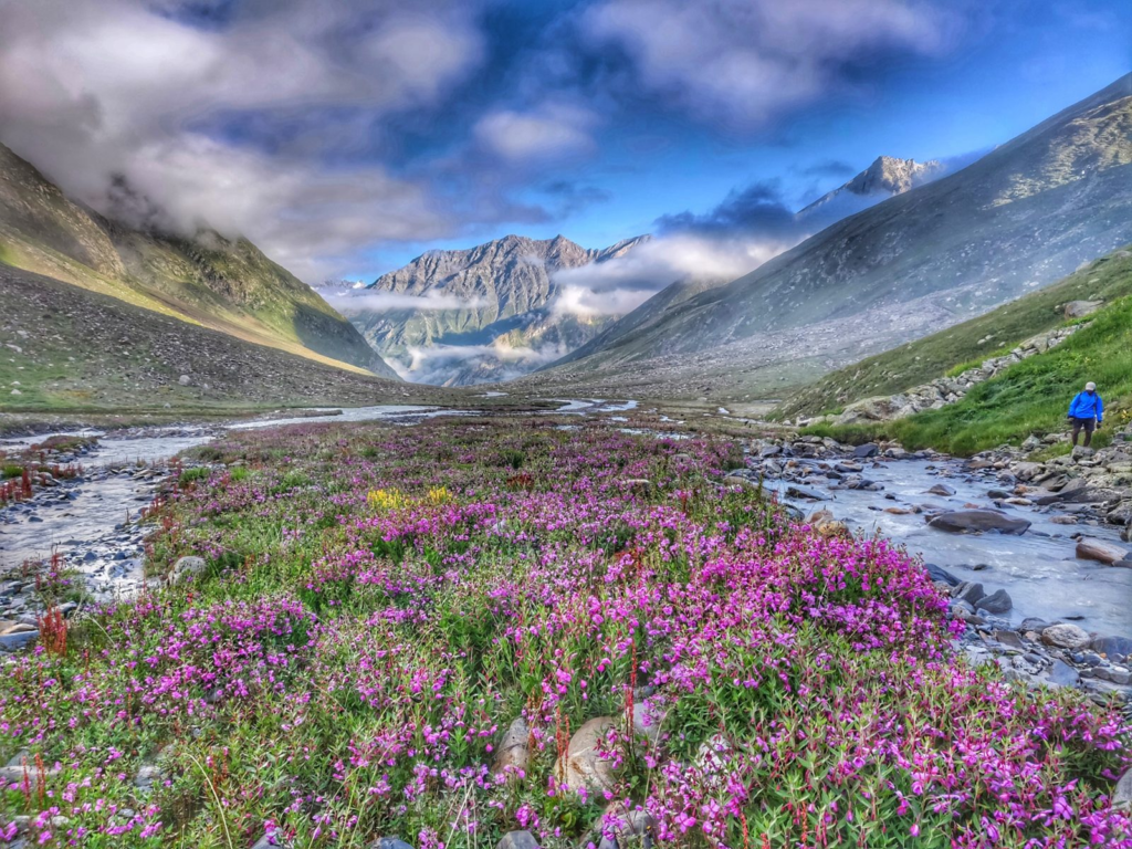
- Chaurasi Pass 44km / 4050m+ (Chamba valley) starting from the last hamlet of Datuin we hike Southeast into the Chanju Nala valley crossing the Tanger Nala and passing the summer dwelling of Riali Got and Khundi Maral Dal pilgrim lake traversing a small glacier across the Chaurasi pass (4600m) descending South and contouring in the slopes high above the Reshal Nala to descend along the Golak Dhar ridgeline which separates the Tundah Nala (East) and Reshal Nala (West) passing the Almi Jot and Jhundla Jot passes to finish in the hamlet of Tundah in the Tundah Nalla valley, tributary of the Ravi river. Blog post 1. Blog post 2
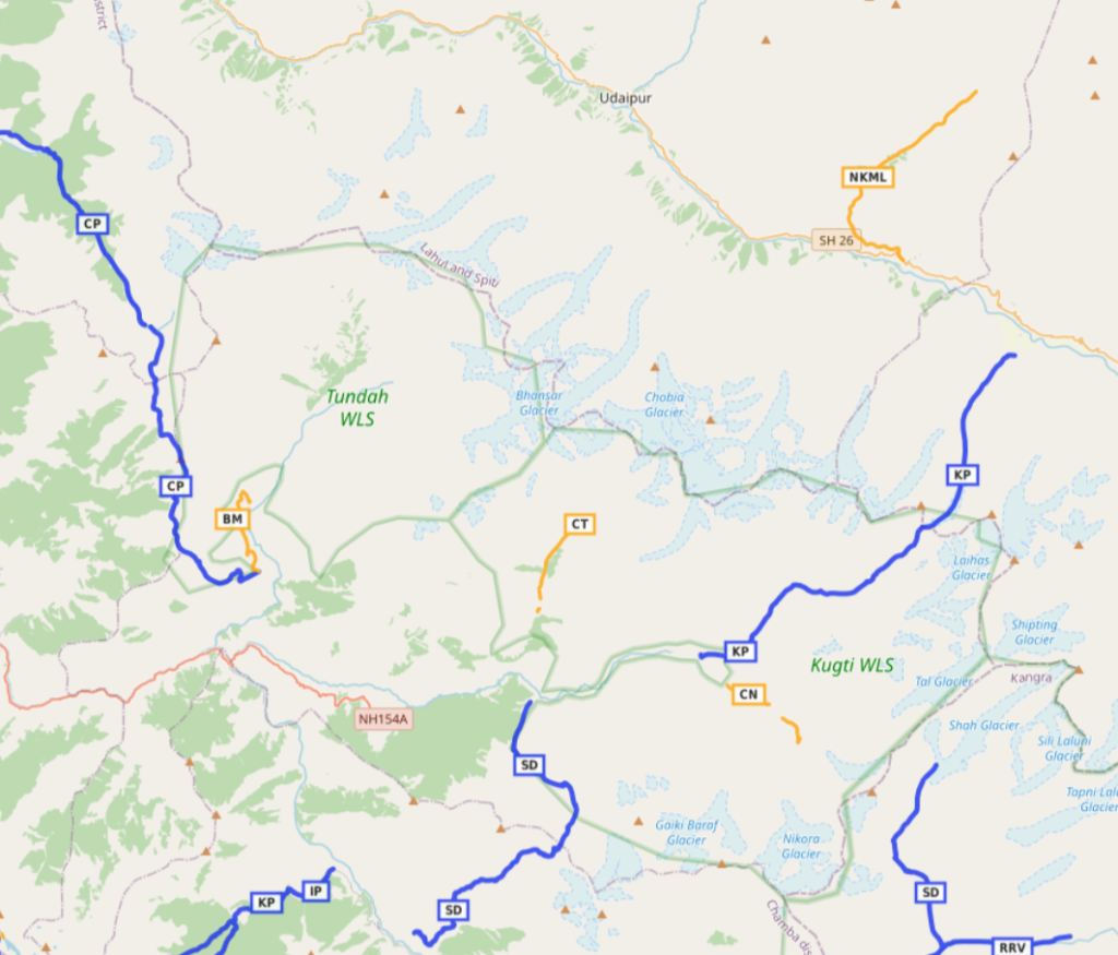
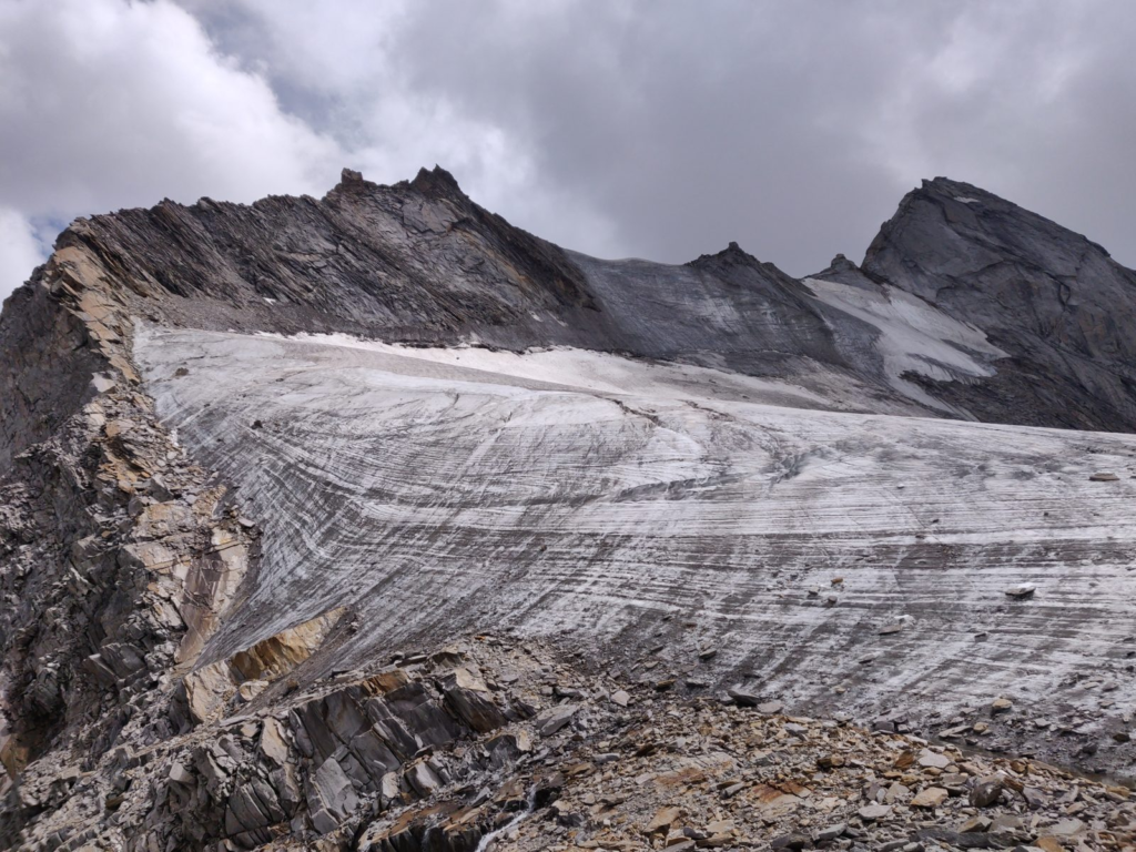
- Kugti Pass 27km / 2700m+ (Lahaul to Chamba) we start from Rape village in the Chenab river valley in Lahaul climbing up South into the Kugti (Rashil) Nala valley passing Marhi dwelling (rest house) hiking up through moraines and glacier in the Alias Nal to the Kugti Galu (5050m) descending via a small ridgeline into the Reling Nal valley crossing the Kabrans ka Nala and Duggi Nal streams descending along the Dubhil Nal via Kalang Mandir to Kugti village in the Chamba valley. Blog post 1. Blog post 2
- Sach pass 55km / 5700m+ from Teesa (Tisa) village in the Baira Nala valley (tributary of the Ravi river in Chamba valley) we climb up North along the West slope of the Taraila Nala stream (Sach pass road follows East slope) passing through the last hamlet of Bhanaudi climbing up Northeast along the Sach Nala to the Sach pass (4400m) to descend Northeast via the ghat road along the West slope of the stream to Killar in the Chenab river valley (Pangi).
- Mani Mahesh 27km / 3580m+ (Chamba valley) trom Tyari village in the Ravi river valley we climb up North into the Kalah Nala valley passing the last hamlet of Kalah climbing up Northeast into the Jali Khad valley across the Sukh Dali pass (Sokdali Gali, 4600m) descending North to Manimahesh Dal (4200m) at the base of the Mani Mahesh Kailash (5634m). From here we can either descend Northwest via the Dhanchu Nala to Harser (pilgrim route). Alternatively we can proceed East across the glacier and the Dam Godi (Chobu) pass (4830m) descending East into Gai Nala valley turning North in the Bhujla Nala valley to Kugti village in the Dudhil Nadi valley. Blog post 1. Blog post 2. Blog post 3
- Neelkanth Mahadev 15km / 700m+ (incomplete mapped) (Lahaul) from Murang in the Chenab river valley following the road Northeast into Thirot Nal valley to the last hamlet of Naingahar where we hike up along the West slope of the Thirot / Alias Nala to Neelkanth Mahadev (4500m) just below the glacier
- Bara Bhanghal 33km / 2500m+ (Kangra) from the road head / hydro project near Nayagraon hamlet we proceed upstream along the North slope of the Ravi river we hike North passing Sindi / Gargu Nala and Dharari / Pher ka Nala turning East passing Khinar hamlet to the remote settlement of Bara Bhanghal at the confluence of the Ravi and Kaliheni Nala rivers. Blog post 1. Blog post 2. Blog post 3
4 Regional Hikes
- Shannal Dhar 12km / 1400m+ (Kangra) from Bara Bhangal we hike up East along the Ravi river climbing North into Laluni Nala valley and turn East to the pilgrim lake of Shannal Dar (4050m) near the Shah Glacier leading up to the Sha Jot pass into Lahaul
- Banni Mata 8km / 1000m+ (Chamba) from Tundah village we hike up North into the Tundah Nala valley passing the hamlets of Chulai, Kuttal, Silpiri, Kumarkani, Sirot, Mandi to the Banni Mata temple. Optionally you can proceed further North into the valley to the last settlement of Bhadra.
- Chobia Nala 6km / 700m+ (Chamba) from the last village of Seri / Kao we hike up North into the Chobia Nala valley (tributary of the Dhudil Nadi) to the alpine meadows (3300m) the base of the Chobia pass to cross over the Pir Panjal into Lahaul
- Chalatu Nala 5km / 600m+ (Chamba) from Kugti village in the Dudhil Nadi valley we hike up Southeast into the Chalatu Nala valley
10 Unmapped Hikes
- Chobia pass (Lahaul to Chamba) from Bhiyari hamlet in the Chenab river valley we climb up South along the Gali Gad stream across landslided slopes, large moraines and a heavily crevassed glacier climbing up West to the Chobia pass (4900m) crossing over the Pir Panjal range descending steeply South into the Baggi Nala turning West to the first settlement of Seri / Kao in the Chobia Nala valley, tributary of the Dudhil Nadi
- Kalicho pass (Chamba to Lahaul) from Tundah village we proceed North along the Western slope of the Tundah Nala valley passing the Banni Mata temple crossing over to the last settlement of Bhadra climbing higher up on the Eastern slope of the Tundah Nala turning East passing through various isolated dwellings in the forest to the last dwelling of Bhansar Kot on the confluence of the Gai Nala and Bhansar Nala. We now climb up Northeast into the Bhansar Nala valley crossing over the Pir Panjal range via the Kalicho pass (4750m) descending Northeast across the Ando glacier into the Me Gad valley to Triloknath in the Chenab river valley
- Darati pass (Lahaul to Chamba) from Tindi village in the Chenab river valley we climb up steeply Southwest into the Tandru Nala valley through beautiful alpine meadows across moraines and glacier crossing over the Pir Panjal via the Darati pass (Drati Jot, 4600m) descending steeply West into the Tanger Nala valley turning South to Daton village in the Chanju Nala valley (tributary of the Barai river. Blog post 2
- Marhu pass (Chamba to Lahaul) from the last hamlet of Bhami we hike up East into the Kamli Nala valley (tributary of the Chanju Nala) crossing the Nakai Nala turning North into the Palor Nala passing the isolated dwelling of Dared Got turning East and climbing South across the Piari ka Jot (3650m) turning East into the Tandru Nala valley crossing over the Pir Panjal via the Marhu pass (4270m) descending steeply into the Marhu Nala turning Southeast into the forest towards the first hamlets of Dugli / Bhujund in the Chenab river valley
- Cheni pass (Chamba to Lahaul) from the last hamlets of Teppa / Hail we hike up Northeast into the Cheni Nala valley (tributary of the Balsio Nala) crossing the Kanjlu and Trishan Nala side-streams passing through beautiful alpine meadows turning East crossing over the Pir Panjal via the Cheni Jot (4320m) descending East into the Cheni Nala to Mindal village in the Chenab river valley
- Pratap Jot (Pangi to Lahaul) from Sach village in the Chenab river valley we proceed Northeast into the Saichu Nala valley, to the last settlement of Tuan turning Southeast into the beautiful alpine meadows of the Jambu Nala crossing the Sirakund Nala climbing up Northeast into the Tante Nala valley onto the glacier above crossing over the Pratap Jot (5150m) descending steeply onto the moraines of the Miyar glacier in the Miyar valley
- Sathya Jot (Pangi to Lahaul) from Tuan hamlet we hike up Southeast into the Jambu Nala valley crossing the Sirakund and Tante Nala streams to Hillu Tuan (4200m) where we climb up Northeast across moraines and a small glacier to the Sathya Jot (5350m) pass from where it appears to require technical skills to descend into the Miyar valley. Alternatively we can proceed further in the Jambu Nala valley across the glacier turning East across the Dagal Jot (5200m) descending Northeast in the Pimu Nala to the Miyar valley
- Chasak Bhatori (Pangi) from Saichu village in the Saichu Nala valley we hike up South into the Chasag Nala valley turning Southeast passing Chasag, Chimi, Murchh to the last hamlet of Chasag Bhator. From here we can proceed further South towards the Gordhar Jot (5050m) descending to Karpat in the Miyar valley
- Tingloti pass (Pangi) from the last settlement of Banu in the Hundan Nala (tributary of the Chenab river) we climb up steeply North to the Tinglotti pass (4750m) descending Northeast into Tiaso Nala valley to the first settlement of Bhataor (tributary of the Chenab river)
- Gadasru Mahadev (Chamba) from Bhunjraru (near Tisa) in the Baira Nala river valley we climb up East along a wide path high above the Joiner Nala valley to the ridgeline separating Joiner Nala (South) and Chhawed Nala (North) passing through several summer dwellings (Dwara, Kindar) crossing over a side-ridge (4450m) to the pilgrim lake of Gadasru Mahadev (4300m) source of the Chhawed Nala valley at the base of the Pir Panjal
References

Navigation
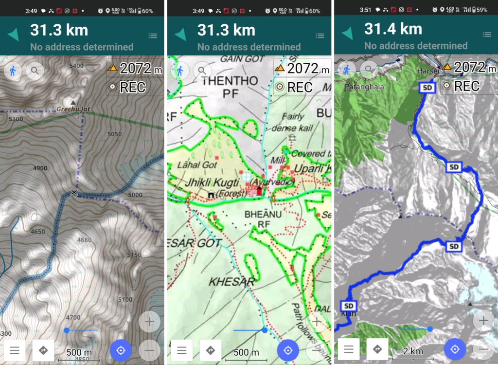
Above traverses can be easily navigated using most mobile mapping apps – many use Open Street Maps as base maps which include tens of thousands of kilometers of trails in Himalayas, Sahyadri, etc. OSM maps can be downloaded on the phone for offline exploration of the mountains without mobile network. Contours can be added to understand the topography of the terrain. Find a short tutorial over here.