
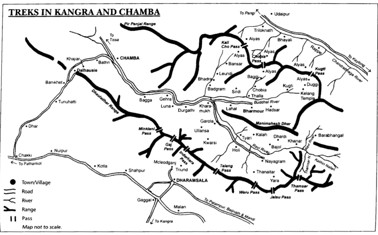
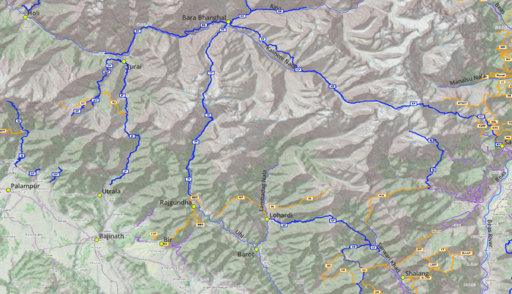
The Eastern Dhauladar is bound by the Kangra plains (South), Chamba valley (North) and Kullu valley (East). High ranges get drained by the Ravi river (North) and Beas, Barot and Lug valleys in the South. There are various beautiful traverses across this range connecting the above valleys through mesmerizing mountain passes. From the top of the Dhauladar (4000m+) one can take in birds eye views on the Pir Panjal range (5000m+) further North.
Geography
Main Rivers
The Eastern Dhauladar gets bound by following major valleys / rivers:
- Ravi river (Bara Bhangal, Holi) in the North. Tributaries: Kaliheni Nala, Thamsar Nala, Sundrail Nala (Surai), Thanetar Nala
- Beas river (Sangchar) in the South/East. Tributaries: Sarwari Khad (Lug valley, Shalang), Uhl river (Barot valley, Barot, Lohardi, Rajgunda), Binwa Khad (Utrala, Bir, Bajinath)
Mountain Peaks
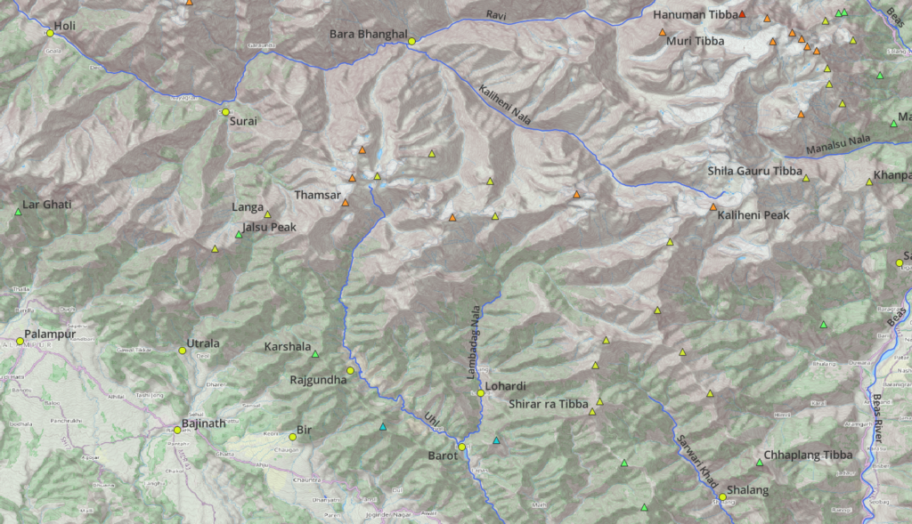
Major peaks in the Eastern Dhauladar include Thamsar, Kaliheni and Hanuman Tibba
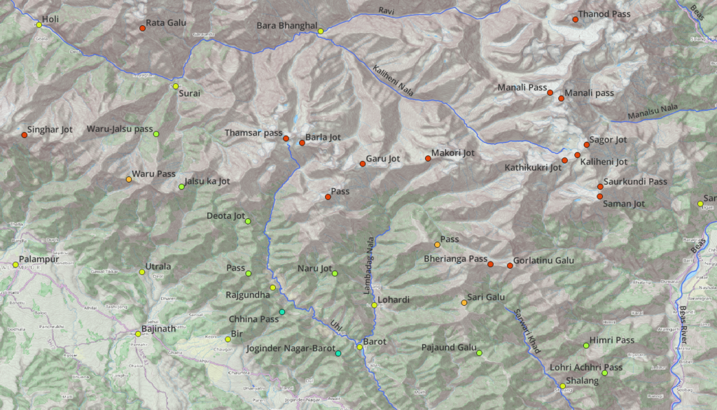
Mountain Passes
There are several popular and lesser known mountain passes in the Eastern Dhauladar including (West to East) Singhar, Jalsu, Waru, Thamsar, Garu, Makori, Kaliheni (Sagor) and Manali pass
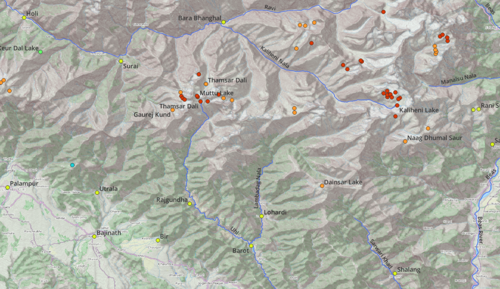
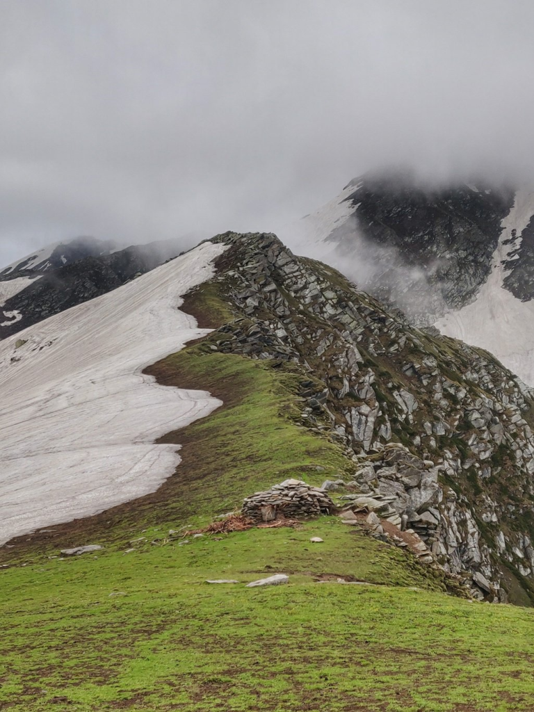
Alpine Lakes
Well known glacial lakes in the Eastern Dhauladar include Thamsar Dal, Kaliheni, Naag Dhumal Saur, Dainsar Lake and several other unnamed alpine lakes
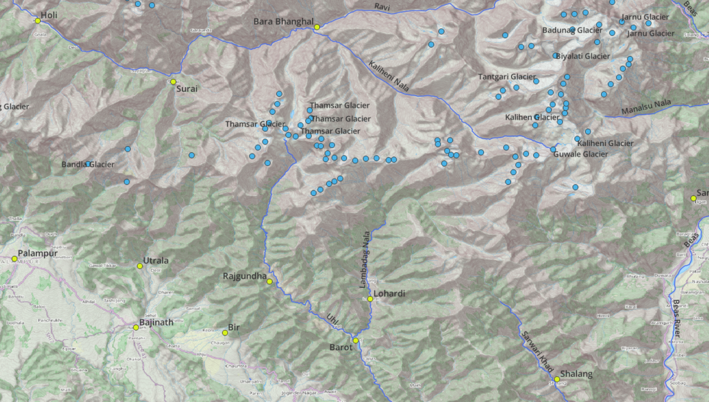
Glaciers
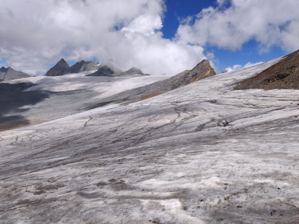
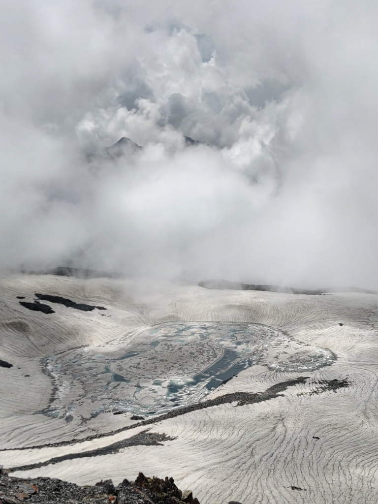
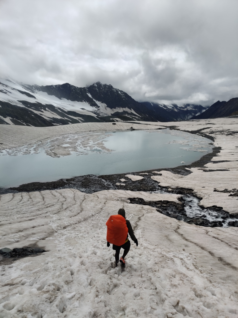
Larger glaciers in the Eastern Dhauladar include Thamsar, Guwala, Tantgari, Biyalati, Kaliheni and Badunag
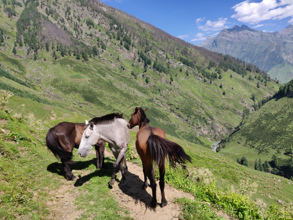
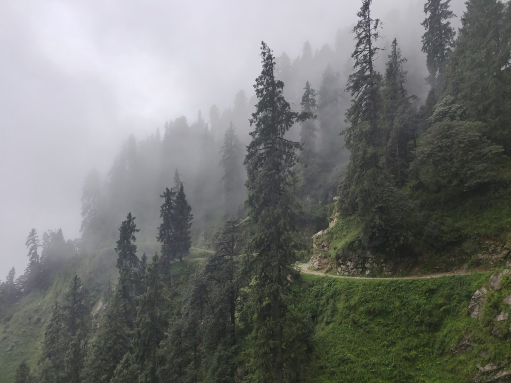
Hiking Routes
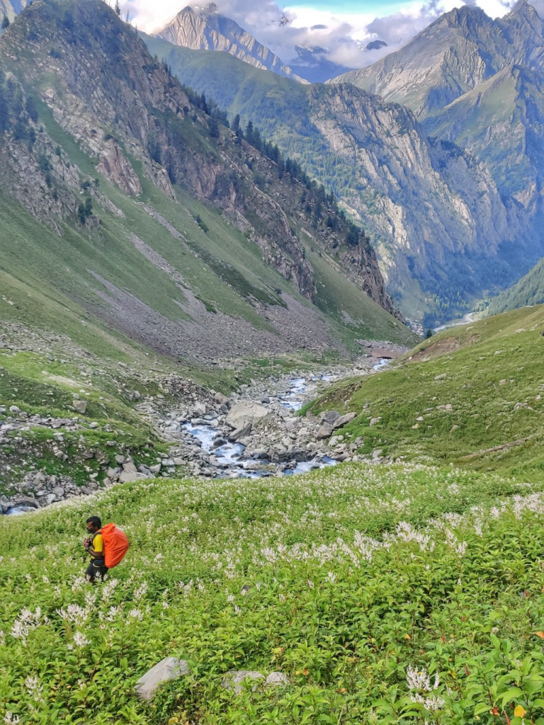
There are numerous beautiful hiking routes that connect opposite valleys across the Eastern Dhauladar. Quite a few have been digitally mapped in Open Street Maps (Waymarked Hiking Trails) and are summarized below:
- Jalsu pass 29km / 2600m+ starting from Utrala in the Kangra plains we hike up North into the lush green Parei Nala valley passing several isolated dwellings until 2700m where we climb up West across the Jalsu pass (3450m) descending North into the meadows above the Sundrali Nala valley to the first settlement of Surai near the confluence of Thanetar and Channi Nala valleys to finish at Lake Wali Mata temple in the Ravi river valley. Blog post 1 Blog post 2
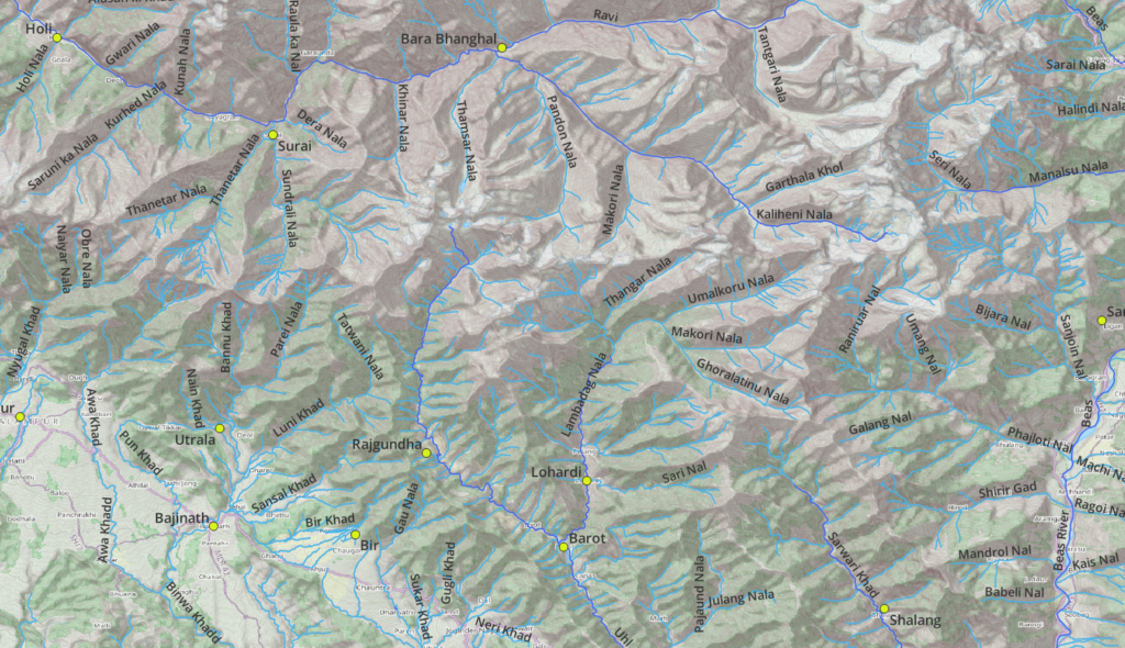
- Chinna pass 19km / 2400m+ climbing up from Bir Northeast along the ridgeline to Billing (paragliding site) and contouring via a jeep track high above the Gau Nala valley turning Southeast across the Chinna pass (2750m) and turning Northwest into the Barot valley to Rajgunda crossing over the Uhl river and turning Southeast towards Baragaran. Blog post 1 Blog post 2
- Waru pass 15km / 1900m+ (incomplete) starting from the Wali Mata temple in the Ravi river valley we climb up West to Chuned village where we turn South across the ridge into the Thanetar river valley to the remote dwelling of Thanetar. Here we cross the Thanetar river twice and climb up South along the river to the Waru pass (3850m) from where we descend steeply into the Awa Khad valley climbing up on the Eastern slope and crossing over the ridge descending to Kandbari Khas in the Kangra plains. Blog post
- Jalsu-Waru 7km / 800m a lesser known path takes us from Thanetar in the Thanetar river valley climbing up East across an unknown pass (3400m) descending North into the Sundrali Nala valley to Bhujora Got at the base of the Jalsu pass. Blog post
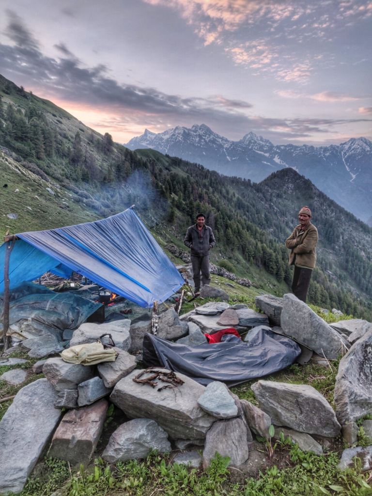
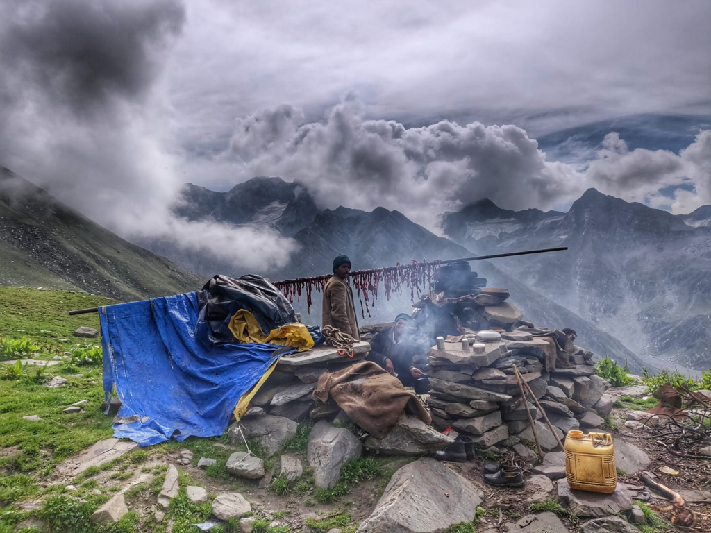
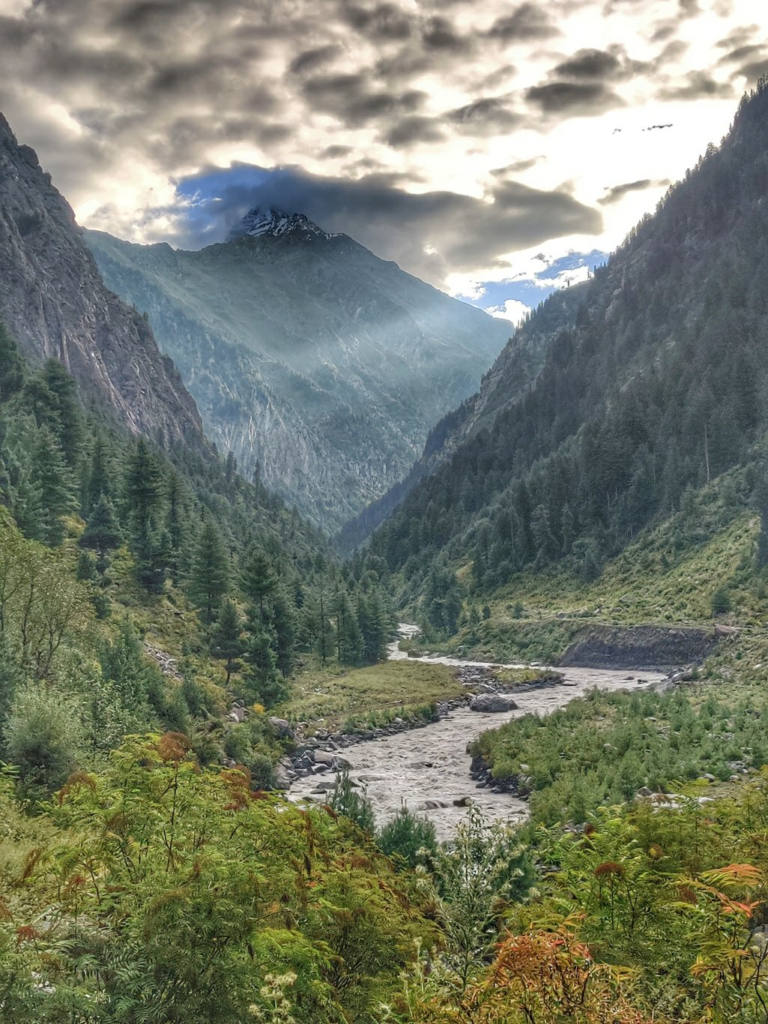
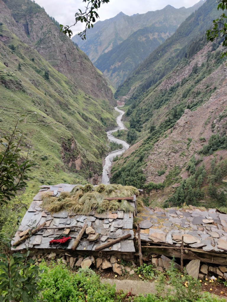
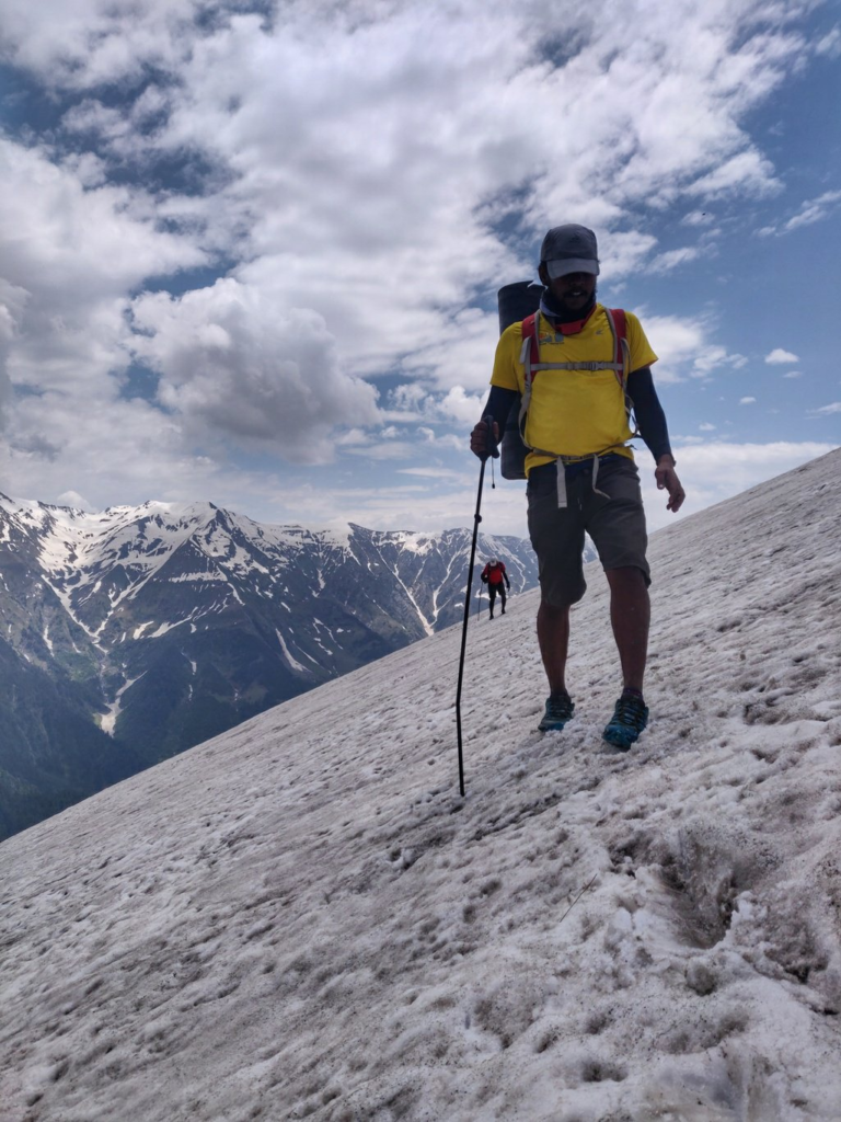
- Thamsar pass 33km / 3000m+ starting from Bara Bhangal in the Ravi river valley we cross over the Kaliheni Nala and climb up South in the Thamsar Nala valley passing Thamsar Dali and Muthu lake at the base of the Thamsar Glacier crossing over the Thamsar pass (4700m) descending via Thamsar Dali into the Uhl river valley and proceeding Southwest along the East bank to the first dwelling of Palachak Deota where we cross over to the West bank to the village of Kukargunda. Blog post Blog post 2
- Makori pass (unmapped) starting from the village of Bhujling we proceed North along the West bank into the Lambadag Nala river valley turning Northeast into the Thangar Nala valley climbing across the Makori pass (4500m) descending West across an unnamed glacier into the Makori Nala valley descending North along the West bank till the Kaliheni Nala valley. Blog post 1 Blog post 2
- Kaliheni pass 52km / 5000m+ climbing up steeply from the Beas river valley near Jogin (1600m) through forest and vast meadows high above the Sanjoin Nala valley crossing over the Eastern Dhauladar through the Sagor Jot (4800m) pass and descending into the Kaliheni Nala valley traversing vast meadows till Bara Bhanghal in Kangra Blog post 1 Blog post 2 Blog post 3 Blog post 4
- Ravi river valley 33km / 2500m+ at the hydro power station near Nayagraon in the Chamba valley we cross over to the North bank of the River river and proceed North above the Ravi valley passing the remote settlements of Sindi, Garaunda, Dharari turning East and passing the settlement of Khingar entering Kangra district till we reach the last village of Bara Bhanghal at the confluence of Ravi river and Kaliheni Nala. Blog post 1 Blog post 2
- Sari pass 21km / 1860m+ an interior pass connecting the Lug and Barot valleys. from Kandincha and Tiun in the Sarwari Khad valley we hike up Northwest to the Sari Galu (3720m) and descend via the Sari Nal valley to Lohardi in the Lambadag river valley, tributary of the Uhl river. Blog post Blog post 2 Blog post 3 Blog post 4
- Dehna Saur lake 10km / 2100m+ Starting from Polang village in the Lambadag Nala valley (tributary of Barot valley / Uhl river) we proceed East in a side-valley and eventually climb up to the ridgeline to the pilgrim lake of Dehna Saur at 4300m. From the lake we can connect to the nearby Blog post
Ghora pass 17km / 1300m+ (incomplete)
Singhar Jot 19km / 3500m+ (incomplete)
References
Navigation
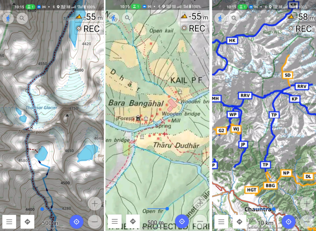
Above traverses can be easily navigated using most mobile mapping apps – many use Open Street Maps as base maps which include tens of thousands of kilometers of trails in Himalayas, Sahyadri, etc. OSM maps can be downloaded on the phone for offline exploration of the mountains without mobile network. Contours can be added to understand the topography of the terrain. Find a short tutorial over here.