
- Part 1 – Base maps
- Part 2 – OSM & Geography
- Part 3 – Traverse Planning
- Part 4 – Elevation data & Topography
- Part 5 -Geo-refercing maps
- Part 6 – Importing Geographic Data
- Part 7 – Terrain Analysis
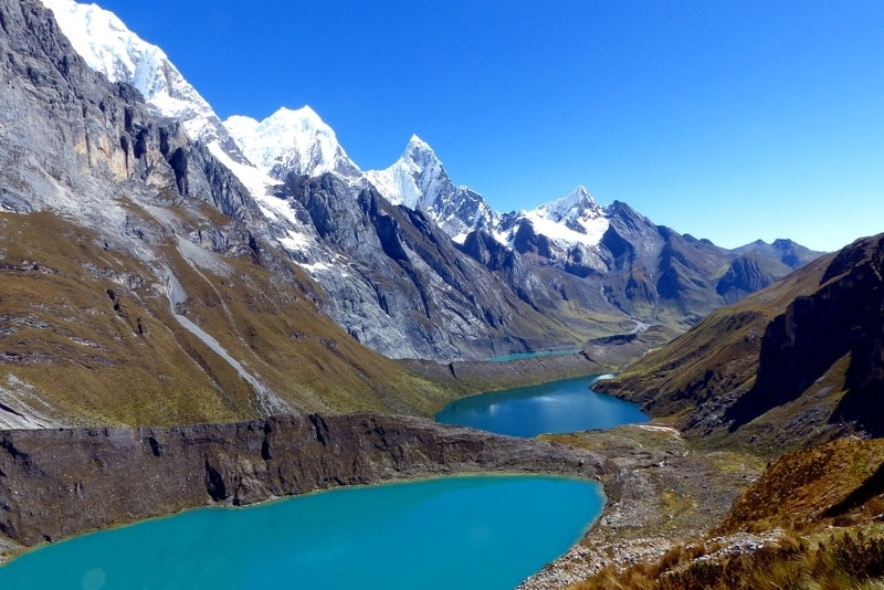
- Part 8 – Geography & Eco Regions
- Part 9 – Climate & Weather
- Part 10 – Hydrology
- Part 11 – Snow Cover
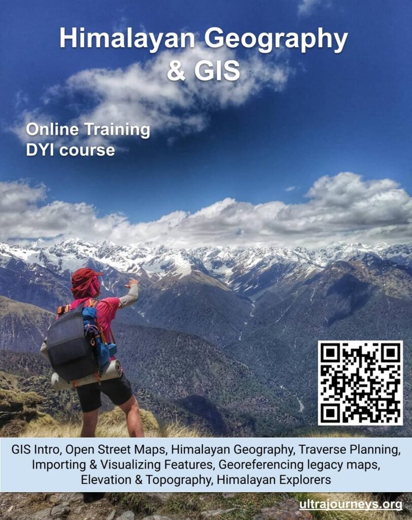
What
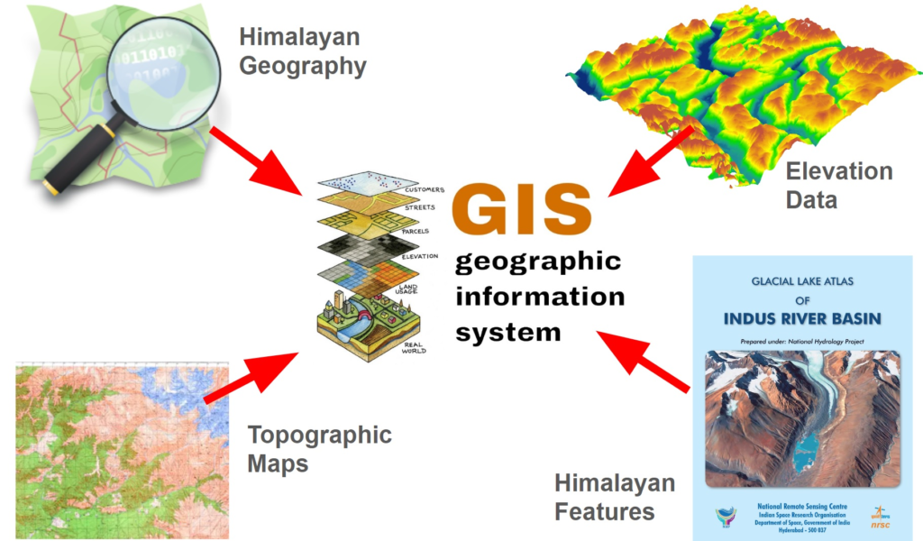
In this online series we combine the power of GIS (Geographic Information System) with OSM (Open Street Maps), DEM (Digital Elevation Model) data and external natural data sets to study and analyze the geography of the Himalayas, terrain analysis, plan Himalayan traverses, geo-reference maps, study mountain ranges & eco regions, analyze climate & weather data, visualize hydrology through basins and rivers and glaciology.
Pre-requisites
- Laptop or desktop (download & install QGIS from here)
Contents
Chapter 1 – Introduction to GIS & Base Maps
- Download and install QGIS
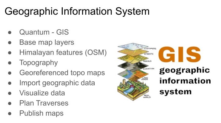
- Introduction to GIS
- Set up important base map layers
- Open Street Maps, Open Topo, Satellite, Waymarked Hiking, Thunder Forest, Survey of India maps
Chapter 2 – OSM & Geography
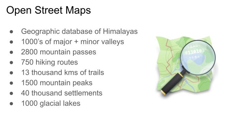
- Introduction to Open Street Maps
- Downloading geographical data from OSM
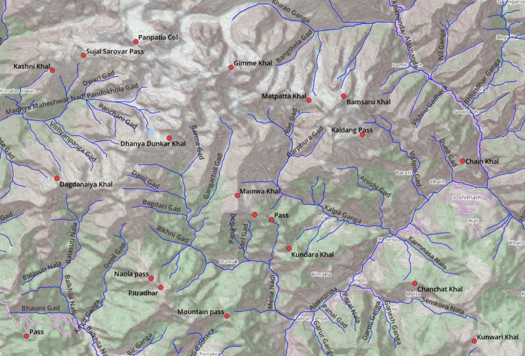
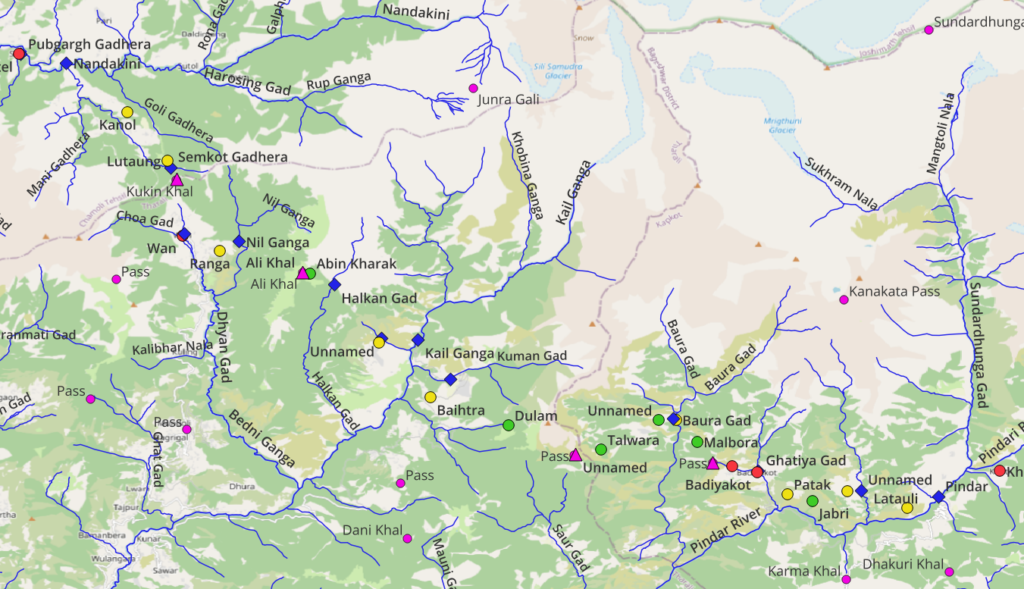
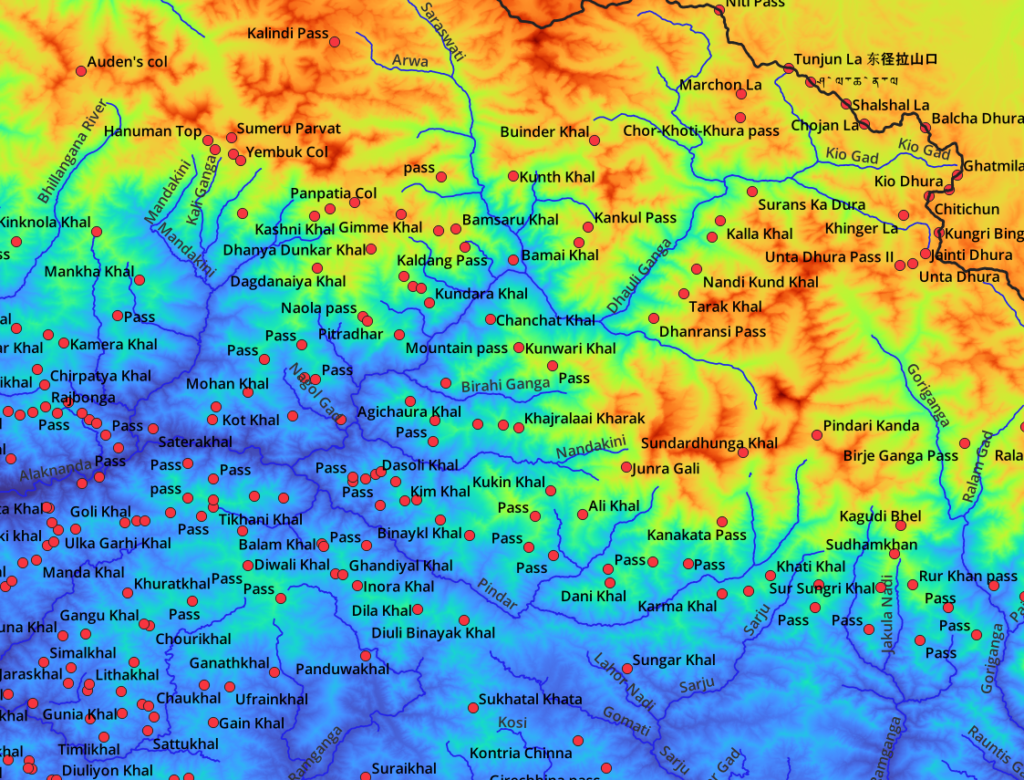
- Visualizing Himalayan valleys, mountain passes and peaks
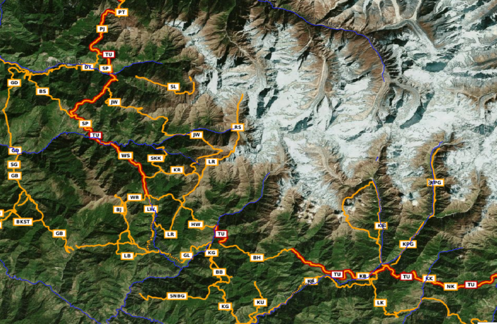
Chapter 3 – Planning a Simple Traverse
- Planning a continuous traverse across multiple passes
- Villages, hamlets and dwellings (food supply)
- Campsites & natural shelters (night halt)
- Identifying POIs along your traverse
- Export a route for offline navigation
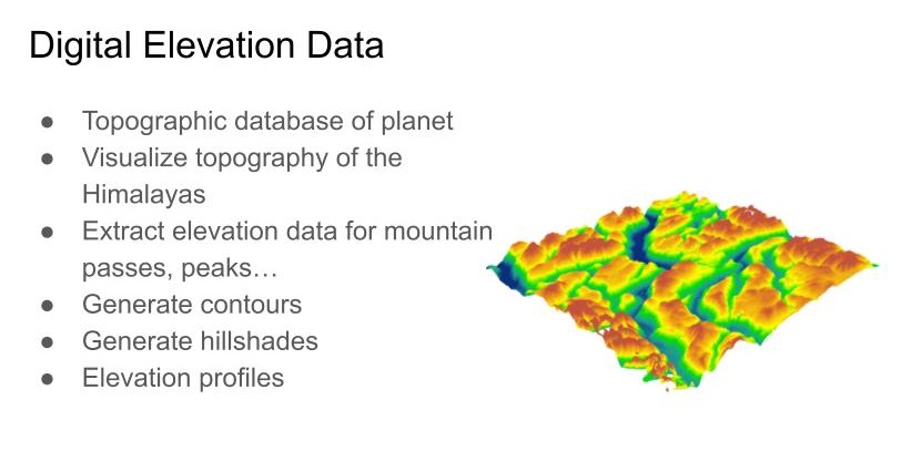
Chapter 4 – Elevation Data & Topography
- Downloading elevation data (DEM)
- Extracting elevation of Himalayan features
- Planning a seasonal Himalayan traverse
- Generating Contours
- Generating Hillshades
- Elevation Profile of a traverse
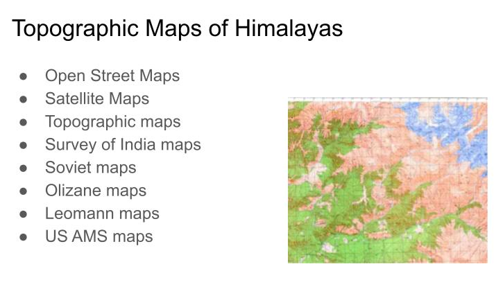
Chapter 5 – Geo-referencing topo maps
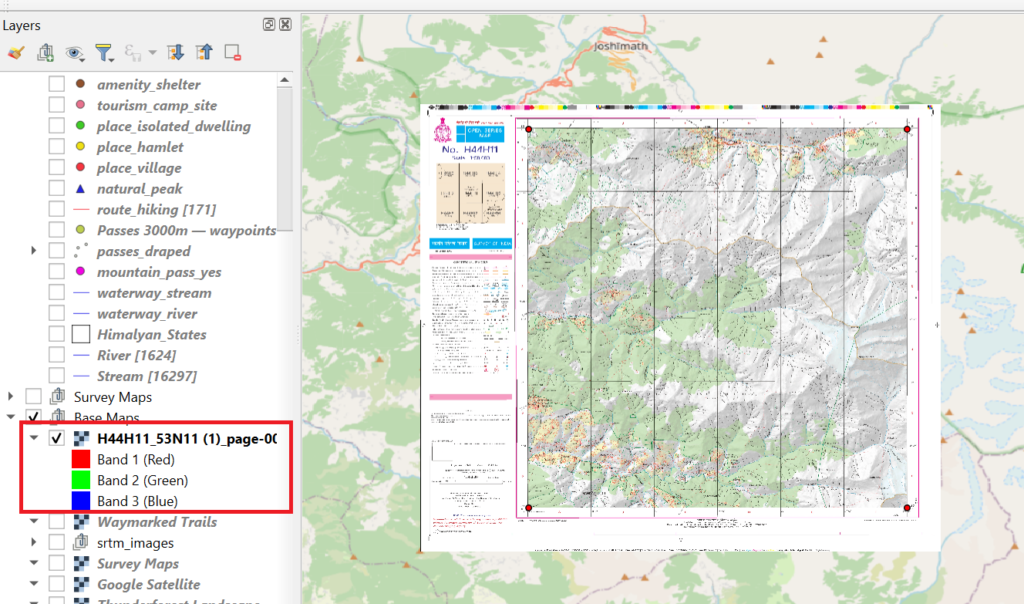
- Survey of India Maps
- Downloading topo sheets
- Coordinate Reference System
- Geo-referencing topo sheets
- Digitizing map features
- Exporting features for offline navigation
Chapter 6 – Importing Geographic Data
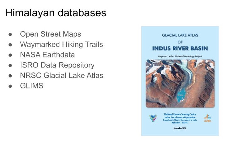
- NRSC Atlas of glacial lakes
- Importing data
- Using Attributes
- Visualization of features
Chapter 7 – Terrain Analysis
- Base Map & Projection
- Target Region & High resolution DEM (elevation)
- Contours (topography low scale)
- Hill shades (topography high scale)
- Aspect (slope direction)
- Slope (steepness)
- Terrain features
- Filling sinks
- Watershed analysis (valleys)
- Stream network
- Delineation (catchment)
- Ridges (inverted DEM)

Chapter 8 – Geography and Eco Regions
- Natural Earth
- NASA Earth Data
- Resolve Eco Regions & Biomes
- Geo Political
- Geographic Features
- Major Rivers
- Topography
- Biomes & eco regions

Chapter 9 – Climate and Weather
- World Clim
- Map Layers
- Temperatures
- Precipitation
- Planning a cycle trip in Europe

Chapter 10 – Hydrology
- Hydro Sheds
- Base Maps
- Rivers
- Basins
- GHNP

Chapter 11 – Snow Cover
- Copernicus Browser
- Sentinel-2 2LA
- Snow Cover (NDSI Band)
- Analyzing Snow Cover in QGIS
- Historical Snow Cover (SCE)
