
In this first part we provide an introduction to GIS and how to add different base map layers to QGIS allowing us to bring up different geographic views.
Contents
- Setting the CRS
- QuickMapServices plug-in
- Open Street Maps
- Thunderforest Landscape
- Waymarked Hiking Trails
- Google Satellite
- Survey Maps
Introduction
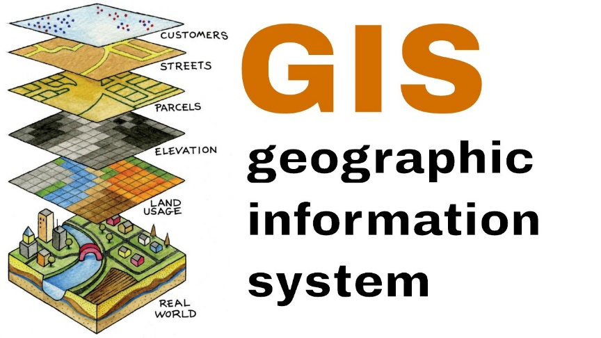
A Geographic Information System (GIS) allows one to visualize and analyze geographic data through multiple layers. For the outdoor community we combine terrain (landscape) communities (villages, hamlets), topography (elevation, steepness), outdoor features (mountain passes, hiking routes, campsites…), legacy maps (Survey, Soviet…) to analyze and plan traverses through the Himalayas.
QGIS

QGIS is a free and Open Source Geographic Information System to create, edit, visualize, analyze and publish geospatial information on Windows, macOS, Linux and BSD. First step is to download and install QGIS from here:
https://www.qgis.org/en/site/forusers/download.html
Note for Mac users: After installing QGIS, the first launch attempt may fail due to security protections. To enable QGIS, control-click on its icon in your Applications folder and select Open in the context menu. A confirmation dialog will display where you need to click the Open button again. This only has to be done once.
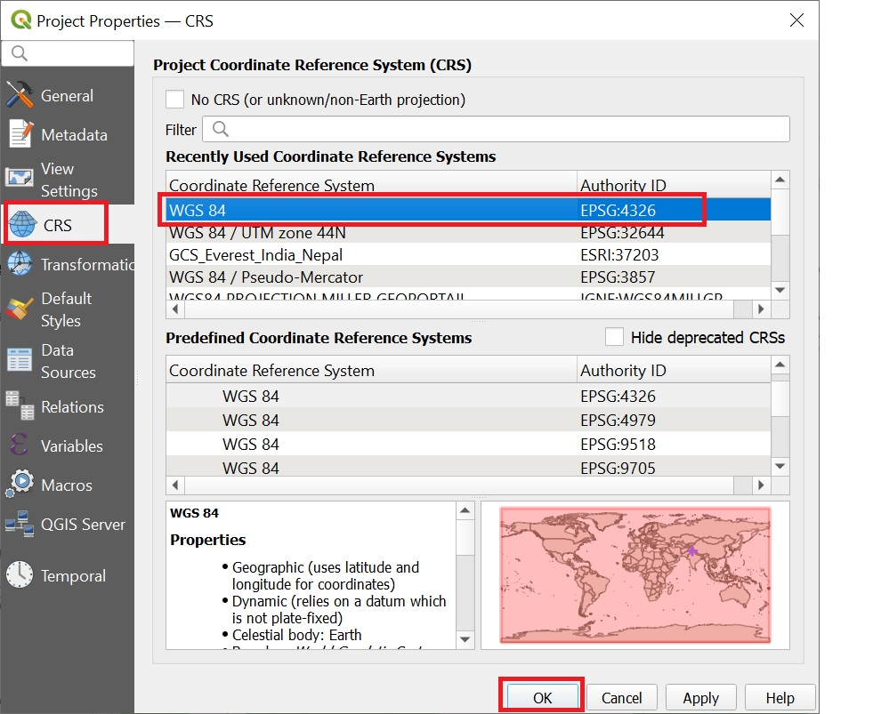
Coordinate Reference System
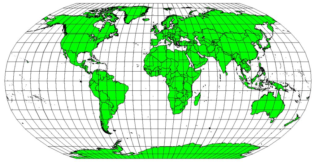
A coordinate reference system ( CRS ) refers to the way in which spatial data that represent the earth’s surface (which is round / 3 dimensional) are flattened so that you can “Draw” them on a 2-dimensional surface.
The World Geodetic System 1984 (WGS84) is a global datum, used for determining positions on the Earth’s surface. The WGS84 is a reference system used by the satellite navigation systems like GPS and is used in various mapping applications
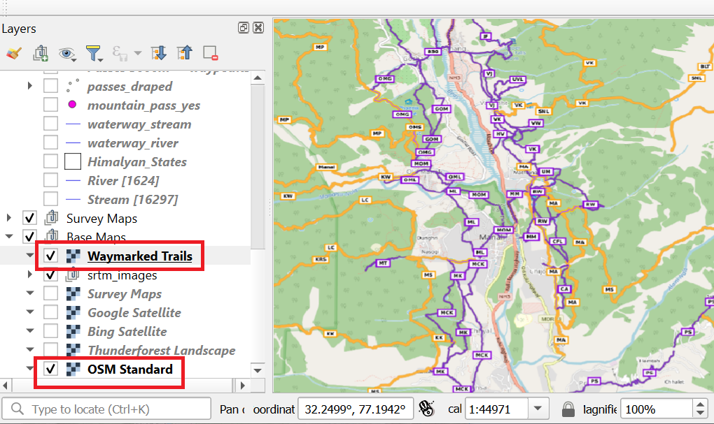
Base Maps
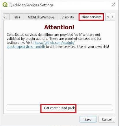
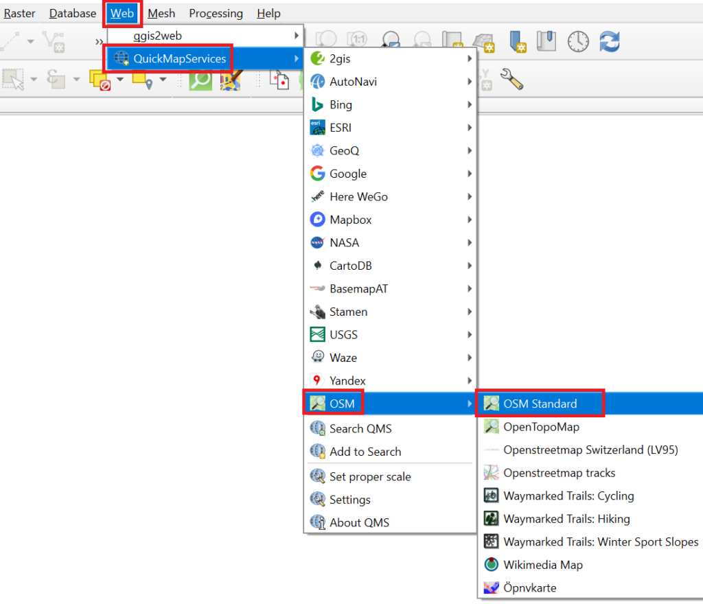
First step is to set up various useful base map layers in QGIS – Open Street Maps, Topography, Satellite, Hiking Routes, Survey Maps. Easiest way is to install the QuickMapServices plugin.

Choose Web menu – QuickMapServices – Settings – More Services and Get Contributors Pack
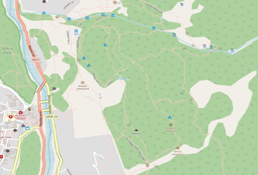
Open Street Maps
OpenStreetMap (OSM) is a free, open geographic database updated and maintained by a community of volunteers via open collaboration. Contributors collect data from surveys, trace from aerial imagery and also import from other freely licensed geodata sources.
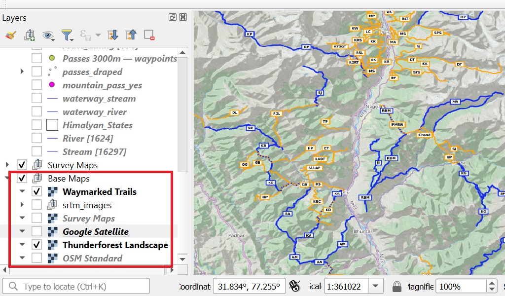
A new raster map layer “OSM Standard” is added to the Layers panel. You can hide / show each layer via the checkbox on the left. You can order layers up / down. Visible layers are drawn bottom to top order. You can group all your base maps in one group.
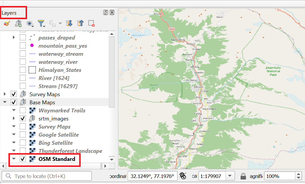
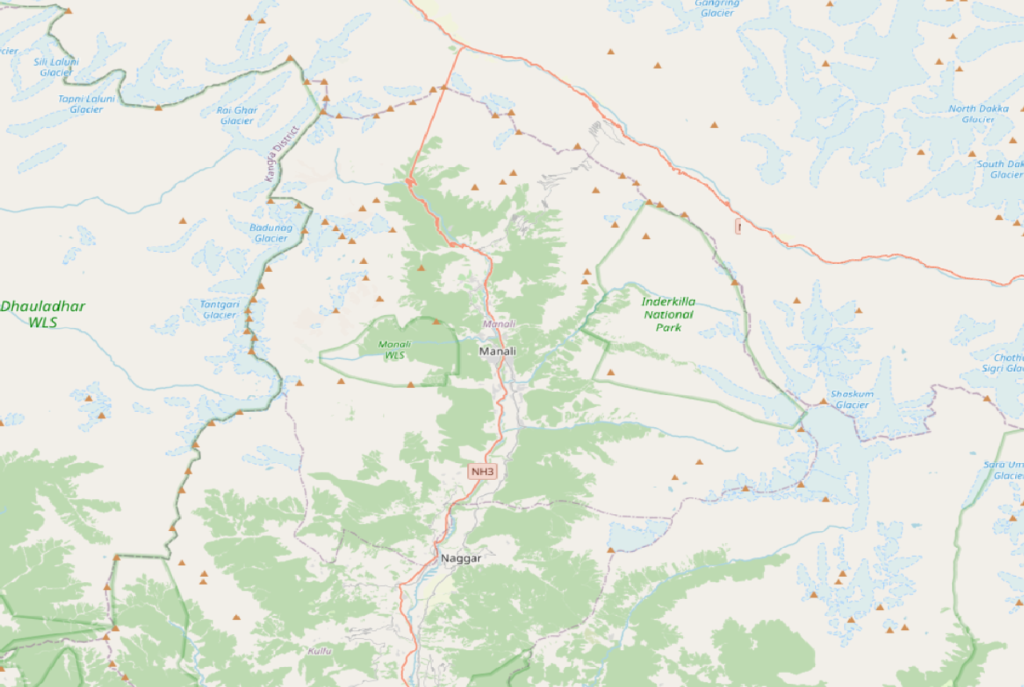
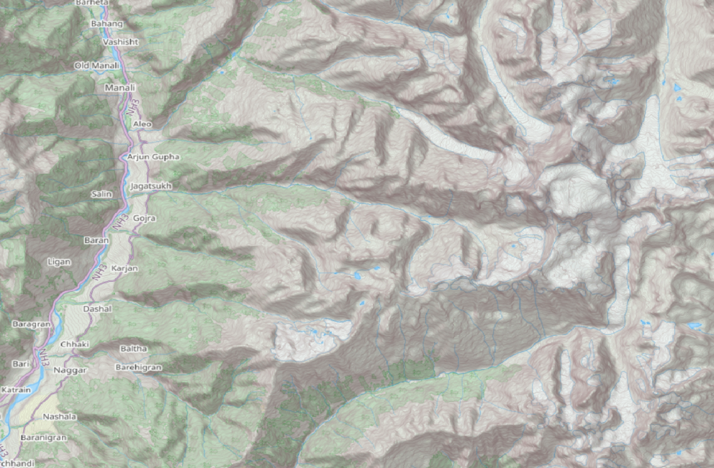
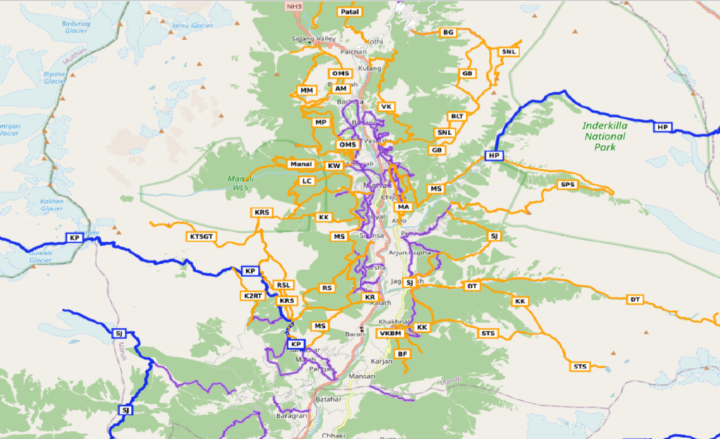
Open Street Maps gives a crisp overview of terrain / landscape at higher scale and outdoor features at lower scale.
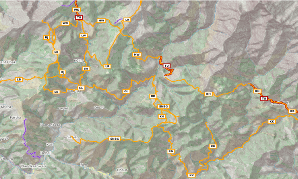
Topographic
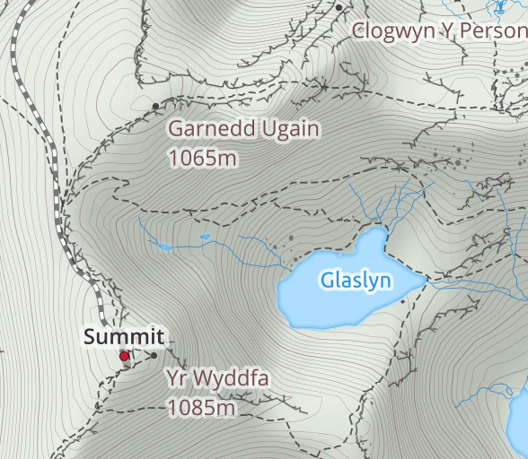
Thunderforest is a global provider of thoughtfully-created activity maps. We host multiple map styles and serve millions of requests per day to clients all around the globe, from multi-national companies who use our product internally, to mountain biking magazines and European tourism organizations.
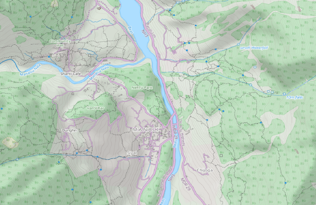
Thunderforest Landscape – Do you need a map that shows the natural world in all its beauty and topographical detail? We’ve done the work for you. Landscape has been designed to be almost three-dimensional when you look at it. It is ideal for users who plan to navigate – and appreciate – wild places.
https://www.thunderforest.com/maps/landscape

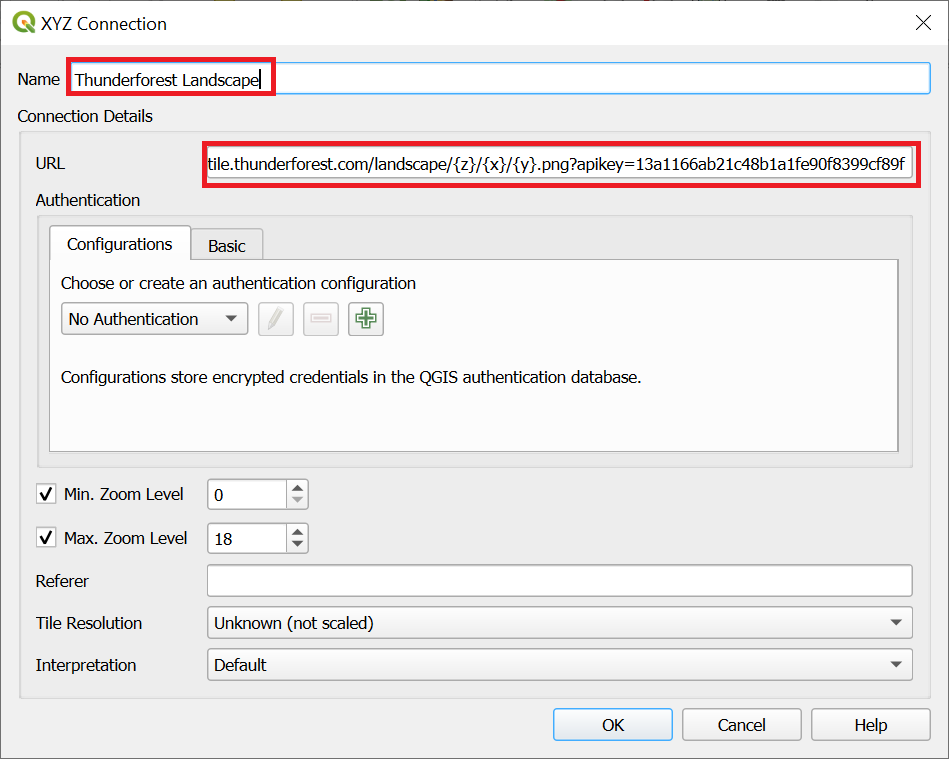
Create a free hobby developer account to receive a URL to an online map tile server which can be added as a layer in QGIS:
https://tile.thunderforest.com/landscape/{z}/{x}/{y}.png?apikey=13a1166ab21c48b1a1fe90f8399cf89f
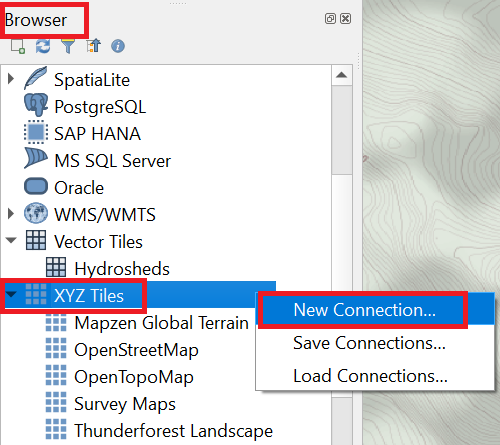
Make sure the Browser plan is visible on screen (View menu – Panels – Browser). Right click on XYZ Tiles and choose New Connection
A new raster map layer is added to the Layers panel. Hide OSM and show Thunderforest landscape to get an excellent topographic view at larger scales bringing out essential outdoor features at lower scale.

Waymarked Trails
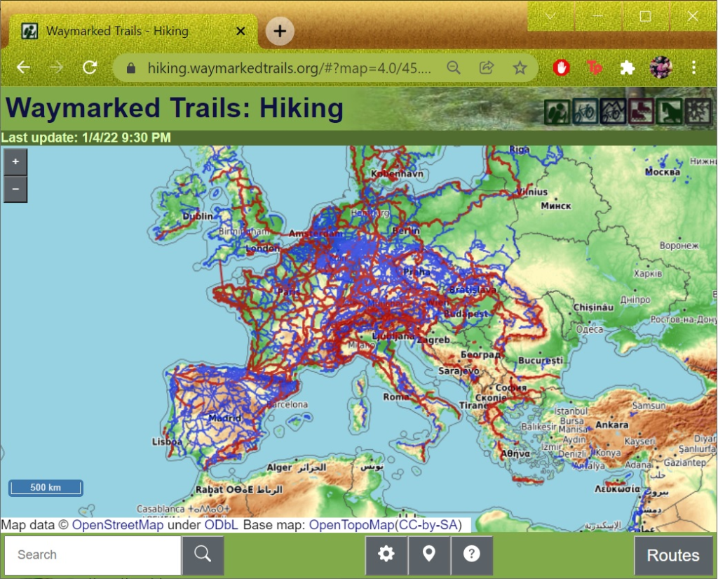
waymarkedtrails.org is a website that renders layers with marked trails for hiking, cycling, mtb, riding, skating or winter sport slopes and additionally hill shading on top of some base map (currently OSM carto or OpenTopoMap). Add below URL to add waymarked hiking trails layer to QGIS:
https://tile.waymarkedtrails.org/hiking/{z}/{x}/{y}.png
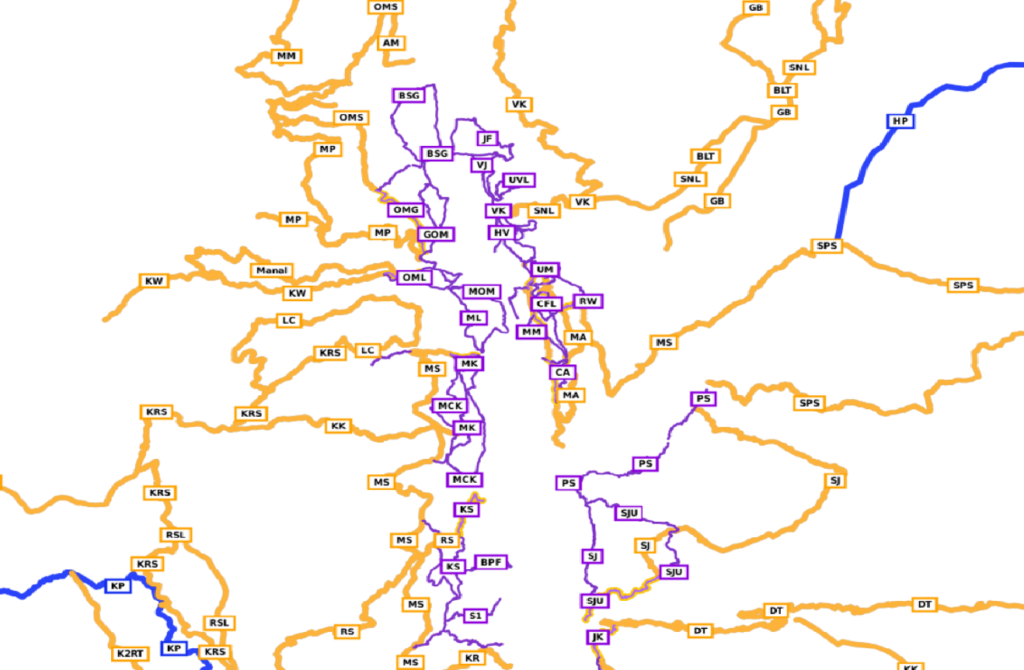
Waymarked hiking trails can be overlaid on other base map layers to show OSM hiking routes over any other basemap. Just ensure the waymarked trails layer is on top so it gets drawn above other maps
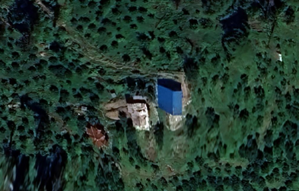
Satellite Map
A satellite map base layer gives an excellent view on the landscape (forest, meadows, rock, glaciers, snow) at higher scales and remote settlements and trails at lower scale. There are several satellite map providers which can be used in QGIS. Let’s add a Google Satellite base layer.

Survey Maps
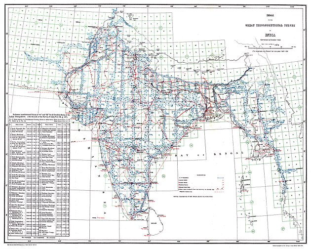
The Great Trigonometrical Survey of India was a project that aimed to carry out a survey across the Indian subcontinent with scientific precision. It was begun in 1802 and finished in 1871 under the East India Company.
Survey of India
Survey of India, The National Survey and Mapping Organization of the country under the Department of Science & Technology, is the OLDEST SCIENTIFIC DEPARTMENT OF THE GOVT. OF INDIA. It publishes the 1:50K scale Open Series Maps which can be downloaded over here:
https://onlinemaps.surveyofindia.gov.in/FreeMapSpecification.aspx
Individual 28x28km toposheets have to be downloaded and geo-referenced in order to be used in QGIS. An easier way to add the Survey maps is by adding this online map tile server:
https://indianopenmaps.fly.dev/soi/osm/{z}/{x}/{y}.webp
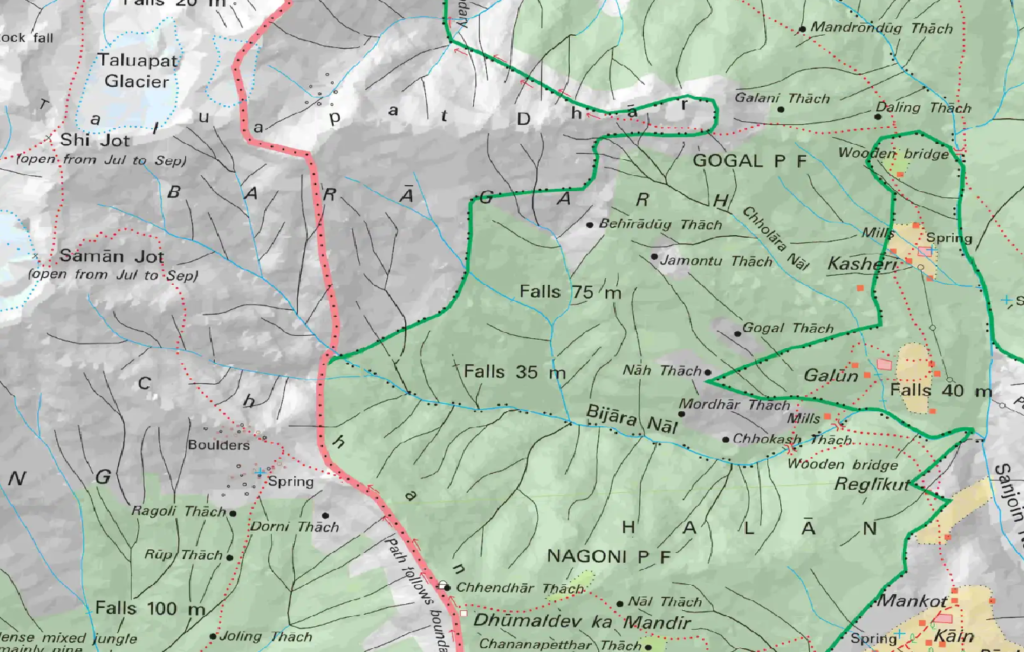
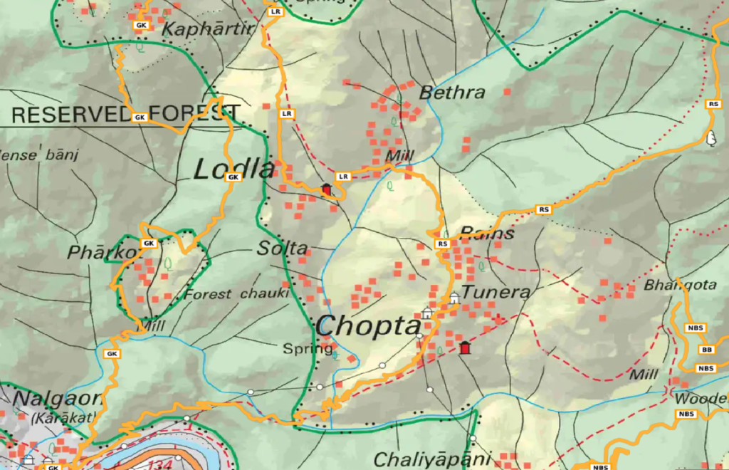
Survey maps are no doubt the most detailed maps of the Himalayas useful in exploring and mapping new hiking routes in OSM showing remote trails and settlements.
You now have a powerful set of base layer maps which you can individually enable to view basic terrain features, satellite landscape, topography, hiking routes and detailed Survey maps.
Let’s take a closer look at the Geography of the Himalayas by downloading and overlaying geographical features from OSM over the above basemaps in chapter 2