
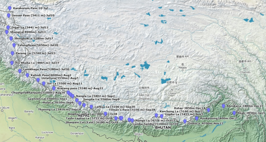
- Route: Ladakh to Arunachal across the Himalayas
- Countries/states: Ladakh, Himachal, Uttarakhand, Nepal, Sikkim, Bhutan, Arunachal
- Total: 3600km / 20km per day = 6 months – mid Jul to early Jan
Contents
- Timeline
- Food drops
- Important notes
- Route
- Monsoon
- Snow cover
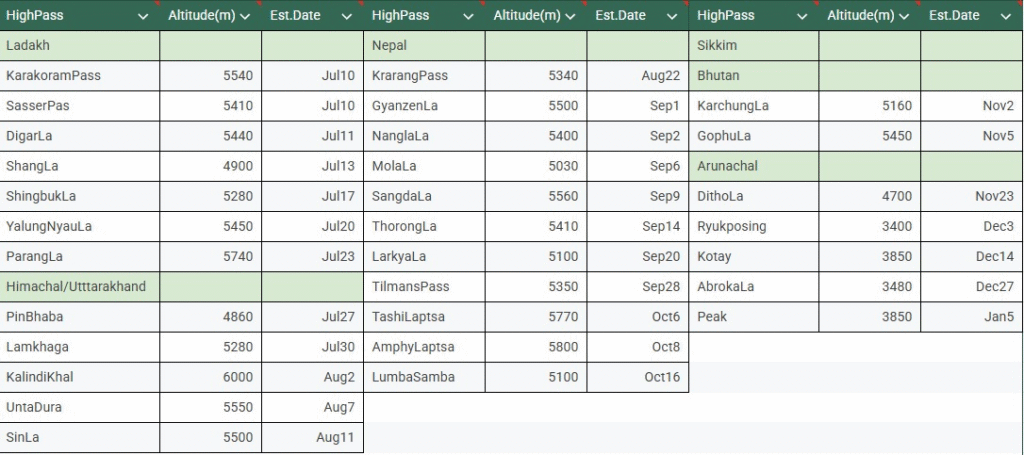
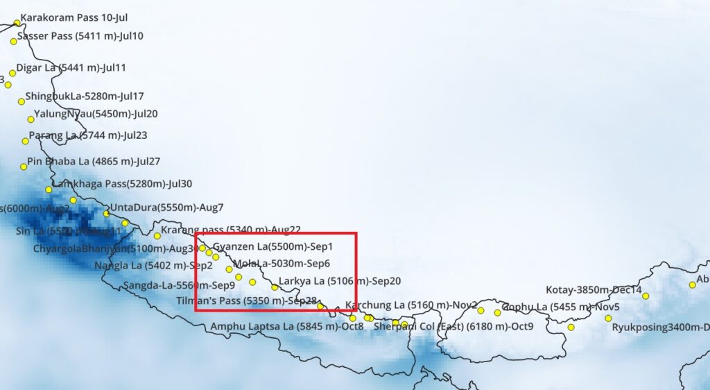
Timeline
Food Drops
| Food Drops | Nr | Location |
| Western Himalayas | 1 | Pahalgam 34.03220 75.32265 |
| 2 | Panikhar 34.11867 75.94676 | |
| 3 | Rumbak 34.05452 77.43160 | |
| 4 | Thukje 33.35974 78.02269 | |
| 5 | Chitkul 31.35179 78.43591 | |
| 6 | Mana 30.77053 79.49561 | |
| 7 | Kathi 30.11209 79.94006 | |
| 8 | Darchula 29.84911 80.54147 | |
| Nepal | 9 | Khandeshwari 29.80780 80.87539 |
| 10 | Simikot 29.97204 81.81844 | |
| 11 | Chandannath 29.27495 82.18327 | |
| 12 | Dangibada 28.97986 82.82490 | |
| 13 | Kagbeni 28.83626 83.78341 | |
| 14 | Darapani 28.52430 84.35449 | |
| 15 | Khorlabesi 28.25446 84.88329 | |
| 16 | Syabru Bensi 28.16367 85.33725 | |
| 17 | Bagaam 27.91903 85.87058 | |
| 18 | Thame 27.83189 86.65048 | |
| 19 | Bhotkhola 27.76385 87.36329 (hiking) | |
| Bhutan | 20 | Phungling 27.35648 87.67289 |
| 21 | Ha: 27.36905 89.29181 | |
| 22 | Punakha: 27.58429 89.85931 | |
| 23 | Trongsa: 27.50161 90.50759 | |
| 24 | lingmethang: 27.26098 91.17137 | |
| 25 | Trashigang: 27.33274 91.54633 | |
| Sikkim | 26 | Pelling 27.30017 88.23549 |
| 27 | Gangtok 27.32905 88.61227 | |
| Arunachal | 28 | Tawang, 27.58827 91.86438 |
| 29 | Tungri, 27.44464 92.38069 | |
| 30 | Jomo, 27.65809 92.99987 | |
| 31 | Koloriang, 27.90192 93.35228 | |
| 32 | Taliha, 28.23346 94.14727 | |
| 33 | Yangrang, 28.53100 94.37595 | |
| 34 | Tuting, 28.99485 94.89201 | |
| 35 | Aruzdu, 28.49080 95.82790 | |
| 36 | Dingliang, 27.97970 96.39576 |
Important Notes
- Bad weather (rain, snow) will introduce unexpected delays (several weeks overall)
- Timeline is based on 20km / day mileage which is only realistic if you go lightweight (30L / 5kg) – lightweight gears + carry just sufficient food till next village
- Sikkim – Survey maps of border regions are not available to public -to be planned
- Nepal – I will reroute around 4 technical passes (no mountaineering gears)
- Nepal/Bhutan – guides are mandatory for civilians – if applicable to you then please get in touch with authorized hiking agencies
- Ladakh to Bhutan – route is accurate / GPS mapped
- Arunachal – I planned a few alternate routes via Survey Maps. These are 1. not GPS accurate and 2. not sure if in use so might require rerouting
- Unexpected snowfall might block certain passes – we can reroute as needed
- Unta Dura is only way North of Nanda Devi (only open to military) – uncertain if this is non / technical pass. If technical, let me know, I can reroute South of the Nanda Devi NP
- Buinder Khal connecting Valley of Flowers to Girthi Ganga valley is not mapped in OSM. Need Survey maps for border regions to plan this route
Route
- GPX files for all sections – download here
- We mostly follow routes mapped in Open Street Maps. Sikkim, Arunachal planned via Survey of India maps
- More detail on route planning in this post
Monsoon
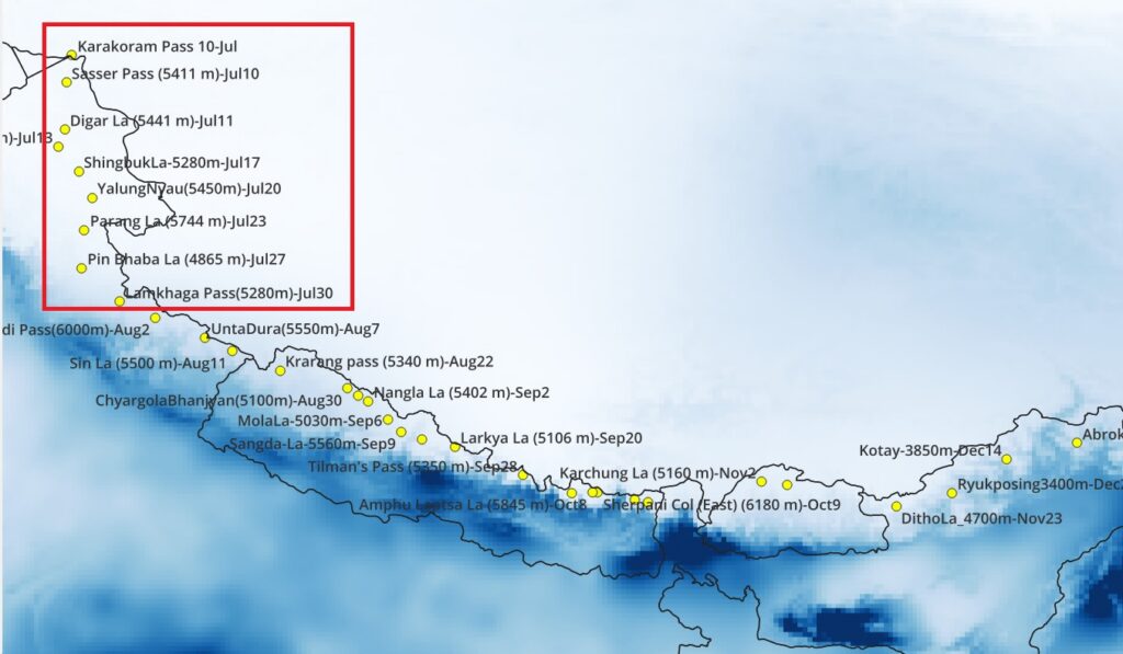
No impact of July monsoon in Ladakh, Spiti, Kinnaur
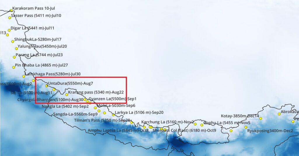
Mostly out of direct reach from the August monsoon in the high passes of Uttarakhand. Although fresh snowfall expected in upper regions. Rains hit during lower transit over Nepal border /Sharda river valley near Darchula.
September monsoon mostly hits Kumaon. Team is out of monsoon reach in central Nepal
Snow
Snow cover analysis based on satellite data from ESA Copernicus Sentinel-2 NDSI (Normalized Difference Snow Index) for year 2024
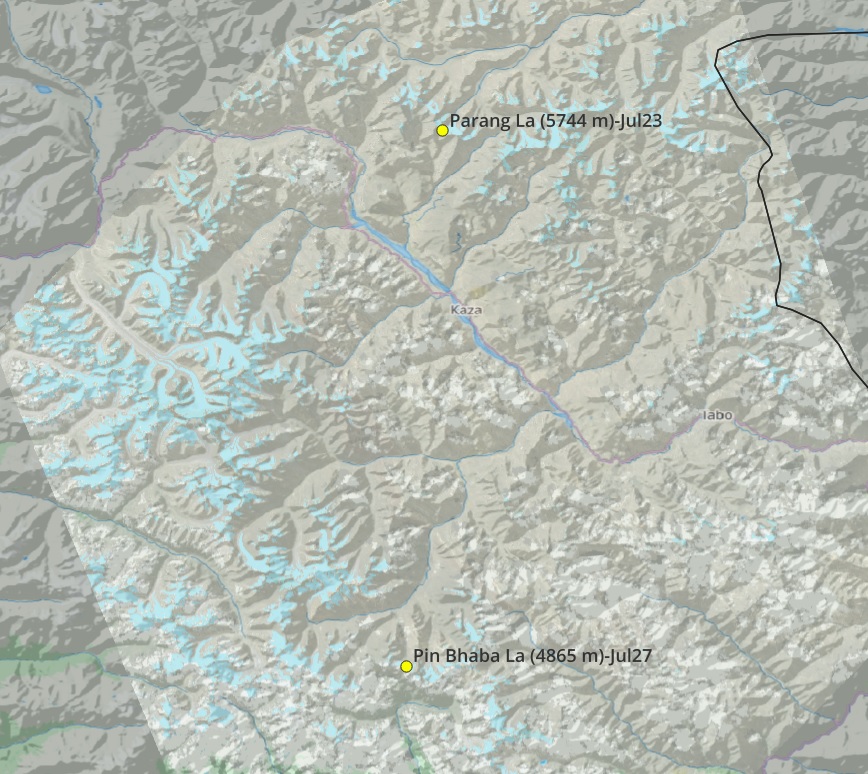
Aug 21 – Parang La and Pin Bhaba mostly snow free till 1-2 months after planned crossing.
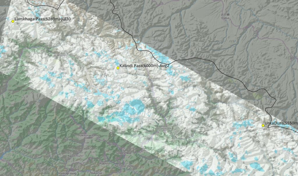
Aug 28 – no cloud free Satellite data available during Jul-Aug monsoon. First partial snow cover image for Lamkhaga, Kaliindhi, Unta Dura
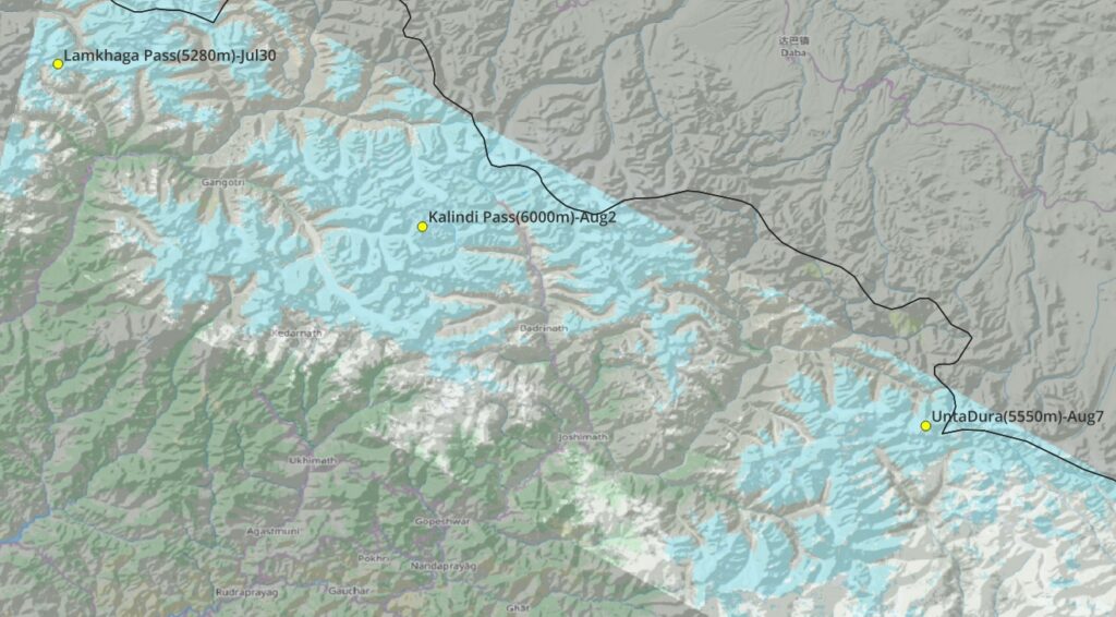
Sep 17 – first clear satellite imagery on Sep 17 – significant snow cover on high passes of Uttarakhand (1.5 month later). Check with Uttarakhand hiking agencies (permits mandatory) on planned dates
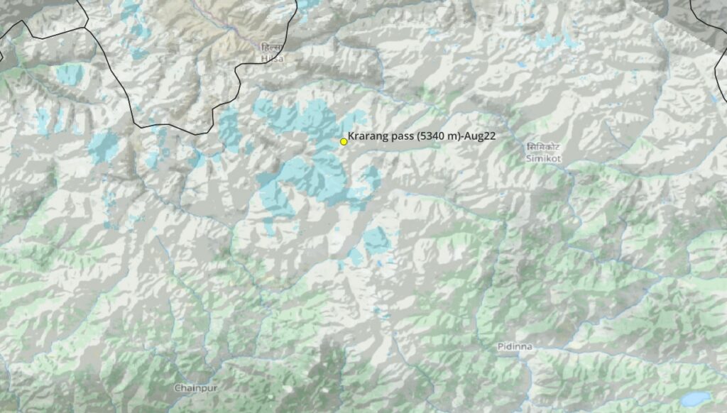
Aug 30 – notable snow cover on West side of first high pass of Nepal – Krarang 5340m. Others are clear. No earlier clear Satellite imagery available due to monsoon cloud cover
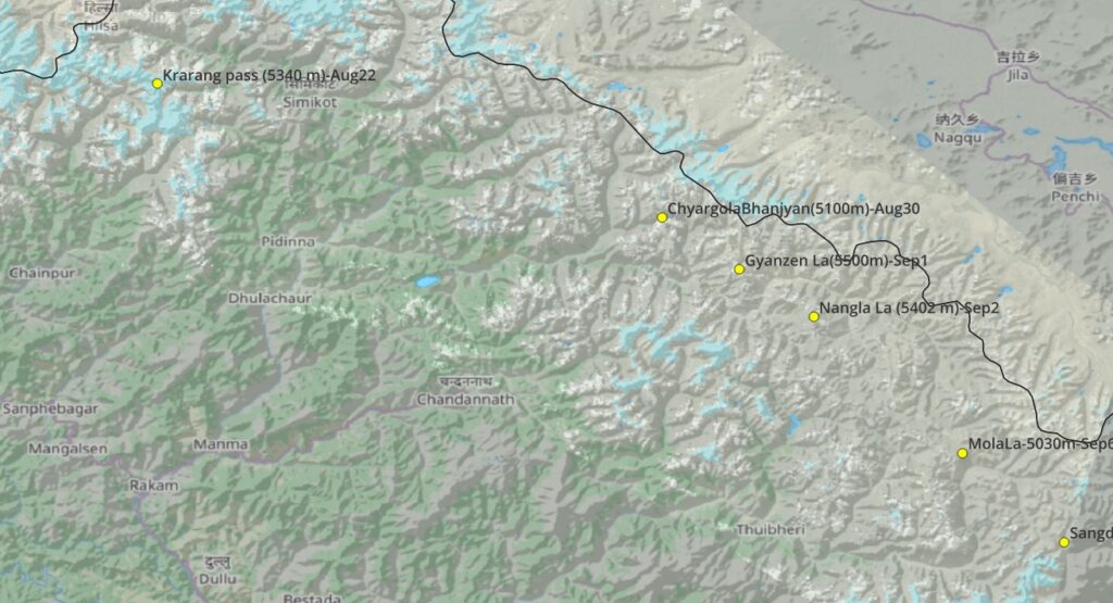
Sep 19 – all clear for the high passes in East Nepal
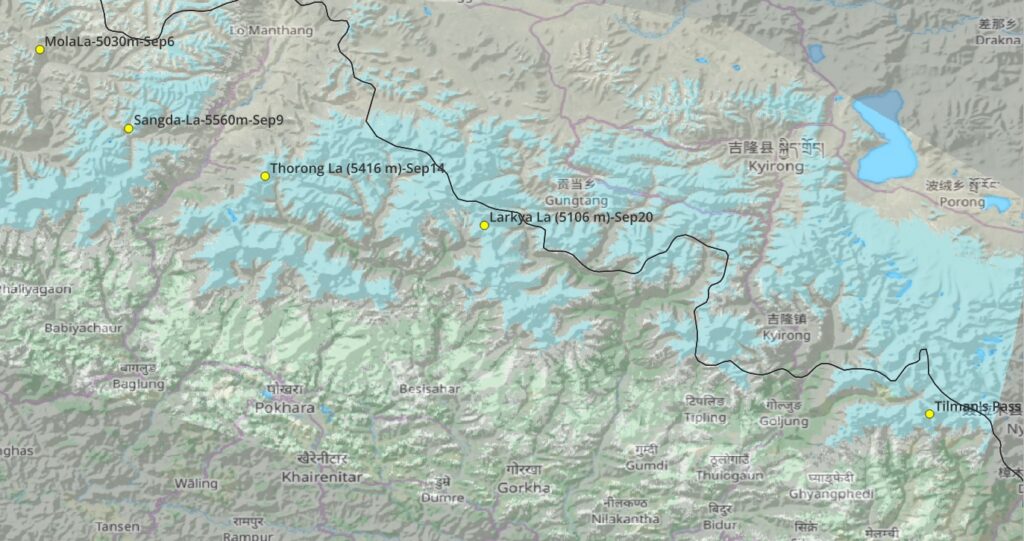
Oct 1 – medium snow cover on high passes in central Nepal – Sangda La, Thorong La, Larkya La, Thilman’s pass
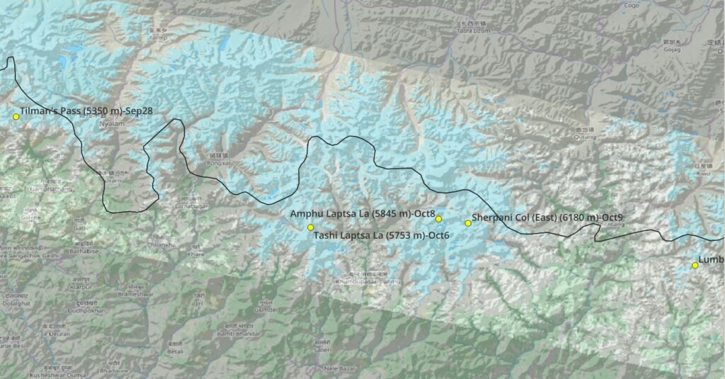
Oct 8 – medium snow cover on the passes in Eastern Nepal / EBC – Laptsa La, Sherpani Col, Lumba Samba
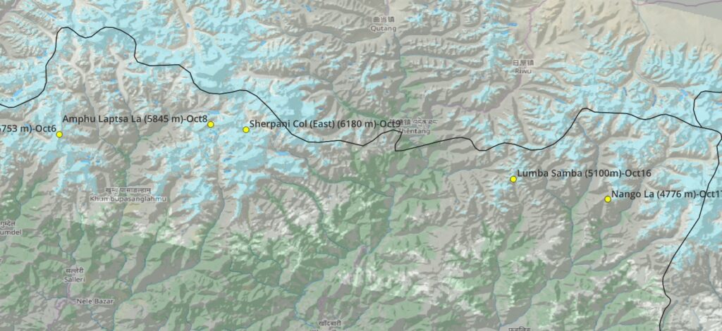
Oct 28 – similar snow cover on the high passes in Eastern Nepal. Touristic so mostly manageable
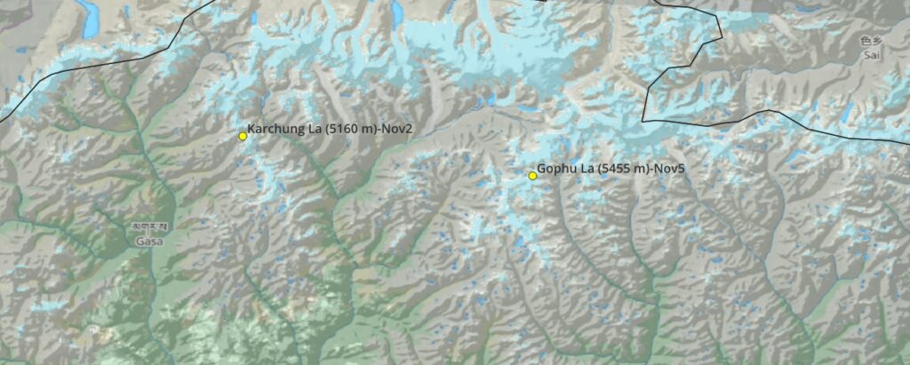
Nov 14 – very little snow on the high passes of Bhutan’s snowman trek (no changes in December due to Southern latitude of Bhutan)
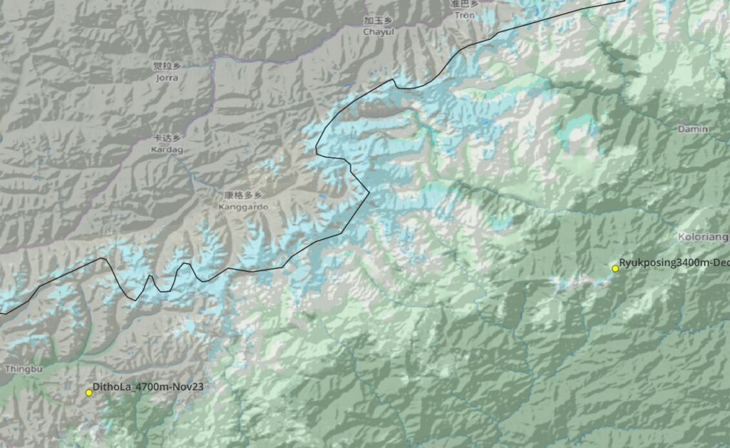
Dec 11 – all clear on planned mid passes in Arunachal
Jan 5 – slightly more snow one month later in Arunachal but no snow close to planned traverse