
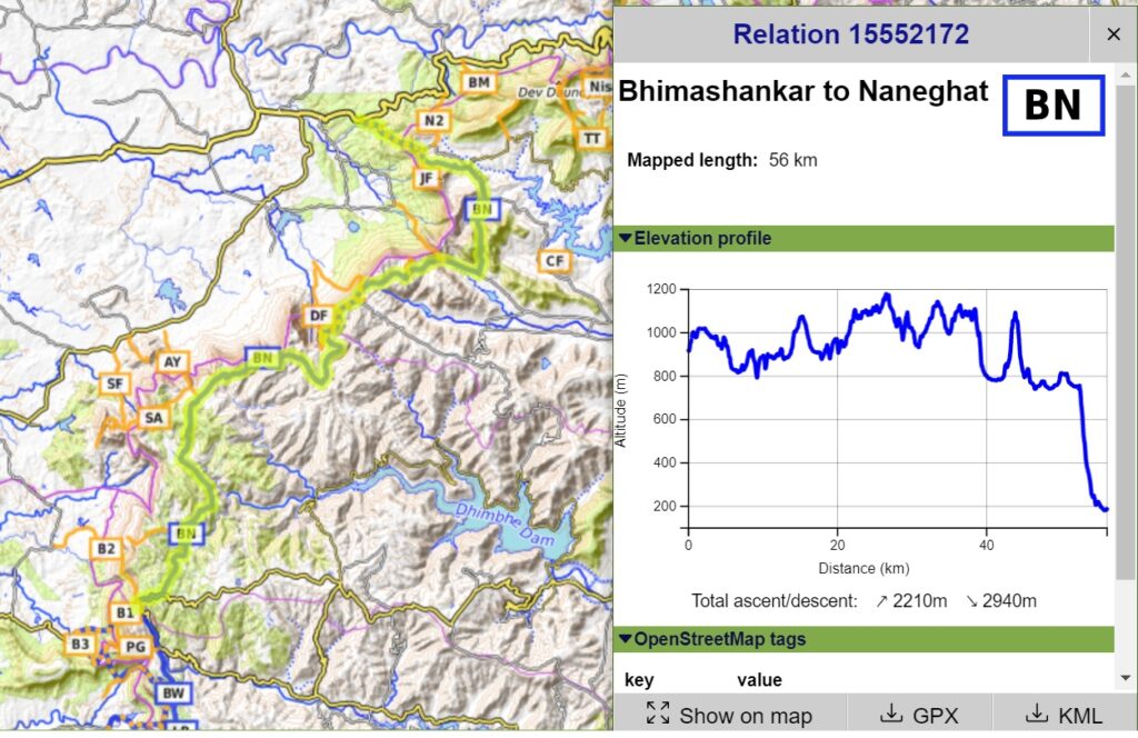
This 112 km long traverse with 3100 meters of elevation gain (ascent) takes you along the edge of the Deccan plateau from Lonavala (South) all the way to Naneghat (North) offering mesmerizing views on the Konkan plains below. It takes you through 15 historical forts, ghat sections, lakes, temples and caves including Shivarata lake, Rajmachi fort, Dhak Bahiri caves, Andhra lake, Kothaligad, Bhorgiri & Padargat forts, Bhimashankar temple, Siddhagad, Gorakhgad & Macchindragad forts, Ahupe ghat, Durga & Dhakoba forts, Darya ghat, Jivdan fort and Naneghat.
The same traverse has been GPS recorded and accurately mapped in Open Street Maps for the international outdoor community. Terrain details, topography and hiking routes can be downloaded in the mobile for offline navigation in the mountains. My favorite map app is OSMAnd.
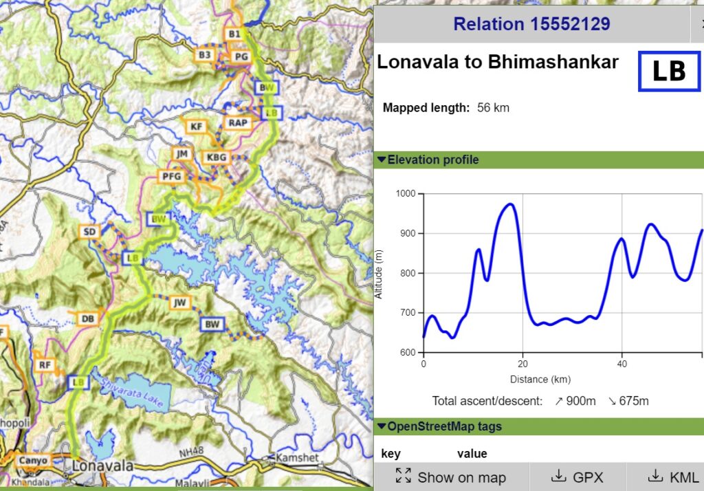
Part 1 – Lonavala to Bhimashankar
- Lonavala to Shivarata Lake – starting from Lonavala (well connected by train from Mumbai and Pune) we climb up North to Thakurwadi hamlet and get into a dirt track which passes by the beautiful Shivarata lake next to the remote Vanati Thakurwadi hamlet.
- Rajmachi Fort – optionally we can take a diversion West towards the twin forts of of Manrajan and Shrivardan offering beautiful views on the Ulhas river valley East.
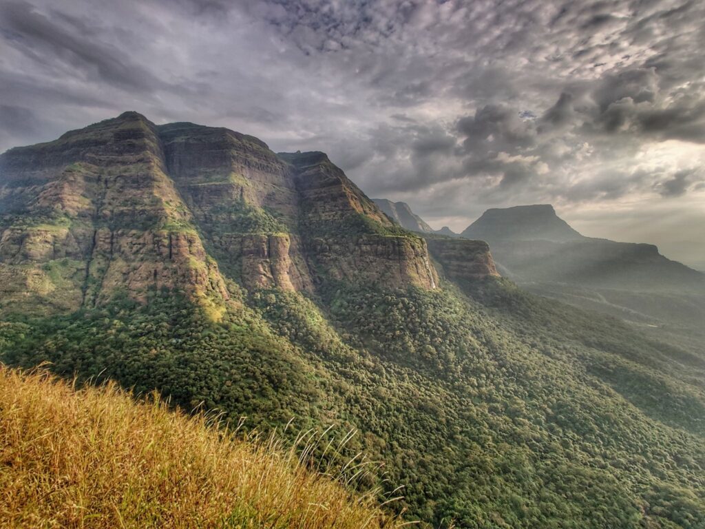
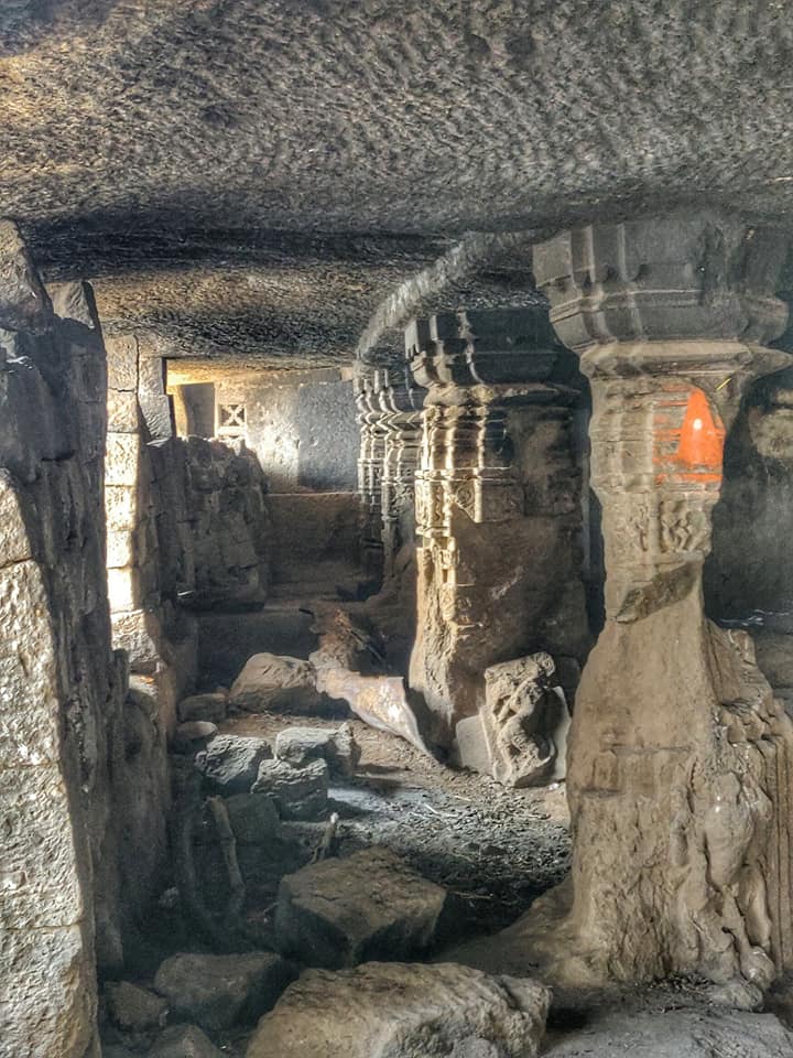
- Dhak Bahiri – proceeding North from the Shivarata lake a trail enters the forest and runs along the Deccan ridge offering views West on the Ulhas river valley below and East the Kundalika Nala. We pass the Dhak Bahiri caves located on a steep rock face behind a small pinnacle
- Andhra Lake – we now climb up onto a flat, uninhabited plateau (1000m) untill we descend into the Andhra lake valley. Here an optional side-trail Saidongar takes us in the Pej Nadi river valley, tributary of the Ulhas river. We now follow a road section around the Andhra Lake till we hit Talpewadi village.
- Bhama Nadi – from Talpewadi we climb out of the Andhra river valley and hop over the Wandrekhind pass (930m) into the remote Bhama Nadi river valley dotted with small farming hamlets
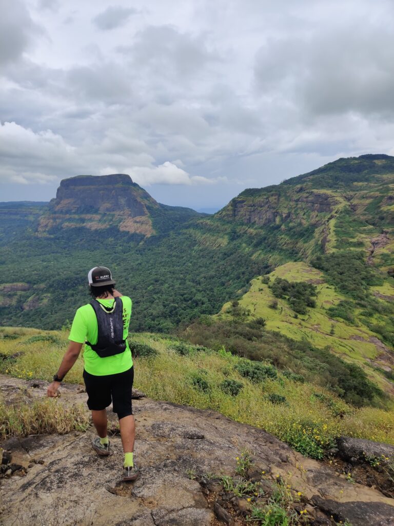
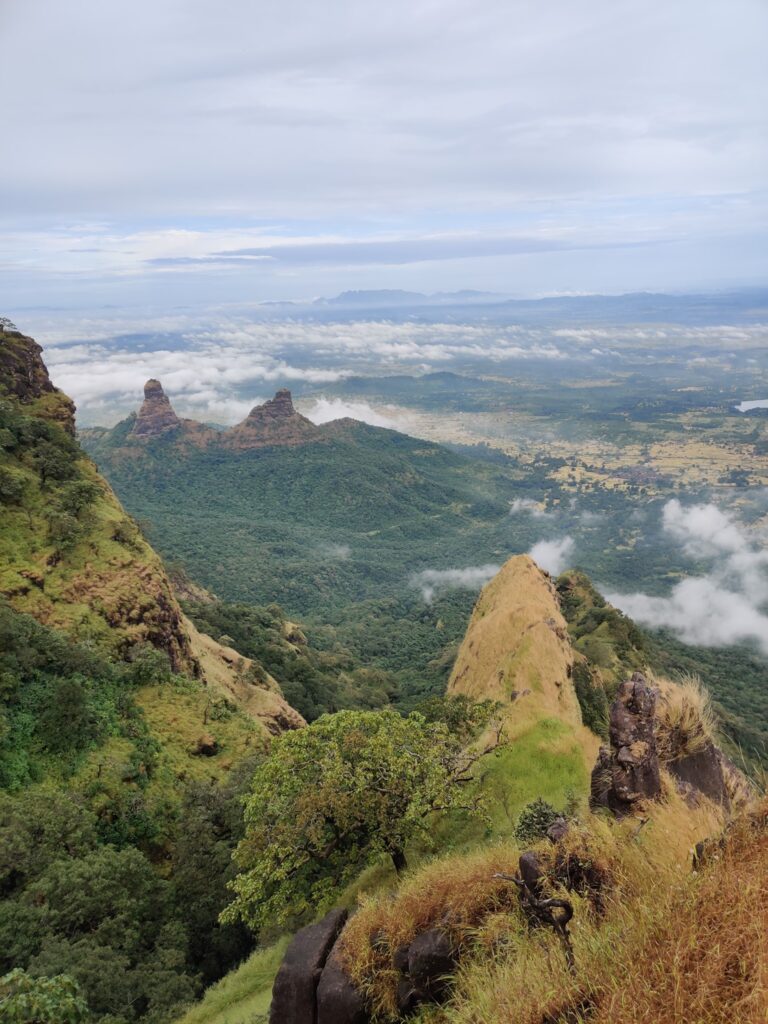
- Shilar Nadi – from Padarwadi we climb out of the Bhama Nadi valley onto the Deccan ridgeline (900m) offering birds eye views on the Shilar Nadi river valley and Kothaligad Fort (optional diversion).

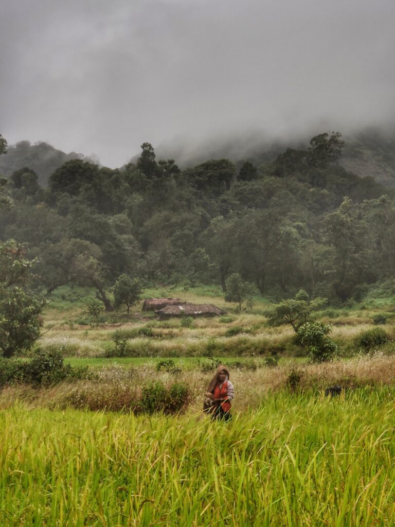
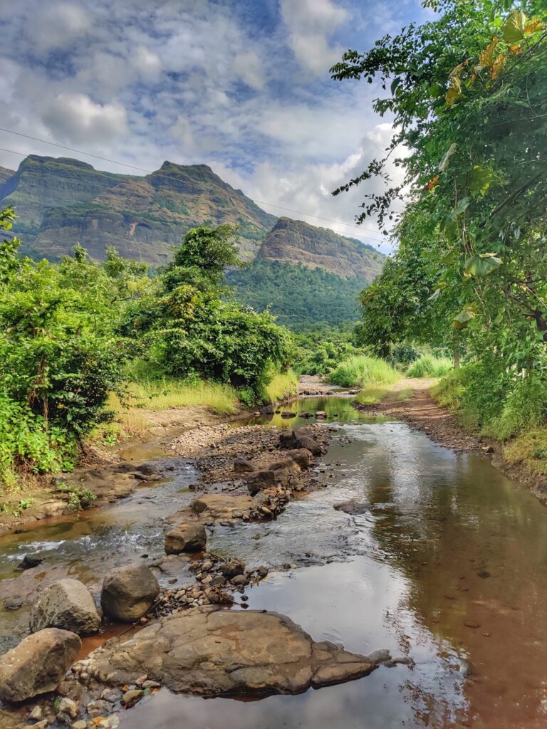
- Bhimashankar – proceeding North along the Deccan ridge we descend into the Bima river valley flowing down from Bhimashankar. We pass Bhorgiri Fort in the East and proceed upstream passing Pedhyacha Ghat until we enter Bhimashankar.
Part 2 – Bhimashankar to Naneghat
- From Bhimashankar we proceed along a small tar road North through remote farming settlements (Kondhval) before we enter the no-mans land of the rolling plains of the Ghod river valley
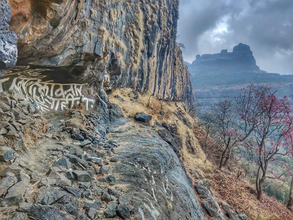
- Siddhagad Fort – before crossing the Ghod river we can short detour through a steep Ghat to nearby Siddhagad fort from where we get stunning views on the Deccan ridgeline
- Ahupe – next we pass through the forest around the Karadia Dongar peak before entering back in open farmlands and small villages of Ahupe Ghat.
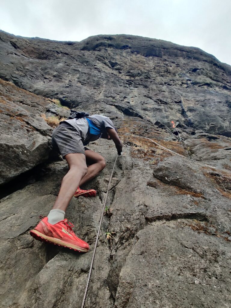
- Gorakhgad & Machhindragad – we can descend the Ahupe Ghat to the Konkan plains below where we can hike up Gorakhgad pinnacle. The nearby Machhindragad pinnacle is a technical climb
- Budra Nadi – after Ahupe we proceed Northeast along small tar roads for a good distance till we hit the small hamlet of Done where we get into a dirt track that takes us North back to the Deccan ridge and contours around the deep Budra Nadi river valley
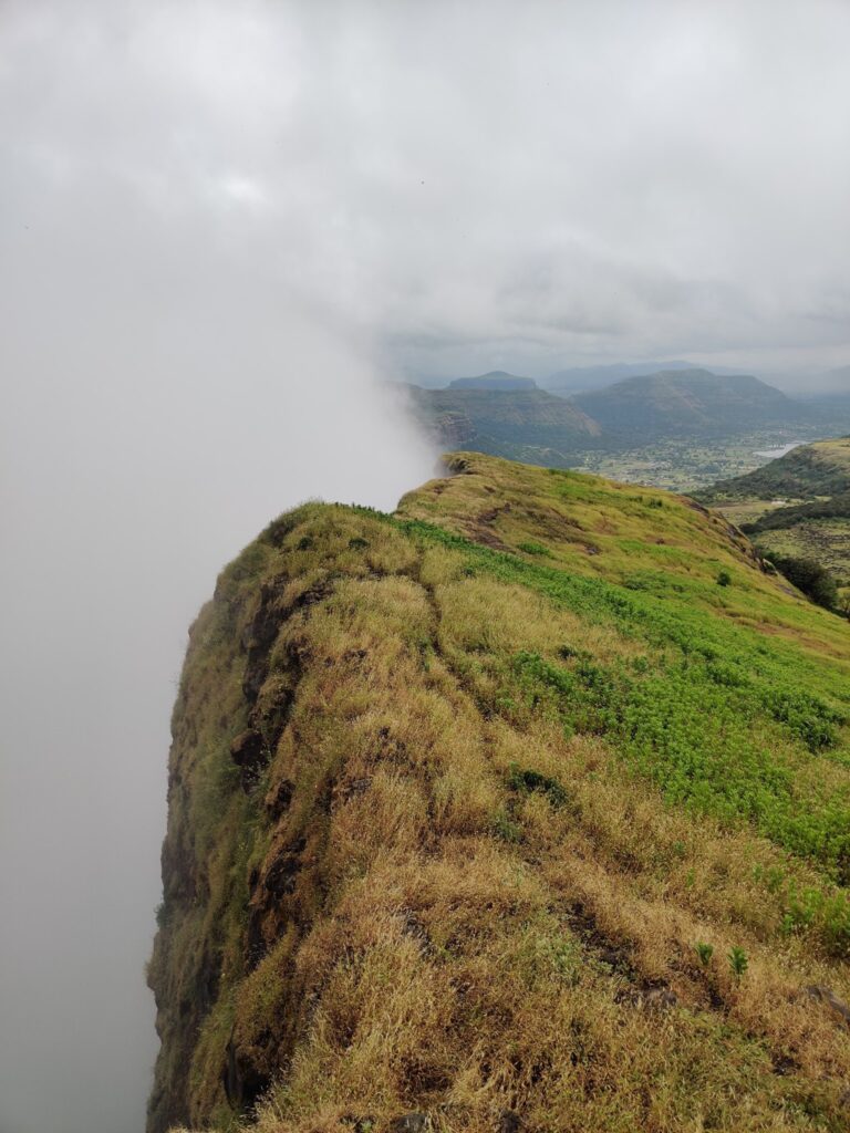
- Durga Fort – stunning views on the Konkan plains far below as we continue to walk along the Deccan ridge till we hit Durga fort
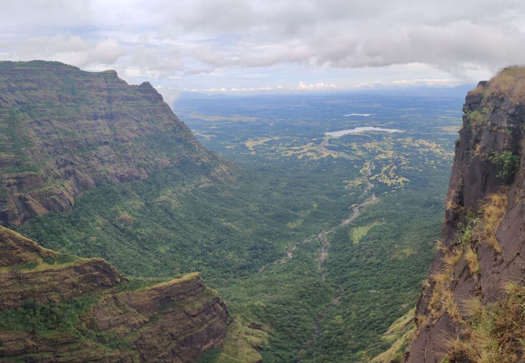
- Darya Ghat – the trail now contours Northeast around the Mina Nadi river valley towards Darya Ghat passing Dhakoba Fort along the way from which we get beautiful views on both the Konkan plains and Mina Nadi valley. Passing Darya Ghat we finally descend in Mina Nadi valley near the village of Pimpalwadi
- Nane Ghat – from Pimpalwadi in the Mina Nadi valley we climb up through a small saddle (1050m) through dense forest into the Kukadi river valley which flows down from Nane Ghat on the Deccan ridge.
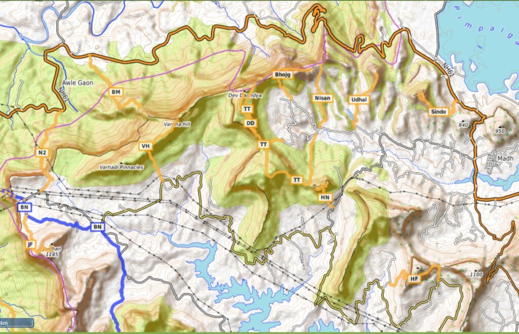
- Jivdhan Fort – near Nane Ghat we can climb the Jivdhan fort overlooking the Konkan plains far below. Several forts overlook the Mina Nadi valley including Chawand, Shivneri, Hadsar, Nimgiri and Hanumangad. Nearby peaks which can be climbed include Vardha Hill, Dev Daundya and Hatkeshwar to Lenyardi caves.
- Ganesh Khind pass takes us to the next Pushpavati Nadi river valley (Pimpalgaon Joga Reservoir) where we find Sindola fort, Udhaya Dongar, Nisanicha Dara, Bhojgiri, Talmachi Taleran and Harishchandragad fort.