
This mesmerizing 80km traverse connects 15 forts and peaks through beautiful forest and ridgeline trails around the old Bhandardhara reservoir (Arthur lake): the popular AMK (Alang-Madan-Kulang) traverse, Sakira and Kalsubai peaks, Pabargat fort, Sindola & Muthkel peaks, Bhairavgad (Shirpunji), Ghanchakkar, Mudha Dongar & Katrabai peaks, Ratangad Fort, Shipnur Dongar and Pandhara peak totaling 4800 meters of elevation gain.
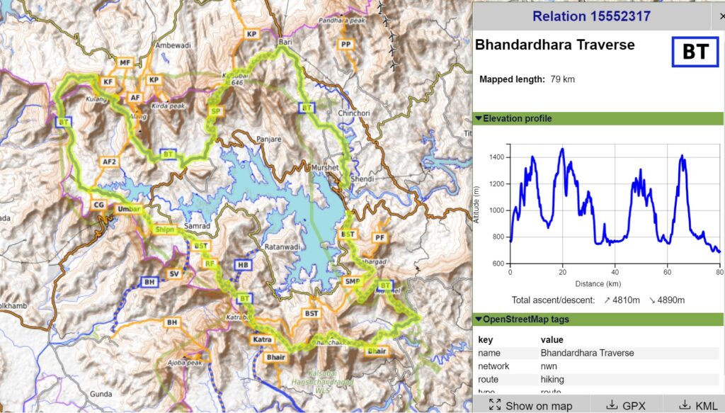
It can be done as a multi-day hike with food supply and night halt in the surrounding villages or camping on top of forts offering mesmerizing views on the surrounding region. In Autumn 2019 I completed the entire Bhandardhara traverse in 4 days (50km/day). The same can be done more relaxed in around 1 full week (30km/day) or if insufficient time available one can break it down in smaller sections.
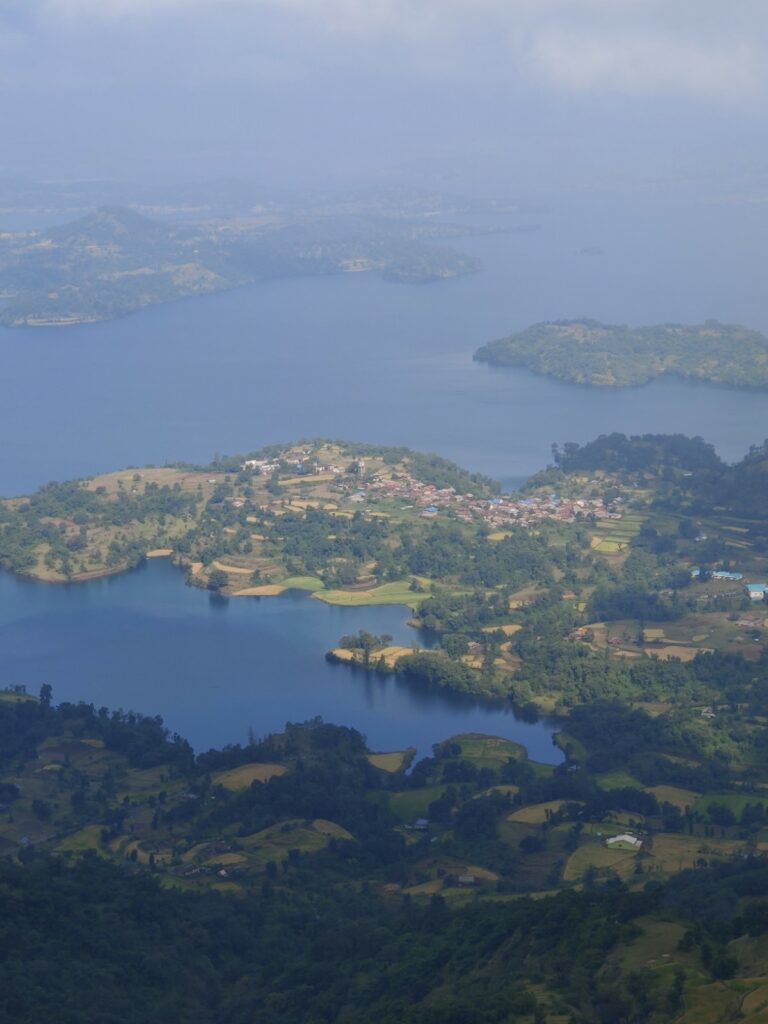
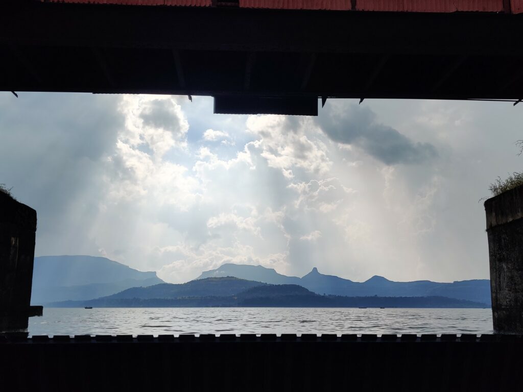
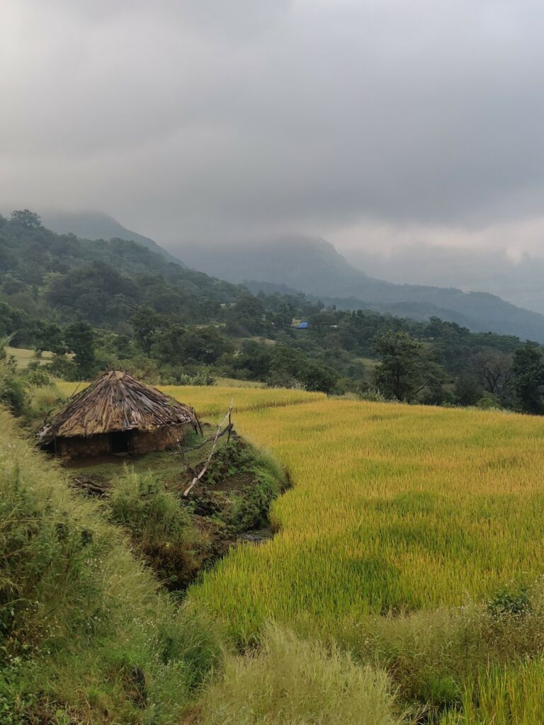
- Bhandardhara dam to Pabargad – the traverse starts from the Bhandardhara dam, one of the oldest dams in Maharastra built during the British era. Optionally we can take a small diversion to climb up Pabargad – 3.5km and 550m+ climb. From the base of Pabargad the trail gently climbs up and proceeds mid-way the Southern slopes through remote farming settlements offering scenic views on the reservoir North.
- Sindola – Mukhtel Peaks – 8km / 720m+ from mid-way section a trail steeply climbs up through a gully to top ridgeline above where we traverse the Sindola (1400m) and Mukhtel (1430m) peaks separated by a small saddle. Birds eye views from the top on the Bhandardhara reservoir (750m) far below. We descend East from Mukthel in the Kundi river valley.
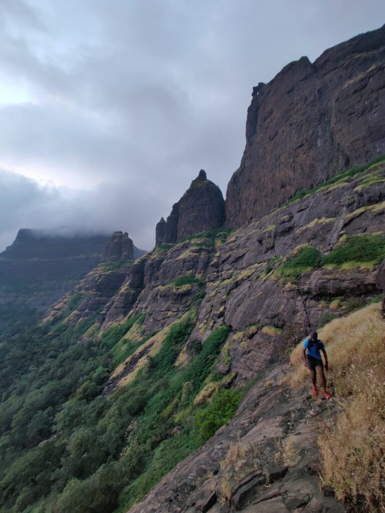
- Bhairavgad – Ghanchakkar 16km / 950m+ crossing the Kundi river we climb up South to Sirpunji on Bhairavgad peak (1250m). From here we proceed West along the main ridge to Ghangchakkar peak (1470m) offering mesmerizing views on the Bhandardhara reservoir to the North
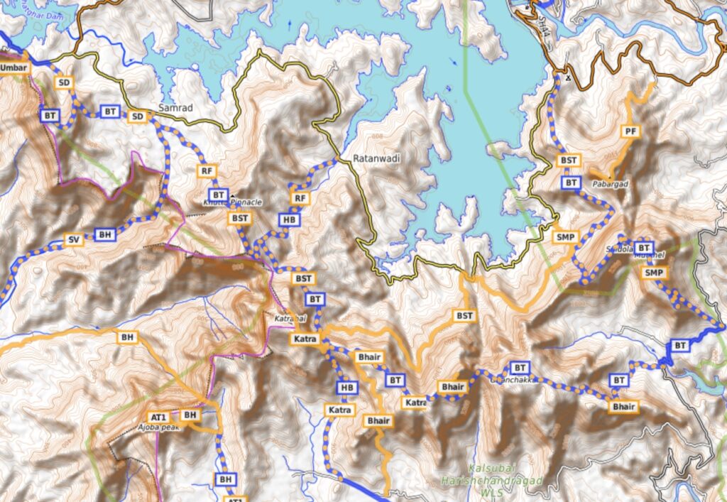
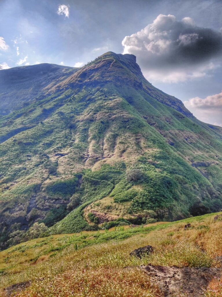
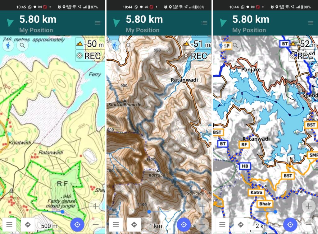
- Katrabai – we dip through a small saddle and proceed further West along the ridgeline passing Mudha Dongar peak (1450m) to Katrabai peak (1400m) offering offering birds eye views on the surrounding Konkan plains far below
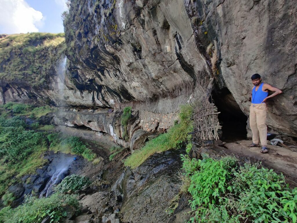
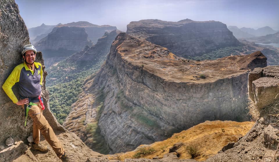
- Ratangad Fort – from Katrabai it’s a short hike to nearby Ratangad fort easily identified through the Khutta pinnacle. From the top of Ratangad we get beautiful views both on the Bhandardhara reservoir (East) and Konkan plains (west) below. From the South side of Ratangad steep near vertical cliffs dropping down into the plains below
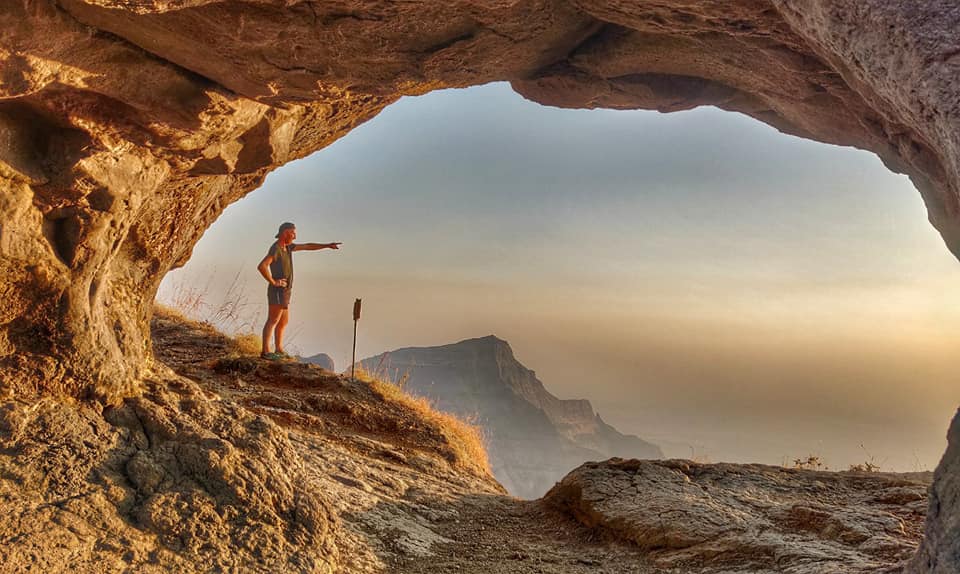
- Shipnur Dongar – after descending form Ratangad we can climb the Shipnur Dongar peak (1070m) located on the main Deccan ridgeline offering excellent views on the steep drop to the Konkan plains below
- Optionally we can descend the Deccan plateau through Umbardara (1.2km / 400m -) and climb back up via Chondhe Ghat (2.3km / 460m+)
- West Bhandardhara plains – next follows a horizontal traverse of the grass plains West of Bhandardhara to the base of Kulang fort. Stunning views as we walk along the Deccan ridge which steeply drops down to the Konkan plains
- Kulang–Madan–Alang traverse – we now climb up along a ridge and contour around to the North of Kulang where we ascent to the top ridgeline and traverse around Kulang-Madan-Alang forts offering mesmerizing views on both North region around Igatpuri and South to the Bhandardhara reservoir. We finally descend from Alang to the reservoir
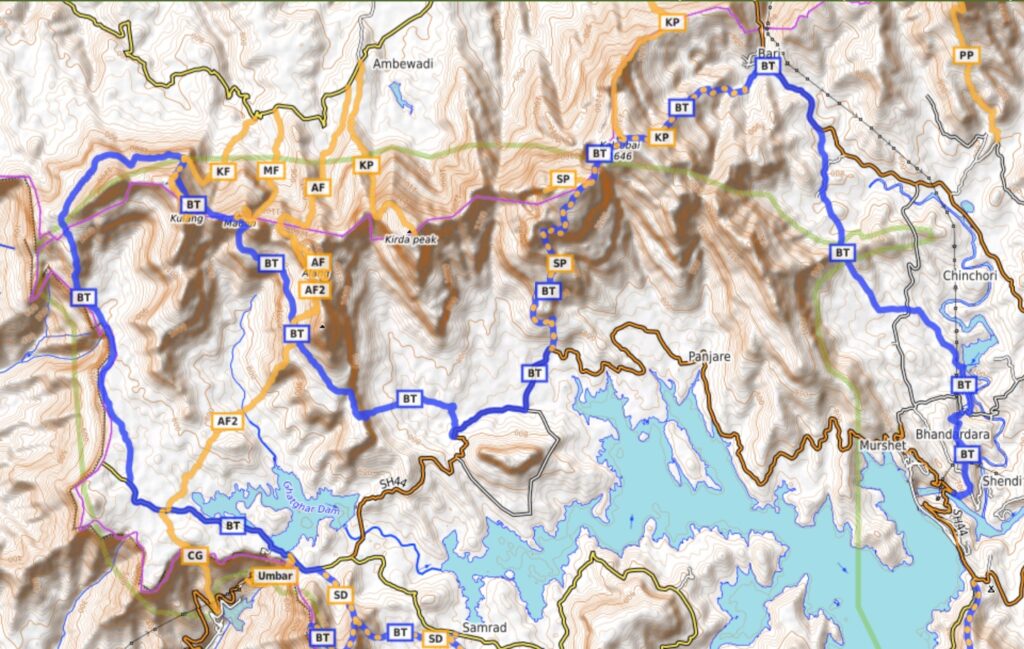
- Sakira – Kalsubai peaks – we climb back up out of the reservoir to Sakira (1500m) from where we connect to Kalsubai at 1646m the highest peak in the region offering 360 degrees views on the surrounding landscape
- Kalsubai to Bhandardhara dam – we finally descend from Kalsubai back to the British era dam to the East of the reservoir
- After descending from Kalsubai we can optionally climb the Pandhara peak (4km / 600m+) to the East or the Kirda peak (4km / 700m+) to the West
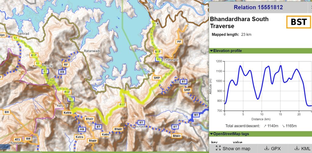
Bhandardhara South Traverse
An equally beautiful but shorter option is the South Traverse which covers 23km and 1150m of elevation gain along beautiful forest trails and remote hamlets mid-way the Southern slopes of the Bhandardhara reservoir from Pabargad to Ratangad.
The above traverses can be easily planned & navigated using mobile through offline Open Street Maps and Survey of India Maps offering rich terrain details including topography, trails, forts, hamlets, etc. My favorite app is OSMAnd.
Stunning !!
It’s quite ultra.