
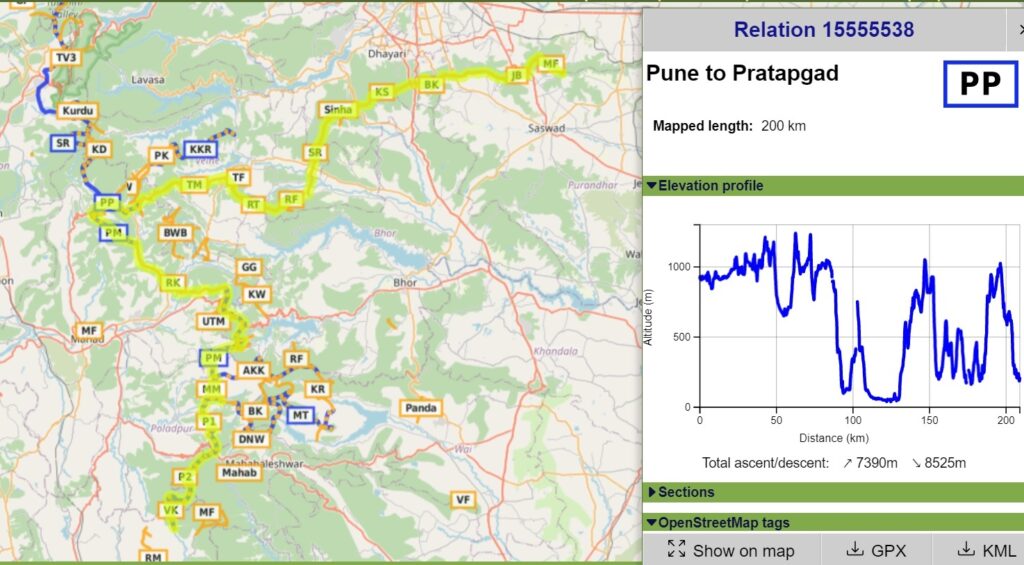
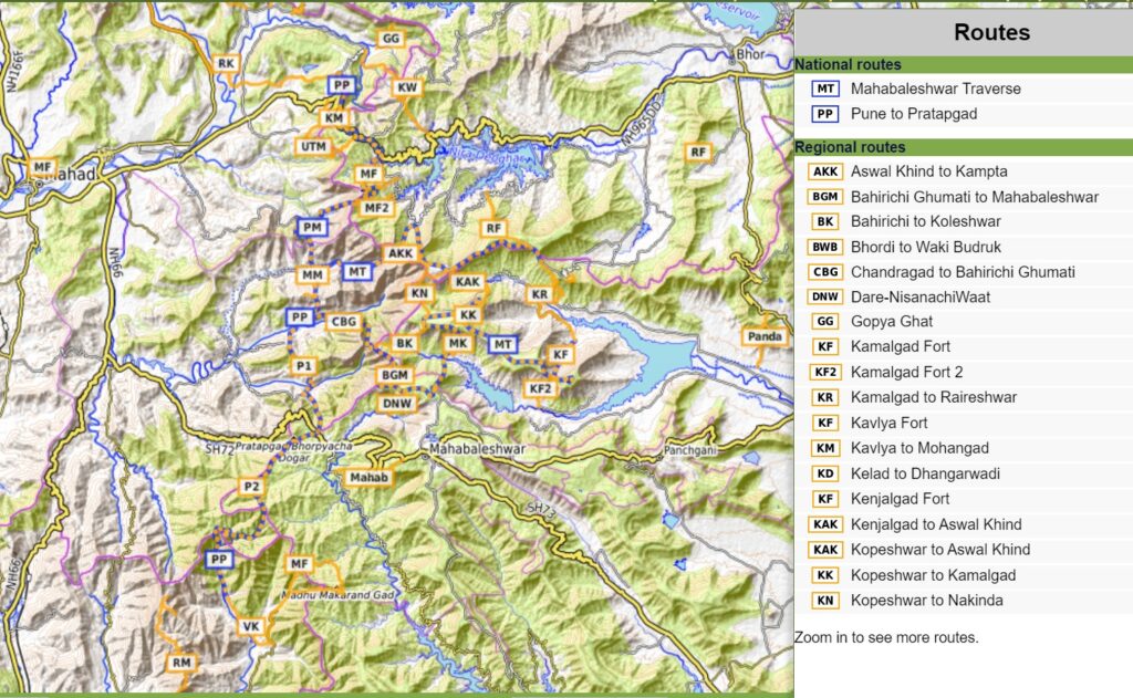
This 200km long continuous traverse takes you across 11 different forts starting near Pune and proceeding West to Raigad before turning South towards Pratapgad in the Mahabaleshwar region. It has a staggering 7390m of elevation gain (85% of Everest’s height) due to the numerous in-between climbs and descends via Malhargad, Sinhagad, Rajgad, Torna, Linganga, Raigad, Kavlya, Mohangad, Mangalgad, Pratapgad and Makrangdad forts. Find more details on the individual sections below.
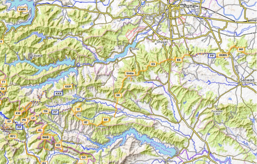
- Malhargad Fort to Dive Ghat – 7km / 200m+ ridgeline trail in South Pune from Malhargad Fort to Dive Ghat (road to Saswad)
- Dive Ghat to Bobdev Ghat – 12 km / 270m+ continue along Southern ridgeline from Dive to Bobdev Ghat offering birds eye views on Pune city to the North
- Bobdev Ghat to Katraj – 8 km / 250m+ proceeding further along the ridge from Bobdev to Katraj Gath (NH48)
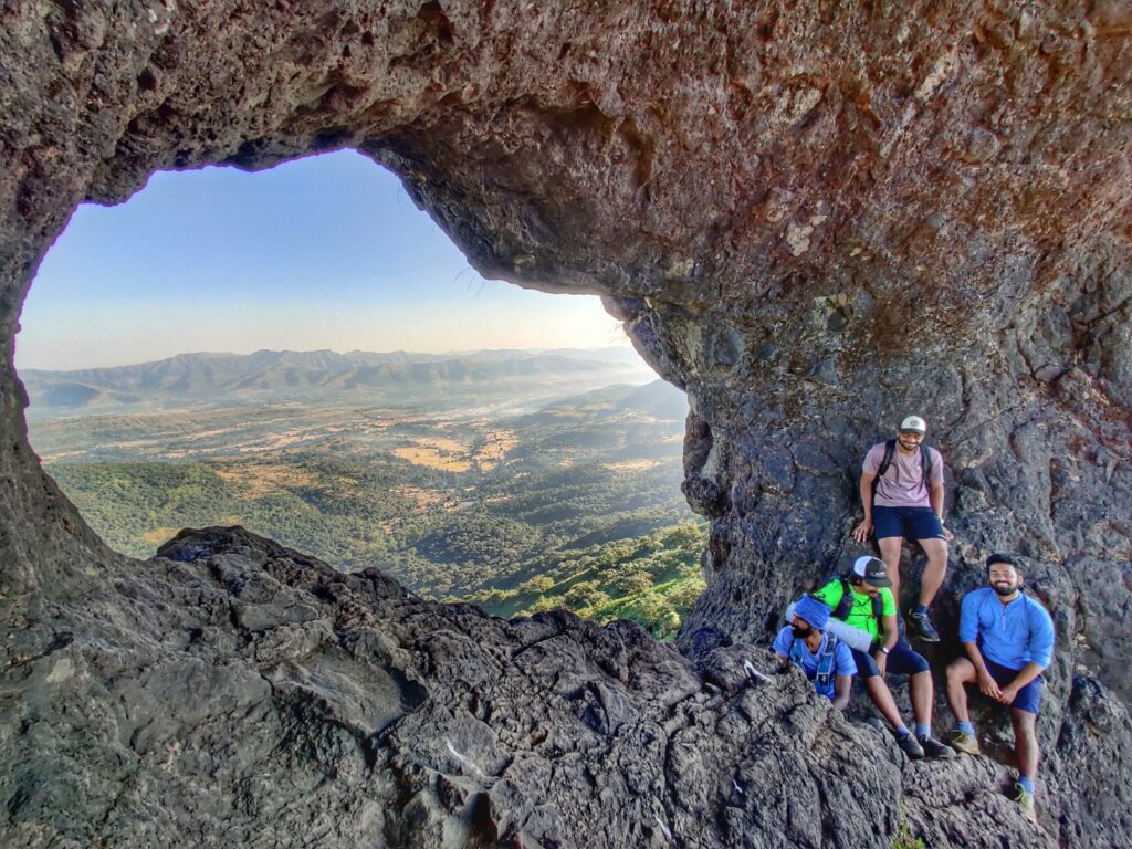
- Katraj to Sinhagad – 14km / 870m+ next section is a popular hiking route along a ridgeline traverse from Katraj Ghat all the way to Sinhagad Fort, Southwest of Pune
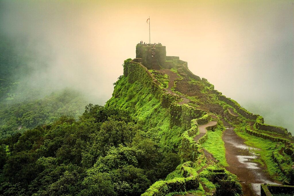
- Sinhagad to Rajgad – 14km / 250m+ from Sinhagad we proceed along the South ridge into the Kanandi river valley to Gunjavene were we climb up to Rajgad Ford the earlier capital of Chatrapatti Shivaji Maharaj’s kingdom overlooking Batghar reservoir
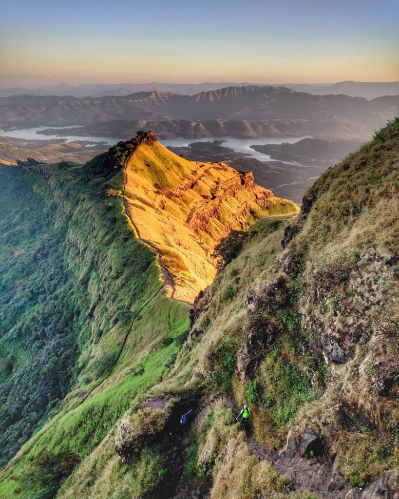
- Rajgad to Torna – 13km / 1050m+ next another popular route connecting along a Western ridgeline connecting Rajgad with neighboring Torna Fort

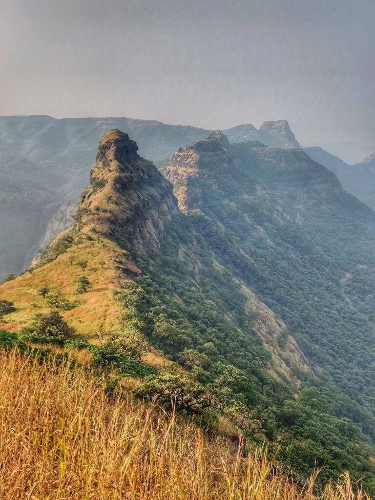
- Torna to Mohari – 14km / 310m+ a lesser known trail along a Western ridgeline connects Torna Fort directly to Mohari (Lingana Fort) overlooking the Kaal river valley
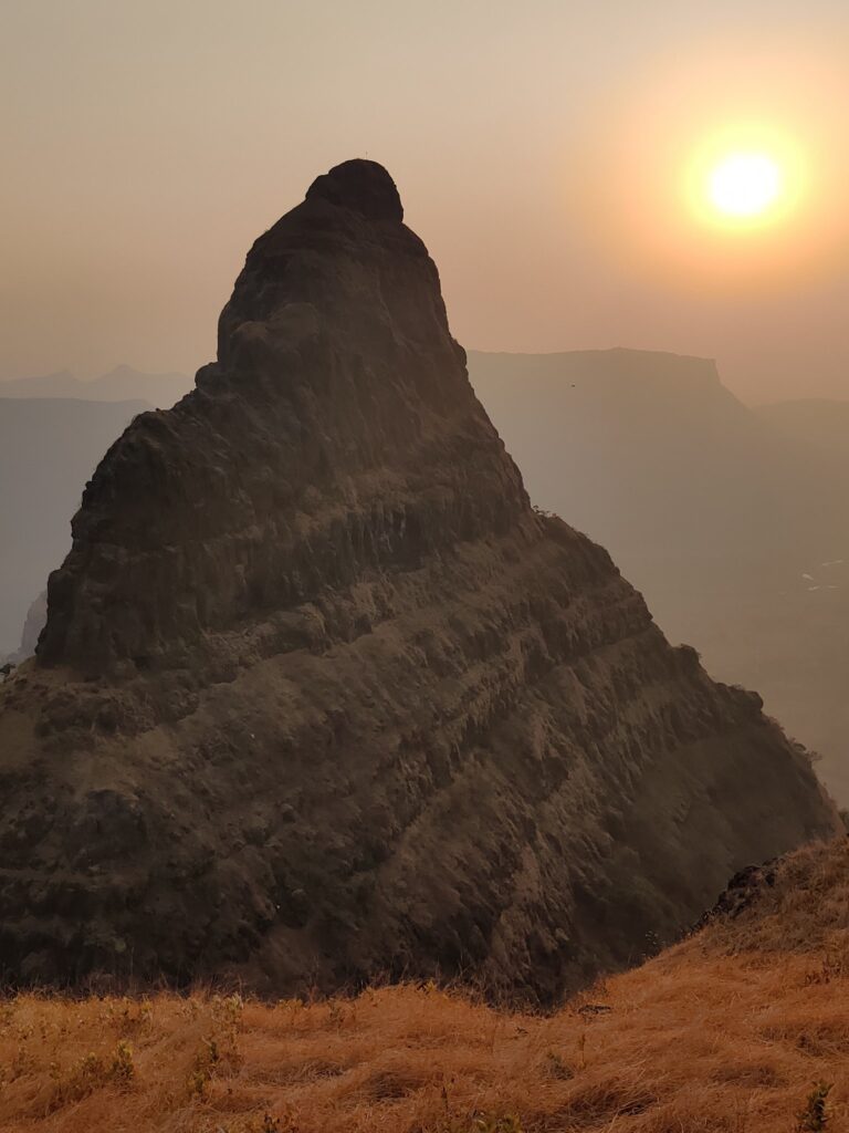
- Lingana Fort – 8km / 100m+ from Mohari village we descend steeply along Lingana Fort (old prison) pinnacle into the Kaal river valley below
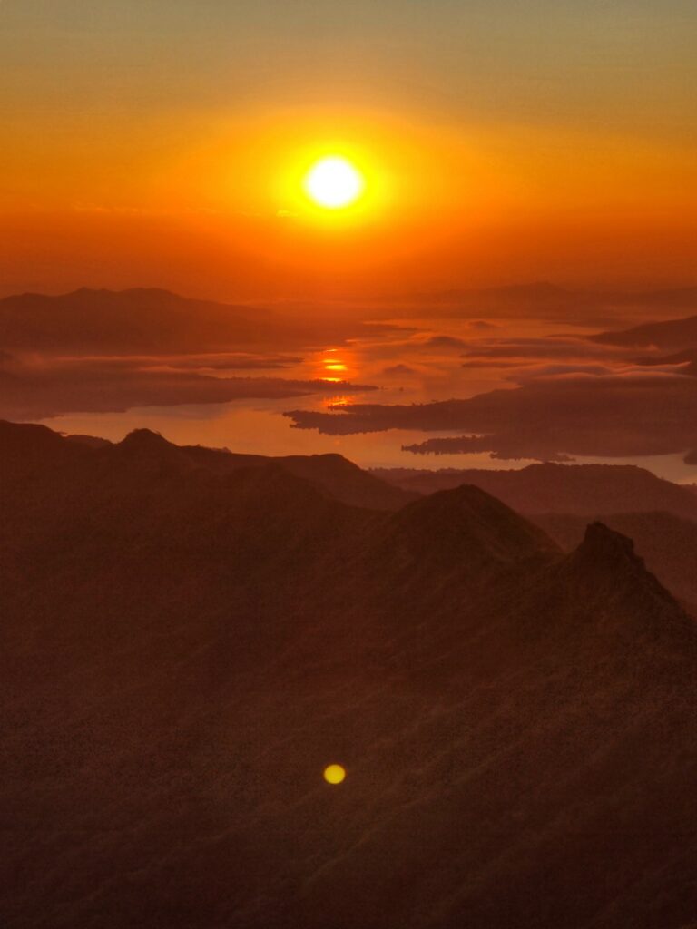
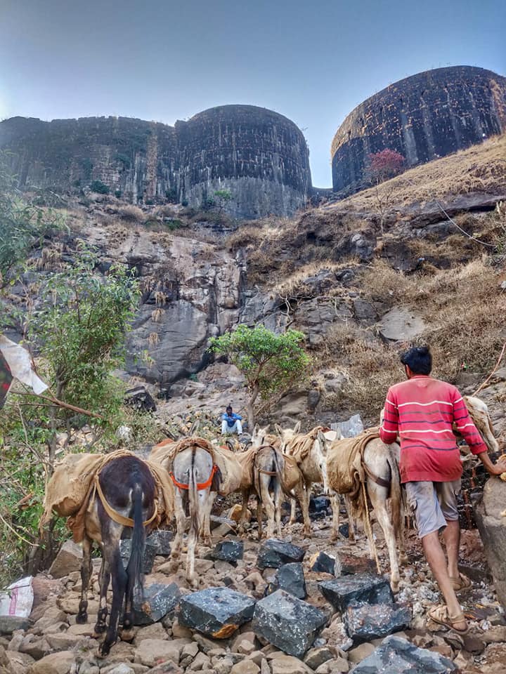
- Raigad Fort 1 – 13km / 800m+ climbing up West out of the Kaal river valley to Raigad Fort the capital of Chatrapatti Shivaji Maharaj’s kingdom
- Raigad Fort 2 – 9.5km / 0m descending South from Raigad Fort overlooking the Gandhari river valley into the Kaal river valley
- Raigad to Kavlya – 20km / 330m+ road section along the Kaal river, crossing the Kharak Nala and climbing up via a trail to the base of Kavlya fort
- Kavlya Fort – 2km / 290m+ lesser known fort near Varandha Ghat overlooking Kaal river and Kharak Nala valleys
- Kavlya to Mohangad – 9km / 500m+ Varandha Ghat road section from Kavlya to Mohangad passing the Nira Deoghar reservoir
- Mohangad Fort – 10km / 600m+ climbing up Mohangad Fort from North ridge and descending West into the Kaal river valley
- Mangalgad Fort – 11km / 700m+ climbing out of the Kaal river valley to Mangalhad and into the Konya river valley (Kamta Nala) of Mahabaleshwar
- Mahadev Mandir – 8.5km / 360m+ climbing out of Kamta Nala across a small ridgeline via Mahadev Mandir into the Dhavli Nala both tributaries of Konya river
- Pratapgad Fort (North) – 13km / 1300m+ from the Dhavli Nala stream we climb up South over the ridgeline, bypassing Chandragad fort and descending into the the Konya river valley to climb up again to Pratapgad fort
- Pratapgad Fort (South) – 15km / 600m+ from Pratapgad fort we descend along a long Southwest ridgeline into the Jagbudi river valley
- Makrangdad Fort – 15km / 1350m+ climbing Northeast out of the Jagbudi river valley to Makrangdad fort overlooking the Konya reservoir
- Optionally we can add the nearby Rasalgad-Sumargad-Mahipatgad section over 26km / 1150m+ overseeing the Dholio and Konya river valleys
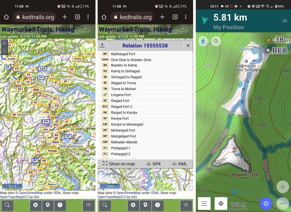
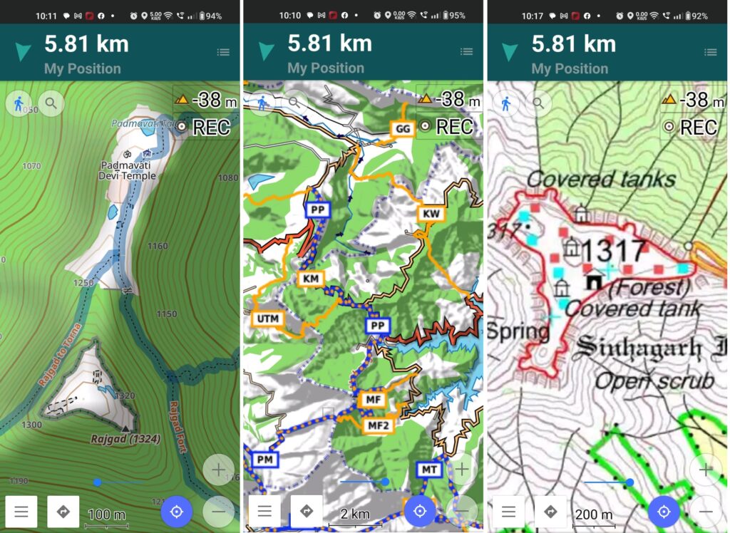
The above traverses can be easily planned & navigated using mobile through offline Open Street Maps and Survey of India Maps offering rich terrain details including topography, trails, forts, hamlets, etc. My favorite app is OSMAnd.
References
- Webinar Pune to Mahabaleshwar / part 1
- Webinar Pune to Mahabaleshwar / part 2
- Pune to Mahabaleshwar traverse
- Sinhangad-Rajgad-Torna traverse