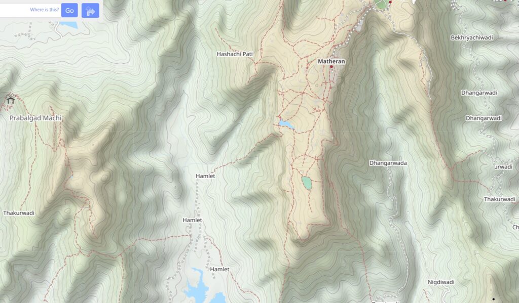
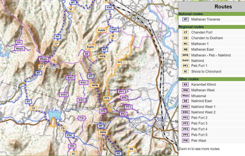
The Matheran range between Panvel (Mumbai, West) and the Uhlas river valley (East) is a true hikers paradise with many scenic trails and dotted with small hamlets and remote dwellings on its forested slopes. The extensive route network consists of short hikes (local, purple), day hikes (regional, orange) and longer traverses (blue, national).
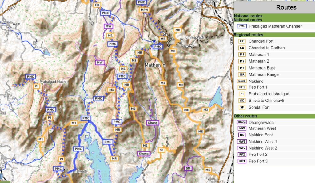
Here we take a closer look at a beautiful 80km trail circuit which takes you across the entire Matheran range connecting several regional trails. This traverse covers 4300 meters of elevation gain (climb) across 8 forts and peaks including Kalavantin Durg, Prabalgad, Ishralgad, Matheran, Sondai, Peb (Vikatgad), Nakind and Chandheri. Let’s take a detailed look at the individual sections below.
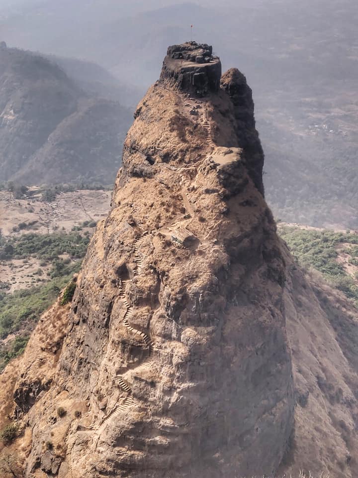
- Kalavantin Durg – 5km / 650m+ starting at Thakurwadi village (near Panvel) on the Western base of the Matheran range we climb up along a dirt track to Prabalgad Machi, a remote village at 450m located on the mid-way slopes. From here we climb up steeply to the popular pinnacle of Kalavantin Durg offering spectacular views on the surrounding Konkan plains and Prabalgad plateau.
- Prabalgad – 16km / 1100m+ from the saddle near Kalavantin Durg we contour below the steep Western rock face and climb up through a small gully towards the top of Prabalgad (750m). Here we get birds eye views on Kalavantin Durg (North) and ridgeline to Ishralgad (South).
- Ishralgad – mid way the Prabalgad plateau we descend through a gully to a mid-way trail which contours mid-way along the Western slopes to a long ridgeline that leads us to Ishralgad fort (500m) on the Southern end. 360 degree views on the Morbe Dharan reservoir (East) and Matheran (Northeast).
- Morbe Dharan – from Ishralgad we descend East to the village of Ishralwadi and tour around the large Morbe Dharan reservoir till the Southern tip of Matheran.
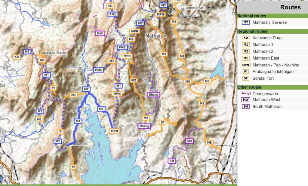
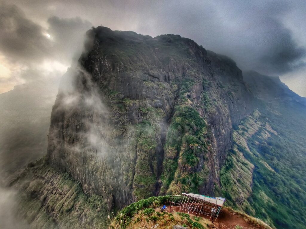
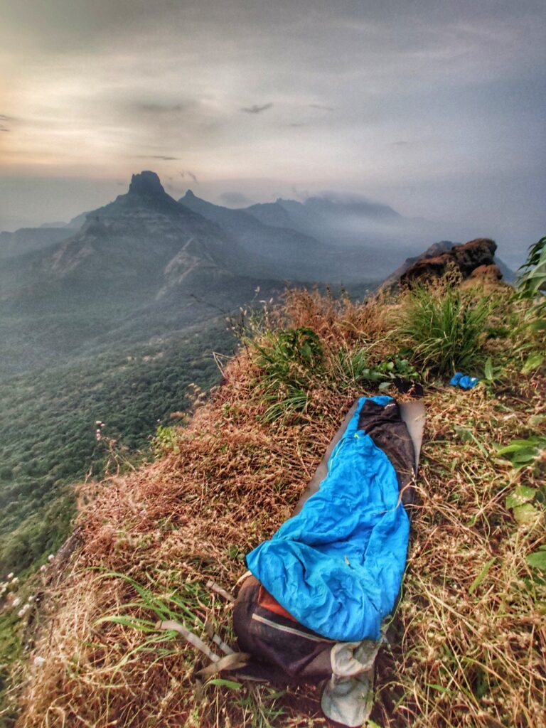
- Matheran – we climb up the Southern ridgeline to the top of the Matheran plateau (750m) and proceed North across the densely forested plateau till we hit the main ghat road where we descend and jump onto the deserted railway track (550m).
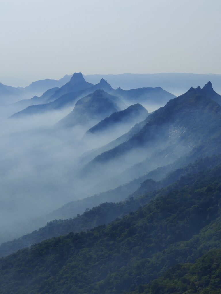
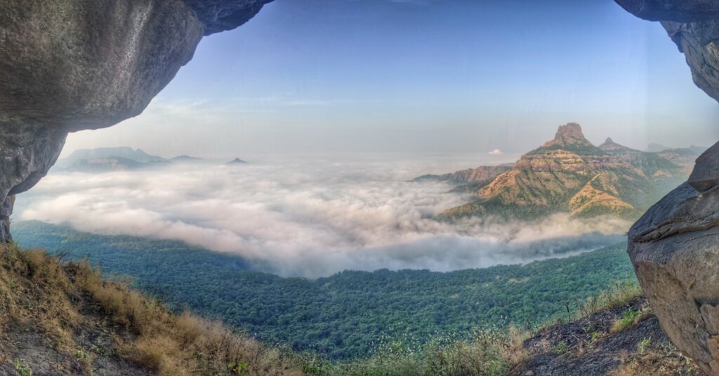
- Peb Fort – the railway track offers birds eye views on the Uhlas river valley to the East. The track contours North around the Matheran plateau after we proceed North along a prolonged ridgeline to Ped fort (Vikatgad, 640m). There are 5 different trails from the Uhlas valley climbing up to Peb fort.
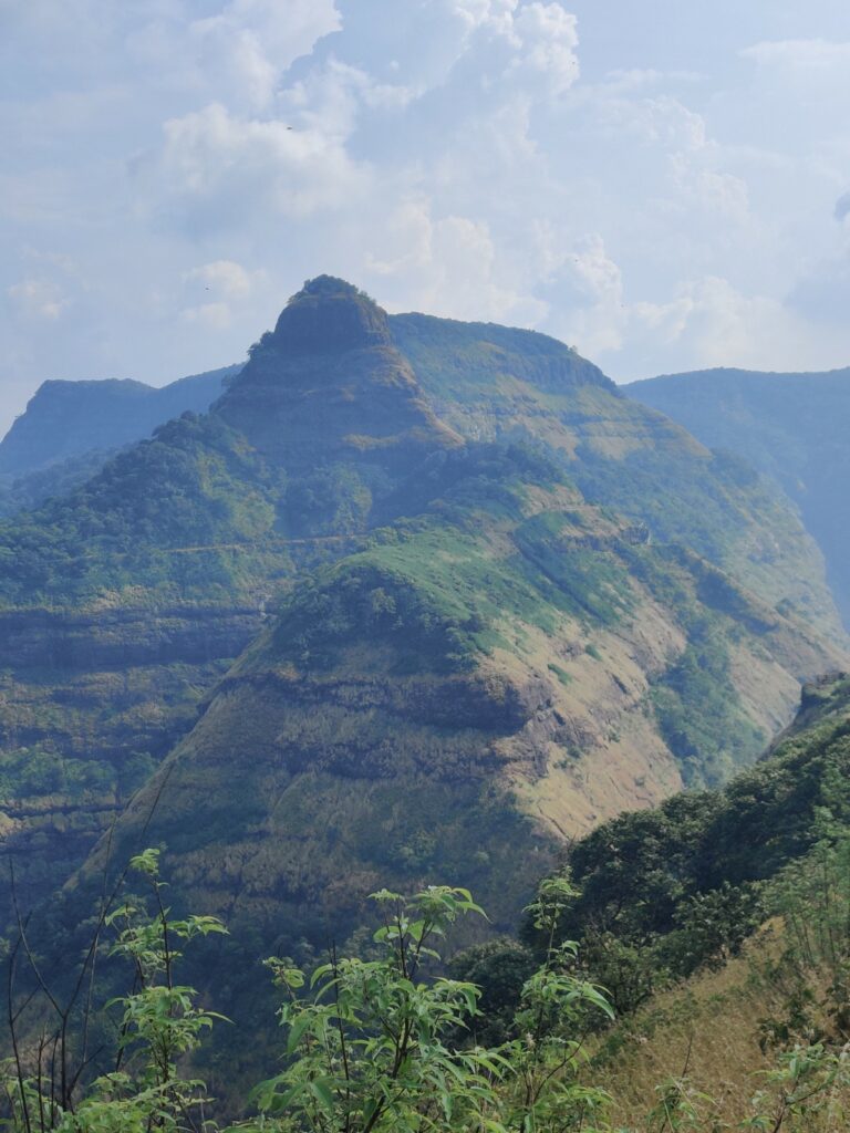
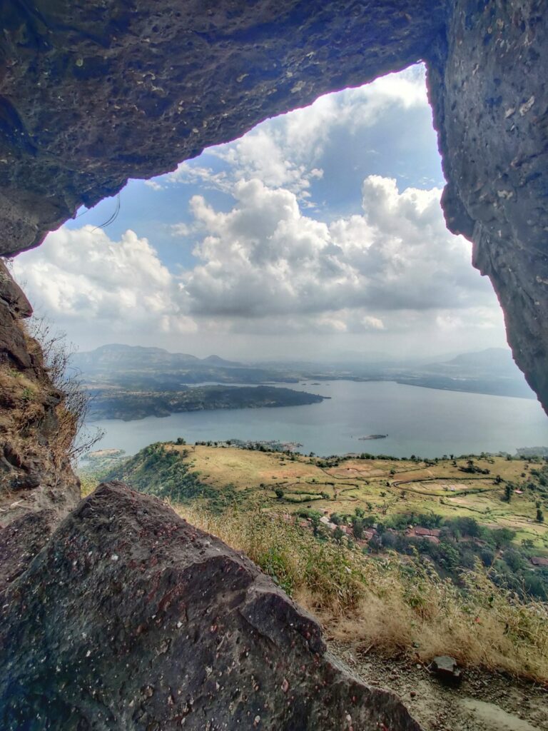
- Nakhind (550m) – from Peb fort we proceed North along a long ridgeline offering beautiful views on both Konkan plains (West) and Uhlas valley (East). The ridge trail is less used and covered with vegetation post monsoon. Nakhind is a small peak with a pin hole offering nice views on nearby Chanderi fort. There are several trails East/North/West around Nakhind connecting remote dwellings.
- Chanderi Fort – 7.5km / From Nakhind we descend East into the Uhlas river valley and climb back up West to Chanderi Fort (700m) which has a unique profile. We descend along the Ghade Nadi to the Western plains.
- Chanderi to Dodhani – 8km Southwest through the plains till we hit the base of Matheran again
- Matheran – Prabalgad – 15km / 1100m+ we climb up again to the Matheran plateau (750m) through the Northern slopes and descend back Southwest to the Morbe Dharam reservoir. We climb back up West to the Prabalgad-Ishralgad ridgeline and immediately descend into the Western plains (NH48)

References