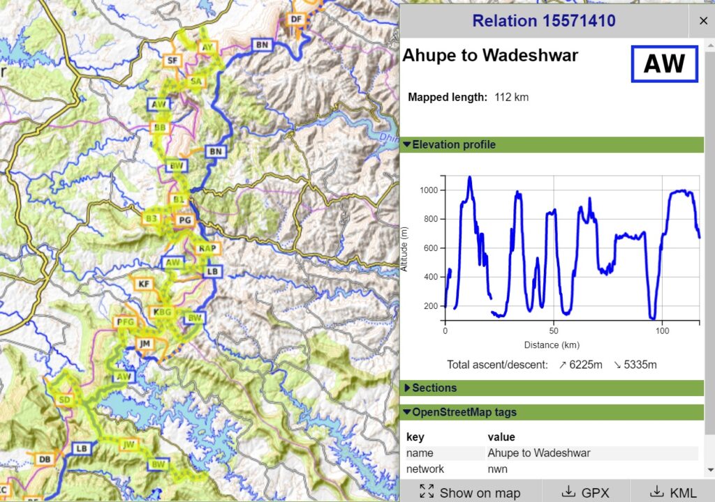
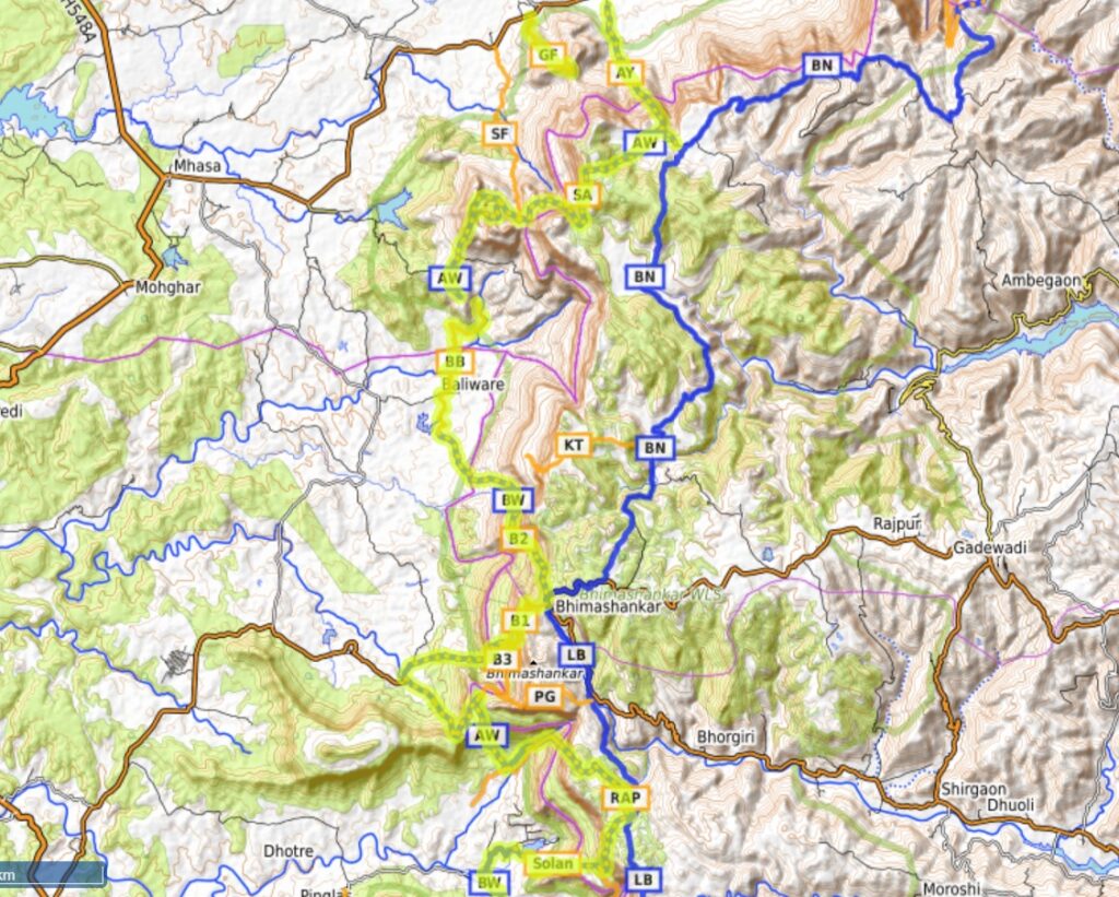
This 112km continuous traverse across 6200 meters of elevation gain (climb) goes North-South in parallel with the Lonavala – Naneghat traverse while ascending / descending multiple times between Konkan plains and Deccan ridge covering 16 forts, valleys, ghats and lakes including Barvi river valley, Gorakhgad, Ahupe ghat, Siddhagad, Poshir river valley, Bhimashankar, Khandas Nadi river valley, Padargad fort, Pedhyacha Ghat, Shilhar Nadi valley, Kothaligad fort, Bhama Nadi valley, Konkand Bail Ghat, Andhra lake, Pej Nadi valley, Sai Dongar and Wadeshwar. Let’s take a closer look at the individual sections below:
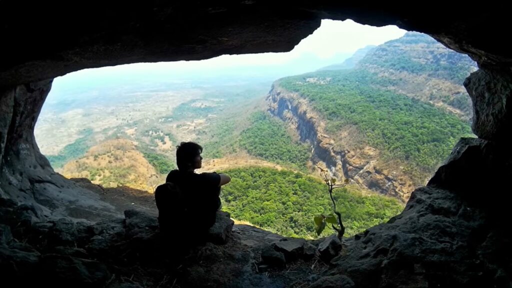
- Gorakhgad Fort – 2.5km / 350m+ we start this traverse in the Konkan plains near Uchale village (SH37) where we climb up the Gorakhgad fort (520m) pinnacle offering imposing views on the nearby Deccan ridge. We also see the nearby pinnacle of Machchindragad fort (technical climb).
- Ahupe ghat – 4km / 760m+ near Khopivli village we hike up steeply to the Deccan ridge via Ahupe ghat (910m). Mesmerizing views from the top on the Konkan plains (Barvi river valley + Barvi lake) below.
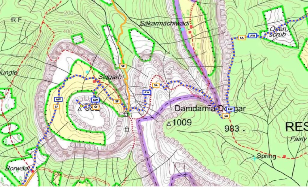
- Ahupe to Siddhagad – 6km / 300m+ from Ahupe we climb up West on the Deccan ridge to 1000m and proceed South towards Damdamia Dongar (1009m) where we descend into a gully to 600m and contour West towards Sidgarh village (480m) located on a mid-level plateau around Siddhagad peak.
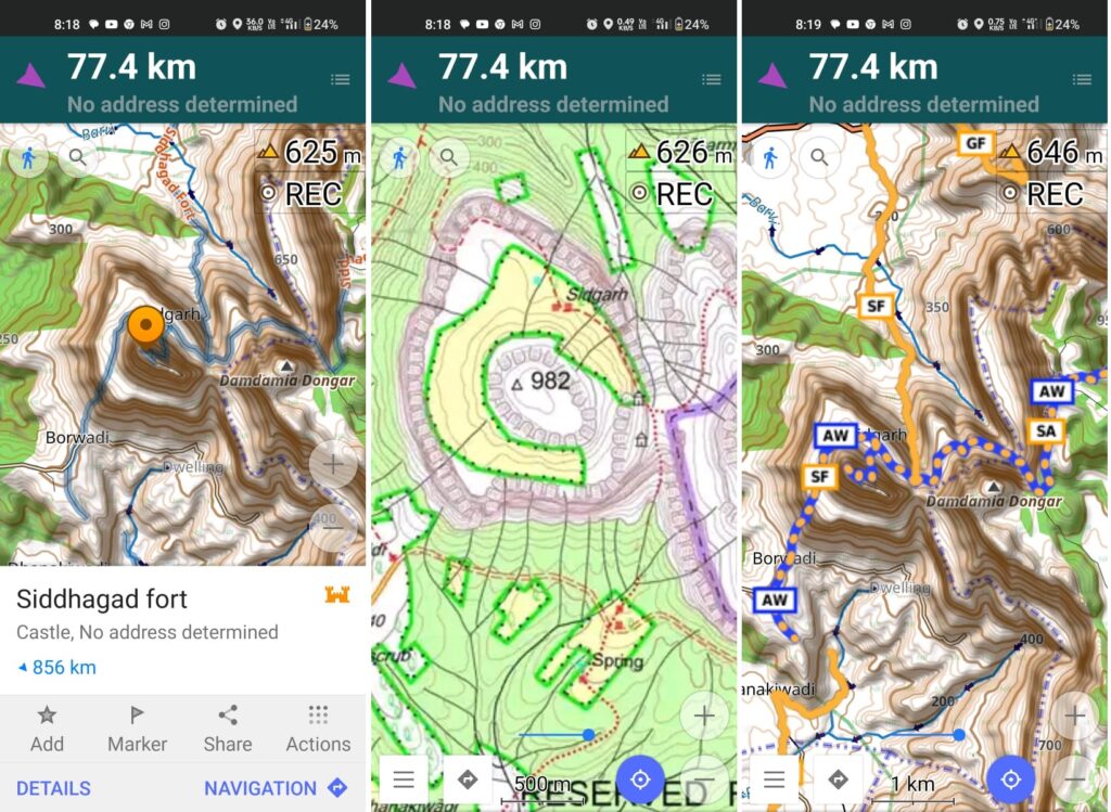
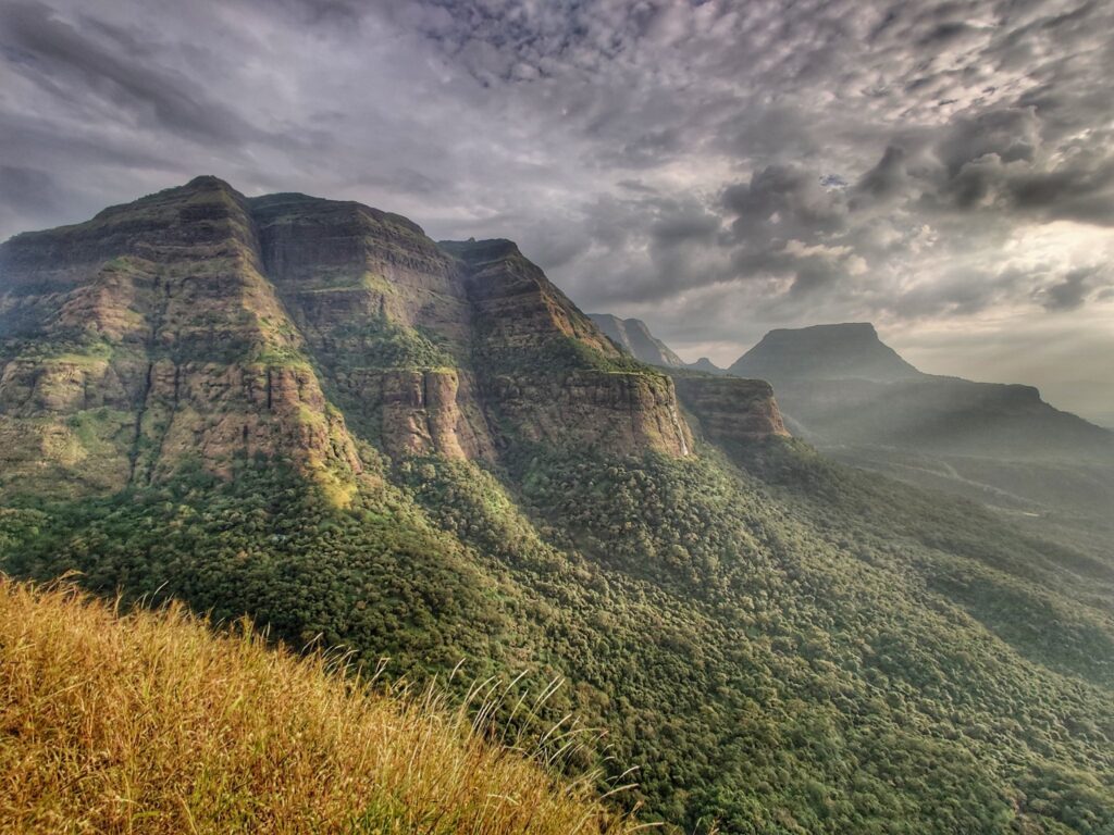
- Siddhagad Fort – from Sidgarh we climb up Siddhagad fort (980m) separated by a saddle from Damdamia Dongar. From the top of the fort we take in mesmerizing views on the nearby Deccan ridge (1000m).
- Poshir river valley – 6km / 60m- from Sidgarh village we climb up West and descend South into the Poshir river valley to the village of Borwadi. We descend further South along dirt tracks to Baliware village.
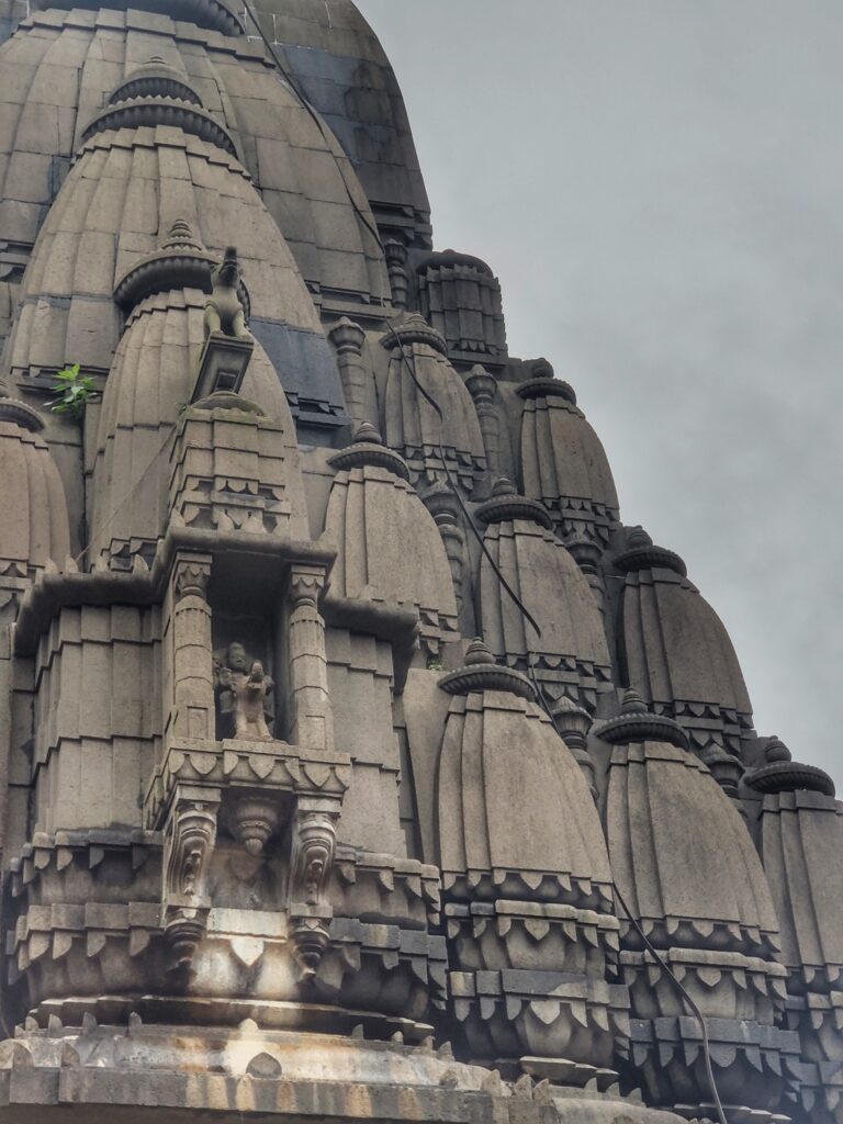
- Bhimashankar – 6km / 980m+ from Baliware village we climb up Southeast out of the Poshir river valley to Bhimashankar (950m) on the Deccan plateau, a well known Hindu pilgrim destination. Bhimashankar is accessible from various routes through the Konkan plains and Deccan plateau.
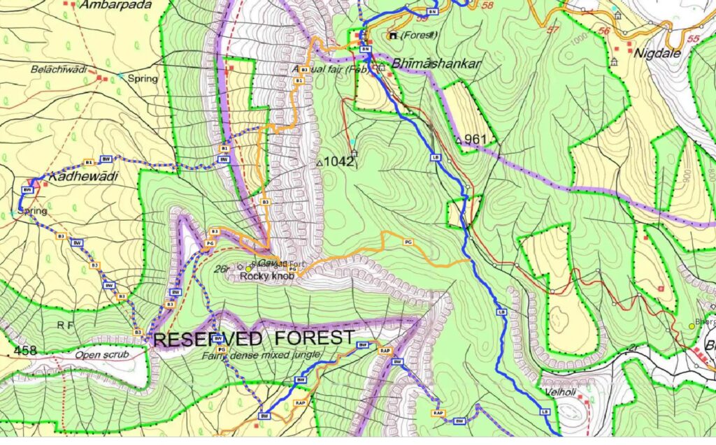
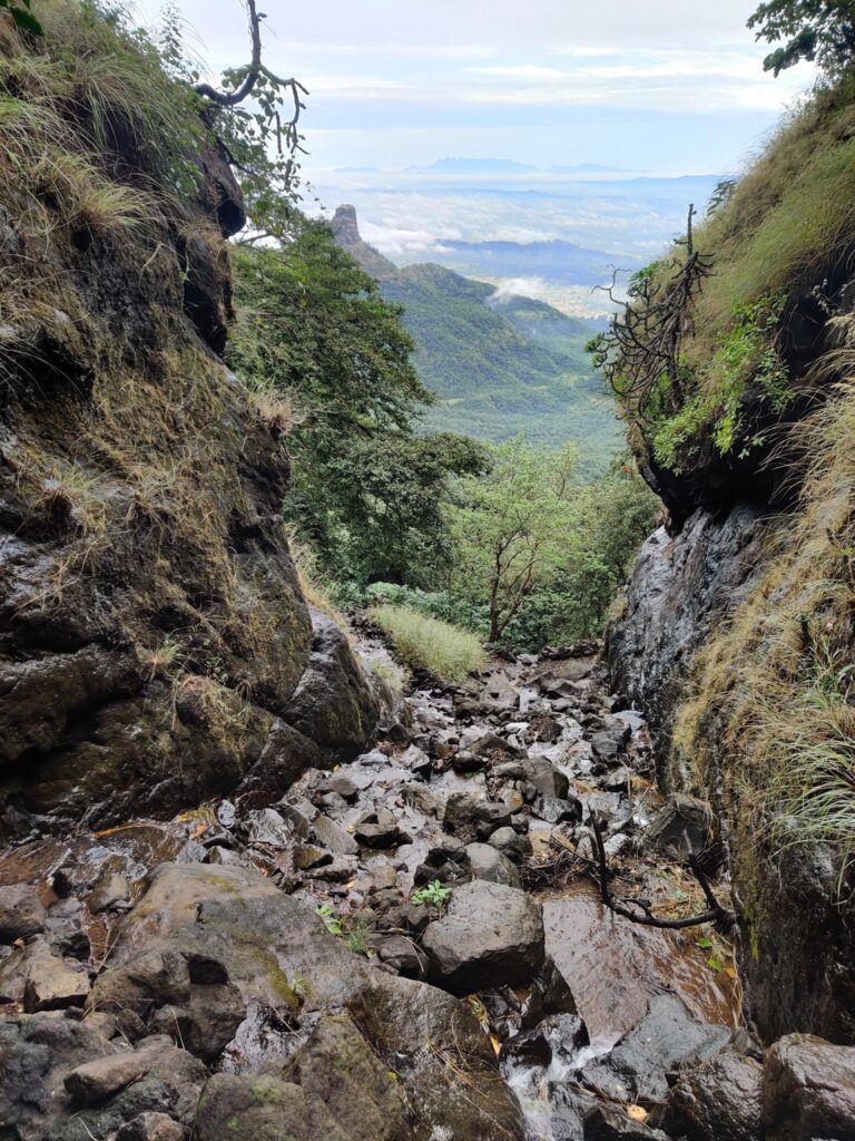
- Khandas Nadi valley – 5km / 820m- from Bhimashankar we descend Southwest back to the Konkan plains into the Khandas Nadi river valley near the village of Kadhewadi.
- Padargad fort – we climb up again Southeast out of the Kandas Nadi valley onto a ridge and proceed further up Northeast to Padargad fort (650m). We descend back South from Padargad into the neighboring Shilhar Nadi river valley.
- Shilhar Nadi valley – we climb back up Northeast out of the Shilhar Nadi river valley and turn Southeast to the Deccan plateau (850m). We proceed along the Deccan ridge South and descend West back to the Konkan plains into the Shilhar Nadi valley near Solandewadi village.
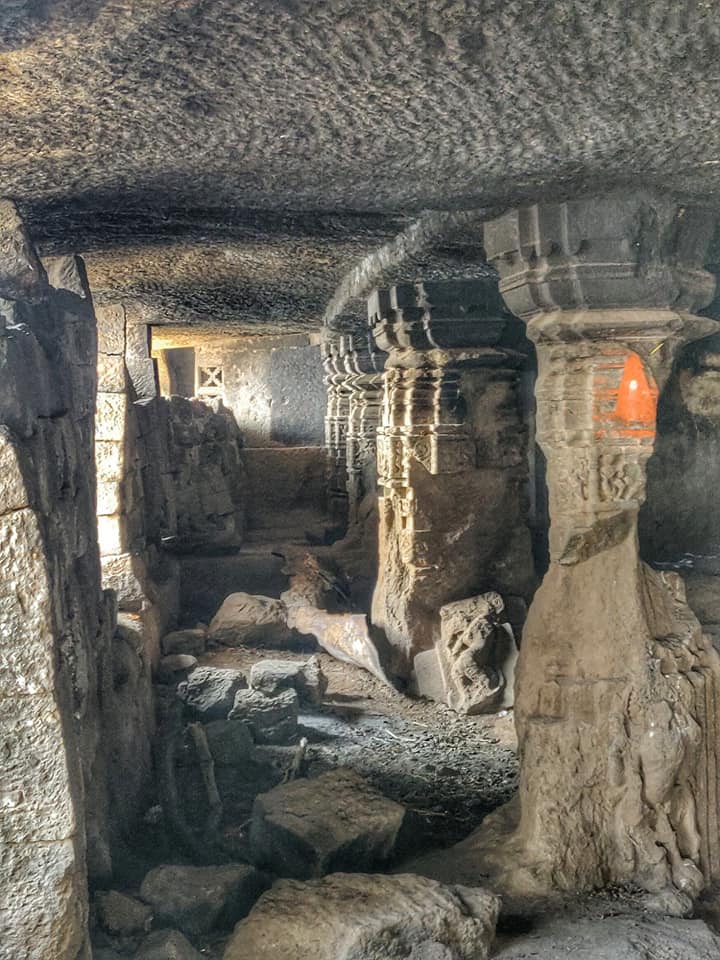
- Kothaligad – we now climb up South to Kothaligad fort (650m) located on a hillock separated by a small saddle from the main Deccan ridge overlooking both Shildar Nadi and Dhamnichi Nadi river valleys.
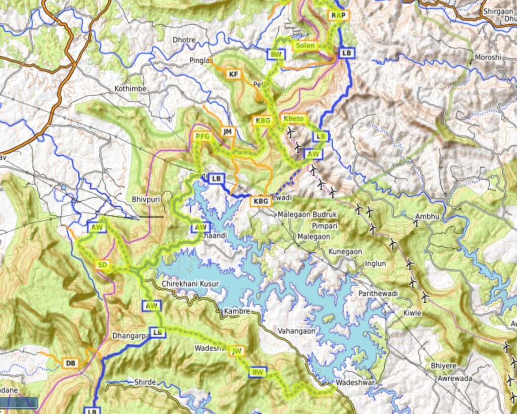
- Kethoba – from Kothaligad we climb up Southeast across the Deccan ridge through a small saddle (870m) and descend East into the Bhama Nadi river valley (flows into the Bhama Akshed reservoir) near the village of Padharwadi.
- Konkand Bail Ghat – we climb up Southwest out of the Bhama Nadi valley across the Deccan ridge through the Konkand Bail ghat (930m) and descend Northwest till mid-way (450m) the Deccan plateau into the Dhamnichi Nadi valley.
- Fenyadevi Ghat – we now contour at around 400m South and then West mid-way the Deccan ridge above the Dhamnichi Nadi valley before climbing back South via the Fenyadevi Ghat (650m) onto the Deccan plateau to Methalwadi village near the Andhra reservoir.
- Andhra lake – we proceed along a village road from Methalwadi to Kosur following Deccan ridge on West and Andhra lake on the East.
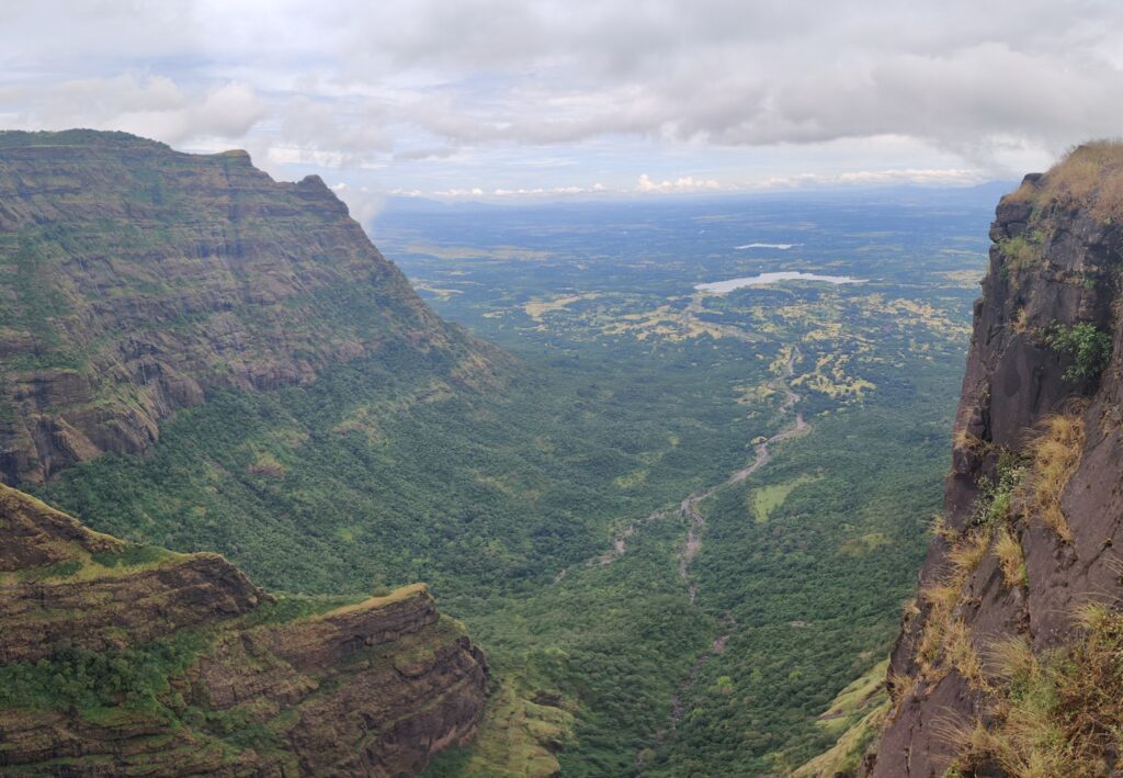
- Sai Dongar – 8km / 600m+ – from Kusur near Andhra lake we do one final descend to the Konkan plains into the Pej Nadi river valley and climb back up via Sai Dongar to the Andhra lake back on the Deccan plateau
- Jambhavali – Wadeshwar – 12km / 300m- the final section proceeds East mid-way a prolonged ridgeline South of the Andhra lake from Jambhavali village to Wadeshwar offering birds eye views on the entire length of the reservoir.
Navigation
Above traverses can be easily navigated using most mobile mapping apps – most use Open Street Maps as base maps which include tens of thousands of kilometers of trails in Himalayas, Sahyadri, etc. OSM maps can be downloaded on the phone for offline exploration of the mountains without mobile network. Contours can be added to understand the topography of the terrain. My favorite app is OSMAnd.