This 72km / 3700m+ circuit (loop) starts from Harishchandragad and proceeds North across the Deccan plateau towards the Bhandardhara reservoir where we take a U-turn back South while hopping between the Deccan ridge (ascend) and Konkan plains (descend) twice. The traverse covers 12 forts, peaks, valleys and lakes including Pimpalgaon reservoir, Harishchandragad fort, Kaladgad fort, Wakadi dongar, Katrabai, Ratangad, Bhandadara, Sandan valley, Ajoba peak, Komba Dongar, Napte Dongar, Sadaba Ohol valley and Harishchandragad.
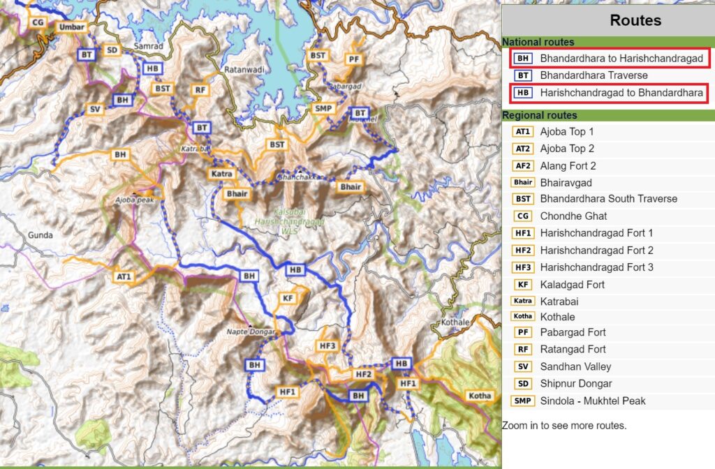
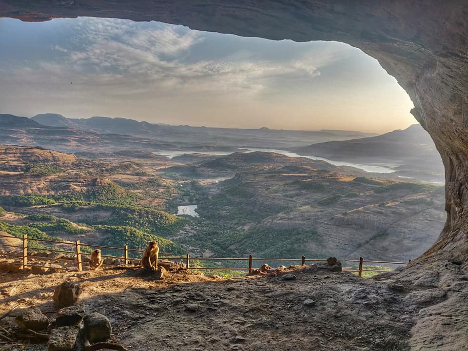
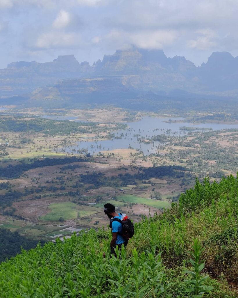
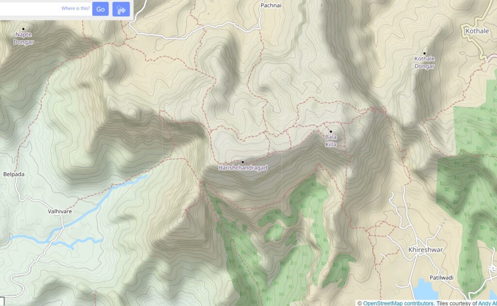
- Harishchandragad – we start from Khireshwar village near the Pimpalgaon Joga reservoir (Kukadi river valley which flows to Junar) where we climb up North in a side-valley to the Tolar Khind saddle. We climb up West to Bala Killa (1384m) and Harishchandragad fort offering spectacular views on the Pimpalgaon region and Kalu river valley South.
- Kaladgad Fort – we descend South into the Mula river valley where we can optionally climb up Kaladgad Fort on Bhairoba Dongar (1070m) offering birds eye views on the valley North
- Mula river valley – we now proceed Northwest across the vast open grass lands of Mula valley fording across the river and passing through remote tribal settlements till the village of Bonchiwadi.
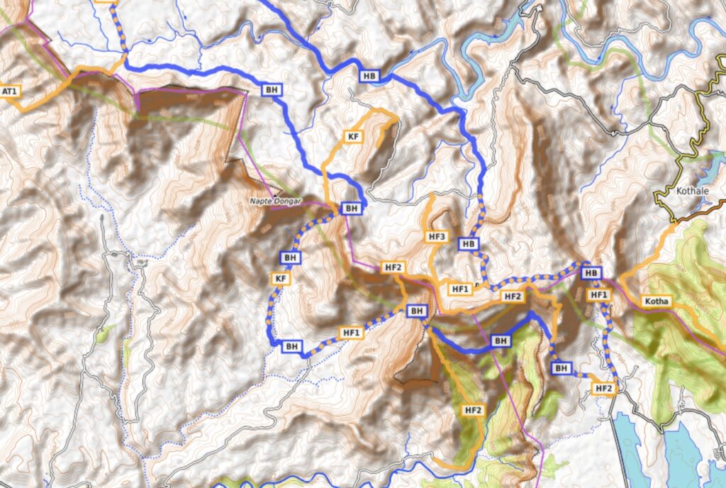
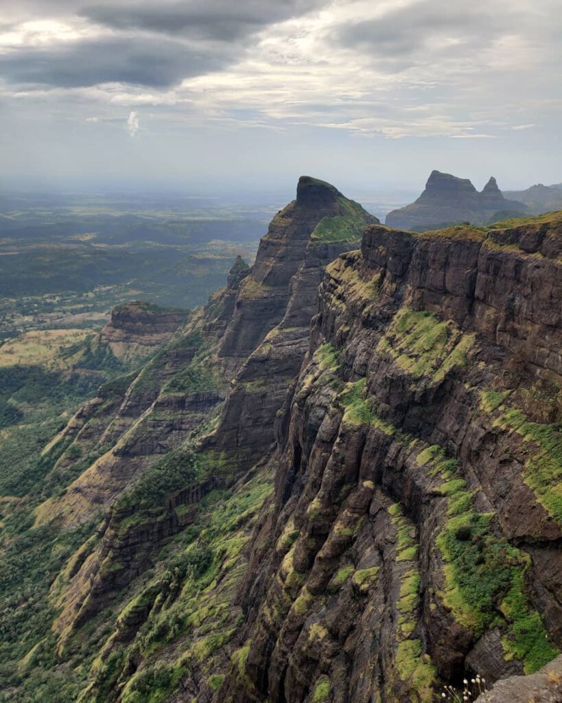
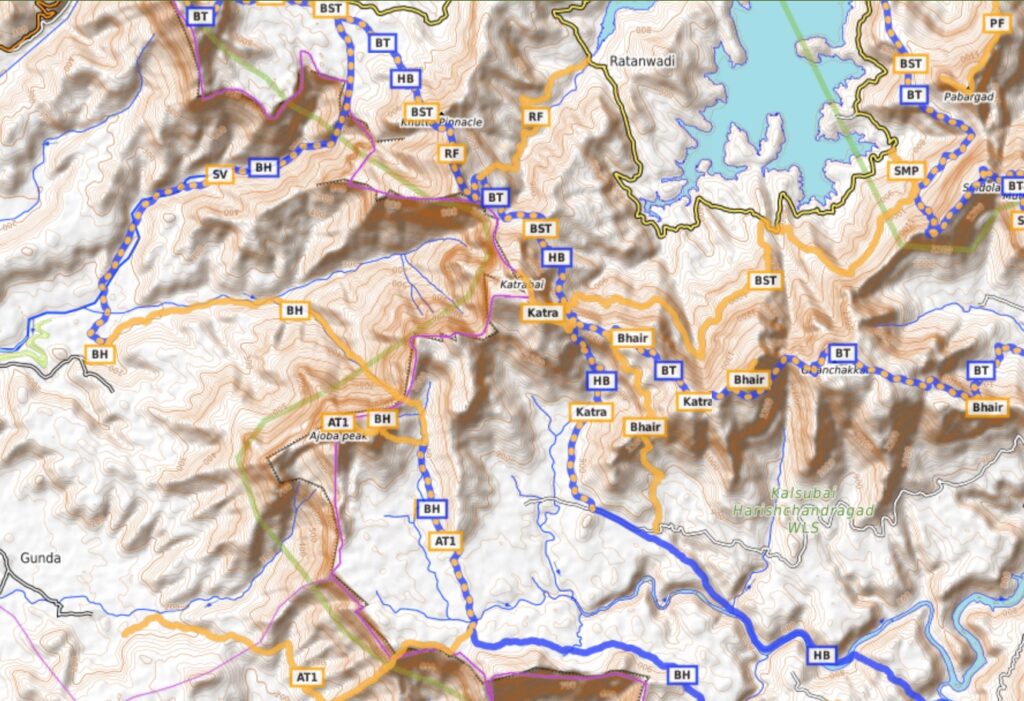
- Katrabai peak – we climb North out of the Mula river valley along the Kamta Ohol stream to a small saddle along the main ridgeline (Katrabai, Mudha Dongar, Ghanchakkar, Bhairavgad) which separates the Bhandardhara (North) and Mula (South) valleys. We pass by Katrabai peak (1400m) offering beautiful views on both valleys which steeply drops West into the Konkan plains (Umbar Ohol stream).
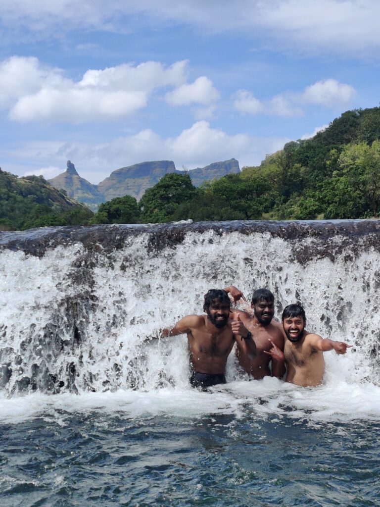
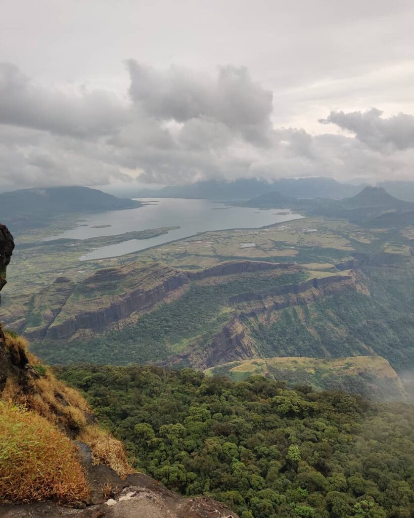
- Ratangad – after crossing the main ridge into the Bhandardhara valley we contour Northwest towards Ratangad fort (1230m) offering mesmerizing views on the Bhandardhara reservoir (East), Umbar Ohol valley (South) and Konkan plains (West).
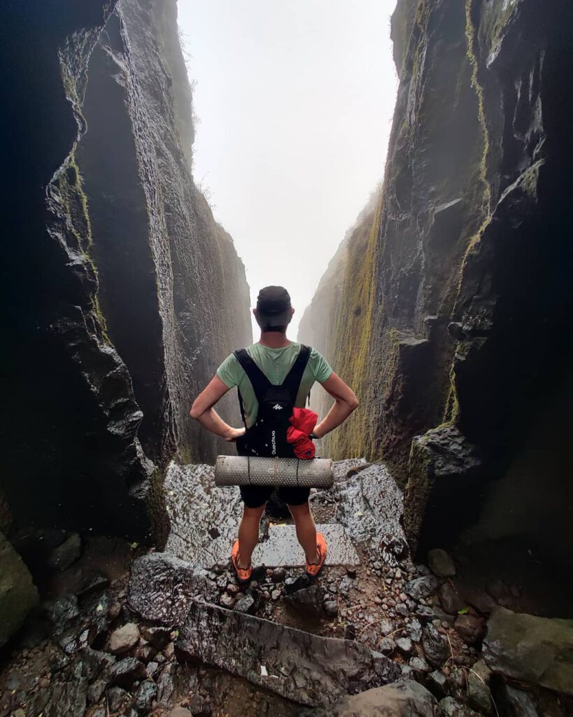
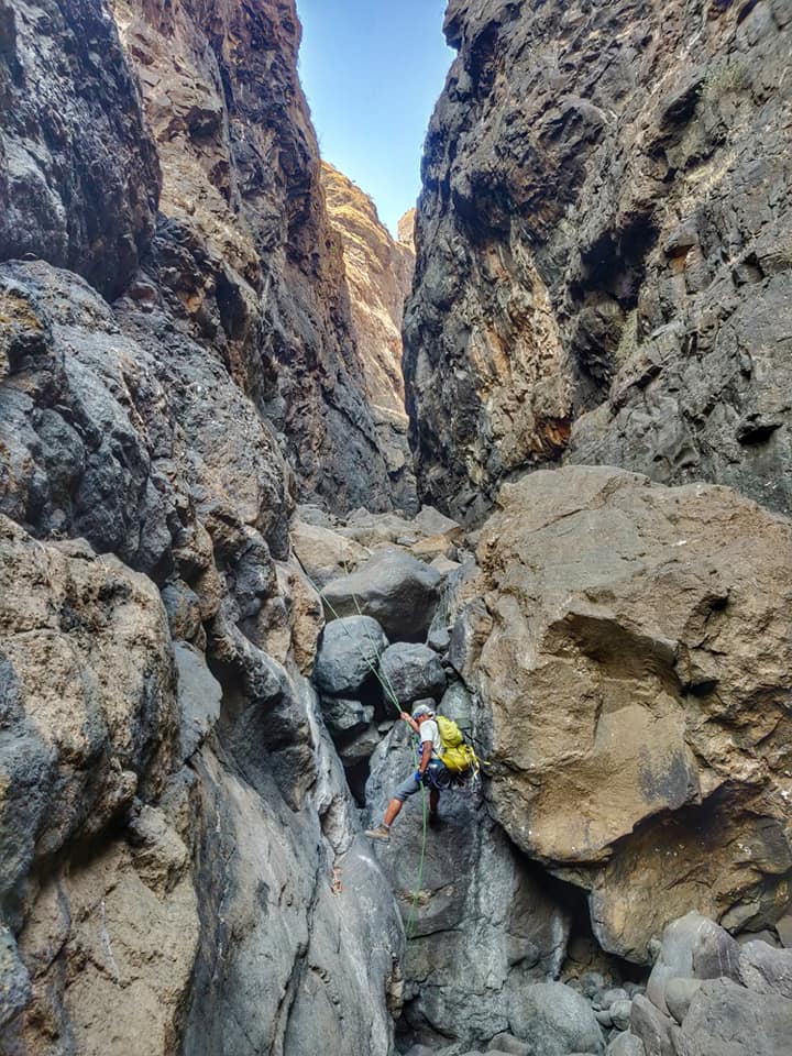
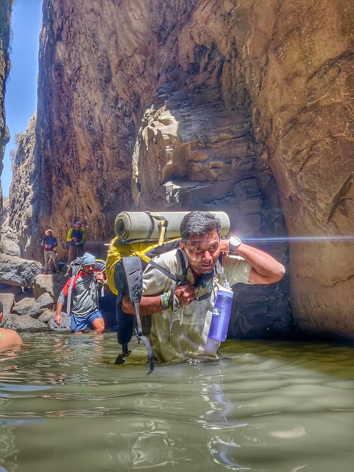
- Sandhan valley – 8km / 600m- we descend from the Deccan plateau to the Konkan plains through the Sandhan valley (Shai river) either West descent (requires rappelling) or South descent (non technical).
- Ajoba peak – from the Konkan plains we climb back up Southeast to the Deccan plateau along the Umbar Ohol stream to a small saddle (980m) in between the Karanda Dongar and Ajoba peaks. We optional scale the Ajoba peak (1250m) offering mesmerizing views on the Konkan plains steep below (West).
- Mula river valley – from Ajoba we once again traverse through the wide open Mula river valley with small rolling hillocks (Southeast direction this time, closer along Deccan ridge)
- Konkan plains – from a small saddle (920m) East of Napte Dongar peak / South of Kaladgad we descend South back to the Konkan plains through the Sadaba Ohol stream to the village of Valhivare
- Harishchandragad fort – from Valhivare we climb back up East to the Deccan ridge to Harishchandragad contouring South around the fort high above the Kamblyacha valley and descending Southeast to the Pimpalgaon reservoir valley to the village Khireshwar from which we originally started
Navigation
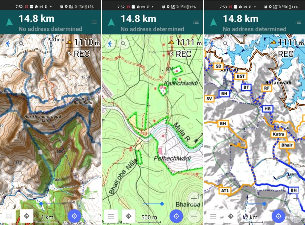
Above traverses can be easily navigated using most mobile mapping apps – most use Open Street Maps as base maps which include tens of thousands of kilometers of trails in Himalayas, Sahyadri, etc. OSM maps can be downloaded on the phone for offline exploration of the mountains without mobile network. Contours can be added to understand the topography of the terrain. My favorite app is OSMAnd.
References