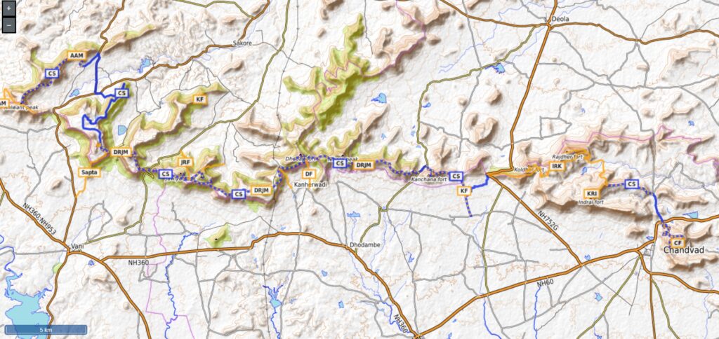
The most important range of Nashik is the Satmala range. This range looks like a necklace placed along Nashik. Here we present a 110km long continuous traverse across this range with 7000 meters of elevation gain which takes you along 20 forts and peaks including (East to West) Chandwad fort, Indrai, Rajdher and Koldher forts, Kachana, Handa Dongar, Vikhariya Dongar, Dhodap, Banda Dongar, Ramlya, Jawlya, Markandeya and Kanhergad forts, Ikhara peak, Saptashrungi, Anchala, Ahiwant and Mohandari forts, Atalya and Taulya peaks.
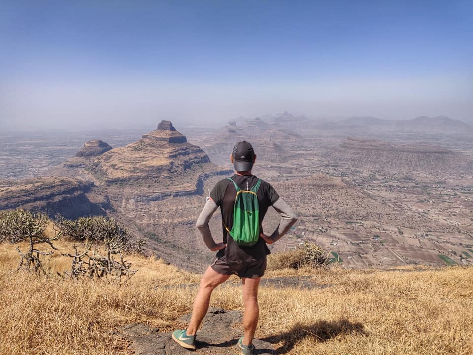
From top of each of above we get mesmerizing views on the surrounding Satmala range and plains. Dhodap is the highest point at 1451m, and third highest in Maharastra after Kalsubai and Salher. The Eastern section is part of the Chandwad range. The range continues further to Ajanta which is known as the Ajanta range. Other forts in this range not part of this traverse (not continuous) include Hatgad, Ankai, Tankai, Gorakhgad, Kanakgiri, Masana and Katra. Best season to visit this range / travers is post monsoon when it’s lush green. Other seasons tend to be very dry due to extreme summers.
Let’s take a closer look at the individual sections below: (East to West):
- Chandwad Fort – 6km / 700m+ located near Chandwad town on the Eastern edge of the continuous Satmala ridgeline traverse. Mid-way we pass the beautiful Chandreshwar temple on a flat plateau from where we climb up to the fort on top of Killa Dongar peak (1212m)
- Indrai – Rajdher – Koldher – 25km / 1000m+ crossing NH60 and proceeding West we climb back up North and come across three nearby forts encircling the Parsul Nadi river valley home to Rajder, Rajdarwadi and Indraywadi settlements. Koldher fort is located on top of Koldari Dongar (1200m).
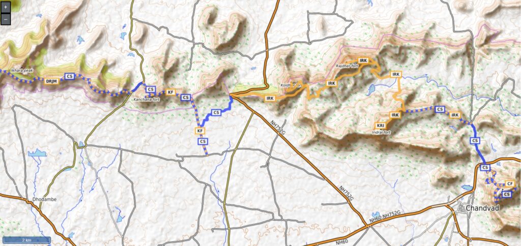
- Kanchana Fort – 6km / 430m+ descending from Koldher we cross NH752G on a small saddle and proceed West to climb back up to Kanchana fort on a small peak (1080m)
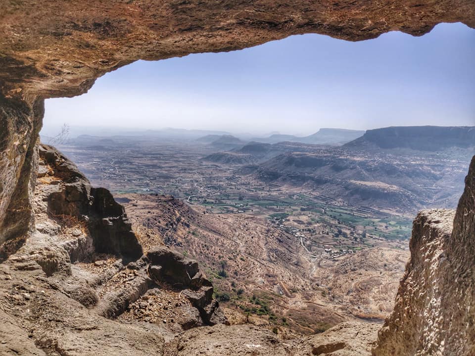
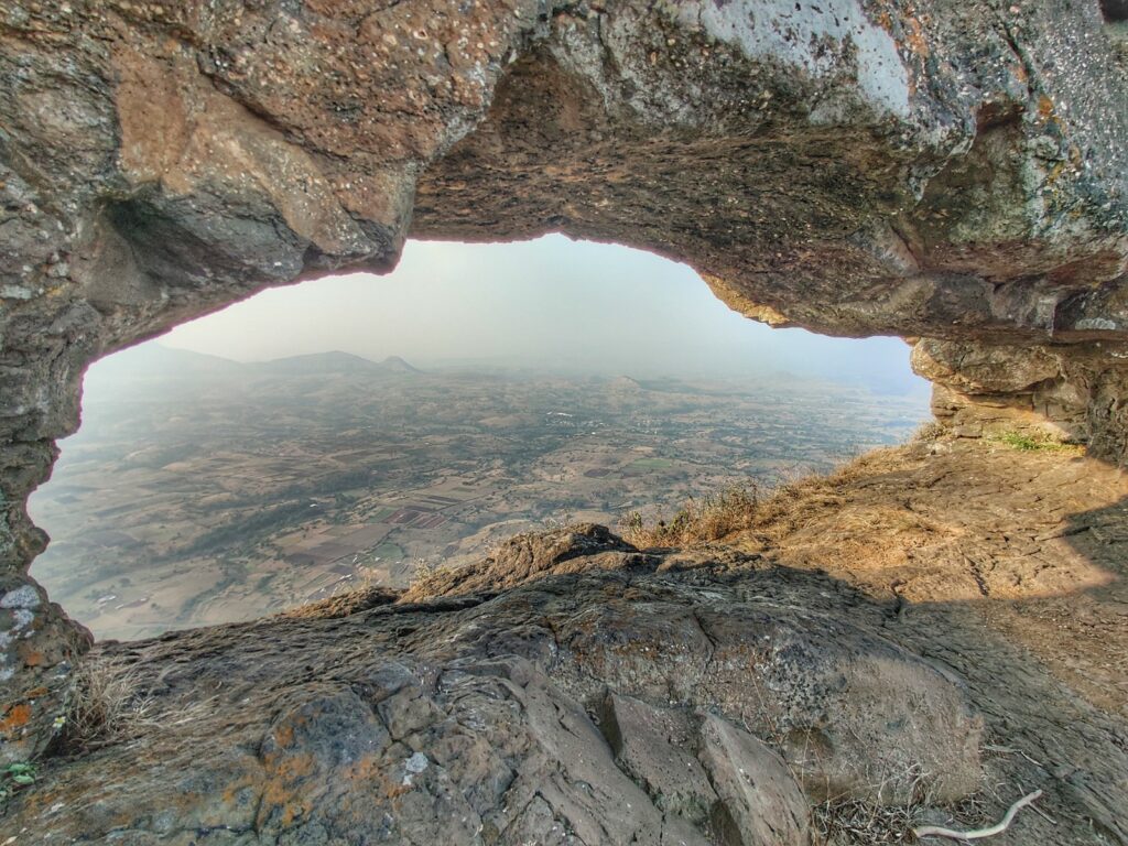
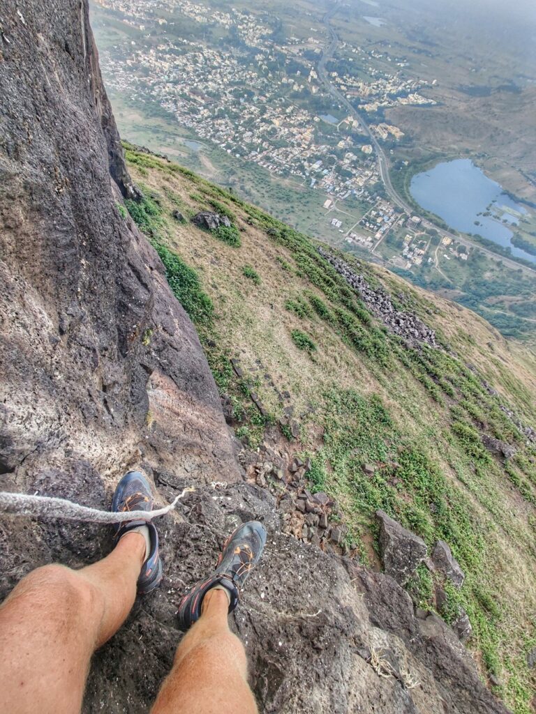
- Dhodap Fort – 8km / 500m+ descending to a small saddle we cross MDR39 and proceed West traversing a long ridgeline with several small peaks and saddles. We pass by Handa Dongar (1120m), Vikhariya Dongar (1062m) and Ikhara peak (1280m) before we hit Dhodap Fort (1451m) the third highest peak in Maharastra after Kalsubai and Salher. Dhodap has a unique silhouette with a wide pinnacle East and a long flat extending ridge plateau West.
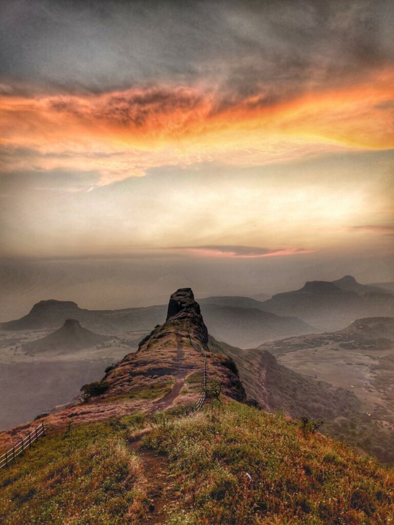
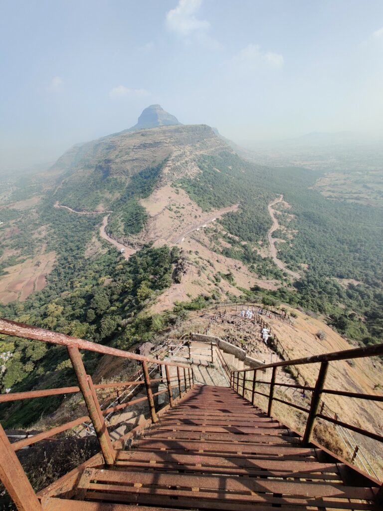
- Rawlya – Jawlya – Markandeya – 33km / 2500m+ mid-way Dhodap we contour West at 1050m along another prolonged ridgeline passing Banda Dongar (1170m) till we hit the twin peak forts of Rawlya (1240m) and Jawlya (1290m) surrounded wide grass covered plateaus grazed by local shepherds. From Jawlya we proceed West along a ridge till we cross a small saddle (MDR4) from where we climb up to Markandeya (1300) a small hillock offering birds eye views on the neighboring Saptashrungi.
- Kanhergad – 1km / 180m+ on a Northern extension of the Satamala range we find Kanhergad fort (1070m) disconnected (no direct trail) from this long traverse
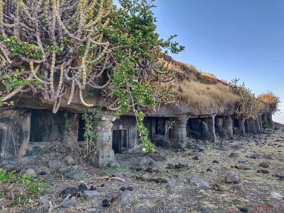
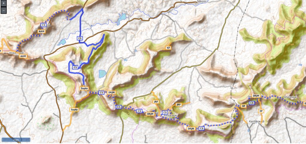
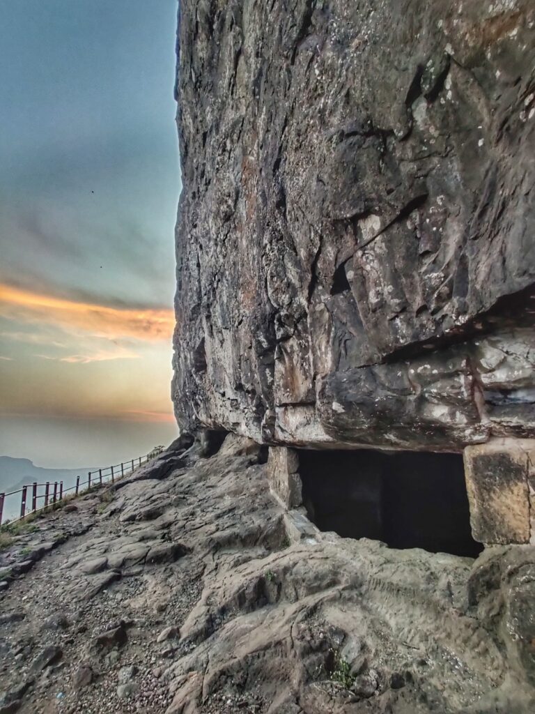
- Saptashrungi – 5km / 500m+ from Markandeya we proceed West across a small saddle to the famous Hindu pilgrim destination of Saptashrungi located near a double pinnacle (1250m). After this we descend North via a ghat road crossing SH17 before climbing up to the final Western section below
- Anchala – Ahiwant – Mohandari – 19km / 1300m+ we initially climb up to Mohandari fort (1050m) and proceed Southwest, descending around a 1150m tall peak before climbing back up to the twin forts of Achiwant (1190m) and Anchala (1050). The trail further extends West to the peaks of Atalya (1170m) and Taulya (1160m).
Nearby forts
- Ankai – Tankai fort (East) – 1.4km / 470m+ twin forts of Ankai and Tankai located South of Manmad town
- Hatgad fort (West) – 2km / 160m+ located South of Saptura
References