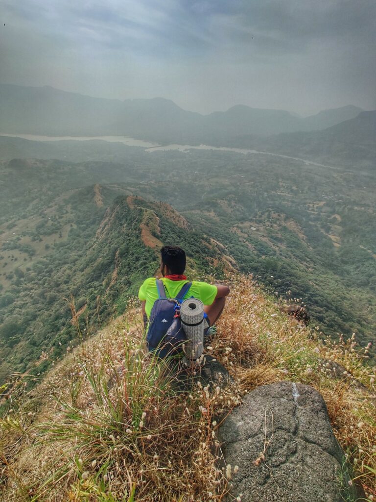
The region around the Manikdoh and Pimpalgaon reservoirs near Junnar has 23 beautiful forts, peaks, lakes and ghat sections worth exploring including Shivneri & Chanwad fort, Darya & Naneghat, Jivdhan fort, Vardha hill, Bhairavgad Moroshi, Dev Daundhya & Talmachi Taleran, Bhojgiri, Nisanicha dara, Udhalya Dongar, Sindola Fort, Hanumantgad and Nimgiri Forts, Hadsar fort, Hatkeshwar – Lenyadri, Harishchandragad fort, Kothale, Bhairavgad Kothale & Kunjargad forts and Manikdoh & Pimpalgaon reservoirs. A total hiking distance of 83km over 8000 meters of elevation gain (climb) across these widely spread out forts and peaks requiring in between road travel. These forts overlook the ancient trade route connecting Konkan plains and the Deccan plateau (Junnar) via Naneghat.
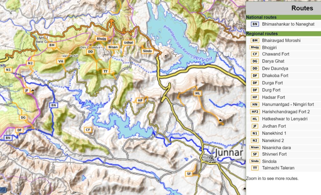
Below we take a closer look at the individual sections (clock-wise around Manikdoh and Pimpalgaon):
- Shivneri Fort 3km / 200m+ well known as the birthplace of Chhatrapati Shivaji Maharaj this 17th century fortification is located on a hillock (1010m) in the outskirts of Junnar.
- Chanwad Fort 1km / 70m+ proceeding 20km West we come across Chanwad Fort (1020m) overlooking the Manikdoh reservoir to the North
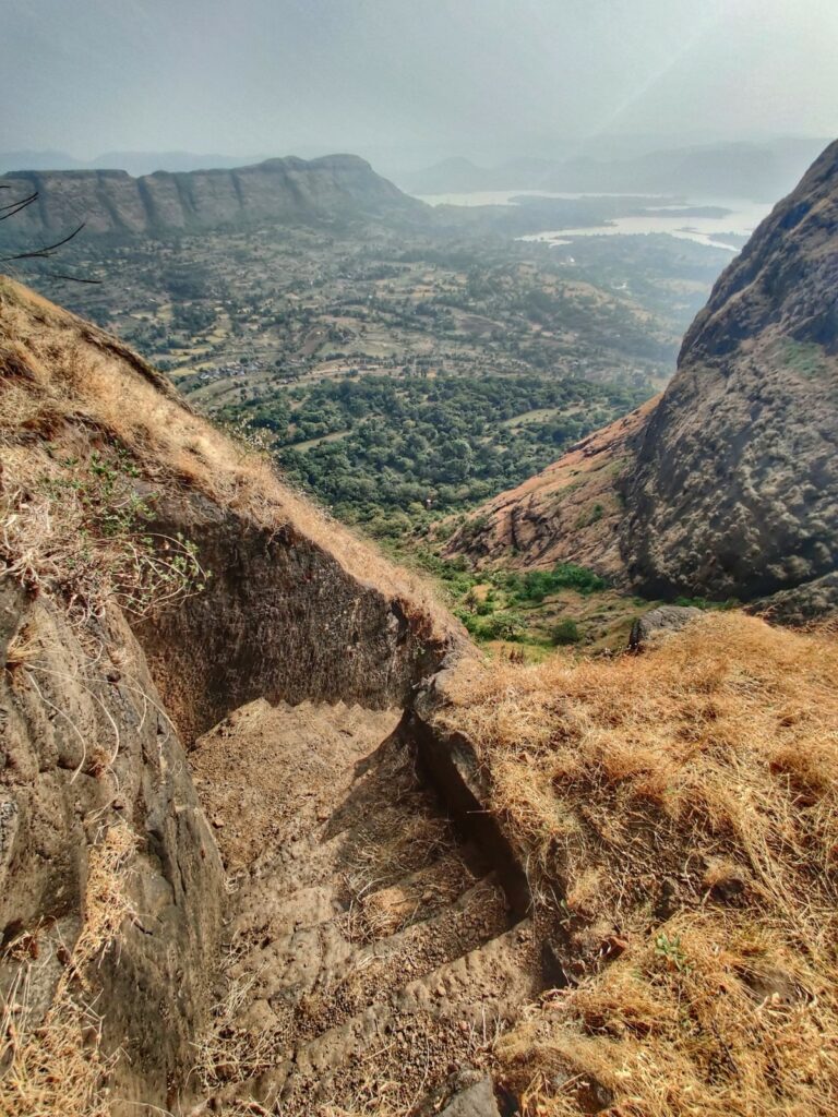
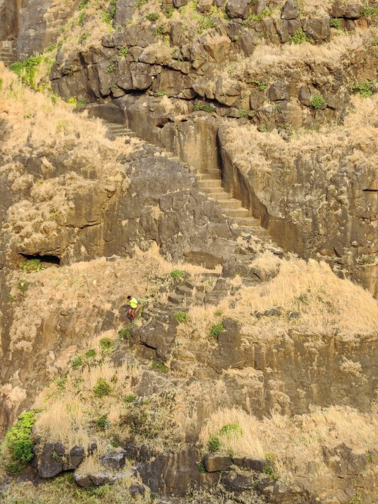
- Daryaghat 5.5km / 800m+ Dary ghat connects the Kanak Vira Nadi river valley in the Konkan plains with the Mina Nala on the Deccan plateau.
- Naneghat 4km / 560km+ Naneghat is the gateway between Kalu river valley in the Konkan plains and the Kukadi river valley on the Deccan plateau. Multiple trails descend from Nangeghat into the plains steep below.
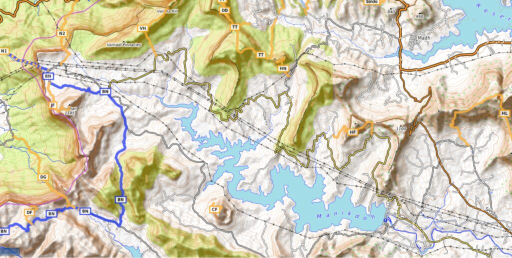
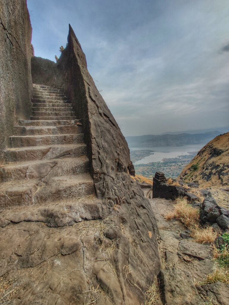
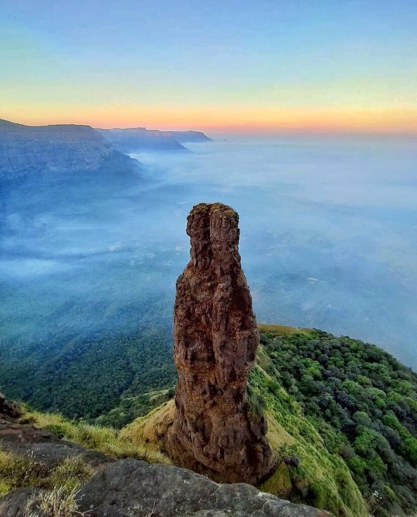
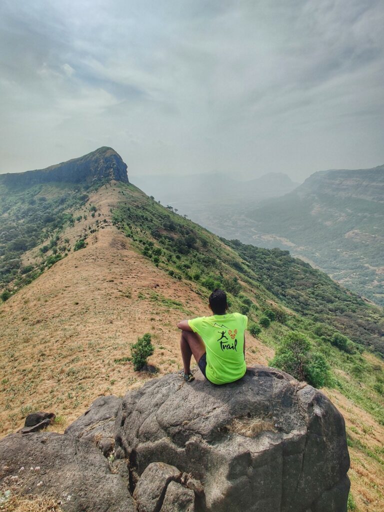
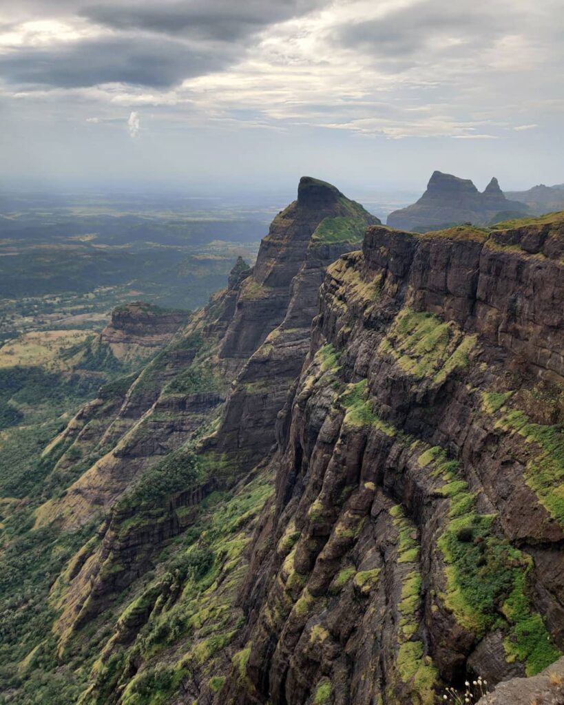
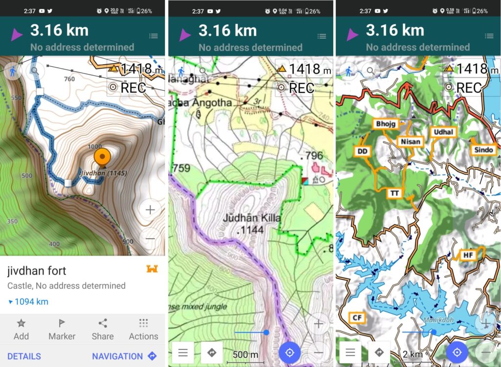
- Jivdhan Fort 3km / 300m+ Jivdhan fort (1145m) located on the Deccan ridge has a unique pinnacle signature and overlooks Naneghat and the Kanak Vira Nadi river valley in the Konkan plains
- Vardha hill 3km / 400m+ Northeast of Jivdhan we find the Vardha pinnacles and hill (1240m) overlooking the Kalu river valley (Northwest) and Naneghat (Southwest)
- Bhairavgad Moroshi 3.5km / 700m+ this fort is located mid-day the Deccan ridge slope at 700m altitude accessible via trail from the Konkan plains and overlooking the Kalu river to the North
- Dev Daundya 3km / 450m+ is a hill (1250m) on the Deccan ridge overlooking the Kalu river valley (North) and Krishnawati Nadi valley (East). Accessible via a trail from the latter.
- Talmachi Taleran 7km / 800m+ a prolonged ridgeline trail connecting Dev Daundya (North) with Hanumantgad (Southeast) contouring around the Krishnawati Nadi valley
- Bhojgiri 2.5km / 300m+ Bhojgiri is a peak (1150m) on the Deccan ridge overlooking the ghat road connecting Konkan plains with Pimpalgaon valley (North) and the Krishnawati Nadi valley (South)
- Nisanicha dara 2.5km / 140m+ a trail climbing up North from the Krishnawati Nadi valley to a saddle on the Deccan ridge between Bhojgiri and a 940m peak. Overlooks (North) the ghat road connecting Konkan plains and Pimpalgaon reservoir
- Udhalya Dongar 2.5km / 300m+ yet another peak (1080m) on the Deccan ridge accessible from the Krishnawati valley and overlooking (North) the ghat section connecting Konkan plains with Pimpalgaon
- Sindola Fort 2.5km / 300m+ Sindola peak (1080m) in line with the 3 above peaks overlooks the Pimpalgaon reservoir (North) and is accessible from the same valley climbing up Northwest along a ridgeline trail
- Hanumantgad / Nimgiri 1km / 120m+ twin forts (1070m) separated by a small saddle overlooking Manikdoh reservoir (South) and Krishnawati Nadi valley (North) accessible from either side
- Hadsar Fort 3km / 200m+ built on a triangular peak (1120m) located further East on the ridgeline separating the Krishnawati Nadi valley (North) and Manikdoh valley (South) accessible from the South
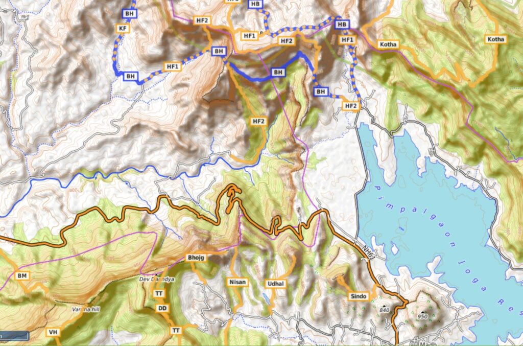
- Hatkeshwar – Lenyadri 10km / 750m+ ridgeline trail connecting the Lenyadri peak (1140m) & caves and Waroda Dongar (1380m) separating the Kukadi valley (South) and Pushpavati Nadi (East) and Pimpalgaon reservoir (North)
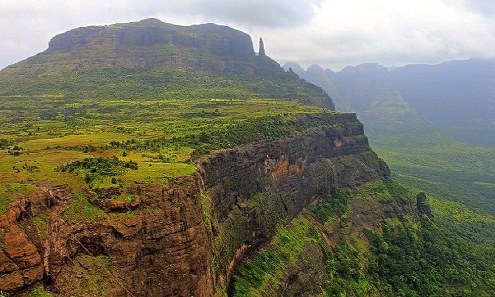
- Harishchandragad 12km / 750m+ a popular hiking destination (1340m) overlooking Pimpalgaon reservoir (Southeast), Kalu river valley (South), Sadaba Ohol valley (West) and Mula river valley (North) accessible from all surrounding valleys
- Kothale – 14km / 900m+ trail along ridgeline separating the Pimpalgaon (South) and Mula river (North) valleys. Climbs up to Kandaka Dongar (1459m) located East of Harishchandragad separated via Tolar Khind saddle. Can be combined with nearby Kunjargad (East) and Bhairavgad Kothale (Northwest).
Navigation
Above traverses can be easily navigated using most mobile mapping apps – most use Open Street Maps as base maps which include tens of thousands of kilometers of trails in Himalayas, Sahyadri, etc. OSM maps can be downloaded on the phone for offline exploration of the mountains without mobile network. Contours can be added to understand the topography of the terrain. My favorite app is OSMAnd.
References