
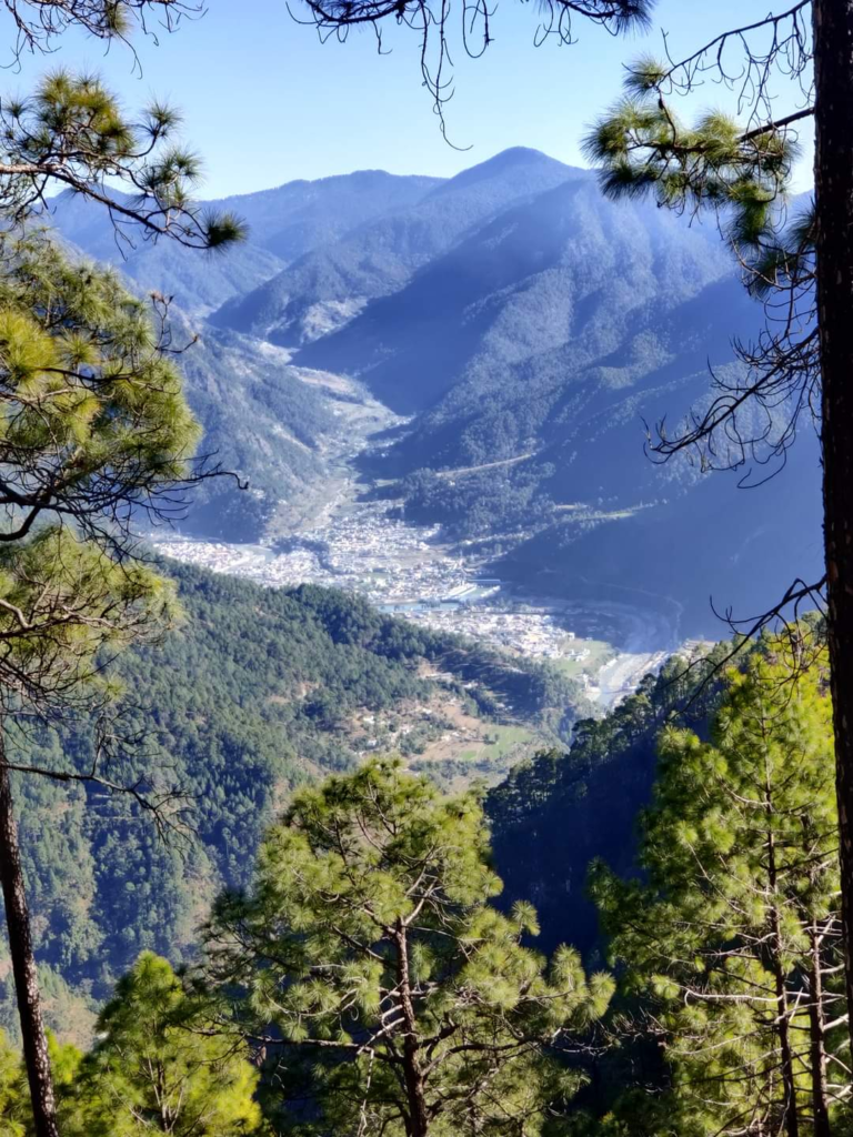
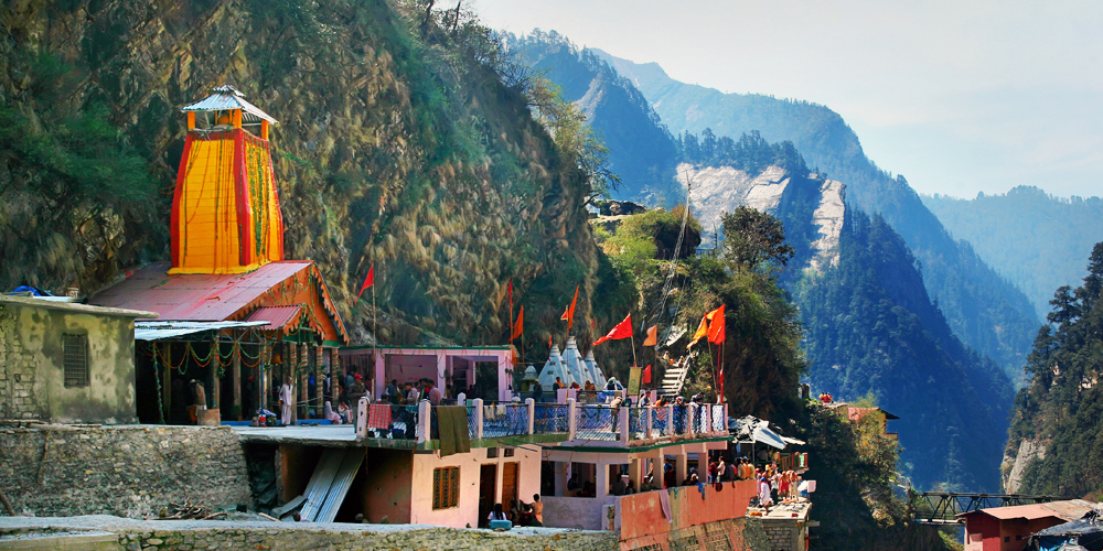
Uttarkashi, meaning Kashi of the north, is a town located in Uttarkashi district in Uttarakhand. Uttarkashi town is headquarters of the district. Uttarkashi is also known as Somya Kashi. Uttarkashi is a Hindu religious place for spiritual and adventurous tourism. Uttarkashi town is also called as Shivnagri
Geography
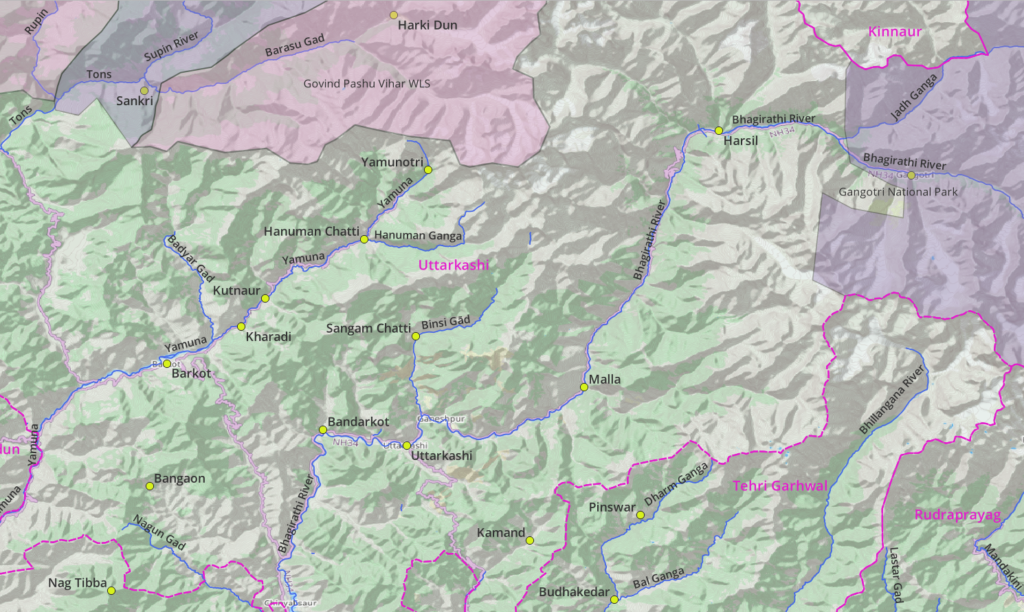
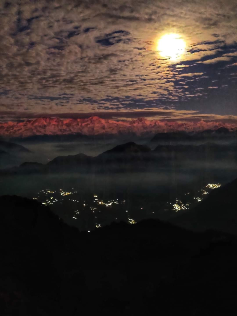
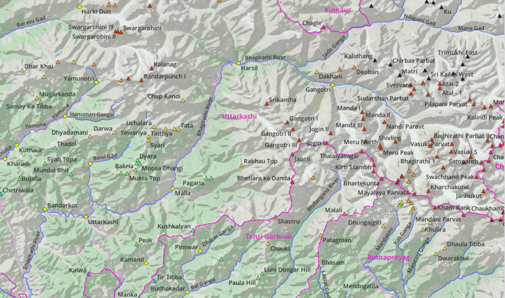
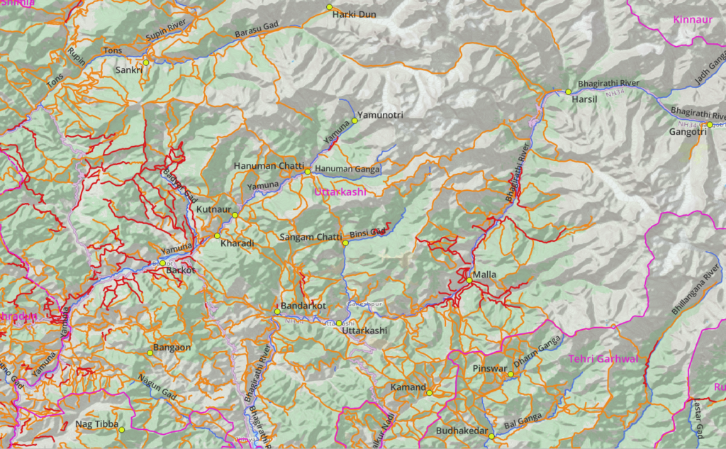
Uttarkashi is bordered by districts Shimla (Northwest), Kinnaur (North), Chamoli & Rudrapayag (East), Tehri Garhwal (South) and Dehradun (Southwest). There are two high ranges: Bandarpunch (North) and Gangotri range (Northeast). Uttarkashi has the Gangotri National Park (Northeast), Govind Pashu Vihar National Park and Wildlife Sanctuary (WLS) (Northwest).
Valleys
3 major rivers drain winter snow and glacial melt from the above high ranges:
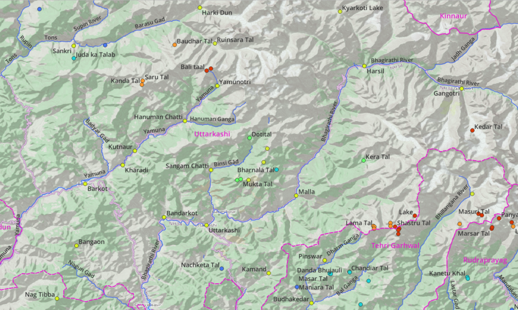
- Tons river (West) – flowing from Baspa and Bandarpunch ranges. Tributaries: Rupin, Supin and Barasu. Settlements: Harki Dun, Sankri
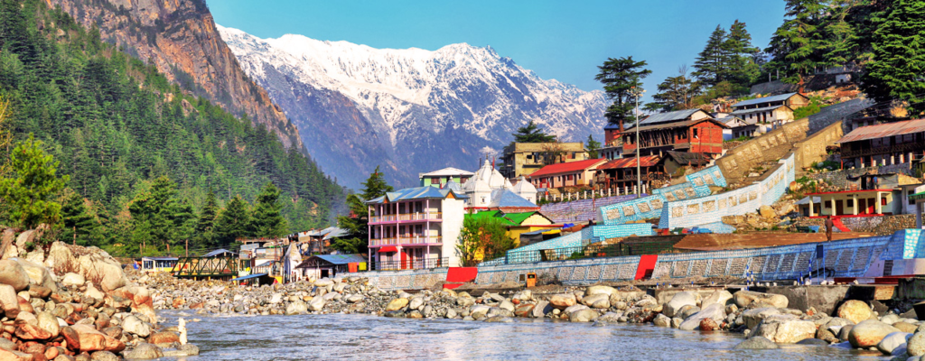
- Yamuna river (Central) – draining the Bandarpunch range. Tributaries: Hanuman Ganga, Badyar Gad, Kamal Nadi. Settlements: Yamunotri, Hanuman Chatti, Barkot
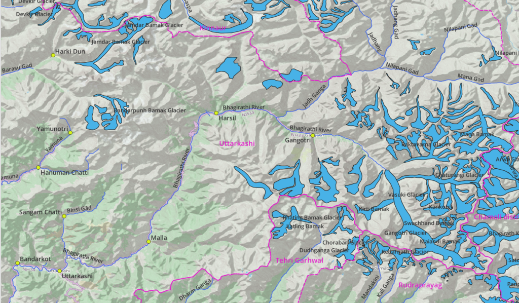
- Bhagirathi river (East) – flowing from Gangotri range. Tributaries: Jadhi Ganga, Binsi Gad. Settlements: Gangotri, Harsil, Malla, Uttarkashi, Bandarkot
Peaks
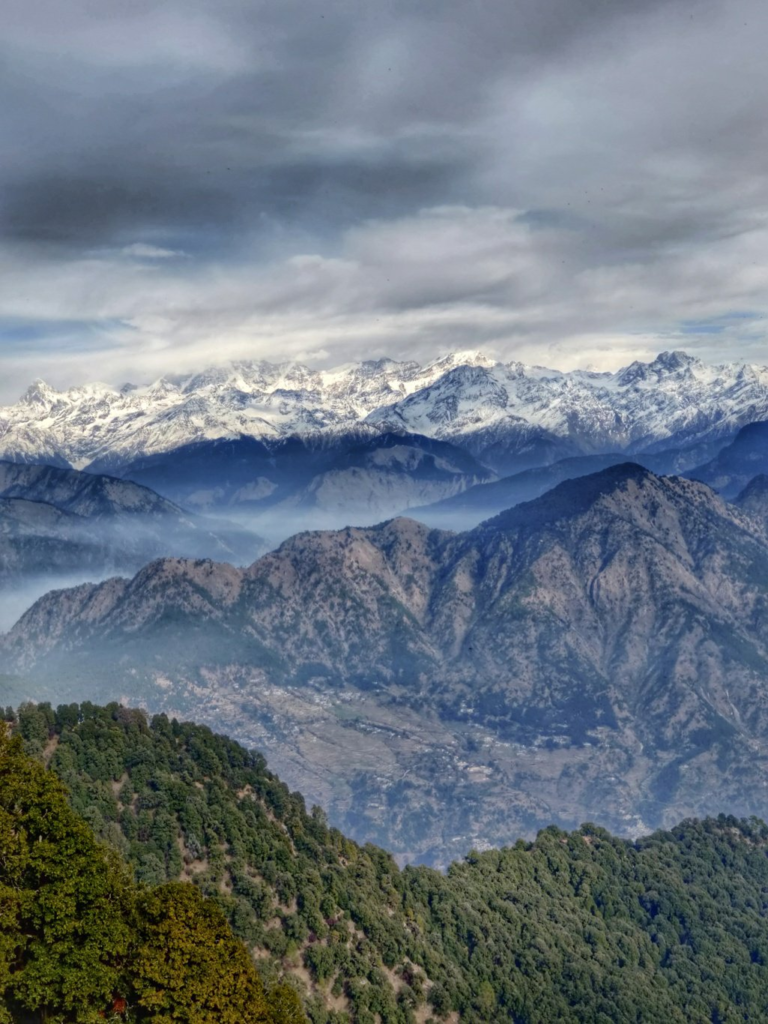
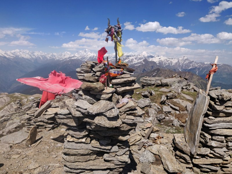
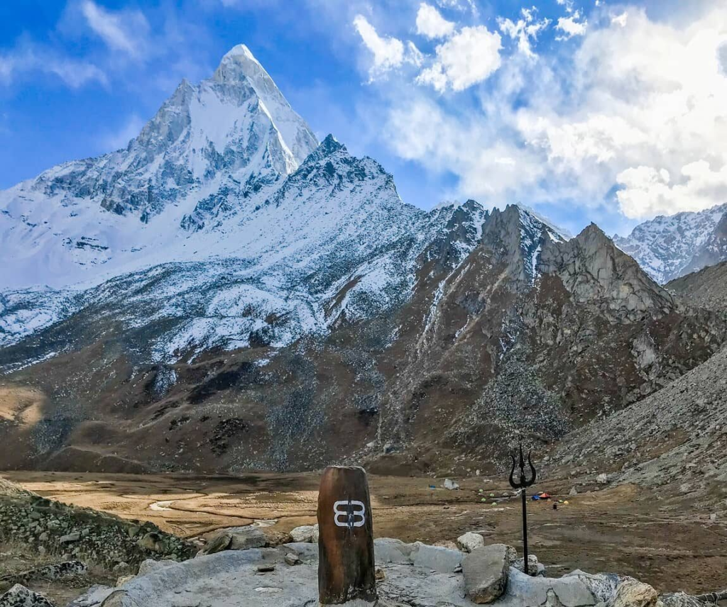
Uttarkashi has hundreds of peaks in the Bandarpunch and Gangori high ranges as well as foothills of the Himalayas, some of which are well known: Kedarnath main (6940m), Bhagirathi I (6856m), Satopanth (7075m), Mana Parbat I (6794m), Meru (6660m), Shivling (6543m), Nandi Parvat (5910m), Gangotri I (6672m), Bandarpunch I (6316m) and Kedarkantha (3800m).
Glaciers
The high ranges of Uttarkashi are home to several major glaciers including: Bandarpunch Bamak, Jambar Bamak, Gangotri, Chaturangi, Katling, Mana Bamak, Rudugaira Bamak and Kedar Bamak.
Lakes
Uttarkashi has a number of higher altitude lakes, few of which are well known: Doti Tal (3080m), Shashtru Tal (4600m) and Kedar Tal (4700m)
Hiking Network
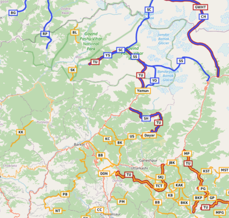
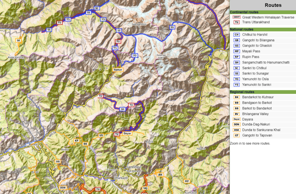
Hiking routes in Open Street Maps (OSM) are categorized in 4 different networks:
- International (red) – long distance paths that cross several countries (or states in case of India)
- National (blue) – walking routes that are nationally significant and long distance paths
- Regional (orange) – walking routes that c ross regions and are regionally significant
- Local (purple) – small local walking routes
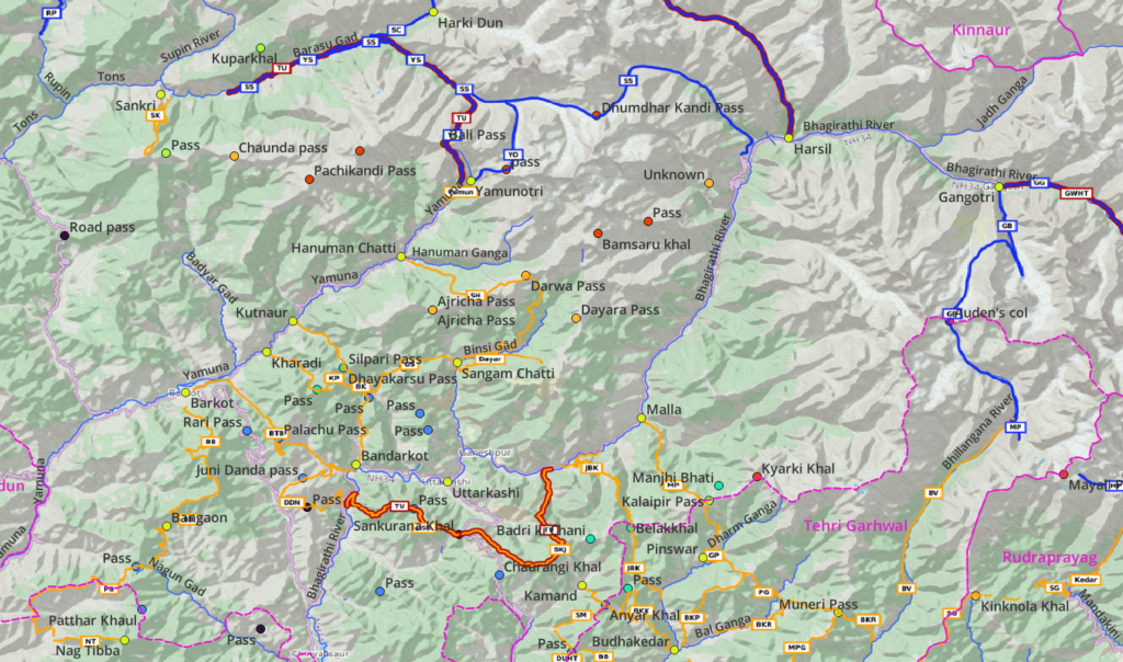
Many routes below have been explored and documented during my Trans Uttarakhand Journeys in Spring 2019 and Winter 20/21. Blogs for individual routes can be found here and here. In addition to the routes presented here many trails and paths listed on the Survey maps are yet to be explored and accurately mapped in Open Street Maps (see below).
7 Local Hikes
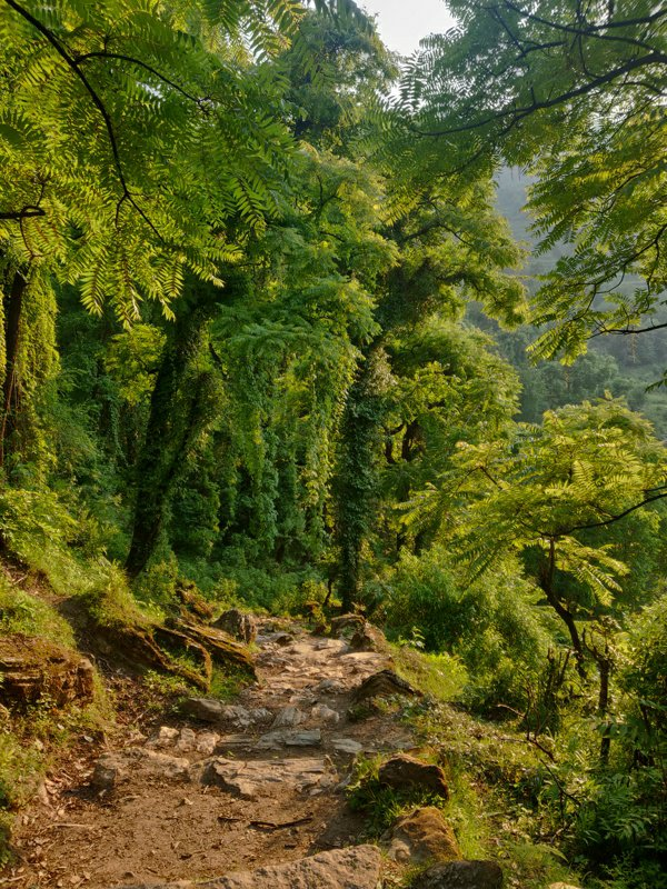
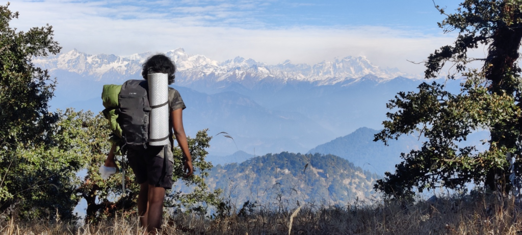
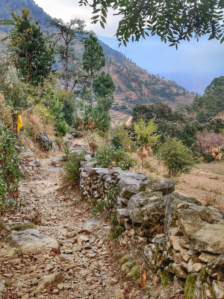
The local hikes (purple) in Uttarkashi district are a perfect start for beginners to gain experience and build confidence before taking up more challenging day/multi-day regional hikes (orange). Local routes can be completed within (less than) one day so no camping / overnight gears are required. Distance and elevation gain (total climb) for each hike is given below.
- Ayana Devi Temple 7km / 1300m+ starting from Ganeshpur in the Bhagirathi river valley we climb up Northeast through the Gawana Gad valley to the Ayana Devi temple at 2150m altitude.
- Upricot to Utraon 11km / 1100m- via unnamed pass (2300m) starting from Upricot in the Barun Gad valley we contour East towards Nismor from where we climb up to an unnamed pass (2300m) and descend East to Utraon in the Asi Ganga river valley. Blog post
- Utraon to Gyansu from Utraon in the Asi Ganga valley we climb up Southwest to an unnamed pass (2300m) descending South to Gyansu in the Bhagirathi river valley. Blog post
- Gyansu to Uprikot 10km / 1100m+ from Gaynsu in the Bhagirathi valley we climb up on the ridgeline separating Barun Gad and Rano Gad side-valleys to eventually descend to Uprikot in the Barun Gad valley. Blog post
- Siri to Marwari – 12km / 1500m+ via Anyar Khal (2350m) starting from the scenic hamlet of Siri in the Siri Gad valley, tributary of Jalkur Nadi, we climb up Northeast into the Siri Gad valley towards the ridgeline connecting to the Anyar Khal pass turning Southeast into the Medh Gad valley towards Budha Kedar on the confluence of the Bal Gad and Dharm Ganga rivers. Blog post
- Nyugaon to Siri 9km / 800m+ via Mankha Khal (2400m) and Chaundiar peak (2800m) we start from Nyugaon in a side-valley of the Jalkur Nadi climbing up East to the Mankha Khal pass (leads to Argad Gad) and continue Northeast along a ridgeline across Chaundiar peak to an unnamed pass (2300m) where we descend Northwest in the Siri Gad valley to the hamlet of Siri. Blog post
- Ramoli to Nyugaon 8km / 900m+ from Ramoli in the Jalkur Nadi we climb up East on the ridge to 1900m after which contour North into a side-valley to the hamlet of Nyugaon. Blog post
- Malla to Pillung 7km / 650m+ starting from Malla village in the Bhagirathi river valley we hike East in the Phulang gad valley crossing the river mid-way and turning Northeast to the hamlet of Pillung.
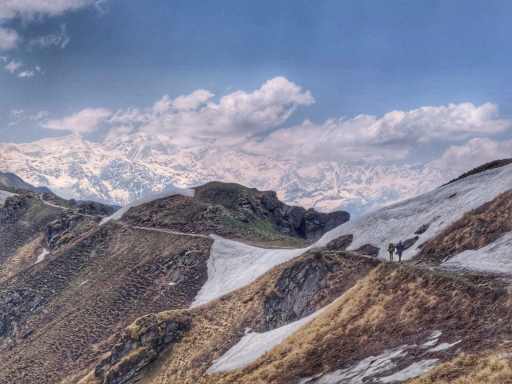
20 Regional Hikes
Once you have gained confidence in the local hiking routes you can try some of these mid-level hikes around Uttarkashi. Depending on your pace most of these routes can be completed as either day or multi-day hikes. Plan accordingly.
- Kedarkantha 14km / 1800m+ to Kedarkantha peak (3800m) a very popular summer and winter destination starts from Sankri in the Tons river valley climbing up South to Kedar Kantha a 3800m high peak offering 360 degree views on the surrounding valleys of Tons (West, North, East), Badyar Gad (South) and Garu Gad (Southwest).
- Baraadsar Lake (incomplete) 10km / 1100m+ from Kashla village in the Supin Gad river valley we climb up Northwest to the ridgeline above separating the Supin Gad (East) and Rupin (West). We proceed North along the ridgeline to the border (4500m) with Shimla district where we descend towards Baraadsar lake (4250m)
- Barkot to Sankri via Kedarkantha peak (3800m) starting from Barkot in the Yamuna river valley we climb up to Rajgarhi and continue into the Badyar Gad valley where we loop around the Paunti Gad and Bali Gad valleys till Darsaun. From here we climb up North on the ridgeline between Bali Gad and Garu Gad to Kedar Kantha (3800m). Blog post
- Barkot to Bandarkot 30km / 1200m+ via Palachu pass (2360m) from Barkot in the Yamuna river valley we climb up South into the Pathar Gad valley to the Palachu pass descending into the Nakuti Gad valley to Bandarkot in the Bhagirathi river valley. Blog post
- Dunda – Dag – Nakuri 23km / 1500m+ via Juni Danda pass (2100m) from Dunda in the Bhagirathi river valley we climb up West in the Ghatu Khala valley till the Juni Danda pass descending into the Khurmola Gad valley contouring South across an unnamed pass (1750m) descending East back into the Bhagirathi valley. Blog post
- Kophara to Khatwa 15km / 1300m+ from Kophara village in the Maje Gad valley, tributary of the Kamal Nadi we hike up Southwest onto the ridgeline above crossing the Jakha Lani, Chakormara Lani, Padma Lani, Binol Lani, Bamnai Lani, Karamba Lani passes towards Bhatwara Tibba (2900m)
- Upricot to Sangam Chatti 14km / 1100m+ via Silpari pass (3000m) starting from Upricot in the Barun Gad we climb up Northeast to the Silpari pass descending to Sangam Chatti in the Binsi Gad valley, tributary of the Bhagirathi river. Blog post
- Bandarkot to Kutnaur 25km / 1750m+ via Dhayakarsu pass (2850m) from Bandarkot in the Bhagirathi river valley we climb up North into the Rano Gad valley climbing up Northwest on the ridgeline between Rano Gad and Brun Gad to the Dhayakarsu pass and descending into the Kuthnaur Gad valley to Kutnaur in the Yamnua river valley. Blog post
- Kharadi to Chatrali 18km / 2600m+ via unnamed pass (2630m) from Kharadi in the Yamuna river valley we climb up Southeast into the Bhansari Gad valley across an unnamed path descending to the dwelling of Chatrali into the Rano Gad valley to Bandarkot in the Bhagirathi river valley. Blog post
- Bangaon to Barkot 28km / 2600m+ via Bahak peak (2960m) from Bangaon in the Daski Gad valley, tributary of the Bhagirathi river we climb up and proceed Northeast along the ridgeline above between Barni Gad and Khurmola Gad turning North towards the Bahak peak and descending to Barkot in the Yamnua river valley. Blog post
- Pantwari to Bandgaon 36km / 2950m+ from Pantwari (start of the popular Nag Tibba hike) we cross the Bhadri Gad valley climbing up North, crossing the Diyari Gad and proceeding East along the ridgeline between Bhadri Gad and Yamuna river valleys crossing over an unnamed pass and contouring across the Nagun Gad, Anyari Khala, and Ghattu Gad to Bandgaon. Blog post
- Dunda to Sankurana Khal 19km / 1700m+ via Nagni Tank (2700m) starting from Dunda in the Bhagirathi river valley we climb up East on the ridgeline between Dhanari Gad and Bhagirathi valleys to Nagni Tank mandir (2700m) where we descend East to the Sankurana Khal road pass. Blog post
- Sankurana Khal to Jamak 25km / 1900m+ via unnamed peak (2950m) starting at the Sankurana Khal pass we climb up East on the ridgeline between Bhagirathi and Jalkur Nadi river valleys turning North to Jamak in the Bhagirathi river valley. Blog post
- Jamak to Budha Kedar 34km / 2200m+ via Belakhal (2950m) from Jamak in the Bhagirathi river valley we climb up East crossing over the Barmand Gad and Andhri Gad streams into the Dugadda valley climbing up to Belakhal pass descending through serene pine forest into the remote Pangrana Gad valley to Budha Kedar in the Dharm Gad valley. Blog post
- Malla to Pinswar 24km / 2000m+ via Kalaipir pass (3300m)from Malla in the Bhagirathi river valley we climb up Southeast into the Pilang Gad valley onto the ridgeline above which takes us to the Kalaipir pass descending South into the Devan Gad valley to Pinswar in the Dhram Ganga river valley. Blog Post Blog post 2 Blog post 3
- Bhatwari to Hanuman Chatti via Dayara pass (3600m) and Darwa pass (3770m) starting from Bhatwari in the Bhillanganga river valley we climb up West above the Papar Gad valley contouring Norhteast around the Dayara peak (3651m) proceeding North along the main ridgeline to the Dayara pass descending Southwest along the ridgeline and dropping Northwest into the valley to cross the Binsi Gad and climb up to the dwelling of Manjhi. From here we continue North to Toli Tal and the Darwa pass crossing over into the Hanuman Ganga river valley where we tried to proceed downstream but got stuck mid way to Hanuman Chatti. Blog post
- Dayara 9km / 1750m – starting from Sangamchatti in the Binsi Gad valley we climb up East onto the Southern slope of the valley to 3200m altitude below the Dayara peak (3651m). Blog post
- Kamand to Jamak via Badri ki Chani (2950m) from Kamand we climb up North to the main ridgeline between Bhagirathi river and Jalkur Gad valleys. We now descend along the Northwest ridgeline into the Kamar Gad valley where we follow downstream till Jamak in the Bhagirathi river valley. Blog post
- Kamand to Budhakedar 21km / 1600m+ via Anyar Khal (2350m) from Kamand in the Jalkur Gad valley we climb up Southeast to the Anyar Khal pass descending Southeast turning Northeast and once again Southeast to Budha Kedar on the confluence of the Dharm Ganga and Bal Ganga river valleys. Blog post
- Banoli to Bamangaon via unnamed pass (2300m) from Banoli in the Gongad valley tributary of the Bal Ganga river we climb up North to East over an unnamed pass descending Northwest into the Jalku Nadi valley across the Chaurangikhal pass to Bamangaon in the Dhanari Gad valley, tributary of the Bhagirathi river
- Kamand to Anyar Khal – 19km / 1750m – starting from Kamand in the Jalkur Gad valley we climb up Northeast to Ghora Khor (2870m) and descend South via the ridgeline between the Jalkur Gad and Pangrana Gad valley to the Anyar Khal road pass between Kamand and Budha Kedar
- Kamand to Belakhal via Badri ki Chani (2950m) – from Kamand we climb up North to the main ridgeline (2970m) between Jalkur Gad and Bhagirathi river valleys where we proceed East across the Badri ki Chani pass contouring Northeast above the Pangrana Gad valley to the Belakhal pass (3000m).
- Thallan to Chande Thaur – 12km / 1500m – from Thallan near Uttarkashi we climb up East in the Indrawati Gad valley to the dwelling of Chande Taur near the main ridgeline between the Bhagirathi river and Jalkur Gad valleys.
- Gangotri to Tapovan – 21km / 1450m – from Gangotri we hike Southeast in the Bhagirathi river valley to the tip of the Gangotri glacier turning South to Tapovan (4400m)
8 National Routes
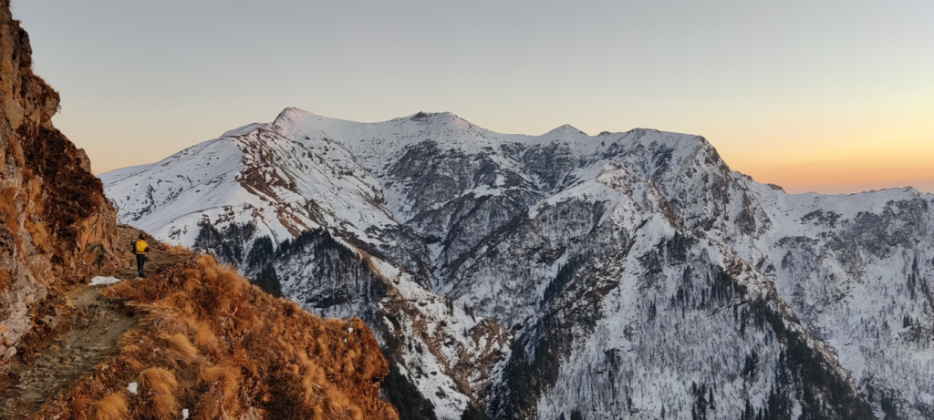
Once you have gained sufficient experience on several regional hiking routes and you feel confident enough you can try some of these higher altitude hikes over longer distance hikes and more elevation gain. These are multi-day hikes which require proper planning.
- Sangam Chatti to Hanuman Chatti 33km / 2900m+ via Darwa pass (3770m) from Sangam Chatti we proceed Northeast climbing up gradually into the Binsi Gad valley, turning North towards Toli Tal (3050m) and crossing over the Darwa pass descending Southwest into the Hanuman Ganga valley, contouring around the Darwa peak (4120m) go Hanuman Chatti in the Yamnua river valley
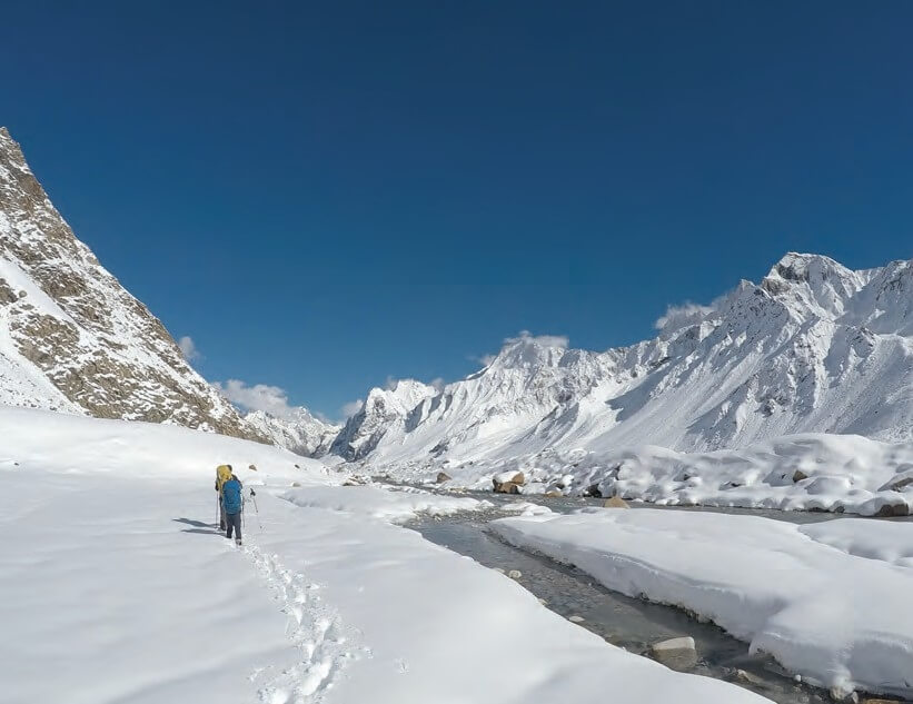
- Yamunotri to Sankri 38km / 2200m+ via Bali pass (4800m) from Yamunotri in the Yamuna river valley we climb up Northwest along a ridgeline to the Bali pass descending North into the Ruswar Gad valley where we proceed Northwest along the stream turning Southwest into the Tons river valley to Sankri

- Yamunotri to Osla 11km / 1000m+ via unnamed pass (4950m) trom Yamunotri in the Yamuna river valley we climb up Northeast tto an unnamed pass and descend North across a glacier into the Ruswar Gad valley to Osla where we proceed as per previous route to Sankri in the Tons river valley
- Sankri to Chitkul 37km / 2700m+ via Borasu pass (5180m) from Sankri we proceed Northeast into the Tons river valley to Har ki Dun where we climb up North into the Maninda Gad valley to the Borasu pass traversing the Bunga Bamak glacier into the Jorya Garang valley turning West into the Baspa river valley to Chitkul
- Chitkul to Harshil 67km / 1760m+ via Lamkhaga pass (5270m) from Chitkul we proceed East into the Baspa river valley turning South towards the tongue of the Baspa Bamak glacier turning Southwest across the Lamkhaga pass. We now descend Southwest to South to Southeast into the Jalandhri Gad valley turning South to Harshil in the Bhagirathi river valley.
- Sankri to Sunagar 66km / 3500m+ via Dhumdhar Kandi pass (5250m) from Sankri we proceed Northeast in the Tons river valley turning Southeast into the Runswar Gad traversing East across the Bandarpunch and Dhumdhar Bamak glaciers to the Dhumbhar Kandi pass. From here we descend Northeast into the Siyanan Gad valley turning East to Southeast to Sunagar in the Bhagirathi river valley.
- Gangotri to Khatling 38km / 2600m+ via Auden’s Col (5450m) from Gangotri in the Bhagirathi river valley we climb up South in the Kedar Ganga valley to Kedar Tal (4730m) contouring West into the Rudugaira Gad valley and climbing up South to Auden’s Col descending Southeast Bhilanganga river valley to the tip of the Khatling glacier in Tehri Garhwal
- Gangotri to Ghastoli 65km / 3600m+ via Kalindi Khal (5950m) from Gangotri we proceed East into the Bhagirathi river valley to Tapovan () turning Southeast traversing the Chaturang Bamak glacier crossing the Kalindi Khal pass near Avalanche peak (6443m) descending East into the Arwa river valley to Ghastoli in the Saraswati river valley of Chamoli district
2 International Routes
These inter-state routes span the entire state of Uttarakhand / Western Himalayas. They include several of the above regional and national routes.
- Trans Uttarakhand 550km / 33800m+ – refer detailed post over here
- Great Western Himalayan Traverse 920km / 33200m+ – refer detailed post over here
References
Navigation
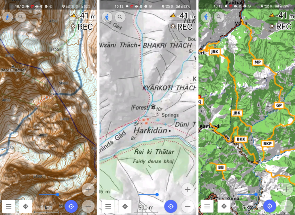
Above traverses can be easily navigated using most mobile mapping apps – many use Open Street Maps as base maps which include tens of thousands of kilometers of trails in Himalayas, Sahyadri, etc. OSM maps can be downloaded on the phone for offline exploration of the mountains without mobile network. Contours can be added to understand the topography of the terrain. Find a short tutorial over here.