

Traversing a 2500m high snow covered ridgeline in February in Udhampur district separating the Ramnagarwali Khad and Tawi river valleys
Introduction
Hi, my name is Peter, I’m a minimalist fast hiker exploring the Western Himalayas alpine-style. I have solo hiked around 10 thousand kms across 300 mountain passes in recent years. My focus is on lesser known, unexplored regions discovering unseen natural beauty and heartwarming hospitality through months-long “ultra journeys” experiencing a sense of inner peacefulness.
My goal for 2022 is to explore thousands of kilometres in remote regions in Jammu & Kashmir throughout the 4 seasons (winter, spring, summer, autumn) and map these routes in Open Street Maps for the benefit of the independent hiking community.
A word of thanks to Sathya who inspired me into Himalayan exploration, Survey of India for publishing detailed Himalayan maps, Huzefa from Blue Bolt Gear for his ongoing support in innovative lightweight gears and the QGIS community for powerful tools for mapping and planning mountain traverses.
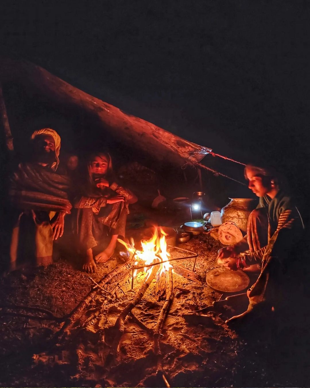
Hospitality around the campfire by the bakarwals in the alpine meadows high above Chenab river valley in Doda district
Planning
My journey into the Western Himalayas was initially hampered with the lack of good, public available maps of the region. This usually meant that I was either downloading existing hiking routes (GPS logs) or doing time consuming analysis of hi-res satellite imagery to identify yet unexplored trails. All this changed in recent times when the Survey of India made the Open Map Series topographic maps publicly available depicting the unseen corners of the Indian Himalayas in stunning detail revealing tens of thousands kms of yet unexplored trails and remote settlements.
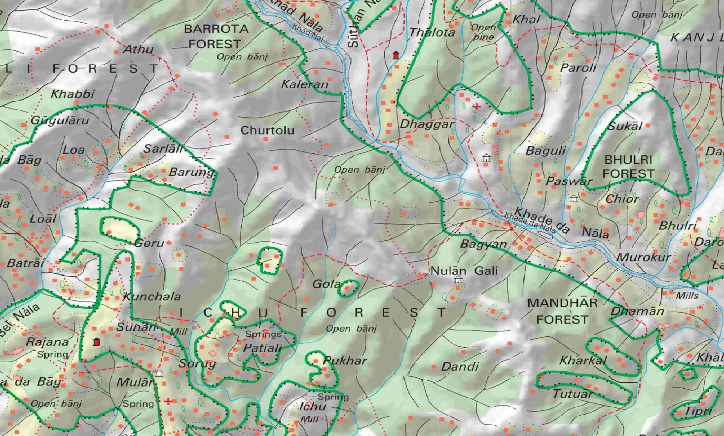
Survey of India maps showing detailed terrain features of the Khade da Nala valley in Udhampur district
Before exploring any new region I usually spent weeks mapping the geography in detail in Open Street Maps which provides a blueprint for planning my months-long ultra journey. For Jammu & Kashmir I studied the topography of the entire state through Survey & legacy maps and mapped important geographic features for the benefit of the independent hiking community:
- Major valleys / Rivers – 50
- Minor valleys / Streams – 1500
- Mountain passes – 700
- Mountain peaks – 600
- Alpine lakes – 500
- Glaciers – 160
- Remote settlements – 5000 (food supply, night shelter)
- Trails to be explored – 13.000km
- Mapped Hiking routes – 50 routes covering 2500km
Mapping of important geographical features of Anantnag district including river valleys, mountain passes, peaks and alpine lakes in Open Street Maps
Inter season exploration means planning a traverse which follows the ever changing snow-line. Each season defines a subset of natural features (passes, lakes, peaks) within a certain altitude range suitable for exploration. In deep winter you’ll hit snow at 2000-2500m altitude while in late summer you can easily hike above 4000-5000m.
Once we identify (hundreds of) target features for exploration we can plan a continuous months-long traverse connecting these via a sequence of trails. I usually target ridgelines providing mesmerising views on surrounding valleys and far off high ranges. My actual route remains dynamic as per the condition of trails (some no longer in use), weather conditions and changing snow-line which requires frequent rerouting.
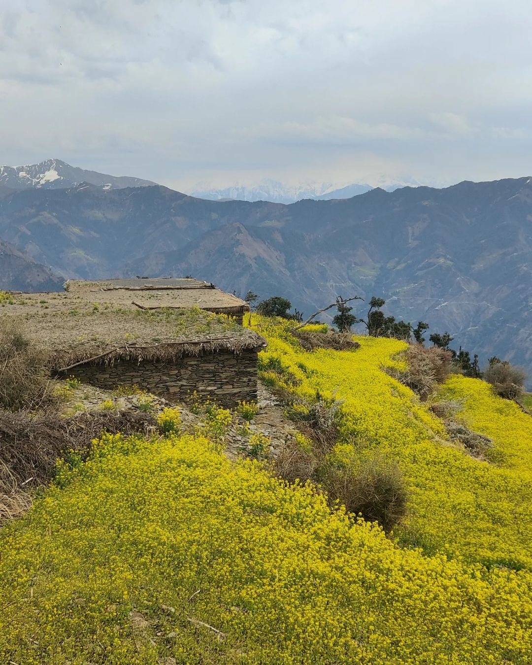
Yellow mustard fields during late winter in alpine dwellings high above Tawi river valley in Udhampur district
As an alpine style hiker I identify periodic (2-5 days) checkpoints for food supply (and charging electronics) to sustain my months-long journeys. These are usually remote hamlets in the valleys in between passes and high ranges. Optimising food ration allows me to minimise weight enabling me to hike much faster in steep terrain and reach my next target quicker. It also allows me to eat fresh nutritious food to sustain long endurance journeys.
I download offline contours essential for understanding the topography of the region to be explored. Too often I see hikers still looking at Satellite / Earth maps instead of learning to read topographic maps which are essential for navigating steep mountainous terrain. Contours also help while exploring off trail or when fresh winter snow covers the trails.
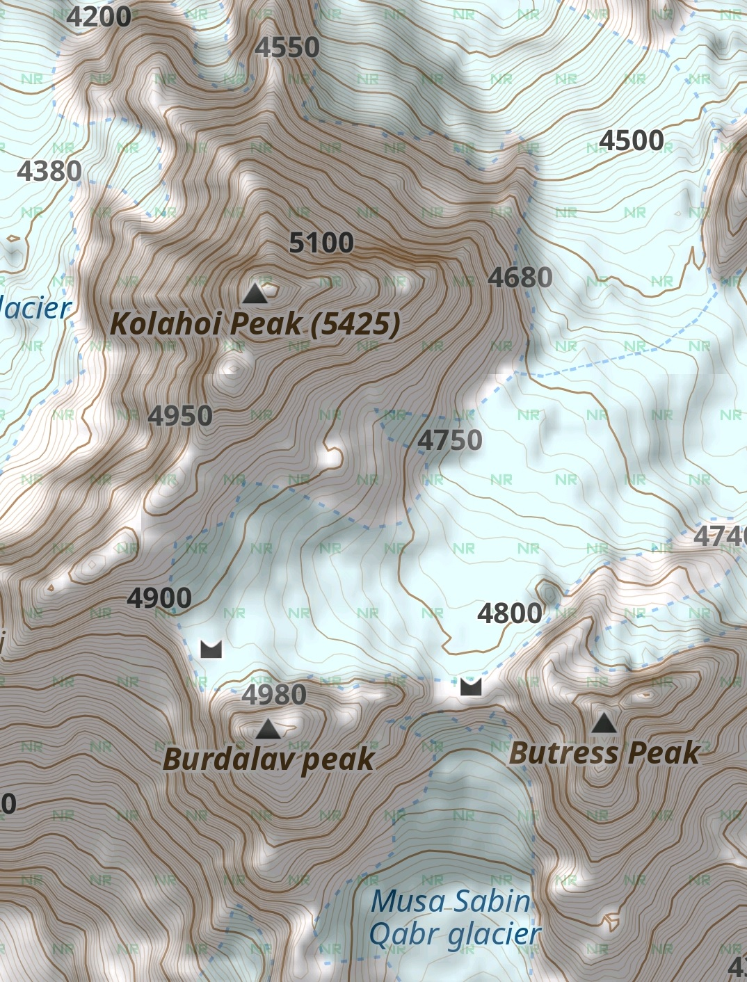
Offline contours used for mobile (GPS) navigation showing the topography of the terrain around the Kolahoi peak in Anantnag district
For field navigation and dynamic (snow, weather) route planning I use offline state level OSM maps which include important geographic features. These scalable vector maps can be viewed at any zoom level for planning longer traverses. Complimentary, I geo-reference and generate offline map tiles for Survey maps which provide me rich terrain detail including accurate trails and umpteen remote settlements for precise navigation and planning of night halts and food supply.

Geo-referenced Survey maps used for offline mobile (GPS) navigation. Here showing detailed terrain features of the Naguni Gad river valley in Doda district
Winter traverse
In February 2022 I did a first low-altitude trans-Jammu winter traverse through Jammu, Udhampur, Kathua and Reasi districts. Starting from the Ravi river valley in Chamba district (HP) and traversing across 300km beautiful ridgelines through the Himalayan foothills to Reasi near Jammu. I identified some 100 target passes in the 2000-2500m altitude range to keep the winter snow below the knee level.
Going higher above the snow-line usually becomes too challenging (slow) on the steep, frozen North facing slopes. I connected several snow clad ridgelines offering mesmerising views on the surrounding Ravi, Siul, Sewa, Tawi, Chenab, Ujh, Anji Khad, Ramnagarwali Khad and Khade da Nala river valleys spanning across the state of Jammu.
The snow covered foothills of the Himalayas (2300m) in the Khade da Nala valley in Kathua district in the month of February
Similar to Uttarakhand, the foothills of J&K are dotted with countless tiny hamlets deep inside the remotest valleys up to 2500m altitude. Each farming settlement is a green oasis within the surrounding forest consisting of a handful of beautiful homes built from natural materials. All hamlets in the same and neighbouring valleys are connected by an extensive network of forest trails and mountain passes providing infinite possibilities for alpine hikers.
One benefit of a low altitude winter traverse is that you are never too far away from these remote hamlets suitable for night halt and food supply. With few outsiders visiting these less explored valleys, one usually experiences overwhelming hospitality. Nothing beats a warm cooked homegrown meal at the end of an exhausting day in the snow. Within an entire month I usually end up at least 15 nights sleeping in a comfortable bed with warm blankets in a cosy wooden room.
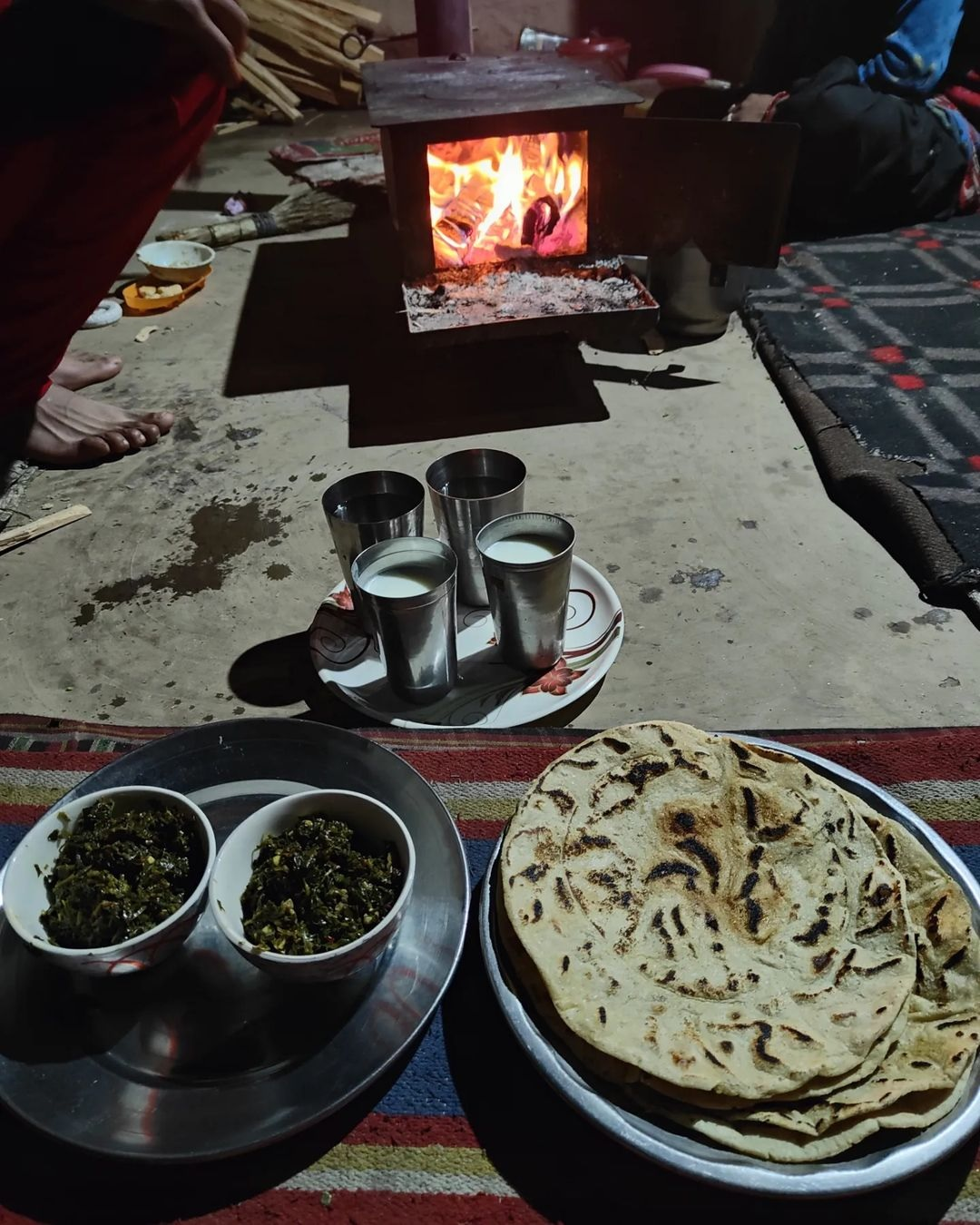
Warm hospitality and a fresh homegrown dinner in a remote hamlet in the Uhj river valley of Udhampur district
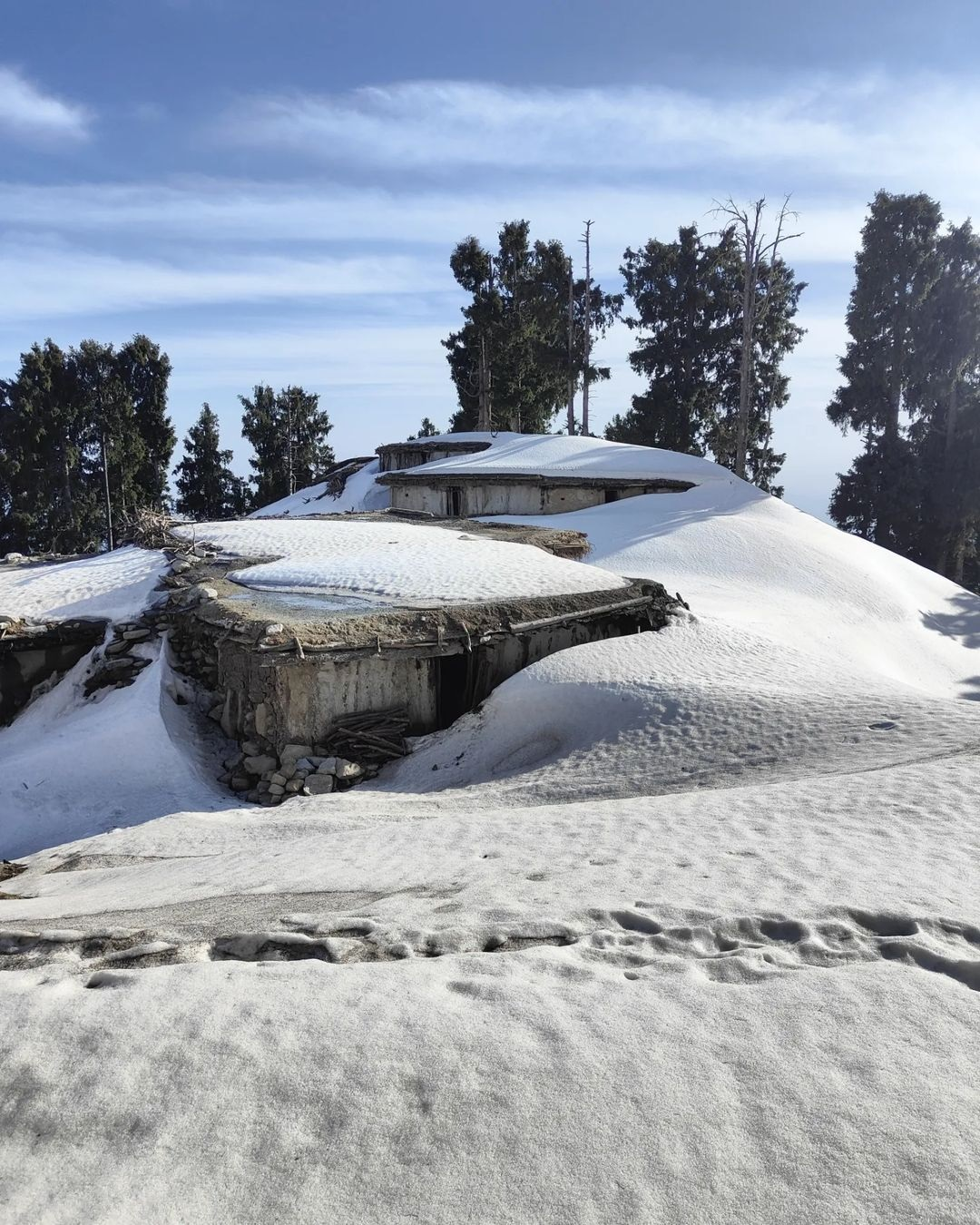
During winter the snow covered alpine meadows are completely desolate. The higher slopes are dotted with countless summer dwellings (up to 3000m) which are all deserted and partly buried in snow. While hiking the ridgelines these uninhabited rock homes are perfect shelters for overnight stay in the cold winter nights and offer some safety against nocturnal predators.
Winters usually offer stable weather conditions (compared to summer / monsoon) resulting in beautiful blue skies contrasting the white landscape. With the sun shining bright above I usually hike in shorts and tee even when sinking knee deep in the winter snow. The melting snow (afternoons) provides plenty of drinkable water reducing the need to carry extra weight.
A snow covered isolated summer dwelling at 2600m altitude in February in the Debi Nala valley of Kathua district
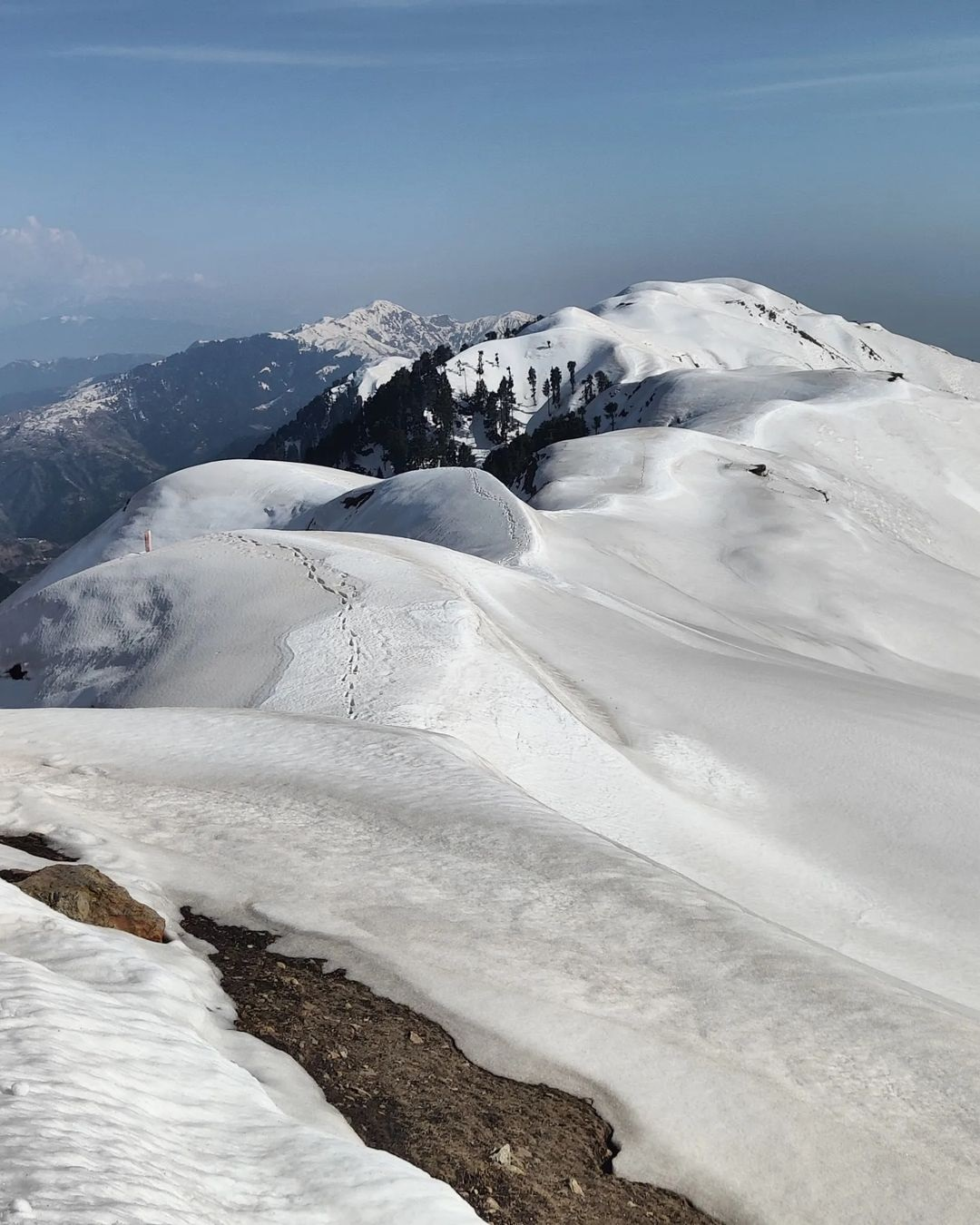
Spring traverse
During April-May I did a second mid-level 800km traverse through the lesser known regions in the districts of Kishtwar, Doda and Ramban. I hiked along 3000-3800m high ridgelines separating the Chenab, Tawi, Niru, Siul, Kal Nal and Kagune Gad river valleys. Further away I got treated to mesmerising views on the snow clad high ranges bordering J&K in the East and North.
Completely deserted in winter, the high alpine meadows are full of life during spring. Bakarwals (shepherds) migrate their large herds of sheep, goats, buffalos to graze the snow fed high meadows during summers. Some travel with entire families across hundreds of kilometres from the plains to spend the entire summer up there. Men with turbans and beards manage the large herds of cattle while women guide horses loaded with camping and cooking gears carrying small children and newborn goaties along the way.
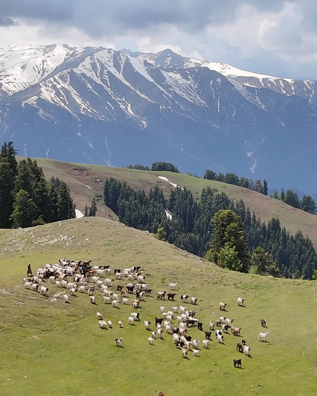
Bakarwals grazing their herds in high alpine meadows in May beneath the snow clad high ranges around Kailash Kund near Bhaderwah in Doda district
As we explore higher altitudes towards summer we are further away from the villages in the valleys below to resupply food. This usually means we need to carry more supplies (weight) to cover higher traverses up there. At the same time with lots of bakarwals in the lush green alpine meadows showing equal warm hospitality food is usually not far away. On some days I get invited for a cup of tea with fresh goat milk 3-4 times a day and enjoy thick, wood fried rotties with delicious sabji around the campfire with the shepherds at night.
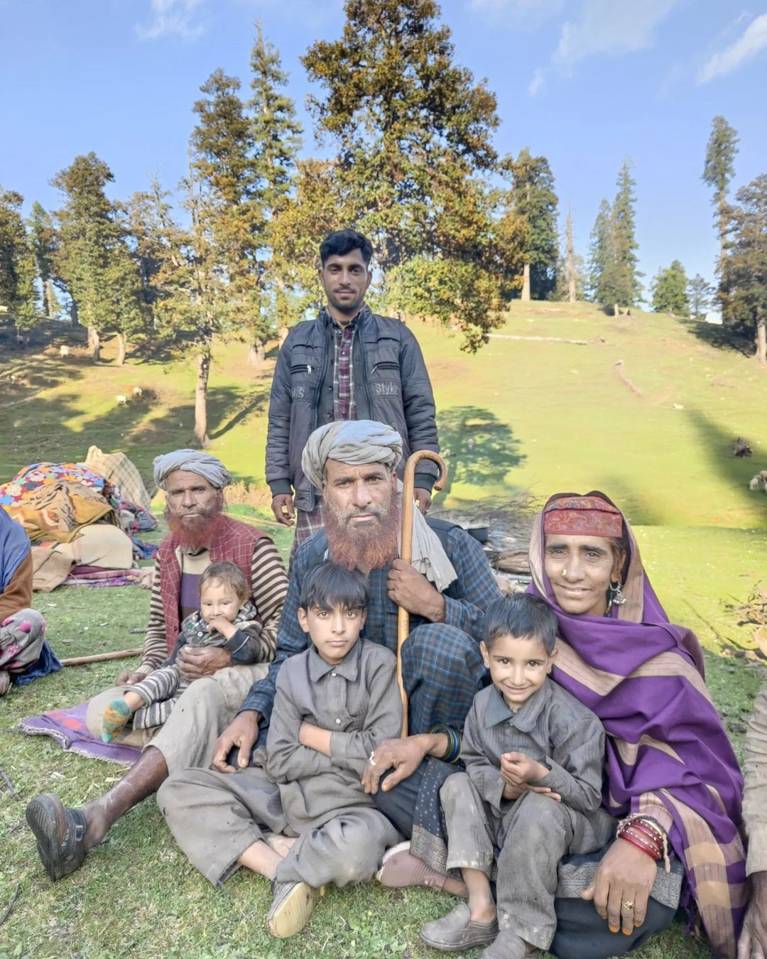
Generations within a bakharwal family grazing cattle in May in the high meadows of Bal Padri in the Kangune Gad valley of Doda district
With few outsiders exploring these lesser known regions of J&K, I get stopped once in a while by villagers with some initial suspicion of my presence given the past history of militancy in the state. Sometimes I end up escorted by men with AK-47s to the local police chowki for an identity and baggage check. After verifying the purpose of my visit though both locals and officials always offer warm hospitality to a lone stranger.
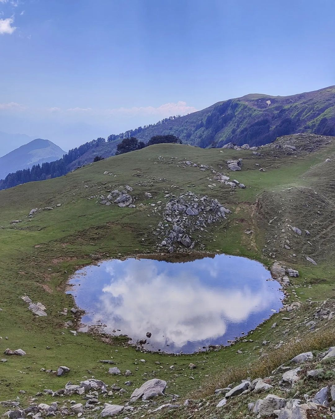
One of the many beautiful lakes in the alpine meadows high above the Siul river valley flowing from the high ranges on the border of J&K and Himachal in Chamba district
Summer / Autumn traverse
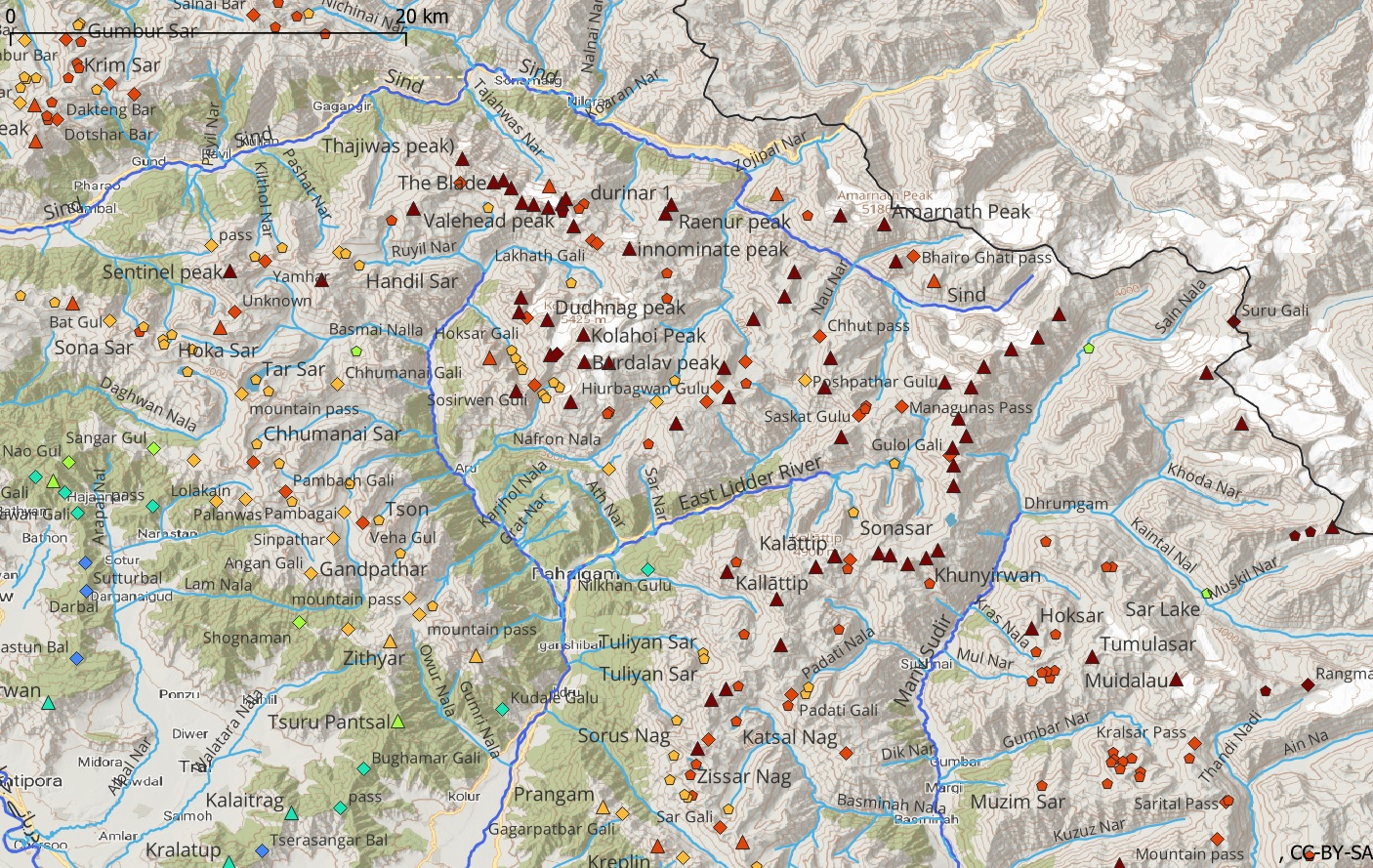
East J&K has hundreds of mountain passes, peaks and lakes in the 2000-4000m altitude range (blue / green / yellow in map below) suitable for exploration during winter and spring seasons. In August and October I am planning a summer and autumn traverse covering 4000-5000m high ranges (orange / red in map below) surrounding the valley of Kashmir. The Pir Panjal range in the South and the high ranges bordering Ladakh in the North are known for hundreds of large, beautiful alpine lakes, some of them with international repute.
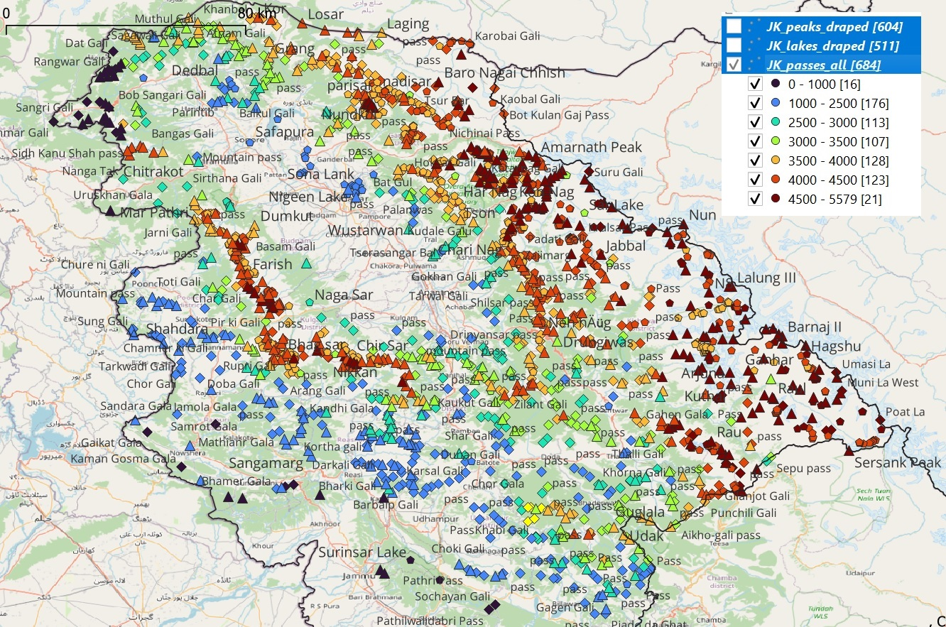
Visualising mountain passes, alpine lakes and peaks color graduated per elevation in QGIS to plan seasonal traverses
The Survey of India maps holds a treasure of unexplored trails for the alpine hiker. Though the maps originate from the 18th century Great Trigonometrical Survey of India many of the mapped trails are still 90% accurate based on my recent years of explorations across the Western Himalayas. Some trails which are no longer in use quickly disappear in this geologically active terrain. Disappearing traditional nomadic lifestyles and migration of young generations to cities mean these ancient paths continue to fade away. Therefore I call out to the independent hiking community to continue exploring, GPS record and digitally map in order to preserve our rich heritage for future generations.
Those interested to learn more about alpine exploration can check out my free online Alpine Hiking Bootcamp on my blog. It consists of 40 hands-on modules condensing years of alpine exploration. Topics covered: geography and topographic maps of the Himalayas, traverse planning and navigation, minimalist fast hiking gears, Himalayan terrains and Geographic Information Systems. So far 250 students have taken up the online course.
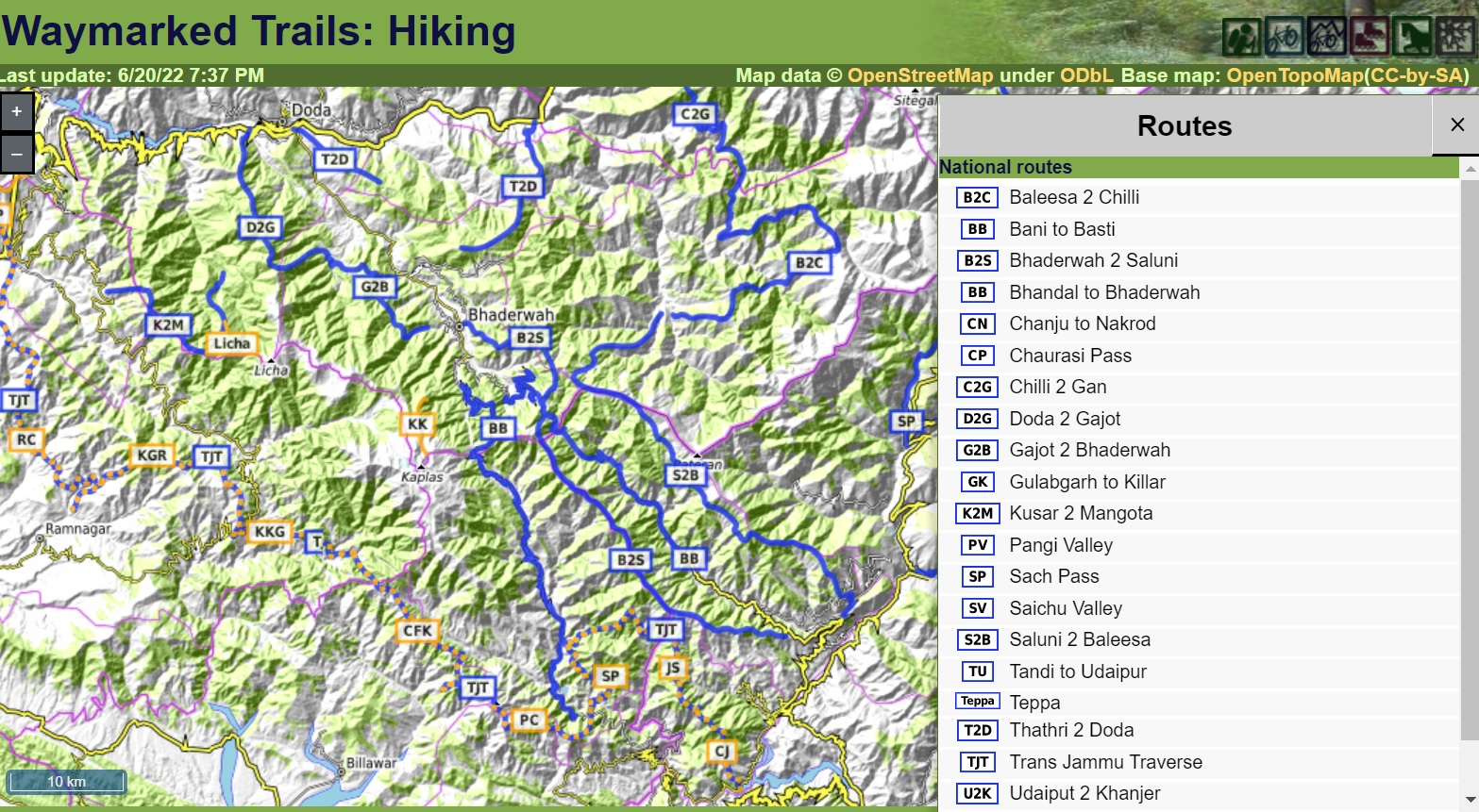
Hundreds of accurate recorded hiking routes in J&K mapped in Open Street Maps available to the independent hiking community
References
Photo selection at tinyurl.com/jk-2022
Daily blog posts on ultrajourneys.org
Visual journey on instagram.com/peter.vangeit
Hundreds of videos on youtube.com/vangeip
Video documentaries on youtube.com/creedaz
Mapped hiking routes on openstreetmaps.org
Survey of India maps onlinemaps.surveyofindia.gov.in
Waymarked Hiking Trails hiking.waymarkedtrails.org
J&K legacy maps zenodo.org/record/3595575
Mobile offline navigation osmand.net
Blue bolt gear blueboltgear.com
Mapping J&K ultrajourneys.org/mapping-jammu-kashmir/
Alpine Hiking Bootcamp ultrajourneys.org/alpine-hiking-bootcamp/
Sathya’s blog sathyastravels.blogspot.com
Quantum GIS qgis.org

Myself scaling the frozen snow covered Northern slope of the Kalethu peak (3700m) in April on border of Chamba and Kathua districts
just came across to read it found very interesting
Thank for exploring J&K as well my hometown (Bhalessa)