
Introduction
Leon Perrin (Australia). Looking at the map/weather for Ladakh, Himachal Pradesh and Uttarakhand. Would it be possible/recommended to begin mid ~ September GWHT just south of Leh then South to Mud, and onward to Uttarkashi and following your footsteps on in a South East fashion through the lower altitudes of Uttarakhand
Arrive Early September Peter Planning to begin traverse straight after bootcamp, so far I have mapped from Rumste Ladakh to Karzok accounting for acclimatisation onward to Kibber down to Mud and Kaphnu.
Actual Plan
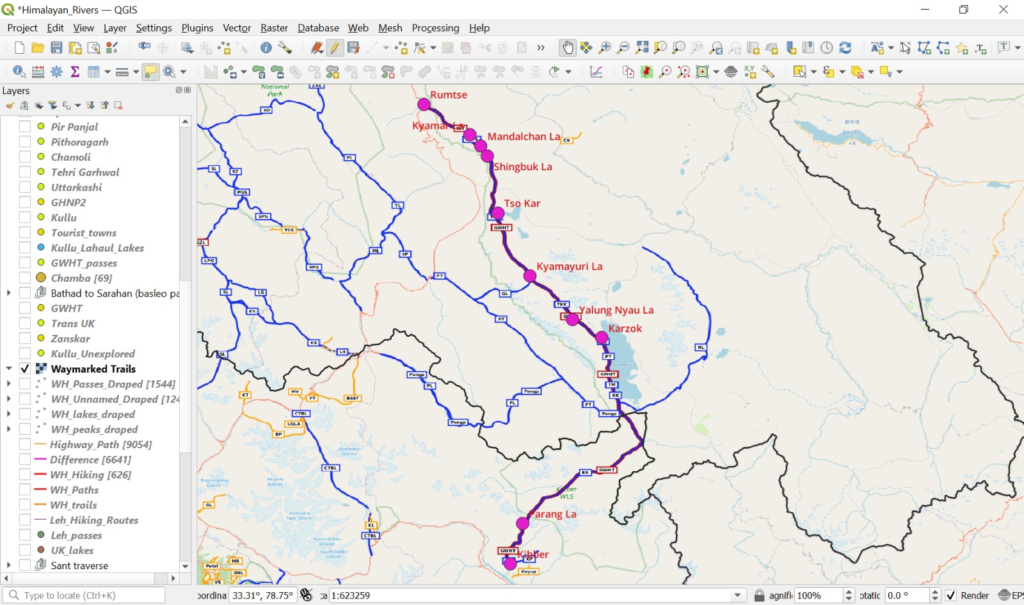
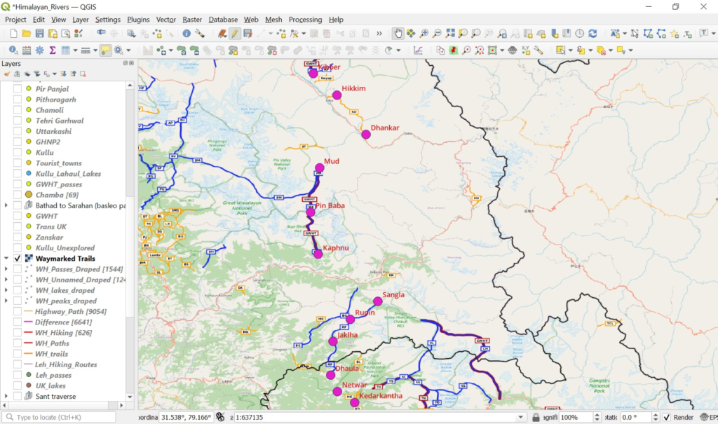
Mid September the winter usually sets in and the snowline starts descending. In Ladakh we are behind the Great Himalayan Range so there is less snowfall and we can stay higher. Once you enter Himachal (Kinnaur) by late September we’ll probably have to stay below 4-4500m altitude and gradually come down to 3500-4000 by October to keep the snow below knee level. Taking this into account I used waymarked hiking trails to create a continuous West-East traverse of individual OSM hiking routes using QGIS below. I have marked both passes and villages (food supply) in between so you can optimize food ration / go ultra light.
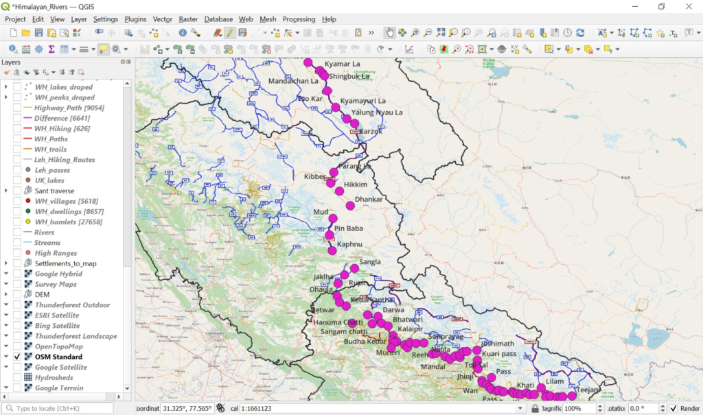
You can download the GPX over here and import in OSMAnd and take a closer look. As usual the weather changes from year to year so we will have to dynamically adjust the route (higher or lower altitude passes) as per the dynamic snowline.
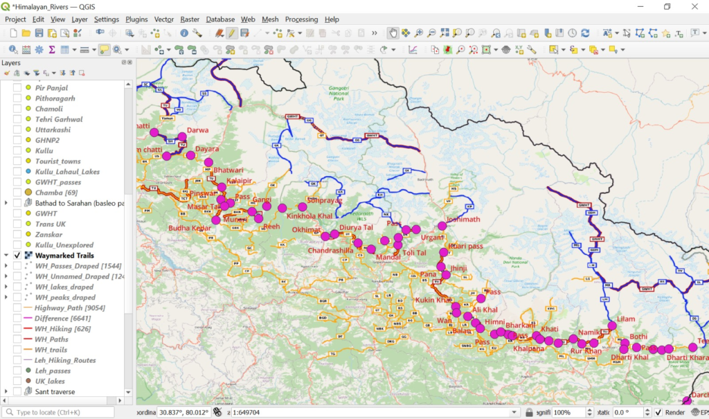
We are skipping the 5000m+ high passes in Himachal/Uttarakhand which will be too high in October. Every year we can see sad news of hikers dying above 5000m while getting caught in bad weather in Autumn so not a good idea.
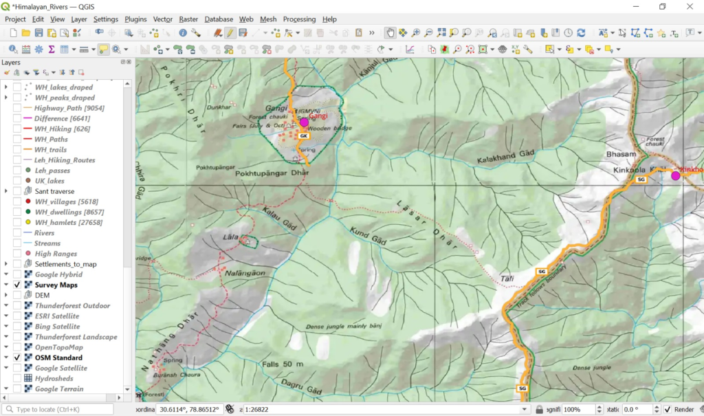
Above traverse follows pre-recorded (GPS) OSM trails which are pretty straightforward to follow. To make it more interesting we can explore some trails of the Survey of India maps in between, GPS record these and digitally map them in Open Street Maps to give back to the community. Survey maps are the most detailed available maps of the Himalayas and although older and based legacy cartography, I found them to be 90% accurate based on my own experience.
To be continued…