
Previous Part 3
7. Trails & Hiking Routes
Jammu & Kashmir has tens of thousands of beautiful trails connecting remote hamlets, nomadic dwellings, alpine meadows, mountain passes and glacial lakes. Some trails are used by semi-nomadic tribes and shepherds to migrate to alpine meadows during summer to graze cattle. Many of these remote trails in the mountains make beautiful hiking destinations.
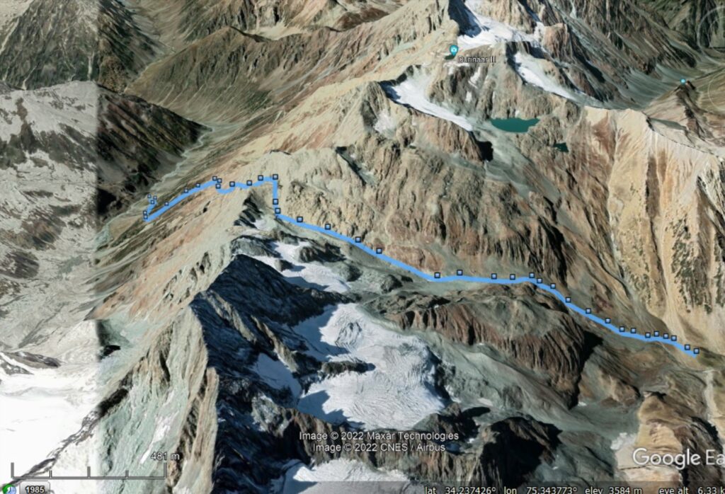
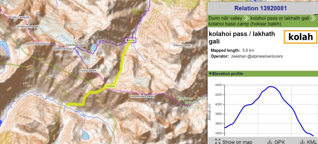
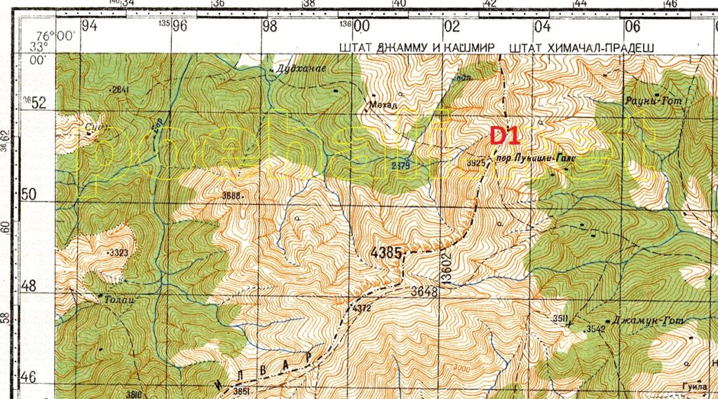
Above / below the trail across the Kolahoi pass connecting the Sind river valley with the base of the Kolahoi peak. This trail has been accurately mapped in Open Street Maps as a hiking route. Below we see the route on a topographic map along with an elevation profile revealing the vertical progression of the same route.
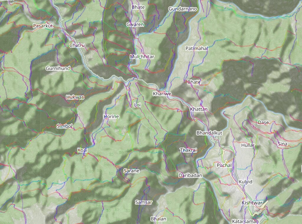
More than 14 thousand kilometers of trails across the mountains of J&K were digitized from legacy maps which can be overlaid on any base map and used for planning and navigation. Below shows the same trails overlaid on Open Street Maps with contours and in-between human settlements offering an excellent map view to the alpine hiker to plan a traverse.
The same legacy trails have been imported in OSM (osm.org) as public “GPS traces” where they can be overlaid directly on any OSM base-map. Trails are spectrum colored as per their steepness (slope).
To accurately map these legacy trails in Open Street Maps they have to be first explored / verified in the field and GPS recorded. Some legacy maps are not very accurate (pre-GPS era) or some trails might have changed over the years or some trails might no longer be in use or destroyed by landslides or overgrown by forest.
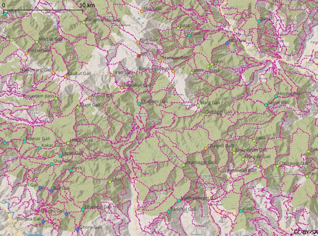
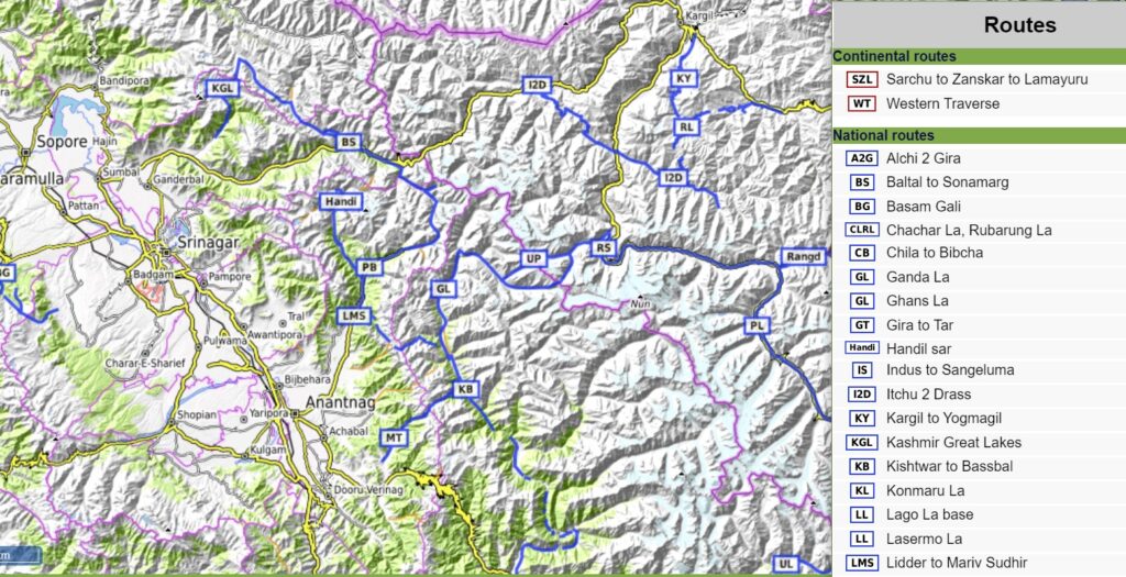
As of April 2022, 56 routes totaling 1200 km have been explored and accurately mapped as “hiking routes” in OSM for Jammu & Kashmir. The same can be comprehensible viewed through Waymarked Hiking Trails. Below map view shows appropriate hiking routes at different zoom levels (intercontinental, national, regional and local routes) enabling the alpine hiker to plan either local hikes or longer traverses combining individual routes.
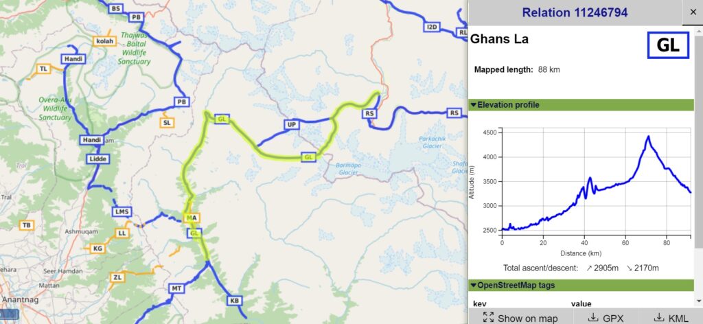
Individual hiking routes can be viewed on map or in tabular form. For each route one can bring up basic details like distance, ascent, descent, elevation profile and download a GPX file for use mobile mapping apps while navigating in the field.
8. Human Settlements
Yet another important feature for the alpine hiker to plan his journey is the location of human settlements in the mountains and valleys. Settlements provide important reference points for food supply, possible night halts and recharging of electronics (offline maps, GPS navigation, photography…).
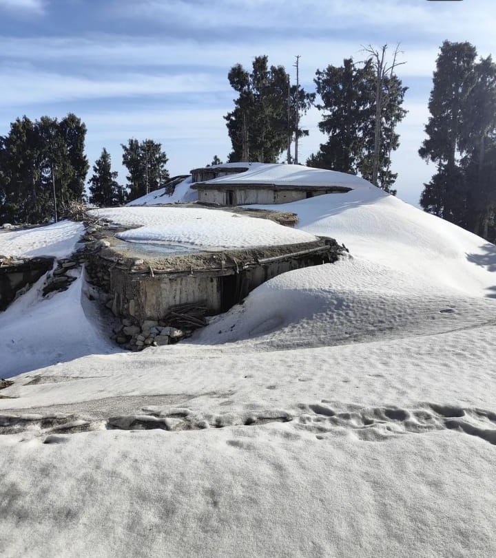
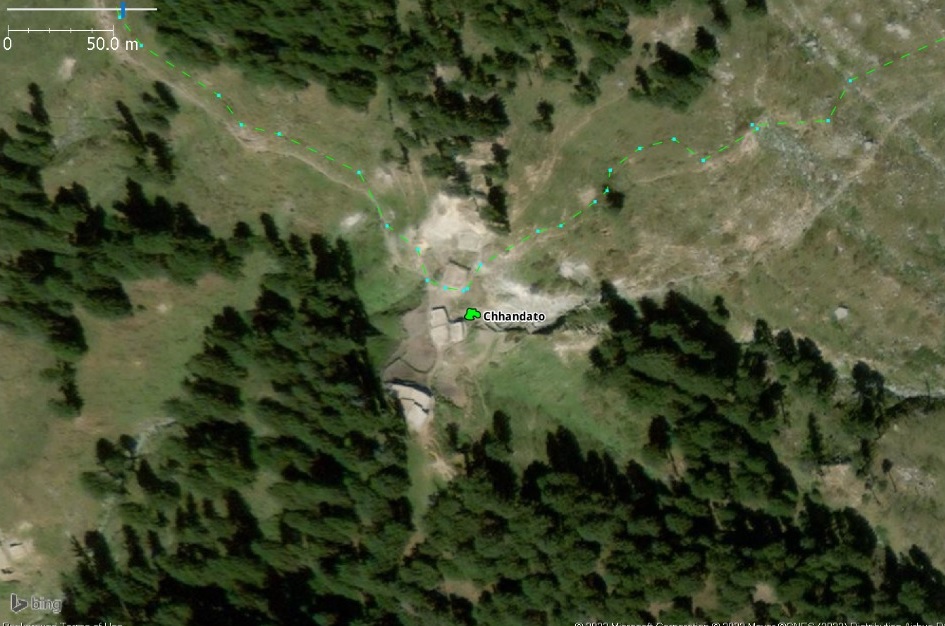
Above / below shows the isolated dwelling of Chhandaro in Doda district, East Kashmir. Located at 2600m altitude this summer dwelling is above the snow line in winter and only inhabited during summer by villagers grazing their cattle in the surrounding alpine meadows.
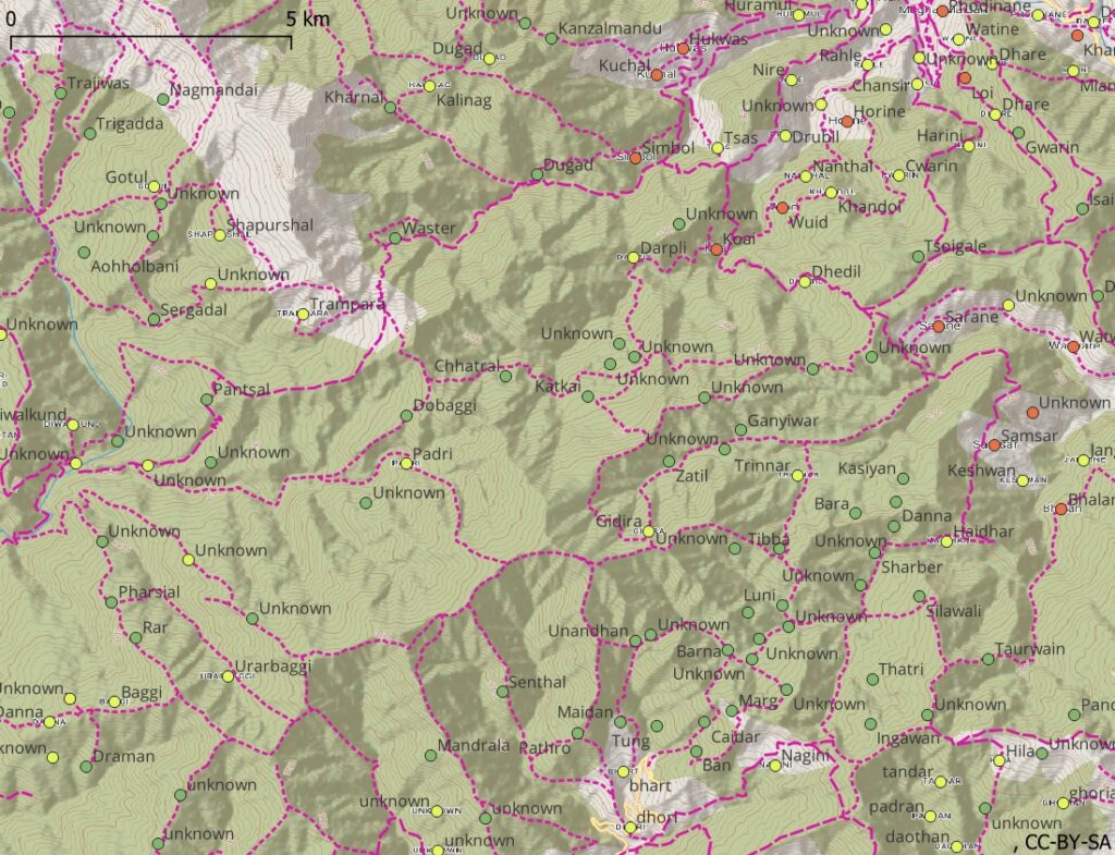
So far around 6000 human settlements in Jammu & Kashmir have been mapped in Open Street Maps . Accurate location and type of settlement has been verified on the satellite map while mapping. Settlements are categorized as towns (larger, pink), villages (medium, red), hamlets (smaller, yellow) and isolated dwellings (smallest, green).
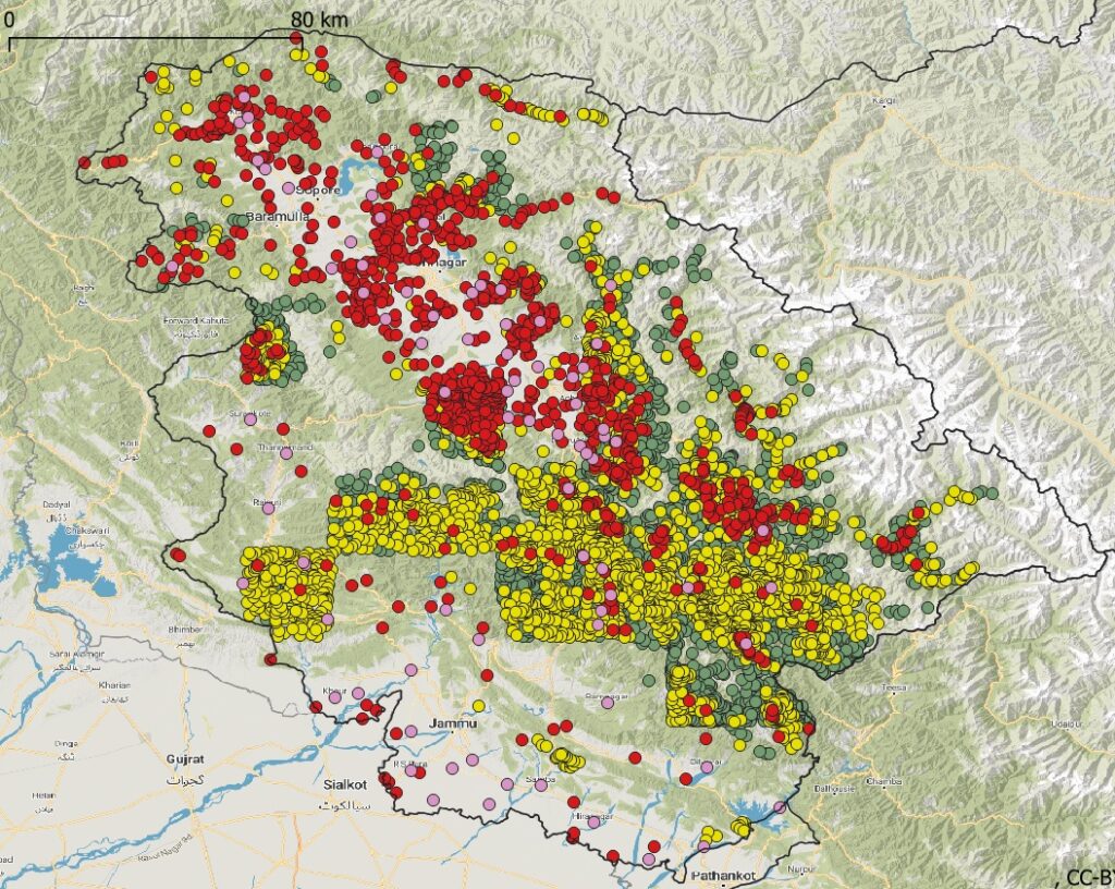
Following number of settlements are mapped for J&K:
- 80 Towns – larger human settlement but smaller then a city
- 1000 Villages – larger rural settlement with basic facilities, like admin, medical, educational, usually connected by road
- 3000 Hamlets – farming settlement usually located deeper inside valleys
- 2000 Isolated Dwellings – handful of homes located higher up slopes usually inside forest
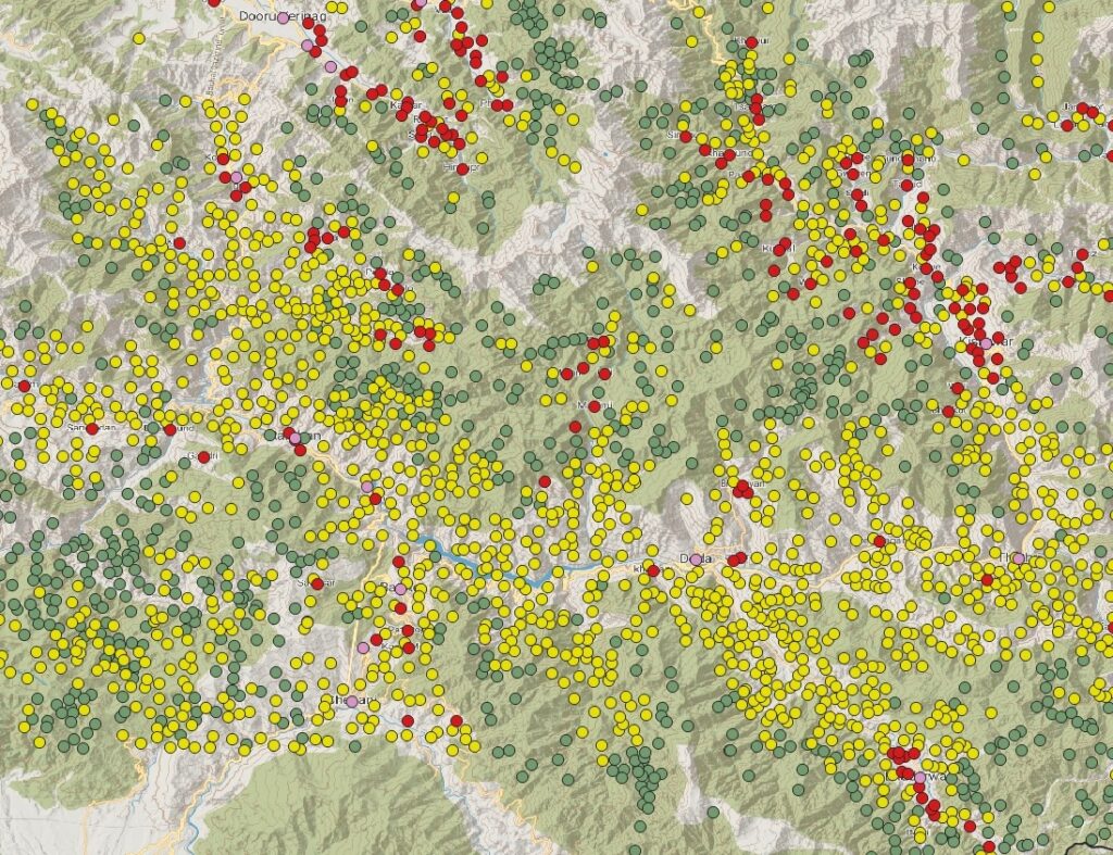
As we zoom in further to a certain region / mountain range we can see individual settlements appear on the map below. Villages (red) are usually located inside the main valleys connected by road. Hamlets (yellow) are farming settlements located further up the slope connected by trails or small tracks. Dwellings (green) are still more remote higher up the valley slope or inside the forest. Some dwellings are seasonal and only inhabited during summer. Above 3000m we usually no longer find any human settlements.
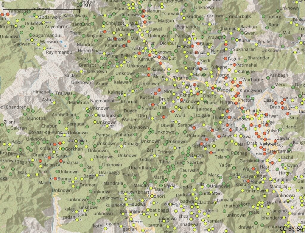
Viewing both digitized trails and settlements on the same map the alpine hiker can easily plan his traverse across the mountains with periodic food / night stops in settlements along the way. This allows him to go light and efficient. Lighter pack = faster pace = quickly reach destination = less food / water / shelter to carry.
9. Planning a Traverse
See Part 5