
Part 2 over here
4. Glacial Lakes
A glacial lake is a body of water with origins from glacier activity. They are formed when a glacier erodes the land, and then melts, filling the depression created by the glacier. Glacial lakes are beautiful hiking destinations. Kashmir is known internationally for its many large high altitude lakes.
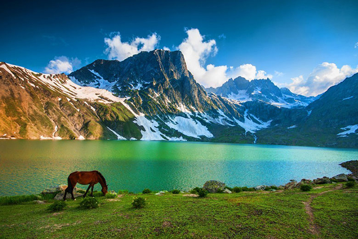
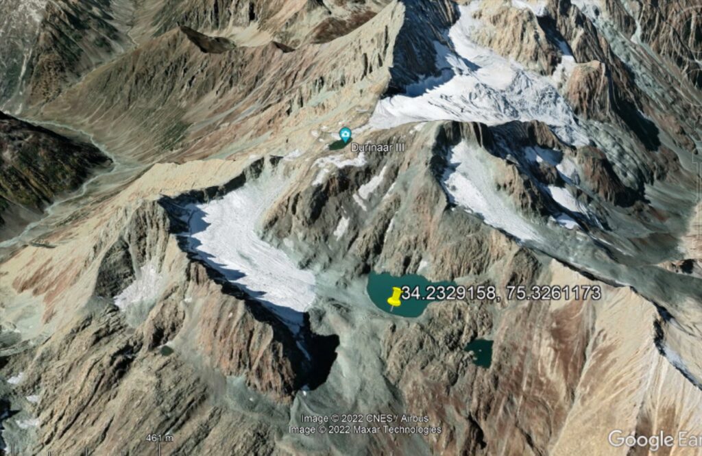
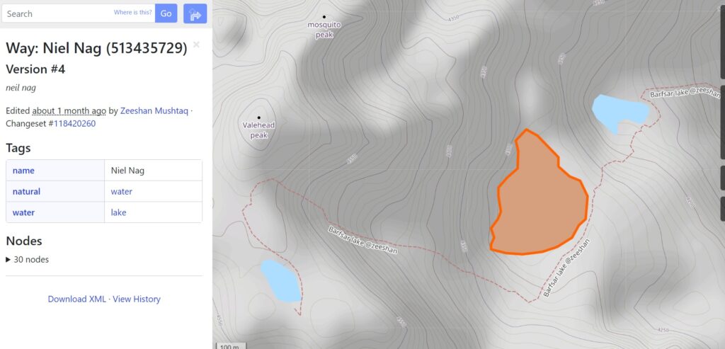
The Great Lakes trek commercially known as Sonamarg – Vishansar – Naranag trek is a famous Himalayan high-altitude trek in the Kashmir Valley. Above / below is the Niel Nag glacial lake located nearby the Kolahoi peak in Anantnag district.
Lakes appear as blue polygons when we zoom in at sufficient low scale in Open Street Maps. In November 2020 the National Remote Sensing Centre (NRSC) part of Indian Space Research Organization (ISRO) created a Glacial Lakes atlas of the Indus River Basin identifying more than 5000 high altitude lakes. Many of these were added to OSM.
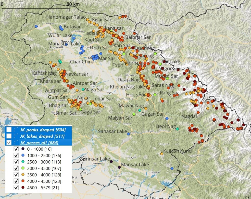
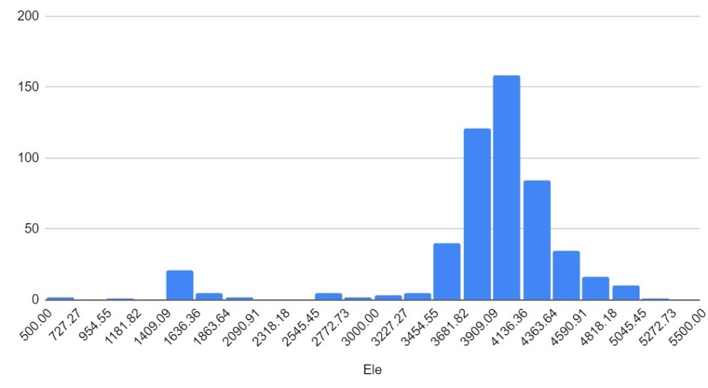
There are 500+ (named and unnamed) alpine lakes mapped in Open Street Maps for Jammu & Kashmir, most of them located at higher altitudes. The map below shows the distribution of the lakes, each colored as per its elevation.
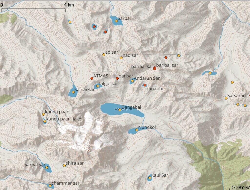
Zooming in to a lower scale we can see the individual lakes appear below revealing their size and altitude as per the contour map. Many glacial lakes are located near the top of the valleys from where a stream originates.
Looking closer at the distribution (altitude histogram) of the glacial lakes we notice that most are located between 3500-4500 meters altitude. This is a much more narrow spread compared to mountain passes or peaks.
Below is a tabular index of glacial lakes (name, geo-location, elevation) sorted alphabetically.
6. Glaciers
A glacier is a persistent body of dense ice that is constantly moving under its own weight. A glacier forms where the accumulation of snow exceeds its ablation over many years, often centuries. Glaciers slowly deform and flow under stresses induced by their weight, creating crevasses, seracs, and other distinguishing features. They also abrade rock and debris from their substrate to create landforms such as cirques, moraines, or fjords.
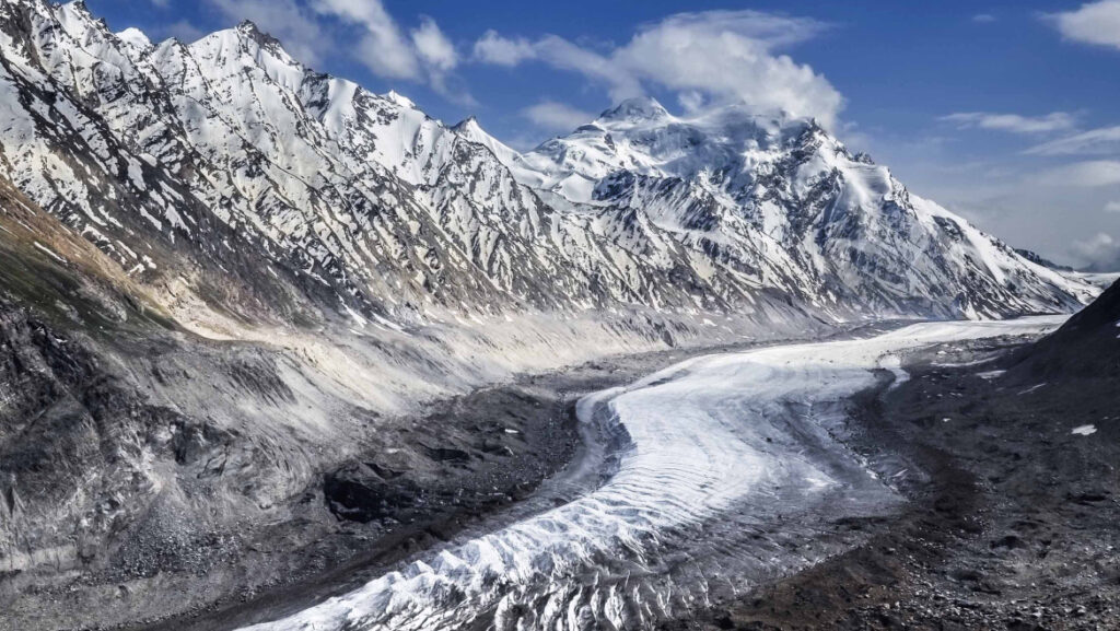
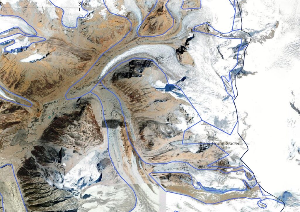
Above shows the Drang-Drung glacier located in the Kishtwar district near the border with Kargil district in Ladakh. Below we see the same glacier on a satellite map. Glacial boundaries as mapped in Open Street Maps (blue lines) sometimes differ from the actual glacier (satellite map) due to climate change and melting.
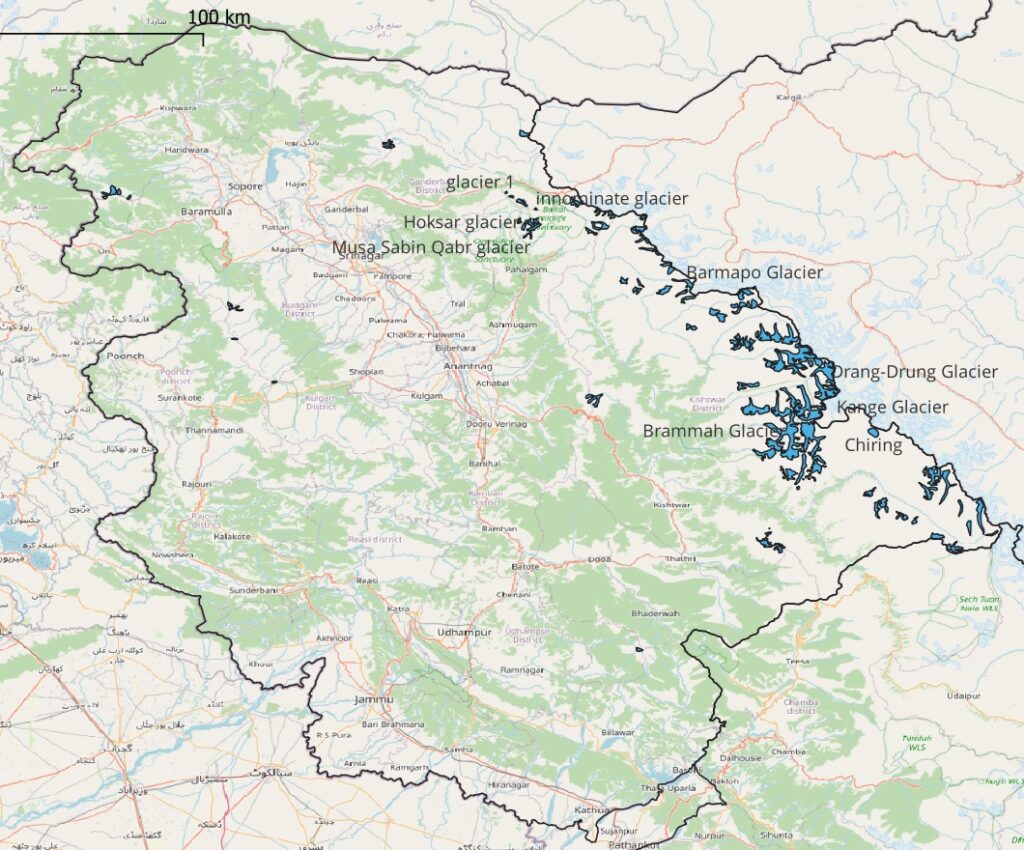
Below map shows the location of 160 (named and unnamed) OSM mapped glaciers in Jammu & Kashmir, many of them located in the Kishtwar district along the Northern border with Ladakh. Some known glaciers are Parkachik, Musa Sabin Qabr, Kolahoi, Kange, Hoksar, Drang-Drung, Chiring, Brammah and Barmapo.
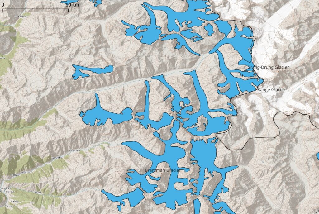
Zooming in to a lower scale the area covered and altitude (range) of each glacier becomes clear on the contour map. Glaciers hang from higher altitude ranges and peaks and give birth to streams lower down the valleys.
7. Trails & Paths
Next Part 4