
Introduction
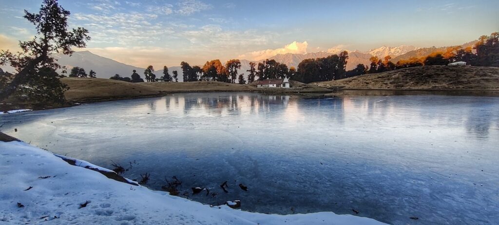
There are thousands of beautiful high altitude glacial lakes in the Indian Western Himalayas. Some are destinations of beautiful hikes and annual pilgrimages. Others are very remote and nearly impossible to reach on foot. Below the beautiful Masar Tal lake partly frozen in December 2020 in the mountains of Tehri Garhwal in Uttarakhand below the sunset lit peaks of the Bandarpunch range:
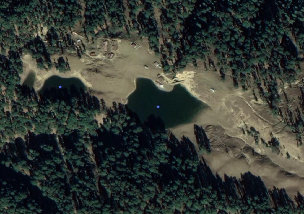
The same glacial lakes can easily be located on hires satellite maps:
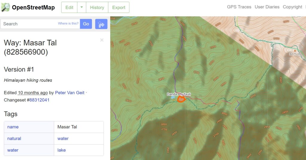
Many glacial lakes have been mapped in Open Street Maps with appropriate tags making them easily searchable / locatable through many public maps / apps:
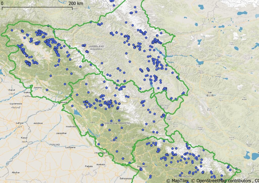
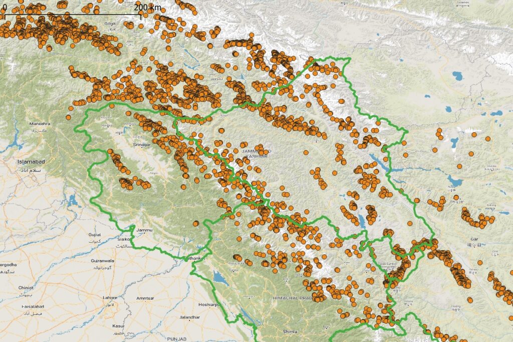
Around 700+ lakes are currently mapped in Open Street Maps in the Indian Western Himalayas:
Glacial Lakes Atlas
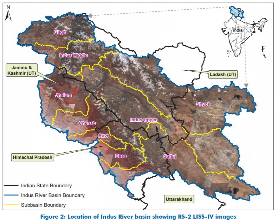
In November 2020 the National Remote Sensing Centre (NRSC) part of Indian Space Research Organization (ISRO) created a Glacial Lakes atlas of the Indus River Basin identifying more then 5000 high altitude lakes.
Mapping lakes in Open Street Maps
Mapping this extensive atlas of glacial lakes in the public domain Open Street Maps dataset adds great value for outdoor enthusiasts, researchers, … allowing them to locate these high altitude water bodies. Below tutorial gives a step-by-step guidance in mapping lakes into OSM:
Step 1. Create your Open Street Maps Account. Open osm.org in your web browser and click Sign Up in the top right corner. You can create a new account or sign up using your Google or Facebook account:

Step 2. Download & Install JOSM Open Street Maps editor from here (Windows Installer). After installation, start JOSM and go to the Edit – Preferences menu. In the Connection Sessions (globe icon), Authentication tab select the Use Basic Authentication option and enter your name and password: (created above in your OSM account)

Go back to the main screen. Select: Imagery – Maxar Premium Imagery to bring up a hires Satellite Map background:
Zoom into any part of the Himalayas at a scale of max. 2km (shown top-left) and click the Download Map icon (green down arrow on toolbar) to download OSM data. You will see forest boundaries, streams, villages, passes, geo-political boundaries… being shown:

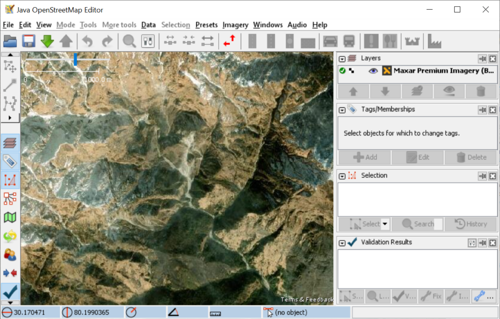
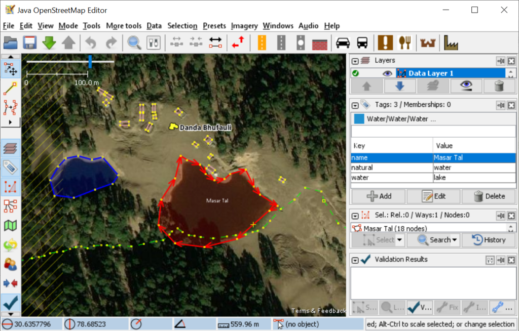
Use Shift-D and copy the coordinates 30.633952, 78.682940 to locate Masar Tal lake, zoom in to a scale of 100m and click the Download Map icon to download OSM data. Select the lake to bring up its OSM data tags on the right side for a natural water body: natural=water, water=lake, name=”Masar Tal”.
Mapping Lakes in Open Street Maps
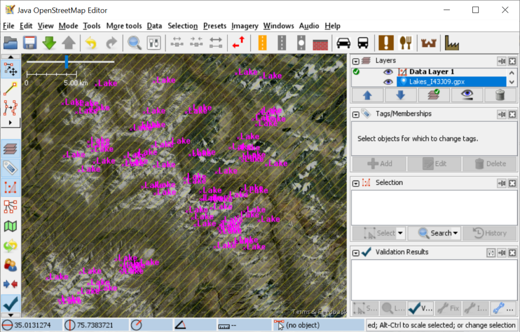
You are now ready to start mapping new glacial lakes into OSM. Download a sample set of lakes over here. Drag n Drop the GPX file onto JOSM to show the location of the various glacial lakes:
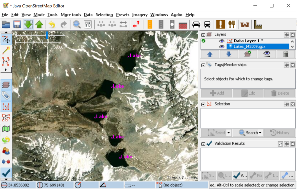
Next, zoom into and of these lakes and press the Green Down Arrow to download the corresponding OSM data set for the shown region:
Take any lake which has not yet been mapped into OSM and use the Line Tool (2nd tool on the left toolbar) to start tracing the outline of the lake. Connect the last point to the first point to complete the shape:
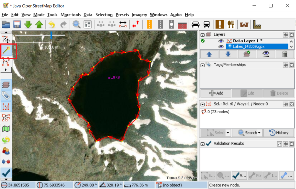
Next add the appropriate OSM data tags to mark the new shape as a natural water body (Tags panel on right side):
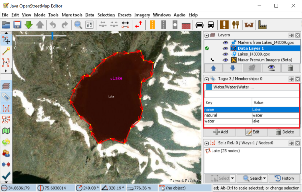
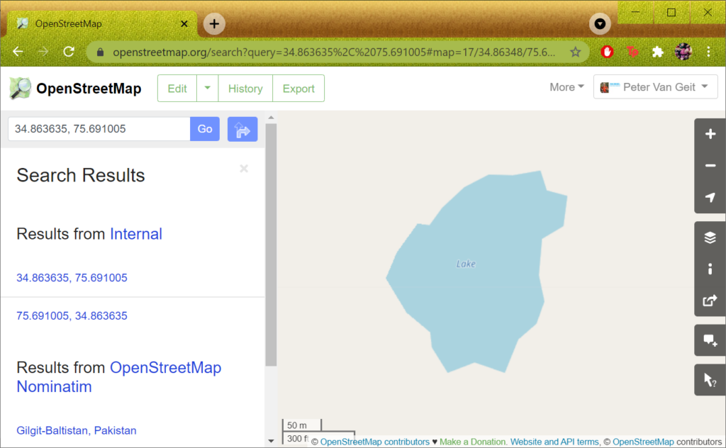
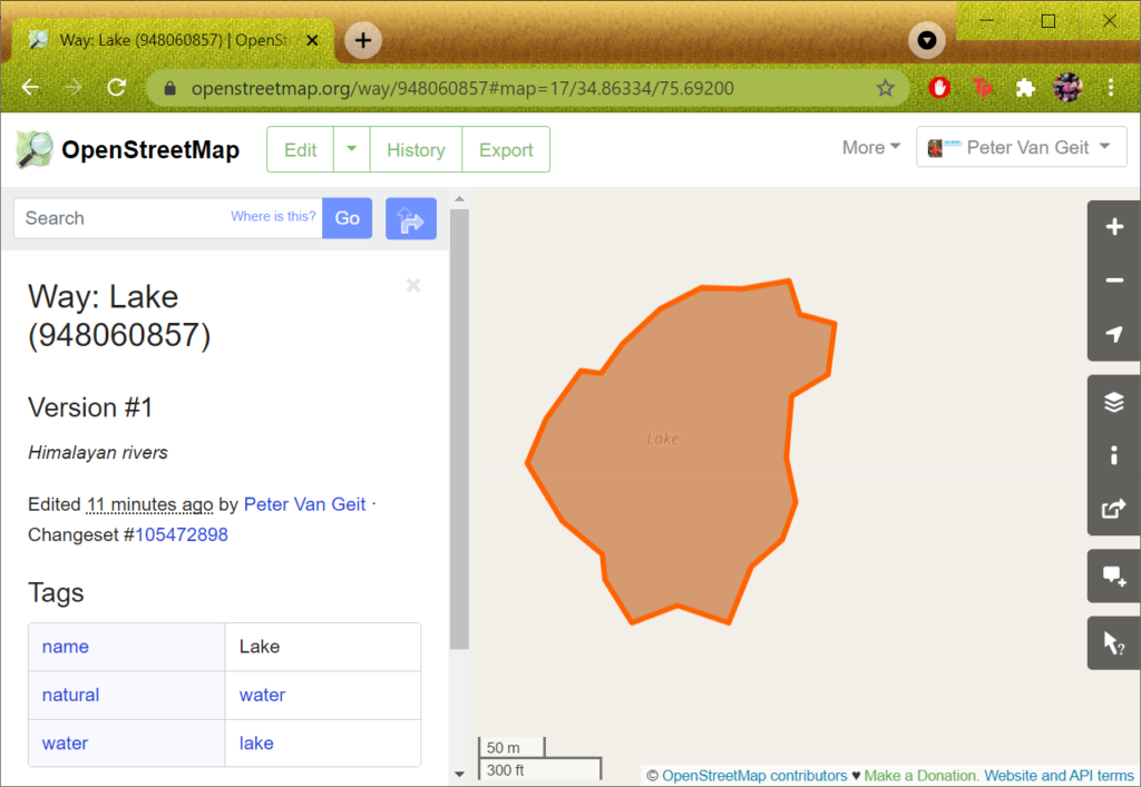
After adding the the required tags, use the Green Up arrow icon to Upload the changes to the OSM data base. After doing so you ll be able to see the newly created lake in Open Street Maps. Open osm.org in your browser and search the lat, lon coordinates displayed in the bottom left corner above:
Use the Query Features (bottom icon on right toolbar) to select any point along the boundary of the lake to show the corresponding OSM feature in the left panel:
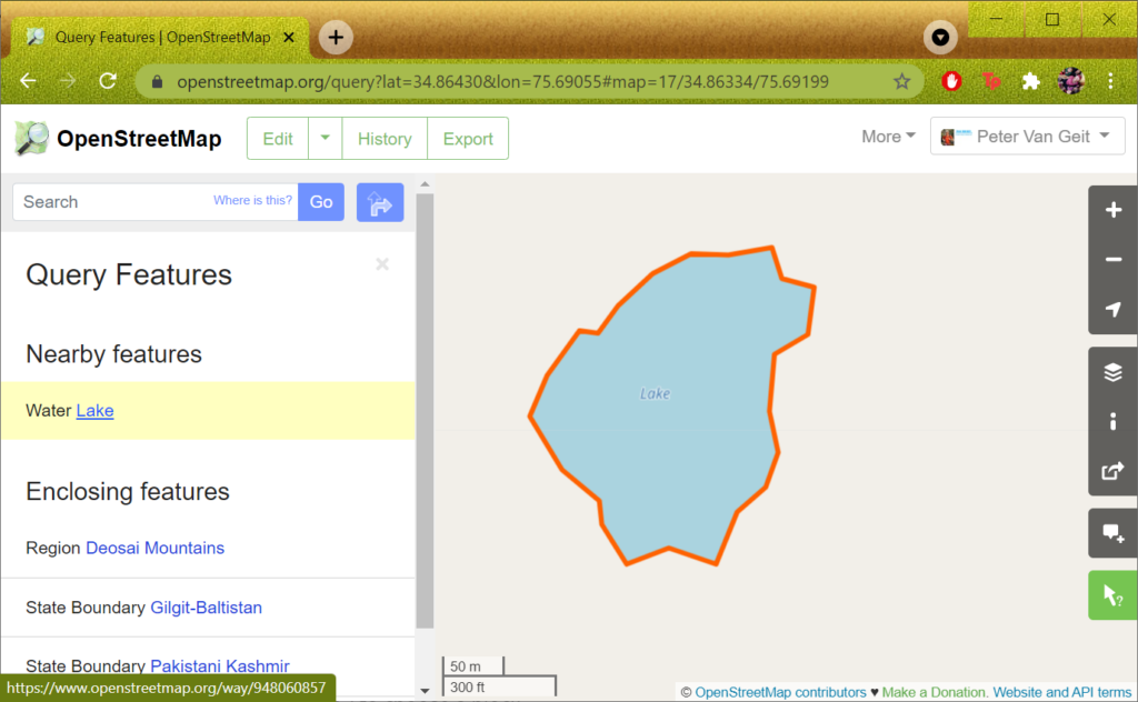
Click on the Lake feature in the left panel to bring up its properties (OSM tags):
Congrats! Your newly mapped lake will now be visible to the world wide community through numerous OSM based map viewers and mobile apps. Note that it might take a short while (week, month) for newly added objects to be reflected in cached OSM tiles used in many apps.
Once you are comfortable with the entire process to map one single glacial lake then get in touch with me to assign you a dedicated region to be mapped.