
This is a step-by-step tutorial how to identify, download, geo-reference, convert and use Survey of India maps for exploration using offline mobile navigation.
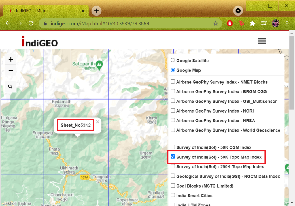
Step 1 – Identify survey map sheet nr
https://www.indigeo.com/iMap.html#10/32.6937/78.0442
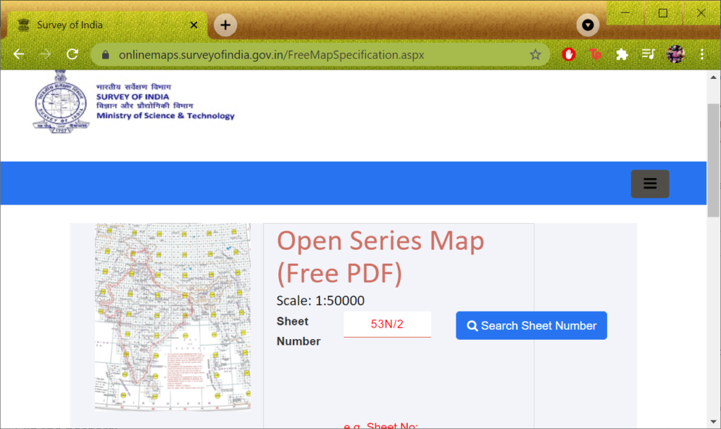
Step 2 – Download survey map
https://onlinemaps.surveyofindia.gov.in/FreeMapSpecification.aspx
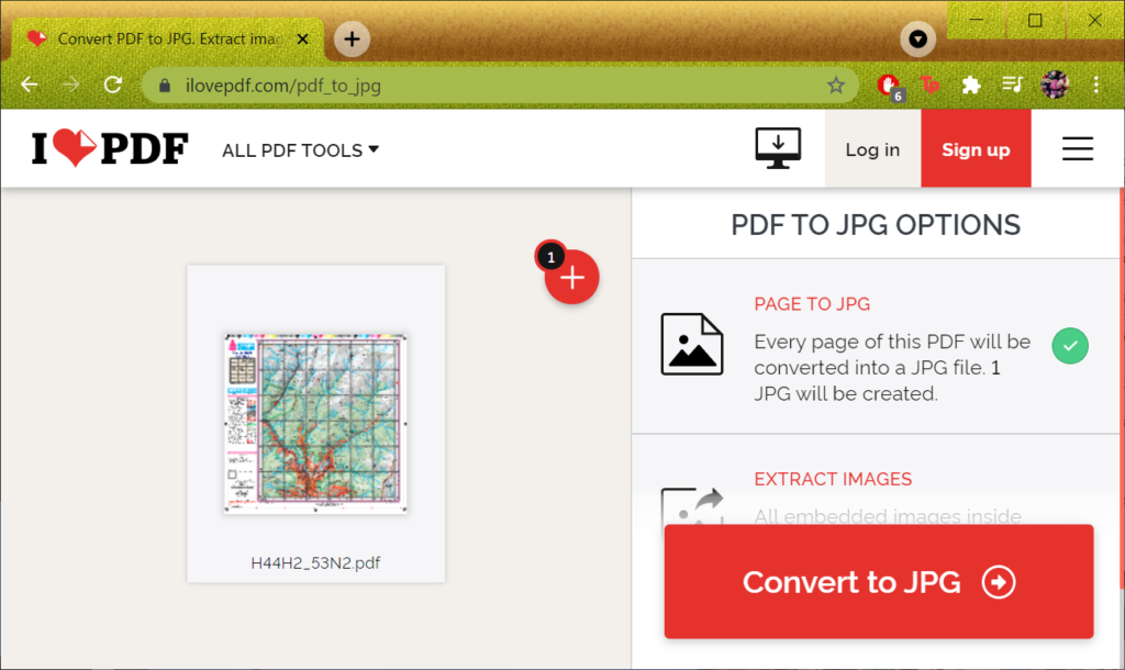
Step 3 – Convert to JPG
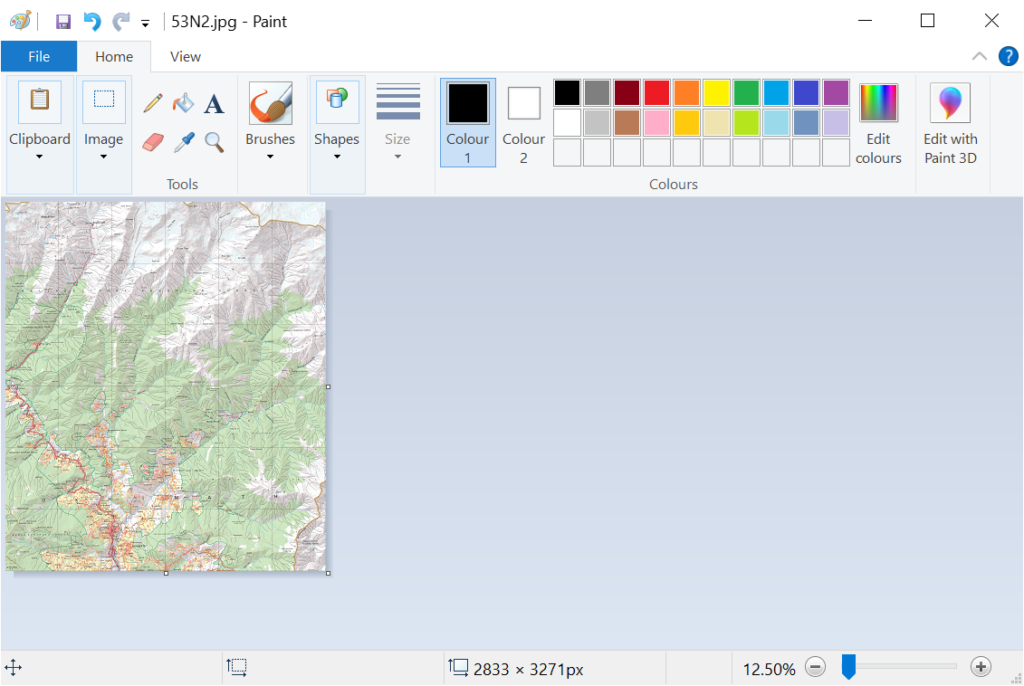
Step 4 – Clip the borders
Microsoft Paint
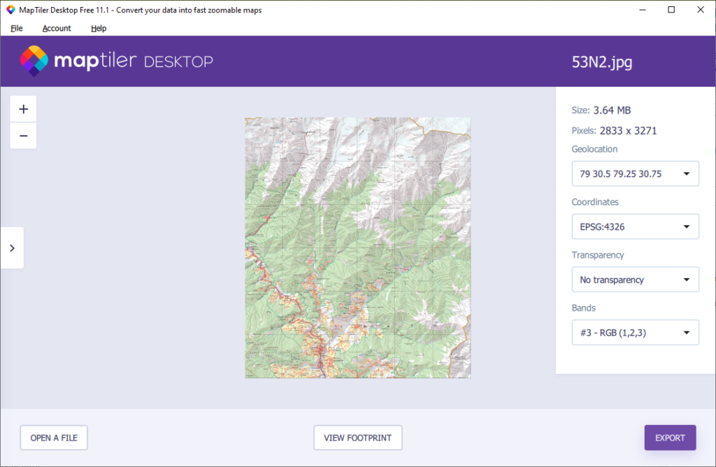
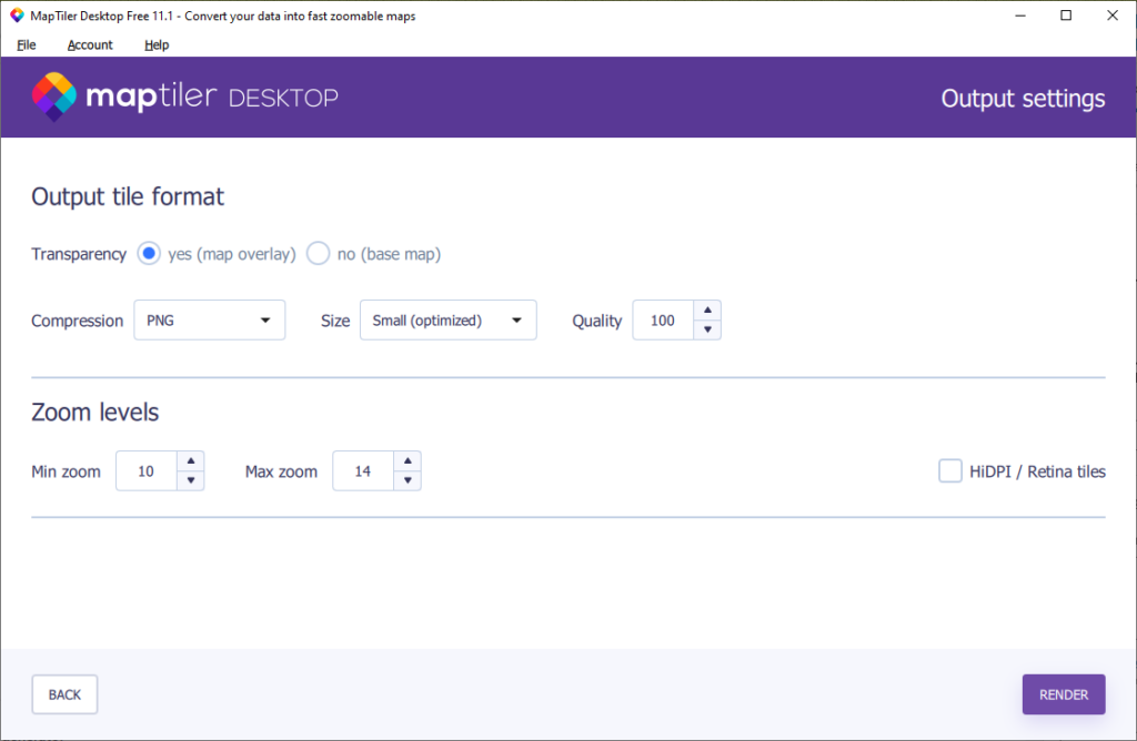
Step 5 – Geo-ref map + export as MBTiles
https://www.maptiler.com/
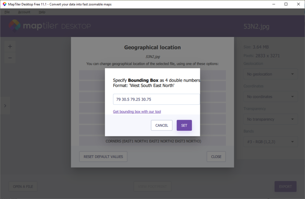
Check the right latitude, longitude coordinates mentioned at the corners of the original Survey map
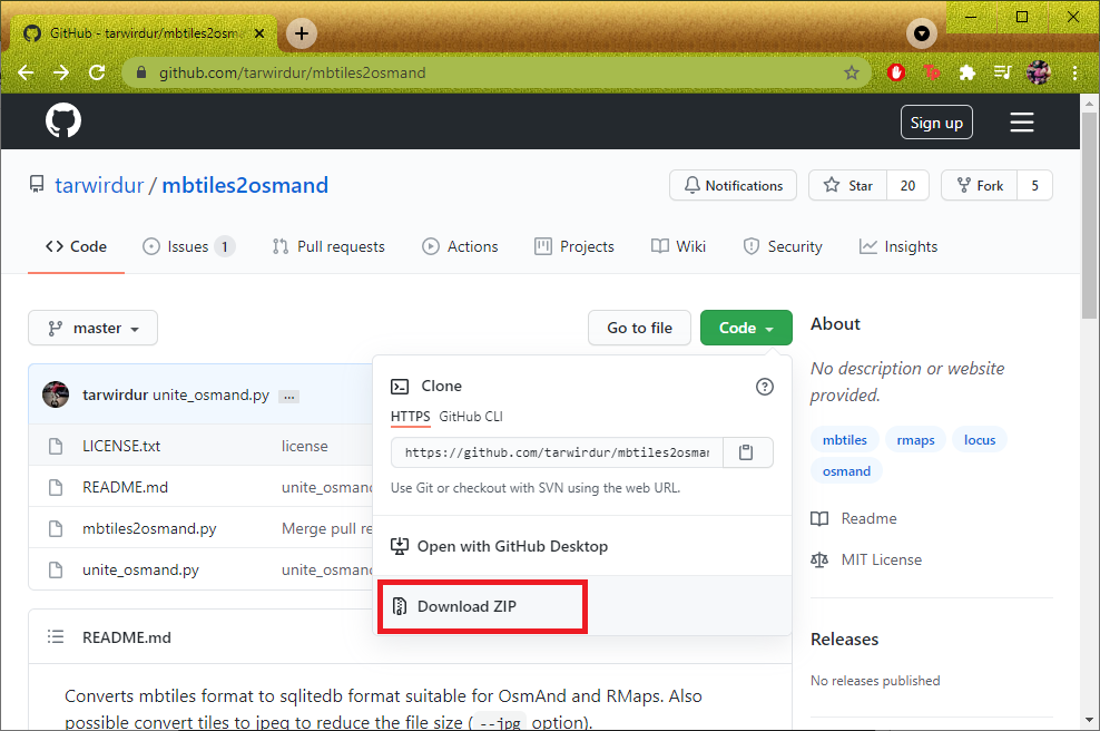
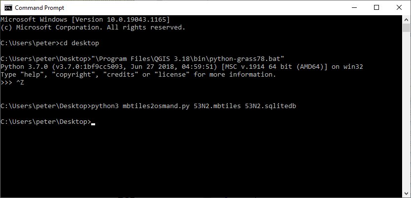
Step 6 – Convert to SQLite format
Download:
https://github.com/tarwirdur/mbtiles2osmand
Run:
python3 mbtiles2osmand.py 47F_6_clip.mbtiles 47F_6_clip.sqlitedb
Step 7 – Load in OSMAnd
Download the SQLitedb file in your phone and set as Overlay map in OSMAnd
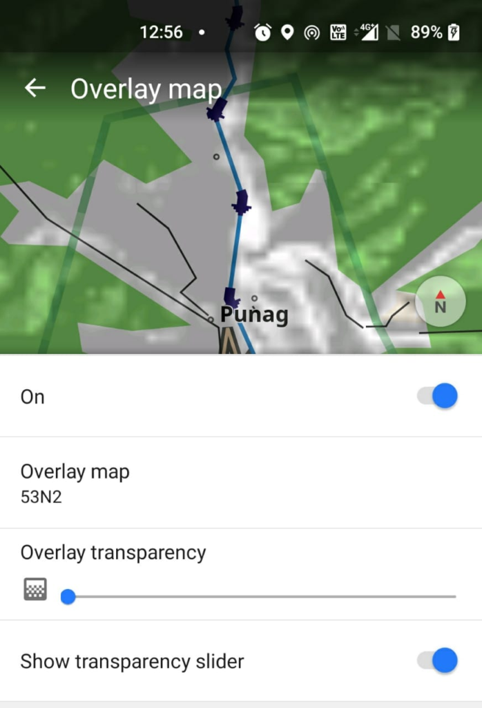
Congratulations! You are now ready to explore the region using offline Survey of India maps on your mobile phone