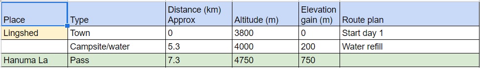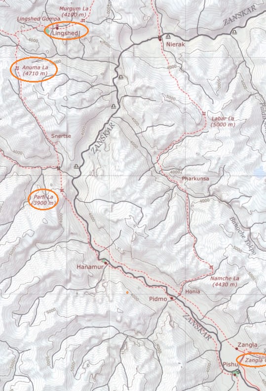
A basic understanding of map reading is essential to plan your trek and find your way in the wilderness. Go through this small practical assignment to familiarize yourself with basics: plan a trekking route from Lingsched to Zangla which is around 50K / 2 day hike. Refer three maps:
1. Olizane (shows route, valleys, passes, landmarks)
2. OSM (shows trail, contours, campsites, bridges, etc.)
3. Google sat map (confirm what’s really there on field)
Identify following important points: possible campsite(s), water points, settlements, stream crossings, bridges, etc. Use the “Measure Distance” tool in OSMAnd to generate a sheet with distance to each point along the way. Validate these points on Google sat map (e.g. bridge is really there?).
After generating this sheet you can plan your each day of your trek: distance, elevation gain, campsite, water points for each day. We usually cover max. 20-30K distance / 500-1500m elevation gain per day. Passes are not crossed in the afternoon (unstable weather). Bigger streams should be crossed during mornings.
Email your answer to peter.vangeit@gmail.com to review.