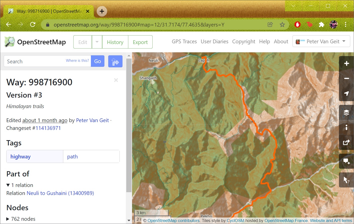
In the previous module we mapped human settlements based on an external geo-referenced data set. In this module we will map trails based on GPS recordings. Mapping trails (Lines) cannot be done through OSMAnd which only supports mapping of Points. We will use the standard OSM web client “osm.org” to map trails.
A friend of mine recently hiked the Kokand and Bail Ghat trail in the Sahyadri:
https://drive.google.com/file/d/19Y8qZNDPbyXAmmVeAqGq871qusDs_lo1/view?usp=sharing
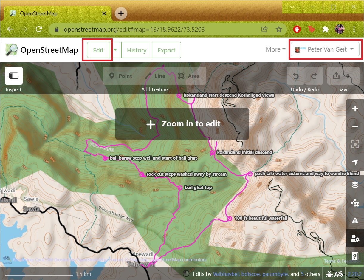
Open “osm.org” in your browser, log in to your OSM profile and select “Edit” to enter Edit mode. Drag-n-drop the above GPX files into the OSM main window to overlay the GPS recorded trail. See Image 1 below.
https://www.openstreetmap.org/#map=15/18.9519/73.5204
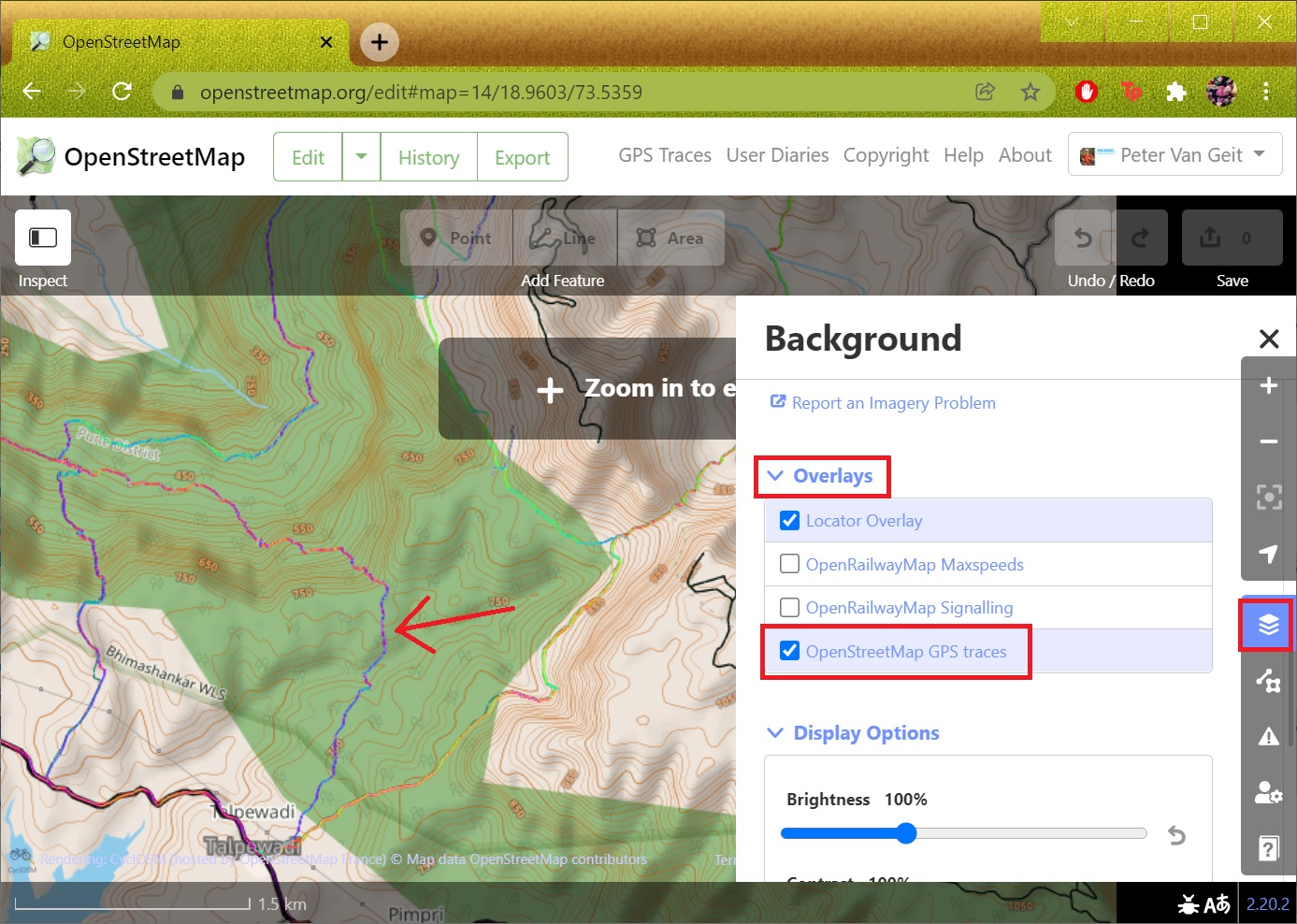
If you had already uploaded your recorded track through OSMAnd as a Public OSM trace then you can simply enable “OpenStreetMap GPS Traces” in the “Overlays” in the “Layers” icon. See Image 2 below.
Mapping Trails
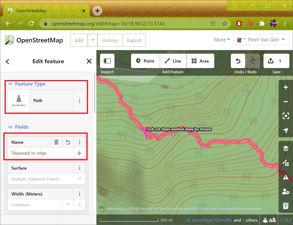
Zoom into the map until the “+ Zoom to Edit” message disappears. Click the “Line” feature to start drawing your trail in OSM. Similar to digitizing trails in QGIS (module 6D) keep clicking along the overlaid GPX file. Ensure to connect the start and end of your trail to existing OSM features (road, trail). Use the mouse scroller to zoom out/in while moving across your recorded trail. See Image 1 below.
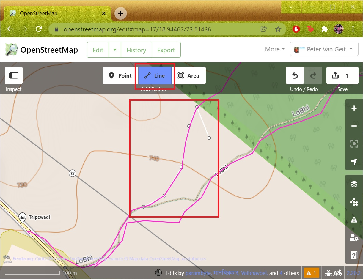
You can map your GPS recording as multiple logical trail segments in OSM: place A to B, B to C, etc. Press ESC to complete one segment and select feature type as “Path” and give it a descriptive name. See Image 2 below.
Uploading Trails
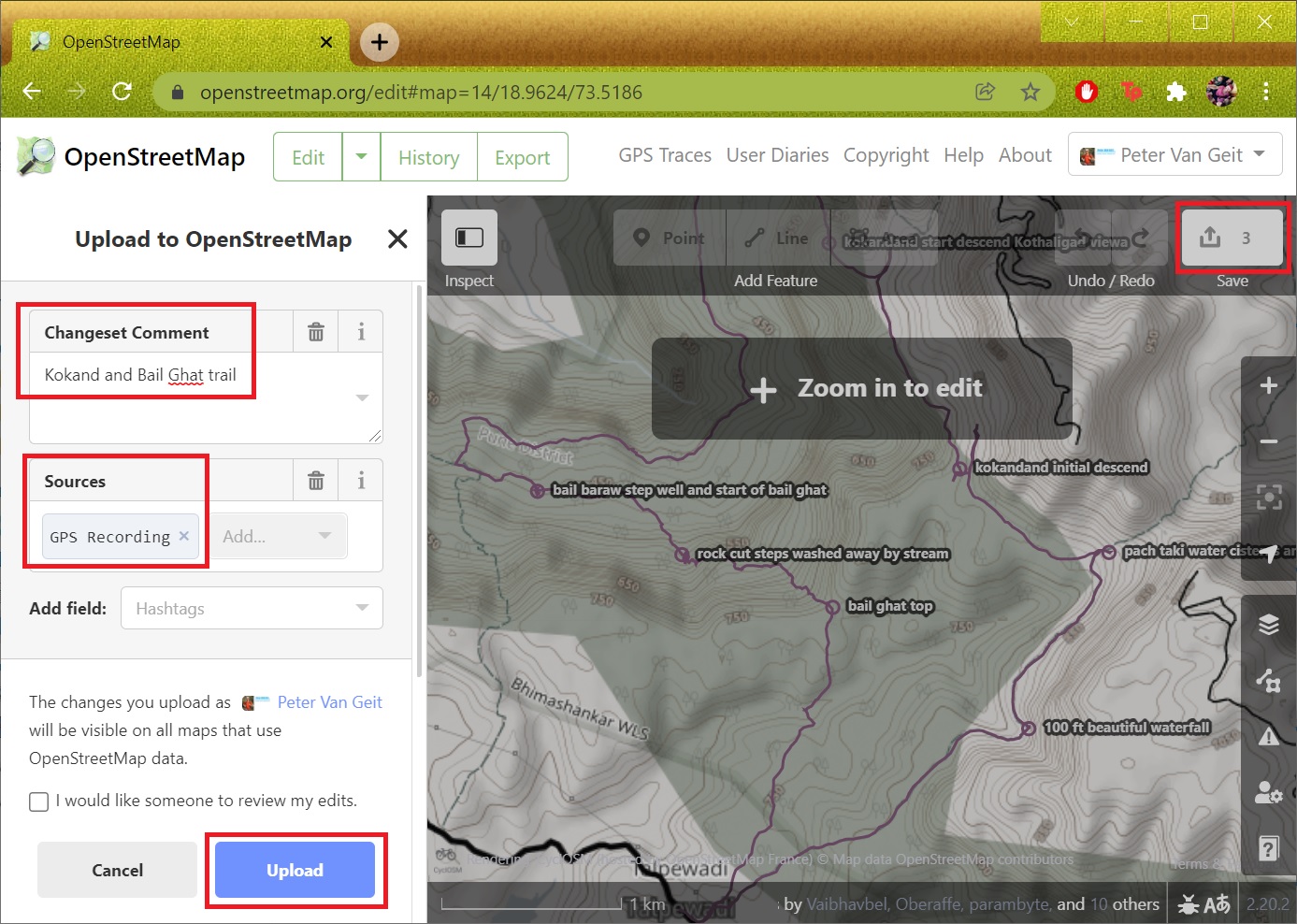
After completing all trail segments click the “Up arrow” top-right icon to upload the newly mapped trail sections to OSM. Provide a proper description and source (GPS recording) and click “Upload” to commit the changes. See Image 1 below.
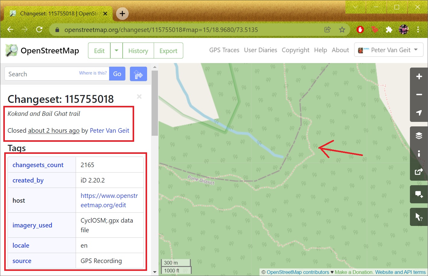
After uploading the changes you can open your OSM Profile, “My Edits” to see the changes (only in the standard OSM basemap, other maps will take longer to reflect). See Image 2 below.
Assignment
Time now for some hands-on to grasp the concepts learned above. Take any of your recent GPS recordings (not yet mapped in Open Street Maps) or ask me for a sample recording. Map the recording as (a) trail segment(s) in OSM with proper tags. Submit in the form below.