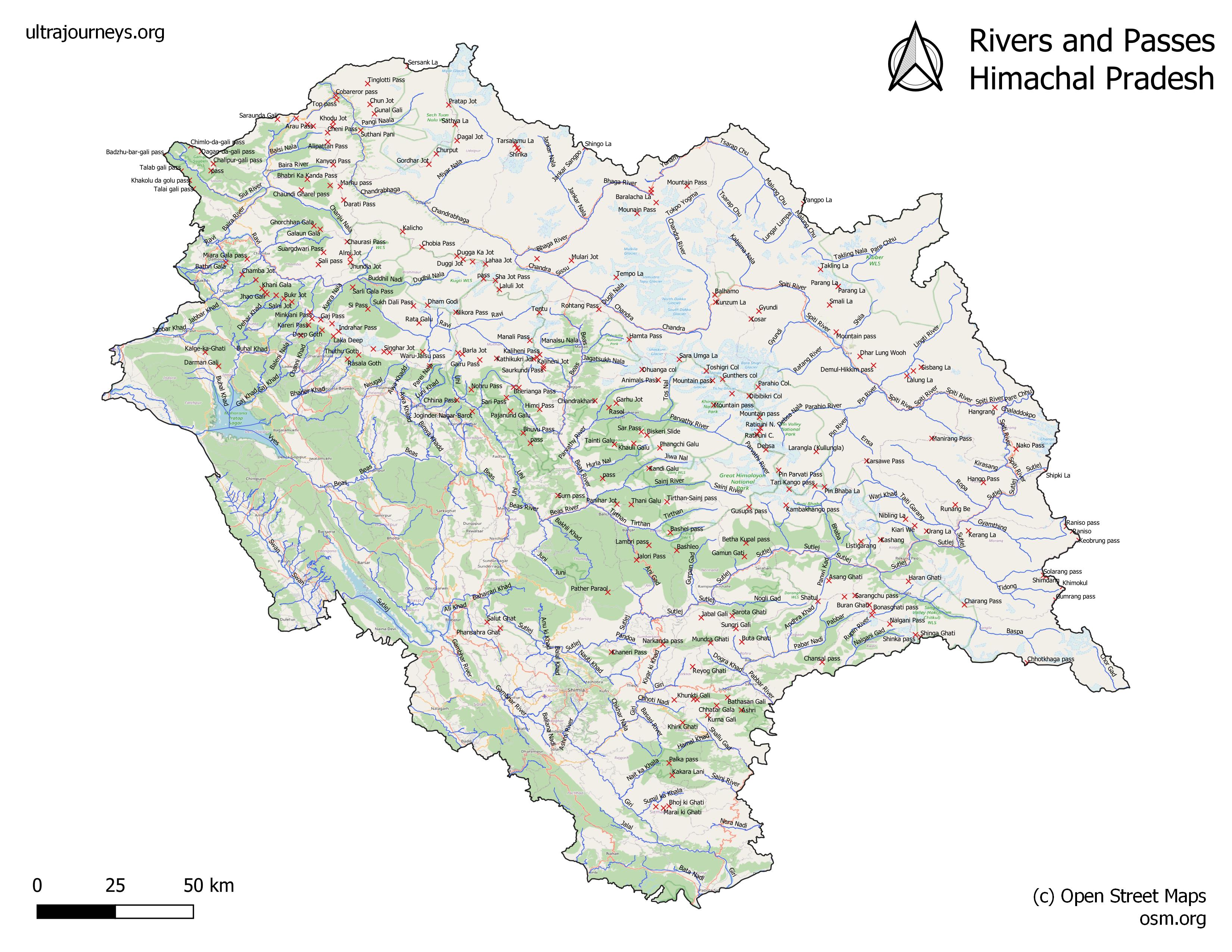
In this first module we will familiarize ourselves with the geography of the Indian Western Himalayas spanning the states of (East to West) Uttarakhand, Himachal, Ladakh and Jammu & Kashmir.
I created high resolution maps of the 4 Himalayan states showing the main rivers (valleys) and numerous passes in between. Rivers drain the high ranges (rain, glaciers and snow) and define the topography of the Himalayas. Passes allow us to cross over high ranges in between neighboring valleys. Understanding this geography is essential to plan hikes or traverses across these high ranges and valleys.
https://ultrajourneys.org/hires-maps-of-western-himalayas/ (JPG)
https://drive.google.com/drive/folders/1m_PvBijbeNPGLzZzNCb1bITzMljaI0YQ?usp=sharing (PDF)
(JPEG maps are easy to view on laptop, PDF format can be viewed / zoomed on mobile)
The Western Himalayas consist of hundreds of rivers (main valleys) and thousands of smaller streams (side-valleys, not shown here for simplification). Thousand+ passes cross high ranges in between adjacent valleys defining beautiful hiking routes.
In further modules of this first section A we will look at various available map sources for the Indian Himalayas visualizing topography and terrain details including hiking routes, peaks, rivers, human settlements, etc. These maps are essential to plan our hiking traverses.
In the second section B we will look into plan various aspects of planning multi-day traverses across one or more subsequent passes and valleys. In my month long ultra-journeys I usually connect hundred+ passes across entire states
Let’s warm up with a small assignment below – take a closer look at each of 4 Himalayan states and familiarize yourself with the main rivers and valleys.