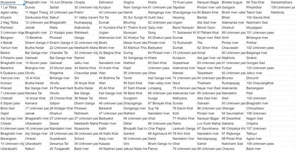
In the winter of 20/21 I explored 2000 km of beautiful hiking routes marked on the Survey of India maps through 500 remote settlements over 1.7 lakh meters of elevation gain (19x height of Everest). Some mapped trails no longer existed, being no longer in use and overgrown by the jungle or destroyed by landslides. The trails marked on the old Survey maps created over a century ago were not always accurate either so I recorded all routes explored and carefully documented them on Open Street Maps and my blog so the world wide hiking community could follow my footsteps with ease. Hope this effort will lead to conservation of these beautiful heritage pathways of Uttarakhand as many of them are no longer in use and are bound to disappear in the coming years
Custom Map
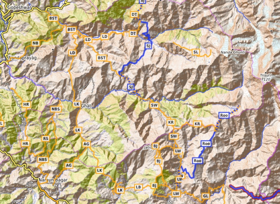
Open Street Map
Traverses
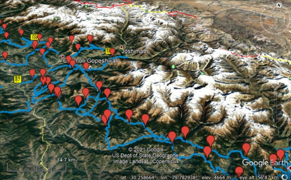
Google Map
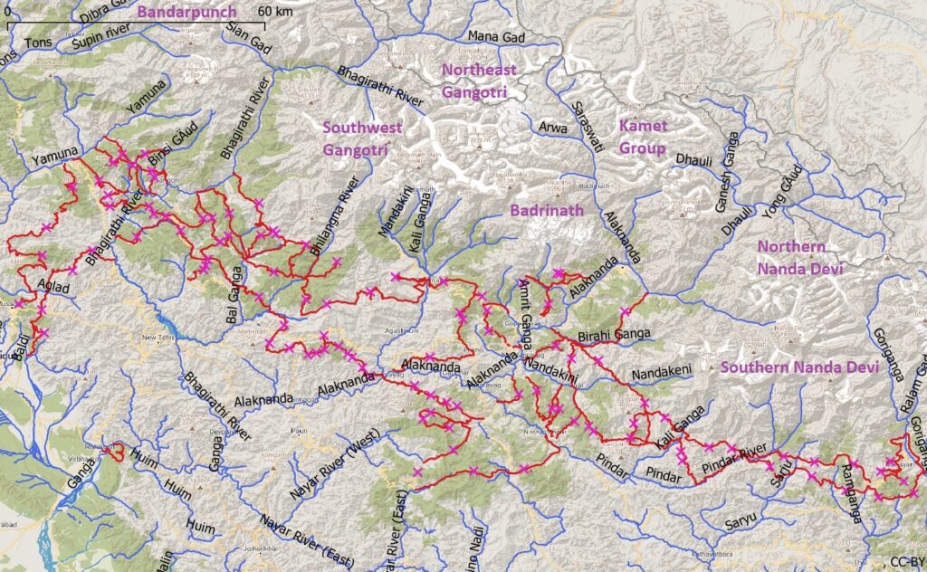
Waymarked Hiking Trails