Link to the full journal.

Link to the full journal.
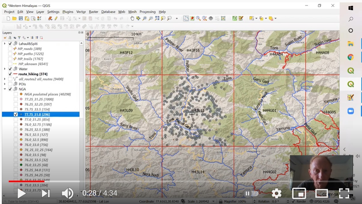
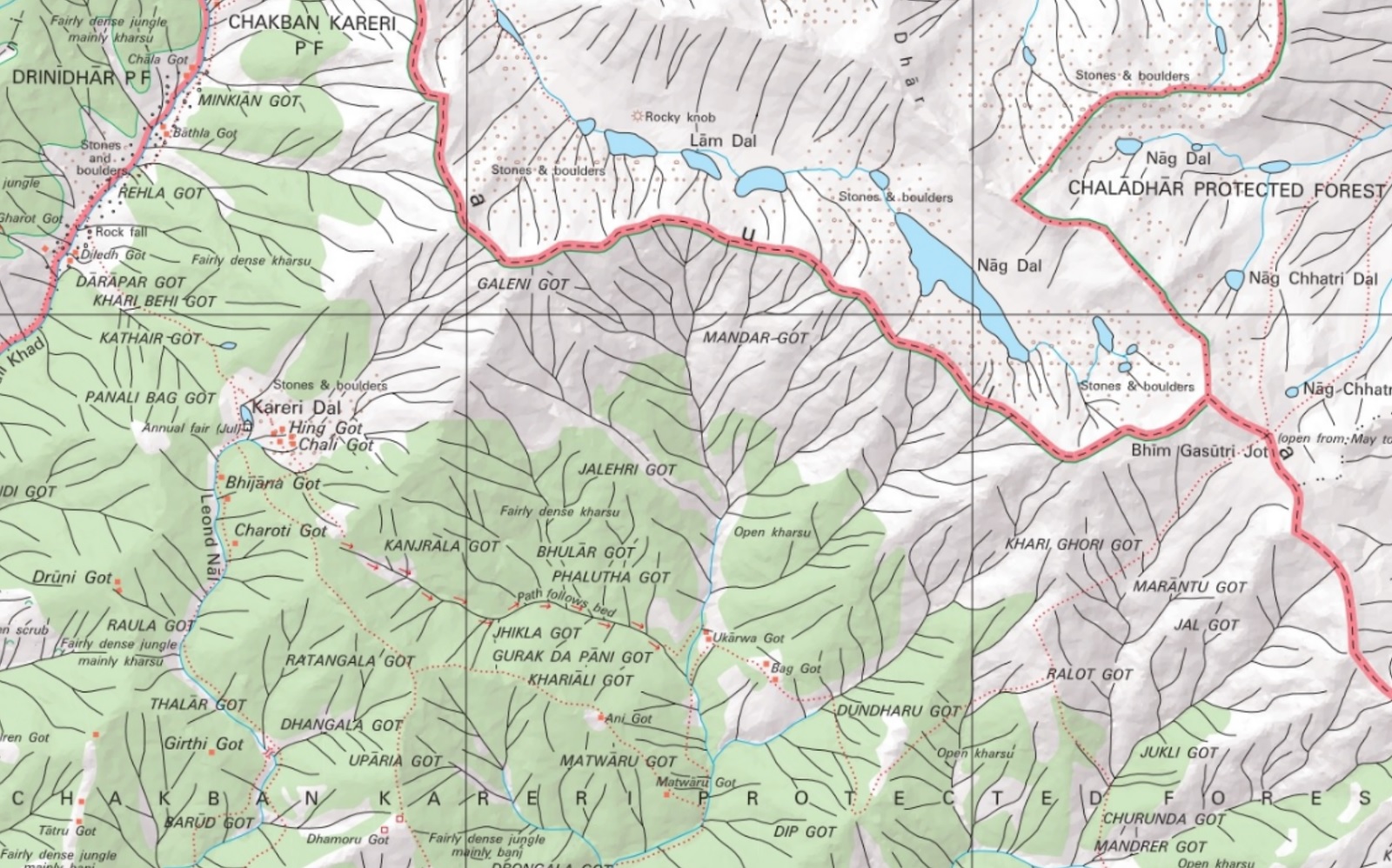
The lack of accurate, detailed maps have always hampered independent hikers to explore the Himalayas. Initiated during the 2020 lockdown…
Previous Part 4 10. Traverse Planning In this final part I will share a few words on how to plan…
Previous Part 3 7. Trails & Hiking Routes Jammu & Kashmir has tens of thousands of beautiful trails connecting remote…
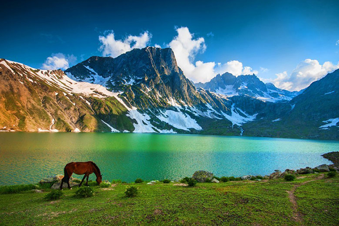
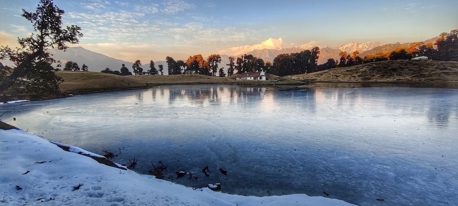
Part 2 over here 4. Glacial Lakes A glacial lake is a body of water with origins from glacier activity.…
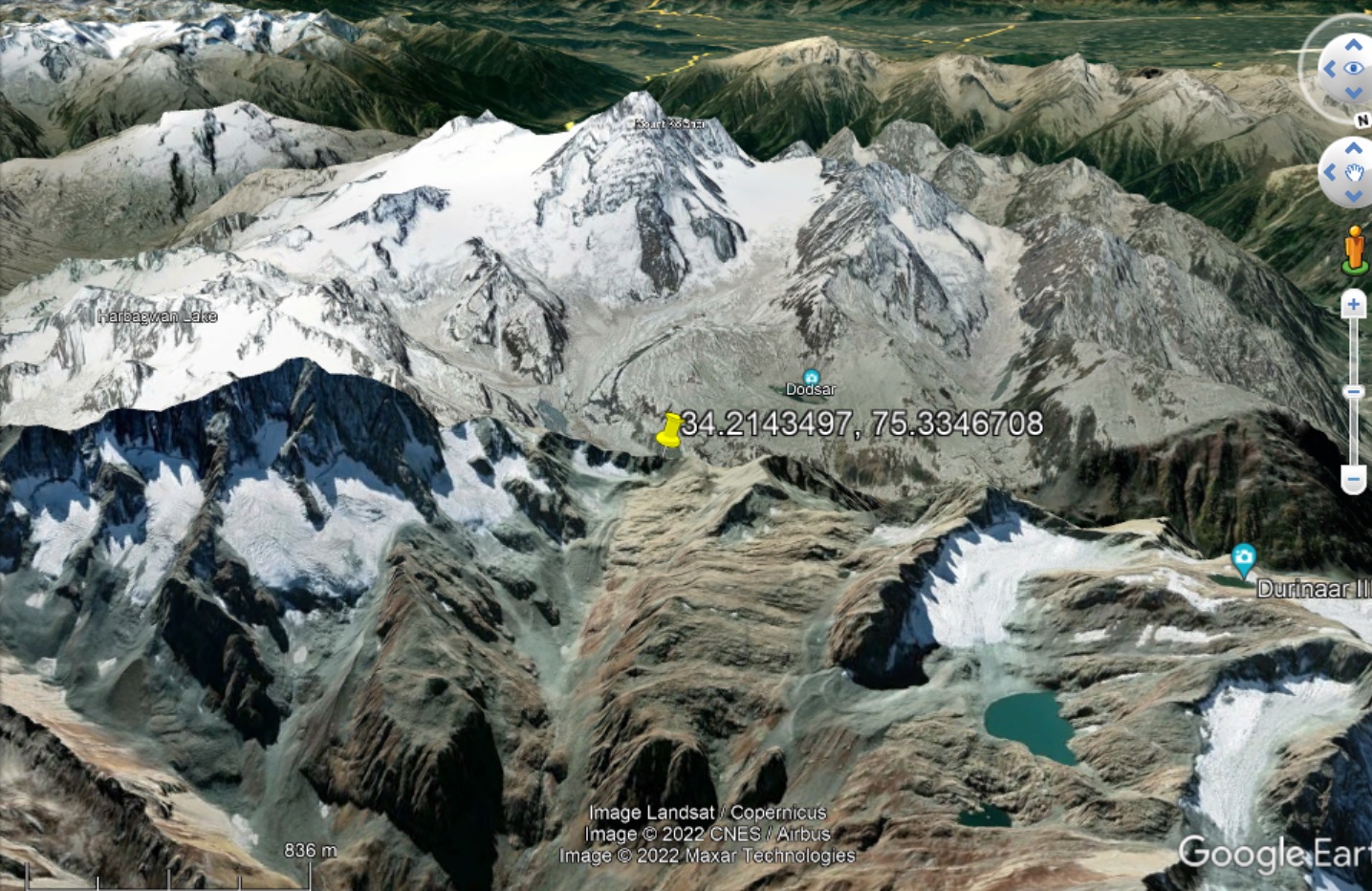
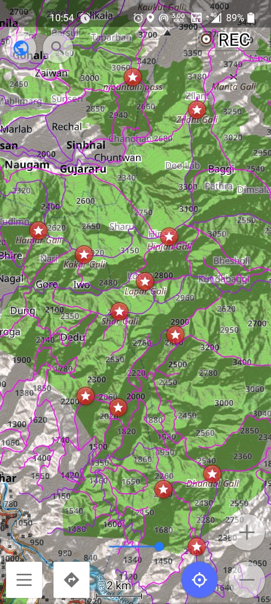
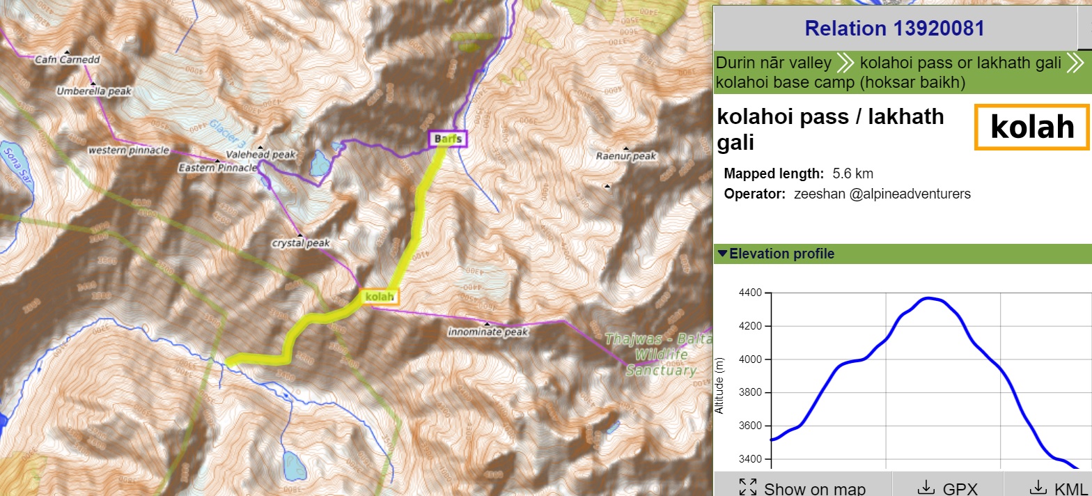
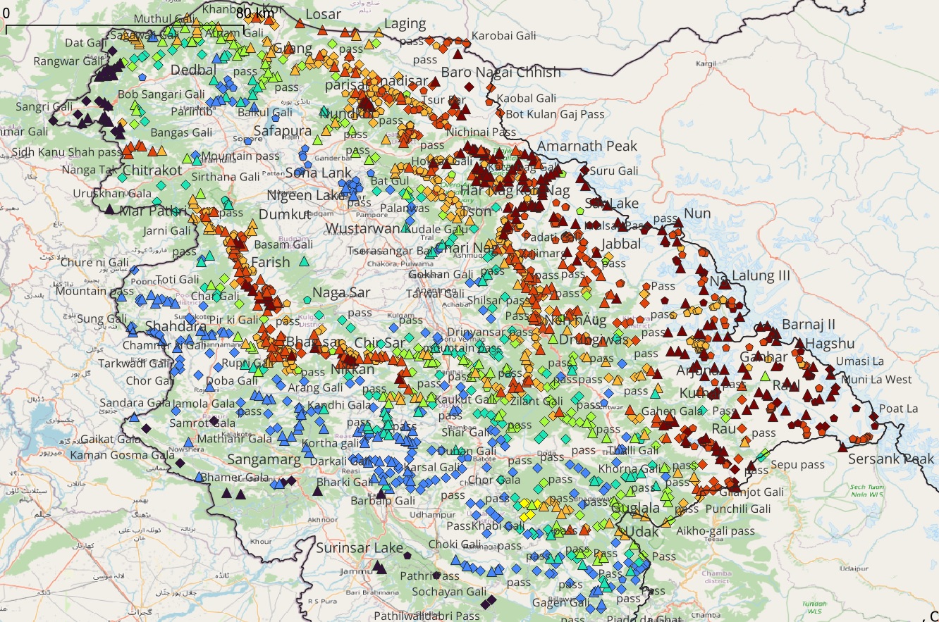
Part 1 over here 2. Mountain Passes Mountain passes are gateways to cross over high ranges or ridgelines connecting neighboring…
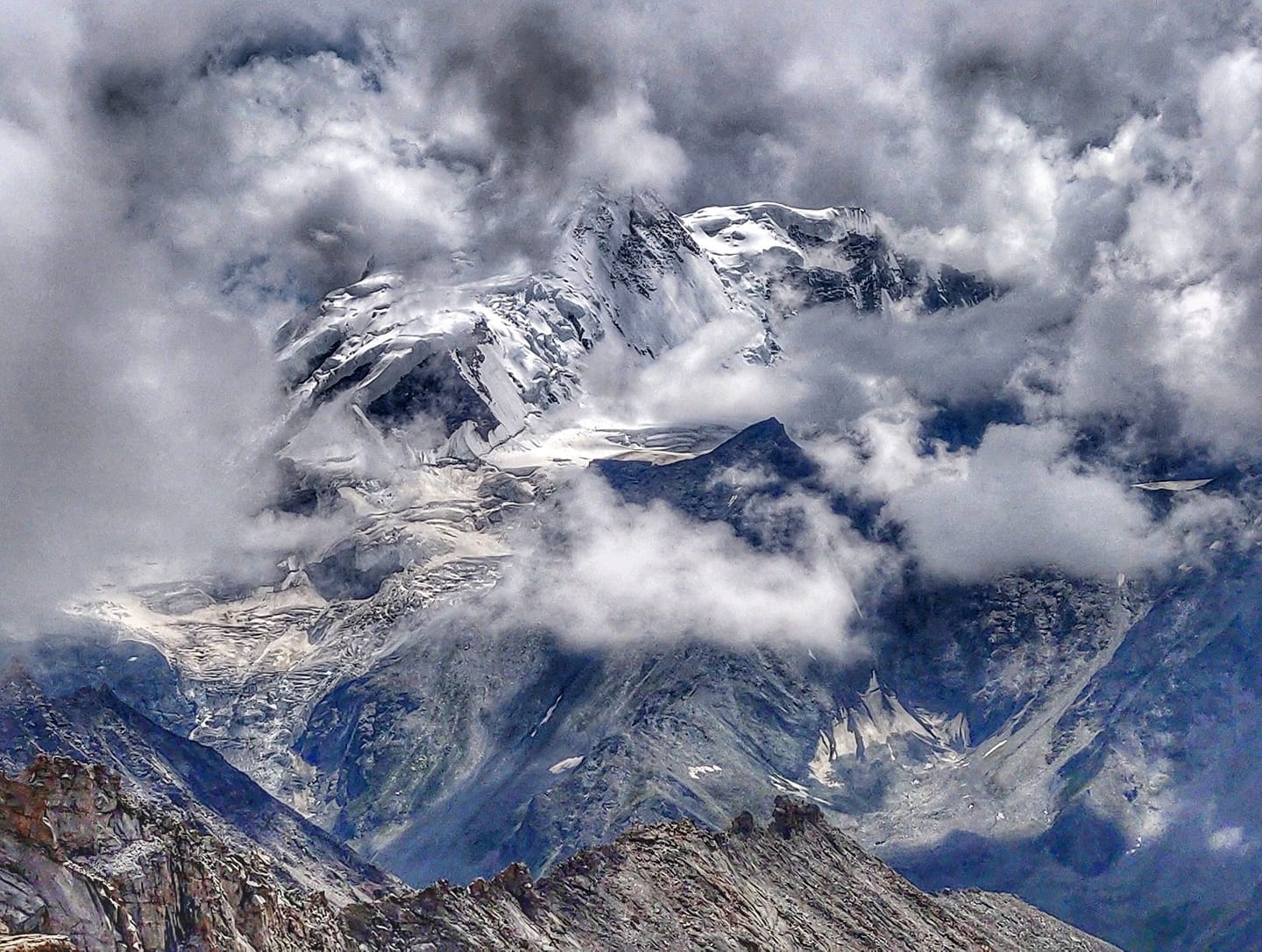
The state of J&K has abundant natural beauty to lure the outdoor enthusiast: numerous beautiful valleys and rivers, extensive trail…
Link to journal During my initial foray into the Indian Western Himalayas in the summer of 2018 I realized the…
Introduction There are thousands of beautiful high altitude glacial lakes in the Indian Western Himalayas. Some are destinations of beautiful…