While assisting Jeremy Bige on planning a route through Nepal I stumbled upon detailed 1:50K/1:25K topo map sheets for Nepal over…

While assisting Jeremy Bige on planning a route through Nepal I stumbled upon detailed 1:50K/1:25K topo map sheets for Nepal over…

While planning a traverse through the Himalayas we need to take into account the seasons. During winter the snowline descends…
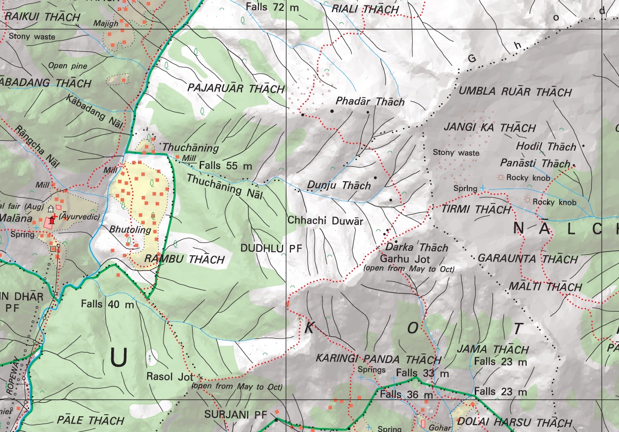
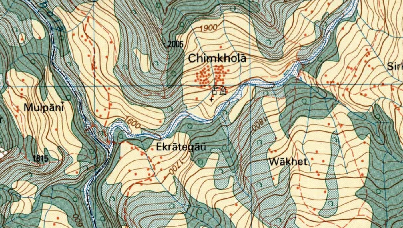
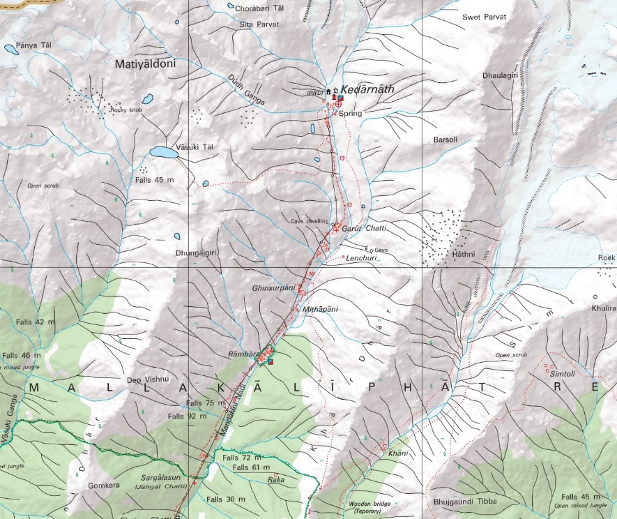
Introduction No doubt the most detailed topographic maps of the Western Indian Himalayas are published by the Survey of India.…
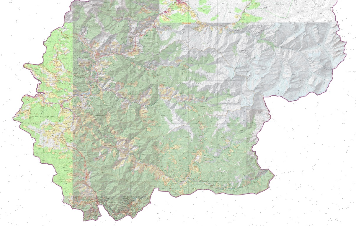
The Western Indian Himalayas consist of 4 states (Himachal, Ladakh, Uttarakhand, Jammu & Kashmir) and 40 districts: Find here high resolution maps for each district which can be used for planning your Himalayan traverses. These maps contain a wealth of terrain details for the outdoor community:
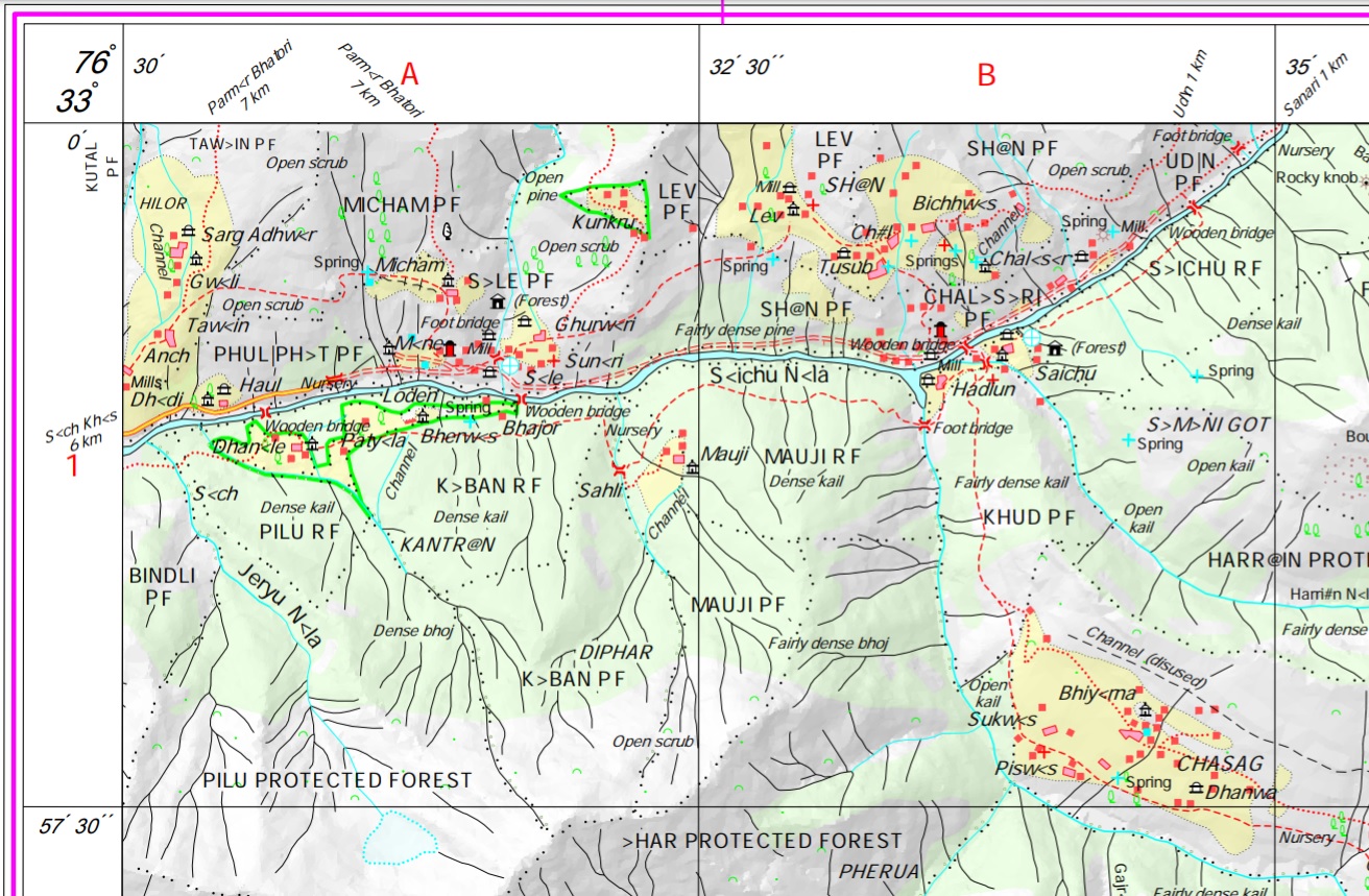
The most detailed and freely available maps of the Himalayas are those published by the Survey of India (SOI). Initially…
This is a step-by-step tutorial how to identify, download, geo-reference, convert and use Survey of India maps for exploration using…
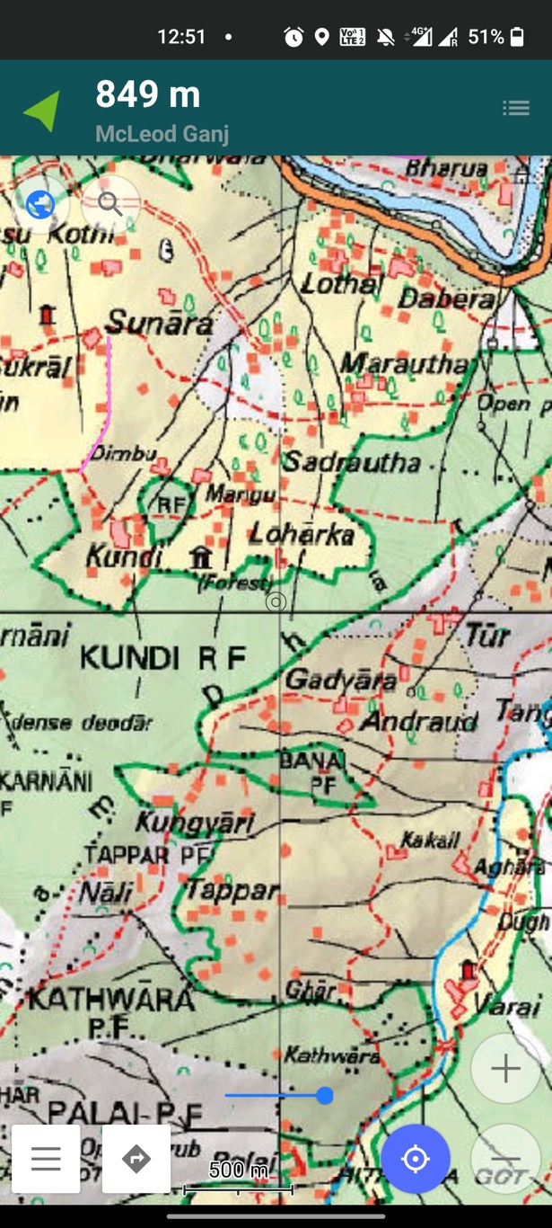
In this tutorial we will demonstrate how to prepare any physical map for mobile navigation use (OSMAnd). Many mobile apps…
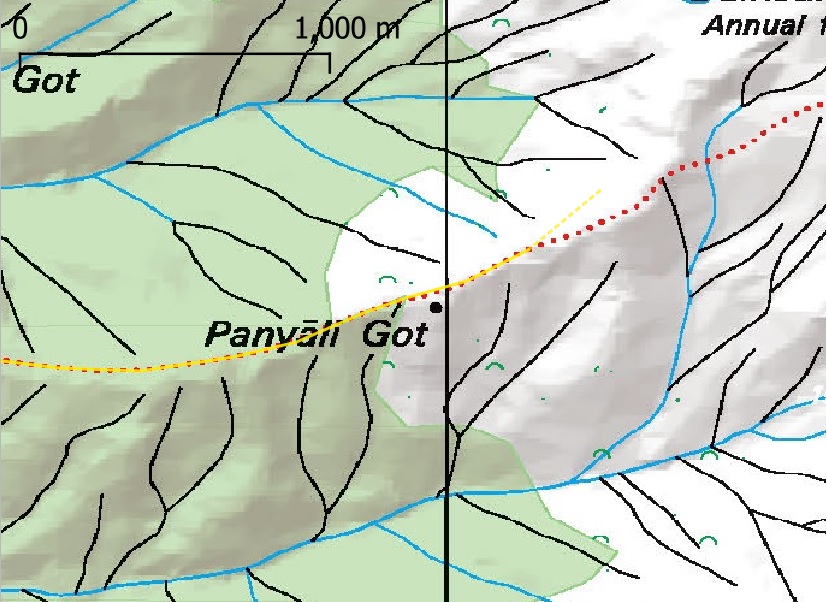
In this short tutorial we will learn how to digitize trails from existing heritage maps using QGIS. We will use…
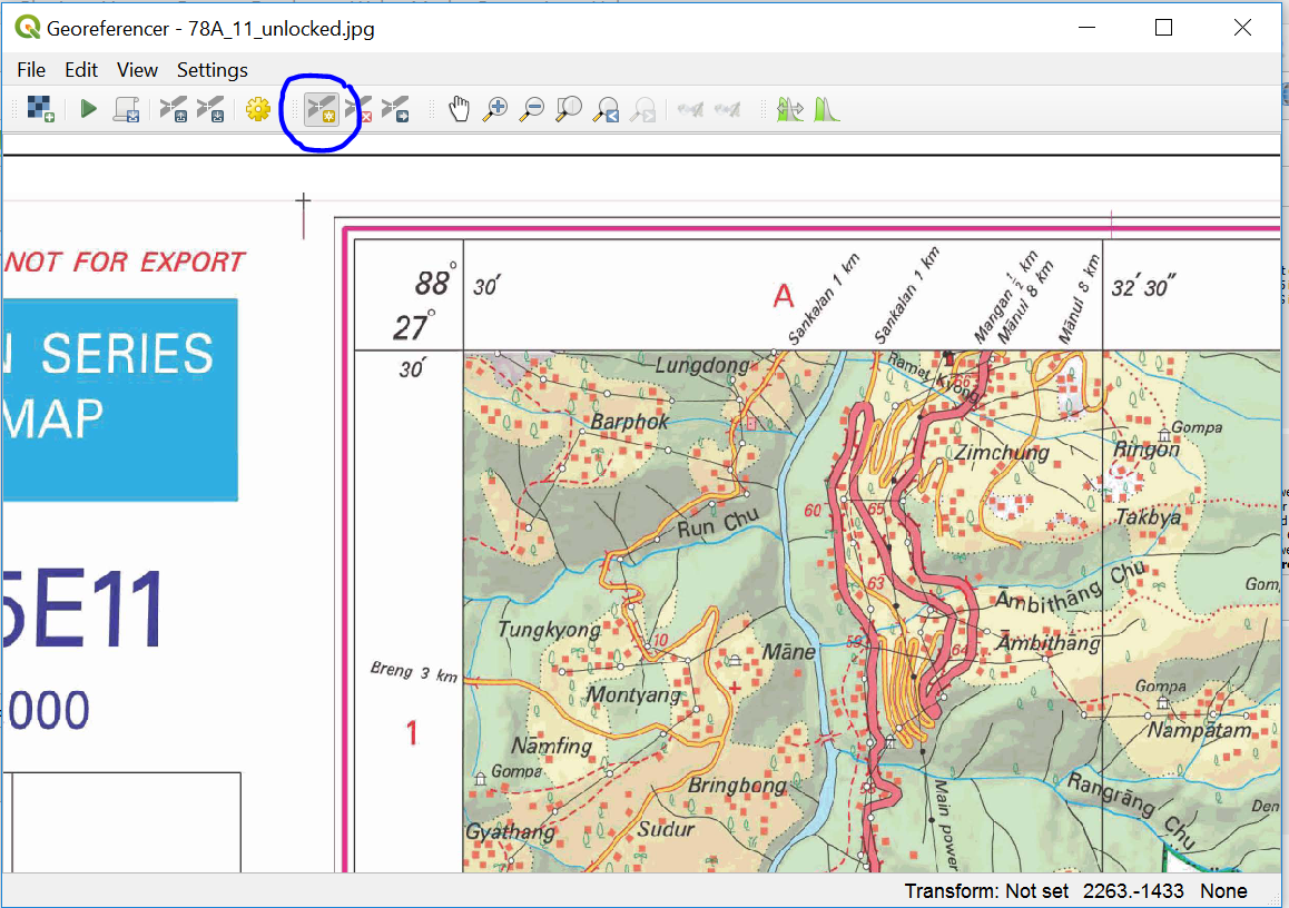
Survey of India (SOI) maps provide freely downloadable 1:50K topographic maps through its portal soinakshe.uk.gov.in/ (Note: Map download limited to…