Contents Atlas of Glacial Lakes In November 2020 the National Remote Sensing Centre (NRSC) part of Indian Space Research Organization…

Contents Atlas of Glacial Lakes In November 2020 the National Remote Sensing Centre (NRSC) part of Indian Space Research Organization…
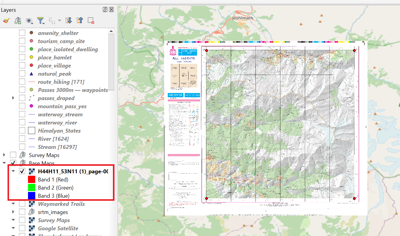
In this chapter we will be downloading & geo-referencing legacy maps like 1:50K Survey of India and 1:100K Soviet Army…
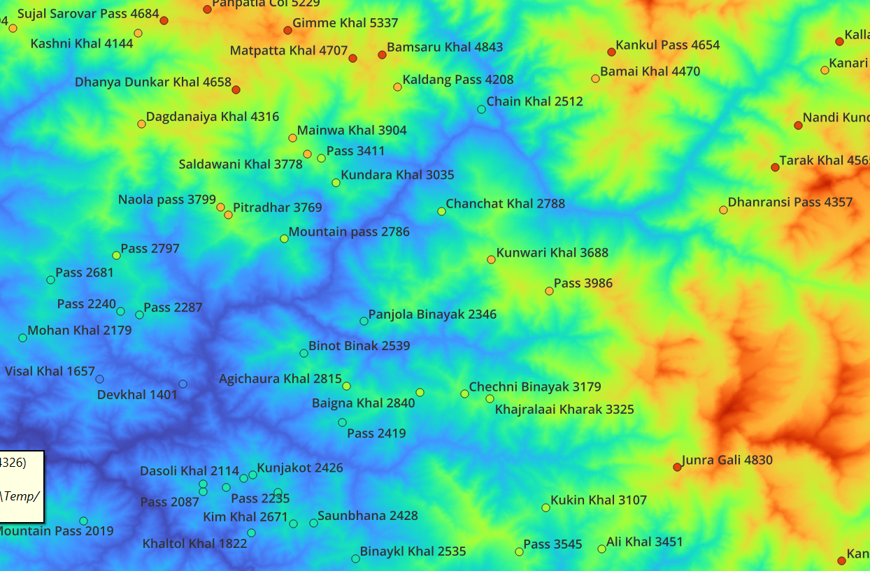
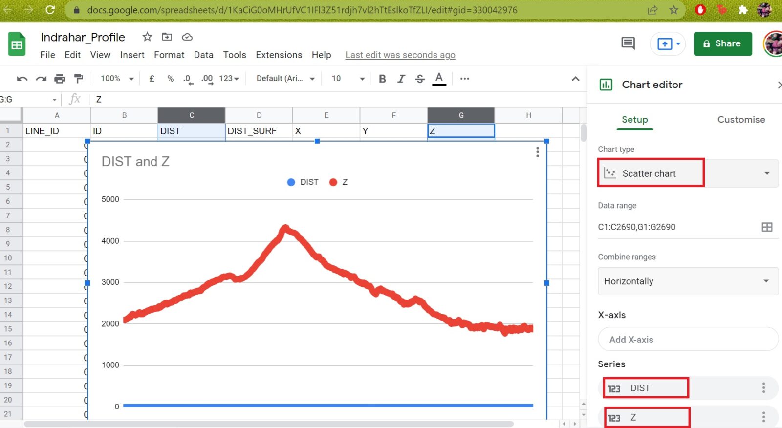
In this module we will be download satellite generated Digital Elevation Model (DEM) data, extract elevation data for Himalayan features,…
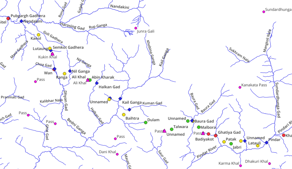
In part 3 we will start planning Himalayan traverses via continuous hiking routes across multiple mountain passes planning for in-between…
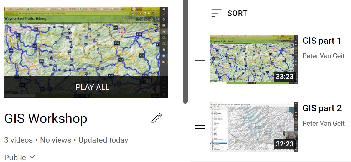
In Part 1 we explained how to add different base map layers to QGIS allowing us to bring up different…
In this first part we provide an introduction to GIS and how to add different base map layers to QGIS…
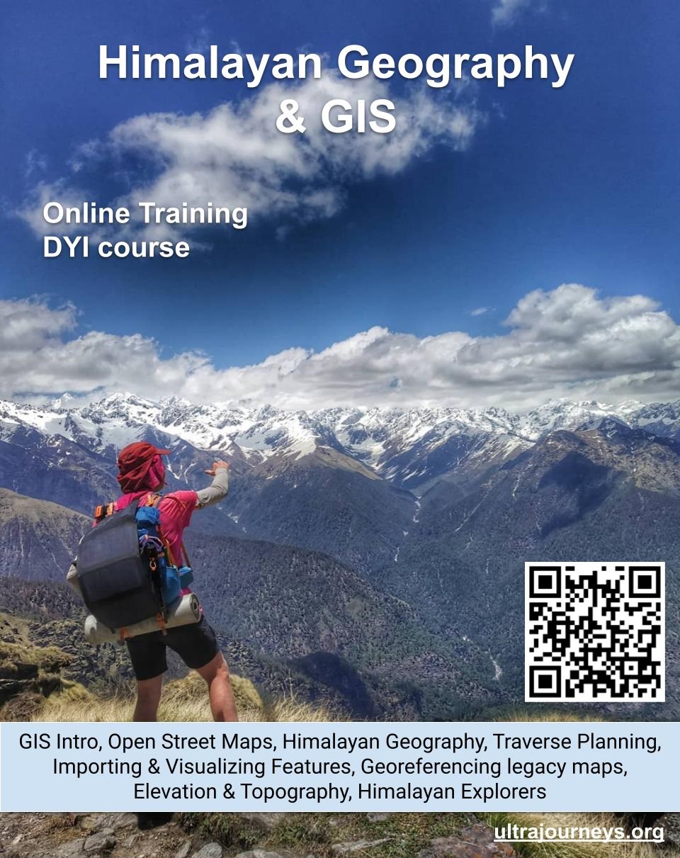
Register here to participate in the online training sessions What In this online training series we combine the power of…
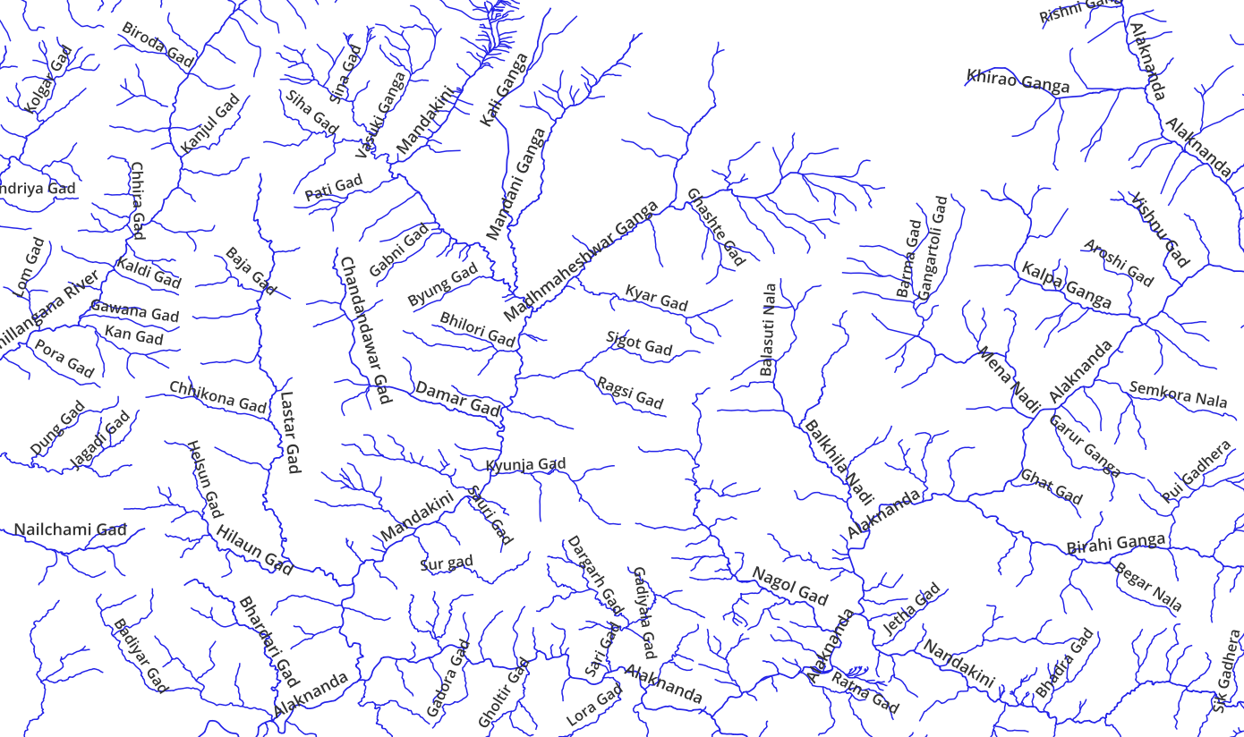
Open Street MapsData modelViewers, OpenTopo, Thunderforest, EditorsHiking – waymarked trails, brouter.deMobile apps, OSMAndHiking RoutesGeo-coding waypoints, trails, GPXElevation profileBlogs, Wikiloc, Ramblr,…
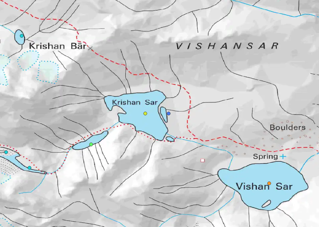
In this module we will correlate Hiking Routes downloaded from Open Street Maps with various Himalayan terrains and features. We…
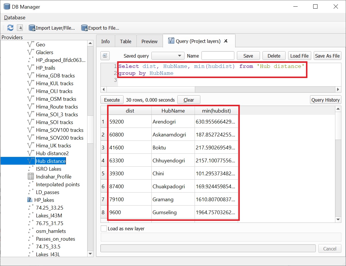
In this module we will play around with various metrics for Hiking Routes downloaded from Open Street Maps. Distance, route…