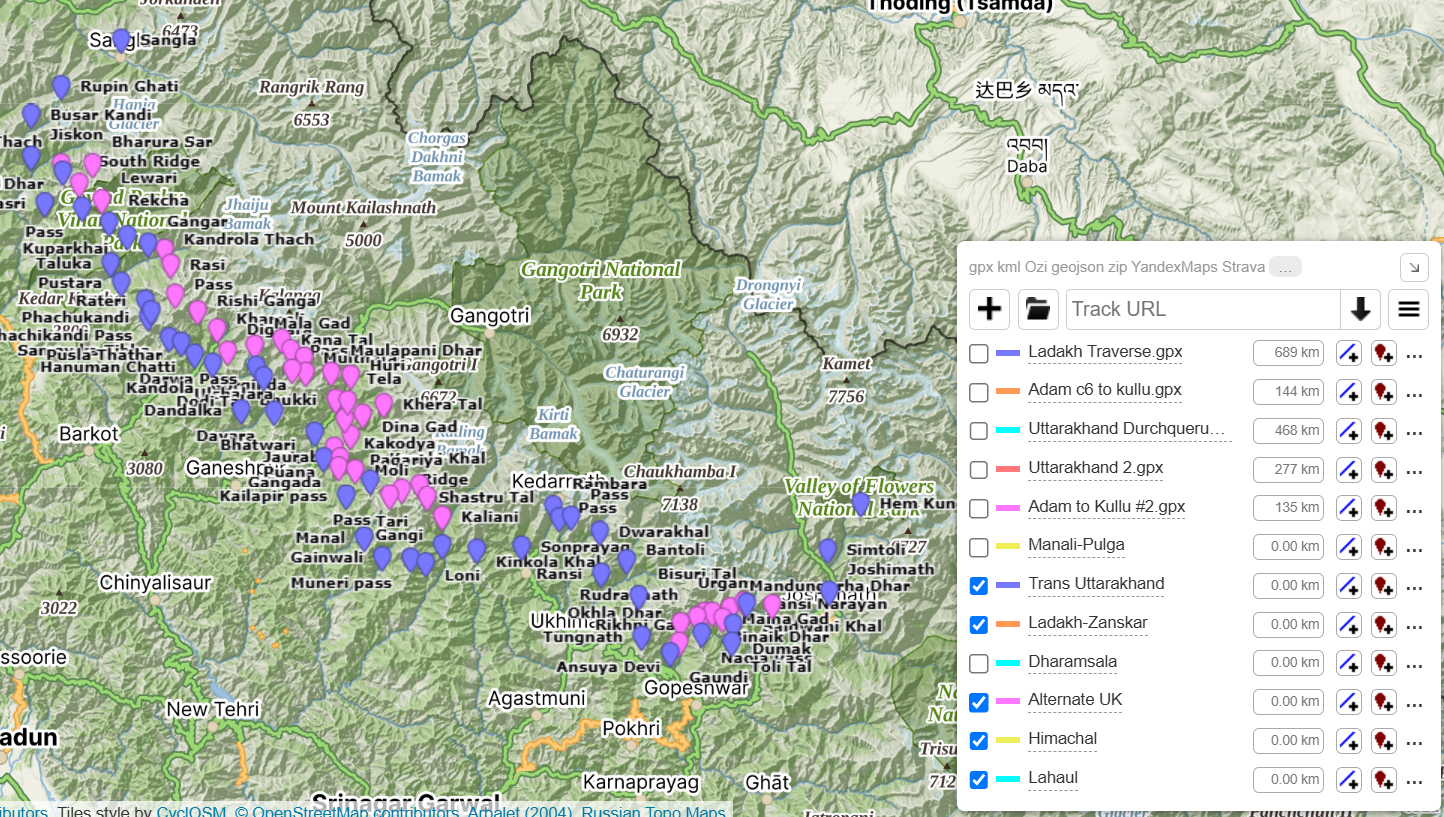
Open Street Maps has more than 750 hiking routes totaling 13 thousand kilometers of scenic trails across the Western Indian…

Open Street Maps has more than 750 hiking routes totaling 13 thousand kilometers of scenic trails across the Western Indian…
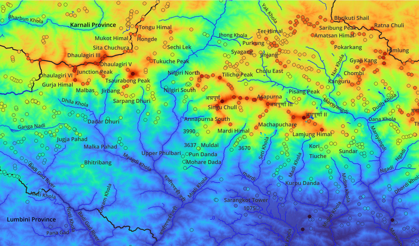
This page links to various posts related to mapping the Nepalese Himalayas allowing independent hikers to plan and navigate this…
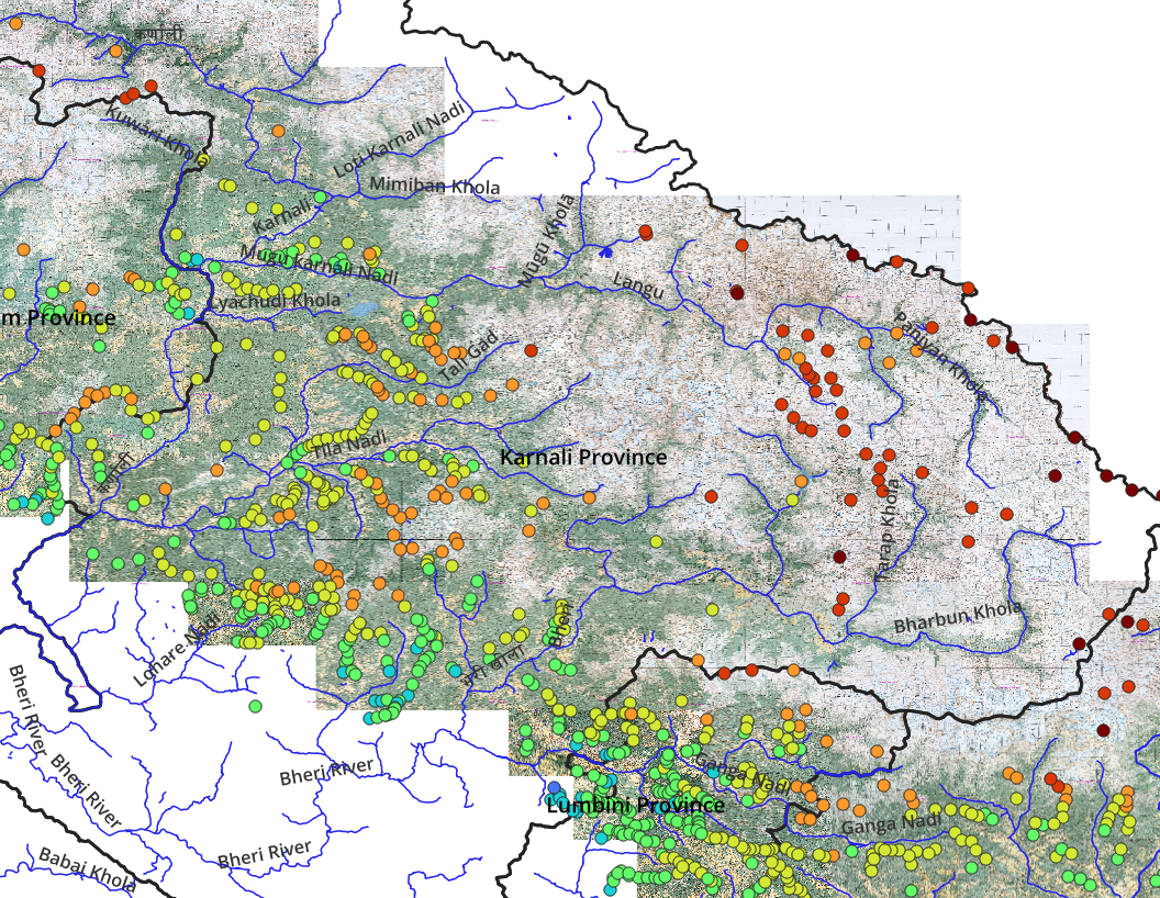
This blog presents an overview on how to map and visualize the geography of a mountain region in order to…
In part 3 we will start planning Himalayan traverses via continuous hiking routes across multiple mountain passes planning for in-between…
Recently a friend of mine asked me to suggest a nice 3 day / 2 night Himalayan traverse for him…

While planning a traverse through the Himalayas we need to take into account the seasons. During winter the snowline descends…
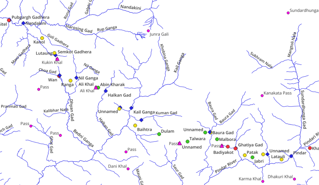
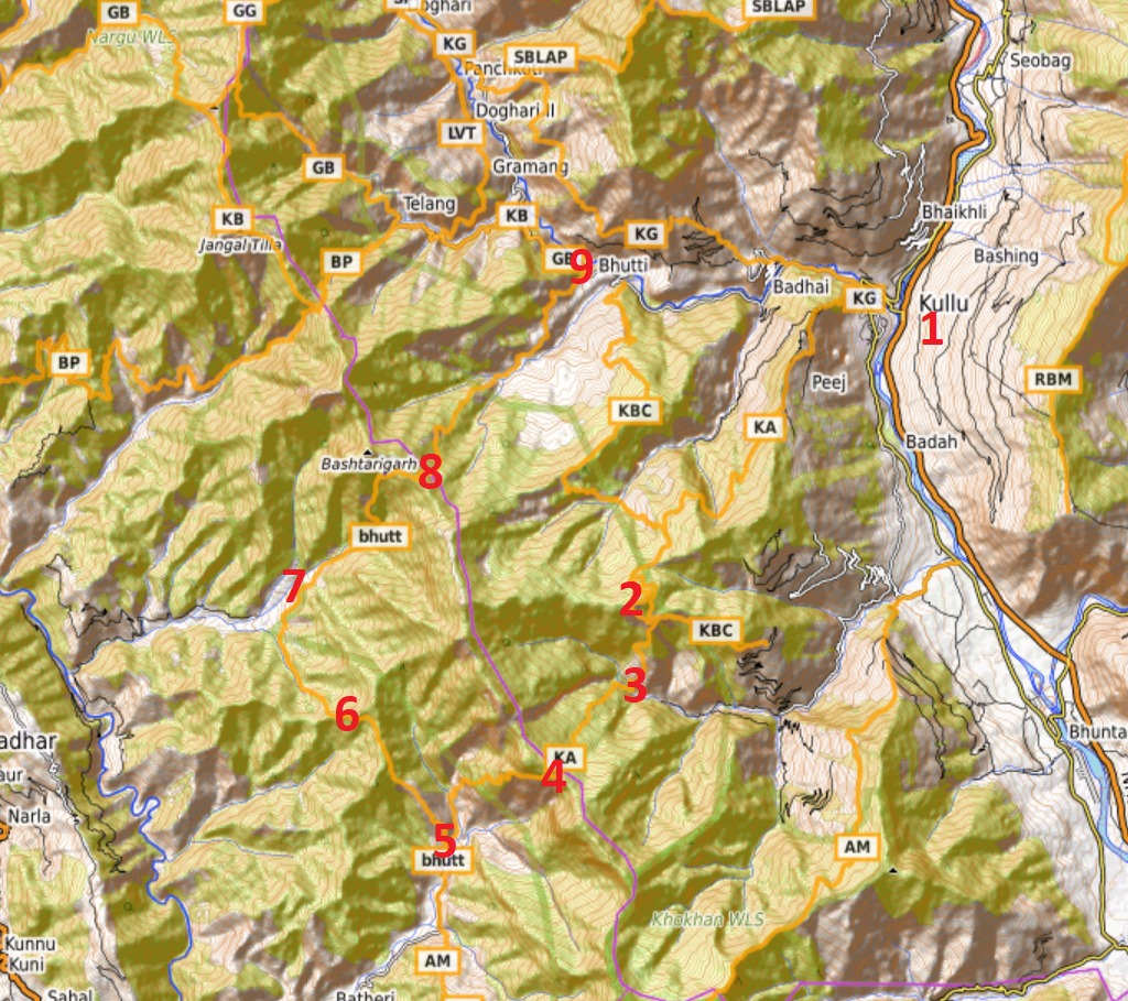
Previous Part 3 7. Trails & Hiking Routes Jammu & Kashmir has tens of thousands of beautiful trails connecting remote…
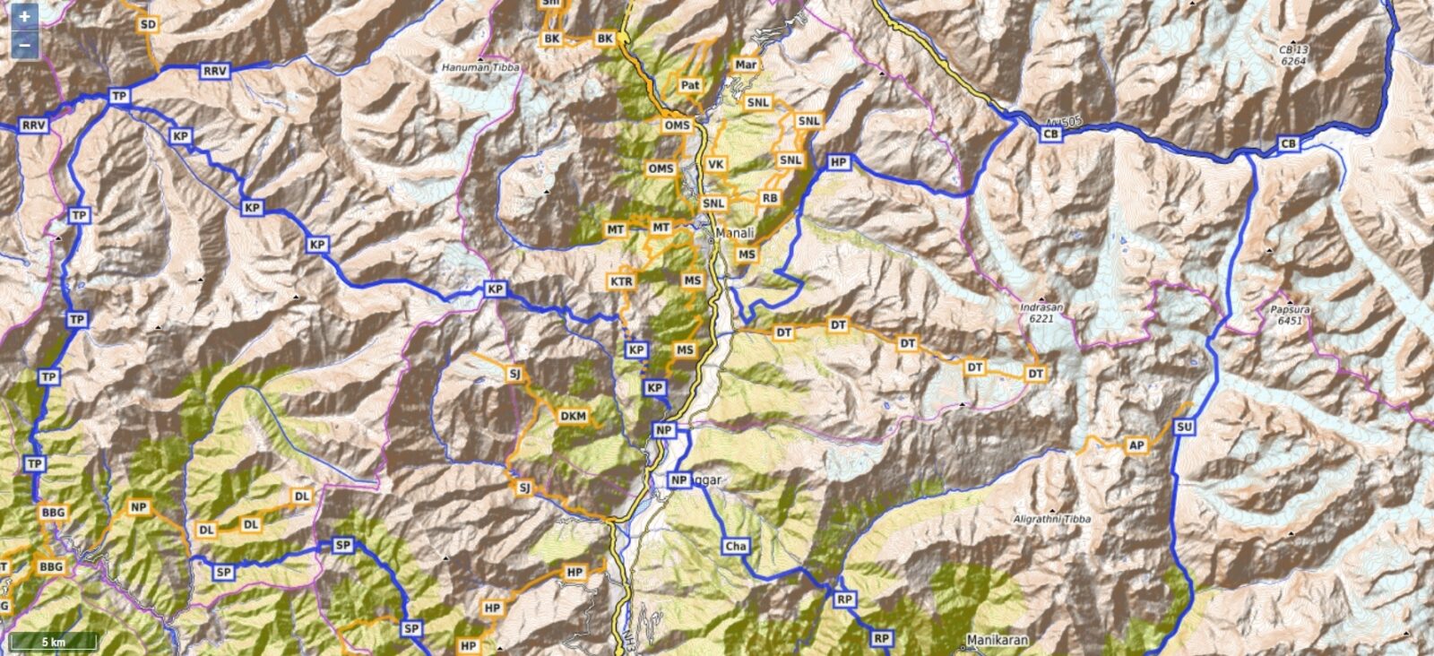
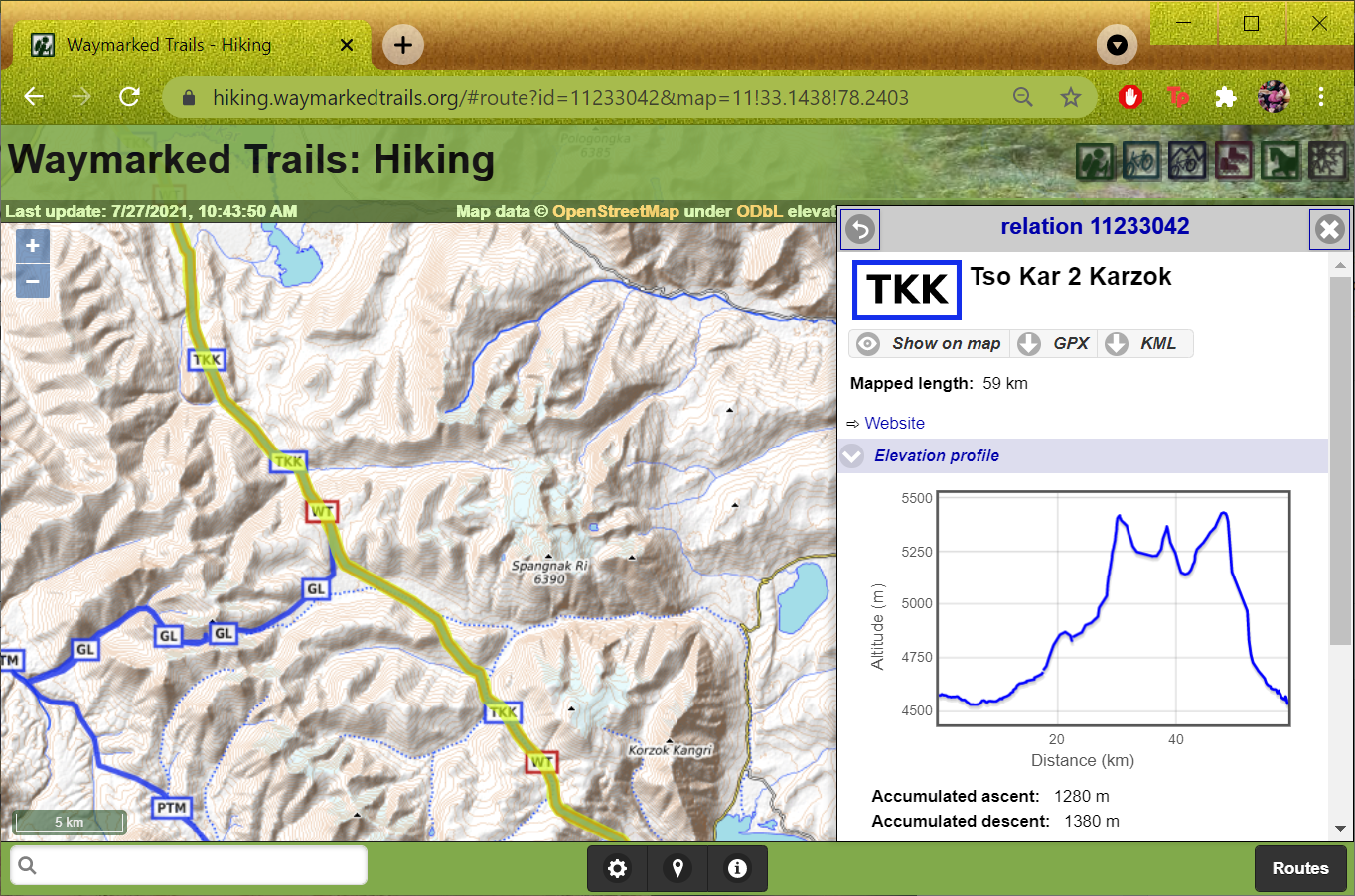
There are many Open Street Map viewers, both web based (planning on laptop) and mobile (offline navigation in mountains) based.…
In this third module we’ll get familiar with one of the most commonly used maps for hiking – Open Street…
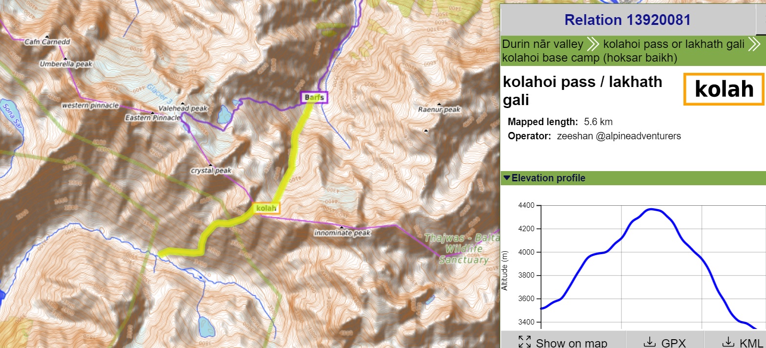
In this post we are using Open Street Maps and Waymarked Hiking Trails to plan a traverse across 18 passes…