

- Hiking Network
- Mobile / QGIS planning
- Web planning
- Map Layers
- Mapy.cz
- Waymarked Hiking Trails
- Survey Maps 1:50K
- Survey Maps 1:25K
- Geography / Altitude Map
- Satellite Map
- Soviet 1:100K topo sheets
- Soviet 1:200K topo sheets
- Nepal Topo Sheets
- Traverse Planning
- Route Profile
Hiking Network
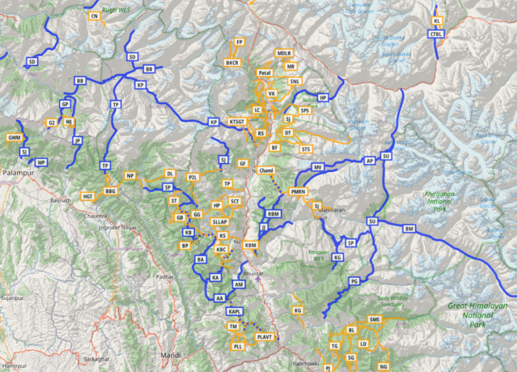
Open Street Maps has more than 750 hiking routes totaling 13 thousand kilometers of scenic trails across the Western Indian Himalayas. Survey of India Maps have 65 thousand kilometers of trails and paths. These large hiking networks enable us to plan continuous long distance Himalayan traverses.

Mobile / QGIS Planning
Planning a traverse can be done on mobile apps like OSMAnd although smaller mobile screens are not ideal for long distance planning. A larger desktop / laptop screen is more suitable for planning purposes. One can use more advanced GIS based software tools which are powerful but involve a steeper learning curve and require powerful hardware. A tutorial on traverse planning in QGIS can be found here.

Web Planning
Looking for easier web based tools for traverse planning I came across several options here. One really nice web site is nakarte.me which offers numerous OSM based and other layers. Similar to OSMAnd and QGIS users can add markers on base map layers marking important POIs along planned traverses like mountain passes, hamlets (food supply), campsites and shelters (night stay) and more.

Map Layers
Mapy.cz
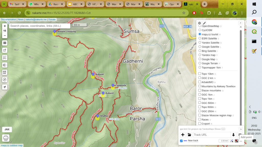

The mapy.cz layer gives a crisp shaded topographic map showing OSM trails at medium scales. Overall Himalayan geography is beautiful rendered at higher scales.
Waymarked Hiking Trails
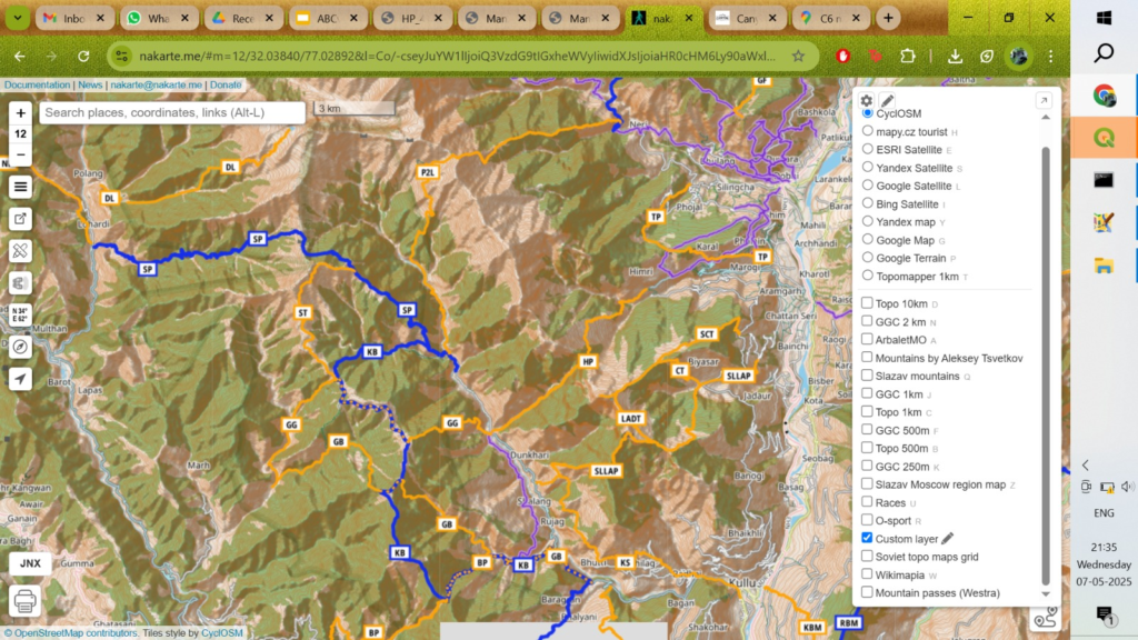
Users can add custom layers like Waymarked Hiking Trails to get a birds-eye view (higher scale) connecting individual OSM hiking routes into long distance traverses across ranges. Add Custom layer – URL: https://tile.waymarkedtrails.org/hiking/{z}/{x}/{y}.png
Survey Maps 1:50K scale
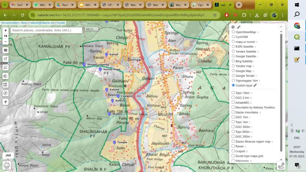
For more detailed planning (terrain details, remote settlements, unmapped trails and paths), one can overlay Survey of India maps using a Custom Layer. Add Custom Layer – URL: https://indianopenmaps.fly.dev/soi/osm/{z}/{x}/{y}.png
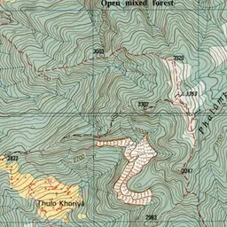
Survey Maps 1:25K scale

Higher resolution / Older Survey maps using 1:25K scale can be accessed a using Custom Layer. Add Custom Layer – URL: https://indianopenmaps.fly.dev/soi/25k/nhp/{z}/{x}/{y}.webp
Altitude / Rivers Map

To understand the overall geography – major rivers and elevation profile of the region add Custom layer URL:
https://indianopenmaps.fly.dev/ultrajourneys/altitude/himalayas/{z}/{x}/{y}.jpg
Satellite Maps

nakarte.me supports several satellite map layers (Google, Bing, ESRI, Yandex) which provide high-resolution imagery to identify remote settlements and trails in the Himalayas, useful for planning your traverse
Soviet 1:100K Topo maps

To view old Soviet military 1:100K scale (limited coverage) topographic maps add a Custom Layer with URL:
https://indianopenmaps.fly.dev/world/topo/russian/100k/gs/{z}/{x}/{y}.webp
Soviet 1:200K Topo maps

To view old Soviet military 1:200K scale (wider coverage) topographic maps add a Custom Layer with URL:
https://indianopenmaps.fly.dev/world/topo/russian/200k/gs/{z}/{x}/{y}.webp
Nepal Toposheets

For detailed terrain planning in the Nepal Himalayas we can overlay the Nepal Toposheet 1:50K/1:25K layer. Add custom layer URL: https://indianopenmaps.fly.dev/nepal/topo/maze/main/{z}/{x}/{y}.webp
Traverse Planning

Users can create / import multiple tracks (GPX) each one marking points of interests (POIs) and tracks segments to plan a Himalayan traverse using above layers. The tracks can be exported as GPX and imported in OSMAnd on your phone for navigating the planned traverse. Refer Guiding Hikers for various sample traverses.

Route Profile

Once the overall traverse is planned (mountain passes, villages, food supply, night halts) one can use brouter.de for profiling individual sections – estimating distance / elevation profile / gradient. Above shows the profile of the Rumtse to Tso Moriri traverse in Ladakh across 7 mountain passes. With a daily mileage of 20km a hiker could plan cover this in 5 days with 4 night halts in between. Total elevation gain is 2909 meters.
🙏