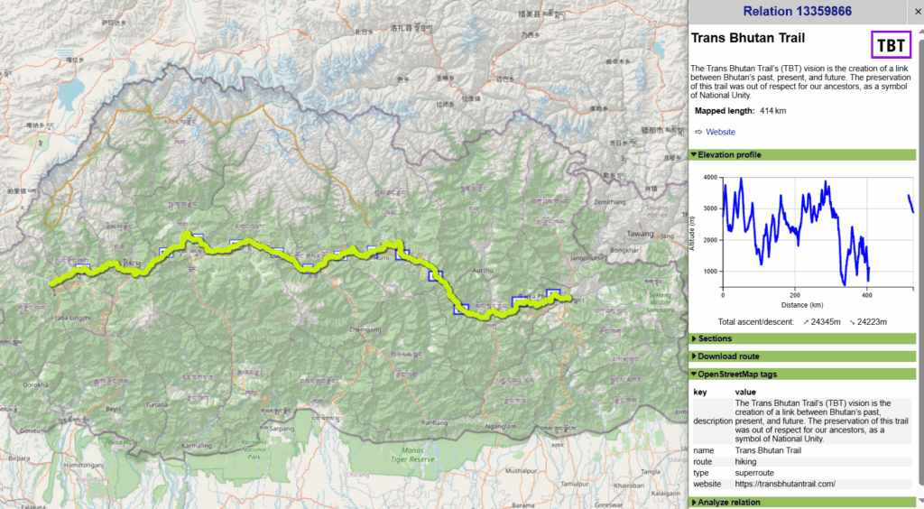
Continuing the Trans Arunachal route further West, the 500km Trans Bhutan traverse takes us from Tawang in Arunachal to Gangtok in Sikkim over 8 passes and many valleys via a mid range (sub 4000m) route. This section is part of the larger Trans Himalaya traverse from Arunachal to Kyrgyzstan.
- Traverse
- Geography
- Route
- Food Supply
- Night Halts
Traverse
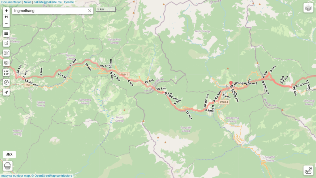
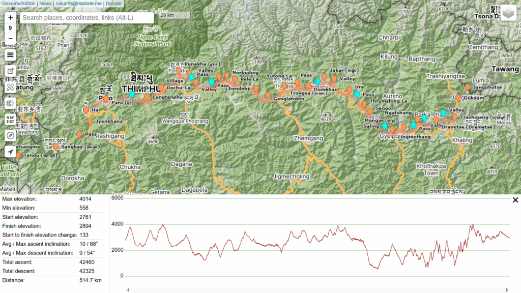
The trans Bhutan traverse is mostly mapped in OSM – 500km long with 24K meters elevation gain. Load below GPX files in nakarte.me to study the route in detail:
Geography
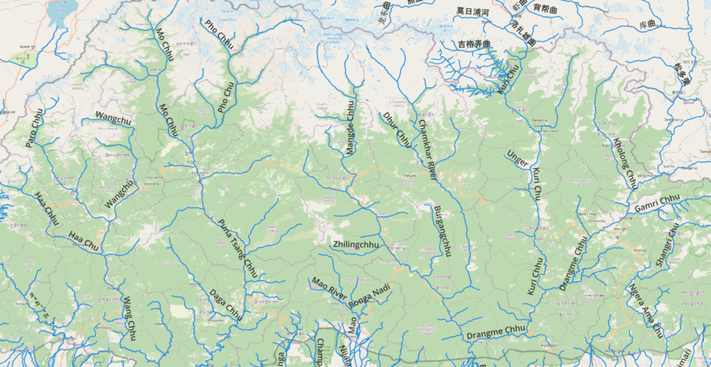
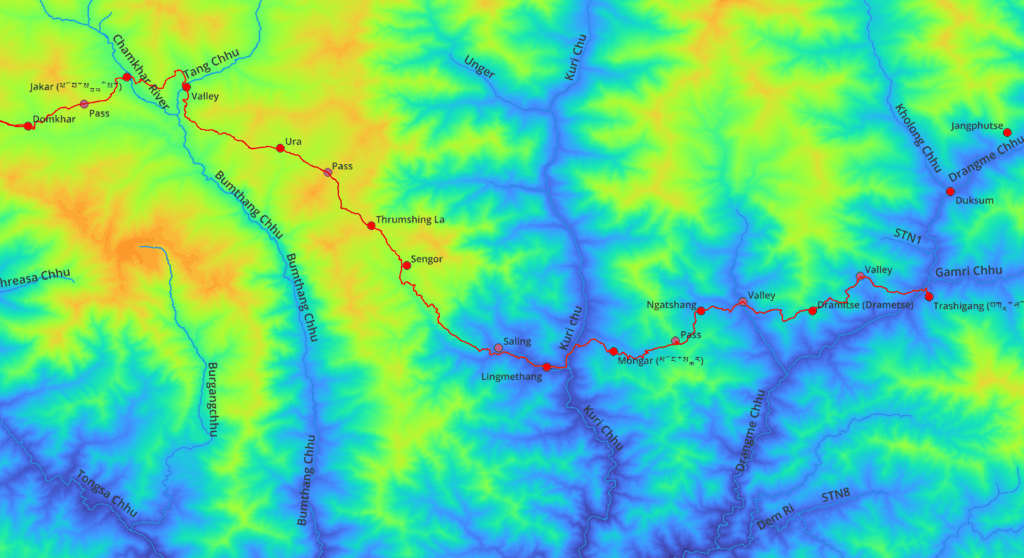
There are 7 major river valleys flowing North to South. Showing the trans Bhutan traverse on an elevation map gives a clear understanding of the various valleys and in-between ranges being crossed while traversing East to West.

Route
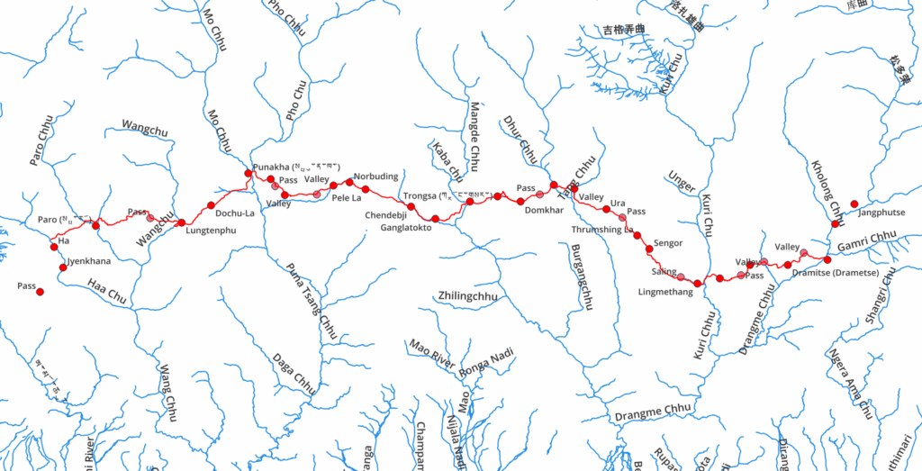
Below sequence documents the 8 mountain passes and numerous valleys being traversed from East to West:
- Tawang Chu
- Kholong Chhu
- Dragme Chu
- Pass
- Unknown valley
- Pass
- Kuri Chu
- Thrumshing La
- Tang Chhu
- Dhur Chhu
- Yutong La
- Mangdue Chu
- Chhusemu Chu
- Pele La
- Puna Tsang Chhu
- Dochu La
- Wangchu
- Pass
- Paro Chhu
- Pass
- Haa Chhu
Food Supply
At an average mileage of 20km per day it would take around 25 days to cross over Bhutan. Assuming a food supply drop every week we would require 4-5 drop points:
- Trashigang: 27.33274 91.54633
- lingmethang: 27.26098 91.17137
- Trongsa: 27.50161 90.50759
- Punakha: 27.58429 89.85931
- Ha: 27.36905 89.29181
Night Halts
Potential night halts every 20km can easily be identified using the km markers displayed by nakarte.me. Focus on villages, campsites or natural shelters nearby running water.