Skip to content
UltraJourneys

Tag: GIS

  • Home
  • Blog
  • About
    • Profile
    • Social Media
      • Instagram
      • YouTube
      • Whatsapp
      • Patreon
      • Substack
      • Facebook
    • Articles
      • Blogs
      • The Himalayan Club
      • ExplorersWeb
      • Outdoor Journal
      • IMF
    • Interviews
    • News
    • Talks
      • Colleges
      • Corporate
      • Public
      • TEDX
    • Awards
    • Relief
  • Courses
    • Field Bootcamp
    • Online Bootcamp
    • Alpine Webinar
    • Navigation Bootcamp
    • GIS
    • Minimalist Gears
    • Himalayan Regions
    • Sahyadri Regions
    • Self Supported Runs
    • Running in Vietnam
    • GIS Workshop
    • Social Media
  • Himalayas
    • Mapping the Himalayas
    • Guiding Hikers
    • Himalayan Regions
    • Gears
    • Traverse Planning
    • Nepal
    • Alpine Lakes
    • Cycle Touring
    • Ultra Running
  • Maps
    • Himalayan Maps
    • Himalayan Traverses
    • Open Street Maps
    • Journey Maps
    • Survey of India
    • Navigation
    • Topography
  • Journeys
    • J&K 2022
    • Himachal 2021
    • Uttarakhand 2021
    • Trans Sahyadri 2019
    • Trans Himalaya 2019
    • Trans Sahyadri 2018
    • Trans Himachal 2018
    • Vietnam 2018
    • Spiti-Pangi 2017
    • Ultras 2017
    • Pangi-Zanskar 2016
    • Vietnam 2016
    • Pangi 2015
    • Spiti 2015
    • Srilanka 2015
    • Shimla-Leh 2013
  • Sitemap

Alpine Hiking 6D – Geo-referencing maps

December 20, 2021 Peter Van Geit

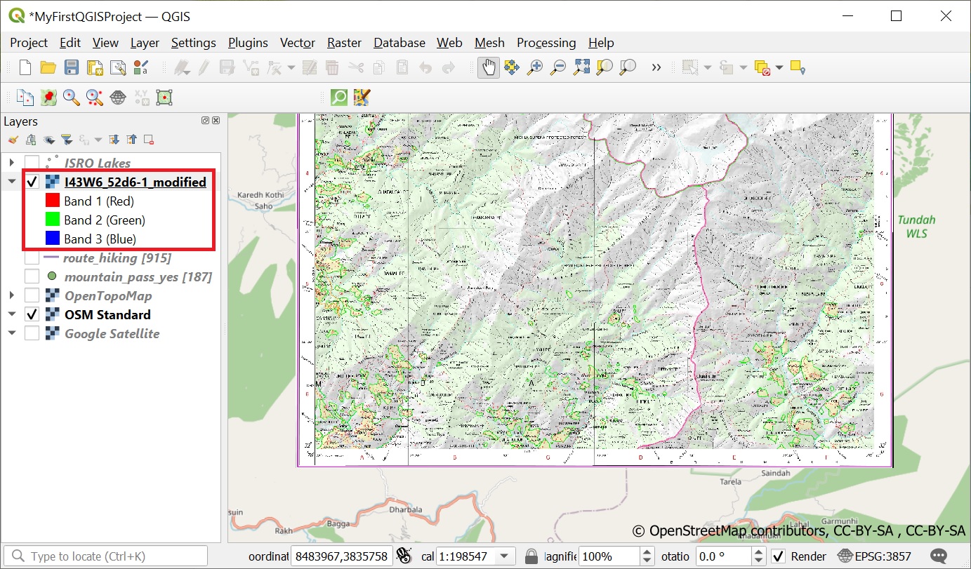
Geo-referencing is the process of taking a digital image and adding geographic information to it so that GIS software can…

Continue Reading →

Posted in: 6 GIS, Alpine Bootcamp DIY Filed under: GIS

Alpine Hiking 6C – OSM data

December 19, 2021 Peter Van Geit

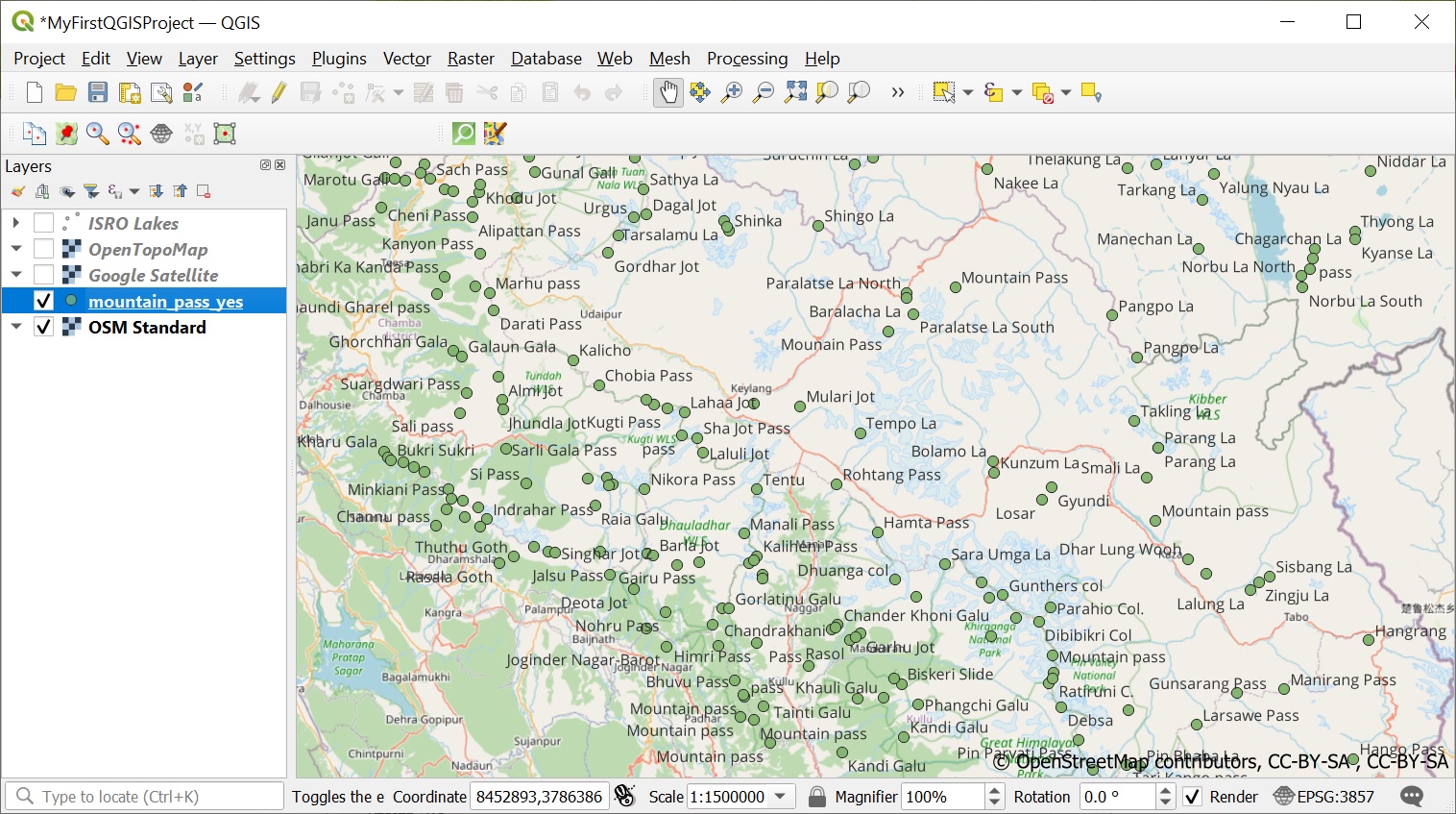
One of the most extensive public datasets of geographic data is Open Street Maps. Let’s play around with some interesting…

Continue Reading →

Posted in: 6 GIS, Alpine Bootcamp DIY Filed under: GIS

Alpine Hiking 6B – Importing and analyzing data

December 18, 2021 Peter Van Geit

Now that we have QGIS up and running let’s start looking at some publicly available data sets for the Western…

Continue Reading →

Posted in: 6 GIS, Alpine Bootcamp DIY Filed under: GIS

Alpine Hiking 6A – QGIS

Peter Van Geit

Congrats on completing the first 5 chapters of the Alpine Style bootcamp: Chapter 1 – Maps of the HimalayasChapter 2…

Continue Reading →

Posted in: 6 GIS, Alpine Bootcamp DIY Filed under: GIS

Preparing maps for mobile navigation use

May 11, 2021 Peter Van Geit 1 Comment

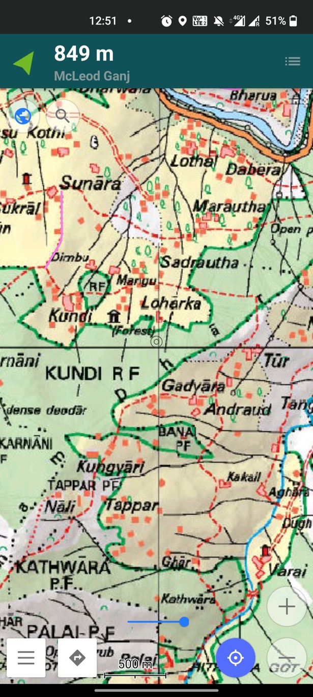
In this tutorial we will demonstrate how to prepare any physical map for mobile navigation use (OSMAnd). Many mobile apps…

Continue Reading →

Posted in: Survey of India Filed under: GIS, Survey of India

Digitizing trails in QGIS

March 15, 2021 Peter Van Geit

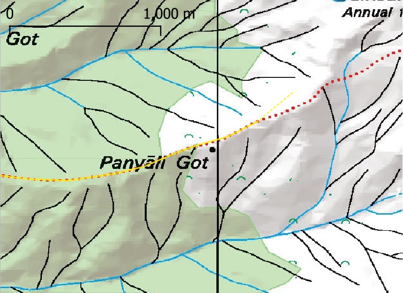
In this short tutorial we will learn how to digitize trails from existing heritage maps using QGIS. We will use…

Continue Reading →

Posted in: GIS, Survey of India Filed under: GIS, Survey of India

Geo-referencing Survey of India Maps

Peter Van Geit

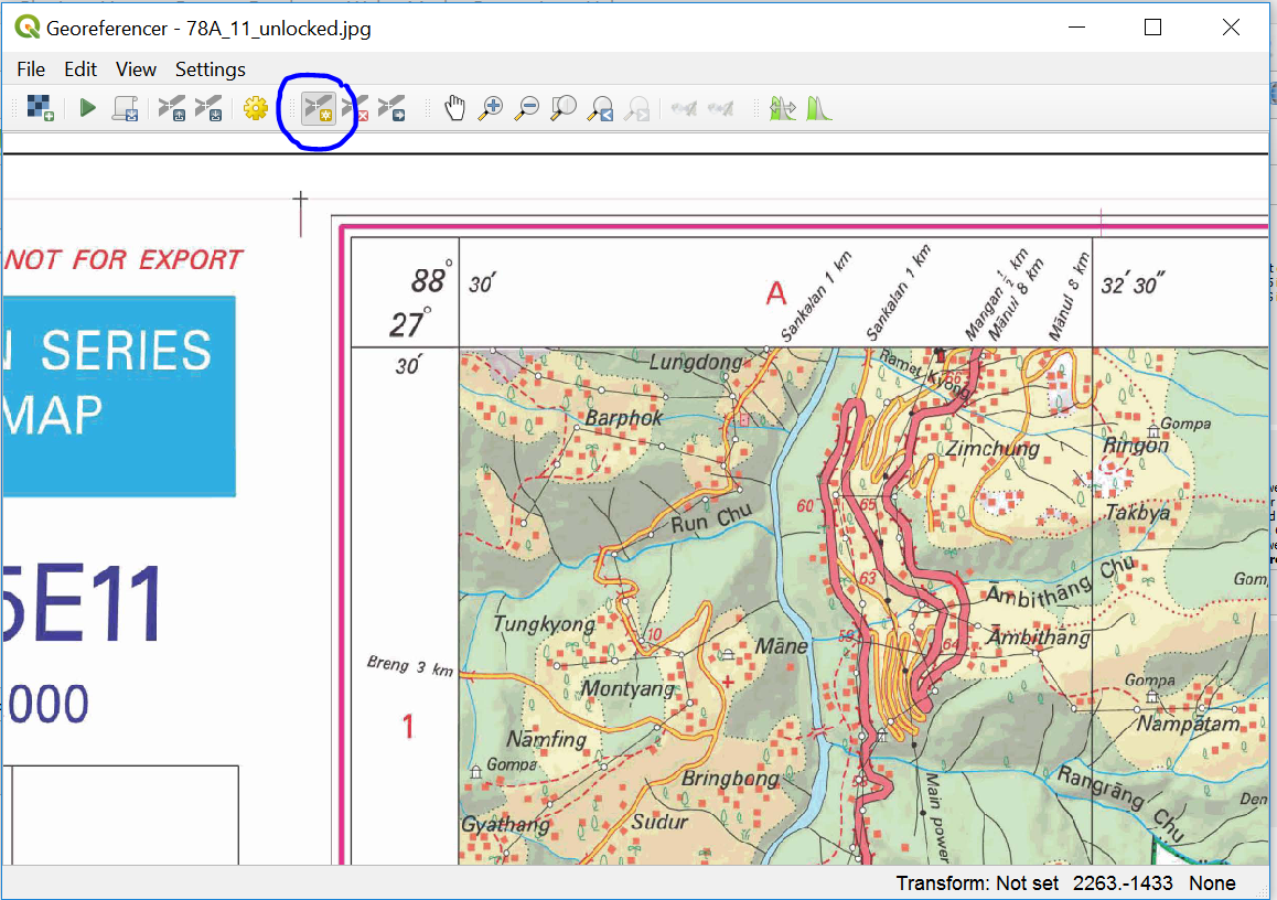
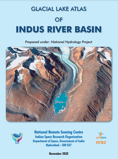
Survey of India (SOI) maps provide freely downloadable 1:50K topographic maps through its portal soinakshe.uk.gov.in/ (Note: Map download limited to…

Continue Reading →

Posted in: 6 GIS, Survey of India Filed under: GIS, Survey of India

Navigation Bootcamp (6) – Geo-referencing Maps

February 20, 2020 Peter Van Geit

Important update: geo-referencing maps can be done directly inside Google Earth – no need to download any separate app. Add…

Continue Reading →

Posted in: Courses, Navigation Bootcamp Filed under: GIS

Post navigation

Page 3 of 3
← Previous 1 2 3

Need guidance on hiking in the Indian Himalayas? Contact me:

  • WhatsApp
  • Instagram
  • Mail
  • YouTube
  • Patreon
  • Facebook

Search

Contents

  • About (167)
    • Articles (40)
      • Blogs (12)
      • ExplorersWeb (7)
      • IMF (4)
      • Outdoor Journal (7)
      • The Himalayan Club (10)
    • Awards (9)
    • Interviews (19)
    • News (14)
    • Profile (4)
    • Relief (16)
    • Talks (70)
      • Colleges (12)
      • Corporate (21)
      • Public (22)
      • TEDX (11)
  • Courses (123)
    • Alpine Bootcamp DIY (64)
      • 1 Maps & Route Planning (5)
      • 2 Navigation (6)
      • 3 Journey Planning (8)
      • 4 Minimalist Gears (7)
      • 5 Himalayan Terrains (8)
      • 6 GIS (7)
      • 7 Open Street Maps (5)
      • 8 Maps of the Himalayas (5)
      • 9 Atlas of the Himalayas (4)
      • 9B Geometrics of Himalayas (6)
    • Alpine Field Bootcamp (14)
    • Alpine Webinar (11)
    • Environment (4)
    • GIS (9)
    • Navigation Bootcamp (13)
    • Social Media (4)
  • Himalayas (134)
    • Cycle Touring (10)
    • Gears (11)
    • Guiding Hikers (15)
    • Himalayan Regions (17)
    • Lakes (12)
    • Mapping Himalayas (15)
    • Nepal (10)
    • Q&A (4)
    • Running (10)
    • Traverse Planning (15)
    • Videos (15)
  • Maps (104)
    • Himalayan Maps (18)
    • Himalayan Traverses (26)
    • Journey Maps (26)
    • Navigation (12)
    • Open Street Maps (13)
    • Survey of India (6)
    • Topography (10)
  • Sahyadris (39)
    • Regions (25)
    • Traverses (14)
  • Ultra Journeys (554)
    • Himachal Autumn 2021 (26)
      • Maps (2)
      • Traverses (23)
      • Videos (1)
    • Himachal Spring 2021 (25)
      • Traverses (24)
      • Videos (1)
    • Himalaya 2018 (65)
      • Articles (10)
      • Maps (3)
      • Talks (5)
      • Traverses (43)
        • Chamba, Pangi (13)
        • Kinnaur, Spiti (9)
        • Kullu, Kangra (16)
        • Ladakah, Zanskar (5)
      • Videos (4)
    • Himalaya 2019 (112)
      • Articles (14)
      • Maps (4)
      • Talks (6)
      • Traverses (78)
        • Chamba, Pir Panjal (11)
        • Dhauladar (14)
        • Kullu (11)
        • Ladakh (16)
        • Uttarakhand (16)
        • Zanskar (10)
      • Videos (3)
    • Himalaya 2022 (4)
      • Maps (4)
    • JK Spring 22 (23)
      • Articles (2)
      • Maps (2)
      • Traverses (18)
      • Videos (1)
    • JK Winter 22 (11)
      • Maps (1)
      • Traverses (9)
      • Videos (1)
    • Pangi 2015 (6)
      • Articles (3)
      • Traverses (3)
    • Pangi-Zanskar 2016 (4)
      • Articles (2)
      • Traverses (2)
    • Sahyadri 2018 (27)
      • Articles (1)
      • Traverses (26)
    • Sahyadri 2019 (77)
      • Articles (5)
      • Map (1)
      • Media (15)
      • Talks (12)
      • Traverses (16)
      • Videos (2)
      • Webinars (26)
    • Sahyadri 2022 (1)
      • Map (1)
    • Shimla-Leh 2013 (6)
      • Articles (3)
      • Traverses (3)
    • Spiti 2015 (6)
      • Articles (3)
      • Traverses (3)
    • Spiti-Pangi 2017 (8)
      • Articles (4)
      • Traverses (4)
    • Srilanka 2015 (4)
      • Articles (3)
      • Traverses (1)
    • Ultras 2017 (7)
      • Articles (2)
      • Races (5)
    • Uttarakhand 2020 (93)
      • Articles (7)
      • Maps (2)
      • Traverses (82)
        • Bageshwar (5)
        • Chamoli (31)
        • Dehradun (1)
        • Pauri Garhwal (5)
        • Pithoragarh (9)
        • Rudraprayag (8)
        • Tehri Garhwal (22)
        • Uttarkashi (12)
      • Videos (1)
    • Vietnam 2016 (6)
      • Articles (3)
      • Traverses (3)
    • Vietnam 2018 (32)
      • Articles (7)
      • Traverses (25)

Site Index

ABC (16) Articles (32) Chamba (24) Chamoli (35) Corporate (21) Cycling (13) Dhauladhar (20) Featured (28) Floods (24) GHNP (18) GIS (28) Guidance (15) Himalayan Maps (18) Himalayan Regions (16) Himalayan Traverses (26) Interviews (27) Jammu (34) Journeys (18) Kangra (28) Kullu (36) Ladakh (26) Lahaul (24) Lakes (19) Mapping Himalayas (15) Maps (27) Navigation (13) News (26) Open Street Maps (18) Pangi (13) Pir Panjal (13) Pithoragarh (15) Presentations (31) Public (15) Running (16) Sahyadri (35) Sahyadri Regions (27) Sahyadri Traverses (26) Talks (12) Tehri Garhwal (31) th19 (14) Traverse Planning (17) Uttarkashi (20) Videos (15) Vietnam (34) Zanskar (22)
  • Home
  • Blog
  • About
  • Courses
  • Himalayas
  • Maps
  • Journeys
  • Sitemap
  • Home
  • Blog
  • About
  • Courses
  • Himalayas
  • Maps
  • Journeys
  • Sitemap
Copyright © 2019 UltraJourneys - Supported by dreams