
Recently I was contacted by Anne, a hiker from Belgium who did a few individual glacial hikes (connected by roads)…

Recently I was contacted by Anne, a hiker from Belgium who did a few individual glacial hikes (connected by roads)…

Introduction In this chapter we will teach you how to perform various interesting types of terrain analysis: Previous GIS chapters…

1. Introduction In this blog post we guide you on how to plan a long distance hiking trail through the…

In this post we explore mesmerizing views on the Himalayas along any given hiking route. During my 4 months Trans…
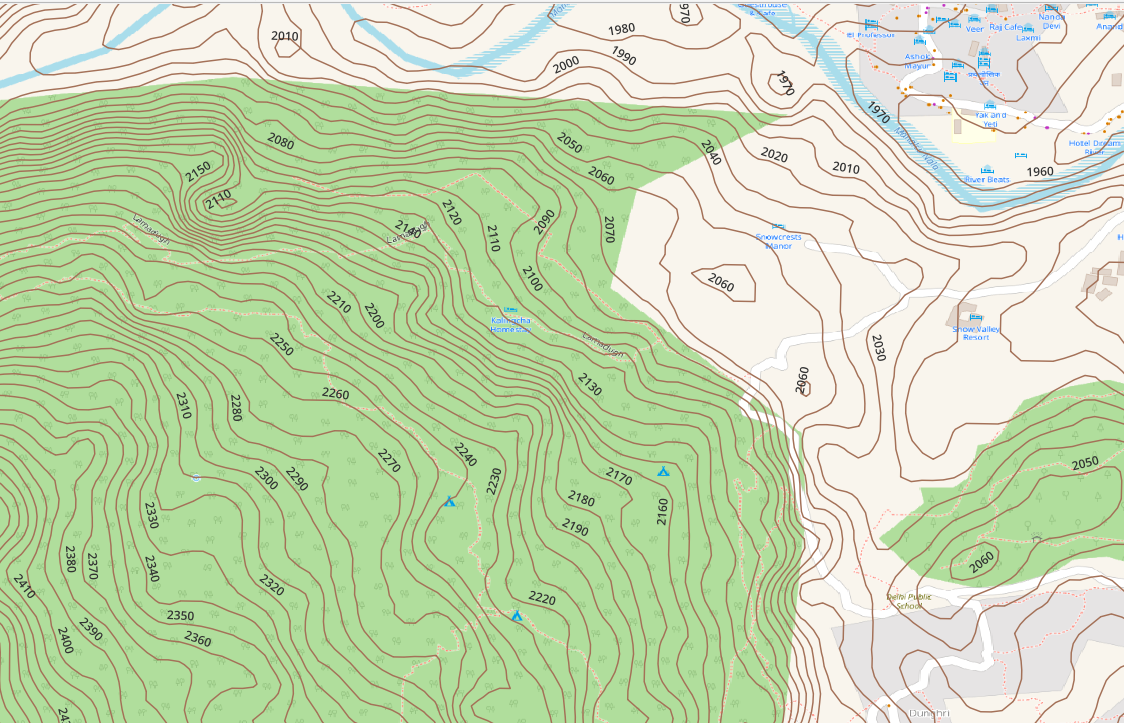
Topography is represented on topographic maps through contour lines. Most contours are generated from 30 meter (1 arc sec) DEM…
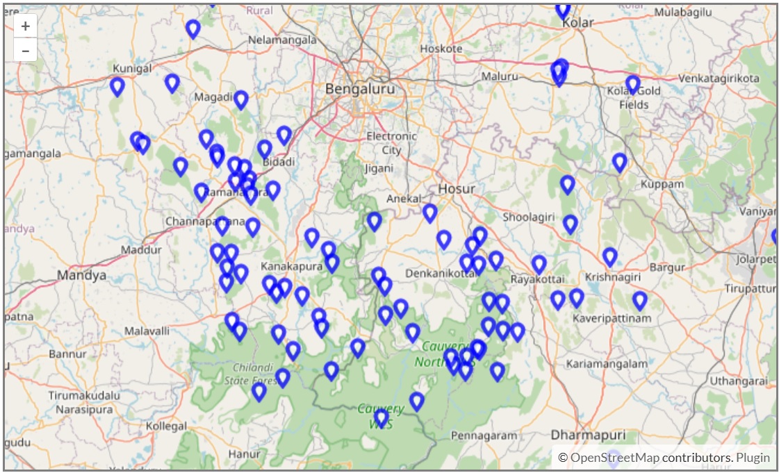
In the map below you can find some 100 hillocks in the outskirts of Bangalore which can be hiked with…

Hiking Network Open Street Maps has more than 750 hiking routes totaling 13 thousand kilometers of scenic trails across the…
For the Alpine Field Bootcamp I generated a few high resolution topographic maps for the 4 states of the Western…
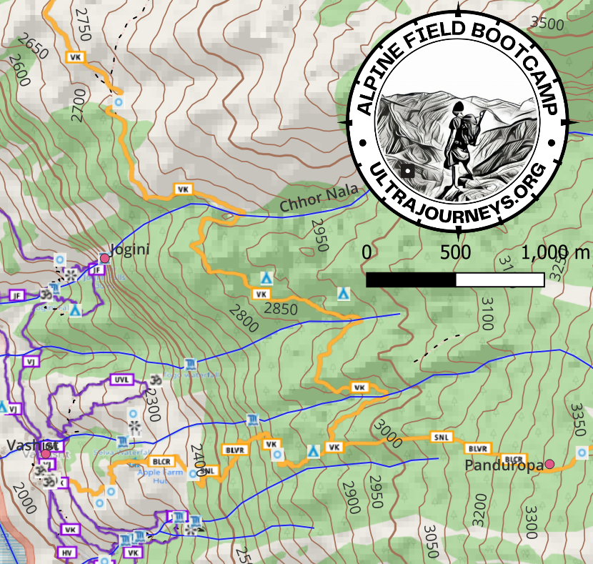
Click below to download a high resolution A3 sized 1:25K scale topographic map of the Manali region showing all hiking…
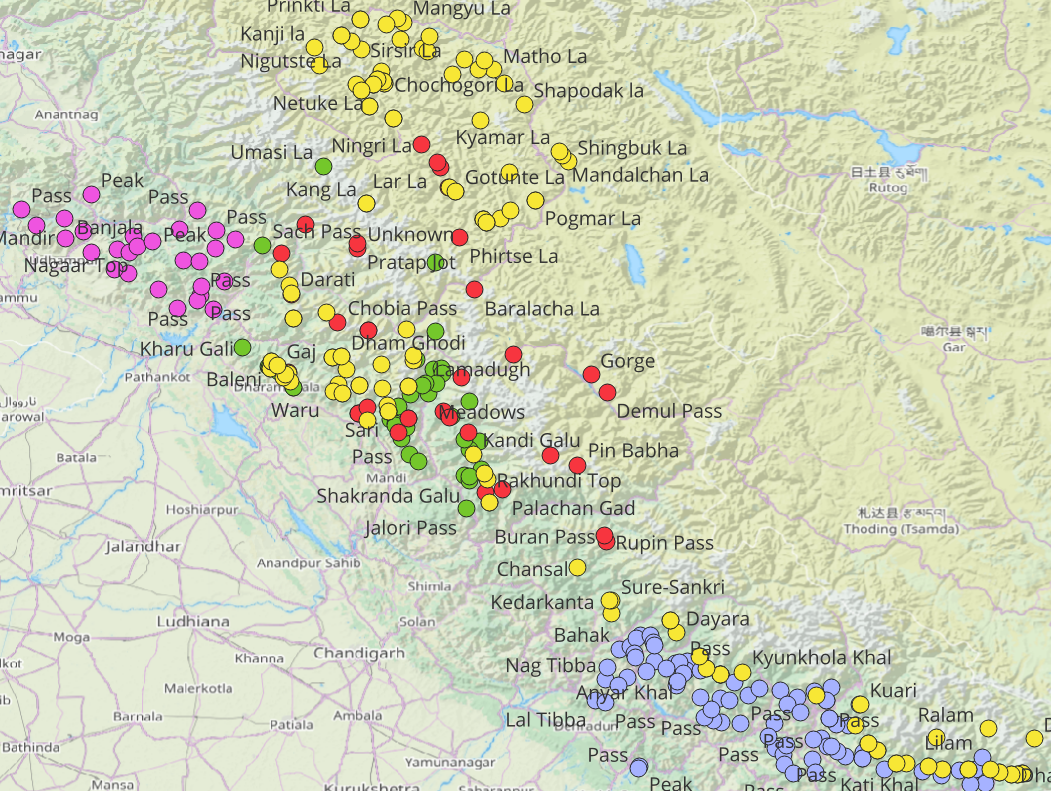
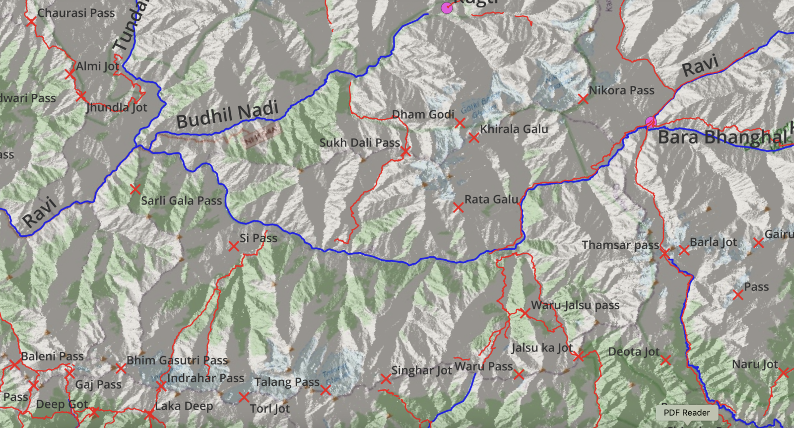
I explored more than 300 mountain passes across 10 thousand kilometers over 4 ultra journeys through the Western Indian Himalayas. Click on the…