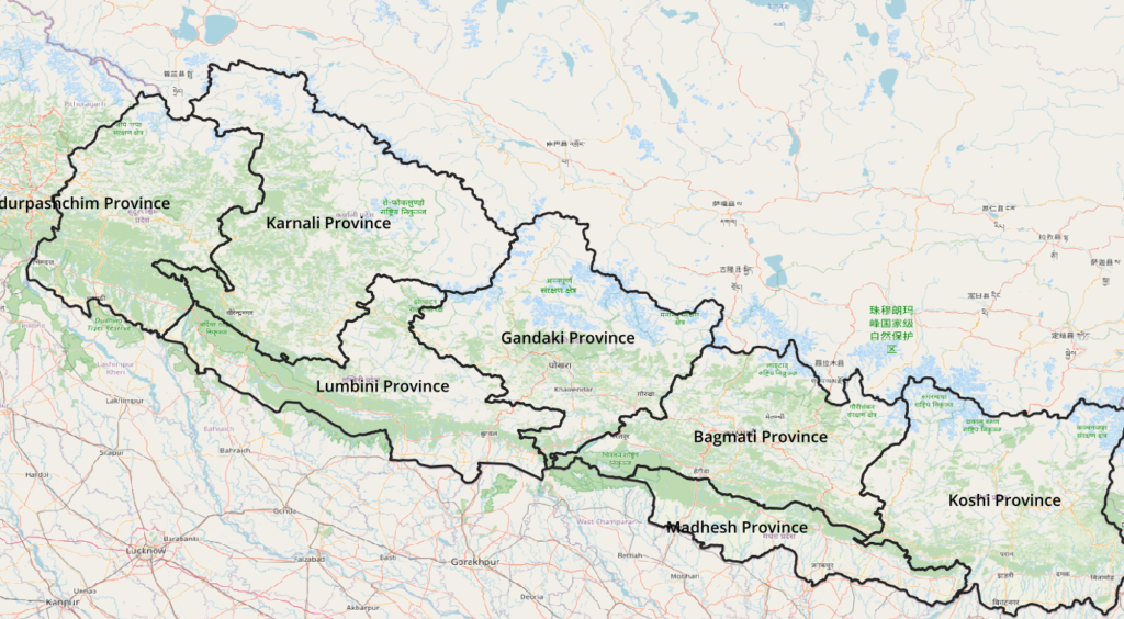
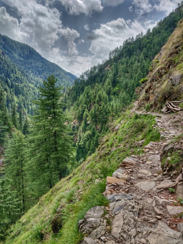
This blog presents an overview on how to map and visualize the geography of a mountain region in order to plan long distance traverses across that region. Nepal is used as an example. Geography is mapped using OSM (Open Street Maps) and visualized using QGIS (Quantum GIS). Legacy 1:50K topo sheets were used. Nepal consist of 7 provinces located between 80-88 East longitude and 26-30 North latitude rising up from 200m in the foothills in the South to 8800m in its high ranges in the North.
- Visualizing Geography
- Traverse Planning
- Mapping Passes
- Navigation
- Human Settlements
- Great Himalayan Trail
Visualizing Geography
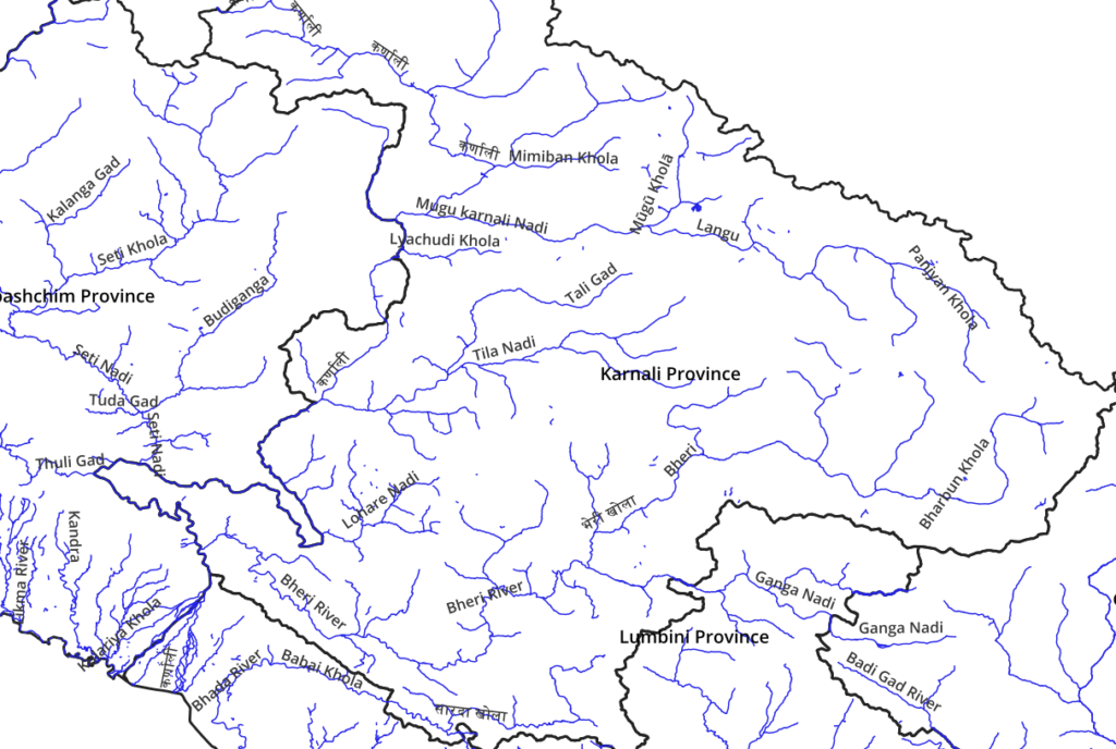
An important prerequisite for the explorer to plan his Himalayan traverses is to understand and visualize the geography of a mountain region. This includes both the high ranges and rivers flowing through major valleys. Winter snow deposited on these high ranges slowly melts during Spring and Summer draining meltwater via smaller streams and major rivers to the lush green foothills creating a seasonal water flow.
Adding mountain peaks to the above geography (valleys) gives us a better view on the altitude range of a given region. Peaks (dots) are colored as per altitude (height above mean sea level) – from lower (blue) to mid (green, yellow) to higher (red) altitudes. Hiking at a certain altitude is usually easier during the season when less or no snow remains on that altitude.
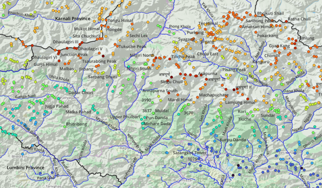
As we move from winter to summer snow melts initially at lower and later at higher altitudes which as a result become more easily traversable during those corresponding months of the year.
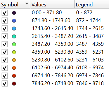
We can also visualize a region using a continuous color map which shows lower (blue) to higher (red) altitudes. Winter snow melts first at lower altitudes as the temperature rises above zero. Snow at higher altitudes melts later in the season making those regions more easily traversable later in the summer. When planning a long distance traverse through a region one always plans per the altitude / season / snowline (lowest altitude where snow remains).
Traverse Planning
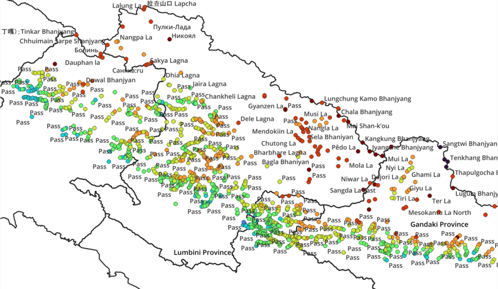
When planning a long distance traverse across multiple valleys (rivers) we cross over in-between ridges / ranges via mountain passes. Passes (dots) are colored as per altitude – from lower (blue) to higher (red) altitudes. Depending on the season / month of the year we usually select those passes which are snow free or with less snow cover for easy cross over.
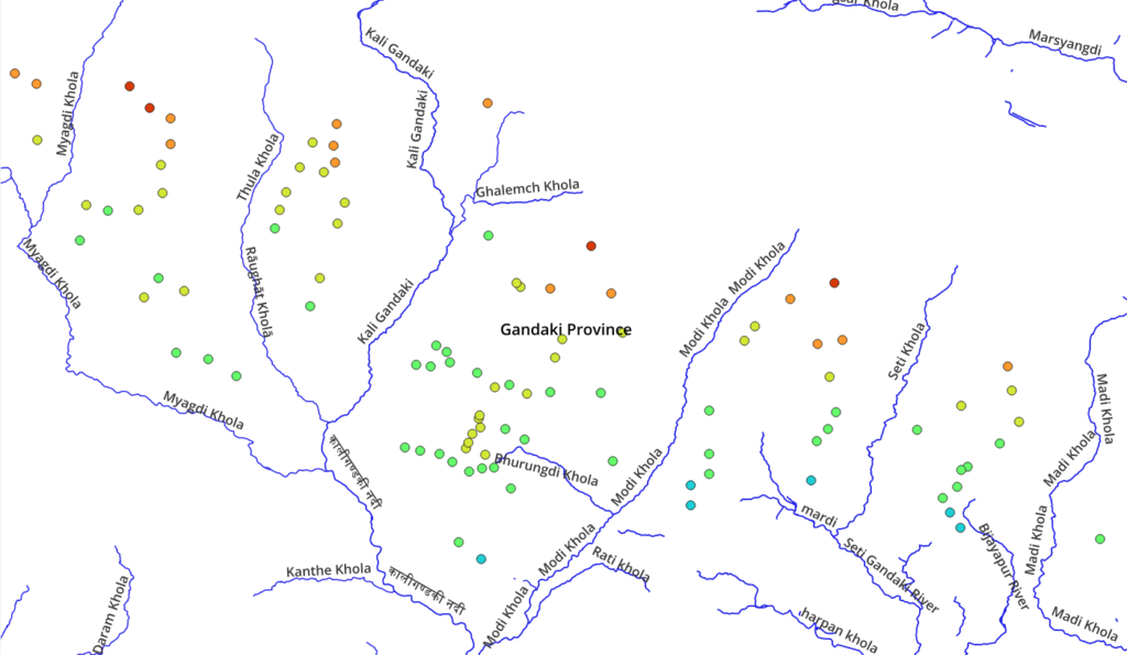
For example to cross over from Modi Khola valley to the Seti Khola valley we could chose either a low (blue) or medium (green-yellow) or high (red) altitude mountain pass shown in between both valleys depending on which altitude (passes) are (nearly) snow free (or limited snow cover) during the month we plan to do this traverse.
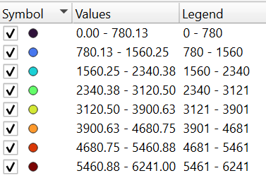
Planning a long distance traverse across many valleys comes down to connecting the right dots / colors. We identify a possible sequence: valley – pass – valley – pass – etc. within a specific altitude range (color) suitable for a given season / month of the year. For example we could hop across green (<3100m) mountain passes in Feb (Winter) or plan a yellow (<3900m) traverse in Mar(Spring) or go for a high altitude red (<5400m) traverse during June (Summer).
Mapping Passes
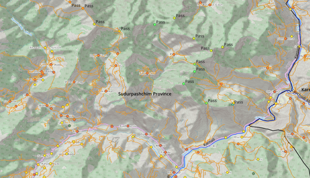
Mountain passes are key in planning a long distance traverse as (1) they allow you to connect neighboring valleys (separated by ridgelines or high ranges) and (2) they are the highest points (maximum snow) along the traverse useful to plan for a given season / month of the year.
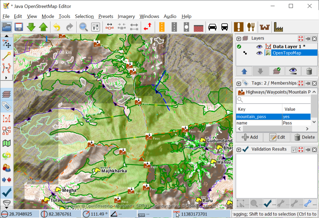
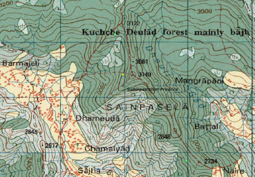
How do we identify and map mountain passes in OSM for a new region? Each country (including Nepal) usually has legacy topography maps where these passes are marked as trails cross over certain high ranges connecting neighboring valleys. The “black X” below marks the pass (Bhanjyan) along the red dashed trail. Not all traversable saddles have been named or mapped on these maps.
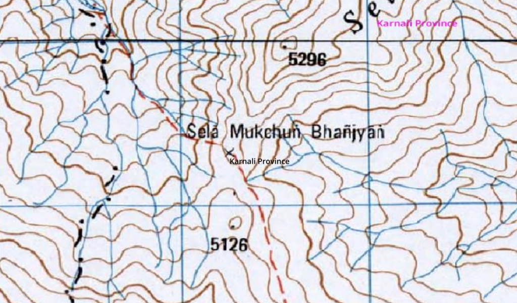
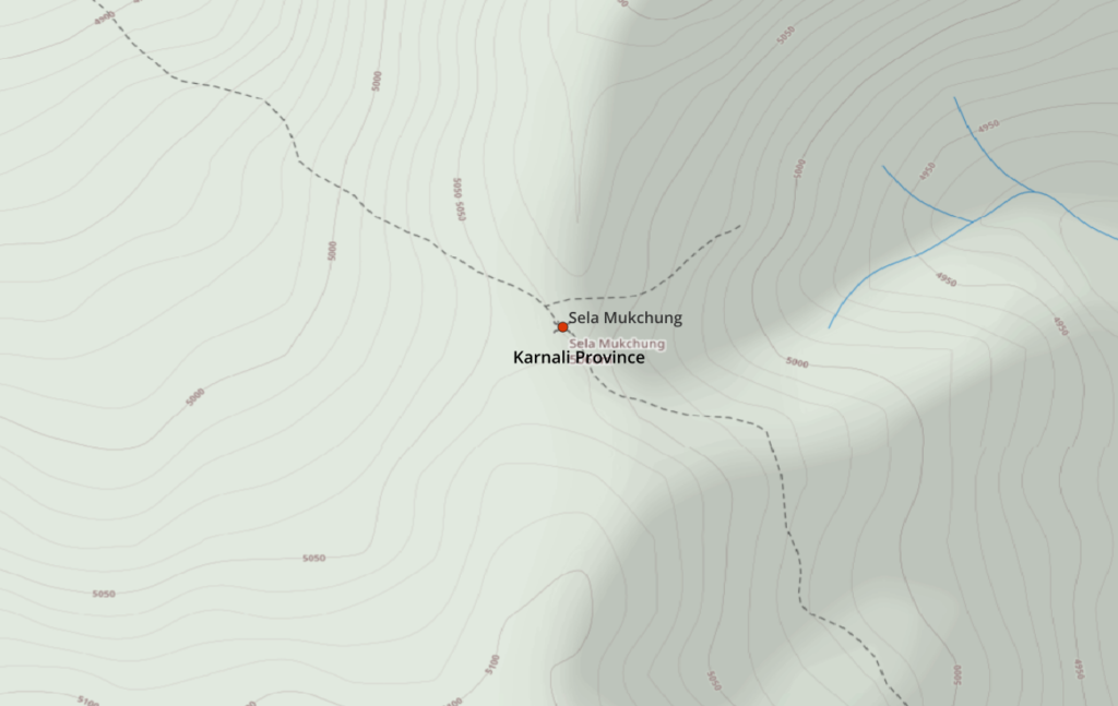
Legacy topographic maps are generally not very precise so before mapping a mountain pass in OSM we should identify the exact location where the trail crosses the ridgeline (high range) usually across a saddle. For this we can bring up an accurate contour map generated from modern satellite DEM (Digital Elevation Model) data where we can identify the exact location of the saddle:
Mountain passes can be mapped in OSM using JOSM a multi-platform Java based editor which can be easily integrated in QGIS where we can load the geo-referenced 1:50K Nepal topo sheets.
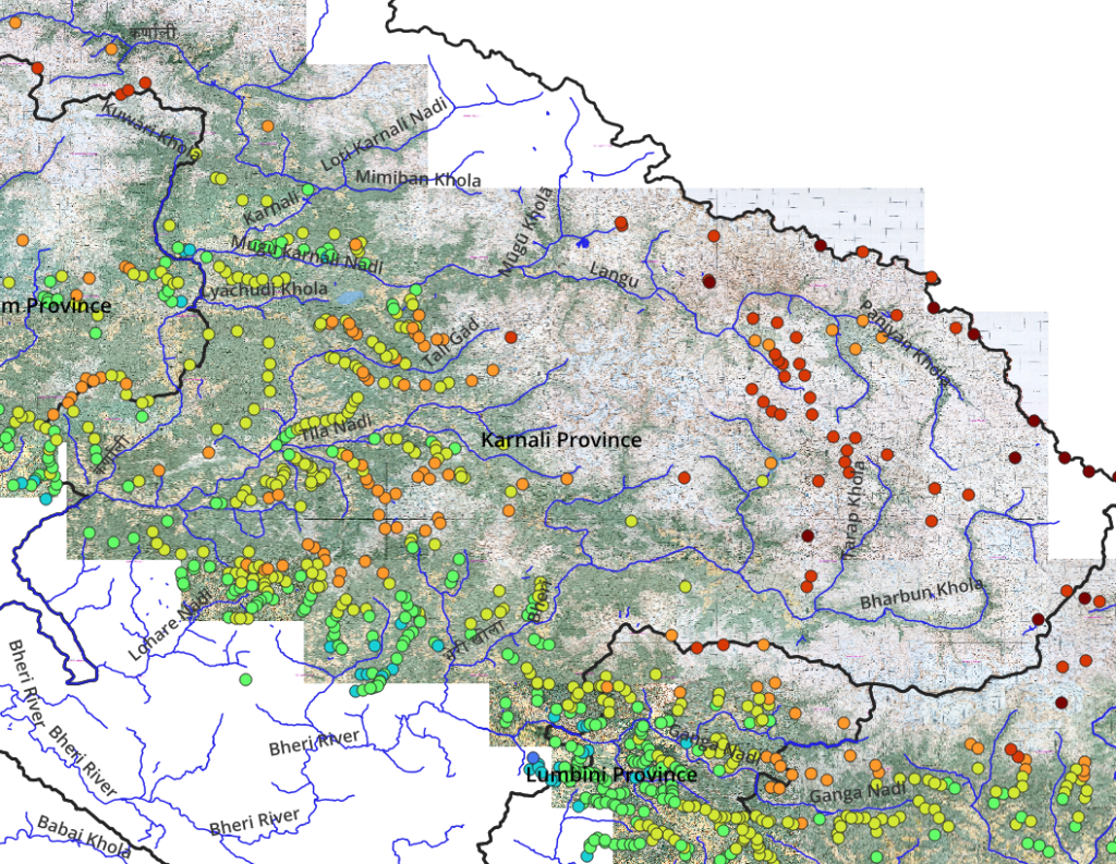
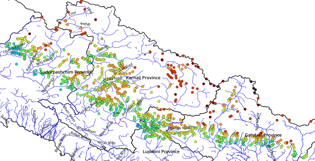
A vast region as Nepal is covered by hundreds of 1:50K scale topo sheets. Each sheet covers 15×15 arc minutes (28x28km) and requires individual geo-referencing and a significant effort to analyze thousands of individual trails, identifying mountain passes where these trails cross over ridgelines. These passes provide valuable short-cuts for the trans Himalayan hiker to quickly hop across neighboring valleys as part of a long distance traverse.
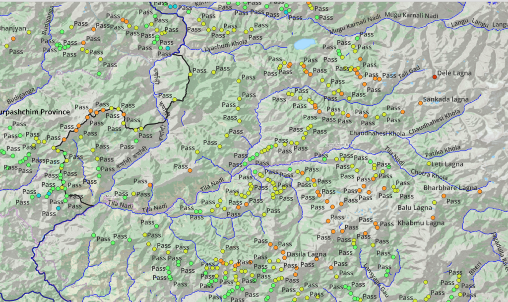
It took several weeks / months of efforts in geo-referencing and analyzing trails on individual topo sheets to map around 1200 mountain passes for the Northern regions (above the cultivated foothills) for the 4 Western provinces of Nepal (around 50% of the country). The result is a beautiful base map (blueprint) which can be used to plan countless long distance traverses across these provinces during different seasons (altitudes). Density of the passes increases in the foothills where frequent trails connect villages in neighboring valleys. As we go to higher altitudes and more inhospitable regions trails and passes become more sparse:
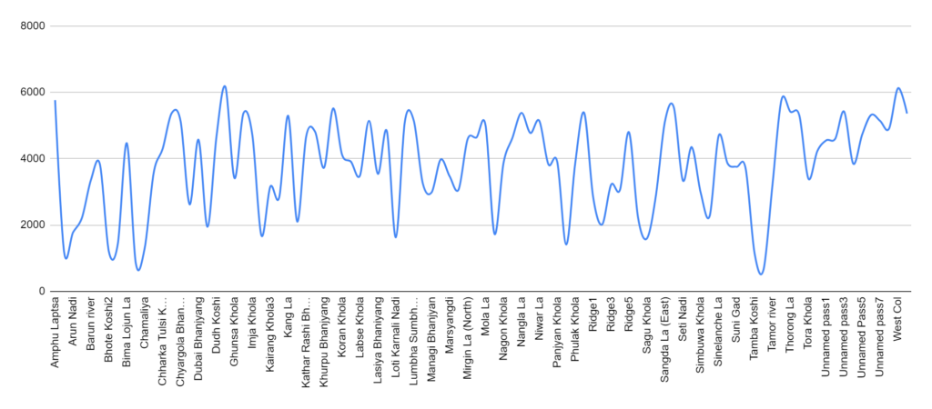
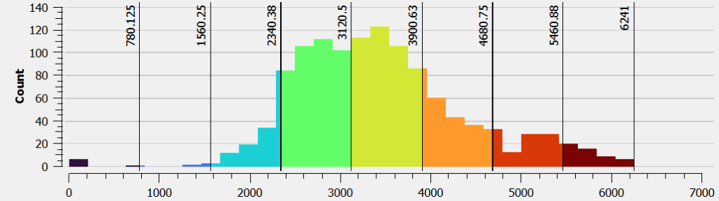
Visualizing the same passes using an altitude histogram which shows that for each month of the year (and time when snow melts there) we have a wide choice (large number) of passes to traverse. The histogram shows the number of passes for each 200m elevation increment. We find maximum passes in the 2400 to 4000m range catering to both novice and advanced hikers. We could plan for a lower altitude (blue, green) traverse near Winter or a higher (orange, red) traverse during Summer when the snowline is much higher.
Navigation
Once you fix a traverse suitable for a given season you can head out and hike the same. Navigating a traverse (finding the actual path on the ground) can be done in various ways: (aside from hiring a local guide of course)
- (1) Follow a clearly visible path or trail periodically checking with local people to stay on the right track using names of villages and passes along the way. Depending on the visibility of the trail, number of nearby trails and intersections we might sometimes lose the right trail and get lost.
- (2) An easier way to stay on track is using trails which are accurately GPS recorded and mapped in OSM (Open Street Maps) and can be easily tracked using a GPS navigation device. We periodically check whether we are still on the right track by (GPS) comparing our location with the pre-mapped trail.
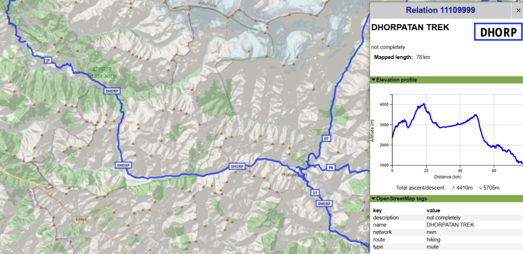
- (3) Sometimes thousands of trails are mapped in OSM resulting in a confusing spiderweb where not every trail leads to a logical destination. To present a more comprehensive overview to hikers OSM has put a layer of “hiking routes” on top of this which only shows well known (curated) trails logically leading to popular destinations:
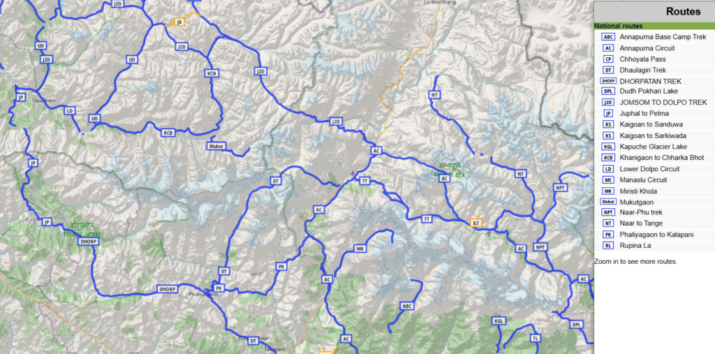
The user gets a comprehensive overview of popular hiking routes in a given region. The routes are presented both on a map as well as in a list. We can select any route to bring up useful details like distance, total climb and an elevation profile which allows us to start planning this route in more detail:
- (4) Some trails are not yet accurately GPS recorded and mapped in OSM but can be located approximately on older topographic maps which can be used as a reference while navigating / finding your way. Below 1:50K topo sheet shows trails as red dashed lines connecting villages (yellow) across in-between passes / ranges. Hikers exploring new trails are advised to GPS record and map them into OSM for the benefit of the outdoor community.
Human Settlements
Once you identify a suitable trail for your planned traverse the next logical step is planning your food ration. It’s usually not feasible to carry food for the entire traverse which would be too heavy. Instead we can just carry sufficient food with us until we reach the next village (red) or hamlet (yellow) where we can resupply thereby optimizing our backpack weight. Villages / hamlets are usually located in the valleys at lower altitudes so they remain inhabitable during winters. These are useful in-between pitstops in valleys while crossing over ridges / high ranges via mountain passes
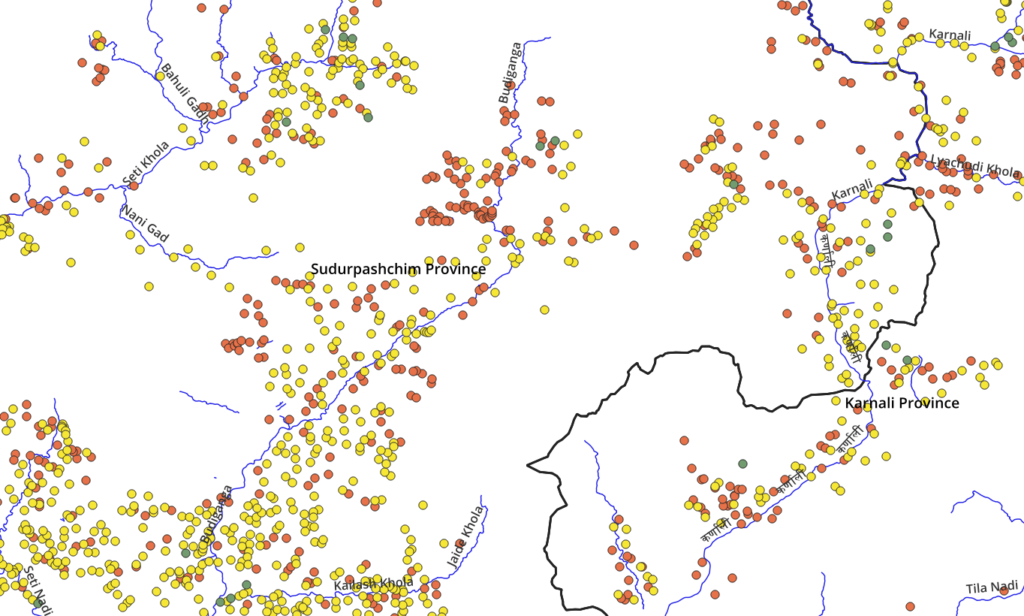
Visualizing both OSM trails and human settlements makes planning your traverse a breeze – just connect the dots. You can plan your route from village to village. Each village has multiple uses: (1) food supply (2) drinkable water (3) charge electronics (4) safe night halt and (5) ask for guidance. A distance traverse now becomes a sequence of valley (villages) – high range (mountain pass) – valley (villages) – ridgeline (pass) – etc. With tens of thousands of villages (hamlets) mapped in OSM for Nepal makes it easy to plan your traverse and optimize your weight.
Great Himalayan Trail
For a real-world example of a trans-Nepal traverse (East to West) please take a closer look at the Great Himalayan Trail in this blog post. Significant mapping efforts were undertaken to map this entire traverse across 49 valleys and 52 mountain passes through easy to visualize & use OSM hiking routes for planning purposes.