
Introduction
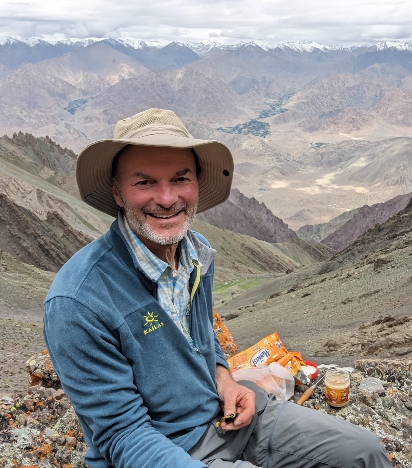
Peter Jost one of my Patrons. I’ve been a bushwalker in Australia for decades and have walked in Sichuan, Qinghai, Nepal, Zanskar over the years. I see you’ve been getting out into the mountains again (Facebook etc). Just whenever you have a chance, would love to talk to you more about telling for a month in Uttarakhand. I don’t know that area at all so I’ve just chosen this area in the east, near Nepal. Could I do a month on these various tracks? Any suggestions
Planning
Below a mid-altitude East to West traverse of Uttarakhand with some nice optional (*) higher altitude North diversions. Food supply points (***).
Optional: Dharma valley (*)
- Beautiful valley running to the North with scenic, remote hamlets
- ***1 dhaba on the way before Sela – pack up food for remaining or avail hospitality at Datu
- Mostly jeep track / dirt track
- Locals usually return by mid May to higher altitude settlements
- Mid way check post by ITBP
- I went along with a local person who told them I would stay with him and return next day so I was allowed in without taking prior permission
- You can walk up to Datu – splendid views on Panghuli
- Beyond that not allowed by ITBP
- Ralam pass (5500m closed in May)
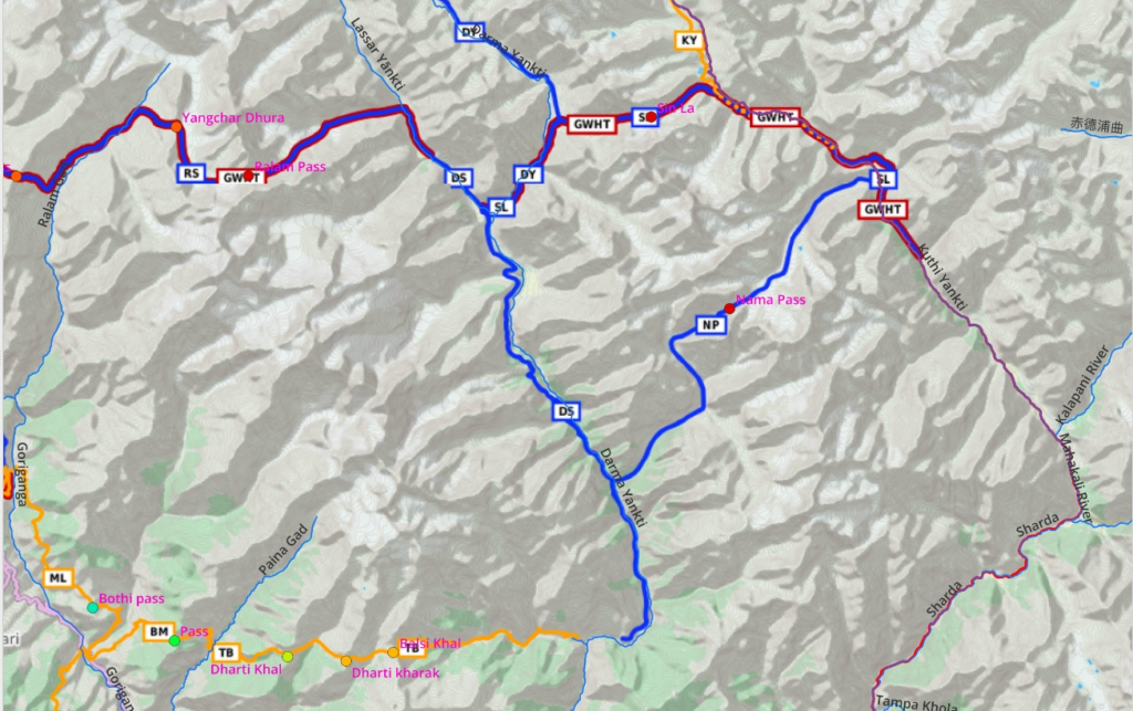
Teejam to Mathkot
- Dharma Yankti valley
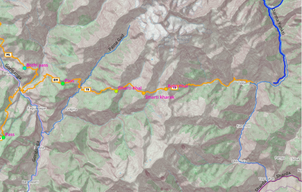
- ***Teejam – pack up 2 days of food
- Sungdom is last settlement / no shops
- Balsi Khal
- Jimba Gadhera – uninhabited
- Dharti Kharak
- Kulka Gadhera – uninhabited
- Dharti Khal
- *** Bona – hospitality, one of private houses has a grocery shop
- Paina Gad valley
- Tomik – small hamlet
- Mujurka Khal
- Rapti – village
- Lot of new road development here
- Madakani Nadi – no bridge, need to cross via Mathkot
- ***Mathkot – bigger town, many dhabas
- Goriganga valley
Goriganga valley
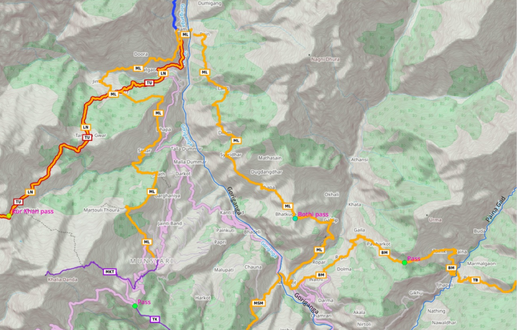
- Bothi
- Rockpath connecting many remote scenic hamlets
- Dilam
- Lang
- Buin/Lilam – dhaba
Optional – Ralam valley (*)
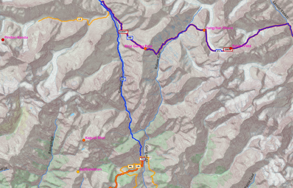
- ***Buin/Lilam – dhaba (no food beyond)
- Here you can proceed along rock path straight North into the Ralam Gad valley
- Beautiful valley till Ralam village 3600m
- Birje Ganga pass into Milam valley (4600m) is probably closed in May (check with locals)
- If so return to Buin/Lilam
- Cross over Goriganga
- ***Lilam – dhaba
Optional – Milam valley (*)

- Lilam proceed north into Goriganga valley
- In 2021 there was new road development here
- (haven’t gone here so not sure on food supply – check at Lilam)
- Several small scenic hamlets on both side of valley:
- Martoli
- Burphu
- Ganghar
- Milam – last hamlet
- Milam glacier
- Untha Dura pass – closed I believe / not familiar
Lilam-Namik
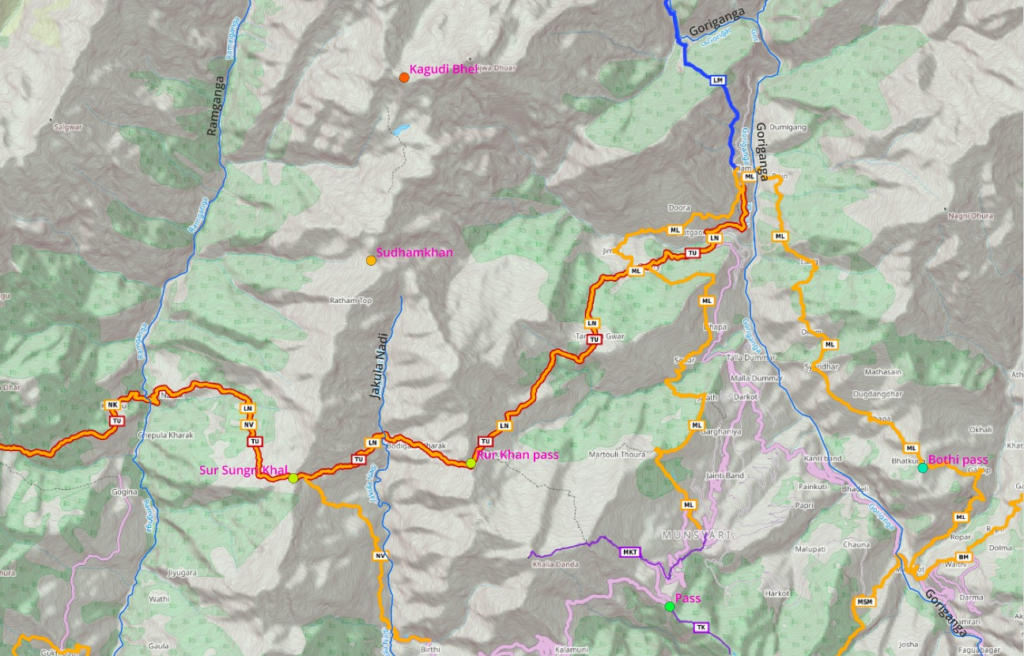
- Goriganga valley
- ***Lilam – dhaba / pack up food
- Kwiri
- Rur Khan pass
- Jakula Nadi – uninhabited
- Sur Sungri Khal
Optional – Namik glacier (*)
- Proceed North after Sur Sungri Khal (Survey map trail)
- Ridgeline traverse Ranthal Dhar
- Kaugudi Bhel pass (4600m) – not sure if open in June
- Namik glacier
- U-turn
- ***Namik village – shop in private home / hospitality
Namik-Khati
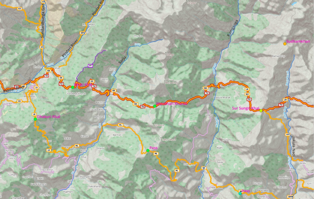
- Ramganga valley
- Kimu
- Optional – ridgeline traverse North to Nand Kund
- Mandhari Kharak pass
- Khalpata
- Sarju river valley
- Khaljuni – private house shop
- Khati Khal
- ***Khati village – dhabas
Optional – Pindari glacier (touristic route) (*)
- Rock path North into the Pindari river valley
- *** Dwali – dhaba
- Phurkia
- Zero point / Pindari Baba Math ashram (around 3700m)
- Return to Khati village
Optional – Sundardhunga valley (popular route) (*)
- ***Kathi – dhaba
- North into the Sundardhunga valley
- Jatoli
- Sundardhunga
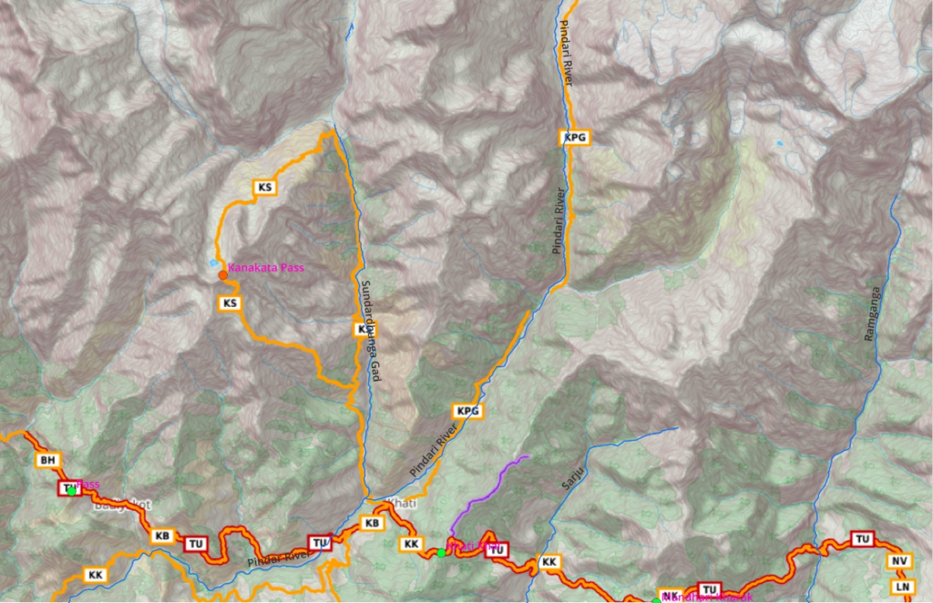
- Climb Southwest to Devi Kund, Nag Kund lakes
- Kanakata pass
- Jatoli
Kathi-Wan
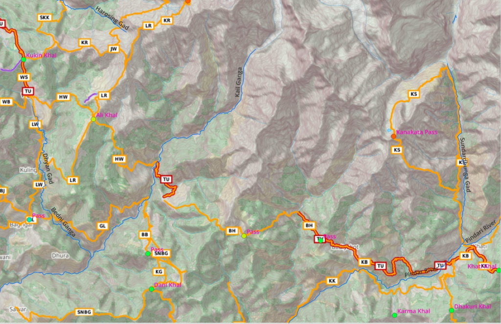
- Surag
- Jabri
- ***Badiyakot – dhaba
- Unnamed pass
- ***Bharakhani – private shop
- Unnamed pass
- ***Himni village – dhaba
- Kail Ganga valley
- ***Balan – private shop
- Ali Khal
- ***Wan village – dhabas
Optional – Rup Kund (touristic) – check if open (*)
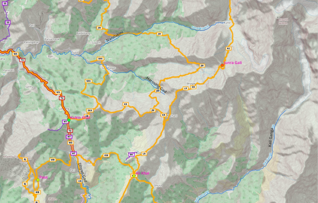
- Proceed North of Ali Khal
- Bedni Bughyal (scenic meadow)
- Rup Kund lake
Optional – Nandakini valley (*)
- From Rup Kund
- Crossover Junra Gali pass
- Descend to Home Kund
- Descend into Nandakini valley
- Follow Survey map trail to Sutol village
- Continue downstream to Sitel village
Wan-Sitel
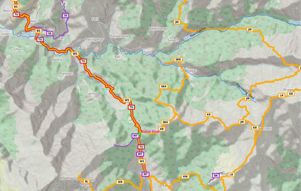
- *** Wan – dhaba
- Kukin Khal pass
- Kanol – private shop
- *** Sitel village – dhaba
Sitel to Jhinji
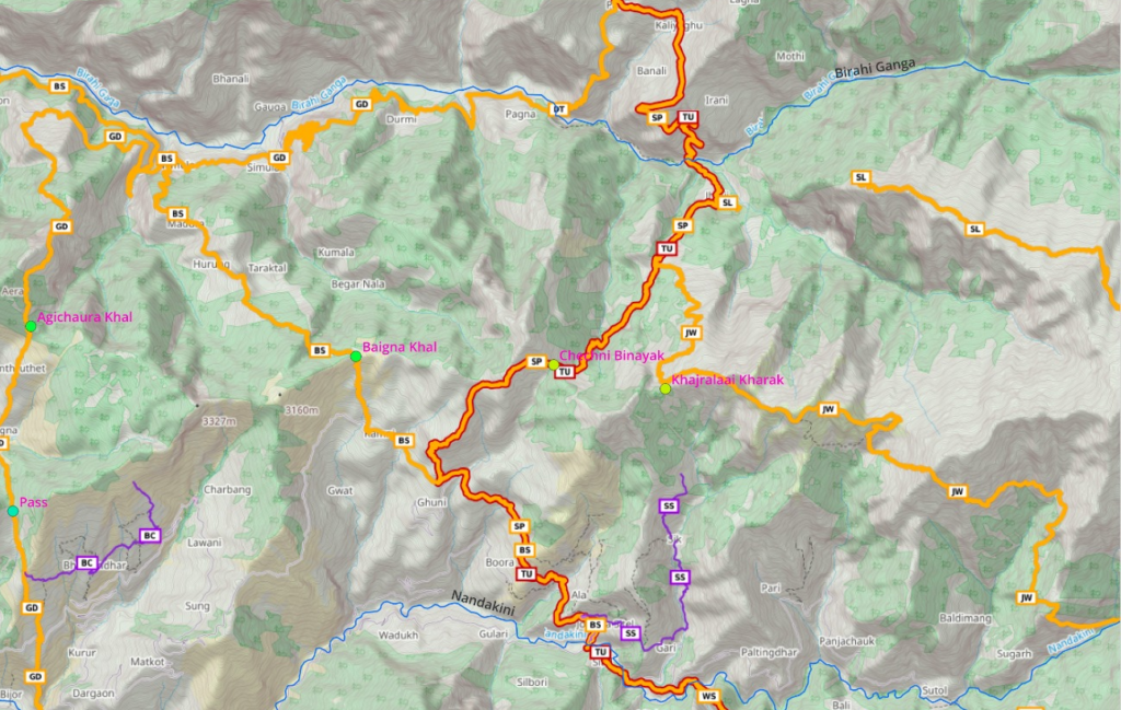
- 3 options to cross over from Nandakini to Birahi Ganga river valley
- Option1
- ***Sitel
- Sutol
- Khajralaai Kharak (Khai Kharak)
- Jhiniji
- Option2
- ***Sitel
- Ghuni
- Chechni Binayak
- Jhinji
- Option3
- ***Sitel
- Sik
- Khajralaai Kharak
- Jhinji – shop
Jhinji to Joshimath
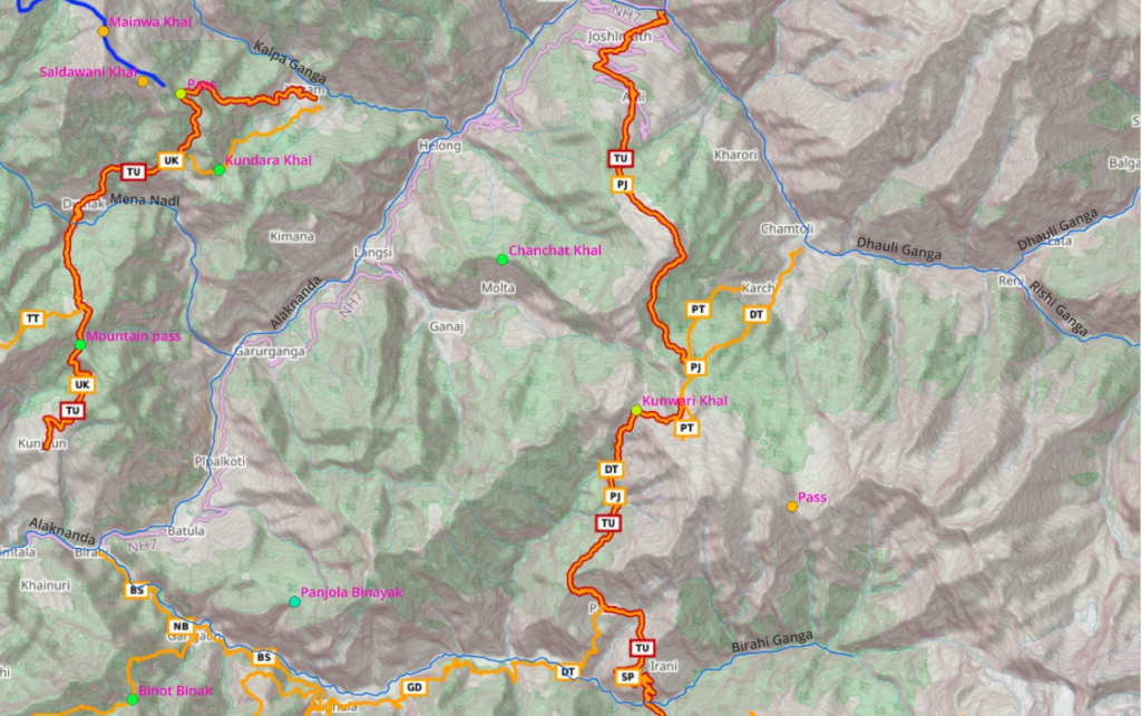
- Jhinji
- Birahi Ganga valley
- *** Pana – shop
- Sartoli meadow
- Kunwari Khal
- Auli
- Joshimath
- Alaknanda river valley
Urgam to Okimath – high altitude
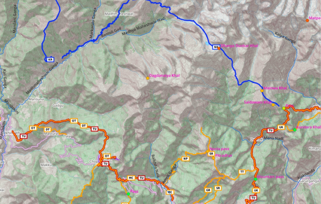
- Alaknanda river valley
- ***Urgam – dhaba
- Saldawani Khal
- ‘Mainwa Khal
- Panch Dhyuli
- Dhanya Dunkar Khal
- Nandi Kund pilgrim lake
- Kashni Khal
- Madhyamaheshwar
- ***Ransi
- Mandakini valley
Urgam to Okimath– mid altitude
- ***Urgam – dhaba
- Unnamed pass
- Kaigot
- ***Dumak – shops
- Toli Tal lake
- Rudranath pilgrimage
- Naola pass
- ***Siroli villlage
- ***Chopta village
- Tungnath temple / Chandrasilla peak
- Diurya Tal lake
- ***Okhimath
- Mandakini valley
- Hitch a ride on road section to Sonprayag
Sonprayag to Gangi
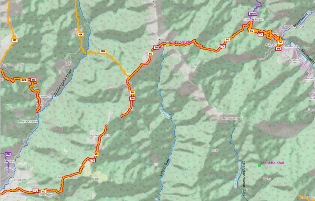
- ***Sonprayag – dhaba
- Kinkola Khal pass
- Gangi village
- Bhilangana river valley
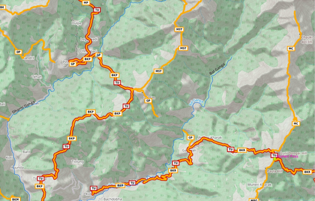
Optional: Shastru Tal (*)
- Bilangana valley
- Gangi
- Kalinai
- Climb up ridgeline to Shastru Tal lake as per Survey map trail
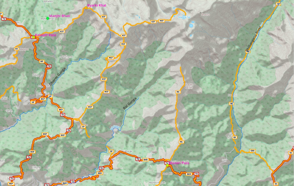
- Gangi to Genwali
- Billangana valley
- Gangi
- Muneri pass
- ***Genwali – small dhaba
- Bal Ganga valley
Optional: Ridgeline to Chauki (*)
- Follow ridgeline trail North from Muneri pass to Chauki peak
- Might possibly also connect to Shastru Tal lake
Genwali to Pinswar
- Bal Ganga valley
- *** Genwali – small dhaba
- Chandiar Tal lake
- Manal dwelling
***Pinswar - Dharm Ganga valley
Optional: ridgeline to Shastru Tal (*)
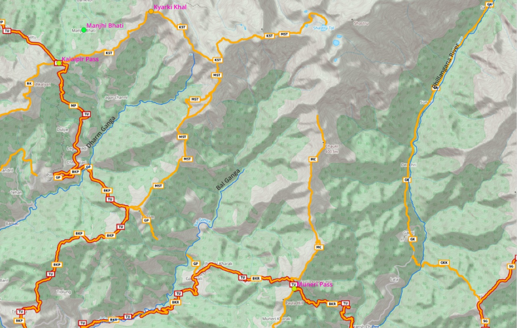
- Manal dwelling
- Follow ridgeline North
- Shastru Tal lake
- Take U turn
- Follow ridgeline West
- Kyarki Kal
- Option 1: descend Northwest ridge to Jaurab (Survey map trail)
- Option 2: proceed Southwest ridge to Kalaipir pass
Pinswar to Raithal
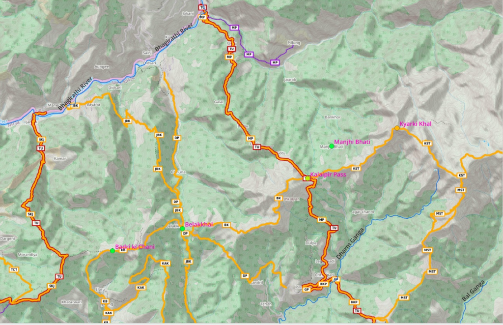
- Dharm Ganga valley
- ***Pinswar
- Kalaipir pass
- ***Malla
- Bhagirathi river
- ***Raithal
- Bhagirathi river valley
Raithal to Bhankoli
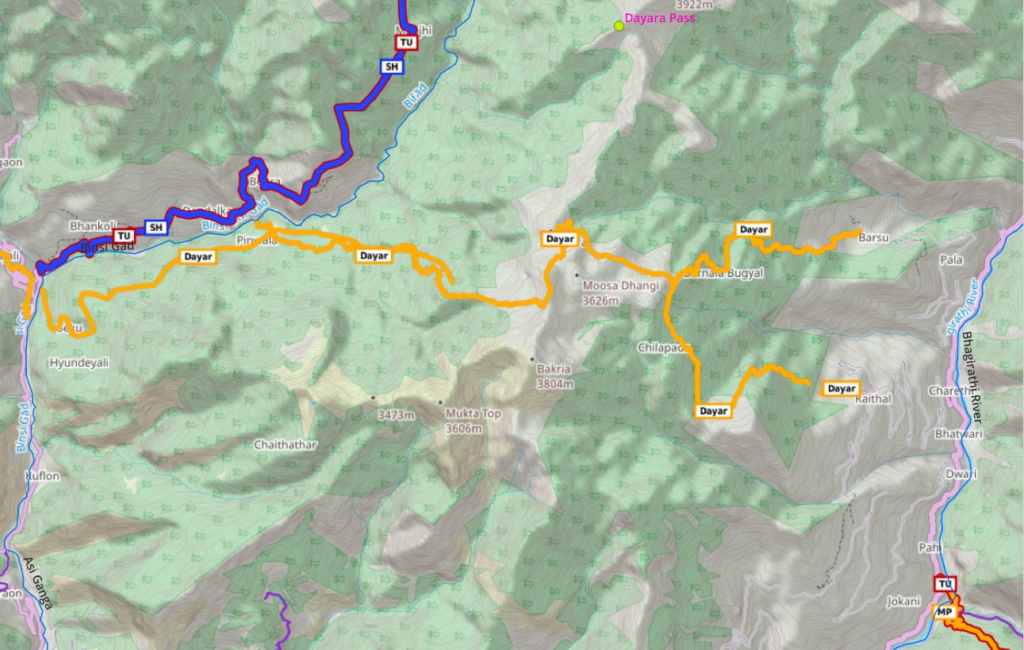
- Dayara pass
- ***Bhankoli
- Binsi Gad valley
Bhankoli to Hanuman Chatti
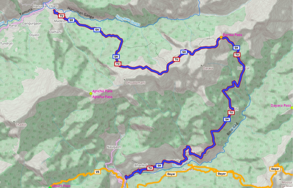
- Bhankoli
- Dodi Tal lake
- Darwa pass
- Kandola
- Hanuman Chatti
- Yamuna river valley
- Option 2: Ajricha pass
- Option 3: Dhayakarsu pass
- Bali pass North needs permission / guide
Barkot to Sankri
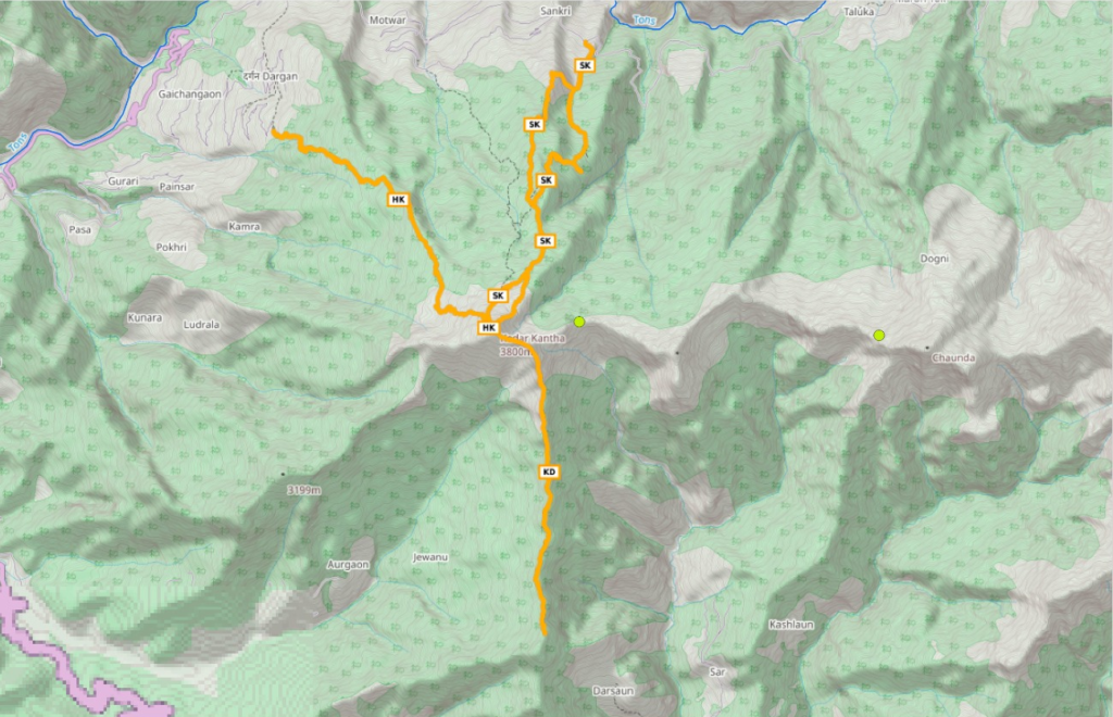
- ***Barkot – dhaba
- Yamuna valley
- ***Rajgarhi
- Follow ridgeline North
- Darsaun hamlet – no food
- Kedar Kantha – touristic peak
- Descend via ridgeline to ***Sankri
- Option2: descend via ridgeline to ***Deora
- Tons river valley
- Forest checkpost at Naitwar