
I woke up from a windy and rainy night on a flat space above the Lumen valley. The boulder next to which I slept did not the wind completely so the flappering of my bivy resulted in a disturbed sleep. Got back down to the nearby bridge and entered into the side valley.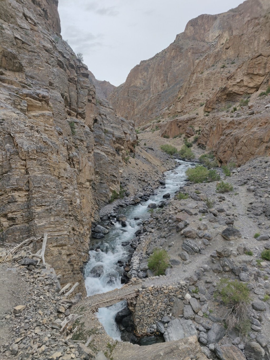 After following the side stream for a while the trail turns right a climbs up 800m towards the Niala Konste La at 4830m. The valley slope turns lush green on the way with one nice campsite halfway having flat space and running water.
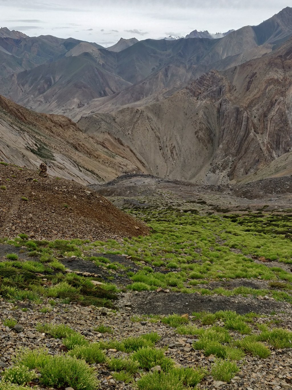 From the top of the pass you get a beautiful view of the Lumen valley which passes by the deserted Tantak gompa and remote hamlet of Shade. From the Niala Konste La the trail contours left around the hill towards a green saddle.
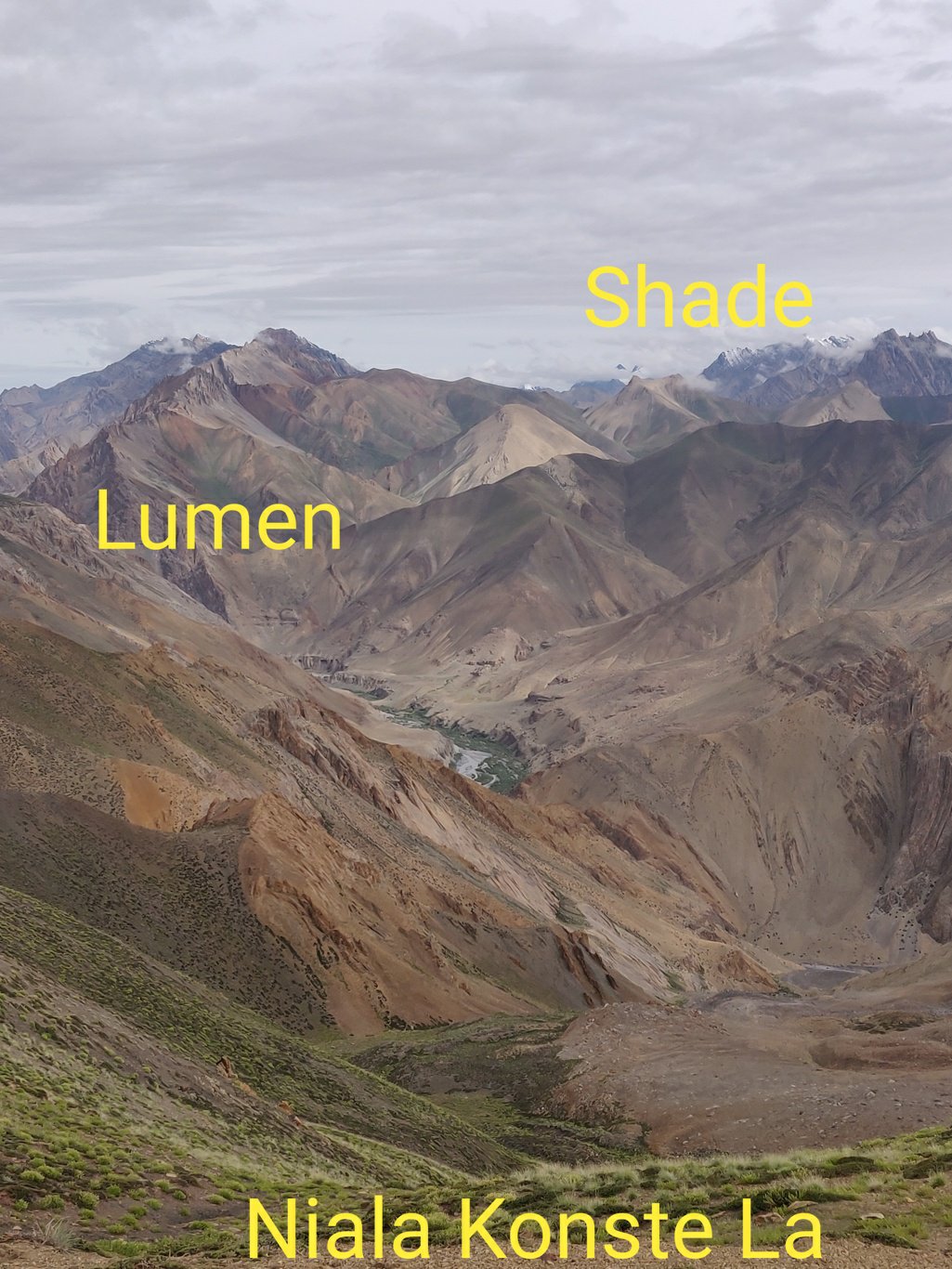 The views on the surrounding valleys and jagged peaks are stunning. A typical Zanskarian out of this world landscape unusually shaped due to high erosion.
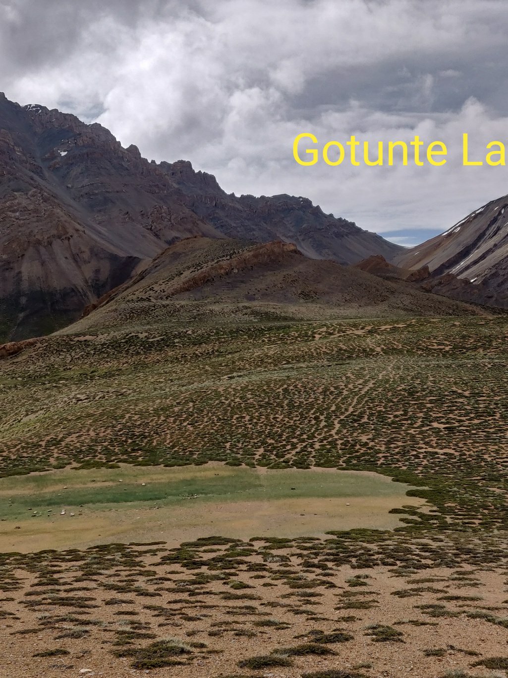 From the saddle you can see a blue lagoon coloured lake in the side valley from which you climbed up to the pass. The lake appears formed by land-slided moraines from the opposite valley slope blocking the water flow.
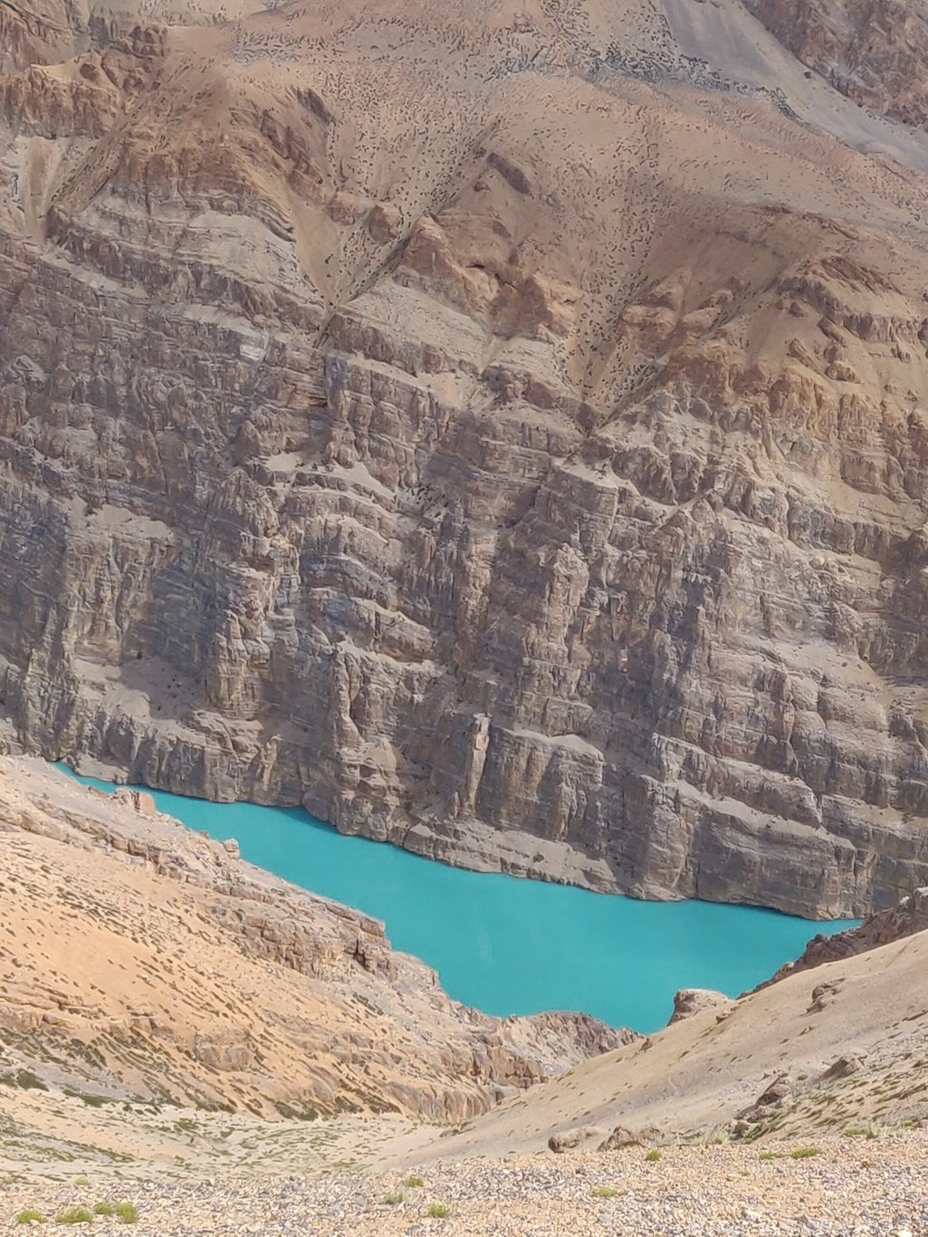 The valley above which feeds into the lake has patches of lush green vegetation and appears fairly flat, open and hikable. These interior valleys make wonderful candidates to explore.
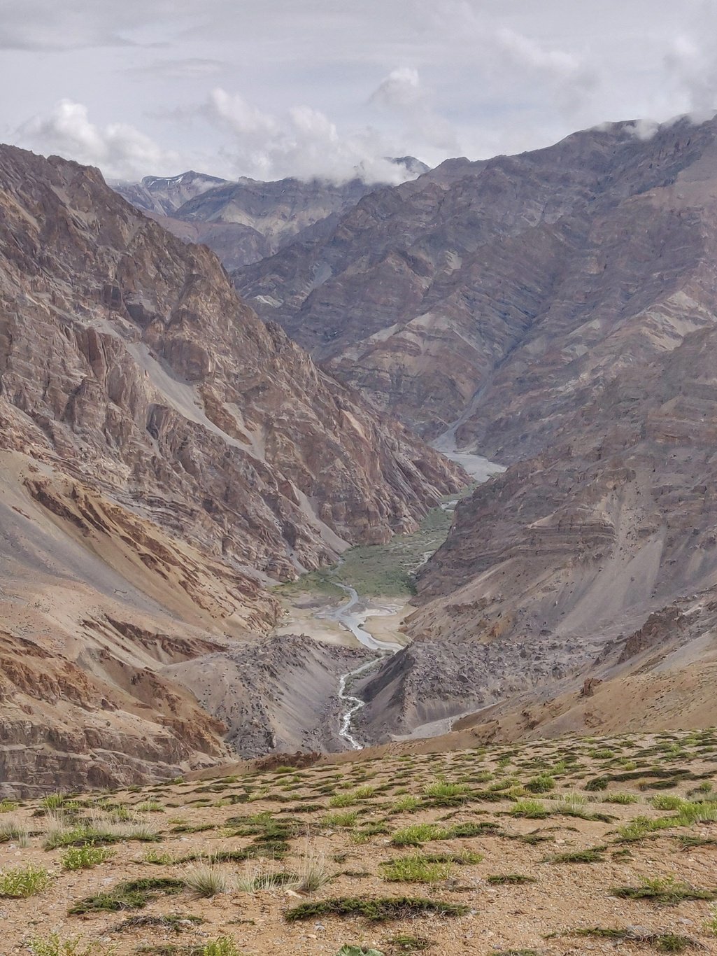 As you walk on the ridges between both passes you come across small bushes of vegetation which bear unusual fruits.
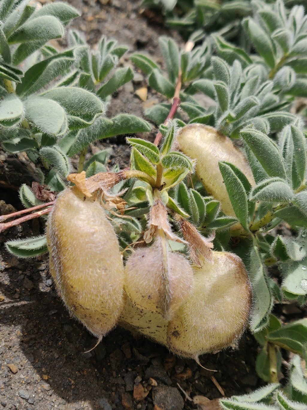 From the saddle the trail gradually climbs up 500m towards the Gotunte La pass at 5140m. The path contours up on the left valley slope through rocky moraines.Below the trail erratically shaped rocks rise up along the valley slope giving the landscape a rugged and unusual appearance. Interior Zanskar looks like a different planet.
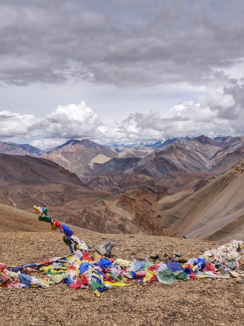 From the top of the Gotunte La pass you get beautiful views on a vast section of the interior Zanskarian mountains towards the Ladakh side. Colourful Buddhist prayer flags mark the pass.
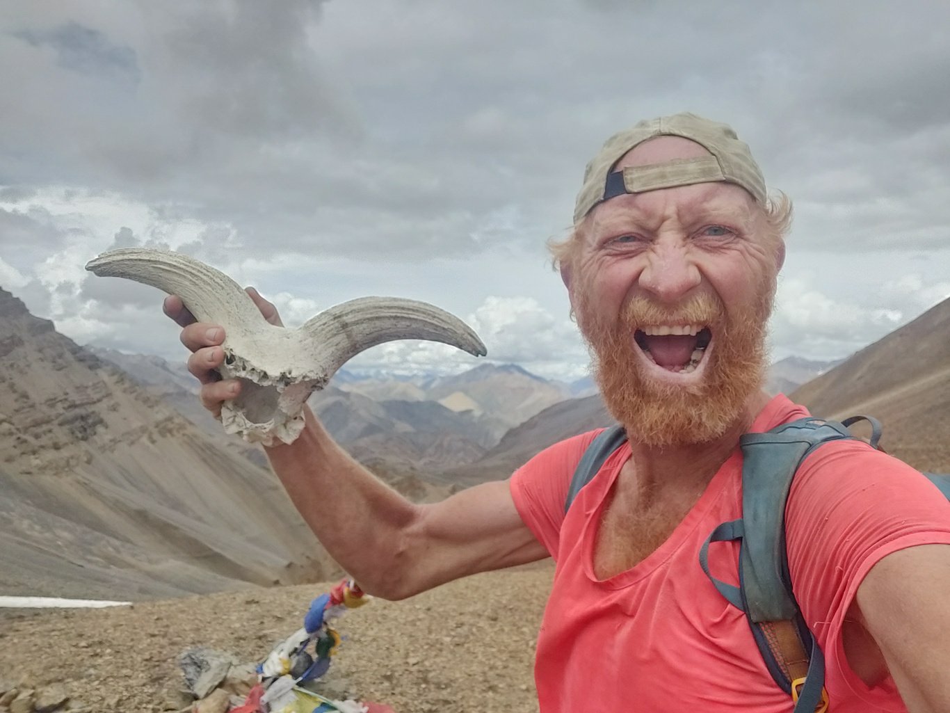 I lift an Ibex skull and raise it up feeling victorious in crossing my 100th pass this season in as many days. Every single one of them was an energy draining effort to scale.
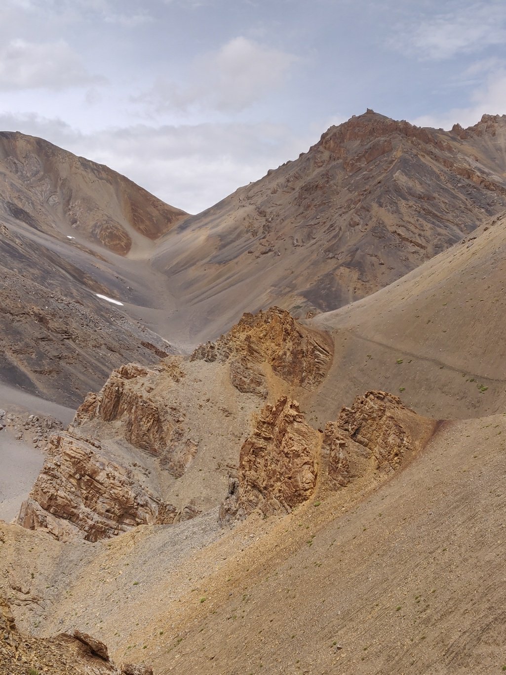 On the other side of the Gotunte La the trail gradually contours down on the left side of the valley above another set of irregular shaped rocks till you cross a ridge from where it descends more steeply into the next valley.
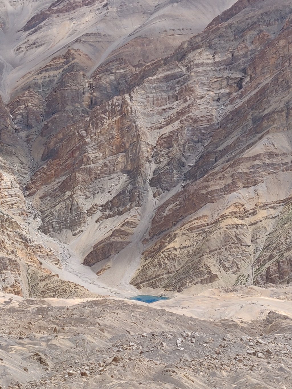 Here also land slided moraines have blocked the stream giving birth to a small blue lagoon coloured lake. This valley has lot of rubble as if long time ago there was a glacier which has now completely melted.
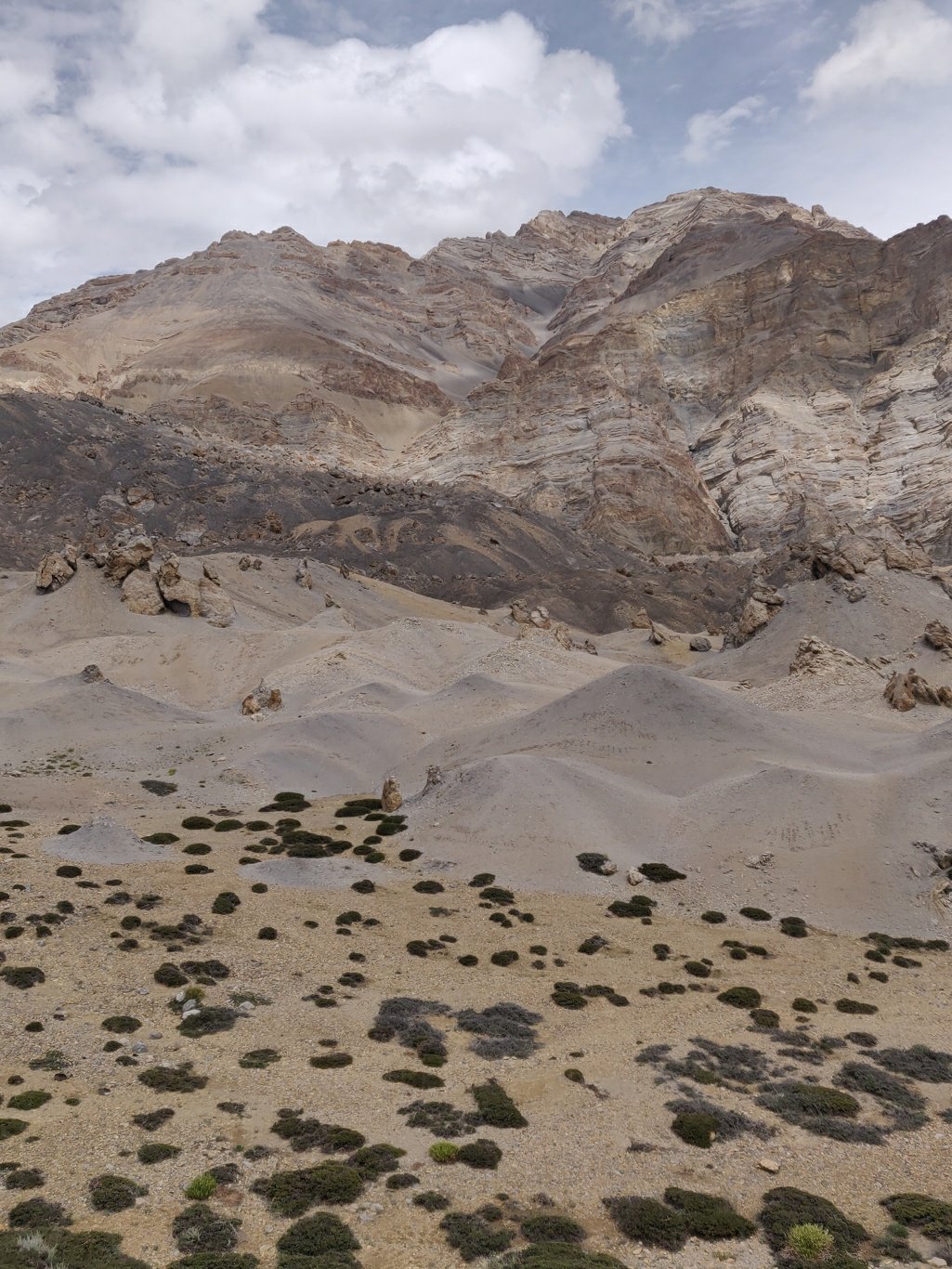 Yellow-orange rocks, white stone dunes, green bushes, black moraines, huge vertical orange coloured rock cliffs give this valley an unearthly look. We now drop elevation quickly to the base of the valley.
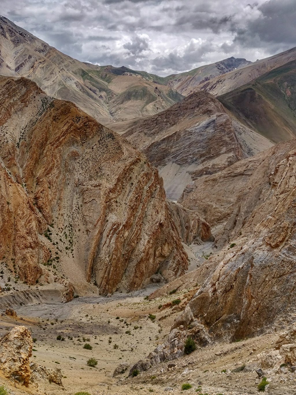 The final section is a narrow canyon between huge vertical walls where you join back into the main, open Tsarap river valley near the hamlet of Hormoch (deserted). Towards the end of the side valley you ll find running, drinkable water.
 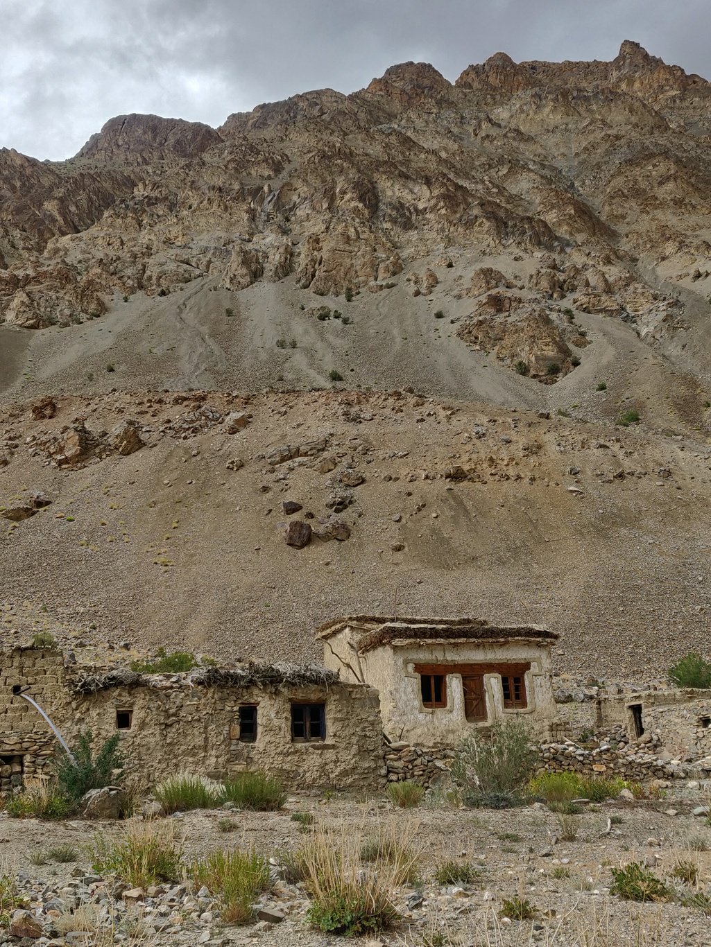 A few buildings remain in the hamlet among several ruins. On the opposite of the Tsarap valley you ll see the hamlets of Marshun and Yursun, slightly bigger settlements. All hamlets are located near side streams which were life lines for the people and surrounding farmlands.
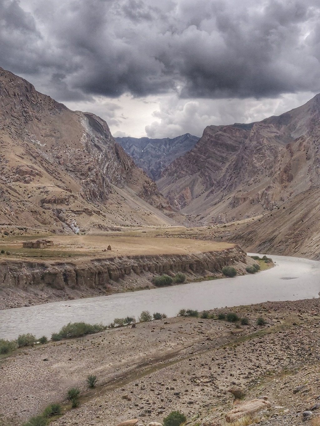 A clear trail runs along the left (upstream) side of the valley above the Tsarap river which sometimes cuts deeper into the landscape. Some 5 km upstream the Zara Chu joins from the left and merges into the Tsarap river.
 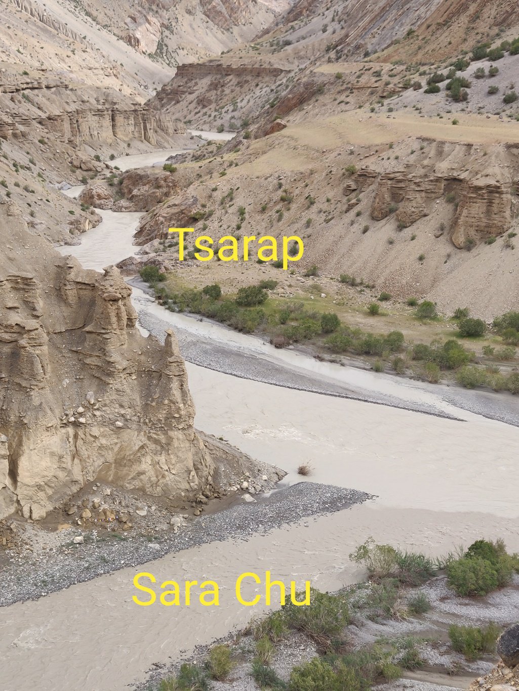 Hikers usually cross the Zara Chu at the confluence where it s wider, less deep and the water currents are less strong. Recently a new bridge was built some 500m upstream the Zara Chu which allows a more easy crossing.
 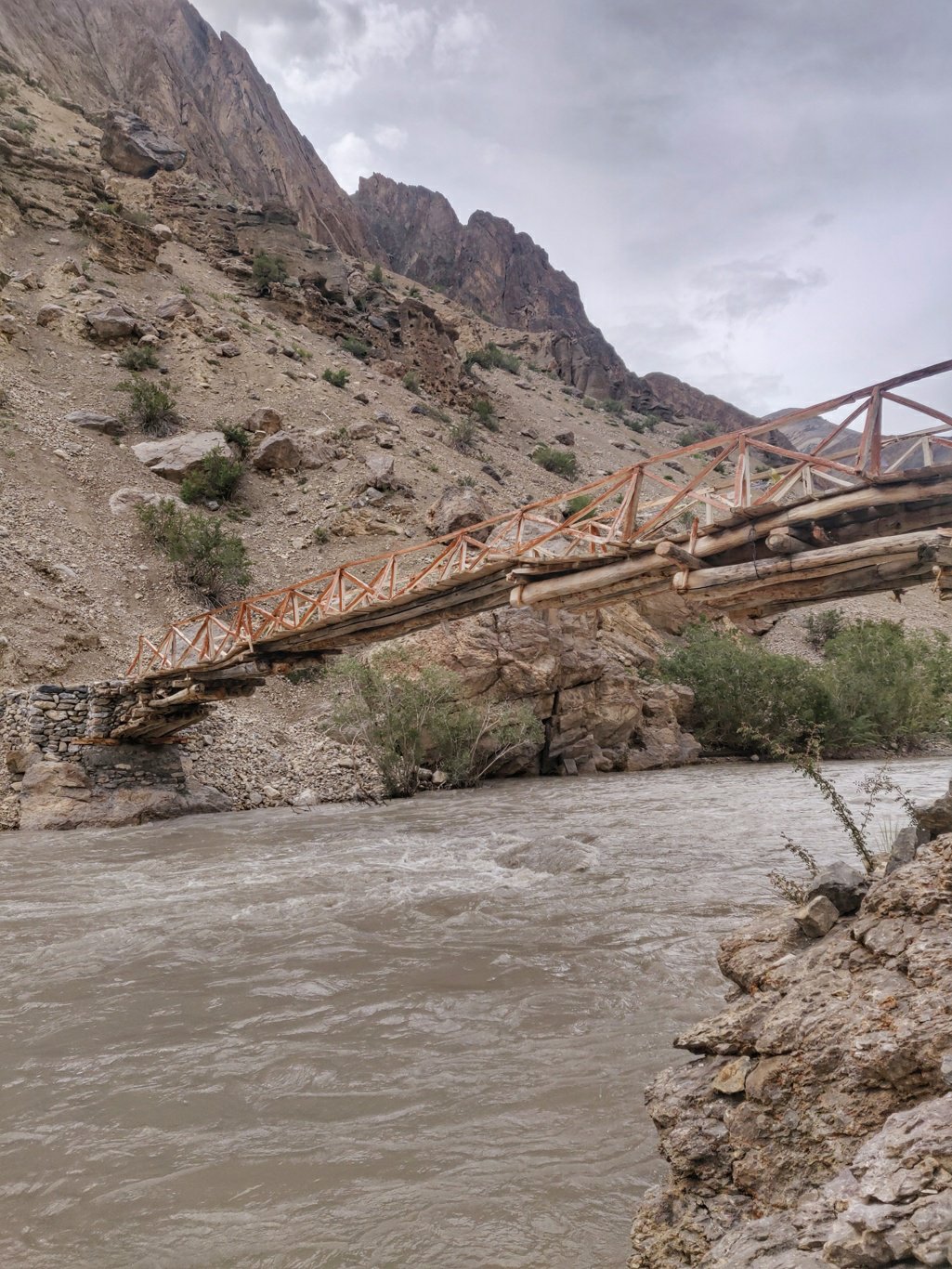 Only issue is that there is no proper access trail yet on either side of this bridge. From the West you ll need to follow a trail which runs on top of a small hill till you are above the bridge and then descend steeply 50m into a gully till you reach the bridge.
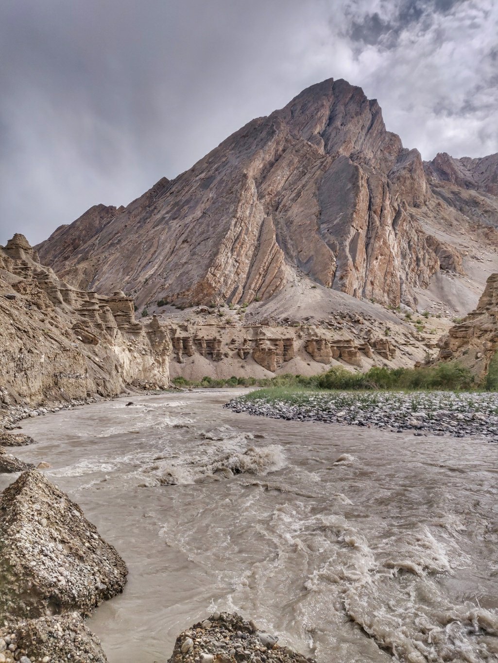 On the East side after crossing the bridge you ll need to wade along the left bank (downstream) of the Zara Chu to reach back to the Tsarap valley where you walk left along the river till the trail goes up again.
 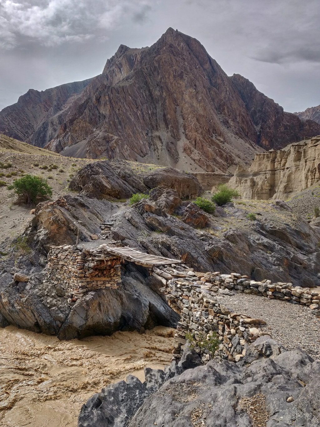 At the same spot the Tsarap runs through a narrow gorge where a bridge allows you to cross to the opposite side. Along the entire length of the Tsarap you ll see a trail which runs on the right side (upstream) connecting hamlets on that side.
 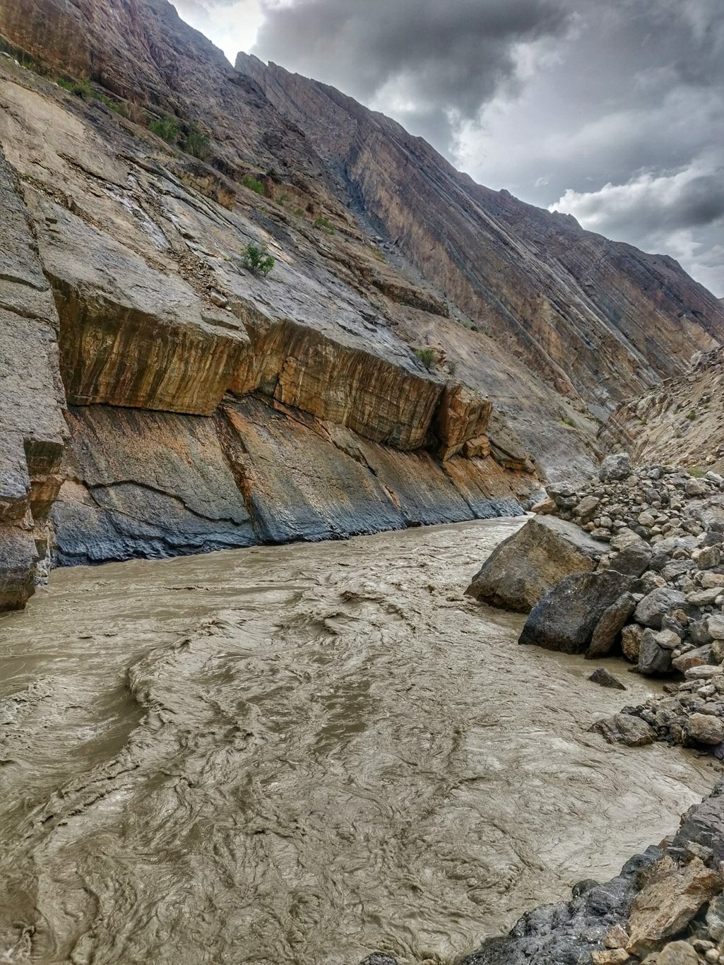 In many places however the right side path is destroyed by landslides and no longer in use. All hikers follow the left (upstream) trail across the entire Tsarap valley.
 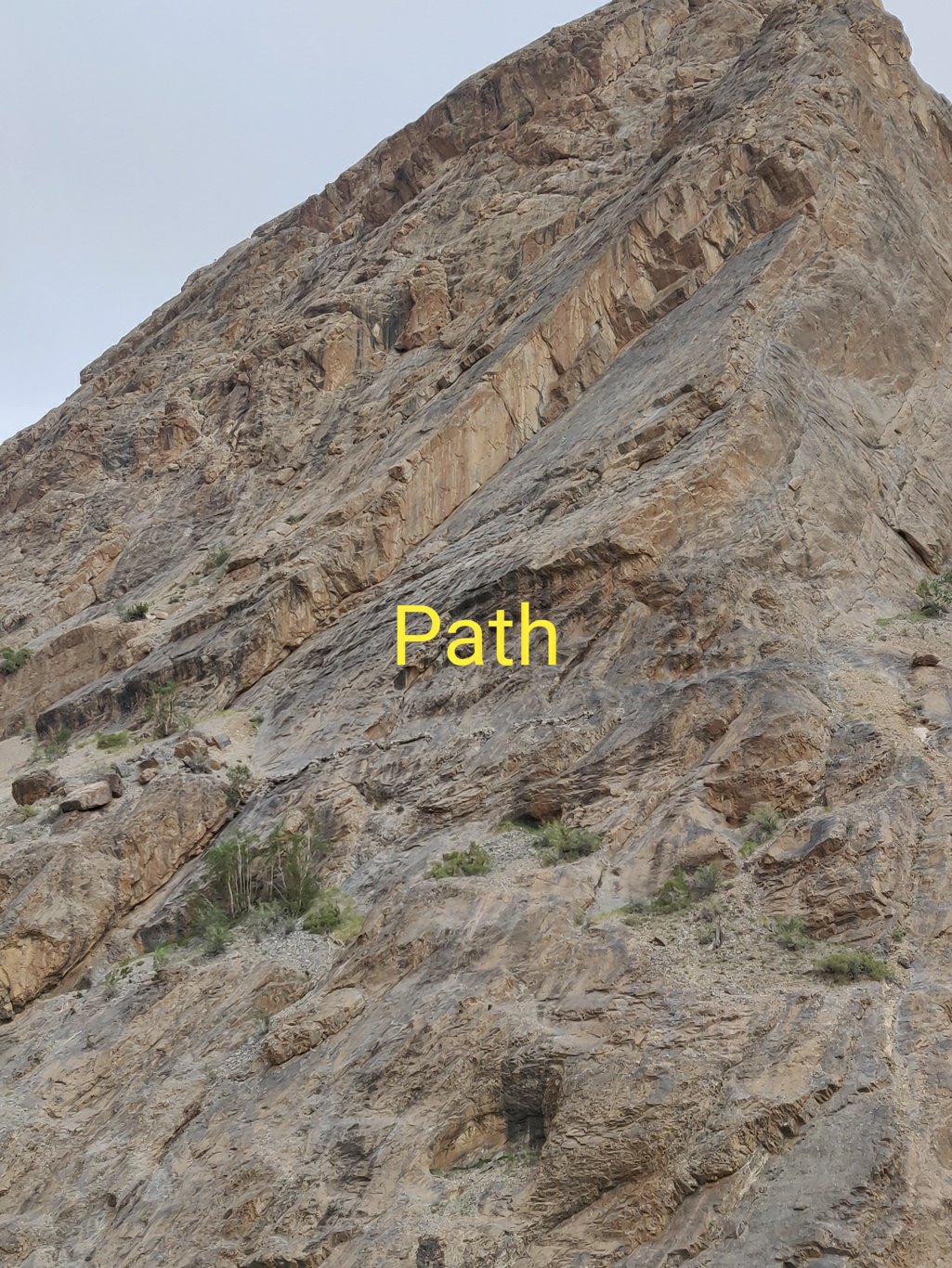 Due to recent heavier rainfall even the left side valley trail has been cut by small landslides from the cliffs above. Nothing large however which prevents you to proceed further. Just watch your step while crossing these small gullies cut by water flows from above.
Another 5km upstream you hit the small settlement of Mune Le which is mostly in ruins. I halt near the side stream before Mine Le to cook some white oats for dinner. The Tsarap river snakes its way through the open valley with regular flat platforms above the stream where people used to farm irrigated by water flowing from side streams
At Mune Le a large compound of several rooms is mostly in ruins. I find one shelter which still has its roof in tact and settle down for the night. Shielded from the cold wind and rain I sleep off peacefully.