Skip to content
UltraJourneys

Tag: GIS

  • Home
  • Blog
  • About
    • Profile
    • Social Media
      • Instagram
      • YouTube
      • Whatsapp
      • Patreon
      • Substack
      • Facebook
    • Articles
      • Blogs
      • The Himalayan Club
      • ExplorersWeb
      • Outdoor Journal
      • IMF
    • Interviews
    • News
    • Talks
      • Colleges
      • Corporate
      • Public
      • TEDX
    • Awards
    • Relief
  • Courses
    • Field Bootcamp
    • Online Bootcamp
    • Alpine Webinar
    • Navigation Bootcamp
    • GIS
    • Minimalist Gears
    • Himalayan Regions
    • Sahyadri Regions
    • Self Supported Runs
    • Running in Vietnam
    • GIS Workshop
    • Social Media
  • Himalayas
    • Mapping the Himalayas
    • Guiding Hikers
    • Himalayan Regions
    • Gears
    • Traverse Planning
    • Nepal
    • Alpine Lakes
    • Cycle Touring
    • Ultra Running
  • Maps
    • Himalayan Maps
    • Himalayan Traverses
    • Open Street Maps
    • Journey Maps
    • Survey of India
    • Navigation
    • Topography
  • Journeys
    • J&K 2022
    • Himachal 2021
    • Uttarakhand 2021
    • Trans Sahyadri 2019
    • Trans Himalaya 2019
    • Trans Sahyadri 2018
    • Trans Himachal 2018
    • Vietnam 2018
    • Spiti-Pangi 2017
    • Ultras 2017
    • Pangi-Zanskar 2016
    • Vietnam 2016
    • Pangi 2015
    • Spiti 2015
    • Srilanka 2015
    • Shimla-Leh 2013
  • Sitemap

Alpine Hiking 10D – Settlements (Part 2)

February 7, 2022 Peter Van Geit

Let’s take a closer on the distribution / proximity of settlements with respect to forest regions. Download “natural” = “wood”…

Continue Reading →

Posted in: 9B Geometrics of Himalayas, Alpine Bootcamp DIY, Courses Filed under: GIS

Alpine Hiking 10C – Settlements

February 5, 2022 Peter Van Geit

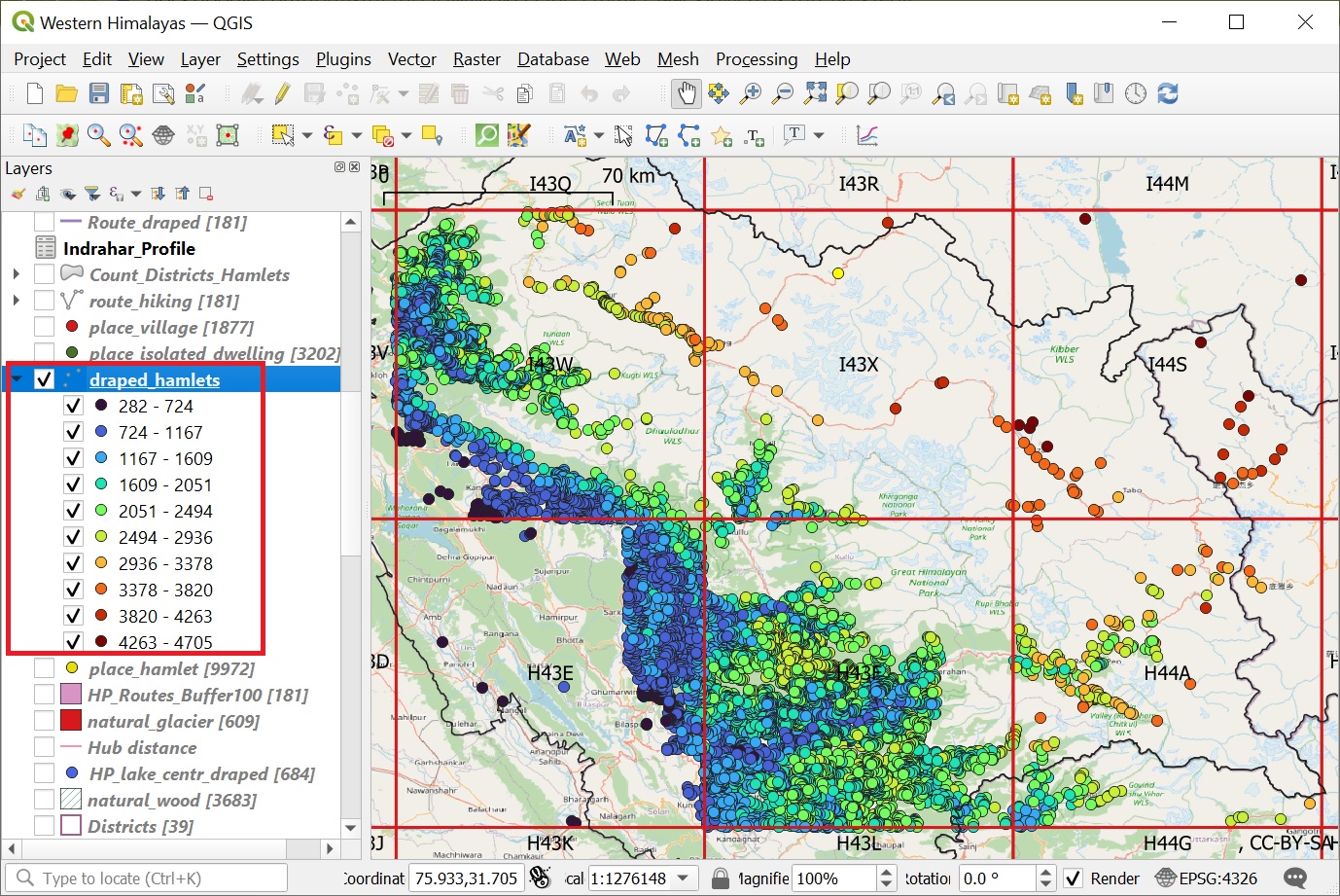
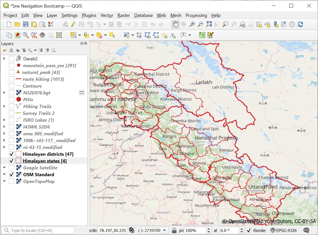
In this module we will download human settlements for the Himachal region from Open Street Maps and play around with…

Continue Reading →

Posted in: 9B Geometrics of Himalayas, Alpine Bootcamp DIY, Courses Filed under: GIS

Alpine Hiking 10B – Lakes & Glaciers

February 3, 2022 Peter Van Geit

In this module we will play around with visualizations of Himalayan lakes and glaciers downloaded from Open Street Maps. Lakes…

Continue Reading →

Posted in: 9B Geometrics of Himalayas, Alpine Bootcamp DIY, Courses, Lakes Filed under: GIS, Lakes

Alpine Hiking 10A – Mountain passes

February 1, 2022 Peter Van Geit

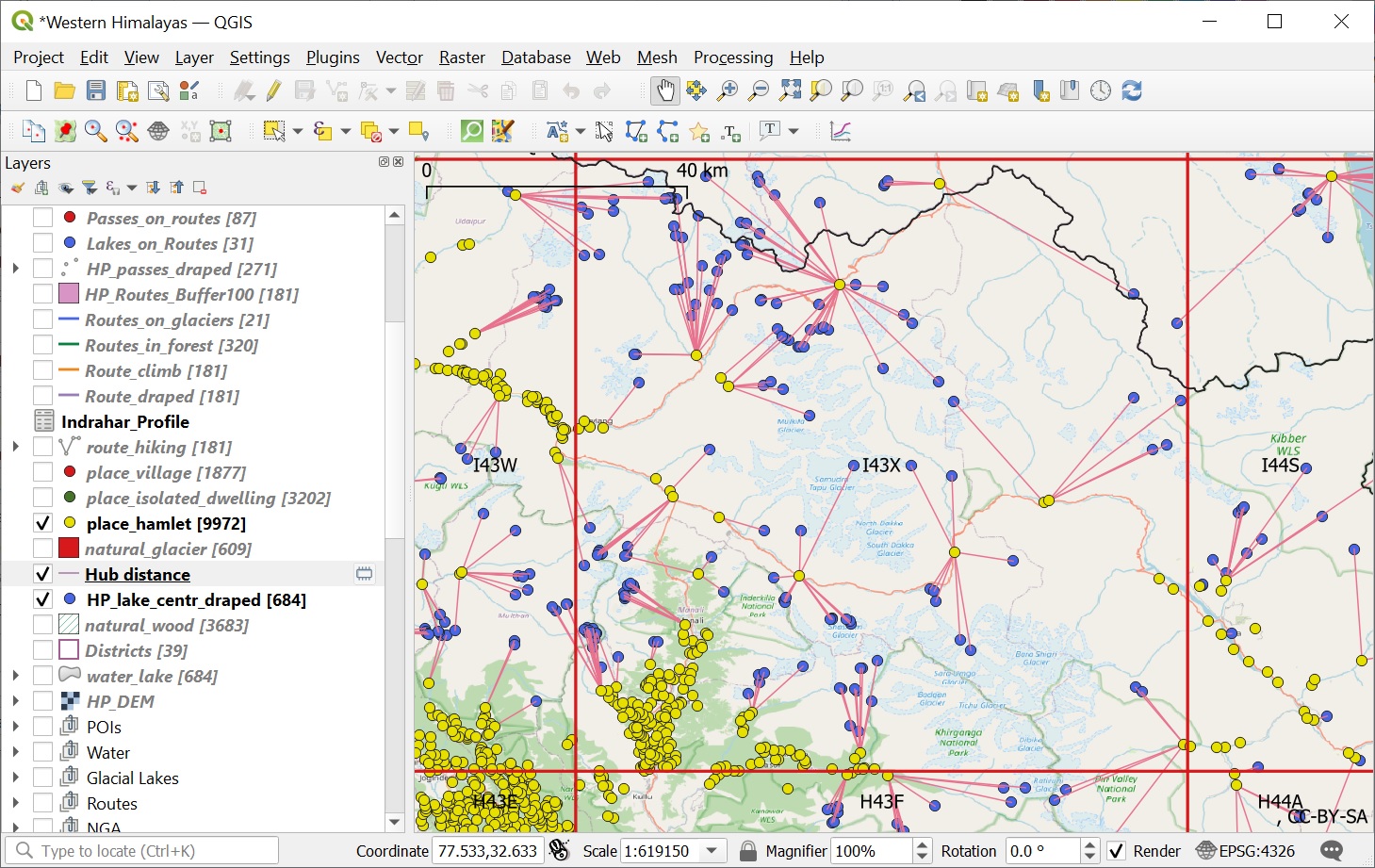
In this chapter we will explore the powerful geometry processing capabilities of QGIS on various Himalayan features. These capabilities will…

Continue Reading →

Posted in: 9B Geometrics of Himalayas, Alpine Bootcamp DIY, Courses Filed under: GIS

Alpine Hiking 9D – Atlas

January 4, 2022 Peter Van Geit

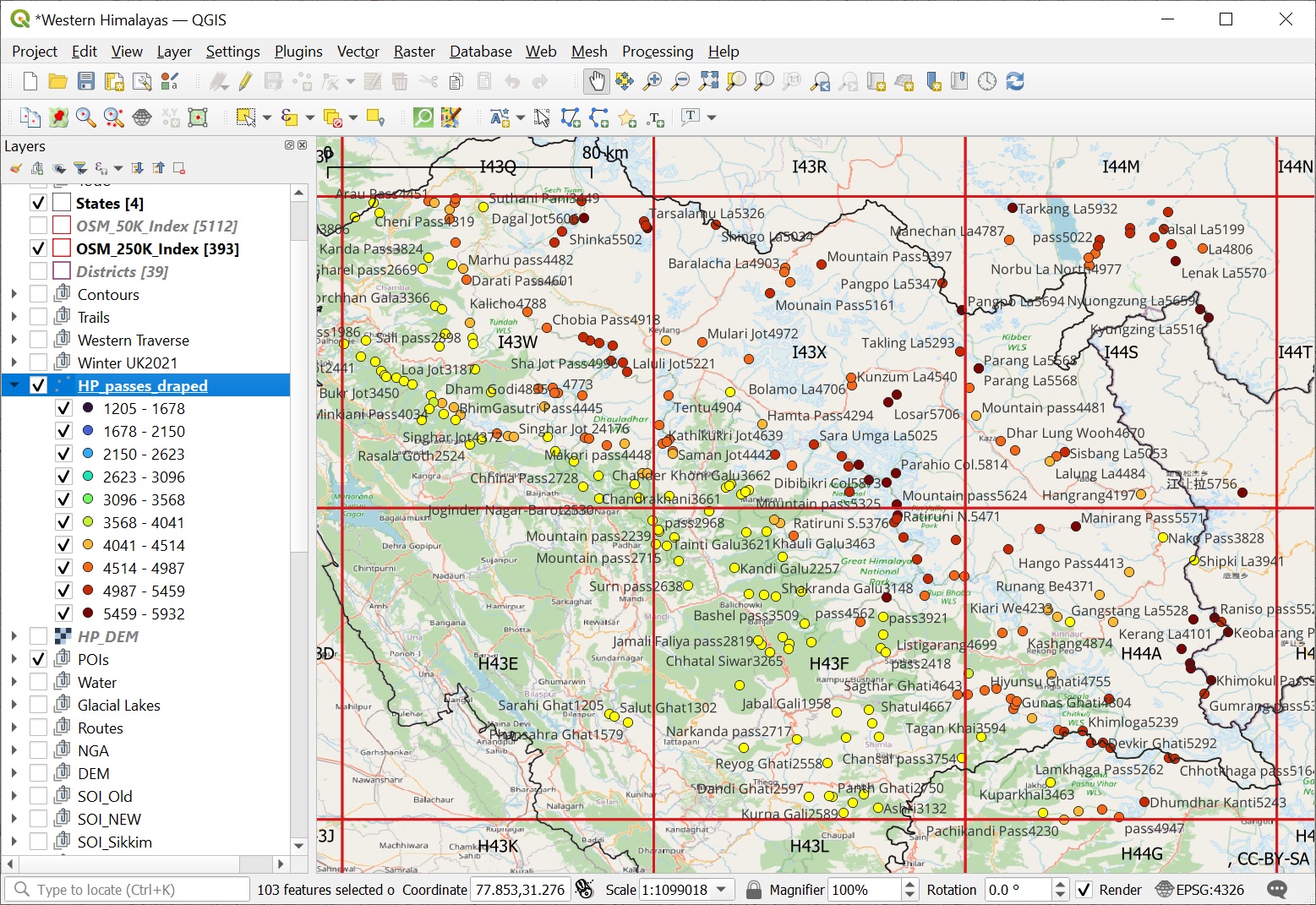
We are now able to visualize all mountain peaks (1958), passes (1393) and alpine lakes (1900) located in the Western…

Continue Reading →

Posted in: 9 Atlas of the Himalayas, Alpine Bootcamp DIY Filed under: Atlas, GIS

Alpine Hiking 9C – Alpine Lakes

January 3, 2022 Peter Van Geit

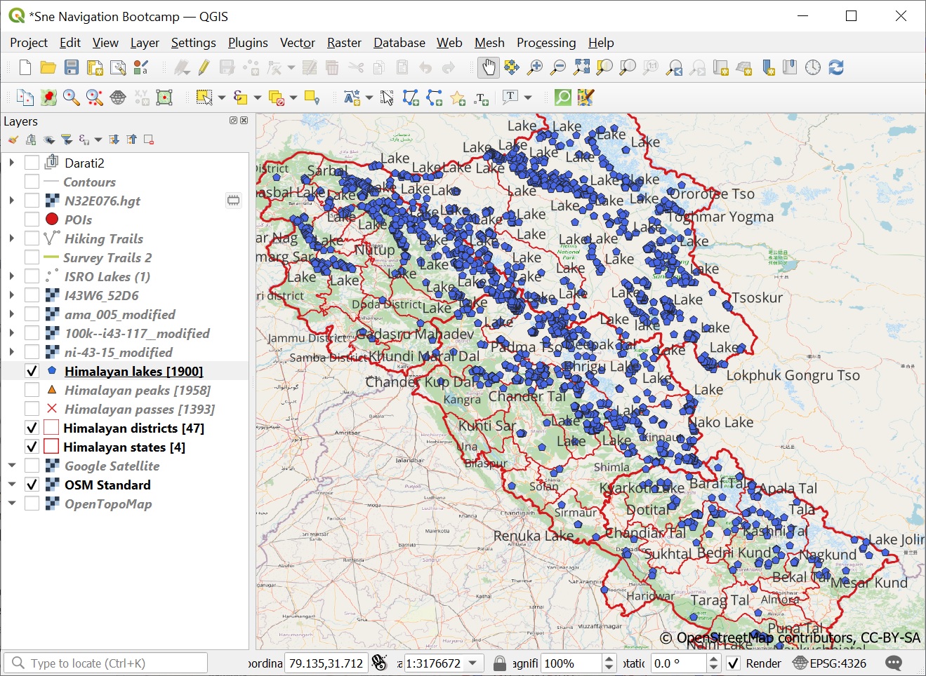
In this module we will query and visualize Alpine lakes from Open Street Maps in QGIS. Lakes are defined in…

Continue Reading →

Posted in: 9 Atlas of the Himalayas, Alpine Bootcamp DIY, Lakes Filed under: Atlas, GIS, Lakes

Alpine Hiking 9B – Passes & Peaks

January 2, 2022 Peter Van Geit

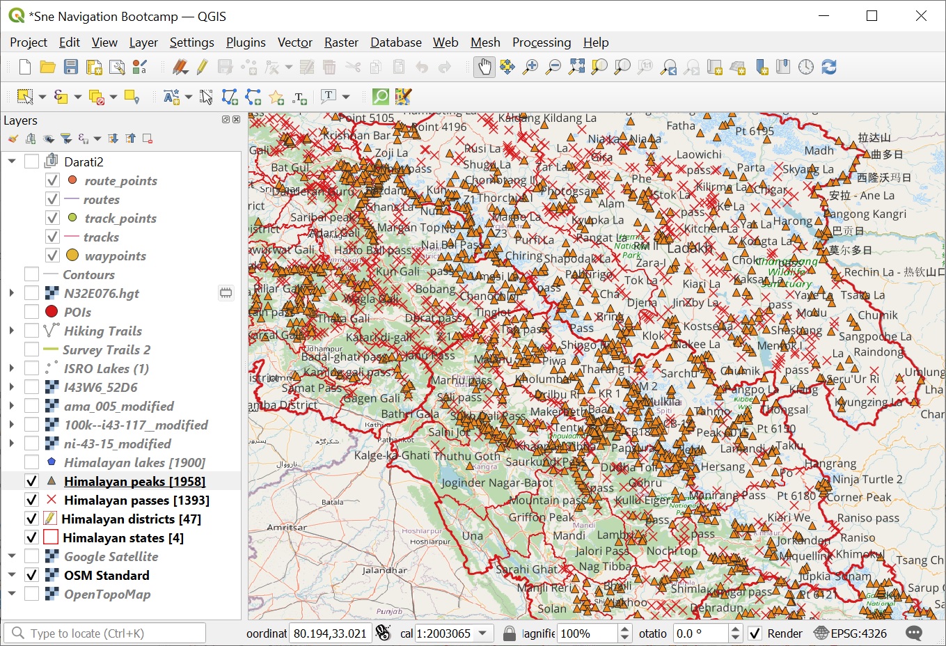
In this module we will retrieve all Himalayan passes and peaks from Open Street Maps and visualize them appropriately in…

Continue Reading →

Posted in: 9 Atlas of the Himalayas, Alpine Bootcamp DIY Filed under: Atlas, GIS

Alpine Hiking 9A – Boundaries

January 1, 2022 Peter Van Geit

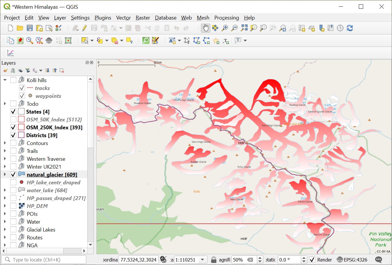
QGIS is a powerful GIS software. In Chapter 6 we learned how to import and visualize geo-tagged alpine lakes, query…

Continue Reading →

Posted in: 9 Atlas of the Himalayas, Alpine Bootcamp DIY Filed under: Atlas, GIS

Alpine Hiking 6F – Maptiles

December 22, 2021 Peter Van Geit

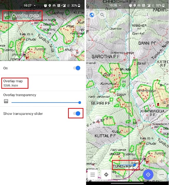
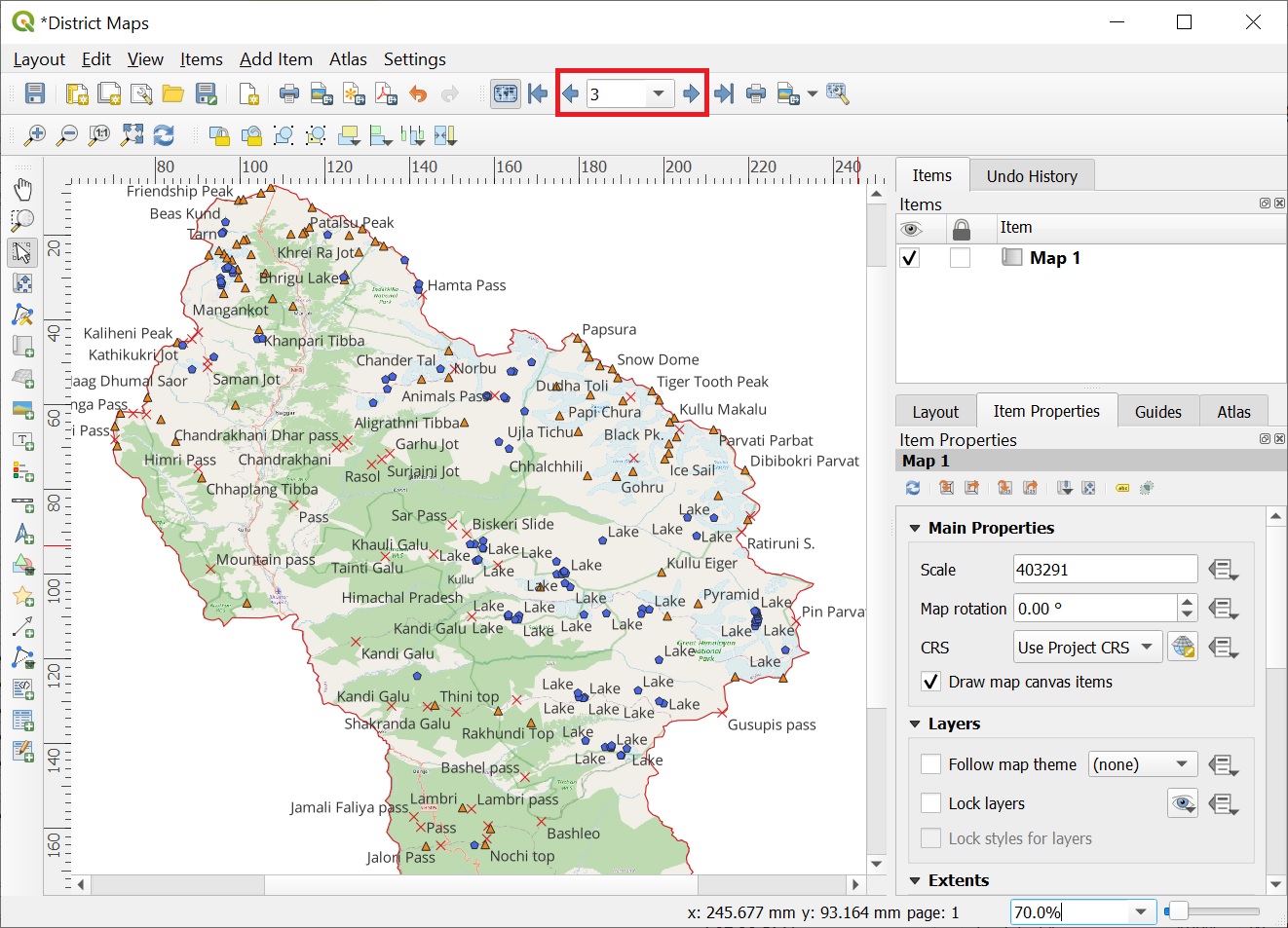
In this module we will export the Survey map with contours in maptiles format which can be used for offline…

Continue Reading →

Posted in: 6 GIS, Alpine Bootcamp DIY Filed under: GIS

Alpine Hiking 6E – DEM & Contours

December 21, 2021 Peter Van Geit

A Digital Elevation Model (DEM) is a representation of the bare ground (bare earth) topographic surface of the Earth excluding trees, buildings,…

Continue Reading →

Posted in: 6 GIS, Alpine Bootcamp DIY, Topography Filed under: GIS, Topography

Post navigation

Page 2 of 3
← Previous 1 2 3 Next →

Need guidance on hiking in the Indian Himalayas? Contact me:

  • WhatsApp
  • Instagram
  • Mail
  • YouTube
  • Patreon
  • Facebook

Search

Contents

  • About (167)
    • Articles (40)
      • Blogs (12)
      • ExplorersWeb (7)
      • IMF (4)
      • Outdoor Journal (7)
      • The Himalayan Club (10)
    • Awards (9)
    • Interviews (19)
    • News (14)
    • Profile (4)
    • Relief (16)
    • Talks (70)
      • Colleges (12)
      • Corporate (21)
      • Public (22)
      • TEDX (11)
  • Courses (123)
    • Alpine Bootcamp DIY (64)
      • 1 Maps & Route Planning (5)
      • 2 Navigation (6)
      • 3 Journey Planning (8)
      • 4 Minimalist Gears (7)
      • 5 Himalayan Terrains (8)
      • 6 GIS (7)
      • 7 Open Street Maps (5)
      • 8 Maps of the Himalayas (5)
      • 9 Atlas of the Himalayas (4)
      • 9B Geometrics of Himalayas (6)
    • Alpine Field Bootcamp (14)
    • Alpine Webinar (11)
    • Environment (4)
    • GIS (9)
    • Navigation Bootcamp (13)
    • Social Media (4)
  • Himalayas (134)
    • Cycle Touring (10)
    • Gears (11)
    • Guiding Hikers (15)
    • Himalayan Regions (17)
    • Lakes (12)
    • Mapping Himalayas (15)
    • Nepal (10)
    • Q&A (4)
    • Running (10)
    • Traverse Planning (15)
    • Videos (15)
  • Maps (104)
    • Himalayan Maps (18)
    • Himalayan Traverses (26)
    • Journey Maps (26)
    • Navigation (12)
    • Open Street Maps (13)
    • Survey of India (6)
    • Topography (10)
  • Sahyadris (39)
    • Regions (25)
    • Traverses (14)
  • Ultra Journeys (554)
    • Himachal Autumn 2021 (26)
      • Maps (2)
      • Traverses (23)
      • Videos (1)
    • Himachal Spring 2021 (25)
      • Traverses (24)
      • Videos (1)
    • Himalaya 2018 (65)
      • Articles (10)
      • Maps (3)
      • Talks (5)
      • Traverses (43)
        • Chamba, Pangi (13)
        • Kinnaur, Spiti (9)
        • Kullu, Kangra (16)
        • Ladakah, Zanskar (5)
      • Videos (4)
    • Himalaya 2019 (112)
      • Articles (14)
      • Maps (4)
      • Talks (6)
      • Traverses (78)
        • Chamba, Pir Panjal (11)
        • Dhauladar (14)
        • Kullu (11)
        • Ladakh (16)
        • Uttarakhand (16)
        • Zanskar (10)
      • Videos (3)
    • Himalaya 2022 (4)
      • Maps (4)
    • JK Spring 22 (23)
      • Articles (2)
      • Maps (2)
      • Traverses (18)
      • Videos (1)
    • JK Winter 22 (11)
      • Maps (1)
      • Traverses (9)
      • Videos (1)
    • Pangi 2015 (6)
      • Articles (3)
      • Traverses (3)
    • Pangi-Zanskar 2016 (4)
      • Articles (2)
      • Traverses (2)
    • Sahyadri 2018 (27)
      • Articles (1)
      • Traverses (26)
    • Sahyadri 2019 (77)
      • Articles (5)
      • Map (1)
      • Media (15)
      • Talks (12)
      • Traverses (16)
      • Videos (2)
      • Webinars (26)
    • Sahyadri 2022 (1)
      • Map (1)
    • Shimla-Leh 2013 (6)
      • Articles (3)
      • Traverses (3)
    • Spiti 2015 (6)
      • Articles (3)
      • Traverses (3)
    • Spiti-Pangi 2017 (8)
      • Articles (4)
      • Traverses (4)
    • Srilanka 2015 (4)
      • Articles (3)
      • Traverses (1)
    • Ultras 2017 (7)
      • Articles (2)
      • Races (5)
    • Uttarakhand 2020 (93)
      • Articles (7)
      • Maps (2)
      • Traverses (82)
        • Bageshwar (5)
        • Chamoli (31)
        • Dehradun (1)
        • Pauri Garhwal (5)
        • Pithoragarh (9)
        • Rudraprayag (8)
        • Tehri Garhwal (22)
        • Uttarkashi (12)
      • Videos (1)
    • Vietnam 2016 (6)
      • Articles (3)
      • Traverses (3)
    • Vietnam 2018 (32)
      • Articles (7)
      • Traverses (25)

Site Index

ABC (16) Articles (32) Chamba (24) Chamoli (35) Corporate (21) Cycling (13) Dhauladhar (20) Featured (28) Floods (24) GHNP (18) GIS (28) Guidance (15) Himalayan Maps (18) Himalayan Regions (16) Himalayan Traverses (26) Interviews (27) Jammu (34) Journeys (18) Kangra (28) Kullu (36) Ladakh (26) Lahaul (24) Lakes (19) Mapping Himalayas (15) Maps (27) Navigation (13) News (26) Open Street Maps (18) Pangi (13) Pir Panjal (13) Pithoragarh (15) Presentations (31) Public (15) Running (16) Sahyadri (35) Sahyadri Regions (27) Sahyadri Traverses (26) Talks (12) Tehri Garhwal (31) th19 (14) Traverse Planning (17) Uttarkashi (20) Videos (15) Vietnam (34) Zanskar (22)
  • Home
  • Blog
  • About
  • Courses
  • Himalayas
  • Maps
  • Journeys
  • Sitemap
  • Home
  • Blog
  • About
  • Courses
  • Himalayas
  • Maps
  • Journeys
  • Sitemap
Copyright © 2019 UltraJourneys - Supported by dreams